To Explore the Land of Canaan: Studies in Biblical Archaeology in Honor of Jeffrey R. Chadwick 9783110757804
This volume is a collection of paper by colleagues, friends and students, in honor of Jeffrey Chadwick. The papers cover
201 63 8MB
English Pages 385 [386] Year 2021
Preface
Contents
A Retrospective on the Career and Impact of Jeffrey R. Chadwick, Archaeologist and Educator
Biblical Historical Geography
Asking for a Place: Identifying the Location of Biblical Eshta’ol
“And There Was Peace between Israel and the Amorites” (1 Sam 7:14): A Biblical and Archaeological View on Israelites and Canaanites in the Shephelah in Late Iron Age I
Finding Mash and His Brothers – The Historical Geography of the “Sons” of Aram (Gen 10:23; 1 Chr 1:17)
Bronze Age Canaan and Its Neighbors
Let’s Trade: Carnelian Beads in the Early and Intermediate Bronze Age Southern Levant
A Better Cut: Diachronic Trends of Butchering Patterns and Technology through the Early and Middle Bronze Ages at Tall Zirā´a, Jordan
The Zooarchaeology of Cult: The Animal Remains from Moshe Dothan’s Excavations of the Middle Bronze Age Canaanite Temple Complex at Nahariya, Israel
Comparing Holes for Ritual Activities at the Snefru Bent and Seila Pyramids
Domus et Urbs: Levantine Middle Bronze Age Jar-Burials as a Family Reaction to Reurbanization
Iron Age Israel and Its Neighbors
A Tale of Two Looms – Domestic Weaving at Tell eṣ-Ṣâfī/Gath
The Food Was Heavenly: Reflections from the Northern Frontier on Divine and Royal Banquets in the Assyrian Empire
All in All, It’s Just Another Stone in the Wall: From Safi to Sicily, 12th-Century Monumental Architecture in the Mediterranean
“The Restaurant at the End of . . . ”: A Discussion of Iron Age Funerary Meats from the Southern Levant
Multiple Aspects of Tribalism in Iron I Israel
“I Should Speedily Escape into the Land of the Philistines” (1 Sam 27:1): Theoretical and Methodical Change in the Archaeology of Philistia
The “Four-Room-House” Complex at Tell Dothan, Area A: An Analysis of Function, Demography, and Cultural Identity
“Will the Ax Boast Against the One Who Cuts with It?” The Use of Axes and Pickaxes in Iron Age Warfare
A Note on the Importance of the Name Manasseh as King of Judah
Ittai and Obed-Edom: The Biblical and Archaeological Evidence for the Presence of Gittite Refugees in Jerusalem
Second Temple Israel
Olive Processing and Ritual Purity in the “Place of the Oil Press”: Reexamining the 1st-Century Features and Functions of Jerusalem’s Gethsemane Grotto
Index
Recommend Papers


- Author / Uploaded
- Aren M. Maeir (editor)
- George A. Pierce (editor)
File loading please wait...
Citation preview
To Explore the Land of Canaan
Archaeology of the Biblical Worlds
Edited by Aren M. Maeir and Haim Goldfus
Volume 4
To Explore the Land of Canaan Studies in Biblical Archaeology in Honor of Jeffrey R. Chadwick Edited by Aren M. Maeir and George A. Pierce
Advisory Board: Benjamin Arubas, Hebrew University Jerusalem, Israel Angelika Berlejung, University of Leipzig, Germany Leah Di Segni, Hebrew University Jerusalem, Israel Moshe Fisher, Tel Aviv University, Israel Isaac Gilead, Ben-Gurion University of the Negev, Israel Shuichi Hasegawa, Rikkyo University, Japan Tom Levy, University of California, San Diego, USA Steve Mason, University of Groningen, Netherlands Amir Mazar, Hebrew University Jerusalem, Israel Stefan Münger, University of Berne, Switzerland David Schloen, University of Chicago, USA Bill Schneidewind, University of California, Los Angeles, USA Wolfgang Zwickel, University of Mainz, Germany
ISBN 978-3-11-075776-7 e-ISBN (PDF) 978-3-11-075780-4 e-ISBN (EPUB) 978-3-11-075785-9 ISSN 2569-1910 Library of Congress Control Number: 2021945430 Bibliographic information published by the Deutsche Nationalbibliothek The Deutsche Nationalbibliothek lists this publication in the Deutsche Nationalbibliografie; detailed bibliographic data are available in the Internet at http://dnb.dnb.de. © 2022 Walter de Gruyter GmbH, Berlin/Boston Cover image: Aerial photograph of Area F at Tell es-Safi/Gath (photographer: Griffin Aerial Imagery). With friendly permission by the Tell es-Safi/Gath Archaeological Project. Typesetting: Integra Software Services Pvt. Ltd. Printing and binding: CPI books GmbH, Leck www.degruyter.com
Preface It is with utmost pleasure that we offer this gift of friendship, gratitude and admiration to our great friend, colleague, teacher and mensch, Jeffrey R. Chadwick, on the occasion of his 66th birthday. When the idea came up of putting together this volume in honor of Jeff (as he is known by everyone), from the very beginning, all potential contributors that we approached reacted with excited willingness to take part in this labor of love and joy. This in itself reflects how everyone who knows Jeff relates to him. Jeff combines several outstanding qualities, which are apparent to all his acquaintances. Whether in the classroom or the field, he is a consummate teacher whose clear, catchy and well-organized lessons are lapped up by students. He is an exceptional leader, well exemplified as Jeff directs an excavation area. The excavation is conducted at an exceedingly high standard, the participants enjoy every moment of it, and all come out enriched by the experience, and many young students became seasoned archaeologists under his wings. As a friend, rarely can one find a more loyal, consistent and go to person – he is simply the best! Jeff is a master of social interactions, knowing what to say and how to say it in just about any situation. If there were ever a dig participant who had difficulty getting along with others, Jeff’s area was the place to go, and all social problems would dissolve. Finally, Jeff’s sense of humor, which at times requires people to get used to, is something that all who have spent time with Jeff, whether at work or at play, appreciate so much! The title of this volume includes the biblical passage “to Explore the Land of Canaan” (Deut 13:2), which so nicely encapsulates Jeff’s relationship with the Holy Land. Combining a deep love, a thirstless interest and deep knowledge, as well as a gifted teacher about all aspects relating to the land. All this and more was why all the participants were so eager to contribute to the volume in Jeff’s honor. Many of the contributors participated in the excavations at Tell eṣ-Ṣâfī/Gath, in which Jeff has been a central figure (directing excavations in Areas F and D East) for more than 20 years. Others are colleagues and friends from various stages of his career at excavations such as Tel Miqne-Ekron, at Brigham Young University in Provo, Utah, or at the Brigham Young University Jerusalem Center for Near Eastern Studies, on Mt. Scopus in Jerusalem. We would like to thank all contributors for their papers, Rebecca Prete and Aaron Ostler of the Faculty Editing Service at Brigham Young University for copy-editing the papers, Haim Goldfus, co-editor (with Aren Maeir) of the “Archaeology of the Biblical Worlds” series, for agreeing to include this book in the series, and to those at de Gruyter publishers, particularly Aaron Sandborn-Overby, for publishing this volume. In closing, all of us, editors and contributors, can but wish our dear friend Jeff, many more years of friendship, camaraderie, archaeology, laughter and enrichment! Ad meah ve-esrim! Aren M. Maeir and George A. Pierce https://doi.org/10.1515/9783110757804-202
Contents Preface
V
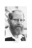
Brent L. Top A Retrospective on the Career and Impact of Jeffrey R. Chadwick, Archaeologist and Educator 1
Biblical Historical Geography Owen D. Chesnut Asking for a Place: Identifying the Location of Biblical Eshta’ol
9
Yigal Levin “And There Was Peace between Israel and the Amorites” (1 Sam 7:14): A Biblical and Archaeological View on Israelites and Canaanites in the Shephelah in Late Iron Age I 24 Chris McKinny Finding Mash and His Brothers – The Historical Geography of the “Sons” of Aram (Gen 10:23; 1 Chr 1:17) 37
Bronze Age Canaan and Its Neighbors Shira Albaz, Kristina S. Reed Let’s Trade: Carnelian Beads in the Early and Intermediate Bronze Age Southern Levant 51 Jeremy A. Beller, Haskel J. Greenfield, Dieter Vieweger A Better Cut: Diachronic Trends of Butchering Patterns and Technology through the Early and Middle Bronze Ages at Tall Zirā´a, Jordan 67 Haskel J. Greenfield The Zooarchaeology of Cult: The Animal Remains from Moshe Dothan’s Excavations of the Middle Bronze Age Canaanite Temple Complex at Nahariya, Israel 108 Kerry Muhlestein Comparing Holes for Ritual Activities at the Snefru Bent and Seila Pyramids 120
VIII
Contents
Aren M. Maeir Domus et Urbs: Levantine Middle Bronze Age Jar-Burials as a Family Reaction to Reurbanization 133
Iron Age Israel and Its Neighbors Deborah R. Cassuto A Tale of Two Looms – Domestic Weaving at Tell eṣ-Ṣâfī/Gath
143
Tina Greenfield, Timothy Matney, John MacGinnis The Food Was Heavenly: Reflections from the Northern Frontier on Divine and Royal Banquets in the Assyrian Empire 157 Louise A. Hitchcock, Shira Gur-Arieh, Laura Pisanu, Madaline Harris-Schober, Aren M. Maeir, Pietro Militello All in All, It’s Just Another Stone in the Wall: From Safi to Sicily, 12th-Century Monumental Architecture in the Mediterranean 182 Liora Kolska Horwitz, Dmitry Yegorov, Patricia Smith, Svetlana Talis, Ianir Milevski “The Restaurant at the End of . . . ”: A Discussion of Iron Age Funerary Meats from the Southern Levant 201 Jill C. Katz Multiple Aspects of Tribalism in Iron I Israel
226
William H. Krieger, “I Should Speedily Escape into the Land of the Philistines” (1 Sam 27:1): Theoretical and Methodical Change in the Archaeology of Philistia 238 George A. Pierce The “Four-Room-House” Complex at Tell Dothan, Area A: An Analysis of Function, Demography, and Cultural Identity 249 Seth M. Rodriquez “Will the Ax Boast Against the One Who Cuts with It?” The Use of Axes and Pickaxes in Iron Age Warfare 266 Itzhaq Shai A Note on the Importance of the Name Manasseh as King of Judah
288
Contents
Joe Uziel Ittai and Obed-Edom: The Biblical and Archaeological Evidence for the Presence of Gittite Refugees in Jerusalem 297
Second Temple Israel Matthew J. Grey Olive Processing and Ritual Purity in the “Place of the Oil Press”: Reexamining the 1st-Century Features and Functions of Jerusalem’s Gethsemane Grotto 313 Index
353
IX
Brent L. Top
A Retrospective on the Career and Impact of Jeffrey R. Chadwick, Archaeologist and Educator I am not an archaeologist. I’m not sure I would be able to spell “archaeology” without the help of spellcheck. I’ve seen some of the Indiana Jones movies and even bought a fedora to look like Harrison Ford. I proudly wore that hat when I visited Israel and other countries in the Middle East. I thought it would give me greater credibility when I talked to people about ancient historical sites and biblical archaeology. But even my impressive Indiana Jones fedora couldn’t hide the fact that I am not an archaeologist, and I don’t even “play” one very well. Although I had read (or more accurately perused) books and articles about the history, culture, and recent archaeological finding of lands of the Bible, I had never met or talked to a real-life archaeologist. However, that all changed in June 1993. And thus began my journey to a greater appreciation for the vital work of archaeologists and my “love affair” with biblical archaeology, albeit as a rank amateur. My family and I had just arrived in Jerusalem. We were jet-lagged, excited, apprehensive, and anxious to explore the city but somewhat fearful to do so. We didn’t speak Hebrew or Arabic. We didn’t know our way around. We didn’t have a map. We didn’t even know where we lived other than it was a dark, dank, and dingy apartment on French Hill in East Jerusalem. There was no food in the kitchen cupboards or refrigerator, and we had three hungry children. We didn’t know what to do, where to go, or how to begin. We all felt like crying (mostly from the jet lag – we hadn’t slept for well over twenty-four hours because we were so nervous). Then came a knock on the door. “Hi. I’m Jeff Chadwick. I teach Ancient Near East at the BYU Jerusalem Center. I’m glad we’re going to be colleagues. I thought you might need some help.” His smiling face encouraged us immediately. He looked young – not much older than the students I would soon be teaching in my Hebrew Bible and New Testament classes. I had heard of Jeff, but I had never actually met him before, until now. I had now finally met my first real archaeologist. Jeff had recently received his PhD in Archaeology and Middle-Eastern Studies from the University of Utah. Although he was a newly minted PhD, he had also studied at and done archaeological fieldwork with Tel Aviv University and the Hebrew University in Jerusalem. I was not familiar with him as an archaeologist, but I was familiar with his teaching in the Educational System of The Church of Jesus Christ of Latter-day Saints and his yearly summer teaching stints for BYU in Israel. Brent L. Top, Brigham Young University, USA https://doi.org/10.1515/9783110757804-001
2
Brent L. Top
Jeff wasn’t visiting me to talk about his archaeological expertise or orient me to my new responsibilities with the BYU Jerusalem Center (commonly known in Jerusalem as “Mormon University”). In fact, he wasn’t visiting me at all. He thought that my family might need a little help in getting to know the city. He was especially sensitive to my wife’s trepidation about finding grocery stores and the kids’ school, as well as driving in Jerusalem without getting killed. “Sensitive” is not a term that is often used for Dr. Chadwick in his academic and professional circles. But that day in June 1993 in Jerusalem, we saw a more personal side of Jeff, and it endeared him to us and impressed us more than his growing academic credentials. From that day, Jeff and I became fast friends. Although I was fairly experienced in teaching the Bible to Latter-day Saint adults and college-age young people, I became acutely aware of my serious lack of knowledge of important background information, such as biblical archaeology, history of the ancient Near East, and an anthropological examination of these ancient peoples. I could competently teach the textual narrative of the Bible and the religious teachings and application drawn from it. But the more I learned from Jeff – sitting in on his Ancient Near East lectures, being taught by him as we visited archaeological sites in preparation for taking students there on fieldtrips, and just peppering him with a myriad of questions – the more I wanted to learn and study and experience. I was beginning to experience what one of Jeff’s former students in Jerusalem said of him: “Professor Chadwick taught us how the land makes the Bible come alive, and the Bible makes the land come alive.” I started to see the Bible and the Holy Land through archaeologist eyes (albeit just a novice, wannabe archaeologist). Instead of just seeing stones strewn about on barren ground, I started to visualize walls and gates, towers and towns. I could almost see an ancient city bustling with people busily engaged in selling and buying. I could almost hear the sounds of the streets and smell the aromas of the market. As I learned about tells and stratification, I found myself looking at every mound and wondering what may lie beneath the surface. I was becoming a biblical archaeologist – or so I fantasized. Just like the students in Jeff’s course on the ancient Near East, I studied his book, The Holy Land: A Geographical, Historical, and Archaeological Guide to the Land of the Bible (coauthored with D. Kelly Ogden). The book included map exercises and study guides for the readings, just like other academic courses, as well as terms and timelines to be memorized. Fortunately, I didn’t have to take the exams. I was just trying to absorb as much as I could and stay at least one day ahead of my own students and not make a fool of myself when I tried to explain the archaeology of a biblical site we would visit. Pretty soon, I was able to place the people and events of the Bible within the archaeological time periods: Middle Bronze Age, Late Bronze Age, Iron Age. The terms were no longer like a foreign language to me. I even learned what transpired between the First and Second Temple periods. Like the students, I was excited to see every mound and exclaim, “There is a tell.” But after visiting so many mounds that they were no longer exciting to us, the
A Retrospective on the Career and Impact of Jeffrey R. Chadwick
3
students would chant, “O hell, not another tell.” Yet, there was Professor Chadwick in his “Live to Tell” T-shirt, smiling broadly from ear to ear, ever ready to share more of his encyclopedic knowledge of archaeological sites in Israel. He couldn’t get enough. Truly, he “lives to tell.” The students learned and loved archaeology and understood its critical relationship to the scriptural text not by reading the textbook, doing the map exercises and study guides, memorizing terms, or studying class notes taken during Professor Chadwick’s class lectures (as interesting as they were). Jeff always had something new to help the students learn. He had songs. Jeff would use songs as learning tools and memory devices to help students remember places and events of the Bible. None of his former students at the Jerusalem Center will ever forget the Shephelah song (to the tune of the 1960s hit “My Boyfriend’s Back” by the Angels) or the one about Tel Megiddo (to the tune of “Kokomo” by the Beach Boys). These are among the “greatest hits” of Dr. Jeff Chadwick. When he was not teaching students with silly songs about the geography and tells of Israel, he was singing songs and playing guitar in his local Utah rock band. We both shared love for classic rock and peppered each other with rock music trivia. While studying the New Testament and visiting archaeological sites in the Galilee, Jeff arranged for the students to have a dance at En Gev on the shore of Kinneret. Chadwick and I became the best DJs En Gev ever saw. Jeff was an archaeologist and academic by day. Rock star at night. So, when his students call him a “rock star,” they don’t know how literal that is. When a terrorist attack on foreign tourists derailed the much-anticipated trip of the BYU Jerusalem Center students and faculty to Egypt during Winter/Spring semester 1994, Jeff jumped into action and helped arrange for us to have the unique experience of working on an archaeological dig. For years, he had worked with Sy Gitin and Trude Dothan at Tel Miqne-Ekron. No doubt, these archaeologists were filled with both excitement and terror at the prospect of having 180 enthusiastic, but inexperienced, students and faculty shoveling and sifting, digging and dancing. Their excitement likely stemmed from the prospect of having so many helping hands (as slave labor), whereas the terror came from the potential damage that could be caused by not-so-helping hands of many young adults, whose brains (particularly the decision-making part) were not fully developed. In those two weeks at the dig, would the potential for hours and hours of preparation work on the grids and then digging under the careful eye of trained archaeologists outweigh the risks of the inevitable horsing around that occurs when trained archaeologists are not looking? I don’t know how Jeff “sold” the idea to the directors and supervisors. I don’t know whether they were excited or apprehensive or most likely both. However, the students were more than excited at the prospect of being personally involved in real-life, hands-on archaeology work, rather than just hearing about it from Professor Chadwick and their religion professors. This was to be a historic event for the BYU Jerusalem Center. As far as I know, it was the first time that all of the students would participate for that length of time on an archaeological dig. They had walked in the footsteps of kings and prophets of
4
Brent L. Top
ancient Israel and Judah. They had walked in the footsteps of Jesus of Nazareth. Now they were actually going to walk in the giant footsteps of Goliath of Gath (or at least try to find some Philistine artifacts). For me personally, I was beyond excited. At last, I was going to be an archaeologist, like Indiana Jones, fedora and all. I was sure that I would help find priceless relics that would someday be housed in the world’s great museums. Unfortunately, as I quickly learned, fantasy is not reality. I hadn’t anticipated the hard work required to just get grids ready to dig. And then there was the suffocating heat; the dirt and dust; sweaty, stinky bodies; and the relentless tedium of the work. I wasn’t prepared for any of that. (I don’t remember that part in Indiana Jones, but I must admit I didn’t see all the movies.) I never found a priceless relic, although our students did find some remarkable things. In fact, Sy and Trude and their staff were impressed by and very complimentary of the work of the students from “The Mormon University.” Now, over a quarter of century since that experience, I am still convinced that Jeff purposely put me in a grid well outside the city walls, knowing full well I would dig and dig and dig and never find anything. At least it cured me of the fanciful desire to be an archaeologist myself and instilled in me an even greater respect and appreciation for Jeff and other archaeologists like him. Now I am content to just read and learn from their works in the comfort of my air-conditioned office. As a testament to Jeff’s impact on the learning and lives of those students who attended the BYU Jerusalem Center from 1993–1994, he was requested to lead a twenty-fifth anniversary tour to Israel for these alumni and their spouses in the summer of 2019. I was privileged to accompany them. Once again it was a remarkable experience, not just learning from Jeff on-site as we had done those many years ago but also observing how these students – now all older than we were when we were their professors – appreciated and honored Professor Chadwick. As one alumnus said: Professor Chadwick has not lost the zeal he had 26 years ago when he first taught me about geography, ancient history, and archaeology. I remember him being so energized by all the fun facts and details he shared with us. When I returned with him in 2019, those of us now in our 40s were lying on the ground, giving into the hot August sun and worn out by the pace of our trip. Yet, Jeff was unaffected by all of it and as eager to teach us that we and our spouses might have a full experience with the land and peoples and events that are so much a part of him. How is it that this man in his 60s can still run circles around his students? He was born to do this. Visiting a tell and learning all about the archaeology of that place might get old to some (and it did to us when we were his students years ago), but to Jeff, the stones and dirt bring twinkle to his eye. His love for what he does has breathed new life into many a tell for countless students.
Another alumnus stated: When I landed in Tel Aviv in 1993 as a 19-year-old from Idaho, I had no idea how my life would be changed and how much I would come to love Israel. Professor Chadwick had no small part in that. I still have his amazing study guides and maps and my notes from his classes. Fast
A Retrospective on the Career and Impact of Jeffrey R. Chadwick
5
forward 26 years. I wanted my son, who happened to be a student in Professor Chadwick’s comparative religion class, to learn from Jeff in Israel as I had done. So we went on the alumni tour, and I was not disappointed. He still has it! I did not think that he could love Israel or know more than he did in 1993, but I was wrong. I have never seen someone love their job and get excited about rocks and tells and all the new findings than Dr. Chadwick. His enthusiasm is amazing and infectious. The wealth of his knowledge is astounding. I will be forever grateful to him for teaching me and my son.
I knew that Jeff Chadwick belonged at BYU. I had seen him in action, both in the classroom and on-site in the land of the scriptures, and I knew of the impact he could have on our students and the academy at large. Others who had also taught with him in Jerusalem felt the same way. The problem was, however, that we don’t teach archaeology classes in our College of Religious Education. We wanted him as a colleague in our college, not across campus in the College of Family, Home, and Social Sciences. We knew what a good religious educator he was. But it would take a few years until just the right spot would open up in our college. By that time, I was no longer just a junior faculty member with little to no influence. I had become associate dean of the college and gladly used some of my influence to encourage my colleagues to consider Jeff for a position as a professor of comparative religions. Since joining our faculty in 2001, Professor Chadwick has taught hundreds of students in his classes on the Hebrew Bible, the New Testament, Judaism, Islam, and survey classes on world religions. The effectiveness and impact of his teaching is seen in these representative comments of students: I have had the privilege of taking three classes from Professor Chadwick, and regrettably, I will not have the opportunity to take another one as I am graduating this semester. His insights and experience brought to his courses have been extremely beneficial to me. I am truly grateful for the opportunity I had to listen and learn from Dr. Chadwick. The things I have learned I will carry with me for the rest of my life. Because of the course I have taken from him, I have a much clearer understanding of myself and the world around me and how it all fits into the Creator’s Great Plan. I absolutely loved this course. I am not the type of student who gets excited about lectures and readings, but with this course, I was always engaged and excited. The course was so organized. The visuals he used in his lectures were clear and informative. The assignments made sense and really facilitated learning. But I have to say that Professor Chadwick was the thing that I enjoyed the most. I love that fact that he addresses each religion in a nonbiased way. He really respects those of other religions and helped us to see all the peoples of the world, regardless of their faith, as truly brothers and sisters. Professor Chadwick is the most talented teacher and communicator I have had in my academic career. He sets up the course workload perfectly, and his assignments are the most practical compared to any other course I have taken. He blew my mind away with how much he knew about biblical archeology and ancient history. He always stressed the importance of reading in the Bible in its overall context. I will honestly read the scriptures differently because of taking his class. This man is almost too good for his own good.
6
Brent L. Top
Certainly, more could be said about Jeff’s effectiveness in the classroom, but the primary purpose of a Festschrift is a published work that pays tribute to a valued colleague with scholarly articles and essays from their academic peers. This Festschrift, by its very nature, bespeaks of the significant stature attained and important contributions made by Dr. Jeff Chadwick in his field. As I mentioned at the outset of this essay, I am not an archaeologist. Nor am I in the same academic league as Jeff. He certainly runs in different scholarly circles than I do, but I do know, nonetheless, that he is highly respected in those circles. His roles as a senior research fellow with the William F. Albright Archaeological Institute in Jerusalem, as a member of the Board of Trustees of the American Schools of Oriental Research (ASOR), and his work alongside some of the best and brightest archaeologists in Israel and the United States – such as Phillip Hammond, Sy Gitin, Trude Dothan, and Aren Maeir – testify of that respect. On a visit to Jerusalem several years ago, Jeff took me to visit some of the archaeological excavations that had been done in the years since I lived in Israel. I was amazed – amazed not just with the remarkable finds but that Jeff was on a firstname basis with the luminaries of archaeology in Israel, including Eli Shukron and Ronny Reich. When Jeff introduced them to me, I must admit that I was a bit starstruck. It was as if I had met Indiana Jones himself. I am so pleased that Dr. Jeffrey R. Chadwick is being honored with this Festschrift. He is most deserving. Although I have nothing really to contribute to the scholarship presented in this volume, I humbly offer this introductory essay with my deepest respect and appreciation for Jeff as an eminent scholar, gifted teacher, valued colleague, and dear friend.
Biblical Historical Geography
Owen D. Chesnut
Asking for a Place: Identifying the Location of Biblical Eshta’ol Introduction The location of biblical Eshta’ol has been greatly disputed over the years. Scholars have agreed on a general location for the city but not on the actual site. At least six sites have been proposed; however, little actual research has been done on Eshta’ol since the first half of the twentieth century. Much of the research done has focused on toponymics because of the lack of archaeological remains. These two methods (toponymics and archaeology), along with geography, will be used in this paper to determine the actual location of Eshta’ol. The city of Eshta’ol is mentioned seven times in the Old Testament,1 and in every ְ instance, it is mentioned along with Zorah. The Hebrew place name ת ָ֥א ֹול ּ ש ׁ ֶאcomes from the root שַאל ׁ (shâ’al), meaning “to ask, inquire, or borrow.” Rainey and Notley understand this word to be a preservation of the infinitive form of the obsolete Gt stem in Akkadian as a carryover from the Canaanite language that has lost any definitive meaning in the Hebrew (Rainey and Notley 2006: 16). The form could also be derived from the Hithpael stem, which would give it a general reflexive meaning. These grammatical suggestions indicate that the place-name “Eshta’ol” should be defined as “to ask,” “entreaty,” or “(place of) asking.” The third option, if taken as the most accurate definition, indicates that Eshta’ol could have been the location of a Canaanite sanctuary or of an oracle.2
Textual References: Geographical and Historical Information Biblically, Eshta’ol was first mentioned in the city lists of Joshua 15. In verse 33, it is listed with Zorah and Ashnah as one of the first cities mentioned in the “lowland”
1 Josh 15:33; 19:41; Judg 13:25; 16:31; 18:2, 8, and 11. The term “Eshta’olites” is mentioned once in 1 Chron 2:53, describing descendants of the clan from Kiriath-jearim. The people from Kiriath-jearim were descendants of Hur and were part of the tribe of Judah (1 Chron 4:1). This verse indicates that after the Danites left this part of the country, their tribal territory was given to Judah. 2 See Burney (1912: 83–84) for further discussion of the grammatical origins of the place-name “Eshta’ol.” Owen D. Chesnut, North Central Michigan College, USA https://doi.org/10.1515/9783110757804-002
10
Owen D. Chesnut
or Shephelah grouping (Fig. 1). The next reference is Josh 19:41, where Eshta’ol is listed between Zorah and Ir-shemesh (probably Beth-shemesh) as one of the first cities included in the territory of Dan. Judg 1:34 states, “The Amorites pressed the people of Dan back into the hill country, for they did not allow them to come down to the plain.” Thus, it seems as if the Danites, after being allotted a number of cities, were forced to abandon all of their territory except for Eshta’ol and Zorah along with a few camps located around those cities. According to these verses, we know that Eshta’ol was a city located in the Shephelah, situated in close proximity to Zorah and in the general area of Ashnah and Beth-shemesh.
Fig. 1: The districts of the Shephelah.
Judges 13 records the story of Samson’s birth to Danite parents in the city of Zorah. Judg 13:25 says, “The Spirit of the Lord began to stir him in Mahaneh-Dan, between Zorah and Eshta’ol.” The name “Mahaneh-Dan” can be translated as “the camp of Dan,” a definition which seems to indicate that this group of Danites was not permanently settled in this area. Perhaps the phrase is simply a general term for the area where the Danites were located, yet it still denotes impermanence. The end of the Samson saga also mentions Eshta’ol. In Judg 16:31, Samson was buried in the
Asking for a Place: Identifying the Location of Biblical Eshta’ol
11
tomb of his father, Manoah, which was located between Zorah and Eshta’ol. In addition to this reference, Eshta’ol is mentioned three other times in Judges 18, in the account of the Danites leaving their area of the Shephelah and settling in the far northern region of the country. In this account, it seems as if Zorah and Eshta’ol were the two main locations where the Danites dwelled. Judg 18:2 reports that five men from each city were sent to spy out and explore the land. When they returned to the two cities with news of a better land at a place called Laish, 600 men set out from Eshta’ol and Zorah to attack and claim the city of Laish as their own. From the above passages, it appears as if Eshta’ol and Zorah were the two most important cities for the tribe of Dan during the period of the Judges. It also seems as if Samson was the tribe’s one hope to claim its inheritance in the northern Shephelah. Any inroads he may have made during his life, however, were quickly wiped away after his death. This lack of long-term success means that the Danites, living in only two permanent settlements (Eshta’ol and Zorah), were even more pressured by the Philistine presence in the Sorek Valley to find a new place to live. In his Onomasticon, Eusebius mentions two Eshta’ols: one near Ashdod and the other near Zorah. Eusebius considered the Eshta’ol (spelled Ασταωλ in the LXX) near Zorah to be the place “where Samson was stirred” (Notley and Safrai 2005: 86). Eusebius placed this location 10 Roman miles north of Eleutheropolis on the way to Nicopolis (Emmaus).3 This early-recorded distance, however, is supposedly a faulty measurement and has since been corrected to 14 Roman miles (Thompson 1978: 104). While the distance first proposed by Eusebius is too short to support the proposed location of Eshta’ol, the new calculation of distance is a better match for the proposed location. Eusebius’s mention of this site is the earliest reference to Eshta’ol outside of the Bible until the 14th century C.E. when Estori ha-Parhi identified Eshta’ol with the modern village of Ishwa’ (Ha-Parhi 1897: 302). He based this identification on the similarity between the modern Arabic name and the Biblical Hebrew name.
19th-Century Sources: Geographical and Toponymic Information The early explorers came to the land of Israel in the 19th century C.E. trying to identify ancient sites and archaeological ruins, as well as to map the country. Their journals of traveling the land can be very helpful in identifying biblical sites and understanding the land as it was before modern construction. Edward Robinson was the first to travel through the northern Shephelah, and though he discussed Zorah, concerning Eshta’ol
3 All Onomasticon references taken from Notley and Safrai (2005).
12
Owen D. Chesnut
he only said: “Of Eshta’ol, which also lay in the vicinity, we could find no trace” (Robinson 1970: 225). The next explorer who went through the Shephelah was Charles ClermontGanneau, who attempted to identify Eshta’ol but had a hard time deciding between ‘Eselin (modern Islin) and Eshu (Ishwa’).4 He originally thought that, phonetically, ‘Eselin was more similar to Ashnah than it was to Eshta’ol and, thus, attributed Eshu to the biblical city of Eshta’ol.5 However, based on the biblical evidence, he realized that Ashnah has to be south of not only Zorah but also Beth-shemesh.6 Clermont-Ganneau admitted that M. Guerin had heard of a legend that the sanctuary of Sheikh Gherib is the tomb of Samson (Guerin 1869: 14), a reality, if true, would identify ‘Eselin as the biblical site of Mahaneh-Dan and Eshu (Ishwa’) as Eshta’ol. Clermont-Ganneau dismissed this view based on unsubstantial evidence and the fact that the tomb of Samson appears to be identified with several different buildings. This idea brought about by Guerin must hold some credence, nonetheless, because for ‘Eselin to be identified with Eshta’ol, there must be an ancient site or ruins of some kind between ‘Eselin and Zorah (modern Tel Zor’a or Sar’a), and there is not. Conrad Schick examined the area of the northern Chalk Moat in 1887, focusing on Artuf but also examining the area around it. He viewed Artuf as the best possible location for Eshta’ol, based on both its name and archaeology.7 The archaeological evidence found includes several installations that Schick discovered around Artuf. There was a press of some kind, which probably was a wine press.8 He also found a tomb with an inner chamber cut into bedrock from the Roman or Byzantine period. Schick excavated a small area around a large columbarium and found another press along with three graves (two square and one round) and an ancient wall. These ancient finds, along with the Roman road running near the site, led Schick to identify Artuf with Eshta’ol. But because he was not able to produce solid dates for the remains, it is hard to agree with his conclusions. In fact, the majority of his finds appear to be from the Roman or Byzantine period, but he did not have the knowledge of ceramic dating to confirm his finds. The Survey of Western Palestine also examined the area being discussed while mapping the country in the late 1800s. They did not even consider ‘Eselin as a possibility and, at the same time, determined that the other sites in the area, such as Deir esh-Sheikh (also called Deir es-Sheikh Ibrahim), Artuf, and Deir abu-Kabus, were for the most part Arab sites with little to no ancient remains. They concluded
4 He also noticed that Artuf was an ancient site, but the name did not fit with any biblical name (Clermont-Ganneau 1971: 203). 5 See Clermont-Ganneau (1971: 215–16) for a detailed account of the toponymics. 6 See Josh 14:1, 15:33, 19:41, and 21:16. 7 The idea of the name “Artuf” coming from the Hebrew is expanded by Malky (1946: 43–47). For more on Schick’s examination of the area, see Schick (1887: 131–59). 8 This conclusion was reached based on examining the drawings included with Schick’s article.
Asking for a Place: Identifying the Location of Biblical Eshta’ol
13
that Eshua’ is “a small village near the foot of a hill, with a well to the west, and olives beneath” (Conder and Kitchener 1883: 25). There seems to be no doubt that the Survey of Western Palestine considered the modern town Eshua’ to be biblical Eshta’ol.9 After traveling through the Shephelah in 1891, George Adam Smith considered Eshua’ to be the site of Eshta’ol, explaining that its location is in close proximity to Zorah and its name is possibly a carryover from the Hebrew word Eshta’ol (Smith 1894: 218). In fact, he wrote that Guerin heard at Beit Atab an old tradition that the name Eshua’ was originally Eshu’al or Eshthu’al (Guerin 1869: 13). It is clear that the majority of early explorers placed Eshta’ol at Eshua’ for reasons mainly relating to toponymics.
20th-Century Sources: Archaeological and Geographical Data Throughout the years, several sites have been suggested for Eshta’ol: Artuf (1503.1306), Khirbet Deir abu-Kabus (1511.1325), Khirbet Deir Shubeib (1488.1336), Khirbet esh-Sheikh Ibrahim (1516.1315), Eshua’ (or Ishwa’; 1512.1320), and Khirbet Islin (or Eselin; 1500.1326; Fig. 2).10 In the beginning of the 20th century, after the earlier explorers conducted their research, there was another group of scholars with greater knowledge of archaeology and toponymics who approached the problem of site identification in greater detail than had the early explorers. W. F. Albright (1924: 9) and John Garstang (1931: 334–35) were the first to weigh in on the side of Eshua’, though neither of them gave much reason for their identification other than its proximity to Zorah. Garstang did go into more detail, however, writing that the modern village of Eshua’ occupies part of the ancient site, which appears to date to the period between the Late Bronze Age and Iron Age I, around 1200 B.C.E. He visited the site in 1928 and identified several pieces of pottery that date to the Early Iron Age I. F. M. Abel also examined this area in the 1930s and found that Artuf has pottery from the Iron Age I, while Deir abu-Kabus has pottery from the LB III and the Iron Age I, as well as a water source (Abel 1938: 321). He made no final statement about which site is the most likely, but he was the first to find pottery dating from the Late Bronze and Iron Age at these sites. John Malky was one of the last of these early 20th-century scholars to weigh in on the debate over the modern-day location of Eshta’ol. He favored Artuf because he believed that its features were similar to what a Canaanite city would have: it had a raised position; several water sources, including a spring called “Ain Shattaleh”; a
9 See Conder (1880: 49), where he said there is no doubt as to the locations of Zorah and Eshta’ol. 10 Old Israel Grid map reference number for location of each site.
14
Owen D. Chesnut
Fig. 2: The possible locations of biblical Eshta’ol.
fortification wall made of large, dressed stones; and a Roman road near to the site (Malky 1946: 44). He also believed that the name “Eshta’ol” could mean “town at the junction of watersources” (Malky 1946: 46), a definition that is highly unlikely based on the previously discussed grammatical constructs. Malky’s argument continues to lose weight because of his own uncertainty. He seemed unsure of his previous definition, so he proposed another: the modern name “Artuf” is a variant of the Arabic word ‘arafe meaning “oracle,” and is based on the original Hebrew definition of Eshta’ol that means “(place of) asking.” This translation also does not stand up to evaluation because it is very difficult linguistically to get “Artuf” from ‘arafe; this linguistic process is infrequent at best.11 Today it is up to modern scholars to sort through the many ideas that have been presented by scholars of the past on the location of biblical Eshta’ol. Kallai (1986: 368) and Rainey (2006: 141) favor its identification with Khirbet Deir Shubeib, but both admit that the village name of Ishwa’ might preserve a vague remembrance of Eshta’ol, and neither cites any evidence for the identification of Eshta’ol with Deir Shubeib. Kallai, however, does mention that the finds at Deir abu-Kabus and Ishwa’ 11 See footnote 9 in Niemann (1999: 27).
Asking for a Place: Identifying the Location of Biblical Eshta’ol
15
Tab. 1: Survey work for possible locations of Eshta’ol (Lehmann, Niemann, and Zwickel 1996, unless otherwise noted). Site
Map Reference
Architecture
Other
Artuf
. Byzantine
stone tomb, oil & wine press, columbarium caves (Schick ). m ancient wall (Malky )
Roman road and high hill (Malky )
Kh. Deir . Byzantine sherds, Hellenistic, & Roman (none Abu Qabus earlier); LB III & IA I (Abel )
building stones in situ, building complex w/many rooms, oil press, and wine press. Cisterns and rock cut tombs (PGE : )
two stone pillars and mosaic tiles
Kh. Deir . a lot of Early Bronze, Iron, Shubeib Persian, Hellenistic, Roman, & Byzantine
Ruined buildings, foundations, cisterns, and caves (PGE : )
x m area
Kh. esh- . Iron Age, Roman, Byzantine Sheikh and Islamic Ibrahim
rock cut tombs, cistern, and oil press. Remains of ancient buildings (PGE : )
Iswa (Eshua)
.
Pottery
Byzantine, Ummayad
stone installations, mosaic, x m cisterns, and terrace walls area
Iron IIC (two sherds), Hellenistic, Roman, and Byzantine. lmlkjar handle (Kuschke ). Iron Age I sherds (Loewenstamm : ).
x m foundation wall w/ floor (dressed wall stones), cave w/oil press, and millstones (.m)
x m oval shaped area
are incompatible with the historical account of Eshta’ol (Kallai 1986: 368). Aharoni (1967: 376) favors Ishwa’, Simons (1959: 146) favors Artuf, and Dorsey (1991: 154) is the only one who favors esh-Sheikh Ibrahim. However, none of them gives any evidence for why they favor these sites. Lehmann, Niemann, and Zwickel completed a comprehensive survey of the Zorah and Eshta’ol area in 1996, and their survey showed that Deir Shubeib and esh-Sheikh Ibrahim have Iron Age remains. They also claim to have found one Iron Age IIC sherd at Ishwa’. Their survey also revealed that Artuf, Deir abu-Kabus, and Khirbet Islin have no remains earlier than the Byzantine period.12 They completely dismiss Deir abu-Kabus, saying that there
12 Remains at Hartuv (er-Rujm), next to Artuf (Moshav Naham), revealed a one-period site of 3 ha dating to the EB I (3500–3050 B.C.E.; Mazar and Miroschedji 1996: 1–40). No remains dating to later periods were found.
16
Owen D. Chesnut
is no toponymic or archaeological evidence. They even go so far as to say that Abel mistook Garstang’s ceramic evidence from Ishwa’ for that of Deir abu-Kabus (Lehmann, Niemann, and Zwickel 1996: 352). In the same article, they do not focus on Khirbet esh-Sheikh Ibrahim or Deir Shubeib as legitimate possibilities, despite the Iron Age sherds found. This group of German scholars views Ishwa’ as the most likely location of Eshta’ol based on archaeological evidence and toponymics. They found an Iron Age IIC sherd at the site, and Kuschke found two Iron Age IIC pieces, one being a lmlk jar handle (Kuschke 1971: 300–1). They also say that the site name “Eshua’” (or “Ishwa’”) is related to the personal name Su’a (Gen 38:2, 12; 1 Chron 2:3) or Sua’ (1 Chron 7:32; Niemann 1999: 28). Niemann (1999) admits that this argument is relatively weak, but it is still adequate compared to its lack of linguistical connections with the other sites in the area (see Tab. 1 for Eshta’ol pottery chart).13
Personal Survey Work In an effort to personally determine which of these sites should be identified with Eshta’ol, I visited three of the possible sites in May of 2006. I did not visit Ishwa’, Artuf, or Islin because of their current location (they had a town, kibbutz, or moshav built on top of the remains). The goal of visiting these sites was to better understand the area, take detailed notes and pictures of any remains, and to identify pottery types.
Khirbet Deir abu-Kabus (1511.1325) The first site I visited was Khirbet Deir abu-Kabus (see Fig. 3), located on a hill overlooking Ishwa’ (modern Eshta’ol), which is off of Route 38. In fact, the first significant thing about the site was its commanding view of the area. The location has an unobstructed view of Zorah, and the basin between the two sites (the beginning of the Chalk Moat) is completely open (Fig. 4).14 The Chalk Moat is an area defined geologically and topographically. Geologically, it is made up of soft Senonian chalk, which separates the hard Cenomanian limestone of the Hill Country from the soft Eocene limestone of the Shephelah. Topographically, it is an area that begins just north of the modern town of Ishwa’, where the hill, made up of Eocene and Senonian, descends into the Sorek Valley. At this point, the Moat is 2 km wide. As the Moat ends at Keilah, its width steadily decreases from its widest point across from the Elah Valley
13 For an updated review of surveys in the area see Hofedeitz (2020). 14 This basin can be considered the northern end of the Chalk Moat, with the sites of Zorah and Eshta’ol as posts on either side.
Asking for a Place: Identifying the Location of Biblical Eshta’ol
17
and comes to a point (Chesnut 2006). Surface sherds were observed on the ascent to the south-southwest slope of the hill. Near the summit a very shallow cave was noticed, with two openings. On the southern summit are remains of walls, poorly constructed and made of small, loose fieldstones (Fig. 5). These walls are most likely remains of either a Byzantine or Arab village, though a Byzantine village is the more likely of the two options because none of the typical signs of an Arab village are present (i.e., Sabra cacti, terracing, or olive orchards). The rest of the remains found on the summit continuing north seemed to confirm that these building remains were Byzantine. Next to the walls is a rock-cut installation, perhaps part of a larger press.15 Two circular cup marks can be observed near this installation: the first is shallow and circular, and the second is deep (45.72 cm) with a square cut made next to it. Continuing across the summit, there was a large cave with an entrance that had been carved from the bedrock. The cave was probably used for burials because no plaster can be seen on the walls; it was largely filled with debris, making further examination difficult.
Fig. 3: View of Khirbet Deir abu-Kabus from Khirbet esh-Sheikh Ibrahim (with modern town of Ishwa’/Eshta’ol between).
Part of a large olive oil press is also located on the summit (Fig. 6), though it is now incorporated into a park area with benches. The press is clearly Roman in nature –
15 Grass and weeds covered the area, but the area of bedrock where the cup marking was found continued.
18
Owen D. Chesnut
Fig. 4: View of the basin separating the hill with Deir abu-Kabus from the hill in the distance where Zorah is located.
Fig. 5: Small fieldstone walls from the Byzantine or Islamic Periods.
Asking for a Place: Identifying the Location of Biblical Eshta’ol
19
a grooved-pier press dating to the second quarter of the first century C.E. (Frankel 1999: 122) – and is associated with a large industrial complex to the north. The grooved-pier press supported a single rotating screw press that is found only in southern Israel (Frankel 1999: 126). This industrial complex consists of a large rockcut rectangle (18 x 15 m) with small, square and circular cuttings located sporadically around the perimeter of the area. There is evidence of a large olive oil press to the northwest of this raised rectangle, and weight stones were found next to it. A spur of the summit continues around to the northwest, and the slopes descend steeply on either side. Pottery was mainly found on the southern slope and the southern summit (the sides facing the Chalk Moat), and the majority of it dates to the Byzantine period, with a few pieces from the Roman and Islamic periods.
Fig. 6: Byzantine olive oil press on the summit of Deir abu-Kabus.
Khirbet esh-Sheikh Ibrahim (1516.1315) Khirbet esh-Sheikh Ibrahim was next visited, which is just off and to the north of Route 395, shortly after the turnoff from Route 38. This site has remains of many large buildings and a wall constructed of large, loose fieldstones as well as cut stones of ashlar masonry (1 m2; Fig. 7). These buildings take up a majority of the northern half of the area where remains are located. Two large olive presses can be seen on the northern and southern sides of these buildings. In the easternmost area of buildings is a cave, which was most likely used for burial; its interior stretches
20
Owen D. Chesnut
Fig. 7: Remains of large buildings on the western slopes of Khirbet esh-Sheikh Ibrahim.
Fig. 8: A possible burial cave at Khirbet esh-Sheikh Ibrahim.
Asking for a Place: Identifying the Location of Biblical Eshta’ol
21
back a considerable distance and, at one point, contains evidence that it was once much deeper but has since been filled in (Fig. 8). A worked stone with several holes carved in it, along with an Iron Age sherd, was found in the cave. On the southern side of the buildings is a large, circular, doughnut-shaped cut rock that covers up a large cistern. Little other pottery was observed, but most of what was found dates to the Byzantine and Islamic periods.
Khirbet Deir Shubeib (1488.1336) Khirbet Deir Shubeib, the third and final Eshta’ol site visited, is located off of Route 44 on the right side of the road as you drive north. It is located in an area with trails for off-road exploration and mountain biking, just past the turnoff for Zorah and before the exit to Taoz. This site was especially hard to find because the area is terribly overgrown with chest-high brush. It was eventually found, but only six sherds and the remains of walls, poorly made with small fieldstones, could be seen.
Conclusions Based on research and personal exploration, the following conclusions can be made on the site identification of Eshta’ol. Islin, Artuf, and even Deir abu-Kabus can be ruled out as the location of Eshta’ol because of their complete lack of appropriate archaeological evidence from the desired time period and the lack of a toponymical connection. If we are to read the biblical account as a geographical reality, then Mahaneh-Dan must be located between Zorah and Eshta’ol, meaning that Khirbet Deir Shubeib would be the best candidate for Mahaneh-Dan (because it is the only site located between Zorah and the other possible sites for Eshta’ol). Khirbet Dier Shubeib has produced pottery evidence from the Iron Age as well as foundation walls around a site of 50 x 50 m area. However, based on the topography of the area, it might be possible that the term “Mahaneh-Dan” refers to the general area of the basin between Eshta’ol and Zorah rather than a specific site (see Fig. 4 for view of basin). LB III and early Iron Age I settlements in this area were probably not very large; at best, they were small villages with shoddy walls, and at worst, they were untraceable campsites (like the name “Mahaneh-Dan” indicates). Eshta’ol and Zorah act as guardians of the basin, watching the routes through the Chalk Moat and Sorek Valley out to the area of the Philistines. “Mahaneh” does mean “settlement” in Hebrew, and in Judg 18:12, Mahaneh-Dan is mentioned as being a place just west of Kiriath-jearim. Thus, the name refers to the area where the Danites set up camp, making the basin between Zorah and Eshta’ol a perfect location (this situation also makes Khirbet Deir Shubeib a good possibility for one of their campsites).
22
Owen D. Chesnut
The above conclusions leave Ishwa’ and Khirbet esh-Sheikh Ibrahim as the two best possible sites for Eshta’ol. The toponymic evidence does indicate that Ishwa’ is a stronger possibility, but its connection to the Hebrew name “Eshta’ol” is by no means a certainty. Also, Khirbet esh-Sheikh Ibrahim is geographically close enough to Ishwa’; therefore, if the name Ishwa’ (Eshua’) is related to the biblical name “Eshta’ol,” it is conceivable that a transfer may have occurred from Khirbet esh-Sheikh Ibrahim. The archaeological evidence is also a tossup since both sites have Iron Age pottery, although the surface sherds at both sites are limited. A large number of scholars identify Ishwa’ with Eshta’ol, while very few consider Khirbet esh-Sheikh Ibrahim. After personally visiting the sites, based on location alone, Ishwa’ seems like a much more likely location for Eshta’ol than does Khirbet esh-Sheikh Ibrahim. Ishwa’ is in a much more commanding location, slightly raised above the surrounding valley, while Khirbet esh-Sheikh Ibrahim is tucked away below the slopes of the hills to the north and east. Ishwa’ has a good, clean line of sight to Zorah (the one city with which it is always mentioned in the Bible) and of the basin forming the beginning of the Chalk Moat, while Zorah is hard to see from esh-Sheikh Ibrahim and the basin cannot be seen at all. Each of these factors solidifies Ishwa’ as the best option to be identified as biblical Eshta’ol.
References Abel, P., 1938. Géographie de la Palestine. Paris: J. Gabalda et Cie (French). Aharoni, Y., 1967. The Land of the Bible: A Historical Geography. Philadelphia: Westminster. Albright, W. F., 1924. Researches of the School in Western Judea. Bulletin of the American Schools of Oriental Research 15: 2–11. Burney, C. F., 1912. On Certain South Palestinian Place-Names. Journal of Theological Studies 13: 83–84. Chesnut, O., 2006. Philistine Incursions through the Northeastern Shephelah in the Iron Age: A Historical-Geographical Assessment of the Chalk Moat. Unpublished M.A. thesis, Jerusalem University College. Clermont-Ganneau, C., 1971. Archaeological Researches in Palestine: During the Years of 1873–1874, Vols. 1 and 2. Jerusalem: Raritas. Conder, C. R., 1880. Tent Work in Palestine. London: Richard Bentley & Son. Conder, C. R., and Kitchener H. H., 1883. Survey of Western Palestine: Memoirs of the Topography, Orography, Hydrography, and Archaeology, Vol. 3: Judea. Jerusalem: Kedem. Dorsey, D., 1991. The Roads and Highways of Ancient Israel. Baltimore: Johns Hopkins. Frankel, R., 1999. Wine and Oil Production in Antiquity in Israel and Other Mediterranean Countries. Sheffield: Sheffield Academic. Garstang, J., 1931. Joshua–Judges. London: Constable & Co. Guerin, M. V., 1869. Description de la Palestine: Judée, Tome III. Paris: L’Imprimerie impériale (French). Ha-Parhi, E., 1897. Kaftor va-Ferah. Jerusalem: Luncz (Hebrew).
Asking for a Place: Identifying the Location of Biblical Eshta’ol
23
Hofedeitz, U., 2020. Die Ortslagen des judäischen Berglandes und des nördlichen Negev von der späten Eisenzeit bis zum Hellenismus. Ägypten und Altes Testament 104. Münster: Zaphon, passim. Kallai, Z., 1986. Historical Geography of the Bible: The Tribal Territories of Israel. Jerusalem: Magnes. Kuschke, A., 1971. Kleine Beiträge zur Siedlunsgeschichte der Stamme Asser und Juda. Harvard Theological Review 64: 291–313. Lehmann, G.; Niemann, H. M.; and Zwickel, W., 1996. Zora and Eschtaol: Ein archaologischer Oberflachensurvey im Gebiet nordlich von Bet Schemesch. Ugarit-Forschungen 28: 343–442. Loewenstamm, S.E. “Eshtaol.” Encyclopedia Biblica vol. 1 ed. E.L. Sukenik (1950): 790. Malky, P. S., 1946. Eshta’ol and ‘Artuf. Journal of the Palestine Oriental Society 20: 43–47. Mazar, A., and Miroschedji, P. de., 1996. Hartuv, an Aspect of the Early Bronze I Culture of Southern Israel. Bulletin of the American Schools of Oriental Research 302: 1–40. Niemann, H. M., 1999. Zorah, Eshta’ol, Beth-Shemesh and Dan’s Migration to the South: A Region and Its Traditions in the Late Bronze and Iron Ages. Journal for the Study of the Old Testament 86: 25–48. Notley, R. S., and Safrai, Z., 2005. Eusebius, Onomasticon: A Triglot Edition with Notes and Commentary. Leiden: Brill. Rainey, A. F., and Notley, R. S., 2006. The Sacred Bridge. Jerusalem: Carta. Robinson, E., 1970. Biblical Researches in Palestine and Adjacent Regions, Vols. 2 and 3. Jerusalem: Universitas. PGE = Schedule of Historical Monuments and Sites., 1944. Palestine Gazette Extraordinary No. 2. 1375, Supplement No. 2: 1219–1338. Schick, C., 1887. Artuf und Seine Umgebung. Zeitschrift des deutschen Palästina-Veriens 10: 131–59. Simons, J., 1959. The Geographical and Topographical Texts of the Old Testament. Leiden: Brill. Smith, G. A., 1894. The Historical Geography of the Holy Land. London: Hodder and Stoughton. Thompson, W. L., 1978. Joshua 15: 33–36: The Examination of a City List and Its Role as a Discipline of Study in the Historical Geography of the Northern Shephelah: Province II. Unpublished M.A. thesis, Jerusalem University College.
Yigal Levin
“And There Was Peace between Israel and the Amorites” (1 Sam 7:14): A Biblical and Archaeological View on Israelites and Canaanites in the Shephelah in Late Iron Age I The opening verses of 1 Samuel 7 describe a situation in which the Philistines had dominated Israel “for a long time, twenty years,” since their great victory at Ebenezer, as described in 1 Samuel 4. In 1 Samuel 7, the Israelites abandoned the foreign gods that they had been worshipping and accepted Samuel’s leadership. Samuel, on his part, assembled the Israelites at Mizpah, sacrificed and prayed to God, led the attack, and was granted a major victory over the Philistines. According to verses 13 and 14, “So the Philistines were subdued and did not again enter the territory of Israel; the hand of the Lord was against the Philistines all the days of Samuel. The towns that the Philistines had taken from Israel were restored to Israel, from Ekron to Gath; and Israel recovered their territory from the hand of the Philistines.” The three verses that follow then go on to describe Samuel’s leadership of Israel: “Samuel judged Israel all the days of his life. He went on a circuit year by year to Bethel, Gilgal, and Mizpah; and he judged Israel in all these places. Then he would come back to Ramah, for his home was there; there he judged Israel, and there he built an altar to the Lord.” Between these two sections, after telling the reader that Israel had recovered their towns and territories “from Ekron to Gath,” verse 14 suddenly interjects: “And there was peace between Israel and the Amorites.” This phrase immediately brings three questions to mind: 1. What Amorites? 2. What sort of “peace”? 3. What does peace with the Amorites have to do with Samuel’s war against the Philistines? Only then, after these questions are answered, we can begin to think about the next question: Is this statement purely part of the literary structure of the book of Samuel, or does it also reflect a historical reality, and if so, what reality does it reflect?
Notes: It is a pleasure to present this article to Jeff Chadwick, a.k.a. “Achish Melek Gat,” in appreciation of many years of friendship. Yigal Levin, Bar Ilan-University, Israel https://doi.org/10.1515/9783110757804-003
“And There Was Peace between Israel and the Amorites” (1 Sam 7:14)
25
What Amorites, and What Sort of Peace? Let us begin with “the Amorites.” This paper is not the place for a full-fledged analysis of the use of the term “Amorites” in the Bible, and it is certainly not the place for a discussion of the problematic relationship between the biblical term “Amorite” and the term “Amurru” as known in many Ancient Near Eastern contexts (about which see Fleming 2016; Homsher and Cradic 2017a; 2017b; and most recently Burke 2021). However, it is quite clear that within the Bible, the Amorites ( )האמריwere one of several Canaanite subgroups and, as such, appear in almost all of the various lists of the Canaanite “nations” (such as Gen 10:15–18, 15:19–21; Deut 7:1; Josh 3:10; and many more). Some passages, such as Num 13:21, supposedly give us more specific information: “The Amalekites dwell in the land of the Negeb; the Hittites, the Jebusites, and the Amorites dwell in the hill country; and the Canaanites dwell by the sea and along the Jordan.” Josh 11:3 states: “To the Canaanites in the east and the west, the Amorites, the Hittites, the Perizzites, and the Jebusites in the hill country, and the Hivites under Hermon in the land of Mizpah.” On the other hand, in quite a few places in the Bible, the term “Amorite” was often used as a synonym for “Canaanite” in general, both for the people and for the land. For example, when, in Gen 15:16, God told Abraham that his descendants will spend four generations in a foreign land “for the iniquity of the Amorites is not yet complete,” he was obviously referring to all of the inhabitants of Canaan. In general, we can summarize that within biblical tradition, the Amorites seem to be the most wide-spread of the Canaanite peoples, sort of “default Canaanites.” In other words, any Canaanite who was not specifically a Girgashite, a Jebusite, a Hivvite, a Hittite, a Perizite or a Kadmonite may be referred to as an Amorite.1 Needless to say, modern scholarship has no idea what cultural or other differences there may have been between the Amorites and other Canaanites, nor has archaeology managed to distinguish between the material culture of an Amorite and that of a Girgashite. So who does “Amorites” refer to in 1 Sam 7:14? Do the Amorites with whom Israel were at peace represent the entire “Canaanite” population of the land, or do they represent a specific group of Amorites? The answer to this question, of course, depends on one’s perspective. For just a sampling, Robert P. Gordon wrote (1988: 108): “The Amorites here represent the pre-Israelite inhabitants of Canaan.” Ralph W. Klein (1983: 69) stated: “The latter word was used quite frequently in Dtr, especially in Joshua and Judges, to denote the inhabitants of Palestine before Israel’s arrival.” P. Kyle McCarter (1980: 147) wrote that the “biblical narrative influenced by Deuteronomy or by the so-called Elohistic portions of the Tetrateuch uses this
1 This is sort of analogous to the way “Russian” was used in the West as a general term for the population of the old Soviet Union, which was often simply referred to as “Russia,” even though the actual Russians were just one of many ethnic groups living there.
26
Yigal Levin
term as an ethnic designation for the entire pre-Israelite population of Palestine and Transjordan. The exceedingly complicated background of the designation has no importance here.” Tony W. Cartledge (2001: 103) also concurred, stating: “‘Amorites’ is the Deuteronomists’ preferred ethnic term for the indigenous populations of Palestine, many of whom remained after the Israelite ‘conquest.’” More recently, David Tsumura (2007: 240) wrote: “The Amorites were the pre-Israelite population of ancient Canaan . . . the term is used here in the widest sense, referring to the totality of indigenous inhabitants.” The way these scholars viewed the identity of these Amorites also influenced their view on the idea of “peace” between the Amorites and Israel. Coming as it does as part of the description of Samuel’s victory and more importantly his leadership – right before that leadership was challenged by the people’s request for a king – the statement is usually assumed to be part of the Deuteronomists’ idealized picture of Samuel. Once again, McCarter (1980: 147) stated: “The writer’s point is simply that during Samuel’s career the Israelites were at peace with those who remained of the indigenous population as well as with the Philistines, who, like the Israelites, were regarded as latecomers. In other words, Israel was safe from internal as well as external threat.” Tsumura (2007: 240) indicated: “The Israelites subdued the Philistines while having a peaceful relationship with the Amorites. In other words, Israel was safe both internally and externally” (note that McCarter assumed that Israel was also at peace with the Philistines, while Tsumura assumed that they had “subdued” them). Others who were a bit more critical used such terminology as “the alleged peace with the Amorites,” about which Klein (1983: 69) wrote: “It seems likely that these verses report Dtr’s theological interpretation of Samuel’s victory rather than its actual historical accomplishments.” Hertzberg (1964: 69) went even further by stating that “the note that relations with the original inhabitants were good does not imply that this was the consequence of a victory. It is intended rather to give a further indication of the influence of the powerful personality of Samuel, who was everywhere respected.” In other words, peace between Israel and the Amorites, who actually represented all Canaanites everywhere, was simply a part of the idealized picture of Samuel’s judgeship painted by the Deuteronomistic historian, meant to accentuate the irony of the people’s request for a king. However we understand the situation described in our story, we should keep in mind that according to Deut 20:10–11, “peace” between Israel and its neighbors means “all the people there shall serve you as forced labor.” Tigay (1996: 188) adopted this interpretation of “peace” in Deut 20:10 and cited ANE parallels for the use of this term: “Offer it shalom, here meaning terms of surrender, a promise to spare the city and its inhabitants if they agree to serve you .” In 1 Kgs 5:1–4 (Eng. 4: 21–24), we are told that “Solomon was sovereign over all the kingdoms from the Euphrates to the land of the Philistines, even to the border of Egypt; they brought tribute and served Solomon all the days of his life . . . . For he had dominion over all the region west of the Euphrates from Tiphsah to Gaza, over all the kings west of the
“And There Was Peace between Israel and the Amorites” (1 Sam 7:14)
27
Euphrates; and he had peace on all sides.” So there, too, “peace” between Israel and their neighbors was understood as Israel’s domination and subjugation of them. We should keep this interpretation in mind to understand our passage as well.
“From Ekron to Gath” What all of these interpretations are lacking is focus – especially geographical focus. While “Amorite” may well be a default term for “Canaanite” in many biblical passages, in 1 Sam 7:14, the geographical context was very clear: “The towns that the Philistines had taken from Israel were restored to Israel, from Ekron to Gath; and Israel recovered their territory from the hand of the Philistines.” Interestingly, the commentators’ understanding of this verse has also changed over time. According to Rabbi David Qimḥi, or Radaq, who was a Bible scholar, grammarian, and philosopher in Provence in the late 12th and early 13th centuries: “And the cities returned – for the tribe of Judah had captured these cities in the beginning, as it says in the beginning of the book of Judges, and then the Philistines returned and took them from them, and now in the days of Samuel these cities returned to Israel” (Cohen 2013: 37, translation my own). Indeed, Judg 1:18 does claim that Judah conquered “Gaza and its territory, Ashkelon and its territory and Ekron and its territory,”2 and Ekron, Ashdod, and Gaza are also listed, albeit as a separate “unit,” in the territory of Judah in Josh 15:45–46 (for which see Aharoni 1979: 348; Tappy 2008). Consequently, Keel (1981: 66) explained that “these two cities were part of the inheritance of Judah . . . and were captured by Judah at the beginning of the time of the Judges but they could not inherit them because of their iron chariots (Judges 1:19).” And McCarter (1980: 147) noted: “From Ekron to Gath . . . . Both were disputed border cities. The writer’s point is that all such cities were controlled by Israel during Samuel’s lifetime, and that the Philistines were confined to a minimal home base.” Unlike the situation that existed even as recently as the 1980s, there is now no doubt as to the identification of Ekron at Khirbet Muqanaʿ/Tel Miqne and of Gath at Tell eṣ-Ṣâfī/Tel Tsafit. Both sites are located in the western, or lower, Shephelah, controlling the Sorek and Elah valleys going from east to west as well as one of the main local routes going from north to south. Archaeological evidence agrees with the biblical text that both cities were part of the “core” area of Philistine settlement beginning in the 12th century B.C.E. and continuing into the Iron Age II (see for example Shavit 2008). It is also clear that neither they or any of the other main Philistine cities were under any sort of Israelite/Judahite “control” during any part of the
2 Although the Greek version of Judges 1:18 actually says that Judah did not conquer them.
28
Yigal Levin
Iron Age I.3 This was already understood by Gordon: “From Ekron to Gath delimits a stretch of border territory which was freed from Philistine control during this period” (Gordon 1988: 108). Tsumura expanded on this idea: The phrase both Ekron and Gath (lit., “from Ekron to Gath”) could mean (1) up to the border between Ekron and Gath; (2) the area between Ekron and Gath – from Mizpah,4 Ekron comes first, then Gath – the geographical situation suggests “from Ekron as far as Gath” (ištu . . . adi . . . “from . . . to . . .”); or (3) both Ekron and Gath; see on 6:18. The third interpretation probably fits the context best; the sense is that the places returned both from Ekron and Gath; namely, “their vicinities” were recovered to Israel . . . it describes the part of the border area that was freed from Philistine control. (Tsumura 2007: 239)
Because of their position in the Shephelah, Gath and Ekron were the nearest of the main Philistine cities to areas of Israelite settlement, and Gath, not surprisingly, was the most frequently mentioned of those cities within the Bible.5 Biblical tradition also emphasizes the position of both cities on the boundary between Israel and Philistia, as can be seen in two examples in 1 Samuel: the return of the ark from Gath to Ekron and from Ekron to Beth-shemesh in chapter 6 and the flight of the Philistines from the Elah valley to Gath and Ekron in chapter 17. Ekron’s status as a frontier town was also reflected in the description of “the land that remains” in Josh 13:3, the boundary description of Judah in Josh 15:11, the mention of “Ekron with its dependencies and villages” in the Judahite town list in Josh 15:45–46, and the counting of Timnah and Ekron within the territory of Dan in Josh 19:43, even if we accept the proposed emendation to “Timnath-Ekron” (as suggested by Aharoni 1979: 312, con. Demsky 2004: 280). The status of that same area of Timnah (Tel Batash, on the Sorek between Ekron and Beth-shemesh) as a frontier zone was also reflected in the Samson narrative (Judges 14), although Ekron itself was not mentioned there (Kelm 1985; Bunimovitz and Lederman 2006). Within biblical narrative, one of the consequences of this frontier status was the inability of the tribe of Dan to settle in the full extent of their allotment. We first hear of this in Josh 19:47 and again in Judg 18:1. Neither of these references, however, actually tell us why the Danites could not settle their territory. Many commentators have assumed that this was because of conflicts with the Philistines (for example Soggin 1972: 195; Boling 1982: 467; Matthews 2004: 174). Others have pointed to the Amorites as the main culprits (Moore 1895: 387; Gray 1967: 170; Nelson 1997: 266). Butler (2009: 391) asked, “Were they defeated by the Amorites (Judg 1:34–35), or was their major problem with the Philistines, as in the Samson narratives?” Webb (2012: 430–31)
3 For fairly recent summaries on Ekron and Gath, see Mazow (2016); Maeir (2017) and references therein. 4 From which Samuel attacked the Philistines according to 1 Sam 7:11. 5 Ashdod = 23; Ashkelon = 13; Ekron = 21; Gaza = 22; Gath = 42. On the way Gath was depicted in biblical narrative and its relationship to the archaeological remains, see Levin (2012a); Pioske (2018).
“And There Was Peace between Israel and the Amorites” (1 Sam 7:14)
29
wrote of “pressure from the local Canaanite population and later the Philistines.” The answer, however, is spelled out in Judg 1:34: “The Amorites pressed the sons of Dan back into the hill country; they did not allow them to come down to the plain.” It was not the Philistines; rather, it was the Amorites.6 This mention of Amorites is much more geographically specific and seems to have escaped the attention of most modern commentators. It did not, however, escape the attention of David Qimḥi: “[Peace] between Israel and the Amorites – I do not know the reason for this story in this place, for we have not seen that there was war at that time between Israel and the Amorites, but rather with the Philistines. And perhaps while the Philistines were fighting Israel, the rest of the Amorites that had remained in the land with the sons of Dan also fought them, as it says in Judges ‘and the Amorites pressed the sons of Dan’ (Judges 1:34) . . . and they fought them, and when they saw that the Philistines surrendered they also made peace with Israel” (Cohen 2013: 37, translation my own). So Qimḥi, who did not have any firsthand knowledge of the geography of the land, did try to “connect the dots” between the different mentions of the Amorites in this context. In this, Qimḥi was followed by some more modern commentators, who were familiar with the geography involved. For example, Keel (1981: 66) stated: These are the remnants of the Amorites who survived in Israel after the wars of Joshua and Deborah. And later they are called “the rest/remnant of the Amorites” (2 Sam 21:2) and “all the people left from the Amorites” (1 Kings 9:20–21), and we have seen that at the beginning of the days of the Judges the Amorites pressured the sons of Dan and took the main part of their inheritance on the sea coast and settled in their place (Judges 1:34–35). And it is possible that the Amorite was also given at that time to Philistine rule and after Samuel’s victory over the Philistines they made peace with Israel (and see Radaq).
Shmuel Abramsky took this idea a little further: “This means naught but that the Amorites had been subjugated by the Philistines and joined hands with Israel against them. It is also possible that they were liberated from the Philistines’ yoke because of the Israelites’ partial victories and dwelt among them in peace. This must refer to the Amorites who lived in the vicinity of Philistia, who, before the arrival of the Philistines, had ‘pressured’ the sons of Dan (Judg 1:34–36). Now there was no conflict between them and Israel” (Abramsky and Garsiel 1993: 84). In other words, unlike the commentators cited above, who assumed that “Amorite” here referred to all Canaanites everywhere, these commentators assumed that the specific Amorites with whom Israel was at peace were the same specific Amorites who had been living on the frontier between the Israelites and the Philistines –
6 While the Greek version of Josh 19:47 actually does mention the Amorites, most scholars believe this to be a secondary reconstruction based on Judges 1:34 (on which see Nelson 1997: 225–226; Rösel 2011: 321; con. Boling 1982: 462–63, who incorporates it into his translation, rendering “Amorites” as “Westerners”).
30
Yigal Levin
the same Amorites who had been in conflict with the Israelites before and now found “peace” with Israel (however one interprets the term) to be more advantageous than war.
The Northern Shephelah in Iron Age I: Between Judah and Philistia While the political situation depicted in these narratives may be interpreted in various ways, all of which depend on our understanding of the purposes and narrative strategies used by the writers, the geographical focus does make it possible to understand what those writers may have known about the Shephelah in the premonarchial period, which then served as the background to their narratives. Over the past several decades, intensive archaeological work in the Shephelah has shown us just how much that region in the Iron Age I and early Iron Age II was different from both the Philistine coastal plain to the west and the Israelite/Judahite hills to the east. The first hint of this contrast came from Gezer. In the HUC excavations at Gezer in the 1960s and 1970s, it became clear that Stratum XIV, reflecting the early Iron Age I, was a poor settlement, whose ceramic traditions were a direct continuation of Late Bronze Age Canaanite traditions. Strata XIII–XI, spanning the late Iron Age I and early Iron Age II, feature local “Canaanite” types together with some Philistine Bichrome ware. In Strata X–IX, Bichrome ware disappeared and was replaced by the sort of red slip that is usually identified with the hill country but on local forms (see most recently Dever 2017: 95, 139; for an updated assessment based on the more recent excavations, see Ortiz and Wolff 2017). From a “biblical” perspective, these findings were not surprising, since such texts as Josh 16:10, Judg 1:29, and 1 Kgs 9:16 make it clear that at least within biblical tradition, Gezer remained a Canaanite town throughout the days of the Judges, Samuel, Saul, and even David, only becoming “Israelite” during the reign of Solomon. Next in line for analysis is Beth-shemesh. Since the beginning of the Bunimovitz-Lederman excavations in the 1990s, it has become clear that the excavations’ level 7, which represents the early Iron Age I, basically exhibits a continuity of local Canaanite material culture, now bereft of the various imports that are typical of the Late Bronze Age. Like at Gezer, there was no Philistine Monochrome, and like at Gezer, fairly small amounts of Philistine Bichrome (about 5% of the total assemblage) appear in level 6 and actually decrease in levels 5 and 4, leading into Iron Age IIA. Bunimovitz and Lederman also emphasize the lack of additional items of Philistine affiliation, such as cylindrical loom weights, anthropomorphic and zoomorphic figurines and vessels, “Ashdoda” figurines, and more (Bunimovitz and Lederman 2009: 121–123; 2017: 28–31).
“And There Was Peace between Israel and the Amorites” (1 Sam 7:14)
31
Within the Bible, Beth-shemesh, unlike Gezer, was clearly assumed to have been Israelite. In fact, just based on the biblical traditions, one would never imagine Beth-shemesh to ever have been Canaanite. It does not appear as a Canaanite city with which Joshua or any of the Judges fought. On the other hand, it does appear in the Danite list in Josh 19:41 (“Ir-shemesh” in the MT) and as a town given by the tribes of Judah and Simeon to the Levitical sons of Aaron in Josh 21:16. It was conspicuously not mentioned in the Samson narrative (despite the obvious similarity of the name שמשוןto )שמש, but the ark story in 1 Samuel 6 seems to assume Bethshemesh to be an Israelite town, in which at least some Levites resided. However, the excavations at Beth-shemesh have also shown a dearth of those material signs usually identified with the Iron Age I “Israelite” population of the hills – no four-room houses and very few collared-rimmed jars – but on the other hand, the almost total lack of pig bones was surprising in a “Canaanite” context. Over the past 30 years, Bunimovitz and Lederman have come to consider this lack of Philistine material culture and this rejection of what turns out to be the Philistines’ favorite food as a sort of Canaanite “cultural resistance” to Philistine domination, a domination which can be seen at nearby Tel Batash/Timnah (for which see Kelm and Mazar 1995: 91–104). Bunimovitz and Lederman believe that “this unfortunate situation made the Canaanites of the eastern Shephelah natural allies of the emerging Judahite kingdom during the first swing of the Sorek seesaw” (Bunimovitz and Lederman 2017: 31; see also 2011; 2017: 28–31, which contains earlier cited literature). The outcome of all of this is that at both Gezer and Beth-shemesh, the two major sites that are closest to the Philistine core realm (both ca. 12 km from Ekron), we can see a definite continuity of Canaanite material culture throughout Iron I. This finding should be enough for our discussion, but it is far from the end of the story. Faust and Katz’s excavations at Tel Eton (Tell ʿAitun) in the eastern Shephelah (Faust and Katz 2011) and Greenberg’s reinterpretation of Albright’s excavation of the nearby Tell Beit Mirsim (Greenberg 1987) reveal a similar pattern: a continuity of Late Bronze Age traditions into the Iron Age I, fairly small amounts of Philistine pottery, and fairly small amounts of “hill country” pottery. The small site of Khirbet Qeiyafa, representing the Iron Age I/Iron Age IIA transition, seems to exhibit similar features.7 A number of scholars have dealt with the situation in the Shephelah during the Iron Age I, including Bunimovitz and Lederman (2011; Lederman and Bunimovitz 2014), Faust (most recently 2019, 2020), Finkelstein (most recently 2020), Garfinkel
7 This despite the excavator’s insistence that Khirbet Qeiyafa should be considered an Iron IIA Judahite fortified city; the pottery was mostly local and “Ashdod ware” and few of the other finds are particularly highland orientated. The lack of pig bones was similar to the situation at Beth-shemesh. For a summary of the debate, see Garfinkel (2017), with references there to opposing views. See also Na’aman (2017); Faust (2020).
32
Yigal Levin
(2017 and others), Koch (2017), Lehmann and Niemann (2014; Niemann 2017), Maeir (Maeir and Hitchcock 2016), Na’aman (2012), Sergi (2013), and Tappy (2009). Each has presented their own view of the relationships between Philistines, Israelites, Judahites, and Canaanites. Some have espoused a “domination” model; some, a “resistance” model; others, more of an acculturation or hybridization type model.
The Reality of the Early Iron Age Shephelah as Reflected in Biblical Narrative My intention here is not to offer a new model. My intention here is to tie in the reality of the Shephelah in the early Iron Age to the narrative of 1 Samuel 7. There, looking at the larger picture, the assumption was that the Israelites or Judahites lived in the hills, in some way dominated by the Philistines, at least since the disastrous events of chapter 4. Now, led by Samuel, they rebelled and were victorious, driving the Philistines back to their core territory, the border of which was the Ekron–Gath line. In doing so, they “liberated” their own border towns, and by the way, they also “liberated” the Amorites living in the same area. We are now able to identify these “Amorites.” As this survey has shown, many of the sites of the Shephelah continued to exhibit “Canaanite” material culture throughout the early Iron Age. At least based on the predominant material culture, the people living there were not “Israelites,” nor were they “Philistines.” We, of course, cannot really know whether these people identified themselves as “Canaanites” or by some other term, or whether they even considered themselves to have a specific ethic identity at all. One could perhaps call them “Shepheleans,” although the term “New Canaan,” coined by Finkelstein (2003) with reference to the northern valleys, could probably serve in the Shephelah as well. Dever wrote that “Tell Beit Mirsim, Beth-Shemesh, Tel Batash, and Gezer form a south–north border of sorts, a buffer-zone, between the Philistine Shephelah and the western flanks of the central hills, where an Israelite enclave sooner or later emerges” (Dever 2017: 137). Maeir and Hitchcock, while pointing out the complexity of identities and the danger of being overly assertive in assigning any single identity to these people, suggested that viewing the Shephelah as a “Middle Ground” or a “Third Space” might be more apt (Maeir and Hitchcock 2016: 218). The process by which this area eventually became “Judahite” during the Iron Age II is also debated (for example, Lederman and Bunimovitz 2014; Lehmann and Niemann 2014; Garfinkel 2017; Koch 2017; Faust 2020), but in any case, it goes beyond the issue discussed here. At any rate, we must remember that the narrative of 1 Samuel 7 is not a historical account in any modern sense of the word. It was presumably composed quite a while after the Iron Age I and obviously went through several editorial stages before arriving at its final resting place in the Deuteronomistic History, between the ark
“And There Was Peace between Israel and the Amorites” (1 Sam 7:14)
33
narrative and the request for a king (see Cartledge 2001: 97). The purpose of the interjection about “peace” between Israel and the Amorites is, in my reading, to glorify Samuel and his God-given victory; whether it was a statement of good neighborly relations between the two sides or an indication that Israel dominated the Amorites is difficult to decide. However, for the author to even know that there had been an “Amorite” population along the Philistine–Shephelah border would necessitate some familiarity, or at least “cultural memories,” of the conditions in the area during Iron Age I. The writer, as in other passages as well, showed an awareness of the “Canaanite” nature of Gezer, of the “Philistine” presence at Timnah, and of the entire area’s status as a frontier zone. I would even suggest, albeit hesitantly, that the above-mentioned “inability” of the Danites to settle their inheritance preserves a memory of the general dearth of settlement seen throughout the Shephelah during Iron Age I (on which see Shavit 2008; Faust and Katz 2011; Faust 2019). While the general consensus seems to place the “blame” for this decrease of settlement with the Philistines (see also Finkelstein 2000: 166–73), who perhaps practiced a policy of “synoecism,” or forced nucleation of Canaanites into the main Philistine cities (Bunimovitz 1998: 107–8), the biblical account seems to reflect a memory of a partially abandoned Shephelah and to blame those very “Amorites” for the fact that the Danites were not living there. Here, as in other places (for which see Levin 2012b; 2012c), we can see that the biblical writers did have some knowledge of the reality of the Shephelah in the premonarchal age – one in which Israelites, Philistines, and “Amorites” co-existed, however uneasily. They knew the geography, they had some memories or knowledge of the ethnic or political situation, and they used those memories in order to build up their narratives. We should take their knowledge into account when building up our reconstructions of the “history” of the period as well.
References Abramsky, S., and Garsiel, M., eds., 1993. I Samuel. Olam Hatanakh. Tel Aviv: Davidson-Itay (Hebrew). Aharoni, Y., 1979. The Land of the Bible: A Historical Geography (revised and enlarged edition). Philadelphia: Westminster. Boling, R. G., 1982. Joshua: A New Translation with Notes and Commentary. The Anchor Bible. New York: Doubleday. Bunimovitz, S., 1998. Sea Peoples in Cyprus and Israel: A Comparative Study of Immigration Process. Pp. 103–13 in Mediterranean Peoples in Transition: Thirteenth Early Tenth Centuries B.C.E., ed. S. Gitin, A. Mazar, and E. Stern. Jerusalem: Israel Exploration Society. Bunimovitz, S., and Lederman, Z., 2006. The Early Israelite Monarchy in the Sorek Valley: Tel BethShemesh and Tel Batash (Timnah) in the 10th and 9th Centuries BCE. Pp. 407–27 in “I Will Speak the Riddles of Ancient Times”: Archaeological and Historical Studies in Honor of Amihai Mazar on the Occasion of His Sixtieth Birthday, Vol. 2, ed. Aren M. Maeir and Pierre de Miroschedji. Winona Lake: Eisenbrauns.
34
Yigal Levin
Bunimovitz, S., and Lederman, Z., 2009. The Archaeology of Border Communities: Renewed Excavations at Tel Beth-Shemesh (Part I, the Iron Age). Near Eastern Archaeology 72: 114–42. Bunimovitz, S., and Lederman, Z., 2011. Canaanite Resistance: The Philistines and Beth-Shemesh – A Case Study from Iron Age I. Bulletin of the American Schools of Oriental Research 364: 37–51. Bunimovitz, S., and Lederman, Z., 2017. Swinging on the “Sorek Seesaw”: Tel Beth-Shemesh and the Sorek Valley in the Iron Age. Pp. 27–43 in The Shephelah during the Iron Age: Recent Archaeological Studies, ed. O. Lipschits and A. M. Maeir. Winona Lake: Eisenbrauns. Burke, A. A., 2021. The Amorites and the Bronze Age Near East: The Making of a Regional Identity. Cambridge: Cambridge University. Butler, T. C., 2009. Judges. Word Biblical Commentary. Nashville: Thomas Nelson. Cartledge, T. W., 2001. 1 & 2 Samuel. Smyth & Helwys Bible Commentary. Macon: Smyth & Helwys. Cohen, M., ed., 2013. Samuel I & II. Mikra’ot Gedolot ‘Haketer’, 2nd ed. Ramat-Gan: Bar-Ilan University Press (Hebrew). Demsky, A., 2004. The Boundary of the Tribe of Dan (Joshua 19:41–46). Pp. 261–84 in Sefer Moshe: The Moshe Weinfeld Jubilee Volume; Studies in the Bible and the Ancient Near East, Qumran, and Post-Biblical Judaism, ed. C. Cohen, A. Hurvitz, and S. M. Paul. Winona Lake: Eisenbrauns. Dever, W. G., 2017. Beyond the Texts: An Archaeological Portrait of Ancient Israel and Judah. Atlanta: SBL. Faust, A., 2019. ‘The Inhabitants of Philistia’: On the Identity of the Iron I Settlers in the Periphery of the Philistine Heartland. Palestine Exploration Quarterly 151: 105–33. Faust, A., 2020. Between the Highland Polity and Philistia: The United Monarchy and the Resettlement of the Shephelah in the Iron Age IIA, with a Special Focus ‘on Tel ‘Eton and Khirbet Qeiyafa. Bulletin of the American Schools of Oriental Research 383: 115–36. Faust, A., and Katz, H., 2011. Philistines, Israelites and Canaanites in the Southern Trough Valley during the Iron Age I. Ägypten und Levante 21: 231–47. Finkelstein, I., 2000. The Philistine Settlements: When, Where and How Many? Pp. 159–80 in The Sea People and Their World: A Reassessment, ed. E. D. Oren. Philadelphia: The University Museum, University of Pennsylvania. Finkelstein, I., 2003. New Canaan. Eretz-Israel: Archaeological, Historical and Geographical Studies 26: 189–95. Finkelstein, I., 2020. Iron Age Chronology and Biblical History Rejoinders: The Late Bronze/Iron Age Transition, Tel ʿEton and Lachish. Palestine Exploration Quarterly 152: 82–93. Fleming, D. E., 2016. The Amorites. Pp. 1–30 in The World Around the Old Testament: The People and Places of the Ancient Near East, ed. B. T. Arnold and B. A. Strawn. Grand Rapids: Baker Academic. Garfinkel, Y., 2017. Khirbet Qeiyafa in the Shephelah: Data and Interpretations. Pp. 5–59 in Khirbet Qeiyafa in the Shephelah: Papers Presented at a Colloquium of the Swiss Society for Ancient Near Eastern Studies Held at the University of Bern, September 6, 2014, ed. S. Schroer and S. Münger. Orbis Biblicus et Orientalis 282. Fribourg: Academic Press. Gordon, R. P., 1988. I & II Samuel: A Commentary. Grand Rapids: Zondervan. Gray, J., 1967. Joshua, Judges and Ruth. New Century Bible Commentary. London and Edinburgh: Thomas Nelson. Greenberg, R., 1987. New Light on the Early Iron Age at Tell Beit Mirsim. Bulletin of the American Schools of Oriental Research 265: 55–80. Hertzberg, H. W., 1964. I & II Samuel: A Commentary. Trans. J. S. Bowden, from the 1960 German ed. Old Testament Library. London: SCM. Homsher, R. S., and Cradic, M. S., 2017. The Amorite Problem: Resolving an Historical Dilemma. Levant 49: 259–83 (2017a).
“And There Was Peace between Israel and the Amorites” (1 Sam 7:14)
35
Homsher, R. S., and Cradic, M. S., 2017. Rethinking Amorites. Pp. 131–50 in Rethinking Israel: Studies in the History and Archaeology of Ancient Israel in Honor of Israel Finkelstein, ed. O. Lipschits, Y. Gadot, and M. J. Adams. Winona Lake: Eisenbrauns (2017b). Keel, Y., 1981. The Book of Samuel: 1 Samuel. Da’at Mikra; Jerusalem: Mosad Harav Kook (Hebrew). Kelm, G. L., 1985. Timnah – a City of Conflict within the Traditional Buffer Zone of the Shephelah. Bulletin of the Anglo-Israel Archaeological Society 1984/1985: 54–61. Kelm, G. L., and Mazar, A., 1995. Timnah: A Biblical City in the Sorek Valley. Winona Lake: Eisenbrauns. Klein, R. W., 1983. 1 Samuel. Word Biblical Commentary. Waco: Word Books. Koch, I., 2017. Settlements and Interactions in the Shephelah during the Late Second through Early First Millennia BCE. Pp. 181–207 in The Shephelah during the Iron Age: Recent Archaeological Studies, ed. O. Lipschits and A. M. Maeir. Winona Lake: Eisenbrauns. Lederman, Z., and Bunimovitz, S., 2014. Canaanites, ‛Shephelites’ and Those Who Will Become Judahites. Pp. 61–71 in New Studies in the Archaeology of Jerusalem and Its Region 8, ed. G. D. Stiebel, O. Peleg-Barkat, D. Ben-Ami, and Y. Gadot. Jerusalem: Israel Antiquities Authority (Hebrew). Lehmann, G., and Niemann, H. M., 2014. When Did the Shephelah Become Judahite? Tel Aviv 41: 77–94. Levin, Y., 2012. Philistine Gath in the Biblical Record. Pp. 141–52 in Tell es-Safi/Gath I: The 1996–2005 Seasons, ed. A. M. Maeir. Ägypten und Altes Testament 69. Wiesbaden: Harrassowitz (2012a). Levin, Y., 2012. Ideology and Reality in the Book of Judges. Pp. 309–26 in The Ancient Near East in the 12th–10th Centuries BCE: Culture and History – Proceedings of the International Conference Held in the University of Haifa, 2–5 May 2010, ed. G. Galil, A. Gilboa, A.M. Maeir, and D. Kahn. Alter Orient und Altes Testament 392. Münster: Ugarit-Verlag (2012b). Levin, Y., 2012. Conquered and Unconquered: Reality and Historiography in the Geography of Joshua. Pp. 361–70 in The Book of Joshua, ed. E. Noort. Bibliotheca Ephemeridum Theologicarum Lovaniensium 250. Leuven: Peeters (2012c) Maeir, A. M., 2017. Philistine Gath after 20 Years: Regional Perspectives on the Iron Age at Tell eṣṢafi/Gath. Pp. 133–54 in The Shephelah during the Iron Age: Recent Archaeological Studies, ed. O. Lipschits, and A. M. Maeir. Winona Lake: Eisenbrauns. Maeir, A. M., and Hitchcock, L. A., 2016. “And the Canaanite Was Then in the Land? A Critical View of the “Canaanite Enclave” in Iron I Southern Canaan. Pp. 209–26 in Alphabets, Texts and Artifacts in the Ancient Near East: Studies Presented to Benjamin Sass, ed. I. Finkelstein, C. Robin, and T. Romer. Paris: Van Dieren. Matthews, V. H., 2004. Judges & Ruth. New Cambridge Bible Commentary. Cambridge: Cambridge University. Mazow, L., 2016. Competing Material Culture: Philistine Settlement at Tel Miqne-Ekron in the Early Iron Age. Pp. 131–63 in Material Culture Matters: Essays on the Archaeology of the Southern Levant in Honor of Seymour Gitin, ed. J. R. Spencer, R. A. Mullins, and A. J. Brody. Winona Lake: Eisenbrauns. McCarter, P. K., Jr., 1980. I Samuel: A New Translation with Introduction, Notes and Commentary. Anchor Bible. Garden City: Doubleday. Moore, G. F., 1895. A Critical and Exegetical Commentary on Judges. International Critical Commentary. Edinburgh: T & T Clark. Na’aman, N., 2012. Khirbet Qeiyafa and the Philistine – Canaanite Struggle in South Canaan in the Early Iron Age. Cathedra 143: 65–92 (Hebrew). Na’aman, N., 2017. Was Khirbet Qeiyafa a Judahite City?: The Case Against It. Journal of Hebrew Scriptures 17.
36
Yigal Levin
Nelson, R. D., 1997. Joshua: A Commentary. Old Testament Library. Louisville: Westminster John Knox. Niemann, H. M., 2017. Comments and Questions about the Interpretation of Khirbet Qeiyafa: Talking with Yosef Garfinkel. Zeitschrift für Altorientalische und Biblische Rechtsgeschichte 23: 245–62. Ortiz, S. M., and Wolff, S. R., 2017. Tel Gezer Excavations 2006–2015: The Transformation of a Border City. Pp. 61–102 in The Shephelah during the Iron Age: Recent Archaeological Studies, ed. O. Lipschits and A. M. Maeir. Winona Lake: Eisenbrauns. Pioske, D., 2018. Material Culture and Making Visible: On the Portrayal of Philistine Gath in the Book of Samuel. Journal for the Study of the Old Testament 43: 3–27. Rösel, H. N., 2011. Joshua. Historical Commentary on the Old Testament. Leuven: Peeters. Sergi, O., 2013. Judah’s Expansion in Historical Context. Tel Aviv 40: 226–46. Shavit, A., 2008. Settlement Patterns of Philistine City-States. Pp. 135–64, in Bene Israel: Studies in the Archaeology of Israel and the Levant during the Bronze and Iron Ages in Honour of Israel Finkelstein, ed. A. Fantalkin and A. Yasur-Landau. Culture and History of the Ancient Near East 31. Leiden: Brill. Soggin, J. A., 1972. Joshua: A Commentary. Old Testament Library. London: SCM. Tappy, R. E., 2008. Historical and Geographical Notes on the “Lowland Districts” of Judah in Joshua xv 33–47. Vetus Testamentum 58: 381–403. Tappy, R. E., 2009. East of Ashkelon: The Setting and Settling of the Judaean Lowlands in the Iron Age IIA. Pp. 449–63 in Exploring the Longue Durée: Essays in Honor of Lawrence E. Stager, ed. J. D. Schloen. Winona Lake: Eisenbrauns. Tigay, J. H., 1996. Deuteronomy. The JPS Torah Commentary. Philadelphia: JPS. Tsumura, D. T., 2007. The First Book of Samuel. New International Commentary on the Old Testament. Grand Rapids: Eerdmans. Webb, B. G., 2012. The Book of Judges. New International Commentary on the Old Testament. Grand Rapids: Eerdmans.
Chris McKinny
Finding Mash and His Brothers – The Historical Geography of the “Sons” of Aram (Gen 10:23; 1 Chr 1:17) Introduction In this paper, I will discuss the historical geography of the “sons” of Aram who appear in the so-called Table of Nations in the genealogy of Shem (Gen 10:23; 1 Chr 1:17). I will evaluate the neglected proposal that “Ḥul” is preserved by the Ḥuleh Lake (ancient Lake Ulatha) in light of recent archaeological surveys in the region. This survey data will also be discussed in relation to the suggestion to identify Gesher with et-Tell and its vicinity. Finally, I will argue that “Mash” can be reconstructed to “Maacah” and affiliated with the site of Abel-beth-maacah (Tell Abil el-Qameh), which will also be compared to the geography of the “sons of Nahor” (Gen 22:20–24).
The Five “Sons” of Shem (Gen 10:22–24; 1 Chr 1:17) The so-called Table of Nations (Gen 10) is filled with a wide variety of biblical toponyms, patronyms, and related ethnic and political groups (see Jericke 2013 for a discussion of the Table of Nations and discussions concerning the place-names in Genesis).1 In terms of its compositional background, Genesis 10 is sometimes thought to incorporate “material from both J and P” (e.g., Speiser 1964: 71; see especially discussion in Mathews 1996: 431–436), while others focus on its unity (e.g., Cassuto 1964: 182–185; Westermann 1984: 498–501; see discussion in Levin 2012: 300–301). I will not attempt to provide a date for the list, detail its compositional history, or figure out its complex interpretive issues (e.g., Sarna 1989: 67–69). Instead, I would like to examine the possible geographical background of the four sons of Aram that appear in Gen 10:23 and its parallel passage in 1 Chr 1:17. Some segments of the Table of Nations are arranged with a clear geographical order, such as the northern group of Canaan’s “sons” in Gen 10:17–18: 1 See also the very useful and regularly updated accompanying website, https://www.odb.bibelwis senschaft.de/index.php (Gertz and Gaß 2016). Notes: Jeff’s passion for the archaeology, geography, history, and (ancient and living) peoples of the Land of Israel is contagious and self-evident to anyone that has had any interaction with him. It is my pleasure to offer this study in his honor. Chris McKinny, Geshur Media, USA https://doi.org/10.1515/9783110757804-004
38
Chris McKinny
the Arkites (Tell ʿArqa), Sinites (Tell Siyannu), Arvadites (Ruad), Zemarites (kingdom of Sumur and Tell Kazel), and Hamathites (Ḥama), which are all situated in the area north of Sidon (the firstborn son of Canaan according to Gen 10:15).2 I will argue that the “sons of Aram” are likewise grouped with geography in mind. Tab. 1: In this paper, my focus will be on the geographical setting of the four “sons of Aram” (Gen 10:23; 1 Chr 1:17), who, as I will argue, are located in northern Transjordan and the Ḥuleh Valley.3 Sons of Japheth (st generation)
Sons of Gomer (nd)
Sons of Javan (nd)
. Gomer . Magog . Madai . Javan . Tubal . Meshech . Tiras
. Ashkenaz . Riphath . Togarmah
. Elishah . Tarshish . Kittim . Rodanim
Sons of Ham (st)
Sons of Cush (nd)
Sons of Sons of Egypt Raamah (rd) (nd)
. Cush . Egypt . Put . Canaan
. Seba . Havilah . Sabtah . Raamah . Sabteca . Nimrod
. Sheba . Dedan
Sons of Shem (st)
Sons of Aram (nd)
. Elam . Asshur . Arpachshad . Lud . Aram
. Uz . Shelah . Hul . Gether . Mash
. Ludim . Anamim . Lehabim . Naphtuhim . Pathrusim . Casluhim . Caphtorim
Sons of Sons of Arpachshad Shelah (nd) (rd) . Eber
Sons of Eber (th)
Sons of Canaan (nd) . Sidon . Heth . Jebusites . Amorites . Girgishites . Hivites . Arkites
. Sinites . Arvadites . Zemarites . Hamathites
Sons of Joktan (th)
. Peleg . Almodad . Joktan . Sheleph . Hazarmaveth . Jerah . Hadoram . Uzal
. Diklah . Obal . Abimael . Sheba . Ophir . Havilah . Jobab
2 See discussion, for example, in Rainey and Notley (2014: 27). 3 For a detailed and exhaustive treatment of the borderlands between Israel and Aram from the Late Bronze through the Iron Age, see Kleiman (2019). See also Zwickel’s (2017) treatment of the region around the Sea of Galilee. 4 LXX includes Elisa/Elishah, which is probably a duplication of 11. Elishah, son of Javan. 5 LXX includes Kainan, which along with Elisa/Elishah makes the list total 72 nations. This list may be reflected in the sending out of 70 or 72 in the different manuscript versions of Luke 10:1, 17 (see discussion in Bock 1996).
Finding Mash and His Brothers
39
Genesis 10 begins by listing a relatively small number of the “sons” of Japheth (Gen 10:2–5; see Tab. 1). Table 1 continues with the longer list of the “sons” of Ham (Gen 10:6–20) before concluding with the “sons” of Shem – the largest of the three groups (Gen 10:21–32). Shem’s “sons” also connect with Shem and Terah’s more specific genealogies in Gen 11:10–32, which culminate with Abram. Before I begin discussing the “sons” of Aram, I will briefly discuss the geography of the “first generation” of Shem’s offspring, which includes five “sons” that cover a vast area of the ancient Near East. (1) Elam represents the Elamite homeland located in present-day Iran. (2) Asshur is the biblical name for Assyria, which is located in present-day northern Iraq. (3) The territory associated with Arpachshad remains debated (Hess 1992; Rendsburg 2019). Many suggest that the name is perhaps connected with the Chasdim/Chaldeans (e.g., Gen 11:28). If so, it is unclear whether this group should be localized in southern Mesopotamia (Babylon is notably absent from the list) in present-day southern Iraq or whether an earlier group of Chasdim was located in northern Mesopotamia (e.g., Rendsburg 2019). (4) Lud is probably identical with Lydia in present-day western Turkey (Beitzel 2009: 96). (5) Aram is understood as the eponymous ancestor of the Arameans, who can be localized in a vast area covering the northern Levant and Upper Mesopotamia (see especially Younger 2016: 1–27). Today, these regions are located in Turkey, Syria, Lebanon, and northern Israel.
The Historical Geography of the “Sons” of Aram (Gen 10:23; 1 Chr 1:17) Uz: The Area around Sheikh Saʿad/Karnaim Uz is the first listed son of Aram; he is perhaps the same Uz that is listed as the firstborn of Nahor and Milcah (Gen 22:21). The various references to Uz ( )עוseem to point to two locations known by this toponym and/or tribal name. Uz is connected with Edom in several passages (Gen 36:28; 1 Chr 1:42; Lam 4:21, cf. Jer 25:20), but the other references clearly indicate that Uz was affiliated with Aram. Uz also appears in the list of the “sons of Nahor,” which most scholars maintain refers to locations or tribes in the region of Syria (e.g., Beitzel 2009: 96). Job’s homeland of Uz (Job 1:1) should most likely be connected with the Aramean Uz in light of the references to the Chaldeans (Job 1:17). According to Younger, the recently uncovered Esarhaddon Succession Treaty from Tell Tayinat (Lauinger 2012) may mention the “land of Uz (Azaʾi)” alongside the land of Karnaim (Qarnē; Younger 2019). Younger has argued that Uz should be associated with the region of Karnaim (Sheikh Saʿad) in the Hauran (2019). Interestingly, Sheikh Saʿad
40
Chris McKinny
is the traditional birthplace and tomb of Job (Onom. 4; 576 in Notley and Safrai 2005: 6–7, 107). Within the mosque of Nabi Ayyub (the prophet Job), a stone is venerated as the “Sachrat Ayyub” (the stone of Job). Schumacher and Oliphant (1886: 191) identified this as an Egyptian stele from the reign of Ramses II.6 The site was also occupied in both the Bronze and Iron Ages (e.g., Younger 2016: 562–563). Clearly, there were other Bronze and Iron Age sites in the vicinity such as Ashtaroth/Tell ʿAshtarah (Abou-Assaf 1968; 1969), but the lack of archaeological research in this vicinity, as well as the ongoing Syrian Civil War, limit our knowledge of this core subregion of biblical Bashan. In line with the above suggestion, Josephus connected Uz with this region – asserting that Uz “founded Trachonitis and Damascus; this country lies between Palestine and Coele-Syria” (Ant. 1.145), although he does seem quite mistaken in his identifications of the other “sons” of Aram. As we will see, connecting Uz with northern Transjordan fits with my suggestions for the locations of the other three “sons” of Aram.
Hul: The Area around the Ḥuleh Lake Hul ( )ח ּולonly appears in the Table of Nations. Josephus connected Hul with Armenia (Ant. 1.145), but this connection seems unlikely given the geographical context of the other Aramean entities.7 Already in the early 19th century, scholars connected Hul with the Ḥuleh Lake (as first argued by Rosenmüller 1840: 1–2.253; “entry for Hul” in McClintock and Strong 1894). While this suggestion has been largely ignored, connecting Hul with the Ḥuleh Lake would seem to fit with the subsequent Gether/Geshur, as well as my argument to associate Mash with Abel-beth-maacah (see below). Josephus refers to Ḥuleh in his description of Herod the Great receiving territory at the expense of Zenodorus, the former tetrarch of Iturea (Richardson and Fisher 2017: 76, 138): “Caesar bestowed his country, which was no small one, upon Herod (the Great); it lay between Trachon(itis) and Galilee, and contained Ulatha, and Panias, and the country round about. He also made him one of the procurators of Syria, and commanded that they should do everything with his approbation” (Ant. 15.360). Josephus’s description indicates that Ulatha was a regional district in close proximity to Panias (i.e., Banias/Caesarea Philippi). It seems likely, that the name Ulatha has been preserved in the Arabic name Buḥeirat el-Ḥuleh (Smith 1894: 481) – although Josephus never referred to the body of water known today as the Ḥuleh Lake by this term. Instead, he called it Lake Semechonitis (e.g., Ant. 5.199; War 3.515, 4.3).8
6 For a recent discussion of this stele, see Younger (2020). 7 See discussion in Jericke (2017), who points to past suggestions in the Masios Mountains. 8 It is also worth noting that this ancient name for the Ḥuleh Lake may also be preserved in Baal, the Heifer, and Anat (KTU 1.10 ii.3–10), which indicates that Baal and Anat go hunting in the marshes of “Shamak” (see Wyatt 2002: 155–156; cf. KTU 1.92 with bibliography).
Finding Mash and His Brothers
41
Interestingly, Semechonitis may be preserved in the name “Summaka,” which is located on the Golan Heights to the southwest of Odem overlooking the Ḥuleh Valley.9 Surveys in the vicinity of the lake have been only partially published, and the area of the lake itself (Maps 10 and 15) has not been published at all.10 One excavated site worth noting is Tel Reʿemim, which is located about 9 km north of Hazor on the southwestern edge of Ḥuleh Lake. Tel Reʿemim has remains from the Middle Bronze, Late Bronze, Iron I, and Iron II over an area of 3–5 hectares (Kleiman 2019: site 091). The survey map of Rosh Pina (Map 18) includes the southernmost portion of Lake Ḥuleh and the vicinity of Hazor – the main Bronze and Iron Age town in the region. Two Iron I and II sites, both located on the extreme southeastern end of the Ḥuleh Basin, are worth noting. Kirad el-Baqqara, located west of Gadot, has Iron I and II remains over 25 dunams, and Meẓad ʿAteret/Crusader fortress Chastelet, located southeast of Gadot, has Middle Bronze, Iron I, Iron II, and Persian remains over 30 dunams (Stepansky 2012: sites 32 and 143; cf. sites 164–165). The eastern edge of the Ḥuleh Basin (i.e., the western edge of the Golan Heights) includes a few sites of interest. Dardara, which is perhaps the town of Seleucia that was conquered by Alexander Yannai (Ant. 13.394; War 1.105), has remains from the Late Bronze and Iron I (Hartal and Ben Ephraim 2014: site 24). The nearby tell of Khirbet ʿEin et-Tineh also has remains from the Iron I and II (Hartal and Ben Ephraim 2014: site 20; cf. also site 14). The northern and northeastern edge of the basin also includes several significant sites. These include the following: Tel Anafa (18 dunams), which was occupied in the Late Bronze, Iron I, Iron II, and Persian periods (Herbert 1993: 1.59–62; Hartal 2016: site 17); Tel Qalil (ca. 35 dunams), which was occupied from the Middle Bronze through Iron II (Kleiman 2019: site 081); Tel Tanim (10 dunams), which was occupied from the Middle Bronze through Persian periods (Hartal 2017: site 75); and the large site of Khisas (70 dunams), which was occupied from the Early Bronze until modern times and includes remains from the Middle Bronze through Persian period (Hartal 2017: site 55). Perhaps future surveys and excavations in the region will reveal even more sites from Bronze and Iron Ages. In any case, the suggestion that Hul should be related to the vicinity of the Ḥuleh Lake remains plausible in light of the preservation of the name in classical and Arabic sources and the large number of suitable archaeological ruins.11
9 This site is “very large” and was occupied during the Middle Bronze, Iron I, and Iron II (Hartal 2016: site 40). Similarly, it is also possible that the name Hul/Ulatha is preserved in the village of Ḥula – today located just on the Lebanese side of the border due west of Qiryat Shemona – but the archaeology of the site is unknown. 10 Map 36/Kefar Nahum (around et-Tell) is in “active survey” and Maps 10/ʿEmeq ha-Hula and 14/ Neot Mordechai are “in preparation” according to http://www.antiquities.org.il/survey/new/de fault_en.aspx. See also Kleiman’s analysis (Kleiman 2019: maps 12–14). 11 Another plausible suggestion for Hul would be to connect it with the city of Ḫulḫulitu (Khalhalah; Younger 2016: 559) that is mentioned in Assyrian sources. Ḫulḫulitu is located in the northeastern part
42
Chris McKinny
Gether/Geshur: North and East of the Sea of Galilee Gether preserves the Aramaic spelling of “Geshur” (see e.g., Younger 2016: 204). Accordingly, Gether can be connected with the Geshurites and the kingdom of Geshur, which was apparently located north of the Sea of Galilee, and is often connected with et-Tell and Tel Hadar (Na’aman 2012; Arav 2013). Geshur or the Geshurites are mentioned numerous times in the Bible.12 The references in Deuteronomy and Joshua (e.g., Deut 3:15; Josh 12:5) refer to Geshur in relation to the tribal borders of Canaan. Most of these references group Geshur with Maacah. The Samuel references (1 Sam 27:8; 2 Sam 3:3; 13:37–38; 14:23, 32; 15:8) all relate to David’s marriage alliance with the kingdom of Geshur and the subsequent difficulties with Absalom.13 Geshur may also appear in an inscription from the 838 B.C.E. campaign of Shalmaneser III (Na’aman 2012: 93; Younger 2016: 206–207). Geshur is often associated with the large Iron Age site of et-Tell (8 hectares), which is located 4 km north of the Sea of Galilee (see especially the discussion in Younger 2016: 204–213). Excavations at et-Tell revealed impressive Iron Age remains of a bit hilani-style palace, as well as two city gates dating to the 10th and 9th to 8th centuries, respectively (e.g., Arav and Bernett 2000; Arav 2013). Some suggest that nearby Tel Hadar14 (northeastern shore of the Sea of Gaillee) along with et-Tell were the two main cities of the Aramean kingdom of Geshur, with the former functioning as the main site in the 12th and 11th centuries B.C.E. and the latter in the 10th through 8th centuries BCE (e.g., Arav 2013; Younger 2016: 209; see also Sergi and Kleiman 2018 for a different viewpoint on the dating of et-Tell and nearby sites). Also noteworthy is Tel ʿEin Gev, a 3-dunam site with Iron I and II remains (Persian pits), a casemate fortification, and a tripartite building, within the grounds of Kibbutz ʿEin Gev (Hartal and Ben Efraim 2012d: site 68; Sugimoto 2015). To this data, I also add the recently announced fortress site of “Nov Hospin excavated by Beʿeri near Moshav Haspin, which they date to the 10th century BCE according to the news reports. The excavation found a carved stone with two bull-headed figures, which seems to be very similar to the two stele with a bull-headed figure found at etTell (Arav and Haverstock 2019). In the absence of even a preliminary report on the findings at Nov Hospin, it is difficult to say much about the date, function, or ethnicity of
of el-Leja – the region of the biblical Arob (see discussion in Kleiman 2019: 339). I wish to thank Assaf Kleiman for sharing this suggestion with me and allowing me to include it as a footnote in this paper.. 12 Deut 3:14; Josh. 12:5; 13:2, 11, 13; 1 Sam 27:8; 2 Sam 3:3; 13:37–38; 14:23, 32; 15:8; 1 Chr 2:23; 3:2. 13 Geshur may also appear in Amarna Letter 256 as “the land of Gari,” but this reconstruction is disputed (Na’aman 2012; Younger 2016: 205–213). See also discussion in Kleiman (2019: 320–321). 14 For a preliminary report of the unpublished excavations, see Yadin and Kochavi (2008). See also Kleiman’s recent treatment of the finds and stratigraphy of Tel Hadar (Kleiman 2019: 1.51–164).
Finding Mash and His Brothers
43
the so-called Geshurite fortress. On the other hand, I can also point out several Iron Age sites in the vicinity that are not typically included in discussions about Gether/Geshur.15 For the sake of simplicity, I have grouped these Iron Age sites from north to south according to their geographical locations along the plains of Bethsaida and ʿEin Gev and in the southern Golan hills. The survey map covering the area around et-Tell (Map of Kefar Nahum – 36) has not been completed, so the area west and northwest of et-Tell is not included in this analysis.
The Plains of Bethsaida and ʿEin Gev The area of the Golan Heights due east of et-Tell was intensely settled during the Middle Bronze Age (and also marked with hundreds of dolmens), almost abandoned during the Late Bronze Age, and sparsely occupied in the Iron I and II (see Hartal and Ben Efraim 2012b: Iron I and II sites 26, 38, 59, and 72). The plain of Bethsaida has several significant sites in the vicinity of et-Tell and Tel Hadar. These include the following: Kfar ʿAqab, a small tell with occupation from the Middle Bronze, Late Bronze, Iron I, and Iron II (Hartal and Ben Efraim 2012a: site 74, cf. site 59);16 Horvat Batra, a ruin with Iron I and II remains above Nahal Batra (Hartal and Ben Efraim 2012a: site 38); Shuqayyif, a large 70-dunam ruin with remains from the Middle Bronze, Late Bronze, Iron I, and Iron II (Hartal and Ben Efraim 2012a: site 84);17 Horvat Kanaf, a ruin with Middle Bronze, Late Bronze, and Iron I remains (Hartal and Ben Efraim 2012a: site 67); el-Khashash, a small ruin with Late Bronze, Iron I, and Iron II remains (Hartal and Ben Efraim 2012d: site 15);18 and ʿAdeise, a ruin within an abandoned Arab village and remains from Middle Bronze, Iron I, and Iron II (Hartal and Ben Efraim 2012d: site 35, cf. sites 32–33, 38).
15 For past discussion of the region of “Geshur,” see, for example, Kochavi (1989); Lipiński (2000: 335–336). For this region, see Kleiman maps 19–22 (2019). 16 This site is usually connected with “Kefar ʿAqavya,” which is mentioned on the mosaic floor of the synagogue at Hammath Gader and in the Jerusalem Talmud (Nazir 44.4), but Hartal and Efraim suggest that the nearby site of Hof Kinar (Dukat Kafer ʿAqab) was the actual location of this town (Hartal and Ben Efraim 2012a: site 73). 17 Compare the large size of this settlement to the 10-dunam site of Tel Hadar and the 80-dunam etTell. 18 The nearby site of ʿEin ʿUwenish (Jewish Roman-era village of ʿEinosh in vicinity of Hippos) also had remains from the Middle Bronze II and Iron II (Hartal and Ben Efraim 2012d: site 25).
44
Chris McKinny
The Southern Golan Hills North and West of Nahal Yarmuk and the Israeli/Syrian Border A number of significant sites have been surveyed in the southern Golan hills within the Israeli border. These include the following: Shabbe, located north of Gamla with Middle Bronze II, Iron I, and Iron II remains (Hartal and Ben Efraim 2012c: site 1); Umm el-Qubur, a fortified site with Middle Bronze, Iron I, and Iron II remains (Hartal and Ben Efraim 2012a: site 72, cf. site 99); Bjuriyye, a “medium-sized tell” near Haspin with Middle Bronze II and Iron II remains (Hartal and Ben Efraim 2012c: site 130); ʿEin et-Taruq, a small site occupied during the Middle Bronze, Late Bronze, and Iron I (Hartal 2012b: site 32); Tell Nab, a ruin within an abandoned Arab village and occupied during MB II and Iron II (Hartal 2012b: site 23);19 Tell edh-Dhaḥab, a 45-dunam tell with remains from the Middle Bronze, Iron I, and Iron II (Hartal 2012b: site 14); Tell Abu Zeitun, categorized as a fortress with remains from the Middle Bronze, Iron I, and Iron II (Hartal 2012b: site 24); Rujm Fiq, a tell with remains from the Iron I, Iron II [excavation], and Persian periods (Hartal and Ben Efraim 2012d: site 66); and Tel Soreg, a small tell occupied during the Middle Bronze, Late Bronze, Iron I, and Iron II with a casemate fortress destroyed in 9th century B.C.E. (Kochavi 1989: 6–9; Hartal and Ben Efraim 2012d: site 89).20 All told, the area in the vicinity of et-Tell and Tel Hadar was intensely settled during the biblical period. Shuqayyif is the largest of these sites and the one in closest proximity to et-Tell – the major Iron Age site in the vicinity. Interestingly, much of the Golan Heights and plains seems to have been largely abandoned during the Iron IIC and through the Persian period following the Assyrian conquest of Tiglathpileser III (Hartal 2012a: 4.8, 4.9). Assuming that there is a connection between this area and biblical Gesher (and perhaps my suggestion about Hul above), the conquest of Tiglath-pileser III in 732 B.C.E. would seem to offer a terminus ante quem for the historical realia of the “sons of Aram” in Gen 10:23. Let us now turn our attention to Mash – the last of Aram’s “sons” mentioned in Gen 10:23.
Mash/Meshech: (Abel-beth) Maacah? Mash (ש ׁ )ַמ, son of Aram, only appears in Gen 10:23, and several textual critical issues are connected with the name. The LXX of Gen 10:32 has Μοσοχ, as does the MT of 1 Chr
19 Both of these sites have been suggested as candidates for Kiriath-ʿAnab/ʿAin-ʿAnab – a town mentioned in New Kingdom documents – although nearby Tell esh-Shihab remains a candidate (e.g., Ahituv 1984: 127). 20 Either of the last two sites may be connected with Aphek of 1 Kgs 20:26, 30 and 2 Kgs 13:17 (see discussion in Levin 2009; cf. Hartal and Ben Efraim 2012d: site 95 [Fiq]).
Finding Mash and His Brothers
45
ֶ ֶ 1:17 (שְך ׁ )ֶמ, which should be compared with the earlier Meshech (שְך ׁ ֶמ/Μοσοχ) of Japheth in Gen 10:2 and 1 Chr 1:5. The Japhethite Meshech (cf. Ezek 27:13, 38:2–3, 39:1) has been identified with the kingdom of Mushki in western Turkey (e.g., Rainey and Notley 2014: 27). This kingdom already appears in Assyrian texts from as early as the 12th century B.C.E. (Parpola 1970: 252–253).21 Clearly, Mash/Meshech, son of Aram, cannot be associated with Asia Minor,22 which is why most scholars do not provide a suggestion for locating Mash (see discussion in Jericke 2019). ֶ One possible suggestion is that שְך ׁ ( ֶמMT 1 Chr 1:17) is a corruption for Maacah ()ַמֲעָכה, which is otherwise known as an Aramean tribe south of Mount Hermon (i.e., Abel-beth-maacah). The Chronicler’s version of “Meshech” may bear witness to a textual corruption for Maacah ()ַמֲעָכה, as the result of a possible confusion of עand ׁ . As we have seen, Maacah (as a toponym/political entity) is typically included ש alongside Geshur in the conquest and settlement narratives (Deut 3:14; Josh 12:5; 13:11, 13). The Kingdom of Maacah is perhaps included among the Aramean states that fought with Ammon against David (2 Sam 10:6–8; 1 Chr 19:7), a supposition that has led some scholars to connect Abel-beth-maacah with the Arameans and perhaps a kingdom known as Aram-Maacah (e.g., Panitz-Cohen and Mullins 2016; Younger 2016: 213–219). The city of Abel-beth-maacah (2 Sam 20:14–22; 1 Kgs 15:20; 2 Kgs 15:29) has been identified conclusively with Tell Abil el-Qameh. Ongoing excavations have revealed that the site was a major settlement during the Middle Bronze, Late Bronze, Iron I, and early Iron IIA (Yahalom-Mack, Panitz-Cohen, and Mullins 2018). Ironically, the excavators have yet to uncover impressive remains from the 8th century B.C.E., which is a period one would expect given the reference to Tiglathpileser III in 2 Kgs 15:29 (Yahalom-Mack, Panitz-Cohen, and Mullins 2018: 153). In any case, reconstructing Mash/Meshech (Gen 10:23; 1 Chr 1:17) as Maacah would seem to fit the general geographic picture of the list of Aram’s sons. Moreover, it also might align with another list of Aramean entities in Genesis: the “sons of Nahor (Gen 22:20–24).
The Geography of the “Sons of Nahor” (Gen 22:20–24) The following is a brief discussion of the related discussion of the historical geography of the twelve “sons” of Nahor (Gen 22:20–24). Uz through Bethuel (sons 1–8)
21 In the 8th century B.C.E., the kingdoms of Mushki and Phrygia seem to have formed a unified kingdom ruled by king Midas with Gordion as the capital of Midas’s kingdom (Bryce 2012: 39–43). For a discussion of the Japhethite Meshech, see Baker (1992: 4.711). 22 Josephus connected Mash with the Mesaneans and Charax Spasini, which was located at the mouth of the Tigris River on the Persian Gulf (Ant. 1.145), but this region does not fit with the other Aramean entities.
46
Chris McKinny
relate to children born to Milcah, whereas Teba, Gaham, Tahash, and Maacah (sons 9–12) were from Reumah. (1) As noted above, Uz should probably be related in some way to Uz among the “sons of Aram” (Gen 10:23), as well as Uz in the Hauran mentioned in Job 1:1.(2) Buz may be the same as the Arabian entity mentioned in Jer 25:23 who are mentioned alongside Dedan and Tema (Arabian tribes). Elihu, the friend of Job, was from Buz (Job 32:2, 6). The neo-Babylonian Chronicle from year five of Esarhaddon (677 B.C. E.) mentions a campaign to Bazu, which may have been located in Arabia (it also appears alongside Hazu in another inscription, see below), but a connection between biblical Buz and this entity is not certain (Cogan 2008: 185). Ephʿal argued against a linguistic connection between the two terms (Ephʿal 1982: 133). (3) Kemuel is said to be the father of “Aram,” which would indicate that Aram was of the same generation as Jacob in the context of Genesis 22, but nothing more can be said ֶ about a possible geographical location (Younger 2016: 95). (4) Chesed (שְך ׁ )ֶמshould be compared to both the name “Arpachshad” (שׁד ַ פְּכ ַ )אְַרand the biblical term “Chalֶ dean” (דּים ׁ )ֶמ. A comparison of these names could conceivably support a location ִ שְְך for a northern Mesopotamian location for Ur of the Chaldeans (Rendsburg 2019). Like Uz and Buz above, the Chaldeans are also mentioned in Job 1:17. (5) Hazo only appears in Gen 22:22, and some scholars link it with the region of Hazu in north Arabia, which is mentioned in an inscription of Esarhaddon (e.g., Eph’al 1982: 133). (6–7) Pildash and Jidlaph are otherwise unknown. (8) Bethuel (the father of Rebekah and Laban) may be related to the region of Paddan-aram (Tell Feddan) in the plain of Haran. The Pilgrim of Egeria (late 4th century C.E.) indicates that Betheul’s burial location was marked near Haran (Itin. Eg. 20.9–11; McGowan and Bradshaw 2018). (9) Tebah can likely be related to the city of Tebah/Tibhath (2 Sam 8:2; 1 Chr 18:8), which is mentioned as a town belonging to Hadadezer of Aram-Zobah that was defeated by David (e.g., Hostetter 1992: 6.343; Lipiński 2006: 210–212). The exact location of this city has not been identified with certainty, but it was likely located in the vicinity of Baalbek in the Lebanese Valley of Beqaʿ (see discussion Lipiński 2000: 323). The city also appears in the Amarna letters and in the conquest list of Thutmose III. (10) Gaham is otherwise unknown. (11) Tahash is often related to the city of Takhshi, which is mentioned in the Amarna correspondence and seems to have been located in the territory of Upe to the north of Damascus (Kitchen 2003: 101). (12) Maacah should likely be related to the Maacathites, who resided near Mount Hermon including the area of Abel-beth-maacah. As I have argued above, Maacah may also be present in a corrupted form as Mash/Meshech in the Table of Nations (Gen 10:23; 1 Chr 1:17). If so, the “sons of Aram” (Gen 10:23) and the “sons of Nahor” (Gen 22:20–24) both begin with Uz and end with Maacah.
Finding Mash and His Brothers
47
Conclusion In this paper, I have examined the historical geographical background to the “sons of Aram” (Gen 10:23; 1 Chr 1:17) – a subset of Shem’s genealogy in the Table of Nations. Previous suggestions have confirmed the identities and locations of Uz (vicinity of Karnaim; as argued recently by Younger 2019) and Gether/Geshur (area north of the Sea of Galilee). Adding to the data associated with Gesher, I reviewed the recently published survey data from the southern Golan Heights and the northern and eastern shores of the Sea of Galilee. These survey data include a number of important Bronze and Iron Age settlements (e.g., Shuqayyif). I also reexamined an old suggestion to connect Hul with the Ḥuleh Lake, which, in my view, is quite tenable
Fig. 1: Map of sites mentioned in article, satellite imagery Google Earth, markings by author.
48
Chris McKinny
in light of the suitable toponym in Arabic, the attestation of the name in Josephus, and the abundant Bronze and Iron Age ruins to the south, east, and north of Lake Ḥuleh. Finally, I suggested that the enigmatic “Mash,” the fourth listed son of Aram, can be reconstructed as “Maacah” in light of variant manuscripts and possible confusion of עand ש ׁ . If accurate, the list of the sons of Aram and the sons of Nahor are bookended with Uz and Maacah (Gen 10:23; 10:22, 24). Summing up these suggestions, it seems possible that the four sons of Aram were located in a fairly limited area between the southwestern Hauran in the east and the northern Ḥuleh Basin in the west. In my view, this suggested geographical grouping is consistent with other geographical groups in the list, such as the northern sons of Canaan (Gen 10:17–18) discussed above.
References Abou-Assaf, A., 1968. Tell Aschtara in Südsyrien. Erste Kampagne 1966. Annales Archéologiques Arabes Syriennes 18: 103–122. Abou-Assaf, A., 1969. Tell Aschtara in Südsyrien. 2. Kampagne 1967. Annales Archéologiques Arabes Syriennes 19: 101–108. Ahituv, S., 1984. Canaanite Toponyms in Ancient Egyptian Documents. Jerusalem: Magnes, Hebrew University. Arav, R., 2013. Geshur: The Southwesternmost Aramean Kingdom. Pp. 1–29 in Arameans, Chaldeans, and Arabs in Babylonia and Palestine in the First Millennium BC, ed. A. Berlejung and M. P. Streck. Wiesbaden: Harrassowitz. Arav, R., and Bernett, M., 2000. The bīt ḫilāni at Bethsaida: Its Place in Aramaean/Neo-Hittite and Israelite Palace Architecture in the Iron Age II. Israel Exploration Journal 50: 47–81. Arav, R., and Haverstock, A., 2019. A New Iconic Stele and High Place at Bethsaida. Baker, D. W., 1992. Meshech. P. 711 in Anchor Bible Dictionary, Vol. 4, ed. D. N. Freedman. New York: Doubleday. Beitzel, B. J., 2009. The New Moody Atlas of the Bible. Chicago: Moody Publishers. Bock, D. L., 1996. Luke. Baker Exegetical Commentary on the New Testament. Grand Rapids: Baker Academic. Bryce, T., 2012. The World of The Neo-Hittite Kingdoms: A Political and Military History. Oxford: Oxford University. Cassuto, U., 1964. A Commentary on the Book of Genesis, Part II. Jerusalem: Magnes, Hebrew University. Cogan, M., 2008. The Raging Torrent: Historical Inscriptions from Assyria and Babylonia Relating to Ancient Israel. Jerusalem: Carta. Eph’al, I., 1982. The Ancient Arabs: Nomads of the Borders of the Fertile Crescent, 9th–5th Centuries B.C. Leiden: Brill. Eusebius Caesariensis, and Saint Jerome., 2005. Eusebius, Onomasticon: The Place Names of Divine Scripture: Including the Latin Edition of Jerome, ed. R. S. Notley and Z. Safrai. Leiden: Brill. Gertz, J. C., and Gaß, E., 2016. Ortsangaben der Bibel (odb). https://www.odb.bibelwissenschaft. de/index.php Hartal, M., 2012. Introduction to Golan Survey. The Archaeological Survey of Israel. http://www.an tiquities.org.il/survey/new/default_en.aspx (2012a).
Finding Mash and His Brothers
49
Hartal, M., 2012. Map of Nov. The Archaeological Survey of Israel. http://www.antiquities.org.il/sur vey/new/default_en.aspx (2012b). Hartal, M., 2016. Map of Shamir. The Archaeological Survey of Israel. http://www.antiquities.org.il/ survey/new/default_en.aspx. Hartal, M., 2017. Map of Metulla. The Archaeological Survey of Israel. http://www.antiquities.org. il/survey/new/default_en.aspx. Hartal, M., and Ben Efraim, Y., 2012. Map of Maʿale Gamla. The Archaeological Survey of Israel. http://www.antiquities.org.il/survey/new/default_en.aspx (2012a). Hartal, M., and Ben Efraim, Y., 2012. Map of Qaṣrin. The Archaeological Survey of Israel. http:// www.antiquities.org.il/survey/new/default_en.aspx (2012b). Hartal, M., and Ben Efraim, Y., 2012. Map of Rujm el-Hiri. The Archaeological Survey of Israel. http://www.antiquities.org.il/survey/new/default_en.aspx (2012c). Hartal, M., and Ben Efraim, Y., 2012. Map of ʿEin Gev. The Archaeological Survey of Israel. http:// www.antiquities.org.il/survey/new/default_en.aspx (2012d). Hartal, M., and Ben Efraim, Y., 2014. Map of Ashmura. The Archaeological Survey of Israel. http:// www.antiquities.org.il/survey/new/default_en.aspx Herbert, S., 1993. Anafa, Tel. Pp. 58–61 in The New Encyclopedia of Archaeological Excavations in the Holy Land, Vol. 1, ed. E. Stern. Jerusalem: Carta. Hess, R. S., 1992. Arpachshad. P. 400 in Anchor Bible Dictionary, Vol. 1, ed. D. N. Freedman. New York: Doubleday. Hostetter, E. C., 1992. Tebah. P. 343 in Anchor Bible Dictionary, Vol. 6, ed. D. N. Freedman. New York: Doubleday. Jericke, D., 2013. Die Ortsangaben im Buch Genesis: Ein historisch-topographischer und literarischtopographischer Kommentar. Göttingen: Vandenhoeck & Ruprecht. Jericke, D., 2017. Hul. in Ortsangaben im Buch Genesis, ed. J. C. Gertz, E. Gaß, and D. Jericke. https://www.odb.bibelwissenschaft.de/ortsnamen/ortsname.php?n=430. Jericke, D., 2019. Mach. in Ortsangaben im Buch Genesis, ed. J. C. Gertz, E. Gaß, and D. Jericke. https://www.odb.bibelwissenschaft.de/ortsnamen/ortsname.php?n=306. Kitchen, K. A., 2003. On the Reliability of the Old Testament. Grand Rapids and Cambridge: Eerdmans. Kleiman, A., 2019. The Archaeology of Borderlands between Israel and Aram in the Iron I–II (ca. 1150–750 BCE). Ph.D. dissertation, Tel Aviv University. Kochavi, M., 1989. The Land of Geshur Project: Regional Archaeology of the Southern Golan (1987–1988 Seasons). Israel Exploration Journal 39: 1–17. Lauinger, J., 2012. Esarhaddon’s Succession Treaty at Tell Tayinat: Text and Commentary. Journal of Cuneiform Studies 64: 87–123. Levin, Y., 2009. Aphek. P. 304–305 in Encyclopedia of the Bible and Its Reception, Vol. 2: Anim–Atheism, ed. C. M. Furey, J. M. LeMon, B. Matz, T Römer, J. Schröter, B D. Walfish, and E. Ziolkowski. Berlin and New York: De Gruyter. Levin, Y., 2012. The Family of Man: The Genre and Purpose of Genesis 10. Pp. 291–308 in Looking at the Ancient Near East and the Bible through the Same Eyes, ed. K. Abraham and J. Fleishman. Bethesda: CDL. Lipiński, E., 2000. The Aramaeans: Their Ancient History, Culture, Religion. Leuven: Peeters. Lipiński, E., 2006. On the Skirts of Canaan in the Iron Age: Historical and Topographical Perspectives. Leuven, Paris and Dudley, MA: Peeters. Mathews, K., 1996. Genesis 1–11: An Exegetical and Theological Exposition of Holy Scripture. Nashville: B&H Publishing Group. McClintock, J., and Strong, J., 1894. Cyclopaedia of Biblical, Theological, and Ecclesiastical Literature. New York: Harper & Brothers.
50
Chris McKinny
McGowan, A., and Bradshaw, P. F., 2018. The Pilgrimage of Egeria: A New Translation of the Itinerarium Egeriae with Introduction and Commentary. Collegeville, MN: Liturgical. Na’aman, N., 2012. The Kingdom of Geshur in History and Memory. Scandinavian Journal of the Old Testament 26: 88–101. Panitz-Cohen, N., and Mullins, R. A., 2016. Aram-Maacah? Aramaeans and Israelites on the Border: Excavations at Tell Abil el-Qame (Abel-beth-maacah) in Northern Israel. Pp. 139–168 in In Search for Aram and Israel: Politics, Culture, and Identity, ed. O. Sergi, M. Oeming and I. J. de Hulster. Tübingen: Mohr Siebeck. Parpola, S., 1970. Neo-Assyrian Toponyms. Kevelaer: Butzon & Bercker. Rainey, A. F. and Notley, R. S., 2014. The Sacred Bridge: Carta’s Atlas of the Biblical World. Accordance. Jerusalem: Carta. Rendsburg, G., 2019. Ur Kasdim: Where is Abraham’s Birthplace?TheTorah.com .https://www.the torah.com/article/ur-kasdim-where-is-abrahams-birthplace Richardson, P. and Fisher, A. M., 2017. Herod: King of the Jews and Friend of the Romans, 2nd ed. New York: Routledge. Rosenmüller, E. F. K., 1840. Handbuch der biblischen Alterthumskunde. Leipzig. Sarna, N., 1989. Genesis. JPS Society: New York. Schumacher, G., and Oliphant, L., 1886. Across the Jordan: Being an Exploration and Survey of Part of Hauran and Jaulan. London: Bentley. Sergi, O., and Kleiman, A., 2018. The Kingdom of Geshur and the Expansion of Aram-Damascus into the Northern Jordan Valley: Archaeological and Historical Perspectives. Bulletin of the American Schools of Oriental Research 379: 1–18. Smith, G. A., 1894. The Historical Geography of the Holy Land: Especially in Relation to the History of Israel and of the Early Church. London: Hodder and Stoughton. Speiser, E. A., 1964. Genesis. New York: Yale University. Stepansky, Y., 2012. Map of Rosh Pina. The Archaeological Survey of Israel. http://www.antiqui ties.org.il/survey/new/default_en.aspx. Sugimoto, D. T., 2015. Stratigraphy of Tel ‘En Gev, Israel: Correlation among Three Archaeological Missions. Palestine Exploration Quarterly 147: 195–219. Westermann, C., 1984. Genesis 1–11: A Commentary. Minneapolis: Augsburg Publishing House. Wyatt, N., 2002. Religious Texts from Ugarit, 2nd Edition. London and New York: Sheffield Academic. Yadin, E., and Kochavi, M., 2008. Hadar, Tel. Pp. 1756–1757 in New Encyclopedia of the Archaeology of the Holy Land, Vol 5: Supplementary Volume, ed. E. Stern. Jerusalem: Israel Exploration Society. Yahalom-Mack, N.; Panitz-Cohen, N.; and Mullins, R., 2018. From a Fortified Canaanite City-State to “a City and a Mother” in Israel: Five Seasons of Excavation at Tel Abel Beth Maacah. Near Eastern Archaeology 81: 145–156. Younger, K. L., 2016. A Political History of the Arameans: From Their Origins to the End of Their Polities. Atlanta: SBL. Younger, K. L., 2019. The Location of the City and Land of Qarnē (Qarnayim) and Aṣi (Uz) Mentioned in the Esarhaddon Succession Treaty. Paper presented at the annual meeting of the American Schools of Oriental Research, San Diego. Younger, K. L., 2020. The God ʾEl of Ramesses II’s Stela from Sheikh Saʿd (the“Job Stone”). Pp. 407–421 in “An Excellent Fortress for His Armies, a Refuge for the People”: Egyptological, Archaeological, and Biblical Studies in Honor of James K. Hoffmeier, ed. R. E. Averbeck and K. L. Younger. Winona Lake, IN: Eisenbrauns. Zwickel, W., 2017. Settlement History around the Sea of Galilee from the Neolithic to the Persian Period. Münster: Ugarit Verlag.
Bronze Age Canaan and Its Neighbors
Shira Albaz, Kristina S. Reed
Let’s Trade: Carnelian Beads in the Early and Intermediate Bronze Age Southern Levant Introduction When one thinks of precious stones, one usually pictures gems such as diamonds, emeralds, or sapphires. In the third millennium B.C.E. Levant, precious stones were lapis lazuli, carnelian, and turquoise – stones to which we have given semiprecious status in modern times. These highly valued stones – prestigious goods – originated from intra- and extraregional sources via trade networks. Their primary use was as items of personal adornment for the elite, mainly in the form of beads and jewelry inlays in pendants and rings. This study focuses on carnelian beads in the Southern Levant and looks at them as luxury trade items beginning with regional urbanization in the EB I. The materials from which beads were fashioned plays a significant role in what we can learn from them. In ancient times, beads were made from a wide variety of natural (e.g. semiprecious stones, shells, ivory) and man-made (e.g. faience, glass) materials, many of which were not found or produced locally. Stone beads were seen in Levantine Late Natufian sites dating to around 12,000 (cal.) B.P. (late Epipaleolithic). While bone and shell beads are known from earlier periods, stone beads appeared in the Neolithic with the emergence of agricultural societies and major technological advances such as domestication of plants and animals (Groman-Yaroslavski and Bar-Yosef Mayer 2015: 77). Carnelian beads are known from Neolithic Cyprus and Anatolia, the Chalcolithic period in the eastern Balkans (Calley and Grace 1988; Kostov and Pelevina 2008; Astruc et al. 2011), and Mesopotamia during the third millennium B.C.E. (Early Mesopotamian I–V, 3100–2100 B.C.E.; Wygnańska and Bar-Yosef Mayer 2018: 286), but the earliest known carnelian beads in the Southern Levant are two beads from Nahal Hemar (Groman-Yaroslavski and Bar-Yosef Mayer 2015). This cave, located in southern Israel, dates to the Middle Pre-Pottery Neolithic B, around 9,000 years ago. These beads not only represent some of the earliest examples of carnelian beads, they also show that Neolithic people had knowledge of the lapidary techniques needed to manufacture them. Sumerian literary texts from Ur and Uruk during the third millennium B.C.E. equate the value of carnelian to that of gold and silver and praise its high value and beauty (Ludvik 2018: 278). Middle and Late Bronze Ages texts from Mari, Nuzi, and Ugarit also mention the high value ofg carnelian (Ludvik 2018: 286). The high valuation of carnelian in the Southern Levant for several thousand years attests to its role Shira Albaz, Kristina S. Reed, Bar-Ilan University, Israel https://doi.org/10.1515/9783110757804-005
54
Shira Albaz, Kristina S. Reed
as a symbol of social status, class, social identity, culture, religion, and personal expression, while its scarcity and value gives it prominence in the interconnectedness of economies, trade networks, and political alliances. In addition, beads can relay information about cultural connections – connectivity in general – and the types of material that were valued and sought after by particular groups.
What Is Carnelian? Beads were sourced from a variety of materials: natural (stone, shell, bone, ivory; see Fig. 1) and man-made (faience, glass, pottery; see Fig. 1). These materials represented the full color spectrum and were manufactured into a wide variety of bead shapes. Nonlocal materials attest to trade networks in use at the time and speak of trade relations, political connections, and cultural ties to other people groups and geographical locations. Elephant ivory and ostrich shells from Africa and the Levant, lapis lazuli from Afghanistan, marine shells and coral from the Red and Mediterranean Seas, faience from Egypt, and carnelian from East Asia or Egypt (Eliyahu-Behar et al. 2016: 609–13) attest to the span of trade networks during ancient times. Of these, carnelian seemed to be a favorite material with ancient jewelers and customers (Moorey 1994: 97). The name carnelian possibly derives from two Latin sources. It may come from the word carneus, which means “meaty,” because of the material’s red color, or it may be from the term “cornel-berry,” which are forest grapes that are reddish in color (Moorey 1994: 96). Carnelian (also cornelian), a variety of chalcedony (part of the quartz family), is a semiprecious gemstone. It is a reddish-orange-brown color, and transparency ranges from translucent to opaque. Comprised of silica minerals, carnelian gets its color from iron oxide impurities. Carnelian can be heated to enhance the color, darken the shade, or change the color to orange or red (Domanski and Webb 2007: 155; Webb and Domanski 2009: 820–21) and stone heat treatment is known to have been done as far back as ca. 4200 B.C.E. (Kenoyer, Vidale, and Bhan 1991: 44–63). Another stone, sard, is similar to carnelian, but it is reddish-brown to brown in color and harder than carnelian. On the Mohs hardness scale, carnelian is 6–7 (same as flint and agate), making it a relatively soft stone to work (Carter 2008; Schumann 2009; International Gem Society 2020, Mohs Hardness Scale). It has a “fibrous” microcrystalline structure, unlike chert or other stones, which have a “granular” microcrystalline structure. Carnelian can be shaped by direct percussion or pressure flaking, ground on a sandstone or quartzite grinding stone, and perforated by various techniques including pecking, drilling, or abrasion (Luedtke 1992: 24–5; Amar 2017: 269–72). Carnelian was undoubtedly popular in ancient times, but the reasons for this are uncertain. In ancient Egypt, the color of the gemstone was often more important than its prestige, evidenced by the combination of cheap glass and costly gemstones
Let’s Trade: Carnelian Beads in the Early and Intermediate Bronze Age Southern Levant
55
in much of the royal and elite private jewelry found in tombs (Harrell 2012: 9). Red symbolized blood, fire, life, and energy in many ancient cultures (Conroy 1921: 6–13; Harrell 2012: 8), so perhaps carnelian physically represented these. In later periods, some believed that carnelian provided treatment and healing to those who carried it on the body (Amar 2017: 273–74). Ludvik hypothesizes that “the popularity of carnelian in the ancient world is tied to its social value” (Ludvik 2018: 213). He supports his theory by citing numerous sources (see Ludvik 2018: passim). Ludvik mentions that in De Lapidius, the work of Theophrastos (ca. 315/314 B.C.E.), a Greek philosopher and Aristotle’s successor, carnelian’s value was in its “rarity and exoticism” (De Lapidius 6.33, cited in Plantzos 1999: 8). Pliny the Elder, in The Natural History, suggested that carnelian’s popularity came from its connection with India and trade affiliation with Arabia, Babylonia, and Egypt (77 C.E.; Pliny the Elder 1855: Book 37). He also stated that carnelian was used in folk medicine to help with blood flow irregularities because it resembled blood, but he criticized this practice as “irrational” (Pliny the Elder 1855: Book 37).
Sources of Carnelian and Trade Networks The chaîne opératoire of carnelian beads involves many facets, including mining, manufacturing, trade, markets, and consumption. Modern mines for carnelian are located on nearly every continent, including Europe, South America, East Asia, Australia, North America, and Africa, with the mines in Egypt, Brazil, and Uruguay producing “gem quality” stones that are desired for jewelry (Hudson Institute of Minerology n. d.; International Gem Society 2020, Carnelian Value). Carnelian is found from Egypt to India and the Arabian Peninsula, but it is not an abundant mineral in the Levant, and it is not found at all in Mesopotamia (Quenet 2018: 196). While there must have been a few ancient mines, the majority of carnelian was likely collected above ground from alluvial deposits and soil depositions. Quarries that may have existed in southern Jordan, southern Sinai, and parts of Egypt are the most likely main sources of quarried carnelian, as these were used during Pharaonic times (Groman-Yaroslavski and BarYosef Mayer 2015: 85), but their locations are unknown. While the exact location of ancient carnelian mines in the Levant remains unclear, carnelian is known geologically from wadis in Yemen and various streams in Sardinia, as well as in the Indus Valley, Mesopotamia, Iran, Anatolia (Moorey 1994: 97), the southern Aegean, Egypt, and the Caucasus (Ludvik 2018: 207). As is known from research literature, the best quality carnelian was mined in Yemen (Sezgin and Neubauer 2010: 177). Stela Ridge, in the Nubian Desert near Gebel el-Asr, is the only known ancient carnelian mine, and it is still in use today (Petrie 1920: 32; Ogen 1982: 108; Harrell 2012). It was known to be used during the Middle Kingdom
56
Shira Albaz, Kristina S. Reed
(ca. 2050–1710 B.C.E.) and shows hints of earlier Old Kingdom (ca. 2686–2181 B.C.E.) and Roman Era (ca. 27 B.C.E.–476 C.E.) activities as well. Also, carnelian was traded from Khambhat in west-central India and arrived in the Southern Levant via a trade route (Ludvik 2018: 631–32). Ethnoarchaeological studies inform us about the manufacture and trade of the carnelian beads. Khambhat was a major center of stone bead production in the world throughout many periods, beginning in the Neolithic (Kenoyer, Vidale, and Bhan 1994). While carnelian can be found in alluvial deposits and collected without mining, this was not enough to supply the prodigious amounts of carnelian found in ancient archaeological contexts in Egypt and the Southern Levant. Based on ancient sources, one or more ancient mines are yet undiscovered in Egypt’s deserts or the Nile River terraces (Harrell 2012: Tab. 1). Another possible source for carnelian was Gujarat and Khambhat in west-central India. Lapis lazuli was brought into Egypt from Afghanistan as early as the late Predynastic period (ca. 3100 B.C.E.), so it is not inconceivable that during subsequent periods, raw material or finished products were known from distant Asian sources as early as the third millennium B.C.E. (Kenoyer, Vidale, and Bahn 1994: 284). Tab. 1: Early and Intermediate Bronze Age Sites with Carnelian Beads. Site
Location
Chronology Stratigraphy
Carnelian Beads
Arad
Negev
EB II
Residential Buildings
Asherat
Western Galilee
EB II
Tomb
Azor-Holon
Coastal Plain EB IB
Burial Cave in cemetery
En Esur
Coastal Plain EB IB
Tomb in cemetery
Hula Valley
Tomb Cave
Gadot
EB I
1 Since the focus of this paper is raw material, bead type, manufacture technique, and so forth will not be addressed. 2 Amiran et al. 1978: pls. 68:4; 69:6, 15; 118:10b. 3 Smithline 2001: Fig. 28:1–20. 4 van den Brink, Gophan and Ocadiah 2007. 5 Golani 2010: 115–119. 6 Greenberg 2001.
Let’s Trade: Carnelian Beads in the Early and Intermediate Bronze Age Southern Levant
57
Tab. 1 (continued) Location
Giv’atayim
Coastal Plain EB I
Burial Cave in cemetery
Golan
Golan
IBA
Dolmens
Tel Aviv
EB IA
Tomb A
Hazor
Upper Galilee
IBA
Hazorea
Jezreel Valley
EB IB
Tomb
Horbat Hani
Samarian Hills
EB IB
Burial Cave
Jericho
Jordan Valley EB IB
Tomb K
from Phase I; from Phase II
EBIB
Tomb A
EBII–III
Tomb F
Haqirya
Chronology Stratigraphy
Carnelian Beads
Site
Kabri
Western Galilee
EB IA
Tomb
Kerazeh/ Korazim
Upper Galilee
IBA
Dolmens
Lachish
Shephelah
EB I–III
Cave
7 Sussman and Ben-Arieh 1966. 8 Epstein 1985. 9 Avisar 2007: 15, 18–20. 10 Meyerhof 1989: pl. 30. 11 Lass 2003: 34. 12 Kenyon 1965: 19–26, Fig. 6:1–3, 11. 13 Unpublished, with Kenyon excavation material at University College London. 14 Kenyon 1960: Figs. 28:1, 55:1–6. 15 Scheftelowitz 2002: 356, Fig. 10.6:4. 16 Turville Petre 1931. 17 Tufnell 1958: 73, pl. 29:6.
58
Shira Albaz, Kristina S. Reed
Tab. 1 (continued) Site
Location
Chronology Stratigraphy
Carnelian Beads
Megiddo
Jezreel Valley
EB IB
Area J
EB I
EBIII
Naeher-Ramla Quarry
Coastal Plain EB IB
Qashish
Jezreel Valley
EB II
Water Reservoir
Qedesh/ Kedesh
Upper Galilee
MBI/IBA
Cult Cave
Qiryat Ata
Coastal Plain EB II
Residential Buildings
Burial Cave
Qiryat Haroshet Jezreel Valley
EB IA
Sha’ar Efrayim
Sharon Plain EB I
Burial Cave
Shamir
Hula Valley
IBA
Dolmen
Lowland
Late EB III
Residential Buildings
Tell Safi/Gath
Carnelian Beads from Archaeological Contexts Although beads are plentiful at Bronze Age and Iron Age sites in the Southern Levant, the study of these beads rarely goes beyond a visual description. This lacuna has resulted in a lack of scientific knowledge about characterization, mineralogy, manufacture techniques, and so forth. While Fourier-transform Infrared Spectroscopy
18 Sass 2000: 392, Figs.12.30:2, 4. 19 Zuckerman 2003. 20 Tadmor 1978. 21 Artioli 2013. 22 Salmon, Zackheim, and Bachrach 2008:16–17. 23 van den Brink 2011: 43–44. 24 Berger and Sharon 2017. 25 Publication in progress by S. Albaz.
Let’s Trade: Carnelian Beads in the Early and Intermediate Bronze Age Southern Levant
59
(FTIR) and Scanning Electron Microscopy (SEM) are readily available and would provide important microanalysis, they are seldom employed in the study of beads. Beads are one of the most common jewelry items found at excavations, often appearing in residential dwellings or tombs, yet many reports focus only on typology, shape, color, and size. The material itself is often discussed in a marginal note, if it is addressed at all, and is often described in generic terms such as “stone” or “bone” without further descriptive details. Milevski (2005: 232–35; 2011: 172–73) stated that the total number of carnelian beads during the EB I–III in the Southern Levant was about 595, but his analysis focused mainly on mortuary contexts, which excluded the occurrences of carnelian beads in other contexts. Thus, the number of carnelian beads during the EB I–III was likely much higher. He gives the number of beads for the Intermediate Bronze Age as “tens of thousands” without much supportive evidence (Milevski 2011: 173). In order to acquire the necessary data for the current study (see Tab. 1 and Fig. 1), we examined reports and publications from various archaeological sites, searching particularly for descriptions of the various beads found. It is important to note that at this stage in the research, we did not conduct any firsthand analysis. Rather, we created a database of known beads and categorized them by raw material and by chronological phase within the Early and Intermediate Bronze Ages,26 according to the description provided in the existing publications. Unfortunately, many reports and publications only provide images of various bead shapes, without any further details. For example, most publications do not provide technical details such as shape, raw material, color, weight, dimensions, and stratigraphic context. In addition, many reports do not properly identify the raw material of the beads. It is important to note that examination and identification of the raw material solely based on macroscopic observation creates inconsistencies in definition, as opposed to examination by microscopic chemical analysis. In order to avoid misidentification, we only used reports and publications that provided the stratigraphic context and referenced the raw materials of the examined beads. The current study (see Tab. 1 and Fig. 1) included data from 25 archaeological sites in the Southern Levant, ranging from Shamir in the north to Arad in the south. The database includes the number of beads per raw material used for production of these artifacts, divided according to period in each of the 25 documented sites.
26 The Intermediate Bronze is a distinct period between EB III and MB IIA that is sometimes referred to as EB IV or MB I.
60
Shira Albaz, Kristina S. Reed
Discussion While faience was the predominant bead material in the Southern Levantine Bronze Age (Eliyahu-Behar et al. 2016), carnelian was also popular for millennia and is found in assemblages throughout the Northern and Southern Levant. The particular use of this raw material to manufacture beads continued through the Roman Era, and carnelian beads have remained fashionable into our modern times, as attested by carnelian jewelry being widely available in stores around the globe. According to our research, carnelian, not faience, is the predominant bead material in the Southern Levantine Bronze Age (see Fig. 1). Of the 1,848 beads we checked from the Early to Intermediate Bronze Ages in the Southern Levant, 603 were made from carnelian. This is a relatively small number considering that there are approximately 630 EB I sites and 590–640 Intermediate Bronze Age sites in the Southern Levant (Richard 2014; Israel Antiquities Authority 2007). Based on the data, we see that carnelian was more common in the EB I and significantly decreased towards the beginning of the Intermediate Bronze Age (see Fig. 2). We also see that the number of beads from certain sites is greater than at others (i.e., Jericho). These findings could mean that more strata was exposed, a tighter mesh was used for sifting, or beads in ancient times were reused or a locale lacked easy access to beads and, therefore, fewer are to be found. It is possible that these data indicate that trade relations with areas where carnelian was mined were strong and stable but probably deteriorated in the beginning of the Intermediate Bronze Age. This
Fig. 1: Raw Bead Materials throughout the Early and Intermediate Bronze Ages.
Let’s Trade: Carnelian Beads in the Early and Intermediate Bronze Age Southern Levant
61
Fig. 2: Carnelian throughout the Early and Intermediate Bronze Ages.
process parallels the beginning of urbanization in the Early Bronze Age (Golani 2003; de Miroschedji 2009, 2014; Greenberg 2014; Chesson 2019), indicating that by defining the sources of nonlocal raw bead materials, we can better understand politics and trade in the region during this time. The greatest concentration of Early Bronze Age carnelian beads is found in Jericho (N = 398), which accounts for 21.5% of the beads in our study. The significance of the large number of carnelian beads at Jericho is unclear, but because of the known regional status of the site during this time period, the presence of so many carnelian beads may indicate strong trade alliances and political and economic ties. The decrease in carnelian beads at Jericho at the end of the Early Bronze Age may indicate cultural shifts as people were introduced to material culture and traditions from other regions and cultures. Perhaps, weakened connectivity with other regions meant carnelian was less available, or new connections meant the introduction of new, more popular, and abundant bead materials. Because many of the documented beads come from a burial context (see Tab. 1), it is difficult to say whether the large number of carnelian beads at Jericho points to it being a local bead production center or trade destination. One important question is why carnelian was so popular. Was it the relatively soft nature of the stone that made it desirable by craftsmen, thus it was more available to consumers? Was it a status symbol to wear beads manufactured from exotic and rare material? Was it the stone alone that people desired, or did the red color hold symbolic
62
Shira Albaz, Kristina S. Reed
meaning? Were red beads more desired than orange-red or reddish-brown beads? Could carnelian’s popularity be as simple as cultural fashion? The answer is likely a combination of things that needs future research in order to clarify them. What remains unclear is whether carnelian came to the Southern Levant in the form of manufactured beads or raw material. If the latter is true, it was then fashioned into beads by local craftsmen, who had to have the knowledge and proper equipment to process the raw material. In the Middle Pre-Pottery Neolithic B, Early Bronze Age, and Intermediate Bronze Age, this production would have required a high level of skill, but this skill was not beyond the capabilities of local people given their detailed craftsmanship of items made of bone and nonprecious stones (Ludvik 2018: 73–95). Based on the analysis of the bead assemblage from Tell es-Safi/Gath,27 it appears that the carnelian beads are derived from local Southern Levantine or Egyptian sources (Albaz 2018). Nevertheless, the beads appear to show qualities (material, shape, surface finish, and manufacture) that suggest they were an Egyptian product (cf. Bader 2015: 16, 203–5, 207, 220; Sowada 2009: 45, 91, 94, 102, 236; Stocks 2003). Egypt has a long history of carnelian craftsmanship for jewelry (Bard 1999: 462; Nicholson and Shaw 2000; Sowada 2009: 45, 91, 94, 236). However, only a chemical analysis of the carnelian may yet determine the exact provenance. Interestingly, raw pieces of carnelian are rarely found at Southern Levantine archaeological sites, and the overwhelming majority of carnelian artifacts are represented by finished products. Future research is needed to identify bead production centers outside of the Levant and trace the trade of finished products from their origin to Levantine sites. Future research should also seek to determine whether local craftsmen produced beads from raw or repurposed material, thereby understanding whether any bead production took place in the Levant or all beads were brought via trade.
Conclusion Beads are the most common decorative jewelry item found at archaeological sites in the Southern Levant. The earliest known use of beads was in the Neolithic period, and they remained a popular jewelry item throughout ancient times. Jewelry has been used for millennia as a way to communicate social status, cultural affiliation, religion and beliefs, and personal expression. The material from which beads are
27 The bead assembly from Tell es-Safi/Gath was analyzed by Shira Albaz, and we want to thank the director of the excavation, Aren M. Maeir, who allowed us to use the information that will be published in the near future.
Let’s Trade: Carnelian Beads in the Early and Intermediate Bronze Age Southern Levant
63
fashioned can tell us about trade networks, political alliances, culture, and socioeconomic connections in the region. Based on data and information from various publications, it appears that throughout the Bronze Age, popularity of bead materials changed according to availability. Despite various social, cultural, and economic relationships in the Bronze Age, these relationships did not seem to affect the choice of raw materials used to produce beads, with craftsmen using what was available to them and utilizing rare minerals when they were available. Because craftsmen used what was available, beads made of special materials are small in number and were likely reworked and given a secondary use or manufactured from the by-product of rarer raw materials in an effort to fully utilize expensive trade materials. A significant portion of precious and semiprecious stones used in any given period were probably recycled from earlier times through robbed tombs, handed-down heirlooms, repurposed objects, and so forth. Since prehistoric times, the use of carnelian for beads has remained significant, important enough that imitation carnelian was made from faience or by placing rock crystal over red paste (Harrell 2012: 9; Ludvik 2018: 712–13). The topic of the mining of carnelian requires further study and exploration, but carnelian’s widespread use in areas not known for having carnelian mines attests to the widespread trade relations in the Levant during ancient times, especially the Bronze Age. With the onset of urbanization in the Early Bronze Age, connectivity with distance cultures and economies would have been possible. Reconstruction and interpretation of ancient exchange networks is a well-established archaeological tool and can be utilized to understand where the raw material was sourced and what influences were present to the people of the Southern Levant during that time. In our opinion, from the data analyzed, carnelian came to the Southern Levant in the form of manufactured beads and other luxury products, not as raw material. The objects arrived through trade, and the character of this trade changed throughout the different periods. We see that before urbanization in the EB I, carnelian was the preferred bead material, being an exotic and nonlocal trade material. Once urbanization took hold in the region, faience became more popular because of trade connections with Egypt, and it became the more sought-after, “exotic” bead material (Albaz 2018). There is little doubt that further study of bead trade networks, such as those for carnelian, can advance our understanding of the Early and Intermediate Bronze Ages in the Southern Levant.
References Albaz, S., 2018. Simple Choices or Hidden Meaning: Understanding Patterns in the Raw Materials of Bead Production throughout the Bronze Age. Pp. 901–10 in Tell It in Gath: Studies in the History and Archaeology of Israel – Essays in Honor of Aren M. Maeir on the Occasion of His
64
Shira Albaz, Kristina S. Reed
Sixtieth Birthday, ed. I. Shai, J. R. Chadwick, L. Hitchcock, A. Dagan, C. McKinny, and J. Uziel. Zaphon: Münster. Amar, Z., 2017. The Beauty of Gemstones: The Breastplate Stones and Precious Stones in the Ancient World. Har Bracha: Har Bracha Institute. Hebrew. Amiran, R.; Paran, U.; Shiloh, Y.; Brown, R.; Tsafrir, Y.; Ben-Tor, A., 1978. Early Arad: The Chalcolitic Settlement and Early Bronze City I: First-Fifth Seasons of Excavations, 1962–1966. Jerusalem: Israel Exploration Society. Artioli, G., 2013. Salvage Excavations at the Early Bronze Age Sites of Qiryat Ata. IAA Reports 18: 222–23. Astruc, L.; Vargiolu, R.; Tkaya, M. B.; Balkan-Atlı; N., Özbaşaran; M.; and Zahouani, H., 2011. Multiscale Tribological Analysis of the Technique of Manufacture of an Obsidian Bracelet from Aşıklı Höyük (Aceramic Neolithic, Central Anatolia). Journal of Archaeological Science 38: 3415–24. Avisar, R. S., 2007. Tel Aviv – Haqirya (2002). Qamma 1: 15–21. Hebrew. Bader, B., 2015. Egypt and the Mediterranean in the Bronze Age: The Archaeological Evidence. Oxford: Oxford University. Bard, K. A., 1999. Encyclopedia of the Archaeology of Ancient Egypt. London: Routledge. Berger, U., and Sharon G., 2017. Shamir, the Dolmen Field. Hadashot Arkheologiyot 129. Calley, S., and Grace, R., 1988. Technology and Function of Micro-borers from Kumartepe (Turkey). Pp. 69–82 in Industries Lithiques: Tracéologie et Technologie. International Series 411, ed. S. Beyries. Oxford: British Archaeological Reports. Carter, T., 2008. Beyond the Mohs Scale: Raw Material Choice and the Production of Stone Vases in a Late Minoan Context. Pp. 66–81 in New Approaches to Old Stones: Recent Studies of Ground Stone Artifacts, ed. Y. M. Rowan and J. R. Ebeling. London: Equinox Publishing. Chesson, M. S., 2019. The Southern Levant during the Early Bronze Age I–III. Pp. 163–82 in The Social Archaeology of the Levant from Prehistory to the Present, ed. A. Yasur-Landau, E. H. Cline, and Y. M. Rowan. Cambridge: Cambridge University. Conroy, E., 1921. The Old Language of Red. Pp. 6–13 in The Symbolism of Colour. London: William Rider. de Miroschedji, P., 2009. Rise and Collapse in the Southern Levant in the Early Bronze Age. Scienze dell’antichità Storia, Archeologia Antropologia 15: 101–29. de Miroschedji, P., 2014. The Southern Levant (Cisjordan) during the Early Bronze Age. Pp. 307–29 in The Oxford Handbook of the Archaeology of the Levant, c. 8000 – 332 BCE, ed. M. L. Steiner and A. E. Killebrew. Oxford: Oxford University. Domanski, M., and Webb, J., 2007. A Review of Heat Treatment Research. Lithic Technology 32: 153–94. Eliyahu-Behar, A.; Albaz, S.; Shai, I.; Maeir, A. M.; and Greenfield, H. J., 2016. Faience Beads from Early Bronze Age Contexts at Tell es-Safi/Gath, Israel. Journal of Archaeological Science Reports 7: 609–13. Epstein, C., 1985. Dolmens Excavated in the Golan. `Atiqot (ES) 17: 20–58. Golani, A., 2003. Salvage Excavations at the Early Bronze Age Site of Qiryat Ata, Vol. 18. Israel Antiquities Authority Reports. Jerusalem: Israel Antiquities Authority. Golani, A., 2010. The Beads from Tomb 80 in the `En Esur Cemetery. `Atiqot 64: 115–19. Greenberg, R., 2001. An Early Bronze Age I and II Tomb at Gadot. `Atiqot 42: 79–94. Greenberg, R., 2014. Introduction to the Levant During the Early Bronze Age. Pp. 270–77 in The Oxford Handbook of the Archaeology of the Levant, c. 8000–332 BCE, ed. M. L. Steiner and A. E. Killebrew. Oxford: Oxford University. Groman-Yaroslavski, I., and Bar-Yosef Mayer, D. E., 2015. Lapidary Technology Revealed by Functional Analysis of Carnelian Beads from the Early Neolithic Site of Nahal Hemar Cave, Southern Levant. Journal of Archaeological Science 58: 77–88.
Let’s Trade: Carnelian Beads in the Early and Intermediate Bronze Age Southern Levant
65
Harrell, J., 2012. Gemstones. UCLA Encyclopedia of Egyptology 1: 1–23. International Gem Society., 2020. Carnelian Value, Price, and Jewelry Information. https://www. gemsociety.org/article/carnelian-gem-information/ International Gem Society., 2020. Mohs Hardness Scale. https://www.gemsociety.org/article/se lect-gems-ordered-mohs-hardness/ Israel Antiquities Authority, 2007. The Archaeological Survey of Israel. http://survey.antiquities. org.il/#/ Kenoyer, J.; Vidale, M.; and Bhan, K., 1991. Contemporary Stone Bead Making in Khambat, India: Patterns of Craft Specialization and Organization of Production as Reflected in the Archaeological Record. World Archaeology 23: 44–63. Kenoyer, J.; Vidale, M.; and Bhan, K., 1994. Carnelian Bead Production in Khambhat, India: An Ethnoarchaeological Study. Pp. 281–306 in Living Traditions: Studies in the Ethnoarchaeology of South Asia, ed. B. Allchin. New Delhi: Oxford University. Kenyon, Kathleen. 1960. Excavations at Jericho, Volume One: The Tombs excavated in 1952–4. Jerusalem: British School of Archaeology. Kenyon, K., 1965. Excavations at Jericho, Volume Two: The Tombs Excavation in 1955–8. London: British School of Archaeology in Jerusalem. Kostov, R., and Pelevina, O., 2008. Complex Faceted and Other Carnelian Beads from the Varna Chalcolithic Necropolis: Archaeogemmological Analysis. Pp. 67–7 in Geoarchaeology and Archaeomineralogy, ed. R. I. Kostov, B. Gydarska, and M. Gurova. Sofia: St. Ivan Rilski Publishing House. Lass, E. H. E., 2003. An Early Bronze Age IB Burial Cave and a Byzantine Farm at Ḥorbat Ḥani (Khirbet Burj el-Ḥaniya) (West). 'Atiqot 44: 1–51. Ludvik, G. E., 2018. Hard Stone Beads and Socio-Political Interaction in the Intermediate Bronze Age Southern Levant, ca. 2500–2000 BCE. Michigan: ProQuest Dissertations Publishing. Luedtke, B. E., 1992. Archaeologists Guide to Chert and Flint. Los Angeles: UCLA Institute of Archaeology. Meyerhof, E. L., 1989. The Bronze Age Necropolis at Kibbutz Hazorea, Israel. International Series 534. Oxford: British Archaeological Reports. Milevski, I., 2005. Local Exchange in Early Bronze Age Canaan. Unpublished PhD Dissertation. Tel Aviv: Tel Aviv University. Milevski, I., 2011. Early Bronze Age Goods Exchange in the Southern Levant: A Marxist Perspective. Sheffield: Equinox Publishing. Hudson Institute of Minerology., n.d. Carnelian. Mindat.org. https://www.mindat.org/min-9333. html Moorey, P. R. S., 1994. Ancient Mesopotamian Materials and Industries. Oxford: Oxford University. Nicholson, P. T., and Shaw, I., 2000. Ancient Egyptian Materials and Technology. Cambridge: Cambridge University. Ogen, J., 1982. Jewellery of the Ancient World. London: Trefoil. Petrie, W. M. F., 1920. Prehistoric Egypt. London: British School of Archaeology in Egypt. Pliny the Elder., 1855. The Natural History. Trans. J. Bostock and H. T. Riley. London: Taylor and Francis, Red Lion Court, and Fleet Street. Plantzos, D., 1999. Hellenistic Engraved Gems. Oxford: Clarendon. Quenet, P., 2018. Semi-Precious Stones. Pp. 193–201 in ARCANE Interregional, Vol. 2: Artefacts, ed. M. Lebeau. Turnhout: Brepols. Richard, S., 2014. The Southern Levant (Transjordan) during the Early Bronze Age. Pp. 330–52 in The Oxford Handbook of The Archaeology of the Levant c. 8000–332 BCE, ed. M. Steiner and A. Killebrew. Oxford: Oxford University.
66
Shira Albaz, Kristina S. Reed
Salmon, Y.; Zackheim, O.; and Bachrach, N., 2008. Qiryat Ḥaroshet – An Early Bronze Age Cemetery in the Vicinity of Tel Qashish. Contract Archaeology Reports 3: 5–31. Sass, B., 2000. The Small Finds. Pp. 349–423 in Megiddo III: The 1992–1996 Seasons, ed. I. Finkelstein, D. Ussishkin, and B. Halpern. Monograph Series 18, Institute of Archaeology. Tel Aviv: Tel Aviv University. Scheftelowitz, N., 2002. Catalogue of Small Finds: Beads. Pp 356–62 in Tel Kabri: The 1986–1993 Excavation Seasons, ed. A. Kempinski. Monograph Series 20, Institute of Archaeology. Tel Aviv: Tel Aviv University. Schumann, W., 2009. Properties of Gemstones. Pp. 20–23 in Gemstones of the World, Newly Revised and Expanded Third Edition. New York: Sterling Publishing Company. Sezgin, F., and Neubauer, E., 2001. Mineral and Fossils. Pp. 155–210 in Science and Technology in Islam, Vol. 4, trans. R. Sarma and S. R. Sarma. Frankfurt: Institut für Geschichte der ArabischIslamischen Wissenschaften an der Johann Wolfgang Goethe-Universität. Smithline, H., 2001. Chalcolithic and Early Bronze Age Caves at Asherat, Western Galilee. `Atiqot 42: 35–78. Sowada, K. N., 2009. Egypt in the Eastern Mediterranean during the Old Kingdom: An Archaeological Perspective. Orbis Biblicus et Orientalis 237. Fribourg: Academic. Stocks, D. A., 2003. Experiments in Egyptian Archaeology: Stoneworking Technology in Ancient Egypt. London: Routledge. Sussman, V. and Ben-Arien, S., 1966. Ancient Burials in Giv'atayim. 'Atiqot (HS) 3: 29–39. Hebrew. Tadmor, M., 1978. A Cult Cave of the Middle Bronze Age I near Qedesh. Israel Exploration Journal 28: 1–30. Tuffnell, O. 1958. Lachish IV: The Bronze Age. London: Oxford University Press. Tuffnell, Olga. 1958. Lachish IV: The Bronze Age. London: Oxford University Press. Turville Petre, F., 1931. Dolmen Necropolis Near Kerazeh, Galilee: Excavations of the British School of Archaeology in Jerusalem, 1930. Palestine Exploration Quarterly 63: 155–66. van den Brink, E. C. M., 2011. A Chalcolithic and Early Bronze Age I Burial Ground near Sha'ar Efrayim in the Sharon Plain. 'Atiqot 66: 1–53. van den Brink, E. C. M., Gophna, R. and Ovadiah, A., 2007. Burial Cave 2 in the Azor-Holon Cemetery: an Early Bronze Age I Tomb with Egyptian Finds. Egypt and the Levant 17: 59–71. Webb, J., and Domanski, M., 2009. Fire and Stone. Science 325: 820–21. Wygnańska, Z., and Bar-Yosef Mayer, D. E., 2018. Beads. Pp. 283–94 in ARCANE Interregional, Vol. 2: Artefacts, ed. M. Lebeau. Turnhout: Brepols. Zuckerman, S., 2003. A Bead. Pp. 177 in Tell Qashish, a Village in the Jezreel Valley: Final Report of the Archaeological Excavations (1978–1987), ed. A. Ben-Tor, R. Bonfil, and S. Zuckerman. Qedem 5. Jerusalem: The Hebrew University of Jerusalem.
Jeremy A. Beller, Haskel J. Greenfield, Dieter Vieweger
A Better Cut: Diachronic Trends of Butchering Patterns and Technology through the Early and Middle Bronze Ages at Tall Zirā´a, Jordan Introduction The analysis of faunal remains from archaeological contexts permits inquiry into a range of behaviors associated with the interaction between humans and animals. Such inquiry has provided information on aspects of carcass processing, status, diet, ethnic identity, and technology of past communities (e.g., Binford 1981; Greenfield 1986, 2002; Lyman 1987; Potts and Shipman 1981). In particular, information on the butchering process can inform not only on the type of technology used (e.g., Greenfield 1999, 2006, 2013; Guilday, Parmalee, and Tanner 1962) but also on the nature of provisioning of urban settlements – such as the production and distribution of food (e.g., Beller, Greenfield, and Levy In press). The Bronze Age of the Southern Levant was a time of urbanization and the emergence of the first complex societies. A notable trend was the development of bronze metal technology and its gradual adoption into different everyday tasks, including butchering (Greenfield 2005, 2013; Greenfield, Beller, and Levy 2018). As is well illustrated from a number of studies throughout the region, bronze metallurgy was not adopted as a quotidian instrument (i.e., knives) during the Early Bronze Age. Instead, chipped stone tools (flakes and blades) continued to be used as the primary butchering tool, continuing a pattern of butchering established long before in the Neolithic and Chalcolithic. Only in the MB II did bronze knives become widespread, but it was still not the dominant technology since metal knife slicing marks usually represented less than 50% of the butchered assemblage. During the Late Bronze Age, metal knife slicing marks began to dominate assemblages (ca. 80%), implying that bronze metallurgy had finally diffused through all levels of society. Nonetheless, chipped stone slicing implements continued to be utilized through the
Acknowledgements: Funding for the research was facilitated by the Social Sciences and Humanities Research Council of Canada, The University of Manitoba, and St. Paul’s College of the University of Manitoba. The authors would like to thank Katharina Schmidt and Jutta Häser for arranging access to the material used in this study and the Deutsches Evangelisches Institut for their hospitality, assistance, and good company. Any errors are the responsibility of the authors. Jeremy A. Beller, Simon Fraser University, Burnaby BC, Canada Haskel J. Greenfield, University of Manitoba, Canada Dieter Vieweger, German Protestant Institute for Archaeology, Jerusalem, Israel https://doi.org/10.1515/9783110757804-006
68
Jeremy A. Beller, Haskel J. Greenfield, Dieter Vieweger
end of the Bronze Age but in ever decreasing frequencies (Greenfield 2004, 2013; Greenfield, Beller, and Levy 2018; Greenfield and Brown 2016; Greenfield and Greenfield 2018; Saidel et al. 2006). As the technology for butchering animals changed from stone to metal during the Bronze Age, it was expected that the nature of the butchering process would also change. In order to test this hypothesis, we present data on butchering of animals from the EB and MB levels at Tall Zirā´a in Jordan, a multiperiod urban site in the Southern Levant. The study examines whether there were diachronic changes or stasis in butchering patterns that corresponded with changes in butchering technology at the site during these early periods of urbanization.
Tall Zirā´a The archaeological site of Tall Zirā´a is located in northwest Jordan, southeast of the Sea of Galilee and close to the modern Wadi Arab Dam (Fig. 1). It is a multiperiod site or tell/tall (Arabic for “artificially stratified mound”) with levels spanning from the Early Bronze Age to the Ottoman period (Vieweger, Häser, and Schutz 2015; Vieweger and Häser 2017a). At the top, the site is 17 m below sea level and is approximately 200 m in diameter. Archaeological surveys and excavations have been conducted over the past 20 years by the German Protestant Institute of Archaeology in Amman directed by Dieter Vieweger (Fig. 2). Tall Zirā´a is notable for containing a relatively continuous occupational sequence from the EB II through the EB IV/MB I and into the MB II (Fig. 3). In particular, the EB IV/MB I is present at the site in two layers. It is absent from most sites in the Southern Levant – in particular, west of the Jordan River Valley. As a result, it is possible to see whether any of these developments occurred in this intermediate period or later.
Methods All butchered bones were identified to their taxon and element using comparative specimens and identification manuals (e.g., Barone 1976; Boessneck 1969; Boessneck, Mueller, and Teichert 1964; Schmid 1972; Zeder and Lapham 2010; Zeder and Pilaar 2010). Age was identified wherever possible based on tooth eruption and wear and states of bone fusion and ossification. Butchering marks were identified by a combination of the naked eye, handheld illuminated magnifying glass, and binocular light optical microscope (25–40x). Silicon molds of several butchering marks were examined using a scanning electron microscope to ensure their identification and to determine the raw material used. For each butchering mark, the type, number, location, orientation, and representative activity were documented. Butchering
A Better Cut
Fig. 1: Map depicting location of Tall Zirā´a among other notable Early and Middle Bronze Age sites in the Southern Levant.
69
70
Jeremy A. Beller, Haskel J. Greenfield, Dieter Vieweger
Fig. 2: Site of Tall Zirā´a, Jordan, in 2011 (Vieweger and Haser 2017: 27).
marks have previously been categorised based on experimental and observational data (Fisher 1995; Greenfield 1999, 2000; Lyman 1987, 1994; Olsen 1988; Walker 1978; Walker and Long 1977). A wide range of butchering mark types was identified on the EB to MB Tall Zirā´a faunal assemblage: bash, chop, saw, scrape, and slice. In-depth descriptions of each were found in previous studies (e.g., Beller, Greenfield, and Levy In press; Beller, Greenfield, and Gaastra In press; Gifford-Gonzalez 2018: chap. 14).
Fig. 3: Excavations of Early to Middle Bronze Age remains in Area I.
A Better Cut
71
The data were described by both the Number of Individual Specimens (NISP) and Number of Butchering Incidences (NBI). The NISP counts a single specimen once, while the NBI reflects the number of times an episode of butchering activity occurred on the same specimen. For instance, a specimen with two separate butchering grooves on either end would be an NISP of one and an NBI of two. The NISP can overcount specimens more susceptible to fragmentation and tends to overrepresent what was actually there. Thus, for butchering, the NBI permits a more suitable analysis of butchering patterns and avoids double counting elements and taxa (Beller, Greenfield, and Levy In press; Greenfield and Brown 2016; Greenfield, Beller, and Levy 2018).
Sample Over 74,000 bone fragments were collected by the excavators of the site from all time periods and were analyzed by Norbert Benecke (Benecke 2020). Subsequently, we sorted through the Early and Middle Bronze Age assemblage and selected bones with butchering marks. Of the approximately 5,147 NISP from the collective Early and Middle Bronze Ages (979 Early Bronze, 1,230 EB IV/MB I, and 2,848 Middle Bronze), a total of 483 NISP (10.85%) exhibited evidence of butchering in various forms (slices, chops, bashes, scrapes, etc.) for a total of 581 butchering incidences (Tab. 1). This percentage was double compared to other contemporary sites from the region, which were generally in the range of 3–5% (Greenfield 2004; Greenfield, Beller, and Levy 2018), attesting to the high level of preservation at the site for these early periods. The 483 bones were unevenly divided among the respective periods: 54 in Early Bronze, 122 in EB IV/MB I, and 307 in Middle Bronze. Similar differences were reflected in the number of butchering incidences per period: 61 in Early Bronze, 148 in EB IV/MB I, and 372 in Middle Bronze. Two important points should be drawn from these data. First, the assemblage increased in size from the Early to the Middle Bronze Age. This increase was because a much larger area of Middle Bronze Age remains was excavated than for the Early Bronze. Second, the presence of substantial EB IV/MB I faunal remains was relatively unique for the Southern Levant. West of the Jordan River, EB IV/ MB I faunal assemblages were very rare, which resulted in difficulties for monitoring the shift from stone to metal butchering tools. Hence, the butchering data from Tall Zirā´a provided a unique opportunity to observe diachronic trends beginning in the Early Bronze and continuing into the Middle Bronze Age.
Butchering Patterns In order to gather conclusions regarding the types of butchering activities, we have drawn upon a number of previous studies, including Binford (1978, 1981) and Lyman
72
Jeremy A. Beller, Haskel J. Greenfield, Dieter Vieweger
(1994), and the personal observation of modern butchers and slaughterers that relate marks at particular locations to specific activities. Several common activities and their indicative marks are listed in Tab. 2. The butchering activities associated with the Early to Middle Bronze levels of Tall Zirā´a assemblage were interpreted from the series of extensive data found in appendix 1 in Beller, Greenfield, and Gaastra (In press), which have been partially compressed into Tabs. 3–7. These data were used to describe the taxonomy, elements, and age profiles of the butchered animals, as well as the distribution and type of butchering mark. Tab. 1: Distribution of animal remains (NISP) and butchering incidences (NBI) by period. Period Early Bronze
NISP
NBI
II/III
III
Older stratum
Indeterminate
Younger stratum
Total
IIA
IIB
IIC
Total II
EB IV/MB I
Middle Bronze
Grand Total
Total
EB II Seven butchered specimens were known from the EB II. These were largely composed of domestic taxa, namely Bos taurus (n = 1), Capra hircus (n = 1), and Ovis/ Capra (n = 2). The only wild taxon was Gazelle sp. (n = 1). Indeterminate large mammals also appeared in low numbers (n = 2).
A Better Cut
73
Tab. 2: Diagnostic features of butchering activities. Table adapted from Beller, Greenfield, and Levy (In press). Activity
Mark
Location on skeleton
Purpose
Brain extraction Chop
Cranium
Open cranium to access and remove brain
Disarticulation
Typically around articular joints or facets
Calculated division of one bone from another, typically division of the limb into smaller units
Slice, chop
Dismemberment Chop, bash, heavy slice
Typically a separation of a Forceful division of body limb from the trunk regardless of articular joints
Filleting
Slice, scrape
Typically shaft portions
Removal of meat around and along bones
Marrow extraction
Bash, chop
Shaft
Retrieval of marrow within the interior shaft
Skinning
Slice
Mainly exterior processing, typically around the head and lower limb
Removal of hide and skin
Slaughter
Slice, chop
Typically around the neck or Intended to kill animal head
Toolmaking
Slice
Anywhere, but mostly shafts Removal of residual flesh to of long bones completely expose the bone
The Ovis/Capra specimens were from a subadult and an indeterminate subadult/ adult. Similarly, the Bos taurus specimen and indeterminate large mammals were subadult/adults. The lone Capra hircus and Gazelle sp. remains were of adult age. In this period, three types of butchering activity were observed across nine incidences (Fig. 4). Filleting appeared as slice incidences on the shafts of long bones and ribs. Disarticulation, also as slices, was present on several vertebrae and the ends of humeri. A bash on a long bone shaft was indicative of marrow extraction. Fourteen butchered specimens were found among transitional EB II/III contexts. Similar to the EB II, these were predominantly domestic taxa, which were represented by Ovis/Capra (n = 7), Ovis aries (n = 2), Bos taurus (n = 1), and Canis familiaris (n = 1). No wild taxa were present, but indeterminate large mammals were indicated by three specimens. The Ovis aries, Bos taurus, and Canis familiaris specimens were of subadult age. Similarly, the Ovis/Capra specimens were represented primarily by subadults and to a lesser extent by adults. Indeterminate large mammals were adult and unidentified age.
74
Jeremy A. Beller, Haskel J. Greenfield, Dieter Vieweger
Fig. 4: Distribution of butchering activities by period.
Two butchering activities were identified from 15 incidences (Fig. 4). Filleting was the dominant activity, as evidenced from the presence of multiple slice incidences and a scrape distributed across the shafts of long bones, ribs, a metatarsus, and a vertebra. Disarticulation was represented by slice incidences upon the proximal ends of an ulna and scapula and the articulation areas of a vertebral centrum.
EB III A total of 33 butchered specimens originated from EB III contexts. The specimens were predominantly of domestic taxa, including Ovis/Capra (n = 12), Bos taurus (n = 4), Sus scrofa (n = 4), and Ovis aries (n = 3). A lone specimen belonged to each of Capra hircus
A Better Cut
75
and Equus asinus. Wild taxa were represented by Dama dama (n = 3), while other specimens belonged to indeterminate medium (n = 3) and large (n = 1) mammals and unidentified taxa (n = 1). The Sus scrofa specimens ranged from infant to subadult and adult. Ovis aries and Bos taurus were represented by subadult and adults, while the Capra hircus and Dama dama specimens were of adult age. The Ovis/Capra specimens exhibited a fair distribution from juvenile to adult. The Equus asinus was a subadult, while the indeterminate medium and large mammals were of unknown age. Four types of butchering activities were identified from 37 incidences (Fig. 4). Disarticulation was the dominant activity. It occurred as slice incidences upon the proximal and distal ends of various long bones and metapodia as well as small limb bones, such as calcanei and an astragalus, and innominates. Filleting also occurred as slice incidences and was concentrated on the shafts of long bones and to a lesser extent on the necks of a rib, fibula, and scapula.
EB IV/MB I (Older) A total of 48 butchered specimens originated from EB IV/MB I (older) contexts. The specimens were mostly represented by domestic taxa, including Ovis aries (n = 7), Sus scrofa (n = 7), Ovis/Capra (n = 6), Bos taurus (n = 5), Equus asinus (n = 3), and two specimens of Capra hircus. Several wild taxa were represented by specimens of Gazelle sp. (n = 3), Dama dama (n = 1), and Capra ibex (n = 1). A considerable portion of the remains belonged to indeterminate medium (n = 11) and large (n = 1) mammals, while a lone specimen was unidentified. The Sus scrofa specimens ranged from juvenile to subadult/adult. Other domestic taxa, Bos taurus, Ovis aries, and Capra hircus, were represented by mostly subadult/adult and adult individuals, though there was one juvenile Bos taurus. By contrast, the indeterminate Ovis/Capra were evenly distributed from juveniles to subadult/adults. The Equus asinus specimens were subadult and subadult/adult, while the indeterminate medium and large mammals were predominantly of unknown age. Among the wild taxa, the Capra ibex, Dama dama, and Gazelle sp. specimens were of adult age, though another Gazelle sp. was a juvenile. In this period, the number of butchering types increased over that of the earlier phases of the Early Bronze Age, since six types were identified from 56 incidences (Fig. 4). Disarticulation occurred in the highest frequency and was mainly found as slice incidences on the ends of various long bones, on the condyles of astragali, and across other smaller limb bones, such as calcanei, carpals, and phalanges. Filleting was represented by slice incidences on the shafts of various long bones, ribs, and scapulae and on cranial fragments. Several indications of dismemberment appearred as chops on a tibia and vertebra and as heavy slices on a mandible, horn core, and astragalus. Four bashes across the distal shafts of tibiae and a long bone were
76
Jeremy A. Beller, Haskel J. Greenfield, Dieter Vieweger
indicative of marrow extraction. Slice incidences on the shafts of two metatarsals suggested skinning, and others on the shafts of long bones and distal shaft of rib represented toolmaking.
EB IV/MB I (Indeterminate) Ten butchered specimens were known from the material that could not be specifically assigned to a subperiod during the EB IV/MB I period. These were largely composed of domestic taxa, namely Sus scrofa (n = 4), Bos taurus (n = 2), and Ovis/ Capra (n = 1). Indeterminate medium mammals were represented by a lone specimen, but no wild taxa were present. The Sus scrofa specimens were particularly young, appearing as infants, juveniles, and subadult. This finding stands in stark contrast to the pattern for the more commonly found Bos taurus, Ovis/Capra, and indeterminate medium mammals, all of which were of subadult/adult age. Seven butchering activities were interpreted from 14 incidences (Fig. 4). Filleting was the most common activity and was mainly found as slice incidences on various long bone and rib shafts. Dismemberment occurred as chops on a vertebra, scapula, and cranium. Three bashes on the shafts of a long bone, scapula, and tibia indicated marrow extraction. A sawing incidence on the distal shaft of a tibia represented toolmaking. Lastly, a slice on a mandible and phalange suggested disarticulation and skinning, respectively.
EB IV/MB I (Younger) Sixty-four butchered specimens were recovered from EB IV/MB I (younger) contexts. These specimens were largely composed of domestic taxa, primarily Sus scrofa (n = 20) followed by Bos taurus (n = 10), Ovis/Capra (n = 8), Ovis aries (n = 4), and Capra hircus (n = 3). The only wild taxon was Gazelle sp. (n = 7), but indeterminate medium (n = 8) and large (n = 4) mammals were also present. The Sus scrofa specimens were again represented by predominantly young individuals, namely juvenile and subadults, though several adults were also present. By contrast, Bos taurus and indeterminate medium and large mammals were mainly composed of subadult/adult and adult individuals. Similarly, Gazelle sp. specimens were almost exclusively of adult age. The Ovis aries, Capra hircus, and indeterminate Ovis/Capra exhibited a fairly even distribution from subadult to adult age classes. This period continued the pattern of containing a wide variety of butchering activities distributed over a wide range of skeletal elements. In this case, five activities were found as 147 incidences (Fig. 4). Disarticulation was the dominant activity and was represented entirely by slice incidences, most of which occurred on the proximal
A Better Cut
77
and distal portions of long bones and ribs, on the condyles of astragali, and at various locations on innominates. This activity was also present on mandibulae and small limb bones, such as calcanei, a phalange, and a metatarsus. Multiple slice incidences and a few scrapes were indicative of filleting. These primarily occurred on the shafts of various long bones and ribs but also on an ulna, a vertebra, and the proximal portions of innominates. Skinning was represented by slice incidences on several lower limb bones, including astragali, a metacarpus, and a centrotarsal, as well as on cranial bones and mandibulae. Further slice incidences on a rib shaft and the shafts of scapulae were indicative of toolmaking. Multiple bashes on the shafts of various long bones represented marrow extraction.
MB IIA The MB IIA could be distinguished stratigraphically at the site from the EB IV/MB I (Vieweger and Häser 2017b). A total of 118 butchered specimens originated from MB IIA contexts. These bones were mainly represented by domestic taxa, namely Ovis/ Capra (n = 40, 33.9%), Sus scrofa (n = 22, 18.6%), Ovis aries (n = 14, 11.9%), Bos taurus (n = 12, 10.2%), and Capra hircus (n = 8). Several wild taxa were also present, though in low frequencies, as Gazelle sp. (n = 3, 2.5%) and lone specimens of Dama dama and Sus scrofa (wild). Additional remains could only be identified as indeterminate large (n = 5) and medium (n = 11) mammals. The Sus scrofa individuals continued to be of a comparatively younger age, including infants, juveniles, and subadults, than the Bos taurus specimens that continued to be primarily older, almost exclusively adults. The Dama dama and Gazelle sp. were largely older individuals, subadult/adult and adult. Lastly, the indeterminate mammals were primarily of unidentified age. The taxa with the largest range of age classes were Ovis aries and Capra hircus specimens, even though their distribution was slightly skewed toward the older classes. This distribution was somewhat reflected in the indeterminate Ovis/Capra, though it was complicated by the high count of subadult/adults. The MB IIA contained the highest number and widest range of skeletal elements. A total of 147 butchering incidences provided evidence of six butchering activities (Fig. 4), of which disarticulation was the most common. It was mainly represented by slice incidences on the distal and proximal portions of femora and humeri, the proximal portions of radii, metatarsi, ulnae, and mandibulae. Seven vertebrae and six innominates also underwent disarticulation, which was indicated by slice incidences on cranial facets and processes of the vertebrae and the proximal portions of the innominates. Filleting appeared as slice incidences and a scrape on bones from all parts of the body. These mainly included the shafts of ribs and long bones (Fig. 5), particularly radii and tibiae, but also indeterminate flat bones and a scapula. This activity was also present on various locations on innominates, namely iliac and ischial shafts. Skinning was primarily found as slice incidences on the proximal portion of several metacarpi
78
Jeremy A. Beller, Haskel J. Greenfield, Dieter Vieweger
and metatarsi as well as a phalange. Additional slice incidences on a mandible and cranial bone also suggested skinning. Dismemberment primarily appeared as chops on several vertebrae, a femur (Fig. 5), and a cranium. Multiple bashes on the midshafts of various long bones, particularly tibiae, as well as on a metacarpus and metatarsus were indicative of marrow extraction. Toolmaking was represented by slice and scrape incidences upon several astragali and the distal portions of two scapulae.
Fig. 5: Butchering marks on bones. Top: Stone slices on a Bos taurus rib (bone 13039-#1) are indicative of filleting. Middle: Stone slice (A) and metal chop (B) on an indeterminate Ovis/Capra femur (bone 13940-#1). The former indicates disarticulation and the latter suggests dismemberment. Bottom: Metal slices on a Sus scrofa radius (bone 17447-#2) are indicative of filleting.
A Better Cut
79
MB IIB A total of 100 butchered specimens were identified in MB IIB contexts. Several domestic taxa appeared in notable frequencies, namely Sus scrofa (n = 21, 21%), Ovis/ Capra (n = 19, 19%), Ovis aries (n = 13, 13%), and Bos taurus (n = 12, 12%). Other domestic taxa included Capra hircus (n = 3) and Canis sp. (n = 1). The wild taxa were only represented by Gazelle sp. (n = 3, 3%). A significant frequency of specimens could only be identified as indeterminate medium (n = 16, 16%) and large (n = 12, 12%) mammals. The Sus scrofa specimens were largely of younger age classes, specifically juvenile and subadult. Similarly, the lone Canis sp. individual was from a subadult age. The Bos taurus, Ovis aries, and Capra hircus specimens were largely represented by older (adult) specimens. The Ovis/Capra age classes were somewhat younger, dominated by juvenile to subadult/adult. Gazelle sp. ranged from juvenile to adult, while indeterminate mammals were mostly of unidentified age with several older specimens. Similar to the preceding period, the MB IIB contained a high number and wide range of skeletal elements, as well as the same butchering activities from 125 incidences (Fig. 4). Filleting was the dominant activity and was entirely represented by slice incidences (Fig. 5), most of which were found on the shafts of various long bones, scapulae, and ribs. Several slice incidences at various locations on vertebrae and innominates were also indicative of filleting. Multiple slice incidences and a scrape were evidence of disarticulation. These primarily occurred on the distal and proximal ends of all long bones, as well as the same locations on scapulae. Other occurrences were discovered across the cranial portion of vertebrae, the vertical ramus of mandibulae, and the shaft of lower limb bones. Skinning was represented by slice incidences on several lower limb bones, including the proximal shafts of a metatarsus, a metacarpus, and two phalanges, as well as two cranial bones. Multiple bashes on long bone shafts, a scapula, and a metacarpus were for marrow extraction. A chop through the acetabulum of an innominate and a slice on the proximal shaft of a rib suggested dismemberment.
MB IIC A total of 89 butchered specimens originated from MB IIC contexts. These were mainly represented by domestic taxa, such as Sus scrofa (n = 24, 27%), Ovis/Capra (n = 17, 19.1%), Bos taurus (n = 12, 13.5%), Ovis aries (n = 5, 5.6%), and Capra hircus (n = 4, 4.5%). Gazelle sp. (n = 6, 6.7%) appeared as the lone wild taxon. Additional remains could only be identified as indeterminate large (n = 13, 14.6%) and medium (n = 8, 9%) mammals. The Gazelle sp. were of subadult and adult age. Young individuals, namely juveniles and subadults, dominated the Sus scrofa age classes. All other taxa, including
80
Jeremy A. Beller, Haskel J. Greenfield, Dieter Vieweger
indeterminate mammal and Ovis/Capra remains, were mostly represented by subadult/adult and adult individuals. The widest range of butchering activities occured during this period. In total, seven activities were interpreted from 100 incidences (Fig. 4). Disarticulation was the activity that occurred in the highest frequency and was entirely found as slice incidences. Most appeared on mandibulae, the end portions of ribs, and various locations on innominates, scapulae, and vertebrae. Fewer incidences were found on long bones, cranial fragments, and bones of the lower limbs. Filleting was also entirely represented by slice incidences distributed across a variety of bones. These mainly occurred on the shafts of various long bones, ribs, and vertebrae. Indications of marrow extraction appeared as bashes on several long bone shafts and the shaft of a metatarsus. A chop longitudinally on an astragalus and another through a vertebra represented dismemberment. Slice incidences on cranial fragments and a mandible and a chop on a metatarsus suggested skinning. Another chop on a parietal bone was indicative of brain extraction. An isolated slice incidence on a scapula and a saw incidence on an innominate represented toolmaking.
Discussion An analysis of the butchered faunal remains from Early to Middle Bronze Age Tall Zirā´a permits insight into the diachronic trends in butchering patterns. In this respect, there are several observations that need to be emphasized. These are denoted by the following points and pertain to the 483 bones and the 581 butchering incidences distributed across the points. While the sample size may seem sufficiently large, there were substantial differences in frequencies between subperiods that may influence the interpretation. At times, it is best to lump the subperiods into larger periods (e.g., EB [II–III], IB [EB IV/MB I] and MB [II]) to avoid any negative influence of small samples. Domestic taxa made up the majority of the butchered assemblage (Tab. 3).The taxa that composed the butchered assemblage were primarily traditional domestic taxa found in the Southern Levant. These include Bos taurus, Capra hircus, and Ovis aries, all of which were exploited by pastoral nomads and sedentary societies for their primary and secondary products. Of particular note was the high frequency (21.1%) of Sus scrofa, which was not found in abundance at other Bronze Age sites in the regions west of the Jordan River Valley, particularly those in the highlands of Samaria and Judea and the Shephelah. Furthermore, the Sus scrofa remains were largely represented by cranial fragments, mandibulae, scapulae, and ribs. There were relatively few remains of limb bones in comparison to the other domestic species. Other domestic species (e.g., Equus, Canis) were found in extremely low frequencies, indicating that they were likely not a dietary staple. There was no evidence that Equus individuals were butchered during the Middle Bronze Age.
A Better Cut
81
Wild animals were acquired but were not a dietary staple (Tab. 3). The wild taxa were found in much lower frequencies than domestic taxa in the butchered assemblage. The specimens were still useful since they indicated that wild animals were hunted and butchered during certain time periods. For example, Capra ibex and Dama dama appeared predominantly during the Early Bronze Age, while Sus scrofa (wild) was hunted during the Middle Bronze Age. Gazelle sp. occurred in all subperiods of each period but in greater frequencies during the Middle Bronze Age. Almost all of the wild specimens were of adult age, indicating that full-grown individuals were preferentially hunted. Individuals of separate taxa were culled at different ages (Tab. 4). The butchered remains of the Bos taurus and collective Ovicaprines were largely of adult and, Tab. 3: Taxa profiles of the butchered assemblage by NISP. Taxon
Period Early Bronze
Bos taurus
II
II/III
III
EB IV/MB I
Middle Bronze
Older Indeterminate Younger
IIA
IIC
Canis familiaris
Capra ibex
Dama dama Gazelle sp.
Mammal, large
Canis sp. Capra hircus
IIB
Grand Total
Sus scrofa
Equus asinus
Mammal, medium Ovis aries Ovis/Capra
Sus scrofa (wild) Unidentified Grand Total
Bos taurus
Taxon and period
Middle Bronze
EB IV/MB I
Early Bronze
Taxon total
IIA IIB IIC
Younger Total
Older Indeterminate
Total
Grand Total
Unknown
III
Adult
Subadult/adult
Subadult
Juvenile
Infant
Age
II/III
II
Total
Tab. 4: Age profiles of the butchered assemblage by NISP.
82 Jeremy A. Beller, Haskel J. Greenfield, Dieter Vieweger
Capra hircus
Canis sp.
Canis familiaris
Middle Bronze
EB IV/MB I
Early Bronze
IIC
IIA IIB
Total
Younger
Older
(continued)
III
II
Total
Total
II
Total
Middle Bronze
Taxon total
II/III
Total
Early Bronze
Taxon total
Taxon total
A Better Cut
83
Dama dama
Capra ibex
Taxon and period
Tab. 4 (continued)
Older
Total III Total Older Total IIA
Taxon total
Early Bronze
Middle Bronze
EB IV/MB I
Grand Total
Unknown
Total
Adult
EB IV/MB I
Subadult/adult
Subadult
Juvenile
Taxon total
Infant
Age
84 Jeremy A. Beller, Haskel J. Greenfield, Dieter Vieweger
Gazelle sp.
Equus asinus
Middle Bronze
EB IV/MB I
Early Bronze
Taxon total
Older
IIB IIC
IIA
Total
Younger
(continued)
II Total
Total
Older
Total
III
EB IV/MB I
Total
Early Bronze
Taxon total
A Better Cut
85
Mammal, large
Taxon and period
Tab. 4 (continued)
Middle Bronze
EB IV/MB I
IIB IIC
IIA
Total
Younger
Grand Total
Unknown
Older
Total
III
II
Total
Early Bronze
II/III
Taxon total
Subadult
Adult
Juvenile
Subadult/adult
Infant
Age
86 Jeremy A. Beller, Haskel J. Greenfield, Dieter Vieweger
Mammal, medium
Middle Bronze
EB IV/MB I
Early Bronze
Category total
IIC
IIB
IIA
Total
Younger
Indeterminate
Older
Total
(continued)
III
Total
A Better Cut
87
Ovis aries
Taxon and period
Tab. 4 (continued)
Middle Bronze
EB IV/MB I
Early Bronze
Taxon total
IIC
IIB
IIA
Younger Total
Older
Total
III
Grand Total
Unknown
Adult
II/III
Subadult/adult
Subadult
Total
Juvenile
Infant
Age
88 Jeremy A. Beller, Haskel J. Greenfield, Dieter Vieweger
Ovis/Capra
Middle Bronze
EB IV/MB I
Early Bronze
Category total
II II/III
Total Older
IIA IIB IIC
Total
Younger
Indeterminate
III
(continued)
Total
A Better Cut
89
Sus scrofa (wild)
Sus scrofa
Taxon and period
Tab. 4 (continued)
IIA
Total
Grand Total
Middle Bronze
Unknown
Adult
IIC
IIB
IIA
Total
Subadult/adult
Taxon total
Middle Bronze
Younger
Indeterminate
Older
Total
III
EB IV/MB I
Total
Early Bronze
Taxon total
Subadult
Juvenile
Infant
Age
90 Jeremy A. Beller, Haskel J. Greenfield, Dieter Vieweger
Grand Total
Unidentified
EB IV/MB I
Early Bronze
Category total
Older
Total
III
Total
A Better Cut
91
92
Jeremy A. Beller, Haskel J. Greenfield, Dieter Vieweger
to a lesser extent, subadult/adult ages. The overall patterns suggested that most animals were butchered only after they were no longer useful for their secondary products. By contrast, the age profiles of Sus scrofa indicated a preference for the consumption of younger subadult and juvenile individuals because they were used primarily for their primary products (e.g., meat, bone; Greenfield 1988, 2010). Consequently, Bos taurus and collective Ovicaprine individuals were culled at an older age than Sus scrofa individuals. Slices were the dominant type of butchering mark (Tabs. 6 and 8). Slices were the most common incidence in each subperiod, with higher frequencies in the Early Bronze Age (88.9%–93.3%) than Middle Bronze Age (75%–82.3%). This decrease in frequency was initially misleading since the “missing” percentages were found in the slice plus break incidences (2.7%–15%) during the Middle Bronze Age. A notable number of metal slice marks caused the bone to break, creating separate but related incidences (slice plus break) during the MB IIB and IIC: nine (plus one potential) and nine (plus three potential), respectively. The utilization of metal, a potentially stronger material than stone, particularly during the MB IIB, likely permitted more force to be applied. Both disarticulation and filleting were largely represented by slice incidences. In contrast, the bashes and chops were commonly associated with marrow extraction and dismemberment. Overall, the frequency of slice incidences in comparison to other types of butchering marks at Tall Zirā´a was roughly similar to the pattern already established for Early Bronze Age sites elsewhere in the Southern Levant, such as Nahal Tillah (83%) and Tell Yarmuth (91%; Beller, Greenfield, and Levy In press; Greenfield, Beller, and Levy 2018). Comparable data are not yet available for the Middle Bronze Age Southern Levant. A wide range of butchering activities was present, particularly in the Middle Bronze Age (Tabs. 7 and 9). Overall, the butchering activities varied in frequency to one another in each subperiod, but there were several consistencies through the Early to Middle Bronze Age. Disarticulation and filleting were always the most common butchering activities. It should be noted that in the Early Bronze Age, primary butchering was not represented, though this gap in the data was likely because of the sample size. During the EB IV/MB I and all three stages of the MB II, skinning (primary) to filleting and toolmaking (tertiary) were present. The full stages were only represented by certain taxa, namely those that appeared in abundance. No evidence of slaughter was found for any taxa. A wider range of skeletal elements was butchered in later periods (Tabs. 5 and 9). Elements from all parts of the body appeared in the Middle Bronze Age, while only a small range were present in the Early Bronze Age. For example, mandibulae, metacarpi, phalanges, sterna, and centrotarsi did not occur in the Early Bronze Age. Some of these elements appeared in the EB IV/MB I, but most were found in the Middle Bronze Age. Many were smaller elements of the lower limb, which often exhibited slice incidences associated with skinning or disarticulation. Other limb bones, such as ulnae, radii, astragali, and metapodia only had one specimen in the Early
A Better Cut
93
Tab. 5: Elements of the butchered assemblage by NISP. Element
Period Early Bronze II
II/III
EB IV/MB I
III
Older
Astragalus
Calcaneus
Carpal Cranium
Femur
Indeterminate
Middle Bronze
Younger
Mandible
Metacarpus
Metapodium
Metatarsus
Phalange
Scapula
Sternum
Radius
Ulna
Innominate
Tibia
Horn core
Rib
IIC
Flat bone
Long bone
IIB
Fibula
Humerus
IIA
Grand Total
94
Jeremy A. Beller, Haskel J. Greenfield, Dieter Vieweger
Tab. 5 (continued)
Element
Period Early Bronze
Vertebra
EB IV/MB I
Middle Bronze
II
II/III
III
Older
Indeterminate
Younger
Centrotarsal
IIB
IIC
Unknown Grand Total
IIA
Grand Total
Bronze Age but multiple in the Middle Bronze Age. However, it is possible that these patterns were reflective of the overall numbers of faunal remains recovered from the contexts of each period, where more specimens originated from later periods. The animals were butchered in a similar style with few changes appearing during the Middle Bronze Age (Fig. 4; Tabs. 6–9). For most elements, the location of butchering marks and associated butchering activities were similar between the Early and Middle Bronze Ages. However, there were several deviations to the general pattern that appeared in the MB IIB-C assemblage and others that have roots in the MB IIA. For example, in the MB IIB, there were very few slices on the shafts of femora that indicated filleting. Disarticulation was the dominant activity on femora and appeared on the distal and proximal ends in the form of slices, where the bone was separated from the tibia and innominate, respectively. In contrast, disarticulation was only identified on the proximal ends during the Early Bronze Age and EB IV/MB I. Further slices on the distal and proximal ends of tibias appeared during the MB IIB, which suggested disarticulation, whereas slices (and disarticulation) were not identified in these locations in previous periods. The occurrence of slices for disarticulation on vertebrae gradually became more concentrated toward the cranial and articular portions of the bone during the MB II. During the MB IIB-C, slices on phalanges for skinning became concentrated on the proximal portions of the bone rather than across the body/shaft as in the Early Bronze to MB I. Similarly, slices appeared on the proximal portions of ribs, which indicated disarticulation, whereas only primarily filleting on shafts was discovered in earlier periods. It is not clear at this point whether these changes were because of the introduction of metal butchering technology or because of the style of butchering. In fact, it is thought that the two sources of change are interrelated since butchering style would change with the introduction of the new technology.
95
A Better Cut
Tab. 6: Butchering incidences of the butchered assemblage. Period
Incidence type by number NBI Bash Chop
Early Bronze
Total
II
Chop and break
Saw Scrape Slice
II/III
Total
Older
Indeterminate
Younger
III EB IV/ MB I
Middle Bronze
IIA
IIB
IIC
Period
Slice and Grand scrape Total
Total
Grand Total
Incidence type by percentage NBI Bash Chop
Early Bronze
Slice and break
Total II
.
.
.
II/III III
.
.
Chop Saw Scrape Slice and break . .
Slice Slice and Grand and scrape Total break .
.
.
.
. .
.
.
.
.
96
Jeremy A. Beller, Haskel J. Greenfield, Dieter Vieweger
Tab. 6 (continued)
Period
Incidence type by number NBI Bash Chop
EB IV/ MB I
Total
.
.
.
Older
.
.
.
Indeterminate .
.
Younger Middle Bronze
Chop and break
.
.
.
Total
.
.
IIA
.
IIB IIC Grand Total
Saw Scrape Slice
.
Slice and break
Slice and Grand scrape Total
. .
.
.
. .
.
.
. .
.
. .
.
. .
.
.
.
.
. .
.
.
.
.
.
. .
.
.
.
.
.
.
.
.
.
.
.
. .
.
.
.
.
Conclusion This study synthesizes separate lines of data to identify diachronic trends of change or stasis related to introduction of metal tools for butchering at some point during the Early and Middle Bronze Ages at Tall Zirā´a. It is rare for sites to have a continuous occupation from the Early Bronze Age through the EB IV/MB I and into the Middle Bronze, such as at Tall Zirā´a. This site provided a unique opportunity to investigate long-term behavioral trends related to the introduction and increasing adoption of bronze metallurgy and its influence on quotidian household activities. There were indeed several trends of note, though most were related to similarities within the butchered assemblage. These included a continued exploitation of domestic taxa and the culling of these animals at specific ages, similar to other urban sites in the Southern Levant. In general, the butchering of different taxa occurred in a consistent style with a similar distribution of marks across most of the elements. This style of butchering was largely maintained from the Early to the Middle Bronze Age with several notable exceptions. These include a proportionally greater number of marks related to disarticulation and fewer marks devoted to filleting, most notably on femora, ribs, and tibiae, in the Middle Bronze Age than in the Early Bronze Age. Greater evidence of skinning was noticed during the later periods,
Middle Bronze
EB IV/ MB I
Early Bronze
Period
IIC
IIB
IIA
Total
Younger
Indeterminate
Older
Total
III
II/III
II
Total
Activity type by number NBI
(continued)
Brain Disartic- Disartic- Dismem- Filleting Filleting, Filleting, Marrow Skinning Toolmak- Unknown Grand extraction ulation ulation, berment skinning toolmak- extraction ing Total skinning ing
Tab. 7: Butchering activities of the butchered assemblage.
A Better Cut
97
EB IV/ MB I
Early Bronze
Grand Total
Period
Younger
.
.
. .
.
.
Older
Indeterminate
.
.
Total
.
.
.
.
.
.
.
III .
.
.
II/III
.
.
.
.
II
.
.
.
.
.
.
.
.
.
.
.
.
.
.
.
.
.
.
.
.
.
.
.
.
.
.
.
Brain Disartic- Disartic- Dismem- Filleting Filleting, Filleting, Marrow Skinning Toolmak- Unknown Grand extraction ulation ulation, berment skinning toolmak- extraction ing Total skinning ing
Activity type by number NBI
Total
Tab. 7 (continued)
98 Jeremy A. Beller, Haskel J. Greenfield, Dieter Vieweger
Grand Total
Middle Bronze
IIC .
.
.
.
.
.
.
IIB .
.
.
IIA
.
.
.
.
Total
.
.
.
.
.
.
.
.
.
.
.
.
.
.
.
.
.
.
.
.
.
.
.
.
.
.
.
. .
.
. .
. .
. .
A Better Cut
99
100
Jeremy A. Beller, Haskel J. Greenfield, Dieter Vieweger
Tab. 8: Distribution of butchery marks by material and period. Material
Mark type
Early Bronze II II/ III
Chipped stone
Total
EB IV/MB I
III Older Indeterminate Younger
Scrape
Slice and break
Total
Bash
Total Chop
Scrape
Slice
Slice and break Metal?
Slice and scrape
Metal
IIC
Saw
Ground stone
IIB
Chop and break
Grand Total
IIA
Chop
Slice
Middle Bronze
Total
Slice and break
Chop Slice
101
A Better Cut
Tab. 8 (continued)
Material
Mark type
Early Bronze II II/ III
Unknown
EB IV/MB I
Middle Bronze
III Older Indeterminate Younger
Total
IIA
IIB
IIC
Chop
Scrape Slice
Slice and break
Grand Total
Grand Total
Tab. 9: Notable butchering patterns by period. Element
Period EB II–III
Astragalus
EB IV/MB I
MB IIA
MB IIB-C
Slices all over body Slice across distal for disarticulation condyles for and skinning disarticulation
Slice on distal condyles for disarticulation and chop on body for dismemberment
Calcaneus
Slices on midproximal portion for disarticulation
Slices on distal and Slices on proximal proximal portions shaft for for disarticulation disarticulation
Slices on distal shaft for disarticulation
Cranium
Chop on frontal bone for dismemberment
Slices in various locations for disarticulation. Chops for dismemberment
Slices in various locations for disarticulation and on premaxilla and frontal for skinning. Chop on parietal bone for brain extraction.
Chop for dismemberment and a slice for skinning on frontal bone
102
Jeremy A. Beller, Haskel J. Greenfield, Dieter Vieweger
Tab. 9 (continued)
Element
Period EB II–III
EB IV/MB I
MB IIA
MB IIB-C
Femur
Slices for disarticulation on proximal end and filleting on shaft
Slices for disarticulation on proximal end
Mainly slices on distal and proximal end for disarticulation. Chops on proximal portion for dismemberment.
Mainly slices on distal and proximal end for disarticulation
Humerus
Mainly slices on proximal and distal ends for disarticulation. Some slices for filleting on midshaft.
Mainly slices on proximal and distal ends for disarticulation. Some slices for filleting on midshaft.
Mainly slices on proximal and distal ends for disarticulation. Some slices for filleting on distal shaft.
Mainly slices on proximal and distal ends for disarticulation. Some slices for filleting on middistal shaft.
Innominate
Slices on ventral face of ischium and proximal portion for disarticulation
Mainly slices on ventral face on proximal portion for disarticulation
Slices on ventral face of proximal portion for disarticulation and filleting, namely on iliac and ischial sections
Chop on acetabulum for dismemberment. Slices around acetabulum and iliac shaft for disarticulation. Some slices for filleting on iliac and ischial sections.
Indeterminate Butchering marks long bones primarily on shaft – bashes for marrow extraction and slices for filleting
Butchering marks primarily on shaft – bashes for marrow extraction and slices for filleting
Butchering marks primarily on shaft – bashes for marrow extraction and slices for filleting
Butchering marks primarily on shaft – bashes for marrow extraction and slices for filleting
Mandible
Mainly slices on heel and ramus for disarticulation
Mainly slices on Mainly slices on heel and ramus for heel and ramus for disarticulation disarticulation
A Better Cut
103
Tab. 9 (continued)
Element
Period EB II–III
EB IV/MB I
MB IIA
MB IIB-C
Slices for skinning on proximal portion and filleting on shaft
Mainly slices for filleting and disarticulation on shaft and proximal end respectively
Slices on shaft for skinning
Bash for marrow extraction on midshaft. Slices for skinning and disarticulation on proximal portion.
Various butchering marks on proximal portion for skinning and filleting
Slices in various locations for disarticulation and skinning
Scrape on midshaft for skinning
Slices for skinning on proximal portions
Metacarpus
Metatarsus
Slices on proximal portion for filleting and disarticulation
Phalange
Radius
Slice on proximal end for disarticulation
Slices on distal and Slice on proximal proximal portions portion for for disarticulation disarticulation and midshaft for skinning
Slices on proximal portions for disarticulation. Bashes on midshaft for dismemberment.
Ribs
Slices all over shaft for filleting
Slices all over shaft Slices all over for filleting shaft for filleting
Slices all over shaft for filleting. Slices on proximal portion for disarticulation.
Scapula
Slices on distal portion for filleting and disarticulation
Slice and chop on Mainly slices on distal portion for distal portion for disarticulation and disarticulation. dismemberment. Slices on shaft portion for filleting.
Slices on distal portion for disarticulation. Slices on midproximal portion for filleting. Bashes on shaft for marrow extraction.
104
Jeremy A. Beller, Haskel J. Greenfield, Dieter Vieweger
Tab. 9 (continued)
Element
Period EB II–III
EB IV/MB I
MB IIA
MB IIB-C
Tibia
Mainly slices on proximal portion for filleting
Mainly bashes on distal shaft for marrow extraction
Bashes for marrow extraction on midshafts and dismemberment on proximal shaft. Slices on proximal and distal ends for disarticulation. Slices on proximal portion for filleting.
Slices on proximal and distal ends for disarticulation. Slices on proximal shafts for filleting.
Ulna
Slice on proximal end for disarticulation
Mainly slices on proximal end for disarticulation
Mainly slices on proximal end for disarticulation
Mainly slices on proximal end for disarticulation
Vertebra
Mainly slices for disarticulation on centrum. Primarily dorsal face.
Slices for disarticulation on centrum and cranial portion. Primarily dorsal face. Some slices for filleting on various processes.
Mainly slices for disarticulation on cranial facets and processes. Primarily dorsal face. Chops for dismemberment.
Mainly slices for disarticulation on cranial facets and processes. Primarily dorsal face.
though this finding may be related to the limited sample size. The suite of butchering marks indicated that activities within the secondary and tertiary stages of butchering (dismemberment to toolmaking) were most common across all periods. In general, there were few changes in butchering style over time at Tall Zirā´a. The majority of butchering marks were slices made by a stone or by metal knife blades. The results from Tall Zirā´a corroborated the broader pattern seen elsewhere: metal butchering implements appeared in the region largely during the Middle Bronze Age. Furthermore, the results also demonstrated that the process of adopting new butchering technology was not completed in the Middle Bronze Age. However, the initial use of metal implements seemed to have minimal impact on butchering style overall. It is not clear whether the few minor changes were because of the utilization of this new technology or were just coincidental. The failure to detect greater changes could be because of the small sample of butchered bones from the Early Bronze Age or the continued high use of stone tools during
A Better Cut
105
the Middle Bronze Age. Future research on later periods at the site (e.g., Late Bronze Age, Iron Age) will enable more rigorous testing of these conclusions. The analysis of butchered remains enables the reconstruction of quotidian activities by the occupants of Tall Zirā´a. It highlights various aspects of daily life at an early urban site in the Southern Levant. Unfortunately, very few assemblages from the same region and time periods have been described in a similar manner, leaving few comparative assemblages. This study is an attempt to change that trend.
References Barone, R., 1976. Anatomie comparée des mammifères Domestiques. Paris: Vigot Freres. Beller, J. A.; Greenfield, H. J; and Gaastra, J. S., in press. The Butchered Faunal Remains and Associated Butchering Patterns from The Early and Middle Bronze Age of Tall Zirā´a, Jordan. In Tall Zirā´a, The Gadara Region Project, ed. D. Vieweger and J. Häser. Beller, J. A.; Greenfield, H. J; and Levy, T. E., in press. The Butchered Faunal Remains from Nahal Tillah, an EB I Egypto-Levantine Settlement in the Southern Levant. Proceedings of the XIIIth Archaeozoology of Southwest Asia and Adjacent Areas, Nicosia, Cyprus, June 6–10, 2017. Benecke, N., 2020. Faunal Remains from Tall Zirā´a. Pp. 493–568 in Tall Zirā´a, The Gadara Region Project (2001–2011) Final Report, Vol. 3: Early and Middle Bronze Age (Strata 25–17), ed. D. Vieweger and J. Häser. Wuppertal: Deutsches Evangelisches Institut (German Protestant Institute of Archaeology). Binford, L. R., 1978. Nunamiut Ethnoarchaeology. New York: Academic. Binford, L. R., 1981. Bones: Ancient Men and Modern Myths. New York: Academic. Boessneck, J., 1969. Osteological Differences between Sheep (Ovis aries Linné) and goats (Ovis capra Linné). Pp. 331–59 in Science in Archaeology, 2nd ed., ed. D. Brothwell and E.S. Higgs. London: Thames and Hudson. Boessneck, J.; Mueller, H. H.; and Teichert, M., 1964. Osteologische unterscheidungsmerkmale zwischen Schaf (Ovis aries Linné) und Ziege (Capra hircus Linné). Kuhn-Archiv 78: 5–129. Fisher, J. W., Jr., 1995. Bone Surface Modifications in Zooarchaeology. Journal of Archaeological Method and Theory 2: 7–68. Gifford-Gonzalez, D. P., 2018. An Introduction to Zooarchaeology. New York: Springer. Greenfield, H. J., 1986. The Paleoeconomy of the Central Balkans (Serbia): A Zooarchaeological Perspective on the Late Neolithic and Bronze Age (4500–1000 BC). Oxford: British Archaeological Reports. Greenfield, H. J., 1988. The Origins of Milk and Wool Production in the Old World: A Zooarchaeological Perspective from the Central Balkans. Current Anthropology 29: 573–93. Greenfield, H. J., 1999. The Origins of Metallurgy: Distinguishing Stone from Metal Cut Marks on Bones from Archaeological Sites. Journal of Archaeological Science 26: 797–808. Greenfield, H. J., 2000. The Origins of Metallurgy in the Central Balkans Based on the Analysis of Cut Marks on Animal Bones. Environmental Archaeology 5: 119–32. Greenfield, H. J., 2002. Distinguishing Metal (Steel and Low-Tin Bronze) from Stone (Flint and Obsidian) Tool Cut Marks on Bone: An Experimental Approach. Pp. 35–54 in Experimental Archaeology: Replicating Past Objects, Behaviors, and Processes, ed. J. R. Mathieu. Oxford: British Archaeological Reports.
106
Jeremy A. Beller, Haskel J. Greenfield, Dieter Vieweger
Greenfield, H. J., 2004. The butchered animal bone remains from Ashqelon, Afridar – Area G. ‘Atiqot 45: 243–61. Greenfield, H. J., 2005. The Origins of Metallurgy at Jericho (Tel es-Sultan): A Preliminary Report on Distinguishing Stone from Metal Cut Marks on Mammalian Remains. Pp. 183–91 in Archaeozoology of the Near East VI: Proceedings of the 6th Sixth International Symposium on the Archaeozoology of Southwestern Asia and Adjacent Areas, ed. H. Buitenhuis, A. Choyke, L. Martin, L. Bartosiewicz, and M. Mashkour. Groningen: Archeological Research and Consultancy. Greenfield, H. J., 2006. Slicing Cut Marks on Animal Bones: Diagnostics for Identifying Stone Tool Type and Raw Material. Journal of Field Archaeology 31: 147–63. Greenfield, H. J., 2010. The Secondary Products Revolution: The Past, the Present and the Future. World Archaeology 42: 29–54. Greenfield, H. J., 2013. “The Fall of the House of Flint”: A Zooarchaeological Perspective on the Decline of Chipped Stone Tools for Butchering Animals in the Bronze and Iron Ages of the Southern Levant. Lithic Technology 38: 161–78. Greenfield, H. J., and Brown, A., 2016. “Making the cut”: Changes in Butchering Technology and Efficiency Patterns from the Chalcolithic to Modern Arab Occupations at Tell Halif, Israel. Pp. 273–91 in Bones and Identity: Zooarchaeological Approaches to Reconstructing Social and Cultural Landscapes in Southwest Asia (Proceedings of the ICAZ-SW Asia Conference, Haifa, June 23–28, 2013), ed. N. Marom, R. Yeshurun, L. Weissbrod, and G. Bar-Oz. Oxford: Oxbow. Greenfield, H. J., and Greenfield, T. L., 2018. Butchering Technology in Middle Bronze Age Ashkelon. Pp. 509–20 in Final Reports of the Leon Levy Expedition to Ashkelon: Ashkelon 6: The Middle Bronze Age Ramparts and Gates of the North Slope and Later Fortifications, ed. L. E. Stager, D. M. Master, and J. D. Schloen. University Park, PA: Harvard Semitic Museum Publications and Eisenbrauns. Greenfield, H. J.; Beller, J. A.; and Levy, T. E., 2018. Butchering Technology during the Early Bronze Age I: An Examination of Microscopic Cut Marks on Animal Bones from Nahal Tillah, Israel. Pp. 20–40 in Tell It in Gath: Studies in the History and Archaeology of Israel. Essays in Honor of A. M. Maeir on the Occasion of his Sixtieth Birthday, ed. I. Shai, J. R. Chadwick, L. Hitchcock, A. Dagam, C. McKinny, and J. Uziel. Münster: Zaphon. Guilday, J. E.; Parmalee, P. W.; and Tanner, D. P., 1962. Aboriginal Butchering Techniques at the Eschelman Site (36LA12), Lancaster County, Pennsylvania. Pennsylvania Archaeologist 32: 59–83. Lyman, R. L., 1987. On Zooarchaeological Measures of Socioeconomic Position and Cost Efficient Meat Purchases. Historical Archaeology 21: 58–66. Lyman, R. L., 1994. Vertebrate Taphonomy. Cambridge: Cambridge University. Olsen, S. L., 1988. The Identification of Stone and Metal Tool Marks on Bone Artifacts. Pp. 337–60 in Scanning Electron Microscopy in Archaeology, ed. S. L. Olsen. Oxford: British Archaeological Reports. Potts, R., and Shipman, P., 1981. Cutmarks Made by Stone Tools on Bones from Olduvai Gorge, Tanzania. Science 291: 577–80. Saidel, B.; Erickson-Gini, T.; Vardi, J.; Rosen, S. A.; Maher, E. F.; and Greenfield, H. J., 2006. Egypt, Copper, and Microlithic Drills: The Test Excavations at Rogem Be’erotayim in Western Negev. Mitkufat Haeven (Journal of the Israel Prehistoric Society) 36: 201–29. Schmid, E., 1972. An Atlas of Animal Bones. New York: Elsevier Publishing Company. Vieweger, D., and Häser, J., eds., 2017. Tall Zirā´a: The Gadara Region Project (2001–11), Vol. 1: Introduction. Germany: Gütersloher Verlagshaus (2017a). Vieweger, D., and Häser, J., eds., 2017. Tall Zirā´a: The Gadara Region Project (2001–11), Vol. 2: Early and Middle Bronze Ages. Germany: Gütersloher Verlagshaus (2017b).
A Better Cut
107
Vieweger, D.; Häser, J.; and Schutz, S., 2015. Tall Zirā´a: Five Thousand Years of History in One Settlement Mound. Berlin: Wichern Verlag. Walker, P. L., 1978. Butchering and Stone Tool Function. American Antiquity 43: 710–15. Walker, P. L., and Long, J. C., 1977. An Experimental Study of the Morphological Characteristics of Tool Marks. American Antiquity 42: 605–16. Zeder, M. A., and Lapham, H. A., 2010. Assessing the Reliability of Criteria Used to Identify Postcranial Bones in Sheep, Ovis, and goats, Capra. Journal of Archeological Science 37: 2887–905. Zeder, M. A., and Pilaar, S. E., 2010. Assessing the Reliability of Criteria Used to Identify Mandibles and Mandibular Teeth in Sheep, Ovis, and goats, Capra. Journal of Archaeological Science 37: 225–42.
Haskel J. Greenfield
The Zooarchaeology of Cult: The Animal Remains from Moshe Dothan’s Excavations of the Middle Bronze Age Canaanite Temple Complex at Nahariya, Israel Introduction The Middle Bronze Age of the southern Levant (ca. 2000–1550 BC; herein MB) is a transformative period wherein urban societies reappear after a long (500 year) hiatus. During this period, political society is transformed into hierarchically organized societies, based on small city-states that are centred on fortified and spatially organised urban settlements (Kempinski 1992a; Kempinski 1992b; Ilan 1995; Mazar 2009; Cohen 2014; Greenberg 2019). At the same time, there are changes in cultural behaviour that reflect the change to an urban hierarchical social system, and the absorption of new social groups and cultural ideas through migration and interaction from neighboring regions to the north and south (e.g., Egypt) (Maeir 2010; Burke 2014). Concomitant with these changes is the introduction of new religious ideas and ritual practices that are reflected architecturally and culturally in the nature of temples and cultic activities (Ottosson 1980; Mazar 1992; Maeir 2003; Katz 2009; Maeir 2010; Namdar, et al. 2018) As noted by (Namdar, et al. 2018:723), “the achievement of social cohesion and solidarity between the different factions of hierarchical Canaanite society was attempted by the ruling elites through the public rituals conducted in the main temples and cultic precincts within the urban realm.” In this paper, previously unpublished zooarchaeological data from the MB cultic archaeological site at Nahariya excavated by Moshe Dothan are presented. The MB Canaanite Temple of Nahariya is an important ritual center from the first half of the second millennium BCE. The data will be used to increase our understanding of ritual behaviour during the MB, and to put into context the use of animals in MB rituals. Few reports dealing with the ritual use of animals in the MB are available for comparison beyond the obvious ritual burials (e.g. Klenck 2002; Katz 2009; Bar-Oz, et al. 2013), or deal with elite precincts that probably relate more to palace economies
Acknowledgements: I would like to gratefully acknowledge the late Sharon Zuckerman and the W.F. Albright Institute of Archaeology for providing the permission, opportunity and logistical support for analyzing the remains from Nahariya. Financial support was provided by the University of Manitoba and the Social Sciences and Humanities Research Council of Canada. Any errors are my own. Haskel J. Greenfield, University of Manitoba, Canada https://doi.org/10.1515/9783110757804-007
The Zooarchaeology of Cult
109
than to cultic behaviour (e.g. Marom, et al. 2014) and communities as a whole (Metzger and Fall 2006).
Location and History of Excavation The Nahariya MB cultic site is located approximately 800 m north of Tel Nahariya on a kurkar ridge overlooking the Mediterranean. It is currently in the midst of the modern city, in fact, on a main thoroughfare, but in ancient times it might have been near the small harbour at the mouth of the Nahal Ga’aton (Dothan 1993:1088; Katz 2009:125). MB Nahariya is a relatively small site (c. 7.5 ha), but played very special roles in the region (Dothan 1993:1088). It is likely a second-tier (town size) or subregional center whose functions include being a cult center (Klenck 1996:4; Fall, et al. 1998). It also likely functioned as the seaport for the kingdom centred on Tell Kabri (only 5 km to the east) (Yasur-Landau, et al. 2008; Yassur-Landau, et al. 2015) for the various costly imported goods for the kingdom, including Middle Cypriote pottery, tin statuary from Anatolia, and other exotic items (Yasur-Landau, et al. 2008; Namdar, et al. 2018). The temple is located on the seacoast. The association of the temple with an important port during a period of intensive maritime trade is relevant when considering that the site is suggested as being dedicated to the cult of the Asherah (or goddess) of the Sea. In 1947, Immanuel Ben-Dor uncovered the remains of a MB building that he identified as a sanctuary (Ben-Dor 1950; Ben-Dor 1951). Moshe Dothan subsequently conducted three seasons of excavation during 1954–55 (Dothan 1956; Dothan 1981; Dothan 1993). He expanded the area of excavation around the large broad room, but focused his efforts on the areas to the south of the building. Between the two sets of excavations, a large sacred area was uncovered. Three structures were identified in the excavation area. The largest is a large rectangular building (originally uncovered by Ben-Dor), with a single broad long room (10.7x6.2 m), oriented on an east-west axis (Figs. 1 and 2). Two smaller rooms were found at either end of the building, and additional rooms at the northeastern corner. Dothan’s excavations established that the building uncovered by Ben-Dor was in fact an auxiliary building to an open-air shrine. South of the long building, there was a smaller square (6x6 m) structure interpreted as a temple. It stood next to a smaller rectangular open-air raised platform interpreted as a bamah. In between all of these structures were large open spaces, part of which was paved with fine pebbles. Dothan’s excavations later demonstrated that the large rectangular building was in fact not a temple, but an ancillary structure for the ritual center focused on the raised platform (Dothan 1993; Katz 2009).
110
Haskel J. Greenfield
Fig. 1: Plan of excavations (reprinted from Dothan 1993). Used with permission of the Israel Exploration Society.
Several phases of occupation were identified from the MB sacred area. These are summarized as follows: – Stratum A (MB IIA) – The terrain was relatively flat and slightly elevated above the surrounding area. In this phase, the square building interpreted as a temple in the south was constructed with an associated irregularly shaped, but level, pebble and rubble coated space (c. 6 m diameter) adjacent to it. To the north and west, the area was an open courtyard. An abundance of ritually-associated finds were found dumped on the exterior surfaces around the square structure. – Stratum B (MB IIB) – Two structures were created during this period. First, the square temple from Stratum A was abandoned and covered by an expansion of the pebble-rubble surface, measuring 14 m in diameter. The center of this surface was placed exactly above the center of the square temple. Three steps were added on its western edge to allow access to the platform. This raised platform is interpreted as a bamah. Second, a smaller structure was constructed to the west of the large platform that included a small platform made of large stone slabs. A foundation
The Zooarchaeology of Cult
111
Fig. 2: Photograph of rectangular temple (reprinted from Dothan 1993). Used with permission of the Israel Exploration Society.
deposit of silver and bronze figurines was found in this area. A third structure was also constructed during this phase – the large long room building in the north. – Stratum C (MB IIB) – In this phase, the large circular platform was raised higher but reduced in size. A rectangular structure was built in its center, which was buried under a pile of rubble marking the center of the bamah at the end of this phase. The northern rectangular building was expanded to include rooms on both the east and west sides and some rooms on the north side. The main phases of the temple’s use are dated to the MB IIB through the LB I. It was finally abandoned during the LB I (c. late 16th century BCE), based on Cypriot imports found in the uppermost stratum (Dothan 1993). Most of the small finds were found in the open-air dumps outside the building and around the raised platform and date to the MB IIB. There were a few remains from the MB IIA and the LB I periods as well. The artifactual assemblage attests to the cultic nature of activities in the area. They include various kinds of votive vessels (e.g. miniature bowls and jugs, seven-cup bowls for libation uses, seven spouted lamps, and cultic stands), metal and clay figurines (human, animal and bird-shaped), jewellery (made from silver and gold, necklaces, and hundreds of beads, including animal-shaped), scarabs, toggle pins for clothing, moulds for figurines and weapons, and the actual weapons themselves (arrowheads and knives). Ceramic vessels for cooking were found mostly in the courtyard mixed with quantities of animal bones (Dothan 1993).
112
Haskel J. Greenfield
Analysis of Faunal Remains The animal bones from Moshe Dothan’s excavations of the Middle Bronze Age levels from the temple complex at Nahariya are curated at the Institute of Archaeology, Hebrew University of Jerusalem. The bones were excavated in 1954, but only briefly analyzed by the author at the request of the late Sharon Zuckerman on February 10, 2008. The bones are curated without any associated provenance information, unfortunately. It could only be determined that they derive from the excavation area, in general, and not any particular locus, stratum, or trench. The bones were stored with the ceramics from the site. In the same boxes were also found flaked stone tools, both modified and unmodified, with and without cortex. The sample was hand-collected, without any attempt at systematic hand-recovery of specimens. It essentially represents a “grab bag” sample of what may have originally existed at the site.
Sample Size All counts are given as NISP (Number of Individual Specimens, corrected for breakage and obvious articulations). Any fragments that could be associated with others are treated as deriving from the same specimen to minimize double counting. It is not worth calculating a Minimum Number of Individuals given the small and biased sample. The sample of bones is very small, especially given the size of the excavation area. Only 50 separate fragments were found and counted. One was articulated with a second element. A few other fragments were parts of other specimens. These are corrected in Tab. 1, leaving a NISP of 44.
Taphonomy The sample is extremely fragmented. Both ancient and modern sources of attrition can be observed. The ancient sources include pre- and post-depositional agents.
Ancient Two types of ancient pre-depositional forms of bone attrition were evident, namely, gnawing and burning. Gnawing by dogs was relatively common. Several fragments of bone and shell were heavily burned.
The Zooarchaeology of Cult
113
Tab. 1: Frequency distribution of animal remains from the cultic area at MB Nahariya (NISP and total number of fragments). Element
Comment
Calcaneus
Body part
Ovis/Capra
Bos taurus
No.
%
No.
.%
Distal limb
%
Carpal
Articulated
.%
Distal limb
Cranium
Fragment
.%
Cranial
Femur
.%
Posterior proximal limb
Humerus
.%
Anterior proximal limb
Loose teeth
.%
%
Cranial
Mandible
With teeth
.%
Cranial
Mandible
Without teeth
.%
Cranial
Maxilla
.%
Cranial
Metapodium
.%
Metatarsus
.%
Distal limb
Phalange
.%
Distal limb
Phalange
.%
Distal limb
Radius
.%
Anterior proximal limb
Rib
.%
Scapula
.%
Anterior proximal limb
Tibia
.%
Posterior proximal limb
.%
.%
Distal limb
Trunk
Vertebra
Sacrum
.%
Trunk
Vertebra
Lumbar
.%
Trunk
Fragment total
NISP total
% NISP
.%
.%
114
Haskel J. Greenfield
Tab. 2: Distribution of taxonomic remains by body part (NISP). Ovis/Capra
Bos taurus
Body part
No.
%
No.
%
Anterior proximal limb
.%
Cranial
.%
.%
Distal limb
.%
.%
Posterior proximal limb
.%
Trunk
.%
.%
Grand Total
.%
.%
.%
.%
Among the natural forms of ancient post–depositional attrition, the most common was subaerial weathering. The bones exhibited characteristics of medium to heavy weathering. The hard outer surface of most of the bones was heavily damaged or entirely removed. The bones were also heavily eroded by the sandy soil matrix, which was still adhering to many of the bones (Fig. 1).
Modern In terms of modern sources of attrition, the majority of bones were also damaged during or after excavation. The majority of specimens exhibited fresh breaks and almost all had fresh scratches (e.g., see Fig. 3).
Taxonomic identification Only two taxonomic categories could be identified in the brief examination of the bones: domestic cattle (Bos taurus) and domestic indeterminate sheep/goat (Ovis/ Capra; see Tab. 1). Both domestic sheep (Ovis aries) and goat (Capra hircus) are present in the assemblage. While it would appear that goats are much more common in the assemblage over sheep, most of the bones were so fragmented that it was difficult to determine if they were sheep or goat and are referred to simply as ovicaprines or sheep/goats. Overall, ovicaprines (Ovis/Capra) specimens dominated the assemblage (NISP=44; 88%), with cattle as the remainder (NISP=6; 12%). The remains of shellfish were also observed but were not quantified.
The Zooarchaeology of Cult
115
Fig. 3: Photograph of bone fragment with slicing cut mark. Photograph by Haskel Greenfield.
Elements Loose teeth are the most common element present. The next most common element is phalanges (1st and 2nd – 20% NISP), followed by mandibles (13%), and ribs (11%). The rest of the element in the body is represented by very few remains (4.4% or less). This distribution suggests that whole animals were present and butchered. The diversity of bone elements is very unequal between the two taxa. Loose teeth were the most common element for both taxa (50% of cattle remains; 22% of sheep/goat remains). Overall, very few cattle remains were recovered (Tabs. 1 and 2). These include loose teeth, a metapodium and two ribs. While this is a small sample, it is a reflection that the whole body was butchered since the sample includes parts of the cranium, trunk and distal limbs. The diversity of sheep/goat bone types was much greater than in cattle and also reflects the entire body (Tabs. 1 and 2). All major parts of the body such as the
116
Haskel J. Greenfield
cranium, anterior and posterior proximal limbs, distal limb and trunk, are represented. Clearly, in both taxa, entire carcasses were processed in this location, roasted, and disposed of.
Butchering Only one bone showed any evidence of butchering activities. A single large slice mark was visible to the naked eye on a very fragmentary vertebral fragment (Fig. 3). It belongs to an Ovis/Capra sacral element, although this identification is tentative due to the limited time available to conduct the analysis. Given its orientation, the slicing mark was probably a result of filleting of meat away from the spinal column. Under a light optical microscope, a second very shallow slice mark parallel to the large mark was visible. Both marks were probably made with the same slicing tool. The morphology of the cut mark indicates that it was made by a sharp Vshaped metal blade, following the technique described elsewhere (Greenfield 1999; Greenfield 2006). This suggests that the ritually butchered animal remains at Nahariya were butchered with metal tools, such as knife blades. This implies that metal butchering tools, which were extremely new at this time in the region, had been adopted for use in cultic parts of the site.
Discussion and Conclusion Knowledge of Middle Bronze rituals has been largely limited to traditional artifacts and their associated depositional complex (Namdar, et al. 2018). In recent years, nontraditional data types such as the zooarchaeological or the remains of animals from archaeological sites have provided a window into this behavioral dimension. However, there are few sites with excavated MB temples where the zooarchaeological data are collected and separately analysed (and reported) from the larger assemblage. The fauna from the MB temple complex at Tel Haror is the best comparative example. The osteological remains of a variety of animal taxonomic groups are recovered from the temple complex, as a whole (Klenck 2002; Katz 2009; Bar-Oz, et al. 2013). The majority of fauna from the temple complex are domestic ovicaprines (sheep and goat), followed by cattle, dogs, pigs, and a variety of wild animals (Klenck 2002:74–76). In the complex, a number of small pits with miniature ceramic vessels and other “votive” objects are found. These include “mostly dogs and birds, that are only rarely represented in the midden deposits” (Klenck 2002:39). The highest percentage of burned remains are found in the temenos (enclosed area of the temple) which suggests that they were burned for ritual purposes (Klenck 2002:74–75). The most famous of the MB temple ritual deposits from the temple complex at Tel Haror is
The Zooarchaeology of Cult
117
that of a domestic donkey (Equus asinus), which is ritually buried in Building 8624 (Klenck 2002; Bar-Oz, et al. 2013). Even though the zooarchaeological sample from the excavations of the cultic area from MB Nahariya is extremely small, some useful information can be gleaned. The zooarchaeological assemblage at Nahariya radically differs from that seen at Tel Haror in its taxonomic diversity. Among vertebrate fauna, only three species were identified (cattle, goat, and sheep) at Nahariya, whereas there is a larger variety of both wild and domestic taxa at Tel Haror. There are a number of potential reasons why this may have been the case, including the differences in the size of the temple complexes as well as differences in bone collection strategies. The smaller and less elaborate temple complex at Nahariya may partially explain why there is such a small range of taxa. Differential bone collection strategies between the 1950s and 1970s excavations may also explain some of the differences, particularly among the smaller animals. On the other hand, given the fact that some bones were collected and curated from the Nahariya excavations, it is likely that the diversity of large and medium mammal taxa would be representative since the bones of these animals are easier to see in the soil and more regularly collected. Hence, it is suggested that the ritual sacrifice of medium and large sized mammals at Nahariya probably reflects cultural differences. At Nahariya, ovicaprines dominate the assemblage, although they are probably underrepresented given bone recovery methods in the 1950s. Similarly, ovicaprines dominate the assemblage at Haror, although certain deposits are dominated by other taxa, such as dogs, birds, and donkeys. It cannot be determined where actual slaughter occurred at Nahariya, but the remains indicate that the temple complex was a location where carcasses were disarticulated, dismembered, and disposed afterwards. It is likely that they were also slaughtered there. This is very similar to the pattern seen at Tel Haror (Klenck 2002; Katz 2009). At Nahariya, the entire carcasses of these species are processed on the site. This is very similar to the pattern observed at MB Tel Haror (Klenck 2002; Katz 2009). The analysis of the single specimen with evidence of clear butchering indicates that metal knives were used in the butchering process. This corresponds with the presence of metal knife blades recovered from the complex. While stone flake tools were also recognized by the author amongst the remains, the single identified butchering mark from Nahariya supports the dramatic change in butchering practices from stone to metal butchering implements that occurs during the MB II in this region (Greenfield 2008; Greenfield 2013). Further, there is evidence from the excavations for the existence of metallurgical industry on-site, such as a stone mold for casting cultic figurines (Dothan 1993). The analysis of the fauna from the Canaanite temple at Nahariya (however few) yields crucial insights into the nature of animals chosen for cultic purposes and the nature of the tools used in their butchering during this formative period of the evolution of Canaanite city states in the southern Levant. In conclusion, poorly collected faunal
118
Haskel J. Greenfield
assemblages from older excavations are worth examining and analysing. They are often all that is available for particular sites, time periods, and depositional contexts. It is likely that the next generation of archaeologists will complain about our recovery and analytical methods as they build upon our accomplishments, as we built upon those of earlier generations.
References Bar-Oz, G., P. Nahshoni, H. Motro, and E.D. Oren, 2013. Symbolic metal bit and saddlebag fastenings in a Middle Bronze Age donkey burial. PLOS One 8(3): 1–7 (e58648). Ben-Dor, I., 1950. A Middle Bronze Age Temple at Nahariya. Quarterly of the Department of Antiquities in Palestine 14: 1–41. Ben-Dor, I., 1951. A Canaanite Temple at Nahariya. Eretz-Israel 1: 17–28. Burke, A.A., 2014. Introduction to the Middle Bronze Age: themes and developments. Pp. 403–13 in Oxford Handbook of the Archaeology of the Levant (ca. 8000–332 BCE), eds Margreet L. Steiner and Ann E. Killebrew. Cohen, S.L., 2014. The southern Levant (Cisjordan) during the Middle Bronze Age. Pp. 445–58 in The Oxford Handbook of the Archaeology of the Levant c. 8000–332 BCE, eds Margreet L. Steiner and Ann E. Killebrew. Oxford Handbooks in Archaeology. New York: Oxford University Press. Dothan, M., 1956. The excavations at Nahariya: preliminary report (seasons 1954/55). Israel Exploration Journal 6: 14–25. Dothan, M., 1981, Sanctuaries along the coast of Canaan in the MB Period: Nahariya. Pp. 74–81 in Temples and High Places in Biblical times, ed Amiran Biran. Jerusalem: Hebrew Union CollegeJewish Institute of Religion. Dothan, M., 1993. Nahariya. Pp. 1090–92 in The New Encyclopedia of Archaeological Excavations in the Holy Land, vol. 3, ed Ephraim Stern. Jerusalem: Israel Exploration Society. Fall, P.L., L. Lines, and S.E. Falconer, 1998. Seeds of civilization: Bronze Age rural economy and ecology in the southern Levant. Annals of the American Association of Geographers 88(1): 107–25. Greenberg, R., 2019. The Archaeology of the Bronze Age Levant: From Urban Origins to the Demise of City-States, 3700–1000 BCE. Cambridge: Cambridge University Press. Greenfield, H.J., 1999. The origins of metallurgy: distinguishing stone from metal cut marks on bones from archaeological sites. Journal of Archaeological Science 26(7): 797–808. Greenfield, H.J., 2006. Slicing cut marks on animal bones: diagnostics for identifying stone tool type and raw material. Journal of Field Archaeology 31: 147–63. Greenfield, H.J., 2008. Metallurgy in the Near East. A zooarchaeological perspective on the origins of metallurgy in the Near East: analysis of stone and metal cut marks on bone from Israel. Pp. 1639–47 in Encyclopedia of the History of Science, Technology, and Medicine in Non-Western Cultures, 2nd edition, edition on the internet, ed Helaine Selin. Dordrecht, Netherlands: Springer Academic Publishers. Greenfield, H.J., 2013. “The Fall of the House of Flint”: a zooarchaeological perspective on the decline of chipped stone tools for butchering animals in the Bronze and Iron Ages of the southern Levant. Lithic Technology 38(3): 161–78. Ilan, D., 1995. The dawn of internationalism: the Middle Bronze Age. Pp. 297–319 in The Archaeology of Society in the Holy Land, ed Thomas E. Levy. London: Continuum.
The Zooarchaeology of Cult
119
Katz, J.C., 2009. The Archaeology of Cult in Middle Bronze Age Canaan: The Sacred Area at Tel Haror, Israel. Volume 40. Piscataway, NJ: Georgias Press. Kempinski, A., 1992. The Middle and Late Bronze Ages: introduction. Pp. 97–98 in The Archaeology of Ancient Israel: The Architecture of Ancient Israel: From the Prehistoric to the Persian Periods, eds Aharon Kempinski and Ronnie Reich. New Haven: Yale University Publishing (1992a). Kempinski, A., 1992. Urbanization and town plans in the Middle Bronze Age. Pp. 121–26 in The Architecture of Ancient Israel: From the Prehistoric to the Persian Periods, eds Aharon Kempinski and Ronny Reich. Jerusalem: Israel Exploration Society (1992b). Klenck, J.D., 1996. Animals in the Canaanite Cultic Milieu: The Zooarchaeological Evidence from Tel Haror, Israel. PhD thesis. Canbridge, MA: Harvard University. Klenck, J.D., 2002. The Canaanite Cultic Milieu: The Zooarchaeological Evidence from Tel Haror, Israel. Oxford, England: Archaeopress. Maeir, A.M., 2003. Does Size Count? Urban and Cultic Perspectives on the Rural Landscape during the Middle Bronze Age II. Pp. 61–69 in The Rural landscape of Ancient Israel. BAR International Series 1121, eds Aren M. Maeir, S. Dar, and Z. Safrai. Oxford: Archaeopress. Maeir, A.M., 2010. “In the Midst of the Jordan”: The Jordan Valley During the Middle Bronze Age (ca. 2000–1500 BCE) – Archaeological and Historical Correlates. Vienna: Österreichischen Akademie der Wissenschaften. Marom, N., A. Yasur-Landau, S. Zuckerman, E.H. Cline, A. Ben-Tor, and G. Bar-Oz, 2014. Shepherd kings? A zooarchaeological investigation of elite precincts in Middle Bronze Age Tel Hazor and Tel Kabri. Bulletin of the American School of Oriental Research 271: 59–82. Mazar, A., 1992. Temples of the Middle and Late Bronze Ages and the Iron Age. Pp. 161–90 in The Archaeology of Ancient Israel: The Architecture of Ancient Israel: From the Prehistoric to the Persian Periods, eds Aharon Kempinski and Ronnie Reich. New Haven: Yale University Publishing. Mazar, A., 2009. Archaeology of the Land of the Bible 10000–586 BCE, 2nd edition. New Haven, Connecticut: Yale University Press. Metzger, M.C., and P.L. Fall, 2006. Economy and subsistence at Tell el-Hayyat. Pp. 65–82 in Bronze Age Rural Ecology and Village Life at Tell el-Hayyat, Jordan, eds Steven E. Falconer and Patricia L. Fall: BAR. Namdar, D., A. Cohen-Weinberger, and S. Zuckerman, 2018. Towards a new understanding of MB IIB cult practices: analyses of seven-cupped bowls from the Shrine of Nahariya. Pp. 723–46 in Tell it in Gath: Studies in the History and Archaeology of Israel: Essays in honor of Aren M. Maeir on the Occasion of the Sixtieth Birthday, eds Itzhaq Shai, Jeffrey R. Chadwick, Louise Hitchcock, Amit Dagan, Chris McKinny, and Joe Uziel. Ägypten und Altes Testament, Band 90: Zaphon. Ottosson, M., 1980. Temples and Cult Places in Palestine. Uppsala: Uppsala Universitat Stockholm. Yassur-Landau, A., E.H. Cline, A..J. Koh, D. Ben-Shlomo, N. Marom, A. Ratzlaff, and I. Samet, 2015. Rethinking Canaanite palaces? The palatial economy of Tel Kabri during the Middle Bronze Age. Journal of Field Archaeology 40(6): 607–25. Yasur-Landau, A., E.H. Cline, and G.A. Pierce, 2008. Middle Bronze Age settlement patterns in the western Galilee, Israel. Journal of Field Archaeology 33(1): 58–83.
Kerry Muhlestein
Comparing Holes for Ritual Activities at the Snefru Bent and Seila Pyramids While researching the connection between the Seila Pyramid, at which I excavate, and other pyramids built by Snefru, I spent a few years seeking permission to visit the so-called valley temple1 at the Bent Pyramid. I was unsuccessful in acquiring such permission because of work being done there. Then, in January 2011, Dr. Jeff Chadwick and I and a few other colleagues were with eighty students on an educational tour of Egypt when a revolution broke out. Riots were happening in Tahrir Square on the day we were scheduled to go to the museum. This situation made a museum visit too dangerous, so we instead decided to take our students to Dashur to see the Red and Bent Pyramids. On that occasion, we were given permission to go to the valley temple. As a result, I was with Dr. Chadwick the first time I was able to explore that temple looking for parallels with the Seila Pyramid, and together we were like two kids in a candy store. His expert and experienced eye was a great boon to me that day. Therefore, it seems fitting to write about the parallels he helped me begin to investigate.
The Seila Pyramid Snefru, first king of the 4th Dynasty, was among the most architecturally innovative rulers of Egypt. It was he who first built a true pyramid. It was he who began the change from a north-south orientation to an east-west one (Muhlestein 2015; Stadelmann, 1997). It was he who began to build temples directly adjacent to the east side of the pyramid and another temple some distance away connected by a causeway. Snefru was also the only king to have built four full pyramids. Three of these, the Meidum, Bent, and Red Pyramids, are well known; the fourth, the Seila Pyramid, is not. BYU has worked on excavating this pyramid and has been periodically releasing publications about the project’s findings (Muhlestein 2015, 2020). The excavation team is in the process of finishing the excavation and making a full publication
1 The valley temple at the Bent Pyramid is no longer considered a true valley temple since evidence has been uncovered for a causeway leading from it to a position lower in the valley near the water, ending in a kind of harbor basin. Thus, it appears to be a prototype of valley temples but not truly on the edge of the water (see Alexanian et al. 2010, 2012). Kerry Muhlestein, Brigham Young University, USA https://doi.org/10.1515/9783110757804-008
Comparing Holes for Ritual Activities at the Snefru Bent and Seila Pyramids
121
about the pyramid. This article explores one new and interesting aspect of the Seila Pyramid. It was not always known that the structure that sat atop a ridge on the eastern edge of the Fayoum was a pyramid. Some felt it was a mastaba, for its pyramid shape was not visible. This was partially because it was covered by Aeolian sands and partially because once the limestone outer casing was stripped away, the mudstone with which the pyramid was built deteriorated unevenly, stripping away some of the pyramid’s shape. Further, a great deal of damage was wrought on the northern side of the pyramid by looters. Petrie (1891) and Grenfell and Hunt (1902) all believed the pyramid was a mastaba. Borchardt (1900) was the first who identified it as a pyramid. Still, the scope of the pyramid was not understood until systematic excavations began in the 1980s, first as a joint excavation between U.C. Berkeley and Brigham Young University and then solely under the auspices of Brigham Young University (Lesko 1982, 1988; Swelim 1987, 2008, 2010). Among the more interesting features of the pyramid are the artifacts and features which point towards ritual activity on both the northern and eastern sides of the pyramid, which fits perfectly with the pyramid’s chronological place at the beginning of the 4th Dynasty as pyramids were transitioning from a north-south orientation to an east-west orientation. The Seila Pyramid, like its contemporary pyramids, exhibits evidence for ritual orientation in both directions (Muhlestein 2015). On the northern side of the pyramid, the remains of a small chapel were found. A gravel base floor was covered by mudbrick and possibly basalt, with some remains of walls also evident (Swelim 2010: 41). Excavation teams could not tell whether the chapel was roofed. The fragmented remains of three ceramic vessels, a small statue, and a stone table were found here, along with an intact triple-basin libation altar.2 All of this evidence points towards cultic activity being a part of the northern side of the pyramid. On the eastern side of the pyramid, even more extensive archaeological features were found. A mudbrick pavement ran along the eastern base, abutting the pyramid itself (Swelim 2010). In the center of this pavement, a nearly 5-meter-wide course of mudbricks was added, extending the brick floor towards the east for another 1.57 meters. This additional paved area was walled in, creating a kind of chapel on the eastern side of the pyramid. In this area, a large slab of stone was found, as was a small wooden oar, about 75 centimeters long. This oar appeared to be for a model boat, which presumably would have been housed in the chapel.3
2 The altar was cracked but complete. The remains of a dissimilar libation altar was found at the so-called valley temple of the Bent Pyramid (see Fakhry 1961b: 13). 3 The remains of ceramic model boats were also found at the so-called valley temple of the Bent Pyramid (see Fakhry 1961b: 14).
122
Kerry Muhlestein
Slightly north of the chapel, adjacent to where the pavement would have been, two round-topped stelae were found. They had both toppled and were broken. One had fallen parallel to the pyramid and the other perpendicular (see Fig. 1). The face of the northern stela was broken and missing; the southern stela contained an inscription with two royal names. The first was the the nsw-bity name Snefru, and the second was Snefru’s Horus name, neb-maat. These names on the southern stela had finally revealed the builder of the pyramid.
Fig. 1: The Seila Pyramid Stelae in situ. Photograph courtesy of Revell Phillips.
It was curious that the pair of stelae seemed to have been set as most pair of stelae were – flanking something of significance between them. Yet these were not set to be on either side of the chapel but rather on either side of an empty space.4 Several fragments of travertine were found near the stelae. These fragments were similar to the travertine used for the libation altar on the northern side of the pyramid, suggesting that another altar could have been between the stelae. A limestone causeway extended eastward from the center of the chapel down the steep slope at roughly a 29° angle, though this angle varies somewhat. The causeway was 7 m long and 8.4 m wide. The ending of the causeway was clearly demarcated by blocks, which were anchored into the bedrock. On the southeast corner of the causeway, a foundation deposit jar was found. It contained a layer of black silt covered by red sand, a clear actualization of the ancient Egyptian concept of the Red Land and Black Land.
4 This is contra what I reported in a previous publication (see Muhlestein 2015: 256).
Comparing Holes for Ritual Activities at the Snefru Bent and Seila Pyramids
123
Snefru’s pyramids were the first to have causeways (Reader 2004). Meidum, which appears to be the earliest of Snefru’s pyramids, had a causeway but no valley temple (Muhlestein 2015). Similarly, the causeway in the Seila Pyramid led to no structure. As I note elsewhere, the Seila and Meidum Pyramids had several elements in common that are unique to these two structures (Muhlestein 2015). At the same time, the Seila Pyramid had some cultic affinities most in common with the Bent Pyramid (Muhlestein 2020). This suggests that the Seila Pyramid was the second of Snefru’s pyramid construction projects, though there was probably some degree of concurrent construction.
Holes at the Pyramid There were other features on the eastern side of the Seila Pyramid. The original excavation reports, and personal communications with the excavation director of the time, spoke of five holes dug into the bedrock next to the eastern chapel. It was reported that there were two holes on the southern side and three on the northern side of the chapel, running in a line parallel with the pyramid. These holes were also reported to be bell-shaped. Our excavation team only had photographs of the two holes on the southern side. Those photographs confirmed the bell-shaped nature of the holes. Because a number of details about the causeway were either unrecorded or were no longer available, the team re-excavated that area in the 2018 season. During the work done that year, we uncovered one of the two holes on the southern side. The hole was ovoid, measuring 25 x 35 cm at the opening. The widest part of the hole was 35 x 42 cm in size. Its slightly rounded base narrowed to 21 x 26 cm, and it is 42 cm deep.5 The second hole was outside of the excavation area that season, but earlier photographs confirmed that the two holes were nearly identical (see Fig. 2). As we worked on the northern side of the chapel, we uncovered the other holes that had been reported from earlier seasons. We were surprised to find that they were not similar to the holes on the southern side and did not match the descriptions we had been given. They were neither bell-shaped nor all in a line. Two holes ran in a line parallel to the pyramid, similar to the pair on the southern side. A third hole was further west, forming a line with the southernmost of these northern holes that ran perpendicular to the pyramid. This caused us to do further excavation, and we found a fourth hole just north of this westernmost hole. Together, those four holes formed a rectangle. The distance between the holes running north to south
5 This description was provided by Deborah Harris in our preliminary excavation report. This is also true of the measurement of the other holes reported just below.
124
Kerry Muhlestein
Fig. 2: One bell-shaped hole from 2018. Photograph by Kerry Muhlestein.
was 2 m (from inside edge to inside edge), and from east to west, 1.5 m (from inside edge to inside edge; see Fig. 3). One hole measured 32.35 cm at the top and 30.29 cm at the base and was 32 cm deep. It sat at 2.02 m east of the second level of the pyramid, 18 m north of the datum point. Another hole, which exhibits evidence of erosion, was 32 cm wide at the top (because of erosion, only one dimension was available) and 22 x 22 cm at the base. The eastern edge had almost completely eroded so that the depth was 0–8 cm from the now extant top of the hole. It was found at 1.40 m east of the second pyramid level and 20.5 m north of the datum. A third hole was a circular pit with sloped sides. It had a top diameter of 54 cm, a base diameter of 40 cm, and was 47 cm deep. It was centered at 18.5 m north of the datum and 3.02 m east of the pyramid. A fourth hole sloped inward from its top surface. This pit had also been subject to serious erosion along its eastern margin. It measured 50 cm across the top, had a base diameter of 24 cm, and ranged between 0 and 21 cm deep. It was located 21 m north of the datum and 3.3 m east of the stones of the second course of the pyramid. Having achieved a more accurate knowledge of the holes on the eastern edge of the pyramid, our task was now to attempt to determine the purpose of these holes. While we once thought that they all had the same general purpose, we now believe that the two holes on the southern side were of a different nature than the four on the northern side and thus held different functions.
Comparing Holes for Ritual Activities at the Snefru Bent and Seila Pyramids
125
Fig. 3: The four holes on the northern side of the eastern edge of the Seila Pyramid. Photograph by Kerry Muhlestein.
As reported previously (Muhlestein 2015), bell-shaped holes similar to those found at Seila were also found at the “valley temples” of both pyramids at Dashur (Fahkry 1952). There was no description of these holes at the Red Pyramid complex, but some details were provided for the Bent Pyramid’s proto valley temple. These holes contained the remains of ceramic vessels (Fahkry 1952).6 Similar holes with pottery remains were also found at the Pyramid Temple of the Red Pyramid (Stadelmann 1997). Thus, we assumed that the two similar holes at the Seila Pyramid also contained ceramic vessels and were used for some kind of offering. Of the four holes found north of the causeway, none was identical to another. Each hole had straight walls but were of varying width and depth. They appeared to be postholes, carved into the bedrock in varying depths to accommodate the changing level of the ground surface. We could not tell what kind of a roof may have been on the posts, yet we could deduce that some kind of pavilion was intended. Here, I must pause to consider the possible functional purpose of the pavilion (see Fig. 4).
6 There is not more information in the final reports (Fakhry 1959, 1961); they do not contain any more detailed information about these holes. Neither is there more information in the German reports (see Stadelmann 1983, 1993; Stadelmann and Sourouzian 1982; see also Alexanian et al. 2010, 2012).
126
Kerry Muhlestein
Fig. 4: Drawing of eastern side of the Seila Pyramid by Kathryn Stubbs and Kerry Muhlestein.
Posthole Parallels Tomb paintings have depicted a canopy-like structure labeled as an ibw. Pictures and texts from at least the 4th Dynasty, the same era as the Seila Pyramid, have illustrated or referred to this structure, and the discovery of actual booth canopy poles in Djoser’s step pyramid complex and Hetephere’s tomb shaft have confirmed its existence (Hassan 1943). In royal contexts, a similar structure is labeled the sḥ-ntr,
Comparing Holes for Ritual Activities at the Snefru Bent and Seila Pyramids
127
or the “booth” or “shrine of god” (Hoffmeier 1981). While the exact function of structures that receive this label have varied (Hoffmeier 1981:174), the structures were frequently associated with funerary purification in some way (Hoffmeier 1981:174), though at other times they seemed to be Anubis shrines (Hoffmeier 1981:176).7 In some instances, it is clear that woven reeds were part of the structure (Hoffmeier 1981:175). When excavating the Khafre valley temple, Hassan found a series of holes in the front court of the temple surrounded by a basin and channels leading to a larger water source. This formation matched depictions of purification booths (Hassan 1943). Hassan believed there was evidence for a similar structure at Menkare’s valley temple. The basin and channels were present, but later alterations to the temple had changed the surface enough that he could not tell whether there had been holes. Hassan further noted that outside a number of valley and pyramid temples were postholes with adjacent water channels that emptied into basins or gullies (Hassan 1943; Gredseloff 1941). This observation makes it seem as if having such booths adjacent to pyramid temples, especially valley temples, was common (Hawass 1990). There has been a great deal of disagreement about the relationship between the valley temple and the sḥ-ntr – some believe they performed similar functions and others disagree (Hawass 1987). Some feel that the postholes represent a canopy-like structure that was part of the burial rites, while others believe that the burial rites were performed in completely separate structures (Hawass 1987). The postholes at the Seila Pyramid may bear some affinity with those found at the valley temples of other pyramids, but there are key differences. Most obviously, the holes at the Seila Pyramid were not in a valley temple, the conception of which seems to have not yet arisen when the pyramid was constructed. Additionally, the pavilion created on the eastern side of the Seila Pyramid was much simpler (only four holes) and smaller than those at other pyramid’s temples. Of course, the cultic structures adjacent to pyramids were small at the beginning of the 4th Dynasty and grew in size and complexity during the reigns of its first five kings; thus, it seems likely that whatever the Seila Pyramid’s pavilion was, it was a prototype or forerunner of later structures, just as its small northern and eastern chapels and its causeway were. It is also worth noting that there does not appear to be any burial chamber at the Seila Pyramid, nor was there ever any intent of interring Snefru there. Thus, whatever this pavilion was for, it was not for the actual burial rites of the king or
7 As will be seen, the exact nature and purpose of this structure was in flux in its earliest stages. Still, an Anubis shrine should not be confused to be a shrine for Anubis, but rather, it was a structure for the washing and purification of the body as it was prepared for burial, which ritual was connected to Anubis. Thus it is sometimes called an Anubis shrine, but it was a shrine for royal burial preparation, not to worship Anubis.
128
Kerry Muhlestein
any kind of purification associated with burial. On the other hand, the pavilion could have been a small imitative representation of something built at another Snefru pyramid that was actually meant for burial rituals.
Pyramid Offering Spaces Because of these significant dissimilarities between the number and arrangement of postholes at later valley temples and those found at the Seila Pyramid, it behooves us to look for other parallels. Another feature found at pyramids is worth investigating, not because of the similarity in terms of the holes, but because of similarity in terms of placement. Snefru’s Meidum and Bent Pyramids and Khufu’s, Khafre’s, Menkare’s, Userkaf’s, and Pepi II’s pyramids all shared a common feature. At the back of the upper temple, in the place nearest to the pyramid’s eastern wall, was a space which was set aside for making offerings (Hawass 1987).8 This space is typically accepted as a zḥ, or “offering hall” (Hawass 1987). The cultic accoutrements differed amongst all these pyramids, but in each case, those accoutrements, such as different types of altars or a false door that received offerings, consistently denoted that offerings were performed there. This finding was so consistent in the earliest part of the 4th Dynasty that the excavation team expected to find something similar at the Seila Pyramid. The comparison between Khufu’s and Khafre’s zḥ spaces is particularly interesting. Hawass (1987) reported that they each possibly had a pair of limestone stelae there, though he did not state his evidence for such. This possibility is particularly important when studying the placement of the limestone stelae at the Seila Pyramid. It seemed odd that the Seila Pyramid stelae were not placed to highlight the chapel at the center of the eastern side but rather were on the northern half of the eastern side. Because the precise location of where the stelae were found was not recorded, and also because they had fallen over long before they were discovered, determining their exact original placement is difficult. Still, by comparing the sketches made of their findspots with photographs of the stelae as they were when originally uncovered, I can deduce with some confidence where they had been found. Because of where it lay and the way it was twisted to almost perpendicular to the pyramid, it appears that the northern stela fell towards the south when it was knocked down by either man-made or natural causes. Assuming that the southern stela also fell towards the south and comparing the positions of both stelae with those of the postholes
8 While initially Hawass names all three Giza Pyramids as having this structure, he then does not include the Khafre pyramid in his list of pyramids with the feature (Hawass 1987:484–85).
Comparing Holes for Ritual Activities at the Snefru Bent and Seila Pyramids
129
that would have formed the eastern pavilion, it appears almost certain that the stelae were originally flanking the pavilion, which is the most logical place for them to have been. The pavilion provides the long-puzzled-over answer as to why the stelae were north of the central chapel of the pyramid. This scenario also stands as a parallel to the proposed stelae-flanked zḥ found at the pyramids of Snefru’s son and grandson. While no remains of postholes have been found at these latter two locations, they were both adjacent to the eastern walls of the pyramids and seem to have been similarly marked by limestone stelae.
Hypothetical Purpose of the Eastern Pavilion Snefru’s pyramid-building program was highly innovative. His Meidum and Seila Pyramids were the early points of his evolving pyramid-complex plan; they appear to be the first smooth-sided pyramids (Muhlestein 2020). They were the first to have causeways, though they did not have valley temples as the Dashur pyramids did and all those that followed. They were also the first to have what would become standard cultic structures and activities on the eastern side. Indeed, all of the new structures found at these two pyramids were expanded upon in the pyramid complexes at Dashur, where they reached a form that was very close to the way pyramid complexes continued for hundreds of years thereafter. Thus, edifices at the Seila Pyramid appear to be fledgling prototypes of structures that were created thereafter. This idea led me to create some hypotheses about the holes found at the Seila Pyramid. I continue to believe that the two bell-shaped holes on the southern side of the eastern edge of the pyramid were designed to hold pottery in which offerings were placed, which parallels finds at the Bent Pyramid “valley temple” and the Red Pyramid’s upper temple. I no longer believe that the purpose of the holes on the northern side of the eastern edge was to hold pottery for offerings. Instead, I believe that these holes are likely evidence for a cultic pavilion. This canopied structure probably functioned primarily as would the zḥ offering spaces of later pyramids, though the later offering areas would no longer employ covered canopies. Still, it seems that the idea of a canopy-covered pavilion did not die out but instead found a different expression at valley temples in later pyramids, especially as an sḥ-ntr, or “shrine of the god.” It is possible that Seila’s pavilion could have been created during the Middle Kingdom. The “valley temple” at the Bent Pyramid experienced significant remodeling and cultic use during the Middle Kingdom (Fakhry 1952, 1959, 1961a, 1961b). Swelim dated, with very little evidence or comparanda, the remains of a basket and a small wooden box found at the Seila Pyramid to the Middle Kingdom (Swelim 1987, in press; Muhlestein 2020). The basket style was already in use in the Old Kingdom, so the style was not a reliable method for dating (Willeke Wendrich,
130
Kerry Muhlestein
personal communication, 2021). Neither does the wooden box present features that seem to be exclusively from the Middle Kingdom. Thus, the Middle Kingdom dating is not strong. Still, it is possible that during the Middle Kingdom, the Seila Pyramid experienced reuse similar to that which occurred at the Bent Pyramid, and that as part of that reuse, a cultic structure was created behind the stelae, or the stelae could have been relocated in conjunction with this cultic structure. In my opinion, the evidence for Middle Kingdom use of the Seila Pyramid is less than conclusive. Thus, while we should recognize the possibility of Middle Kingdom structures at Seila, it seems more likely that the placement of the holes and stelae were from the Old Kingdom. If my hypothesis is correct, then it is possible to reconstruct the purpose of the pavilion at the Seila Pyramid. It seems probable that the pavilion was a shrine for a god. One of the stelae surrounding the shrine contained the nsw-bity and Horus name of Snefru. This inscription suggests that the pavilion was a shrine to the deified king. Further, if the later sḥ-ntr’s purification purpose stemmed from its early form at the Seila Pyramid, then some kind of purification rituals must have taken place there, perhaps in the form of purifying images of the king. At the same time, because of the zḥ parallels, it is probable that offerings to the deified king took place under the canopy in addition to any purification rituals. The travertine fragments found there, which were similar to an altar found on the north side of the pyramid, could be the remains of an offering altar used in the pavilion.
Conclusion If these hypotheses are correct, then the fledgling innovative ideas present at the Seila Pyramid can be traced to find specific later expressions at succeeding pyramids. The eastern porch, with its apparent limestone table/altar would morph into an upper temple at later pyramids. The model boat that was found there would become the boat pits at the pyramids that came at Giza and Dashur, which, in turn, hearkened back to earlier royal burial boat pits (Ward 2006). The causeway, as attested at Meidum and Seila, remained but was lengthened in later pyramids. While the Seila Pyramid’s causeway seemed to have led to nothing, it in fact ended at a foundation deposit, a kind of offering which sacralized the entire complex. The red and black earth in the Seila Pyramid foundation jar connected the pyramid complex to the idea of the creation of Egypt. In later pyramid complexes, the causeway ended at valley temples, a place where the pyramid complex was connected to the Nile and its creative imagery. The bell-shaped holes for offerings that were found at the eastern edge of the Seila Pyramid were re-expressed and relocated in the Bent Pyramid “valley temple,” a structure that was also an evolving idea. The Seila Pyramid’s pavilion shrine became both the zḥ found at the eastern edge of later pyramids and the sḥ-ntr found at
Comparing Holes for Ritual Activities at the Snefru Bent and Seila Pyramids
131
later valley temples. While many features of the Seila Pyramid are somewhat unique, they all seem to have been springboards to later expressions that expanded on the concepts these features represented. In this way, the Seila Pyramid and its cultic elements served as part of the beginning of Snefru’s innovative pyramid ideas. It was a nascent pyramid complex and represents an important transition point in the history of the development of Egyptian pyramids.
References Alexanian, N.; Arnold, F.; Blaschta, D.; Pinke, J.; and Seidlmayer, S., 2012. The Necropolis of Dahshur: Ninth Excavation Report Autumn 2011 and Spring 2012. German Archaeological Institute/Free University of Berlin. https://doi.org/10.13140/RG.2.1.4998.1600 Alexanian, N.; Bebermeier, W.; Blaschta, D.; Ramisch, A.; Schutt, B.; and Seidlmayer, S., 2010. The Necropolis of Dahshur: Seventh Excavation Report Autumn 2009 and Spring 2010. German Archaeological Institute/Free University of Berlin. https://doi.org/10.13140/RG.2.1.4801.5522 Borchardt, L., 1900. Die Pyramide von Silah: Auszug aus einem Berichte. Annales du Service des Antiquites de l’Egypte 1: 211–14. Fakhry, A., 1952. The Excavation of Snefru’s Monuments at Dahshur: Second Preliminary Report. Annales du Service des Antiquites de l’Egypte 52: 563–94. Fakhry, A., 1959. The Monuments of Sneferu at Dahshur I. Cairo: The General Organization for Government Printing Offices. Fakhry, A., 1961. The Monuments of Sneferu at Dahshur, Vol. 2: The Valley Temple: Part 1: The Temple Reliefs. Cairo: The General Organization for Government Printing Offices (1961a). Fakhry, A., 1961. The Monuments of Sneferu at Dahshur, Vol. 2: The Valley Temple: Part 2, The Finds. Cairo: The General Organization for Government Printing Offices (1961b). Gredseloff, B., 1941. Das ägyptische Reinigungszelt, Extrait des Annales du Service des Antiquités de L’Égypte. Cairo: Institut Français d’Archéologie Orientale. Grenfell, B. P., and Hunt, A. S., 1902. Graeco-Roman Branch: Excavations in the Fayum and at El Hibeh. Pp. 2–5 in Archaeological Report: 1901–1902, ed. F. Ll. Griffith. London: Egypt Exploration Fund. Hassan S., 1943. Excavations at Giza, Vol. 4: 1932–1933, Annales du Service des Antiquités de L’Égypte. Cairo: Government Press. Hawass, Z. A., 1987. The Funerary Establishments of Khufu, Khafra and Menkaura during the Old Kingdom. Unpublished Ph.D. dissertation, University of Pennsylvania. Hawass, Z. A., 1990. The Pyramids of Ancient Egypt. Pittsburgh: The Carnegie Museum of Natural History. Hoffmeier, J., 1981. The Possible Origins of the Tent of Purification in the Egyptian Funerary Cult. Studien zur Altägyptischen Kultur 9:167–77. Lesko, L., 1982. Excavation Report: Seila in the Fayoum, 1981. American Journal of Archaeology 86: 275. Lesko, L., 1988. Seila 1981. Journal of the American Research Center in Egypt 25: 215–35. Muhlestein, K., 2015. Transitions in Pyramid Orientation: New Evidence from the Seila Pyramid. Studien zur Altägyptischen Kultur 44: 249–58. Muhlestein, K., 2020, Excavations at the Seila Pyramid and Ritual Ramifications. Pp. 32–47 in Excavations at Fag el-Gamous and the Seila Pyramid, ed. K. Muhlestein, K. V. L. Pierce, and B. Jensen. Harvard Egyptological Studies 7. Leiden: Brill.
132
Kerry Muhlestein
Petrie, W. M. F., 1891. Illahun, Kahun and Gurob 1889–90. London: D. Nutt. Reader, C., 2004. On Pyramid Causeways. The Journal of Egyptian Archaeology 90: 63–71. Stadelmann, R., 1983. Die Pyramiden des Snofru in Dahschur: Zweiter Bericht über die Ausgragungen an der nördlichen Steinpyramide. Mitteilungen des Deutschen Archäologischen Instituts, Abteilung Kairo 39: 225–41. Stadelmann, R., 1997. The Development of the Pyramid Temple in the Fourth Dynasty. Pp. 1–16 in The Temple in Ancient Egypt: New Discoveries and Recent Research, ed. S. Quirke. London: British Museum. Stadelmann, R.; Alexanian, N.; Ernst, H.; Heindl, G.; and Raue, D., 1993. Pyramiden und Nekropole des Snofru in Dahschur, Dritter Vorberichtüber die Grabungen des Deutschen Archäologischen Instituts in Dahschur. Mitteilungen des Deutschen Archäologischen Instituts, Abteilung Kairo 49: 259–94. Stadelmann, R., and Sourouzian, H., 1982. Die Pyramiden des Snofru in Dahschur: Erster Bericht. Mitteilungen des Deutschen Archäologischen Instituts, Abteilung Kairo 38: 379–93. Swelim, N., 1987. The BYU Expedition to Seila in the Fayoum, Egypt: The Pyramid of Seila Locally Called ‘el Qalah, the Season of 1987. Newsletter. http://nabilswelim.com/downloads/Seila_ n_let.pdf.pdf Swelim, N., 2008. An Aerial View of the Layer Monument of Snfrw a Seila. Pp. 647–53 in Zeichen aus dem Sand: Streiflichter aus Ägyptens Geschichte zu Ehren von Günter Dreyer, Studien zur Kultur und Sprache der ägyptischen Frühzeit und des Alten Reiches, Vol. 5, ed. E.-M. Engel, V. Müller, and U. Hartung. Wiesbaden, Germany: Harrassowitz Verlag. Swelim, N., 2010. Reconstructions of the Layer Monument of Snfrw at Seila. Pp. 39–56. In Echoes of Eternity: Studies Presented to Gaballa Aly Gaballa, ed. O. El-Aguizy and M. S. Ali. Wiesbaden, Germany: Harrassowitz Verlag. Swelim, N., in press. Seven Layer Monuments of the Early Old Kingdom. https://nabilswelim.com/ downloads/MSP_Pre.pdf.pdf Ward, C., 2006. Boat-Building and Its Social Context in Early Egypt: Interpretations from the First Dynasty Boat-Grave Cemetery at Abydos. Antiquity 80:118–29.
Aren M. Maeir
Domus et Urbs: Levantine Middle Bronze Age Jar-Burials as a Family Reaction to Reurbanization Introduction In the early second millennium B.C.E., from the very beginning of the Middle Bronze Age, major changes are seen in the cultural, social, and economic structures in the Southern Levant (for recent overviews with extensive discussions, see, for example, Greenberg 2019: 180–271; Yasur-Landau 2019). These changes, and the processes enabling them, continue for quite an extended period, over several centuries. Among the various aspects appearing at this time, one sees the reappearance of urban entities in the region, something that had largely disappeared towards the end of the EB III (ca. 2500 B.C.E.). This process of urbanization, which commences in the Coastal Plain and some of the inner valleys of Canaan in the early Middle Bronze Age, slowly spread during later stages of this period into more inland and peripheral parts of the Southern Levant. This expansion can be connected to many underlying processes that occurred at the time, including social and economic changes, major shifts in technological traditions, and the fact that Canaan plays a role in the international web of connections that flourished at the time. Without a doubt, urbanization, and the various facets connected to it, are among the salient features of this period. Various elements relating to urbanization include fortifications, public buildings, and temples, features that stand out in comparison to what existed in the periods preceding and following the Middle Bronze Age. These elements of urbanization all indicate major social changes at the time, including the formation of distinctive social hierarchy, movement of populations from rural or nomadic ways of life to urban settings, and forced labor – most likely – for the construction of the various urban facets. Hierarchy is seen in these cities, particularly when comparing palaces and “patrician houses” to the abodes of the
Notes: The central idea in this paper is based on a lecture that I gave in May 2006 at Ben-Gurion University in the Negev in a meeting of the now defunct “Middle Bronze Age Study Group.” I would like to thank Dr. J. Rubin for help with my Latin (or lack thereof). Aren M. Maeir, Bar-Ilan University, Israel https://doi.org/10.1515/9783110757804-009
134
Aren M. Maeir
lower echelon population. Similarly, differential access to status and wealth symbols and various new technologies are evident during this period.
Middle Bronze Age Burial A clear indication of the transformation that occurred during the Middle Bronze Age, in comparison to the preceding EB IV, can be seen in the burial customs during this period (e.g., Hallote 1995; Greenberg 2019: passim; Yasur-Landau 2019: 413–18). This transformation affected a broad range of burials, some known already from the EB IV and some representing new types of burials. Multigenerational tombs, usually in caves, as well as the so-called warrior burials, are seen in the EB IV and the Middle Bronze Age, perhaps indicating some of the cultural continuities between these two periods. On the other hand, there are several types of burials that appear in the Middle Bronze Age without EB IV precedents. These burials include the following types: more burials, of various types, within settlements; specific types of built tombs; intramural burials with rich assemblages and prestige items, most likely of highranking individuals or families; burials with equids; and burials of infants in jars (infant jar-burial [IJB]), which were most often (but not only) placed under the floors of domestic structures. As is well known, mortuary remains and their differentiation can serve as an excellent indication of socioeconomic changes (e.g., Saxe 1970; Rowlands, Larsen, and Kristiansen 1987; Parker Pearson 1999). In this paper, I would like to suggest a possible socially oriented interpretation that might explain some of the underlying mechanisms and processes for the appearance of the IJBs during the Middle Bronze Age, and in particular, the many IJBs found under the floors of Middle Bronze Age domestic structures.
IJBs in the Middle Bronze Age Most recently, Beth Alpert Nakhai (2018) extensively summarized the phenomenon of the IJB during the Middle Bronze Age,1 and thus, there is no need to review this phenomenon. Rather, I would like to point out some of the salient features relating to these burials. As noted above, the IJBs are unknown in the preceding EB IV and
1 This study (Nakhai 2018) was published in a festschrift volume in my honor. I would, once again, like to thank Dr. Nakhai for this excellent study that she submitted to the volume. Do note that Jeff Chadwick, was one of the editors of the festschrift (Shai et al. 2018).
Domus et Urbs
135
make their appearance in the early MB I. These burials become very popular throughout the Middle Bronze Age but decrease and disappear, almost completely, during the LB I. Several features and characteristics of these burials can be noted (as summarized by Nakhai 2018). The IJBs are most common in urban settlements, but they do appear, at times, in rural sites. The IJBs rarely, if ever, appear in “family” (collective) tombs. Rather, they are most often interred under the floors of domestic structures – during the life of these structures. That said, there are examples of IJBs that were placed in and around site fortifications. Finally, the infant population interred in these burials ranges from neonatal until about 2–3 years of age.
Previous Interpretations of the IJBs Over the years, quite a number of suggestions have been raised to interpret the IJBs. At an early stage of the archaeological research in the Southern Levant, it was suggested that these burials should be seen as foundation deposits or sacrifices, where babies were interred under the floors and walls of houses as part of the rituals related to the construction and foundation of a house (e.g., Sellin 1904: 33–37; Macalister 1912: 432–33). This interpretation is hard to accept since many examples of IJBs, were interred during the occupation of a house, as part of the ongoing use, and life, of the house occupants. Similarly, there is little, if any, evidence of IJBs that were inserted below the foundations of walls as a house was built. Another common suggestion, which overall seems quite acceptable, is to relate the IJBs as a “return to the womb.” Because of the fetal position of the deceased and the closed, “womb-like” vessel, it was suggested that the infants were buried in a manner reminiscent of their mother’s womb (e.g., Hallote 1995: 102; Ilan 1995: 135). An attempt to relate the IJBs to rituals known from Late Bronze Age Ugarit was raised as well. Based on an early reading of the Story of Aqhat, it was thought that there was mention of “Mount qnqny,” supposedly a name for the afterworld in Ugarit (Mazar [Maisler] 1934). Accordingly, it was suggested that the toponym qnqny, quite similar to Semitic qnqn (jar), could be connected to the IJBs. This suggestion has been disproven for the simple reason that the reading “Mount qnqny” is not accepted anymore (e.g., Pitard 1994). Most recently, Nakhai (2018), in her comprehensive discussion on the IJBs, suggested that they reflect the burial of children who were not considered social persona outside of their nuclear family. Thus, the women of the house, who controlled domestic activities conducted in the house, whether subsistence or ritual related, buried the infants – who were not yet full-scale members of society – within the houses, a part of society that was the woman’s domain.
136
Aren M. Maeir
These various suggestions, whether acceptable or not, do not answer the simple question why the IJBs appeared during the early Middle Bronze Age, after having not been in use since protohistoric periods (Streit 2016).
Why Did the IJBs Appear in the Middle Bronze Age? As noted above, to comprehend the function of burials in a society, one must assume that burials, of various kinds, are a reflection of a society’s structure and symbolic frames of reference. In fact, social interpretations of mortuary remains, as opposed to understanding burials mainly as reflecting religious and cultural traditions, have been argued for several decades (e.g., Saxe 1970; Rowlands, Larsen and Kristiansen 1987; Parker Pearson 1999). That being the case, one should ask the following questions: Why do the IJBs appear in the Middle Bronze Age? Why do they become rare again during the Late Bronze Age, only to appear again, in certain contexts, during the Iron Age? What can be inferred from this about Middle Bronze Age society and its social and symbolic processes? I would like to present a suggested explanation of this phenomenon, based on an interpretation of the appearance of jar burials during the Neolithic period. Ian Hodder (1990, 1992), in his seminal book The Domestication of Europe, attempted to explain the structure and ideology of Neolithic society on the backdrop of a dichotomy between agrios (the wild) and domus (the home or house). He argued that the various components of Neolithic culture and society are evidence of the societal negotiation, and tension, between the undomesticated, “untamed” world (agrios) and the domesticated, “tame” world – as represented by the Neolithic house (domus). According to Hodder, the appearance of the jar burials (and other symbol-laden features) should be understood as a reaction of Neolithic society to the deep and, in many cases, dramatic changes during this period, all of which had profound effects on the family structure. Summarizing the appearance of child burials with Neolithic houses, Hodder states that “the role of the domus as reproducer of life was retained in the burial of children in the house. In this way the separation of spheres [=domus and agrios; AMM] was clarified” (Hodder 1990, 1992: 250). A similar perspective might be useful to explain the underlying reasoning for the appearance of baby burials in jars in the Middle Bronze Age. I suggest that it is a reaction to the appearance and processes of urbanization. During the preceding EB IV period, either rural or nomadic/seminomadic lifestyles were the norm. With the beginning of the Middle Bronze Age, connected with the drastic social, economic, and political changes that occurred in the eastern Mediterranean in general and the Southern Levant in particular, there is a clear process of transition from rural and/ or nomadic lifestyles to urban ways of life. Not all of the population in Canaan moves to urban living, but in many cases, for those that did, the move occurrs over
Domus et Urbs
137
an extended period during the Middle Bronze Age. However, the ongoing appearance of urban settlements throughout the Middle Bronze Age – from the very beginning of the Middle Bronze Age and slowly spreading to more and more regions throughout this period – clearly entails movement of populations from formerly rural to newly urbanized settings. It can be assumed, as seen from numerous examples from historical and anthropological sources (e.g., Cohen 1974; Fox 1977; Smith 2003), that the transition to an urban lifestyle can bring on severe pressures and demands on the family unit (and on the individuals themselves). These pressures include distinct feelings of alienation, and the family unit feels that it is “under siege” and threatened, by the social, economic, and ideological requirements of the frameworks of urban society. Perhaps, then, during the Middle Bronze Age, there existed a symbolic dichotomy between home or house (domus) and the urban setting or city (urbs). I would argue that the appearance of IJBs is a reaction to the appearance and the processes of urbanization. During a time when the family unit was under pressure from the social, economic, and ideological demands of the multi-tiered and complex urban society, the IJBs, which were most often found within the houses, served as an attempt to safeguard and ensconce, within the family’s abode (the domus), a pivotal and emotionally charged element of the family – the young child or infant. Since children younger than the age of about 3 years (an age that may be connected to weaning) in many premodern societies do not have a social persona beyond their immediate nuclear family (as stressed in Nakhai 2018), such a lack of status for infants may very well have been the case in Middle Bronze Age Canaan as well. And if so, keeping the baby within the family, in life and death, was a way of protecting the family, and in particular its vulnerable members, from the threatening fabric of urban society and its demands and pressures on the family. The occurrence of IJBs might be seen as a response to the alienation of urban life during the Middle Bronze Age, from people who had moved from nonurban lifestyles to an urban way of living. Needless to say, other factors may have influenced the appearance and use of IJBs in Middle Bronze Age Canaan. For example, why were some of these burials placed in relationship to fortifications? Clearly then, more study of this topic is needed. Why do IJBs so quickly fade away as a common burial method during the Late Bronze Age? It can be suggested that either this practice decreases in frequency because of changes in the urban character of Late Bronze Age cities (seen, for example, in fewer fortifications; e.g., Kempinski 1992; Greenberg 2019: 282), or, perchance, over a process of several centuries, families in Canaanite urban society adapted and got used to urban life and its pressures. Further, why do IJBs reappear in the Iron Age, in particular in Philistia (e.g., Nakhai 2018: 103; Faerman, Lev-Tov Chattah, and Smith 2020)? These are issues beyond this paper that will hopefully be dealt with in the future. It is with great pleasure that I dedicate this paper to my longtime close friend and colleague Prof. Jeffrey R. Chadwick. Jeff, as everyone calls him, while better
138
Aren M. Maeir
known for his research and excavations on the Iron Age, has also researched and excavated Middle Bronze Age levels, both at Hebron and Tell es-Safi/Gath. Jeff, without a doubt, is the combination of a great friend, a super “mensch,” a gifted field archaeologist, a talented teacher and leader – an overall great guy! I’ve been fortunate to have worked closely with Jeff for more than 20 years, and I look forward to many more years of work and friendship! !עד מאה ועשרים
References Cohen, A., ed., 1974. Urban Ethnicity. London: Tavistock. Faerman, M.; Lev-Tov Chattah, N.; and Smith, P., 2020. Infants. Pp. 701–4 in Ashkelon 7: The Iron Age I, ed. L. Stager, D. M. Master, and A. J. Aja. Harvard Semitic Museum Publications, Final Reports of the Leon Levy Expedition to Ashkelon. University Park, PA: Eisenbrauns. Fox, R., 1977. Urban Anthropology. Englewood Cliffs, NJ: Prentice-Hall. Greenberg, R., 2019. The Archaeology of the Bronze Age Levant: From Urban Origins to the Demise of City-States, 3700–1000 BCE. Cambridge World Archaeology. Cambridge: Cambridge University. Hallote, R. S., 1995. Mortuary Archaeology and Middle Bronze Age Southern Levant. Journal of Mediterranean Archaeology 8: 93–22. Hodder, I., 1990. The Domestication of Europe. Oxford: Blackwell. Hodder, I., 1992. The Domestication of Europe. Pp. 241–53 in Theory and Practice in Archaeology, ed. I. Hodder. London: Routledge. Ilan, D., 1995. Mortuary Practices at Tel Dan in the Middle Bronze Age: A Reflection of Canaanite Society and Ideology. Pp. 117–39 in The Archaeology of Death in the Ancient Near East, ed. S. Campbell and A. Green. Oxbow Monograph 51. Oxford: Oxbow. Kempinski, A., 1992. Middle and Late Bronze Age Fortifications. Pp. 127–42 in The Architecture of Ancient Israel from the Prehistoric to the Persian Periods, 2nd ed., ed. A. Kempinski and R. Reich. Jerusalem: Israel Exploration Society. Macalister, R., 1912. The Excavation of Gezer, 1902–1905 and 1907–1909, Vols. 1–3. London: J. Murray. Mazar (Maisler), B., 1934. Infant Burials in Jars (in Hebrew). Yediot 3: 57–59. Nakhai, B. A., 2018. When Considering Infants and Jar Burials in the Middle Bronze Age Southern Levant. Pp. 100–28 in Tell It in Gath: Studies in the History and Archaeology of Israel; Essays in Honor of A. M. Maeir on the Occasion of His Sixtieth Birthday, ed. I. Shai, J. R. Chadwick, L. Hitchcock, A. Dagan, and J. Uziel. Ägypten und Altes Testament. Münster: Zaphon. Parker Pearson, M., 1999. The Archaeology of Death and Burial. Phoenix: Sutton. Pitard, W., 1994. The Reading of KTU 1.19:III:41: The Burial of Aqhat. Bulletin of the American Schools of Oriental Research 293: 31–38. Rowlands, M.; Larsen, M.; and Kristiansen, K., eds., 1987. Centre and Periphery in the Ancient World. New Directions in Archaeology. Cambridge: Cambridge University. Saxe, A., 1970. Social Dimensions of Mortuary Practices. Unpublished Ph.D. dissertation, University of Michigan, Ann Arbor. Sellin, E., 1904. Tell Ta’annek: Bericht über eine mit Unterstützung der Kaiserlichen Akademie der Wissenschaften und des K.K. Ministeriums für Kultus und Unterricht unternommene ausgrabung in Palästina. Denkschriften der Kaiserlichen Akademie der Wissenschaften, Philosophisch-historische Klasse 50/4. Wien: Österreichische Akademie der Wissenschaften.
Domus et Urbs
139
Shai, I.; Chadwick, J. R.; Hitchcock, L.; Dagan, A.; McKinny, C.; and Uziel, J., eds., 2018. Tell It in Gath: Studies in the History and Archaeology of Israel; Essays in Honor of Aren M. Maeir on the Occasion of His Sixtieth Birthday. Ägypten und Altes Testament 90. Münster: Zaphon. Smith, M. L., ed., 2003. The Social Construction of Ancient Cities. Washington, D.C.: Smithsonian. Streit, K., 2016, Protohistoric Infant Jar Burials of the Southern Levant in Context: Tracing Cultural Influences in the Late Sixth and Fifth Millennia BCE. Pp. 171–85 in From Sha‘Ar Hagolan to Shaaraim: Essays in Honor of Prof. Yosef Garfinkel, ed. S. Ganor, I. Kreimerman, K. Streit, and M. Mumcouglu. Jerusalem: Israel Exploration Society. Yasur-Landau, A., 2019. The Middle Bronze Age. Pp. 333–436 in Archaeology of the Land of Israel: From the Neolithic to Alexander the Great, Vol. 1 (in Hebrew), ed. A. Faust and H. Katz. Raanana: Open University of Israel.
Iron Age Israel and Its Neighbors
Deborah R. Cassuto
A Tale of Two Looms – Domestic Weaving at Tell eṣ-Ṣâfī/Gath Introduction The ubiquity of loom weights found in Iron Age contexts throughout the Southern Levant underscores the significance of textile production in antiquity. The systematic study of these weights and their findspots furthers our understandings of how textiles were made and how production was organized. Their contexts demonstrate a range of manufacturing modes from small-scale household production for domestic consumption to large-scale specialized production for elite and cultic consumption, as wells as trade. They provide important clues to identifying the people and their stories behind the production: who they were, where they worked, what they wove and who they were weaving for.1 The various contexts for the more than 600 loom weighs discovered at Tell eṣ-Ṣâfī/Gath (Fig. 1),2 present a unique opportunity to study the diverse production modes and the centrality of textile production in the daily lives of this Iron Age city’s inhabitants.3 This paper, honoring Jeffery R. Chadwick, deals with the “stories” gleaned from the contexts of two groups of loom weights found in Area F on the upper-west side of the summit, excavated under Jeff’s direction. The excavations in Area F revealed a series of domestic occupational phases from the Middle Bronze Age to the Persian period. As such, this area is the prime location on the tell for investigating household activities, thust providing a glimpse into the daily lives of the residents, and, relevant to this contribution, to the role of textile production in their lives. Those of us fortunate to have excavated under Jeff’s guidance at Tell eṣ-Ṣâfī/Gath have learned that the finds – stratigraphy, artifacts, architecture, and everything in-between – tells a tale, and as archaeologists, we must open our eyes and study the evidence with this in mind in order to reconstruct these stories.
1 See, for example, Cassuto (2019); Andersson Strand, and Nosch (2015); Boertien (2013); Shamir (1996); Barber 1991 and bibliographies therein. 2 The current excavations at Tell eṣ-Ṣâfī/Gath are directed by Prof. Aren Maeir from Bar-Ilan University. See Chadwick and Maeir (2012, 2020) for overviews and bibliography. 3 The loom weights found at Tell eṣ-Ṣâfī/Gath from 1996–2016 are the subject of the author’s Ph. D. dissertation (Cassuto 2019): The Fabric of Society: Textile Workshops in the Southern Levant – a Case Study from Iron Age Tell eṣ-Ṣâfī/Gath, at Bar Ilan University, Ramat Gan. The dissertation will be incorporated into the future publications of the excavation reports. Deborah R. Cassuto, Bar-Ilan University, Israel https://doi.org/10.1515/9783110757804-010
144
Deborah R. Cassuto
Fig. 1: General plan of site. With the permission of Aren Maeir, Tell es-Safi/Gath Archaeological Project.
The Warp-Weighted Loom Clay loom weights4 are the nonorganic remains of warp-weighted looms (Fig. 2), which when found in archaeological contexts, constitute the primary evidence for weaving in the archaeological record. Tied to the warp threads attached to the upper beam of a loom5 they are used to create the tension necessary through which the weaver passes the weft threads in order to produced woven textiles (Crowfoot 1936–37; Broudy 1979; Vogelsang-Eastwood 1989; Sheffer 1981; Barber 1991; Shamir 1996). The earliest evidence for this loom has been found in Neolithic excavations in present-day Hungary (Barber 1991: 91–113), from which its use seems to have spread eventually reaching the northern Mediterranean. While, the ubiquity of loom weight finds across the northern
4 Loom weights have also been formed out of gypsum, such as those found in the area of Beth Shean (see Mazar 2020), and even stone, as in the EB IIB at Tell Abu-Kharaz (Fischer 2009: 109–12, Figs. 2–5). 5 Frequently woven bands, or heading bands, creating a border with extended weft threads were attached to the loom. For examples, see Barber (1991, Fig. 3.27). For how these bands were woven, see Stærmose-Nielsen (1999, Figs. 8B and 9).
A Tale of Two Looms – Domestic Weaving at Tell eṣ-Ṣâfī/Gath
145
Fig. 2: Warp-weighted loom. Drawing by Shoshana Cassuto.
Mediterranean (e.g., Mycenae, Crete, and Cyprus) demonstrates a regional preponderance of this particular weaving technology (Barber 1991; Andersson-Strand and Nosch 2015), farther to the east, in Late Bronze Age Canaan, the absence of loom weights suggests that different looms were being used here at the time. These were most likely the ground looms (two-beam horizontal looms), as depicted in Egyptian iconography from as early as the Neolithic period (Barber 1991: 83), or the two-beam vertical looms, which were most likely introduced to the region around the time they appear in New Kingdom Egyptian wall paintings, or both (Barber 1991: 114).6 Whereas these looms employ two beams to fix the warp threads, the warp-weighted loom employs rows of clay weights in the place of the lower or second beam; these weights, while providing suffi-
6 Other looms, such as the backstrap loom or even simple frame looms, could have been in use; however, in the absence of any iconographic representations from the region, such modes of cloth production have no concrete representation.
146
Deborah R. Cassuto
cient tension, enable a degree of flexibility, and, hence, the ability to produce more intricate weaves in the cloth, such as tapestries and twills.7 At the beginning of the Iron Age, the evidence for the warp-weighted loom in the Southern Levant initially appears in two centers: the Beth Shean Valley in the north (Browning 2001; Rahmstorf 2005; Mazar 2020) and Philistia in the south (see Stager 1991, 1995; Killebrew 2005; Yasur-Landau 2009; Cassuto 2018, 2019; Maeir et al. 2019: 97–99; Walton and Aja 2020). Rahmstorf (2005: 158–60) and Mazar (2020) maintain that these phenomena were the outcome of the widespread changes taking place in the 12th century B.C.E. eastern Mediterranean associated with the Sea Peoples’ activities.8 Subsequently, during the course of the Iron Age, based on the increasing dispersion and quantities of loom weight finds throughout the Southern Levant, weaving on the warp-weighted loom became ubiquitous (Barber 1991; Shamir 1996; Mazar 2018, 2020; for Transjordan Boertien 2013).
Textile Production in a Domestic Quarter at Tell eṣ-Ṣâfī/Gath The excavations in Area F (Fig. 3), on the upper-west slope of the summit of Tell eṣṢâfī/Gath, revealed a domestic neighborhood dating from the Iron Age I (Philistine 1/Monochrome) to Iron Age IIB (Strata F12–F7; Chadwick and Maeir 2020: Table 5.1).9 Evidence for domestic weaving was found in two structures (Fig. 4) where loom weights were discovered clustered together (Chadwick and Maeir 2020: 315–21, 2012; Cassuto 2019: 36–45, 2018: 56).10 Within the overall corpus of more than 600 loom weights found across the site, the contexts for those found in Area F provide the best examples for investigating household weaving at Iron Age Tell eṣ-Ṣâfī/Gath.11
7 Although no direct evidence of twills or tapestry weaving has been discovered in the Southern Levant to date, because of the poor preservation of Iron Age textiles, it would be wrong to presume that such weaving styles were not manufactured in the region. 8 Although this is most likely the case overall, in my mind the concurrent appearances of the warpweighted loom in these two separate regions should be related to two different localized phenomena. 9 Area F constitutes the longest nearly complete sequence of occupation layers excavated on the tell, dating from the Early Bronze Age through to the British Mandate (Chadwick and Maeir 2012, 2020). 10 An additional 22 loom weights were found in Area F in either isolated or poor contexts. 11 Loom weights in other areas on the tell were found in contexts associated with non-domestic modes of textile production, such as large-scale production in Area A or production associated with cultic activities in both Areas A and D (Cassuto 2017, 2018, 2019).
A Tale of Two Looms – Domestic Weaving at Tell eṣ-Ṣâfī/Gath
147
Fig. 3: Aerial View of Area F. With the permission of Aren Maeir, Tell es-Safi/Gath Archaeological Project.
Fig. 4: Iron Age I–II Schematic loom weight contexts. With the permission of Aren Maeir, Tell esSafi/Gath Archaeological Project.
The earlier of the two groups of loom weights consisted of nine weights found on the surface of Room 106450 (Stratum F11). All the weights were perforated; however, their shapes varied – square, tear-drop, spherical, and conical (Fig. 5). Despite the fact that there was no standardization in their form, their weights and thicknesses were similar enough that they would have technically functioned well set up
148
Deborah R. Cassuto
together on a warp-weighted loom.12 Artifacts found in the vicinity of the loom weights in Room 106450 included a Philistine cooking jug and a Philistine 2 bowl, supporting the assumption that the house was inhabited by a Philistine household during the early Iron Age (Chadwick and Maeir 2020: Table 5.1). The second group of loom weights consisted of ten weights, all perforated and spherical (Fig. 6), and were discovered in the courtyard of the four-room-style House 75350 (Stratum F7), alongside pottery affiliated with 8th century B.C.E. Judah (Chadwick and Maeir 2020). The historical context of each group represents a different phase in the history of the Iron Age occupation of the tell. The domestic structure associated with Room 106450 belongs to a period of strong Philistine presence at Gath, whereas House 75350 represents a period long after Philistine Gath had fallen and been abandoned, and it had been incorporated into the kingdom of Judah. They also represent two phases in the history of the warp-weighted loom in the Southern Levant: the early introduction of the warp-weighted loom to the region by the Philistines and the subsequent widespread implementation of this loom by the 8th century B.C.E. throughout the region (Shamir 1996). Textile production at the household level was primarily for a family’s own consumption while any surplus products could be used to supplement household economy. Cloth had many functions and would have been used to clothe family members and provide furnishings, linens, storage sacks, blankets, carpets, sieves, storage covers, and more. In the Ancient Near East, the responsibility for household textiles fell to the women. They were taught from a young age to master the crafts of weaving and spinning from their mothers and, in turn, passed their knowledge to their daughters (Barber 1991, 1994; Cassuto 2008).
The Warp-Weighted Loom and Weaving in Early Iron Age Philistia As previously noted, the appearance of the warp-weighted loom in early Iron Age Philistia, alongside Philistine material culture, has linked this form of weaving to the northern Mediterranean origins of some of the Philistines and, hence, included in the repertoire of foreign technologies and behaviors brought with them from their homelands (Maeir et al. 2019). One wonders what the circumstances were for the transference of this particular technology. Acknowledging the significance of household weaving as a female-specific task (Barber 1991; 1994; Cassuto 2008), some scholars (Bunimovitz and Yasur-Landau 2002: 214–25; Yasur-Landau 2003: 12 Recent experimental studies have demonstrated how the functional parameters of loom weights can be used to determine whether they could have been used together on a loom and to assess the range for possible weaves produced by a set of loom weights (see Mårtensson, Nosch, and Andersson Strand 2009; Firth 2015; Olofsson et al. 2015).
A Tale of Two Looms – Domestic Weaving at Tell eṣ-Ṣâfī/Gath
149
48, 2009) have proposed that the technique of weaving on the warp-weighted loom was brought to Philistia by women who migrated from areas where this loom was prevalent. Such appears to have been the case for the inhabitants of the Iron Age I Philistine house in Area F, where the loom weights were found alongside Philistine wares.
Vestis Virum Facit – Philistine Garments? In the words of Erasmus, “Clothes make the man,” and very few things identify a person, or a group of people, greater than how they present themselves to others in their choice of attire. Even today, clothing styles can be identified as representing one’s geographic, ethnic, or racial associations (e.g., the sari as Indian, the poncho as South American, the kimono as Japanese), with one’s occupation (e.g., a priest’s collar, a cowboy’s getup, and all sorts of uniforms), and with one’s social status. Looking at iconographic depictions of ancient people, we can differentiate between various peoples, such as Egyptians, Mesopotamians, and Minoans, based on their attire. How one dresses identifies who that person is, cueing others on one’s social status, ethnic origins, occupation, gender, or age. In a broader sense, attire “reflects the identity of an individual or a group of peoples more than most other aspects of material culture since it combines both technological achievements and aesthetic values of society” (Gleba 2011: 13). Since “Philistine identity was initially focused on maintaining cohesion and preserving continuity with its own past” (Maeir, Hitchcock, and Horowitz 2013: 3), we can propose that their identity was expressed not only in the material culture preserved in the archaeological record but in their attire as well. However, without the actual garments and in light of the limited iconographic depictions of Philistines, most of which are in battle or associated with cult, we have no way of knowing how they dressed.13 We can presume that, initially they wore clothing similar to what they identified with from their homelands.14 It is also likely that they brought with them the knowledge of how to make these garments and that this was the impetus behind the initial transference of the technology of the warp-weighted loom.
13 For studies on Philistine jewelry, see Verduci (2014); for discussion of women’s hairstyles in the Medinet Habu depiction of the land battles, see Sweeney and Yasur-Landau (1999); for discussion on the different headdresses worn by the Philistine warriors as depicted in the same wall paintings, see Yasur-Landau (2013); and for references to garments depicted on Philistine figurines, see BenShlomo (2010). 14 At least in the early stages of their presence in Philistia.
150
Deborah R. Cassuto
Fig. 5: Iron Age I Loom Weights, Room 106450, Stratum F11. With the permission of Aren Maeir, Tell es-Safi/Gath Archaeological Project.
In the Samson narrative, Samson tells Delilah15 to weave the braids of his hair into her loom’s web and to tighten it with a stake, yated ( יתדJudg 16:13), and he will lose his strength. This passage is interesting since it not only describes domestic weaving but also implies that the loom was a warp-weighted loom. The term yated is the clue as to the type of loom she used. The yated is mentioned a few times in the Hebrew Bible, referring to a stick of a certain width, made of wood or metal. It was sometimes used as a post in the ground –
15 Interestingly, the bible does not tell us much about Delilah’s ethnic orientation. On the one hand, she is in cahoots with the Philistines interested in overpowering Samson, on the other hand her name seems to have Semitic origins (Lackowski 2019). If she is indeed Philistine, we can easily associate her loom with the warp-weighted loom. Notably, she resides in the Sorek Valley (Judg 16:4), which, as Lackowski (2019:213) points out, was a “porous border separating Israel and Philistia.” As such, this border would have easily served as a prime route for cross-cultural transference and the exchange of technological knowledge between the two entities, exposing Delilah to foreign behaviors and fashions.
A Tale of Two Looms – Domestic Weaving at Tell eṣ-Ṣâfī/Gath
151
as for tents (e.g., Judg 4:21), in reference to the mishkan (e.g., Exod 34:18) – sometimes to be hung from as on a wall (e.g., Ezek 14:3), and in one case, described as carried at one’s waist to be used as a digging tool, a reference that indicates of the size of a yated (Deut 23:14). But how would such a stake have been used to “fix” Samson’s hair into the loom’s web, meant to keep him from breaking away? The stakes used in the construction of a horizontal ground loom are not mobile; they are attached to the ends of the beams and are fixed into the ground to stabilize the loom itself. They play no role in tightening the web on the loom. However, in the case of the warp-weighted loom, a stake (a brake or spoke) would have been used to help roll the woven cloth around the upper beam (Fig. 1), such as was still practiced in the mid-20th century C.E. by weavers in Scandinavia (Broudy 1979: Fig. 2.11). This removable stick first helps to roll the upper beam and then is used to lock the beam in place so that it doesn’t unroll. So, after
Fig. 6: Loom weights from Iron Age II House 75350, Stratum F7. With the permission of Aren Maeir, Tell es-Safi/Gath Archaeological Project.
152
Deborah R. Cassuto
weaving the slumbering Samson’s hair into the warp threads of her loom, Delilah would have “tightened” the web – that is, rolled the upper beam and the cloth on it, and fixed it in place with the yated, or brake.
Warp-Weighted Loom and Weaving in 8th Century B.C.E. Judah During the course of the Iron Age, we witness an increase in the use of the warpweighted loom during the 9th century B.C.E. in Philistia and its environs (Maeir et al. 2019: 98) and its spread into Judah by the 8th century B.C.E. (Shamir 1996; McKinny and Cassuto forthcoming). Hence, by the 8th century B.C.E., the warpweighted loom is ubiquitous throughout the Southern Levant and Transjordan. The adaption and spread of this technology to households beyond Philistia indicates interrelations which would have been the pathways for the transference of how to weave on this particular loom. Weaving, like spinning, was a learned and practiced technique taught generationally, from mother to daughter.16 At face value, this technology switch may appear to be fairly straightforward; however, setting up a warp-weighted loom entails added considerations, such as calculations for the weights and the tensions required for different thread types and thicknesses based on the characteristics of the product (e.g., tightly woven, loosely woven, thick threads, fine threads, etc.). Although the loom is simple to construct, and weaving on an upright loom would have made the activity much easier for those women who wove kneeling or squatting, the setup of the warp threads on the warp-weighted loom entails “several operational steps to be performed in a specific order and this required specialist knowledge and skills” (Ulanowska 2020: 151). Several points have been suggested as the impetus behind the for the technological switch from two-beam looms to the warp-weighted loom and its widespread dispersion throughout the region: it takes up little floor space since it can be propped against a wall or stand on an A-frame, the loom itself is simple to construct, longer textiles can be woven and rolled around the upper beam as the work continues, and its suitability for producing more complex weaves, such as twills (Barber 1991; Culter 2012: 151; Ulanowska 2020: 151). This later spread of the warp-weighted loom beyond Philistia seems to be represented in the group of loom weights found in the 8th-century-B.C.E. house in Area F. By this time, the Philistine Gath had long been abandoned and the kingdom of Judah had spread westward and incorporated the city into its realm. The loom
16 In Prov 31:10–31, the Woman of Valor, Eshet Chayil, tends to her domestic duties and her family, which include spinning and weaving for her household’s needs.
A Tale of Two Looms – Domestic Weaving at Tell eṣ-Ṣâfī/Gath
153
weights were found in a typical four-room house (see Shiloh 1970, 1973; Netzer 1992) and appear to reflect an explicit set of cultural norms identifiable with Iron Age II in the Southern Levant. The loom weights in House 75350 were found in an area identified as the courtyard.17 This is the central area, an elongated room or space, at the front of the house where most household activities were performed. Loom weights in Iron Age II houses are mainly found alongside artifacts associated with food preparation, such as millstones and cooking installations, usually in the courtyard, or central room (Cassuto 2008). A woman working in this area of the house would have had complete access and eye contact to the various rooms necessary for performing her household tasks and tending to her children (Cassuto 2008: 77). The archaeological evidence for female-specific quotidian activities in the central room of the four-room house demonstrates a mindset that concentrated on the woman’s centrality within the household. This mindset contrasts with that of other ancient societies which limited women’s social interactions and activities to more inaccessible areas of their houses.
Summary The absence of textiles in the archaeological record of preserved textiles is afar from representing the actual role that textiles and their production played in the ancient world. This dearth of textiles has distorted of our view of how people once lived and of the work and time invested in producing them. The centrality of weaving in domestic contexts has only become identifiable because of the preservation of clay weights used on warp-weighted looms during two specific periods in the Iron Age revealed in Area F at Tell eṣ-Ṣâfī/Gath. The two groups of loom weights that were discovered in Area F date to two distinct historical periods in the settlement of the site: the Iron Age I Philistine settlement and the Iron Age II Judahite settlement. Therefore, each of these represents a different stage in the history of the warpweighted loom in the region, and they signify redomesticated textile production in each of these periods.
17 There are differing opinions as to whether this area was an open-air courtyard or a roofed space (see, for example, Shiloh 1973: 278; Netzer 1992: 196–97; Daviau 1999: 113–36).
154
Deborah R. Cassuto
References Andersson-Strand, E., and Nosch, M.-L., 2015. Tools, Textiles and Contexts: Investigating Textile Production in the Aegean and the Eastern Mediterranean Bronze Age. Oxford, UK: Oxbow. Barber, E., 1991. Prehistoric Textiles: The Development of Cloth in the Neolithic and Bronze Ages with Special Reference to the Aegean. Princeton: Princeton University. Barber, E., 1994. Women’s Work: The First 20,000 Years: Women, Cloth and Society in Early Times. New York: W.W. Norton. Ben-Shlomo, D., 2010. Philistine Iconography: A Wealth of Style and Symbolism. Orbis Biblicus et Orientalis 241. Fribourg: Vandenhoeck & Ruprecht Gӧttingen. Boertien, J. H., 2013. Unravelling the Fabric: Textile Production in Iron Age Transjordan. Ph. D. dissertation, Groningen University. Broudy, E., 1979. The Book of Looms. Hanover, NH: University Press of New England. Browning, D. C., Jr., 2001. Loomweights. Pp. 248–58 in Timnah (Tel Batash) II: The Finds from the First Millennium BCE, ed. A. Mazar and N. Panitz-Cohen. Qedem 42. Jerusalem: The Institute of Archaeology, The Hebrew University of Jerusalem. Bunimovitz, S., and Yasur-Landau, A., 2002. Women and Aegean Immigration to Cyprus in the 12th Century BCE. Pp. 211–22 in Engendering Aphrodite: Women and Society in Ancient Cyprus, ed. D. Bolger and N. Serwint. Boston: American Schools of Oriental Research. Cassuto, D., 2008. Bringing Home the Artifacts: A Social Interpretation of Loom Weights in Context. Pp. 63–78 in The World of Women in the Ancient and Classical Near East, ed. B. Alpert Nakhai. Newcastle upon Tyne: Cambridge Scholars Publishing. Cassuto, D., 2017. Modes of Textile Production in Cultic Contexts in the Iron Age Southern Levant. Pp. 189–98 in Textiles and Cult in the Ancient Mediterranean, ed. C. Brøns and M.-L. Nosch. Ancient Textiles Series 31. Oxford, UK: Oxbow. Cassuto, D., 2018. Textile Production at Iron Age Tell eṣ-Ṣâfi/Gath. Near Eastern Archaeology 81: 55–58. Cassuto, D., 2019. The Fabric of Society: Textile Production Workshops in the Southern Levant – a Case Study from Iron Age Tell eṣ-Ṣâfī/Gath. Ph.D. dissertation, Bar Ilan University. Chadwick, J. R., and Maeir, A. M., 2012. How Households Can Illuminate the Historical Record: The Judahite Houses at Gath of the Philistines. Pp. 501–18 in New Perspectives on Household Archaeology, ed. B. J. Parker and C. P. Foster. Winona Lake, IN: Eisenbrauns. Chadwick, J. R., and Maeir, A. M., 2020. The Stratigraphy and Architecture of Area F-Upper, Strata F4-F8A. Pp. 291–342, in Tell eṣ-Ṣâfī/Gath II: Excavations and Studies, ed. A. M. Maeir and J. Uziel. Ägypten und Altes Testament 105. Munster: Zaphon. Crowfoot, G. M., 1936–37. Of the Warp-Weighted Loom. The Annual of the British School at Athens 37: 36–47. Culter, J., 2012. Ariadne’s Thread: The Adoption of Cretan Weaving Technology in the Wider Southern Aegean and the Mid-Second Millennium BC. Pp. 145–54 in KOSMOS: Jewellery, Adornment and Textiles in the Aegean Bronze Age, es. M.-L. Nosch and R. Laffineur. Leuven: Peeters. Daviau, P. M. M., 1999. Domestic Architecture in Iron Age Ammon: Building Materials, Construction Techniques and Room Arrangement. Pp. 113–36 in Ancient Ammon, ed. B. MacDonald and R. W. Younker. Leiden: Brill. Erasmus, D., 1536. Collected Works of Erasmus: Adages IIvii1 to IIIiii100, Vol. 34. Trans. R. A. B. Mynors, from Latin 1992. Toronto: University of Toronto. Fischer, P. M., 2009. Textile Production at Tell’Abū al-Kharāz, Jordan Valley. Pp. 109–17 in A Timeless Vale: Archaeological and Related Essays on the Jordan Valley in Honour of Gerrit Van
A Tale of Two Looms – Domestic Weaving at Tell eṣ-Ṣâfī/Gath
155
Der Kooij on the Occasion of His Sixty-Fifth Birthday, ed. E. Kaptijn and L. P. Petit. Leiden: Leiden University. Firth R. J., 2015. Mathematical Analysis of the Spindle Whorl and Loom Weight Data in the CTR Database. Pp. 153–90 in Tools, Textiles and Contexts: Investigating Textile Production in the Aegean and Eastern Mediterranean Bronze Age, ed. E. Andersson Strand and M.-L. Nosch. Oxford: Oxbow. Gleba, M., 2011. You Are What You Wear: Scythian Costume as Identity. Pp. 13–28 in Dressing the Past, ed. M. Gleba, C. Munkholt, and M.-L. Nosch. Oxford: Oxbow. Killebrew, A., 2005. Biblical Peoples and Ethnicity: An Archaeological Study of Egyptians, Canaanites, Philistines, and Early Israel, 1300–1100 B.C.E. Archaeology and Biblical Studies 9. Leiden: Brill. Lackowski, M., 2019. Victim, Victor, or Villain? The Unfinalizability of Delilah. Journal of the Bible and its Reception 6(2): 197–225. Maeir, A. M.; Ben-Shlomo, D.; Cassuto, D.; Chadwick, J. R.; Davis, B.; Eliyahu Behar, A.; Frumin, S. S.; Gur-Arieh, S.; Hitchcock, L. A., Horwitz, L.; Manclossi, F.; Rosen, S. A.; Verduci, J.; Weiss, E.; Welch, E. L.; and Workman, V., 2019. Technological Insights on Philistine Culture: Perspectives from Tell es-Safi/Gath. Journal of Eastern Mediterranean Archaeology and Heritage Studies 7: 76–118. Maeir, A. M.; Hitchcock, L. A.; and Horowitz, L. K., 2013. On the Constitution and Transformation of Philistine Identity. Oxford Journal of Archaeology 32: 1–38. Mårtensson, L.; Nosch, M.-L.; and Andersson Strand, E., 2009. Shape of Things: Understanding a Loom Weight. Oxford Journal of Archaeology 28: 373–98. Mazar, A., 2018. Weaving at Tel Rehov and the Jordan Valley: A Chapter in Iron Age Technology and Economy. Eretz-Israel 33: 161–175. Mazar, A., 2020. Objects Related to Textile Production. In Tel Reḥov, A Bronze and Iron Age City in the Beth-Shean Valley, Vol. 5: Various Objects and Natural-Science Studies, ed. A. Mazar and N. Panitz-Cohen. Qedem 63. Jerusalem: The Institute of Archaeology, The Hebrew University of Jerusalem. McKinny, C., and Cassuto, D. (In press). Looms on Location – Textile Production in the Shephelah and the Identity of Biblical Beth-ashbea (1 Chr 4:21). Netzer, E., 1992. Domestic Architecture in the Iron Age. Pp. 193–201 in The Architecture of Ancient Israel, ed. A. Kempinski and R. Reich. Jerusalem: Israel Exploration Society. Olofsson, L., Andersson Strand, E., and Nosch, M.-L., 2015. Experimental Testing of Bronze Age Textile Tools. Pp. 75–100, in Tools, Textiles and Contexts: Investigating Textile Production in the Aegean and Eastern Mediterranean Bronze Age, ed. E. Andersson Strand and M.-L. Nosch. Oxford: Oxbow. Rahmstorf, L., 2005. Ethnicity and Changes in Weaving Technology in Cyprus and the Eastern Mediterranean in the 12th Century BC. Pp. 143–172 in Cyprus: Religion and Society from the Late Bronze Age to the End of the Archaic Period. Proceedings of an International Symposium on Cypriote Archaeology, Erlangen 23–24 July 2004, ed. V. Karageorghis, H. Matthäus, and S. Rogge. Möhnesee: Bibliopolis. Shamir, O., 1996. Loomweights and Whorls. Pp. 135–70 in Excavations in the City of David 1978–85, Directed by Y. Shiloh, Vol. 4: Various Reports, ed. D.T. Ariel and A. De Groot. Qedem 35. Jerusalem: The Institute of Archaeology, The Hebrew University of Jerusalem. Sheffer, A., 1981. The Use of Perforated Clay Balls on the Warp-Weighted Loom. Tel Aviv 8: 81–83. Shiloh, Y., 1970. The Four-Room House: Its Situation and Function in the Israelite City. Israel Exploration Journal 20: 180–90. Shiloh, Y., 1973. The Four-Room House – The Israelite Type House. Eretz-Israel 11: 277–85.
156
Deborah R. Cassuto
Stærmose-Nielsen K.-H., 1999. Kirkes væv. Opstadvævens historie og nutidige brug. Forsøg med fortiden 6. Lejre: Historisk- -Arkæologisk Forsøgscenter Lejre. Stager, L., 1991. Ashkelon Discovered: From Canaanites and Philistines to Romans and Muslims. Washington, D.C.: Biblical Archaeology Society. Stager, L., 1995. The Impact of the Sea Peoples in Canaan (1185–1050 BCE). Pp. 332–48 in Archaeology of Society in the Holy Land, ed. T. E. Levy. London: Leicester University. Sweeney, D., and Yasur-Landau, A., 1999. Following the Path of the Sea Persons: The Women in the Medinet Habu Reliefs. Tel Aviv 26: 116–45. Ulanowska, A., 2020. Looms in Spaces: The Warp-Weighted Loom in the Aegean Bronze Age and the Modern Experience of Weaving. Bulletin de l’Association pour la Promotion des Recherches sur l’Âge du Bronze 18: 146–52. Verduci, J., 2014. Personal Display in the Southern Levant and the Question of Philistine Cultural Origins. Pp. 247–68 in Polish Archaeology in the Mediterranean, Vol. 23/2: Special Studies: Beyond Ornamentation; Jewelry as an Aspect of Material Culture in the Ancient Near East, ed. A. Golani and Z. Wygnańska. Warsaw: Polish Centre of Mediterranean Archaeology, University of Warsaw. Vogelsang-Eastwood, G. M., 1989. Textiles. Pp. 57–61, in Picking up the Threads: A Continuing Review of Excavations of Deir Alla, Jordan, ed. G. van der Kooij and M. M. Ibrahim. Leiden: University of Leiden, Archaeology Centre. Walton, J. T., and Aja, A. J., 2020. Weaving Implements. Pp. 493–528 in Ashkelon 7: The Iron Age I, ed. L. E. Stager, D. M. Master, and A. J. Aja. University Park, PA: Eisenbrauns. Yasur-Landau, A., 2003. The Many Faces of Colonization: 12th Century Aegean Settlements in Cyprus and the Levant. Mediterranean Archaeology and Archaeometry 3: 45–54. Yasur-Landau, A., 2009. Behavioral Patterns in Transition: Eleventh-Century B.C.E. Innovation in Domestic Textile Production. Pp. 507–15 in Exploring the Long Durée: Essays in Honor of Lawrence E. Stager, ed. J. D. Schloen. Winona Late, IN: Eisenbrauns. Yasur-Landau, A., 2013. The “Feathered Helmets” of the Sea Peoples: Joining the Iconographic and Archaeological Evidence. Talanta 44: 27–40.
Tina Greenfield, Timothy Matney, John MacGinnis
The Food Was Heavenly: Reflections from the Northern Frontier on Divine and Royal Banquets in the Assyrian Empire Let all the gods be brought to me! Let there be conversation! Let them sit at a banquet, eat grain and drink choice wine! Let them decree a destiny for Marduk their champion. (Enuma Eliš III.7–10)
The quote from Enuma Eliš, the Babylonian creation epic – with which we head our contribution – is a neat epitome of the role of feasting in society, the cementing of the social contract through shared conspicuous consumption.1 It is an enormously important phenomenon, with roots stretching back millennia. Undoubtedly, though, the spectacle reached a particularly extravagant level of expression in the fabulous opulence of the Assyrian Empire. To date, the primary evidence for this has been textual, illustrated, and illuminated by depictions in iconographic sources such as sculptures, ivories, and seals (Fig. 1). One thing that is clear is that the actors were both human and divine. But the nature of the evidence, which is simultaneously complex and intermittent, raises many questions. Where is the dividing line between a royal repast and a feast? How do we distinguish the daily offerings passing through the temple on a routine basis and a banquet of the gods When does a meal become a banquet? Is there relevant evidence in the archaeological record? Are there elements which are specifically or uniquely Assyrian? In order to address these questions, in this article we distinguish between “divine feasting,” with the goal of nourishing the gods themselves in a temple setting, and “royal feasting,” taking place in the palace with the king at the head of the table, although it was understood by all that his place was decreed and legitimated by the gods. A further category, “display feasting,” would have taken place in elite residences across the Assyrian Empire for a variety of reasons, such as celebrating marriages, births, and deaths amongst the wealthier and more powerful members of Assyrian society. In part, these distinctions are contextual, distinguishing between what happened in temples, in palaces, and in elite residences. We argue that this distinction is vital, however, in that each context would have elicited distinct activities, with varied
1 The following abbreviations are used in this article: AHw = Akkadisches Handwörterbuch, CAD = Chicago Assyrian Dictionary, and SAA = State Archives of Assyria. Tina Greenfield, University of Saskatchewan, Canada Timothy Matney, University of Akron, USA John MacGinnis, British Museum, UK https://doi.org/10.1515/9783110757804-011
158
Tina Greenfield, Timothy Matney, John MacGinnis
Fig. 1: Ivory plaque depicting a royal banquet (59.107.22, courtesy Metropolitan Museum).
menus and taboos, and possibly requiring discrete material components. All feasting as defined here is an inherently political act, whether to praise or petition the gods, appease one’s allies or enemies, or create lasting social obligations through the distribution of wealth using food and drink as gifts. The cuneiform texts from Assyria provide us with a wealth of detail on divine feasting, and, likewise, palatial reliefs add significantly to what we know of royal feasting from the epigraphic record. However, it is the archaeological record – and especially zooarchaeological data – that provides evidence for all three feasting categories, through the durable bones of the animals consumed at, and later discarded from, such feasts. Here we use the terms “feast” and “banquet” interchangeably to refer to a set of behaviours encompassing the production and execution of an entire event. This is a broad definition which involves more than just the consumption of food and drink in a ritualistic, symbolic, or economic setting. One part of Assyrian divine and royal feasting was sacrifice, the large-scale ritual presentation of food and drink to the gods. We use the qualifier “large-scale” here to distinguish between these actions and those of the simple making of a prayer or a token offering to the gods that was probably a daily occurrence around tables across the spectrum of Assyrian economic classes. Finally, we make sparing use of the term “conspicuous consumption,” since using variations in food and drink as economic markers (for example, differing quality cuts of meat, animal species, and even recipes) would also have been commonplace for all citizens within the empire. Our preference for the term “display feasting” marks a large-scale, episodic employment of food and drink as a deliberate activity with political implications. In this contribution, we examine the textual and archaeological evidence for divine and royal feasting. The former is drawn from a broad range of sources; the latter focuses on the site of Ziyaret Tepe, Assyrian Tušhan, where a comprehensive program of zooarchaeological sampling and analysis provides a robust dataset for examining the evidence for feasting at a major urban site.
The Food Was Heavenly: Reflections from the Northern Frontier
159
The Site of Ziyaret Tepe (Neo-Assyrian Tušhan) An 18-year campaign of fieldwork at Ziyaret Tepe (1997–2014) uncovered a broadly representative sample of the neo-Assyrian provincial center of Tušhan, located on the right bank of the Tigris River in the Diyarbakır Province of modern southeastern Turkey.2 When refounded by Assurnasirpal II in 882 B.C.E., Tušhan was located at the northern edge of the empire, where it had strategic importance as part of a series of fortified centers securing the Assyrian border with the state of Šubria across the Tigris to the north. The city also served as a launching point for military campaigns and resource-gathering expeditions for vital materials into the nearby foothills of the Taurus Mountains, especially timber needed for the construction of monumental buildings both in the region and in the Assyrian heartland. Our excavations in 22 different areas at Ziyaret Tepe recovered neo-Assyrian remains from numerous contexts, from governor’s residences to the dwellings of commoners (Fig. 2). For the current discussion, the excavation of a large palace on the eastern edge of the high mound is particularly important. This area was excavated as Operation A/N in 2000–2002 and again in 2007–2013. The building was given the moniker “the Bronze Palace” because of the large quantity of bronze artifacts found in a series of cremation burials excavated in the eastern courtyard (Fig. 3).3 A large portion of the paved open courtyard was excavated, together with the adjacent throne room on its western side. It is from this palatial context that our best evidence for feasting derives. Additionally, excavations in Operation G/R in the lower town, investigated over nine seasons between 2001 and 2013, are of significance here. There were two principal buildings excavated in this operation: a large elite residence (the eastern building) and a major administrative complex (the western building).4 The role of this western building as a distribution center is clearly indicated by the texts found in two rooms in the southeastern corner of the building; by a range of additional artifacts of administration such as seals, sealings, weights, and clay tokens; and by the presence of large pithoi for storing grain.5 The evidence of the texts suggests that the complex had a connection with a temple of Ištar and was involved in provisioning activities at Tušhan, including for religious ceremonies (Parpola 2008). As will be seen, we believe that the archaeozoological evidence suggests that there was also a dimension of supplying the elite.
2 The preliminary reports for the Ziyaret Tepe Archaeological Expedition were published in the journals Anatolica and Kazi Sonuçları Toplantısı. For recent overviews of the project as a whole, see Matney et al. (2017, 2020). 3 For details of the palace’s stratigraphy and overall plan, see Matney et al. (2015: 129–32). Previous faunal analysis is found in Wicke and Greenfield (2013). 4 For Operation G/R, see MacGinnis in Matney et al. (2015: 83–86). 5 For the tokens, see MacGinnis et al. (2014); Monroe (2016).
160
Tina Greenfield, Timothy Matney, John MacGinnis
Fig. 2: Topographic plan of the Assyrian city of Tušhan, modern Ziyaret Tepe. Separate operations were given letter designations.
As in other cities within the empire, there is a clear distinction between the domiciles of elite and commoner, seen in terms of architecture, ceramics, and other goods; the use of rare or precious materials; and other trappings of status. Elsewhere, we have discussed in detail the status distinctions seen in everyday diets across the city (see Greenfield 2014, 2015; Greenfield and Rosenzweig 2016; Matney et al. in press). Wealth differentials expressed through access to the highest quality ingredients are particularly clear in the distribution of animal products; the elites were seen to have been provided with the most-desired portions of each animal and with higher status wild animals.6 In this paper, we expand on this evidence for daily or routine access to better foods by focusing on the issue of episodic largerscale feasting or banqueting, especially within the most elite echelons of Tušhan. 6 For example, a small number of exotic animals are present in two of the elite residences (Operations A/N and U), and presumably, these were consumed or presented as part of the display of wealth. Some of the larger wild species (for example, Cervus elaphus [red deer]) are also present in higher frequencies in the elite residences.
The Food Was Heavenly: Reflections from the Northern Frontier
161
Fig. 3: Reconstruction based on the plan of D. Wicke of the Bronze Palace in Operation A/N in Phase II (7th century BC). The solid black walls were excavated; blue shading indicates the location to two large courtyards. The throne room is denoted with two tracks along which a moveable brazier was placed.
Divine Feasting in the Cuneiform Record The subject of divine feasting in the neo-Assyrian Empire is fascinating (see most recently Ermidoro 2015: 121–59). It was a theatrical food-processing operation on an industrial scale, performed in settings of opulence and hugely laden with multiple layers of meaning. With respect to the food, the core material of our evidence comes from administrative documents listing the offerings before individual gods. Dozens of these records survive, providing us with rich details of the scope and variety of the foodstuffs involved, both for the regular daily and monthly offerings and for various scheduled feasts. To give a flavor of this material, the following is a typical record of some monthly offerings:
SAA VII 181 1 ox, 10 sheep, 1 duck – gate of the big shrine; 1 ox, 10 sheep, 1 duck – gate of the small shrine;
162
Tina Greenfield, Timothy Matney, John MacGinnis
2 oxen, 1 sisalhu ox, 30 sheep, 2 ducks = before Ištar of the Temple; in all 4 oxen, 1 sisalhu ox, 50 sheep, 4 oxen, offerings of the month of Ab. (Fales and Postgate 1992: 179). The following is a typical example of the fare offered to Aššur:
SAA VII 207 3 thighs, 3 shoulder, outer cuts; 2 cuts of shoulders; the stomachs, kidneys, livers, hearts of 7 oxen; 5 whole sheep; 1 sheep of the temple; 1 goose, 1 duck, 10 turtledoves; 1 tureen of bouillon, 1 of soup; 7 large loaves; 11 l. of regular offerings loaves; 11 l. of spiced offerings loaves. 1 2-l. jar of hammurtu-beer; 1 flagon of bittersweet beer; 1 flagon of beer of bruised grain; 3 bags of chickpeas; 3 bags of sesame; 8 bags of kernels 1 cup of fig beer; 1 cup of small onions; 1 cup of quinces; 1 cup of olives 1 basket of mixed fruit (These are) the leftovers from before Aššur. (Fales and Postgate 1992: 193–94) It would be relatively straight-forward, if tedious, to give a long list of the references pertaining to offerings and divine consumption as documented in Assyrian texts, but the devil would be lost in the detail, the wood would not be seen for the trees, and what kind of an offering to our celebrant would that be? Let us start with the scale of the problem. Assyria was host to a complex and confusing array of gods and temples. At the very heart was the temple of Aššur. In some ways, Aššur can be regarded as the primus inter pares of the high pantheon. To an original inner circle consisting of Aššur, Šamaš, Sin, Ištar, and Adad7 can be added Anu, Ea, Enlil, Ninlil, Nabû, Marduk, the Ṣibitti, Nergal, Nusku, Ninurta, Amurru, and others, as well as the cluster groups of the Igigi and the Anunnaki. Another addition to this list is Ištar of Arbail, on whom more information will be given below. These are the gods, invoked in royal inscriptions and in blessings and curses, who governed the affairs of the empire. They were worshipped across Assyria proper, and at the height of the empire, all had temples, or at least shrines, in all of the imperial capitals. Moving further afield, a study of Assyrian temples in the provinces is beyond the scope of this article, but special mention must be made of the temple of Sin of Harran,8 a massive institution which had a central role in
7 This seems to be the stable core of the deities represented on stelae and rock reliefs up until the time of Shalmaneser III. 8 For Assyrian activity in Harran, see most recently Novotny (2020).
The Food Was Heavenly: Reflections from the Northern Frontier
163
imperial ideology. It would be legitimate to also factor in the Babylonian temples for the period that it was under Assyrian rule, but that is also beyond the limits of space in this article. What is important to appreciate is that the Assyrian divine estate encompassed a score or so of major temples, hundreds of middle-ranking temples, and a limitless number of small temples and shrines. The Assyrians themselves were well aware of this complexity. This awareness is perhaps best seen in the tākultu texts – the “Götteraddresbücher” – which were lists from the 7th century B.C.E. whose governing objective was to enumerate the deities venerated in all the main temples of Assyria for purposes of cultic inclusion (Frankena 1954; Meinhold 2009: 377–412, no. 13; Ermidoro 2015: 144–47; Parpola 2017, nos. 38–48).9 But the futility of the endeavor is evident. While the texts do, indeed, list hundreds of deities, the catalogue cannot possibly be complete: most of the imperial capital cities – Assur, Kalhu, Nineveh – are listed, but Dur Šarrukin is not; of the top-tier provincial centres, Arbail, Kurbail, and Tua (Kilizu?10) are included, but others such as Šibaniba (Tell Billa), Imgur-Enlil (Balawat), and Kar-Mullissi (Keremlis) are not; within each of these centers a range of gods are listed, but it cannot be all. Lastly, while some cultic paraphernalia (standards, statues, items of furniture and jewelry, etc.) is included, it cannot, again, possibly be everything. What this all tells us is that while the Assyrian scribes aimed for an encyclopedic comprehensiveness, such an endeavor was unachievable. The roots of this were both conceptual – the boundaries of what was perceived as divine were not fixed – and practical – the problems of gathering and organizing so much data. Whether they admitted it or not, even the scribes of the Assyrian court did not know the full inventory of who or what was venerated in Assyria, even within the sanctioned framework of the state. And so it is for modern scholars. It would be impossible to map the trackless expanse of the divine inventory of Assyria, and it would be insane to try. For one thing, we generally do not even have the requisite data. However, out of this vast medley, there is one temple system about which we are, in fact, relatively well informed, and it is furthermore the one at the very heart of the regime: the temple of Aššur in Assur, the Ešarra.11 While offerings to Aššur must have been instituted from at least the third millennium B.C.E., the system intensified in the Middle Assyrian period, when the expansion of Assyria into a nascent empire was consolidated, on a religious level, in a
9 For discussions on the tākultu rituals see, for example, Pongratz-Leisten 2015: 392–403 and Parpola 2017: XXVI–XLVII; for a study of the section of the tākultu dealing with Arbail, see MacGinnis 2020a. 10 For the proposal that Tua is to be equated with Kilizu, see Masetti-Rouault (in press). 11 It is generally accepted that, unlike the other major deities, Aššur only had one temple, the Ešarra in Assur, the famous exception which proves the rule being the temple of Aššur in Kar Tukulti-Ninurta. Of course, the lack of temples does not mean that Aššur was not worshipped throughout Assyria, and there remains the issue of the formal identification of the temples where Aššur’s symbol was venerated in provincial capitals (and perhaps other major centers) across the empire.
164
Tina Greenfield, Timothy Matney, John MacGinnis
formal system of contributions of totemic foodstuffs (barley, honey, sesame, and fruit) sent to the Ešarra from all the provinces of the empire (Postgate 2013: chap. 4.1; Jakob 2017: 150; Parpola 2017: XXXI–XXXIII). This schema continued into the neo-Assyrian period, again increasing in both scope and volume, reaching its culmination in a program of processing animal and plant foodstuffs on an industrial scale, the crystalized epitome of the religious-agricultural complex of the Assyrian Empire. Dozens of documents record the feasts prepared, with menus typically consisting of oxen, sheep, geese, duck, doves, grains and pulses, multiple types of bread, beer and wine, milk, yogurt, soup, onions, olives, fruit, and spices.12 The quantities of food are vast. On a practical level, the food was redistributed, as “remnants” (rēhānu or rēhātu), the allocation of which involved intricate and detailed protocols.13 On the divine level, who was thought to consume these enormous meals? Was it a dinner for one, for Aššur alone, in splendid isolation – a Louis XIV (or XVIII) of the divine court of Assyria? Possibly for the day-to-day meals, this was indeed the case. But for the more extended feasts, Aššur’s consort (Šerua, alternatively Ninlil) and other family members must have been invited. Then the invited extended from this successive circle of Aššur’s divine court (vizier, scribe, chariot driver, and so on) and servants before spilling over into the real – human – world to bring in the king, his family, his court, the staff of the Ešarra, and other retainers. Of course, this divine invitation list exactly mirrored the protocol and procedure for banquets of the Assyrian court. The maintenance of this system was an empire-wide enterprise, involving the produce, labor, infrastructure, and organizational expertise of the entire state. Of course, the food was only one part of the whole. The full show featured the divine images – which could be magnificent in themselves – and guests dressed in splendid robes, wore elaborate jewelry, sat on exquisite furniture, and ate off dishes of precious metal, all while listening to an accompaniment of music, singing, and the chanting of hymns (Fig. 4).14 The word for banquet was qarītu, so the master of the banquet was the bēl qarīti (Parpola 2017: 171). One of his roles must have been to coordinate the ritual. A text from Nineveh gives us an idea of the character such
12 The compositions of the offerings are listed, for example, in administrative texts (e.g., SAA VII nos. 182–219) and decrees (e.g., SAA XII 68–81); the most extensive of these, SAA XII 69, a decree of Adadnerari III authorizing an intricate list of expenditures of oil, honey, flour, chickpeas, lentils, bread, cakes, and beer for a variety of festivals, has been studied in detail by Gaspa (2009–2010, 2012). 13 Details of the redistributive regime are actually much better known from Babylonia, especially from the neo-Babylonian and Hellenistic periods, when, however, the character of the process was heavily shaped by the impact of the privatization so characteristic of those periods (and not of the Assyrian empire). 14 The details of divine garments and jewelry are, again, much better known from the neo-Babylonian than the neo-Assyrian period. We do get occasional insights, though – various items of divine property are recorded in texts, such as SAA VII nos. 60, 62, 81 (and very likely many other texts in that volume). Germane to our present discussion are the necklace of crystal beads and silver mirror among the accessories for a banquet of Gula (Parpola 2017: 81–83, no. 30).
The Food Was Heavenly: Reflections from the Northern Frontier
165
Fig. 4: Neo-Assyrian cylinder seal showing a seated goddess (probably Ištar) and a god (probably Šamaš) standing on a horse either side of an offering table; of the three symbols in the upper field, the seven orbs are of the Ṣibitti, while the winged disc probably here represents Aššur, and the disc on a tasseled pole Sin of Harran (BM 89409, courtesy Trustees of the British Museum).
proceedings could take: “You set up a table before the chair. You place three quarts of grain on the table, half of groats, half of cut grain. You bring finest flour, oil, honey, beer and wine before it, place a censer before it, then a bowl of dates, figs and virgin oil on the table. The singer intones (the hymn) ‘Exalted Ea.’ You perform a sheep offering, during which the singer intones ‘O Enlil, Enlil.’ You offer roasted meat, during which the singer intones ‘Judge of the world’” (Parpola 2017: 83–84, no. 31). The text goes on to describe how a wad of wool should be split up and placed at various key locations around the divine image. The titles of the next hymns to be sung – “Dispeller of Darkness,” “You Will Trample on the Evil One,” and “Illuminator of Darkness” – underline the serious and profound aspect of the performance: the enlisting of the divine to overcome human afflictions. Every aspect of the proceedings – the preparation and serving of the food, the changing of the garments, the purification of the priests, the consultation of omens – was governed by a massive ritual overburden designed to ensure the effective achievement of this objective without being compromised in any way. For our final example, we turn to Arbail and its tutelary goddess, Ištar of Arbail. While a cult of Ištar must again go back to at least the third millennium B.C.E. (MacGinnis 2014: 40–43, 2020; Nissinen 2020), it is in the periods of Assyrian expansion that it rises to prominence. By the neo-Assyrian period, and especially the late neo-Assyrian period, Ištar of Arbail was a figure of world renown, presiding over a school of prophecy celebrated far and wide and was one of the high deities of the Assyrian Empire. The center of the cult was the great temple atop the citadel mound of Arbail (modern Erbil), the Egašankalamma, and a wealth of knowledge
166
Tina Greenfield, Timothy Matney, John MacGinnis
about the temple comes from letters, royal inscriptions, hymns, prayers, and other sources. This includes a glimpse into some of the rites practiced there, as exposited in a cultic commentary dealing with a variety of themes including fertility and the cult of Tammuz (Livingstone 1989, no. 38). However, it is actually a second cult installation which interests us here more: the temple known as the Palace of the Steppe (Egaledinna), Ištar’s countryside residence at Milkia (or Milqia). The temple was not precisely identified, but it was probably located just outside of Arbail (cf. MacGinnis 2020b: 102, no. 25), where the goddess was worshipped in her avatar Šatru (MacGinnis 2014: 43, 2020: 159, 161–62; Nissinen 2020: 132, 137). An akītu ceremony was carried out here once or twice a year – Ištar traveling out to Milkia in her chariot, her journey and sojourn reported in the royal correspondence. The tenor of the Assyrian akītu ceremony was radically different from that of its Babylonian counterpart. Both were overtly, blatantly political, but they were blatant in different ways. The Babylonian akītu celebrated and legitimized kingship through the supremacy of Marduk, established by his defeat of chaos. The Assyrian counterpart, while incorporating this ideology – Marduk, of course, reprojected as Aššur (Lambert 2014) – was also a militaristic spectacle with parades and the ritual humiliation and execution of captured opponents (Weissert 1997; Pongratz-Leisten 1994, 1997; Ermidoro 2015: 140–42; Parpola 2017: LVI–LXIV; Goldstein and Weissert 2018: 262–67). Thus, Shalmaneser III, Esarhaddon, and Ashurbanipal all record celebrating the festival (isinnu) of Šatru in Milkia. Furthermore, Esarhaddon and Ashurbanipal rebuilt or renovated the akītu house in Milkia, and it is not unlikely that Shalmaneser III will have done the same. Germane to our purposes is that the centerpiece of the festivities at Milkia was an alfresco banquet whose menu included fruit, lamb, birds, soup, bread, honey, oil, wine, and beer (MacGinnis 2014: 43); there are even surviving directions for how to correctly set up the tables bearing these offerings (MacGinnis 2014: 87). This information is not the only glimpse we get into feasts at Milkia. Esarhaddon, in his description of restoring the akītu house, stated: “I established 10 sheep, 10 birds, 7 homers of wine, 4 homers of [. . .] beer . . . for the table of the divinities in the akītu house in the open countryside” (MacGinnis 2014: 73). Once again, we have a lavish meal, not on the same scale as Aššur’s banquets, perhaps, but impressive nonetheless. Perhaps the most important aspect of the meal at Milkia is that, set within the context of an akītu ceremony whose core function was cementing the pact between people, king, and god, those participating in this banquet – both human and divine – were thereby partaking in the central tenet of Assyrian faith, the core myth of the Assyrian Empire: the unassailable position of the king, anointed by Aššur as ruler of the world. The divine banquet was an artifact of the idealized society of the gods, a reflection of human society without (or at any rate, with fewer) imperfections. Of course, the examples we have discussed are but a fraction of the whole, the tip of the iceberg. We have not even touched – in part because of the inadequacy of our knowledge – on any of the other banquets that must have been staged to
The Food Was Heavenly: Reflections from the Northern Frontier
167
accompany the weddings, dalliances, and other key milestones in the lives of the gods. But common to all of this feasting is that the ritual enacted within the divine sphere replicated itself on the human plane. The strivings of mankind were mirrored, validated, reinforced by the programmatic ritual of the gods. Seen in this way, the sharing in the food of the divine banquet was not simply a privileged perquisite, although it must, surely, have been perceived as just that, but it was an entry and inclusion into the cosmic order – explaining and justifying, but also predicated on, the participation of the whole world brought within the reaches of the empire in the civilizing mission of Assyria. This perception is perfectly expressed in a letter to Esarhaddon from a priest dealing with the remnants from the temple of Marduk: “Whoever eats leftover from the temple of Marduk will live ” (SAA XVIII: 133). At this level, divine banquets are religion as a tool of political expression. The yoke is handmaiden to the grain.
Zooarchaeological Evidence for Divine Feasting As described above, Esarhaddon provided an abbreviated menu for the divine feast established as part of his restoration of the akītu house. Although brief, the list is interesting in both what it does and does not include: sheep, birds and various alcoholic drinks are listed, while other common domesticates were found unworthy for this divine feast. Missing are goats, cattle, pigs, or any wild mammals. The birds may have included a mix of wild and domestic species (see below). But from a zooarchaeological point of view, their presence is interesting, since birds only form a tiny fraction of the faunal remains recovered from Assyrian sites. The animals to be sacrificed and consumed by the gods (and their earthly representatives) are a combination of one of the most common and one of the least common types of animals, at least as evidenced by faunal remains. The most immediate question that comes to mind is how the zooarchaeologist might distinguish between animals killed for, and eaten at, a divine feast from those that met a more mundane fate. One possible piece of evidence would be differences in butchery practices. The attention and care focused on the ritual performance of animal slaughter might well result in a clear difference in the nature of butchery marks compared with those on bones from animals that met their end in everyday slaughter for human consumption. For example, butchery patterns, from filleting, skinning, and disarticulation of animals in order to provide specific parts or portions of meat to citizens for consumption, can often be identified based on the slices or (especially) chop marks in specific areas.15 Unfortunately, in the faunal assemblage from Tušhan, only a very small percentage of the butchered remains show
15 Arnold and Lyons 2011; Miracle and Milner 2002 are just two of many studies involving the analyses of butchering marks to determine animal carcass processing.
168
Tina Greenfield, Timothy Matney, John MacGinnis
any sign of chopping or other distinctive processing that could be indicative of the special processing of selected elements. It appears that the Assyrians were excellent butchers, very meticulous in their disarticulation of elements, even in quotidian contexts. They primarily made small slices at the proximal and distal ends of bones (i.e., the joints on skeletal elements) in order to separate the soft tissues from the bone, keeping the element fully intact. They very rarely chopped straight through the joints or bashed their bones, actions that could be interpreted as indicative of mundane consumption, not sacrifice. Likewise, the use of particular or preferential cuts of meat might have been central to the divine feast, and the distribution of those cuts could, in theory, provide evidence of the feast itself. The pattern of meat portion preference within the zooarchaeological record not only is an excellent indicator of status within a population but also provides insights into meat elements chosen for sacrifices or feasts. For example, the humerus (upper limb bone) is considered the most preferred skeletal element for sacrifices to the gods – quite possibly because of the high meat and fat content of the element (McKinnon 2010). In addition, we do have textual information on meat portion distribution to different ranks of society (Capitanio 2004; Parpola 2004), which helps us understand the specific types of meat cuts provided for consumption to different sectors, including the upper echelons. Also, the preference for the left-sided limbs of an animal is a good indicator of the use of these elements for sacrifice and can help differentiate between behavior related to feasting or sacrifices (MacKinnon 2010). The cuneiform texts provide some insight into these avenues of research, and although the great majority of texts remain silent on such details, there is some information outlining which animals (and which elements) are preferred for sacrifices by different gods (Fales and Postgate 1992; Gaspa 2011, 2012). Patterns of consumption related to side preference are less detailed in the texts, which leave us somewhat in the dark on this issue. Finally, it might be expected that food served at the tables of the gods might comprise rare or exotic species that held ritual or symbolic value by the very virtue of being scarce or difficult to procure. However, we are struck in this instance by the focus of Esarhaddon on the most common of domesticates: sheep. In fact, we know of no instance in which the divine feast called for the rarest mammal species to be sacrificed. Almost certainly, rare species were not specifically called for because there could be no certainty that such species would be available on demand, as would be necessary for either scheduled or emergency offerings. Even so, merely the presence of sheep bones can hardly be taken to be indicative of divine feasting without exceptionally clear contextual evidence. Birds, however, are perhaps more illustrative as they are rare as a proportion of total animal consumption in Assyria. To return briefly to the textual data, there are both similarities and differences between the picture we see from the data from mammals and what emerges from the data from birds. With regard to birds, the offerings to Aššur repeatedly show a clear standard component consisting of ducks (paspusu), geese (kurkû, usu), and
The Food Was Heavenly: Reflections from the Northern Frontier
169
turtledoves (sukaninu). There are, however, rarer additions to this list, such as gray partridge (kakkabānu), wood pigeon (tamšilu), and the unidentified kupītu, tarmazillu, and ušamutu birds. Very likely, the underlying reason for this pattern is that the ducks, geese, and turtledoves were farmed and could therefore be relied upon to be in dependable supply for scheduled regular offerings, whereas the less common birds could only be presented when they were caught. In the zooarchaeological data from Tušhan, birds can clearly be regarded as delicacies, or prestige items, reserved primarily for royalty and the elite. The Bronze Palace displays a variety of birds including both wild and domestic taxa.16 The majority of bird bones came from one particular room in the palace. This pattern of distribution may suggest that the birds were not kept only for consumption but perhaps also for other purposes such as a menagerie, augury, and breeding for hunting.17 Remains of birds were also found in the Operation G/R administrative distribution center in the lower town. This building housed several additional species of birds, and we hypothesize that they were bound for delivery to the palace when needed. As seen in Tab. 1, in the Bronze Palace, the identified domestic, tamed, and wild taxa make up 2.62% of the sample. Possible domestic or tamed bird taxa are Alectoris sp. (red-legged partridge) and Columba sp. (pigeon),18 each with one specimen. In addition, several taxa of wild birds are present in small numbers including: Anthropoides virgo (demoiselle crane) and Gallus gallus domesticus (domestic) and ferus (wild red jungle fowl/wild chicken).19 In the Operation G/R distribution center, five different avian taxa (including the very general Aves sp. category) are present with a combined frequency of 2.48%. Four different genera or species of Aves were identified: Anser anser (greylag goose), Alectoris rufa sp. (red-legged partridge), Anthropoides virgo (demoiselle crane), and Melanocorypha sp. (singing lark).20
16 A single bird each was identified from two elite residences; (the eastern building) in Operation G/R and in the elite residence in Operation U. 17 See Collins (2002: 238) for zoos, divination, and hunting; De Zorzi (2009) for augury; and Greenfield, Wicke, and Matney (2013) for feasting and breeding. 18 Tamed birds are often difficult to assign to either the wild or domestic designation. In the “tamed” category are ducks, pigeons, partridges, and geese, all of which are found in this building. Tamed birds are known from neo-Assyrian texts (see De Zorzi 2009; Fales and Postgate 1992; Freedman 1998, 2006; Grayson 1991). 19 Domestic Gallus gallus remains have been tentatively identified from the site with the aid of Dr. Joanne Cooper of the Tring Natural History Museum, UK (Joanne Cooper, personal communication). Of the five specimens, one has been tentatively assigned as domestic and one as wild. They are currently undergoing further analysis. 20 This species was identified with the help of Dr. Joanne Cooper, who suggested that the specimen in question is a bimaculated passerine. However, it was not possible to establish an exact identification of what kind of singing lark this was.
170
Tina Greenfield, Timothy Matney, John MacGinnis
Tab. 1: NISP and relative frequencies of collapsed taxonomic categories Aves for the Bronze Palace (A/N) and the Administrative/Redistribution Centre (G/R). Taxa Aves
Op A/N Sum of NISP ()
Alectoris rufa sp. (red legged partridge) Alectoris sp. (partridge)
Anser anser (greylag goose) Anthropoides sp. (crane)
Admin.Center Op G/R
% of Total NISP
Sum of NISP ()
% of Total NISP
.%
.%
.%
.%
.%
.%
.%
.%
.%
.%
.%
.%
Columba sp. (small pigeon)
.%
.%
Gallus qallus dom. (?) (domestic chicken)
.%
.%
Gallus qallus fer. (red jungle fowl)
.%
.%
Gallus qallus sp.
.%
.%
Anthropoides virqo (demoiselle crane) Aves sp.
Melanocorypha sp. (lark) Grand Total
.%
.%
. .%
Perhaps one of the most interesting species within the Aves category is the lark, which is native to the region and inhabits damp environments near lakes and swamps with dense vegetation present. The Tigris River to the north of the site provides exactly this kind of setting. While larks are endemic to the Near East, finding specimens in the Operation G/R distribution center is possibly the first evidence of them in this region during this period. This information is significant in that these birds are thought to be one of the types of birds that could be used in augury – that is, divination through observing the actions and behavior of birds (De Zorzi 2009; Frederick M. Fales, personal communication, 2014). An additional important observation to note from the bird assemblage from the Bronze Palace is the presence of both wild and domestic chicken (Gallus Gallus ferus. and Gallus gallus domesticus, respectively). Neither of these taxa were found in any of the other buildings or residences across the site. The appearance of these taxa is quite extraordinary, particularly since domestic chicken is thought to be newly domesticated in this period – these specimens in the Bronze Palace may be the earliest evidence in this region yet found. As such, the domesticated chicken would have been quite rare indeed, worthy of a royal or divine table. It is therefore
The Food Was Heavenly: Reflections from the Northern Frontier
171
not surprising that these specimens are found only in the royal residence, certainly an example of conspicuous wealth display and possibly elite consumption in display feasting.
Royal Feasting in the Assyrian Cuneiform and Iconographic Record Against this background, we now turn to the realm of royal banquets. This subject is also vast and supported by a body of cuneiform evidence that is, again, considerable, even if not quite as extensive as that for the offerings and banquets of the gods (see, for example, Reade 2005: 25–27; Collins 2008: 99, 136–37; Ermidoro 2015: 89–120, 161–236; Collins 2018: 44–51). As with the divine banquets, we move along a sliding scale from the inner world of private dining up to massive displays of imperial pomp. The two ends of the scale are neatly encapsulated for us in two of the most famous episodes from Assyrian court history: Ashurbanipal’s banquet scene from Nineveh and the Kalhu banquet of Ashurnasirpal II (Fig. 5).
Fig. 5: The Banquet Stele of Ashurnasirpal II from Nimrud (courtesy British Institute for the Study of Iraq).
172
Tina Greenfield, Timothy Matney, John MacGinnis
Ashurbanipal’s banquet scene is truly extraordinary (Ermidoro 2015: 232–36; Collins 2018: 50–51; Winter 2020). At first glance a surprisingly personal vignette, the scene is in reality a masterly piece of propaganda. It is pulsed with imperial power. The viewer is lured unwittingly into the innermost sanctum of the Assyrian king, an apparent participant in the off-stage life of Ashurbanipal as he relaxes drinking wine with his queen. The effortless command of such wealth and ease in the surroundings serve to underline the complete mastery of the Assyrian king. The not overtly conspicuous sight formed by the head of the Elamite king Teuman hanging in the tree achieves the near impossible, appearing understated, even subtle. It is an astonishing exposé of the human heart of the imperial machine. At the other end of the scale, the world order is celebrated and consolidated through formal feasts. The most spectacular illustration of this comes from the famous “Banquet Stele” of Ashurnasirpal II with its records of the celebrations, or at least details of the food supplies, held by Ashurnasirpal at the dedication of his new palace at Kalhu in 879 B.C.E. (Fig. 6; F 1952; Grayson 1991: 288–93, no. 30; Ermidoro 2015: 200–7). According to the stele, the king invited 69,574 guests. This included 5,000 dignitaries from across the entire empire and 16,000 citizens from Kalhu itself. The resources poured into this endeavor were colossal. The following give some extracts: “100 oxen, 1,000 calves, 14,000 sheep . . . then 200 more oxen and 1,000 more sheep . . . 1,000 deer, 1,000 duck, 10,000 pigeons, 10,000 jerboas, 10,000 fish, 10,000 eggs, 10,000 loaves of bread, 10,000 jugs of beer, 10,000 flagons of wine, and all manner of fruit, vegetables, nuts, oil, honey, ghee, herbs, and spices.”
Fig. 6: Ashurbanipal relaxing in his garden with his wife, the severed head of the Elamite king Teuman hanging in the tree to the left (courtesy Trustees of the British Museum).
The Banquet Stele certainly gives us our most detailed record of an Assyrian feast, but there must have been many other such banquets, if not always on such an ambitious scale. Occasionally, these banquets are mentioned in the royal inscriptions.
The Food Was Heavenly: Reflections from the Northern Frontier
173
An interesting example is the banquet provided by Shalmaneser III at his granting of kidinnūtu (exemption from taxes and state labor duties) to the citizens of Babylon, Borsippa, and Cutha in his ninth year (Grayson 1996: 31, 76); the three-day celebration held by Esarhaddon on the completion of his restoration of the temple of Aššur must have likewise included one or more banquets (Leichty 2011: 128, no. 57 vii. 26–30). Fortunately, in addition to these sporadic references in the royal inscriptions, we have the evidence of numerous administrative texts which list the food prepared for official state banquets. The menus are diverse, but once again, they feature beef and lamb, a variety of fowl (ducks, geese, pigeons, doves, partridges), jerboas, and fish (SAA VII nos. 148–54; see further Ermidoro 2015: 192–200). The banquet records also give us some indication of who was invited to these feasts. Just as with Aššur and the tiers of divine family and court who orbit around him, a strict hierarchy attends upon the Assyrian king at ceremonial banquets. Among other duties, the king must invite the gods, the communion between human and divine thereby coming full circle in reciprocal participation.21 Gods aside, places were laid for the great and the good.22 At the very top was the queen, the crown prince, the king’s offspring (zēr šarri), and the grand vizier (sukkallu dannu). Immediately below these would come the provincial governors and client kings – these, with their own entourages, will be the 5,000 dignitaries of the Banquet Stele. Then there is a large selection of military officers and lastly the ranks of scholars (ummānu) and diviners (bārû). In the common Middle Eastern tradition, once all these had had their fill, the table would have been opened to progressively junior ranks, finally trickling down to the very lowliest. As with the divine banquets, there were strict protocols for the conduct of these feasts.23
Zooarchaeological Evidence for Royal Feasting Clearly, some individuals were able to differentially acquire high-status wild animals, especially mammals, for royal banquets, as well as for elite display feasting. At Tušhan as elsewhere in the empire, meat is wealth, and the evidence from Ziyaret Tepe demonstrates that how individuals chose to display this wealth is quite variable: exotic species, prime cuts of domesticates, and nonlocal or exotic large game animals hunted at considerable effort. Such patterns are not unusual and can be
21 Thus, Ashurnasirpal invited Aššur and all the great gods of the land to his banquet (Grayson 1991: 292, 104–5; cf. Ermidoro 2015: 103–4, 112, 155–59, 206, 243). 22 Cf. the discussion of the “King’s Mess” by Kinnier Wilson (1972: 27–33), and Ermidoro (2015: 99–105); for an exhaustive examination of the royal household in the neo-Assyrian period, see now Gross (2020). 23 Best preserved in K 8669 (Parpola 2017: no. 33), studied in detail by Ermidoro (2015: 161–89).
174
Tina Greenfield, Timothy Matney, John MacGinnis
seen in the multiple references to feasts hosted by the most powerful neo-Assyrian elites (Fales and Postgate 1992; Grayson 1991), but not necessarily by the lesser elites and commoners (Nemet-Nejat 1998; Radner 1997, 2008a, 2008b). In order to address the evidence for Assyrian royal feasting at Tušhan, we examined the distribution patterns of high-status food animals both generally across the site and specifically within royal contexts such as the Bronze Palace.24 Deposits of wild mammal bones found in primary archaeological contexts in the Operation A/N excavations form an important indicator of the range of animals consumed in the palace, even if they cannot be tied to a specific feasting event. Tab. 2 provides data from each of the identifiable taxa found at Ziyaret Tepe. In the first row, the status value of each animal as a food source is provided (Greenfield 2014, 2015; Greenfield and Rosenzweig 2016; Greenfield and Matney in press; Matney et al. in press). The values in the second row show percentage frequencies of all taxa from the entire neo-Assyrian corpus excavated across all operations (including those found within Operation A/N). The third row provides associated percentage frequencies of the faunal assemblage from Operation A/N only. The differences between the Bronze Palace wild faunal distributions and those of the combined neo-Assyrian contexts are evident in the accompanying pie charts. Table 2 demonstrates that the range of animals eaten in the Bronze Palace is broader than that evidenced in other, nonroyal buildings across the site (see also Greenfield and Matney in press). Likewise, aside from taxa such as Pisces and Aves, we found that a number of high-status wild mammals such as red deer (Cervus elaphus), wild cattle (Bos primigenius), and fallow deer (Dama dama sp.) are represented almost exclusively in the Bronze Palace.25 These wild species were probably not part of a divine feast, at least if the textual inventories we have are an accurate guide. Rather, they were most likely consumed in royal settings, perhaps at banquets over which the king presided on his visits to the regional center at Tušhan. When looking at site-wide species diversity, it is important to note that a significant percentage of the animal bones found in the distribution center in Operation G/R
24 A significant literature demonstrates that representations of animals in neo-Assyrian reliefs, cylinder seals, and other iconographic imagery were important as indicators of the value assigned to animals within the imperial ideology, both in economic (food) and religious (sacrifice) contexts. (See Brandl 2013; Curtis and Reade 2006; Herrmann, Coffey, and Laidlaw 2004, 2008; Nadali 2009–2010; Karlsson 2013; Liverani 1979; Watanabe 2002; Winter 2010.) 25 The recovery of these faunal remains reopens the issue of mapping the Assyrian words for varieties of deer on to modern identifications, an area of lexicography which is still not yet settled. For example, Grayson (1991: 103, 4.25, 154.127, 226.36, 292.110) translates ṣabītu (MAŠ.DÀ) as “deer,” whereas CAD (Ṣ: 42–44) takes this to be “gazelle”; naiālu, which CAD (N1: 152), following Landsberger, translates as “roe deer,” whereas AHw (II: 725) has it as “Reh,” which includes that possibility but not exclusively, and Grayson (1991: 103, 4.19) leaves it as “naiālu-deer.” There is room for new work here, and these issues will be further explored in the authors’ forthcoming work on Assyrian hunting practices.
175
The Food Was Heavenly: Reflections from the Northern Frontier
Tab. 2: Percentage frequencies of identified taxa of wild animals from the Neo-Assyrian contexts at the entire site (all operations with faunal remains including A/N) and from only Operation A/N. All percentages are calculated on the total remains recovered from primary deposits. The pie charts represent the same data in a graphic format.
Status
% of all operations
Taxa
11.66% 1.23% 1.23% 5.52% 1.23% 7.98% 1.23% 2.45% 0.61%
30.00% 0.00% 1.25% 3.75% 0.00% 10.00% 1.25% 2.50% 0.00%
0.00%
2.50%
1.84% 1.23%
3.75% 1.25%
Capreolus caprelous Gazella gazella Sus scrofa fer. Sus scrofa sp. (fer.)
9.82% 19.02% 13.50% 1.84%
12.50% 11.25% 5.00% 2.50%
Lupus sp. Lepus sp. Rodentia
0.61% 17.18% 1.23%
0.00% 12.50% 0.00%
Aves Bos indicus Bos primigenius Bos sp. (fer.) Camelus sp. Cervus elaphus Dama dama Pisces Panthera leo
High
High non-food conspicuous consumption Reptilia (Testudo graeca) Canidae (fer.) Capra ibex
Medium
Low
Sus scrofa sp. Sus scrofa fer.
% of A/N within all operations
Sus scrofa sp. Sus scrofa fer.
Aves Pisces
Rodentia Panthera leo Lupus sp.
Bos indicus Bos primigenius Bos sp.
Lepus sp.
Aves
Camelus sp. Canidae Gazella gazella Capra ibex
Lepus sp.
Cepreolus capreolus Dama dama Cervus elaphus Gazella gazella Dama dama
Cervus elaphus Cepreolus capreolus
Pisces Bos primigenius Bos sp. Canidae Capra ibex
are from high-status animals such as Bos indicus, Bos primigenius, and a variety of Aves species. We hypothesize that these animals were kept in the distribution center to supply the Bronze Palace, since the particularly large species are not found in other buildings across the site26 and their findspots in Operation G/R do not point
26 Save for the one Aves sp.
176
Tina Greenfield, Timothy Matney, John MacGinnis
towards residential or domestic use. If one considers the presence of these large high-status animals primarily in the Bronze Palace and in the building that distributes supplies to the palace, a strong case can be made that these large wild animals served the purpose of royal feasting, or at the very least, the consumption of rare resources related to display feasting. Table 2 also indicates a low presence of fish remains in the Bronze Palace, a perhaps unexpected finding given the immediate proximity of Tušhan to the Tigris River, as well as the mention of 10,000 fish in the Banquet Stele. Since the primary archaeological loci for this building were sieved and floated, it is unlikely to be an issue of recovery bias. One explanation for the lack of fish might be taphonomic processes, such as filleting of fish by the river and only bringing meat to the site or cooking in a manner that led to poor fish bone preservation. Conceivably, fish could have been used in high-status activities, such as sacrifices, that involved burning the specimens. Finally, it could also be that the Assyrian occupants of Tušhan simply did not regularly eat fish. But given that fish remains are found in earlier periods from ancient Mesopotamia (for example at Nippur) in contexts associated primarily with sacrifice to the gods, it is curious that at Ziyaret Tepe, fish are only found in the palace, and even then, only in small quantities.27 Lastly, we return to the range of birds served in royal banquets. In the Banquet Stele, we have evidence for the provision of ducks (paspusu), geese (kurkû, usu), turtledoves (sukaninu), and pigeons (summatu), as well as the unidentified mesukku and qāribu birds and unspecified large and small birds. From entries in the banquet lists, wood pigeon (tamšilu), gray partridge (kakkabānu), and the unidentified marrutu bird may be added to this list. Two remarks may be made here: (1) ducks, geese, and turtle doves are, as in the divine banquets, a mainstay, though not quite so dominant as in the temple offerings, and (2) the rarer birds served in royal banquets partially overlap with those served to the gods (gray partridge, wood pigeon), with others that are exclusive either to the royal table (mesukku, qāribu, marrutu) or the divine altar (kupītu, tarmazillu, ušamutu). The latter point may not be too significant – it may simply reflect a combination of the chances of the hunt and the incompleteness of our sources.
27 The other two fish remains found at the site come from Operation W, in a small sounding in the administrative building in Operation G/R. While cuneiform references to fish are not overly common, fish are often depicted in sculptures from the imperial palaces – for example, the reliefs of Sargon II showing the transport of timber at Khorsabad and Sennacherib’s sea battle scenes at Nineveh.
The Food Was Heavenly: Reflections from the Northern Frontier
177
Conclusion The importance of feasting in Mesopotamian society broadly – as referenced in our opening Enuma Eliš quote – was a vital social function occurring in many contexts and almost certainly in elite settings periodically. Feasting during the Assyrian Empire – divided here into three broad and somewhat overlapping categories as divine, royal, and display – reached great extravagance as seen in the quantity of animals, grain, wine, and beer that were ordered for the palace dedication by Ashurnasirpal II. Frequent divine banquets are also well attested in the epigraphic and iconographic records. The archaeological record for such feasting is, however, sparse and often circumstantial. The most frequent and durable artifacts related to food consumption – such as ceramic, stone, and metal cooking, serving and storage vessels and animal bones and charred plant remains – are ubiquitous at most Assyrian sites. As such, these artifacts cannot easily be associated or assumed conclusively to be paraphernalia for divine, royal, or elite banquets (drinking vessels made of gold or silver and the like may be an exception to this). Barring a great conflagration which preserves a great feast midstride, the archaeologist interested in feasting must search for more elusive evidence. In this article, rather than focusing attention on the material artifacts related to food preparation and serving as possible indicators of feasting, we have focused on the issue of the food itself, which could signify a special occasion such as a divine or royal banquet. Faunal remains have proven useful indicators when collected and analyzed as large samples28 across a site such as Ziyaret Tepe. We focused on the presence of exotic species of birds as possible indicators of feasting or banqueting, specifically because they are mentioned in the cuneiform record. Likewise, when examining royal or display feasting, at Ziyaret Tepe we were able to look at the pattern of consumption of large wild mammals that we deemed to be high status because of their scarcity in the region, the difficulty of obtaining them, and their associated high yield of quality meat. In both cases, the birds and the “exotic” wild mammals were found primarily either in the Bronze Palace (Operation A/N) or in an administrative building in the lower town (Operation G/R, western building). The absence of these rare and exotic species in the datasets of the remaining 20 excavation areas is compelling evidence pointing to the value and importance of these species at the table – whether it is the god’s table or that of his powerful earthly representatives. When examined in comparison with the faunal remains from across the site, we found a lack of evidence for a specific feast or a banquet – those will remain the stuff of great carved reliefs and cuneiform inscriptions. Rather, we found
28 The entire faunal assemblage (inclusive of all contexts) recovered at Ziyaret Tepe is extremely large. The total number of fragments collected site-wide is roughly 250,000. The total assemblage associated directly with the neo-Assyrian period at Tušhan is approximately 50,000 fragments.
178
Tina Greenfield, Timothy Matney, John MacGinnis
evidence for a cumulative pattern across hundreds of thousands of animal bones in hundreds of archaeological contexts illustrating that those animals consumed at divine, royal, and display feasts were found in exactly the places where, based on the epigraphic evidence, we expected them to be. Food for thought in this celebration of Prof. Chadwick!
References Arnold, E., and Lyons, D., 2011. Ethnozooarchaeology of Butchering Practices in the Mahas Region, Sudan. Pp. 105–120 in Ethnozooarchaeology: The Present and Past of Human-Animal Relationships, ed. U. Albarella and A. Trentacoste. Oxford: Oxbow. Brandl, B., 2013. Cylinder Seals. Pp. 993‒1010 in Megiddo V: The 2004‒2008 Seasons, ed. I. Finkelstein, D. Ussishkin, and E. Cline. Tel Aviv: Institute of Archaeology of Tel Aviv University. Capitanio, P., 2004. Meat, Prebends and Rank: A Short Note on the Distribution of Sacrificial Meat in Seleucid Uruk. Pp. 257–67 in Food and Identity: In the Ancient World, ed. L. Milano and C. Grottanelli. Padova: S.A.R.G.O.N. Collins, B. J., 2002. Animals in Hittite Literature. Pp. 237–50 in A History of the Animal World in the Ancient Near East. Handbuch der Orientalistik 64, ed. B. J. Collins. Leiden: Brill. Collins, P., 2008. Assyrian Palace Sculptures. London: British Museum. Collins, P., 2018. The Battle of Til Tuba Cycle and the Documentary Evidence. Pp. 34–51 in I Am Ashurbanipal King of the World, King of Assyria, ed. G. Brereton. London: Thames & Hudson. Curtis, J. E., and Reade, J. E., eds., 2006. Art and Empire: Treasures from Assyria in the British Museum. London: British Museum. De Zorzi, N., 2009. Bird Divination in Mesopotamia New Evidence from BM 108874. Kaskal 6: 85–132. Ermidoro, S., 2015. Commensality and Ceremonial Meals in the Neo-Assyrian Period. Antichistica 8. Studi Orientali 3. Venice: Edizione Ca’Foscari. Fales F. M., and Postgate, J. N., 1992. Imperial Administrative Records, Part I: Palace Administration. Helsinki: Helsinki University. Frankena, R., 1954. Tākultu: De Sacrale Malltijd in het Assyrische Ritueel. Leiden: Trio. Freedman, S., 1998. If a City is Set on a Height, Vol. 1: The Akkadian Omen Series Šumma Alu Ina Mēlê Šakin, Tablets 1–21. Occasional Publications of the Samuel Noah Kramer Fund 17. Philadelphia: The Samuel Noah Kramer Fund, The University of Pennsylvania Museum. Freedman, S., 2006. If a City is Set on a Height, Vol. 2: The Akkadian Omen Series Šumma Alu Ina Mēlê Šakin, Tablets 22–4. Occasional Publications of the Samuel Noah Kramer Fund 19. Philadelphia: The Samuel Noah Kramer Fund, The University of Pennsylvania Museum. Gaspa, S., 2009–2010. Organizing the Festive Cycles at the Aššur Temple: Royal Dispositions for the Provision and Processing of Foodstuffs in First Millennium BC Assyria. State Archives of Assyria Bulletin 18: 91–144. Gaspa, S., 2011. Bread for Gods and Kings: On Baked Products in Profane and Cultic Consumption of Ancient Assyria. Food & History 9: 3–22. Gaspa, S., 2012. Meat Offerings and Their Preparation in the State Cult of the Assyrian Empire. Bulletin of the School of Oriental and African Studies 75: 249–73. Goldstein, R., and Weissert, E., 2018. The Battle of Til Tuba Cycle and the Documentary Evidence. Pp. 244–75 in I Am Ashurbanipal King of the World, King of Assyria, ed. G. Brereton. London: Thames & Hudson.
The Food Was Heavenly: Reflections from the Northern Frontier
179
Grayson, A. K., 1991. Royal Inscriptions of Mesopotamia Assyrian Periods, Vol. 2: Assyrian Rulers of the Early First Millennium BC I (1114–859 BC). Toronto: University of Toronto. Grayson, A. K., 1996. Royal Inscriptions of Mesopotamia Assyrian Periods, Vol. 3: Assyrian Rulers of the Early First Millennium BC II (858–745 BC). Toronto: University of Toronto. Greenfield, T., 2014. Feeding Empires: The Political Economy of a Neo-Assyrian Settlement. Cambridge: Cambridge University. Greenfield, T., 2015. The Palace Vs. The Home: Social Status and Zooarchaeology at Ziyaret Tepe, a Neo-Assyrian Administrative Provincial Capital in Southeastern Turkey. Journal of Eastern Mediterranean Archaeology and Heritage Studies 3: 1–26. Greenfield. T., and Matney, T., in press. Stews, Ewes, and Social Cues: Commoner Diets at NeoAssyrian Tušhan. In Fierce Lions and Fat Tailed Sheep: Animal Encounters in the Ancient Near East, ed. L. Recht and C. Tsouparopoulou. Cambridge: MacDonald Institute for Archaeological Research. Greenfield, T., and Rosenzweig, M., 2016. Assyrian Provincial Life: A Comparison of Botanical and Faunal Remains from Tušhan (Ziyaret Tepe), Southeastern Turkey. Pp. 305–21 in Proceedings of the 9th International Congress on the Archaeology of the Ancient Near East, 9-13 June 2014, Basel, Vol. 2, ed. R. A. Stucky, O. Kaelin, and H.-P. Mathys. Wiesbaden: Harrassowitz. Greenfield T.; Wicke, D.; and Matney, T., 2013. Integration and Interpretation of Architectural and Faunal Evidence from Assyrian Tušḫan, Turkey. Bioarchaeology of the Near East 7: 1–29. Gross, M., 2020. At the Heart of an Empire: The Royal Household in the Neo-Assyrian Period. Orientalia Lovaniensia Analecta 292. Leuven: Peeters. Herrmann, G.; Coffey, H.; and Laidlaw, S., 2004. The Published Ivories from Fort Shalmaneser, Nimrud. London: British School of Archaeology in Iraq. Herrmann, G.; Coffey, H.; and Laidlaw, S., 2008. Ivories from the North West Palace (1845–1992). London: British School of Archaeology in Iraq. Jakob, S., 2017. Economy Society and Daily Life in the Middle Assyrian Period. Pp. 143–60 in A Companion to Assyria, ed. E. Frahm. Oxford: Blackwell. Karlsson, M., 2013. Early Neo-Assyrian State Ideology: Relations of Power in the Inscriptions and Iconography of Ashurnasirpal II (883–859) and Shalmaneser III (858–824). Uppsala: Institutionen för lingvistik och filologi. Kinnier Wilson, J. V., 1972. The Nimrud Wine Lists. Cuneiform Texts from Nimrud 1. London: British School of Archaeology in Iraq. Lambert, W. G., 2014. Babylonian Creation Myths. Winona Lake: Eisenbrauns. Leichty, E., 2011. Royal Inscriptions of the Neo-Assyrian Period, Vol. 4: The Royal Inscriptions of Esarhaddon, King of Assyria (680–669 BC). Winona Lake: Eisenbrauns. Liverani, M., 1979. The Ideology of the Assyrian Empire. Pp. 297–317 in Power and Propaganda: A Symposium on Ancient Empires, ed. M. T. Larsen. Copenhagen: Akademisk Forlag, Livingstone, A., 1989. Court Poetry and Literary Miscellanea. State Archives of Assyria 3. Helsinki: Helsinki University. MacGinnis, J. D. A., 2014. A City from the Dawn of History. Oxford: Oxbow. MacGinnis, J. D. A., 2020. Ištar Triumphant: Matrix of an Imperial. Pp. 157–64 in Arbela Antiqua: Actes du colloque international d’Erbil (7–10 avril 2014) tenu sous la présidence de Zidan Bradosty; Arbèles antique – Histoire d’Erbil prè-islamique, ed. F. Alpi, Z. Bradosty, J. Giraud, J. MacGinnis, and R. Mattila. Beirut: IFPO (2020a). MacGinnis, J. D. A., 2020. The Gods of Arbail. Pp.101–18 in In Context: The Reade Festschrift, ed. I. L. Finkel and S. Simpson. Oxford: Archaeopress (2020b). MacGinnis, J. D. A.; Monroe, W.; Wicke, D.; and Matney, T., 2014. Artifacts of Cognition: The Use of Clay Tokens in a Neo-Assyrian Provincial Administration. Cambridge Archaeological Journal 24: 289–306.
180
Tina Greenfield, Timothy Matney, John MacGinnis
MacKinnon, M., 2010. “Left” is “Right”: The Symbolism Behind Side Choice among Ancient Animal Sacrifices. Pp. 250–58 in Anthropological Approaches to Zooarchaeology: Complexity, Colonialism and Animal Transformations, ed. D. V. Campana, P. Crabtree, S. D. deFrance, J. Lev-Tov, and A. Choyke. Oxford: Oxbow. Masetti-Rouault, M. G., in press. Changing Gods at Qasr Shemamok: Local Cults and the Assyrian Empire at the Beginning of Iron Age. In In Between the Age of Diplomacy and the First Great Empire (1200–900 BCE): Ancient Western Asia Beyond the Paradigm of Collapse and Regeneration; Proceedings of the International Congress, Paris, INHA 18–19 April 2019, ed. I. Calini, L. d’Alfonso, R. Hawley, and M. G. Masetti-Rouault. New York. Matney, T.; Greenfield, T.; Köroğlu, K.; MacGinnis, J.; Proctor, L.; Rosenzweig, M.; and D. Wicke., 2015, Excavations at Ziyaret Tepe, Diyarbakır Province, Turkey, 2011–2014 Seasons. Anatolica 41: 125–76. Matney, T., Greenfield, T.; MacGinnis, J.; Hartenberger, B.; and Rosenzweig, M., in press. Living at the Gate: Identification of Specialized Military Housing at Neo-Assyrian Tušhan (Ziyaret Tepe). In No Place Like Home: Ancient Near Eastern Houses and Households, ed. L. Battini, S. Steadman, and A. Brody. Oxford: Archaeopress. Matney, T.; MacGinnis, J. D. A.; Wicke, D.; and Köroglu, K., 2017. Ziyaret Tepe: Exploring the Anatolian Frontier of the Assyrian Empire. Edinburgh/Istanbul: Cornucopia. Matney, T.; MacGinnis, J. D. A.; Wicke, D.; and Köroglu, K., 2020. Eighteen Years on the Frontiers of Assyria: The Ziyaret Tepe Archaeological Project. Pp.85–118 in Imperial Connections: Interactions and Expansion from Assyria to the Roman Period. Proceedings of the 5th “Broadening Horizons” Conference (Udine 5–8 June 2017), Vol. 2, ed. K. Gavagnin and R. Palermo. Trieste: EUT. Meinhold, W., 2009. Ištar in Assur: Untersuchungen eines Lokalkultes von ca. 2500 bis 614 v. Chr. Alter Orient und Altes Testament 367. Münster: Ugarit-Verlag. Miracle, P., and Milner, N., eds., 2002. Consuming Passions and Patterns of Consumption. Cambridge: McDonald Institute for Archaeological Research. Monroe, M. W., 2016. Token and Tablets: Administrative Practice on the Edge of the Empire – the Evidence from Ziyaret Tepe (Tušhan). Pp. 41–48 in The Provincial Archaeology of the Assyrian Empire, ed. J. D. A. MacGinnis, D. Wicke, and T. Greenfield. Cambridge: McDonald Institute for Archaeological Research. Nadali, D., 2009–2010. Neo-Assyrian State Seals: An Allegory of Power. State Archives of Assyria Bulletin 18: 215–44. Nemet-Nejat, K., 1998. Daily Life in Ancient Mesopotamia. Connecticut: Greenwood. Nissinen, M., 2020. Ištar of Arbela. Pp.129–56 in Arbela Antiqua: Actes du colloque international d’Erbil (7–10 avril 2014) tenu sous la présidence de Zidan Bradosty; Arbèles Antique – Histoire d’Erbil prè-islamique, ed. F. Alpi, Z. Bradosty, J. Giraud, J. MacGinnis, and R. Mattila. Beirut: IFPO. Novotny, J., 2020. Royal Assyrian Building Activities in the Northwestern Provincial Center of Ḫarrān. Pp.73–94 in The Reach of the Assyrian and Babylonian Empires: Case Studies in Eastern and Western Peripheries, ed. S. Hasegawa and K. Radner. Studia Chaburensia 8. Wiesbaden: Harrassowitz. Parpola, S., 2004. The Leftovers of God and King: On the Distribution of Meat at the Assyrian and Achaemenid Imperial Courts. Pp. 281–312 in Food and Identity in the Ancient World, ed. C. Grottanelli and L. Milano. Padova: S.A.R.G.O.N. Parpola, S., 2008. Cuneiform Texts from Ziyaret Tepe (Tušhan), 2002-2003, State Archive of Assyria Bulletin 17, pp. 1–137 Parpola, S., 2017. Assyrian Royal Rituals and Cultic Texts. State Archives of Assyria 20. Helsinki: Neo-Assyrian Text Corpus Project.
The Food Was Heavenly: Reflections from the Northern Frontier
181
Pongratz-Leisten, B., 1994. Ina šulmi irub: Die Kulttopographische und ideologische Programatik der akītu-Prozessionen in Babylonien und Assyrien im 1. Jahrtausend v. Chr. Mainz: von Zabern. Pongratz-Leisten, B., 1997. The Interplay of Military Strategy and Cult Practice in Assyrian Politics. Pp. 245–52 in Assyria 1995, ed. S. Parpola and R. M. Whiting. Helsinki: Helsinki University. Pongratz-Leisten, B., 2015. Religion and Ideology in Assyria. Studies in Ancient Near Eastern Records 6. Berlin: De Gruyter. Postgate, J. N., 2013. Bronze Age Bureaucracy. Cambridge: Cambridge University. Radner, K., 1997. Die Neuassyrischen Privatrechtsurkunden als Quelle für Mensch und Umwelt. State Archives of Assyria Studies 6. Helsinki: Neo-Assyrian Text Corpus Project. Radner, K., 2008. The Middle East: Family. Pp. in 450–51 in Encyclopedia of Society and Culture in the Ancient World, ed. P. Bogucki. New York: Facts on File (2008a). Radner, K., 2008. The Middle East: Food and Diet. Pp. 475–56 in Encyclopedia of Society and Culture in the Ancient World, ed. P. Bogucki. New York: Facts on File (2008b). Reade, J. E., 2005. Religious Ritual in Assyrian Sculpture. Pp.7–61 in Ritual and Politics in Ancient Mesopotamia, ed. B. N. Porter. American Oriental Series 38. New Haven: American Oriental Society. Watanabe, C., 2002. Animal Symbolism in Mesopotamia: A Contextual Approach. Vienna: Institut für Orientalistik der Universität Wien. Weissert, E., 1997. Creating a Royal Hunt and a Royal Triumph in a Prism Fragment of Ashurbanipal. Pp. 339–58 in Assyria 1995, ed. S. Parpola and R. M. Whiting. Helsinki: Helsinki University. Wicke, D., and Greenfield. T., 2013. The Bronze Palace at Ziyaret Tepe: Preliminary Remarks on the Architecture and Faunal Analysis. Pp. 63–82 in New Research on Late Assyrian Palaces. Conference at Heidelberg, January 22nd, 2011, ed. D. Kertai and P. A. Miglus. Heidelberg: Heidelberger Orientverlag. Winter, I. J., 2010. On Art in the Ancient Near East of the First Millennium B.C.E. Leiden: Brill. Winter, I. J., 2020. The Harpist’s Left Hand: A Detail from the “Banquet Scene” of Ashurbanipal in the North Palace at Nineveh. Pp. 127–34 in In Context: The Reade Festschrift, ed. I. L. Finkel and S. Simpson. Oxford: Archaeopress.
Louise A. Hitchcock, Shira Gur-Arieh, Laura Pisanu, Madaline Harris-Schober, Aren M. Maeir, Pietro Militello
All in All, It’s Just Another Stone in the Wall: From Safi to Sicily, 12th-Century Monumental Architecture in the Mediterranean Introduction Worked stone in Philistia has been frequently limited to highly visible elements such as column bases, pavements, and ritual features such as altars (Hitchcock and Maeir 2017). This contribution presents a study of a selected group of Iron I monumental buildings and building elements in Areas A and C at Tell eṣ-Ṣâfī/Gath.1 These remains can be potentially situated within the context of what is known about Sea Peoples’ architecture in the Mediterranean, as seen at the 12th century B.C.E. “Anaktoron” at Pantalica, Sicily, and in changes in Final Bronze Age Sardinia. Stratigraphic excavations of the Iron IIB siege tower in the lower city in Area C at Tell eṣ-Ṣâfī/Gath indicate that the tower was built on the foundations of an earlier Iron I building (Gur-Arieh and Maeir 2020).2 This earlier building has been interpreted as a temple based on the ceramic and faunal remains associated with it as well as its
1 Authors are responsible for the following sections: SG-A for the Tell eṣ-Ṣâfī/Gath, Area C, tower; MH-S for Tell eṣ-Ṣâfī/Gath, Area A, and drawings; LAH for overall comments and on the Tell eṣṢâfī/Gath tower; AMM for Tell eṣ-Ṣâfī/Gath and overall comments; PM for Pantalica; LP for Sardinia. It is with great pleasure we present this article to our dear friend and colleague Jeffrey Chadwick whose interest in architectural planning and modularity in the biblical world (e.g., Chadwick 2020) resonates strongly with Hitchcock’s (1997: esp. 246–47, no. 20 on the pitfalls of metrology) and Militello’s (2017) interests in modularity, architectural planning, and design in Minoan Crete and in Sicily. LAH’s research was funded by the University of Melbourne’s Special Studies and Universal Grant Program. LAH’s and PM’s research was further supported by the University of Catania, the University of Heidelberg, and the DAAD. 2 For the early (Iron IB) phase of the gate in Area D East, see Maeir (2020a). Louise A. Hitchcock, University of Melbourne, Australia Madaline Harris-Schober, University of Melbourne, Australia; Ludwig-Maximilians-Universität München, Germany Shira Gur-Arieh, Ludwig-Maximilians-Universität München, Germany Laura Pisanu, University of Cagilari, Italy; University of Melbourne, Australia Aren M. Maeir, Bar-Ilan University, Israel Pietro Militello, University of Catania, Italy https://doi.org/10.1515/9783110757804-012
All in All, It’s Just Another Stone in the Wall
183
rectangular layout. The monumentality of the building is indicated by the size of its blocks, three of which were drawn and catalogued by Hitchcock at the suggestion of Maeir.3 We discuss below the remains of a similarly monumental Iron I wall that was uncovered and catalogued during the final season conducted in Area A on the north eastern side of the upper city at Tell eṣ-Ṣâfī/Gath. Although the Area A structure was not completely excavated because of the closure of the upper city, it demonstrates that monumental architecture was more widespread at early Philistine Gath than originally thought. In addition, we will argue in this article that the tradition of worked masonry survives the Late Bronze to Iron Age transition and that it was broadly spread throughout the Mediterranean. In doing so, we begin also to recognize the western Mediterranean component of the Sea Peoples’ traditions.
Coastal and Island Networks Our map (Fig. 1) combines data from Galvin’s (1999) map of modern piracy routes and Crielaard’s 1998 map of 12th-century-B.C.E. trade routes in the Mediterranean to present several kinds of information. Our map depicts many features, among which are the sites mentioned in this article, possible geographical choke points that could have made ships vulnerable to attack, and potential long-distance maritime routes and microroutes (see Bell 2005). These routes extend from the Atlantic to Cyprus, showing how Cypriot goods and eastern Mediterranean ideas might have traveled west via a Sardinian network. Though Crielaard focuses on the 11th-10th centuries B.C.E., Italian objects were coming into the eastern Mediterranean before and after the Bronze to Iron Age transition. In addition to more mundane items such as handmade burnished ware (e.g., papers in Karageorghis and Kouka 2011) and a broad assortment of other objects, the Italian connection is dramatically illustrated by the bronze Italian razor and Naue II sword found in a house in 12th century B.C.E. or LM IIIC Kastrokephala, in Crete (Kanta and Kontopodi 2011). This era was preceded by the well-known era of internationalization characterized by globalized flows (e.g., Bremmer 2018; Hitchcock 2020a) or transmissions of objects, ideas, technology, and peoples – both free and unfree. Tell eṣ-Ṣâfī/Gath is prominent among the post-collapse sites in the Mediterranean. It is one of five major cities in the Philistine “Pentapolis” mentioned in the Bible, and it is famously associated with the story of the giant Goliath. Along with Tel Miqne-Ekron, Tell eṣ-Ṣâfī/Gath is situated in the Shephelah, which served as a
3 However, for an alternative interpretation assigning the blocks to layer C6-2a dated to the Iron IIA period, see Gur-Arieh and Maeir (2020).
184
Louise A. Hitchcock et al.
border zone between the coastal plain to the west and the central hill country to the east in modern Israel. Literary traditions and archaeology associate the area with the migration of the so-called Sea-Peoples from different parts of the Mediterranean (e.g., Hitchcock and Maeir 2018). In excavating some of the earliest remains on the tell, poor construction skills, reuse, or later disturbances frequently resulted in uncertainty with regard to identifying walls of the 12th century B.C.E. (Hitchcock 2019). This phenomenon is also evident at other sites, as on Crete at the defensible settlement at Kavousi-Vronda where the identification of walls was uncertain enough to be referred to as “linear accumulations” (e.g., Day et al. 2012). Thus, it can sometimes be unclear how many stones make a wall (e.g., Cline 2017). At the north end of Area A at Tell eṣ-Ṣâfī/Gath, where the deposit is deeper as a result of sloping terrain, Hitchcock, Maeir, and Harris-Schober were surprised to uncover a monumental wall separated from the later, 9th-century-B.C.E. wall built on top of it by a thin layer of fill (Fig. 2). Between the earlier wall and the later wall, there was a striking change in pottery style from Iron IIA to early Iron I, as well as a striking change in soil color (Figs. 3a–c).4 The stones that formed the earlier wall are enormous with two of them measuring approximately 0.8 x 0.9 m. The west faces of two of the stones are flat, while the sides and back are cut back to form a trapezoidal shape with smaller stones filling the interstices. The result is a stone with five worked faces (Begg 2004) illustrating a technique G. R. H. Wright (1997–1998) termed “bastard” ashlar. This technique was common in 13th century B.C.E. Cyprus, where it is especially evident at Alassa-Palaiotaverna (Hitchcock 2003) as well as in earlier Minoan ashlar architecture.
Fig. 1: Map approximating piracy and trade routes in the Mediterranean in the Late Bronze to Early Iron Age (based on Galvin 1999; Crielaard 1998).
4 This lower, earlier wall is W20A70C03.
All in All, It’s Just Another Stone in the Wall
185
Fig. 2: The 9th century B.C.E. Wall 18A70C01 above the 12th century B.C.E. Wall 20A70C03, looking east. To the south, the fill between 01 and 03 is clearly visible. Photo by L. Hitchcock.
Fig. 3a: Square 70C, west section, with chalk line demarcating boundary between the 9th and 12th centuries B.C.E. Photo by L. Hitchcock.
Area C below and to the east of the tell of Tell eṣ-Ṣâfī/Gath is known as the site of a 9th-century-B.C.E. tower and siege trench created by the forces of Hazael, King of Aram Damascus, who besieged and destroyed Gath in approximately 830 B.C.E. However, Gur-Arieh and Maeir’s (2020) study indicate it was constructed on monumental foundation walls of the 12th century B.C.E. These earlier walls were reused in the construction of the tower. Finds that were associated with this building
186
Louise A. Hitchcock et al.
Fig. 3b: Wall 20A70C03, looking south. Photo by L. Hitchcock.
Fig. 3c: Wall 20A70C03, drawing, scale 1:20, north at bottom. Drawing by M. Harris-Schober.
All in All, It’s Just Another Stone in the Wall
187
took the form of decorated Mycenaean-style pottery and faunal remains, which indicate the presence of a feasting area, possibly a temple or at least a building where ritual and/or ceremonial activity occurred (Hitchcock, Maeir, and HarrisSchober 2019). Although only the foundation footprint is preserved, it contains many parallels in both secular and religious contexts throughout the Mediterranean in Philistia as at Tell Qasile (Mazar 1980, 2000) and Nahal Patish (Nahshoni and Ziffer 2009), Cyprus and the Aegean in the form of double temples (e.g., Negbi 1988; Gilmour 1993), the Aegean islands and mainland, and Crete (Hitchcock and Maeir 2017). Among the foundations of the 12th-century-B.C.E. structure in Area C, Hitchcock selected three of the monumental blocks that sit on top of the foundations for more detailed study using a system devised for cataloguing preclassical architecture (Hitchcock 2003). Some of the blocks were large and squared, whereas Block 2 conformed more to the trapezoidal arrangement discussed above with regard to Area A and measured L 0.58 x W 0.8 x H 0.3 m (Fig. 4). Tool marks were evident on it and the surface was flattened on its top, front, and west side, probably to create a leveling course and carry the upper wall. Another notable feature of this block was the oblong cutting on the top. This cutting may have been a pry or wedge hole (Oleson 2010: 123), a feature common in classical architecture but rare in prehistoric architecture. The purpose of pry holes was to help maneuver a higher block into place.5
Fig. 4: Tell eṣ-Ṣâfī/Gath, Area C, siege tower/cult building foundations, Wall 70024, Block “2” hammerdressed block with pry hole, scale 1:10. Drawing by L. Hitchcock and M. Harris-Schober.
5 The pry hole measures L 16 x W 6 x Depth 5 cm. This large block has both Iron I and Iron II ceramics associated with it, making the date uncertain (Gur-Arieh and Maeir 2020: esp. 184). It is also possible that the stone was reused. A similar parallel can be found in the tower at Maa-Palaeokastro on Cyprus, one of two ashlar buildings on the site built of reused stone (e.g. Karagheorghis and Demas 1988). Other examples of early pry holes have been detected on Cyprus at Hala Sultan Tekke and at Kouklia-Palaepaphos (Hitchcock 2020b: 231–32, 239–42).
188
Louise A. Hitchcock et al.
Further west in southeastern Sicily, the site of Pantalica was situated on a hill in the Hyblean mountains girded and guarded by the Anapo and Calcinaro Rivers (Tusa 1988). The surrounding hillsides included extensive necropolises of over three thousand rock-cut tombs in use from the Late Bronze Age onwards (Fig. 5; Leighton and Albanese Procelli 2019). Of relevance to this contribution, however, was an intriguing 12th century B.C.E. or Late Sicilian Bronze Age monumental building, the Anaktoron (Fig. 6). Initially excavated by Orsi in the late 19th century C.E. (Orsi 1899), the Anaktoron has been recently restudied by the University of Catania. The following summary is based on Militello (2017, 2018) and Tomasello (1992, 2004, 2019). The Anaktoron is characterized by a precise grid (Tomasello 1992: Fig. 21; Militello 2017: Fig. 5) laid out as a “megaron” style of plan (e.g., Hitchcock 2010) consisting of ten rooms with precisely squared corners. The walls used large hammer-dressed blocks throughout, sometimes in double rows, which are preserved to a height of two courses in the south. Its maximum dimensions are 37.40 north-south x 14.64 east-west meters, quite large for this era. Pantalica’s circulation pattern was reconstructed by Militello (2017: Fig. 4, 2018: Fig. 5) based on his analysis of the placement of monolithic stone blocks for thresholds and jambs (Fig. 7). It shows one notable Mycenaean characteristic, in the form of axially or centrally placed doorways in many of the rooms. Its circulation patterns referred to above and in Fig. 6 seem otherwise distinct, emphasizing interaction between rooms or between pairs of rooms and the exterior of the building rather than with the interior spaces, possibly indicating local needs and uses associated with communal activity (Borgna 2012: 145). The uniqueness of its circulation pattern combined with foreign references or styles of its masonry technique and plan indicate an entanglement of the local and the foreign while superficially emulating or appropriating a foreign architectural tradition. The interior spaces indicate little potential to interact with each other. The thickness of the walls and the narrowness of Room B suggest a staircase that could have served as a pantry on the ground floor, a typical function for this type of space, and indicate that the building had an upper floor. It can be assumed that the upper floor would have had a very different circulation pattern with rooms interacting with each other rather than with the exterior. Several features represent an architectural break with the past in Late Bronze Age Sicily: the strict formal layout of the building, enormous worked stone blocks, and the trapezoidal cutting technique set out in double rows of stones to create an ashlar effect as discussed above (Fig. 8). As yet, there are no known comparanda for this type of architecture on Sicily. Instead, it is quite possible that the architect and builders could have come from abroad or that they were familiar with foreign architectural traditions (e.g., Hitchcock 2008). Although the masonry technique appears homogeneous based on cursory observation, careful study of the structure reveals several techniques and several stages of construction. Citing a personal communication of a study in experimental archaeology (Bessac cited by Devolder 2017) has argued that the motor skills required for stone working had to be developed around
All in All, It’s Just Another Stone in the Wall
189
the age of 14. Similar arguments have been put forth regarding the development of motor skills for textile production (Tzachili 1997: 272–80; Cutler 2016) and for the wielding of weapons (Skogstrand 2017). At the very least, it may be proposed that the builders at Pantalica took inspiration from or were influenced by monumental constructions further east, including mainland Greece (Tomasello 2004), Cyprus, and Philistia, as discussed by Hitchcock and Maeir (2017). Regrettably, the early artifactual remains from the Anaktoron are minimal given Medieval-era rebuilding over the structure (Orsi 1899). However, decorated pottery, including Pantalica-style high-pedestalled vases, and burnt animal bones in Hall A and spreading into adjoining rooms suggest feasting activities (Borgna 2012) and are in character with roughly contemporary sites in neighboring regions, such as Building C–D at Sissi and Quartier Nu at Malia on Crete (Hitchcock and Maeir 2017, with further references) and Tell eṣ-Ṣâfī/Gath (Hitchcock et al. 2015). The siting of the Anaktoron is strategic, giving a panoramic view of the surrounding region, which conforms to or recalls the siting of Mycenaean acropolises as argued by Bernabò Brea (1990). Furthermore, there was a monumental fortification and retaining wall, possibly with a tower (Fig. 9), most evident on the south to discourage a hostile approach. The idea of cutting off an approach by outsiders in such a way suggests a defensive strategy similar to that at Maa-Palaeokastro (Karageorghis and Demas 1988), a promontory in Cyprus that Hitchcock and Maeir (2016) have suggested was a pirate settlement based on its mixed material culture and on its strategic location. At Pantalica, the architectural features, their monumentality, and their care in construction suggest the wealth, knowledge, and authority to harness resources
Fig. 5: Pantalica, Sicily. Hillside necropolis, Late Bronze through Christian periods. Photo by L. Hitchcock.
190
Louise A. Hitchcock et al.
Fig. 6: Pantalica, Sicily. Anaktoron. Plan showing reconstructed circulation patterns, 12th century B.C.E. Plan by P. Militello.
All in All, It’s Just Another Stone in the Wall
191
Fig. 7: Pantalica, Sicily. Anaktoron. View of squared corners of building, indicated by large monolithic blocks, 12th century B.C.E. Photo by L. Hitchcock.
Fig. 8: Pantalica, Sicily. Anaktoron. View of wall showing double row of worked trapezoidally cut stones, 12th century B.C.E. Photo by L. Hitchcock.
192
Louise A. Hitchcock et al.
such as a planner as well as skilled stonecutters and builders. It can also be noted that Aegean-inspired ceramics were plentiful from the Pantalica cemetery, and a notched cattle scapula (Fig. 13), with links to scapulamancy known from Cyprus (Webb 1985) and Philistia (Zukerman et al. 2007), was excavated in Syracuse.
Fig. 9: Pantalica, Sicily. Fortification for Anaktoron, 12th century B.C.E. Photo by L. Hitchcock.
Fig. 10: Esterzili, Sa Domu de Orgia, Sardinia. Rectilinear megaron-style of building, Final Bronze Age. Photo by M.A. Fadda (2015).
All in All, It’s Just Another Stone in the Wall
193
In Sardinia, during the 12th century B.C.E., new types of cult buildings such as holy wells and rectangular temples became widely spread across the island, probably because of social changes that happened during the long-dominant Nuragic civilization. Nuraghe are primarily unique to Sardinia6 and are characterized by monumental buildings that took the form of a truncated conical tower built of drystone wall masonry using blocks of various sizes, some quite enormous. Inside the nuraghe there were overlapping rooms covered by a false dome or tholos, accessed by a corbel arch doorway. Nuraghe are accessed by a doorway on the ground level via a corridor, giving access to stairs to upper floors, and they were fortified with additional subsidiary domed structures. The doorways and the domes of nuraghe were constructed by means of the corbelling technique. This technique was also found in later Mycenaean architecture: in tholos tombs, bridge construction, gate construction, and in the famous galleries at Tiryns. The oblong outer dome provided support for an inner, narrower conical structure that was not subject to collapse as the wider and rounder Mycenaean tholos tombs were. It is possible that Mycenaean builders were influenced by Sardinian construction techniques of stone working and use of the corbelling technique, however, the usage of this technique and the style of architecture rendered was distinct. Nuraghe are widely diffused throughout Sardinia, where they possibly served as checkpoints for interior routes that were constituted by river valleys, and they controlled access to natural resources such as metals and arable land. Their monumentality was realized through a long-lived tradition in the use of large blocks often also carefully worked. Thus, the Nuragic tradition was distinguished by specific construction practices and unique plans in the Mediterranean architecture of the Bronze Age and in the Iron Age. Although we tend to regard the 12th century B.C.E. as the Iron Age or transition in the central and eastern Mediterranean, this era is still regarded as the Late or Final Bronze Age in Sardinia. While past scholars have tried to link the phenomenon of architectural change to climate change that gave rise to drought conditions at this time (between 1550 and 550 B.C.E.), this situation remains to be verified for Nuragic Sardinia. Depalmas (2014) has suggested that the connection between water as a primary good and a decrease in water reserves served as the basis for the later construction of holy wells and water temples. The social changes that occurred during the Late Bronze Age sometimes also lead to the transformation of earlier Sardinian nuraghe into places of cult. The monumentalization of a spring source was undertaken inside the Nuraghe Nurdole (Orani, NU) during the Final Bronze Age and exemplifies this phenomenon. Inside the Nuraghe Nurdole, the water seems to have had a central role as a ritual element. Drains were installed in order to move the water from the spring to a tank
6 An exception is found in the nearby Balearic Islands and Iberia (Holt 2014 on the architecture), which may have been involved further afield in the tin trade with Cornwall (see Berger et al. 2019).
194
Louise A. Hitchcock et al.
(Salis 2015). Around the tank, numerous objects including pottery, faïence amulets, and bronze artifacts were left as ritual offerings. Stylistic changes in the “bronzetti” (Gonzalez 2012), small bronze figurines bearing an uncanny resemblance to the Cypriot “Ingot” god and to representations of the Sea Peoples in terms of their pose and panoply,7 demonstrate that Nurdole probably went on to be used as a cult building over the following centuries. The same continuity in the deposition of cult offerings at nuraghe buildings appeared in Su Mulinu site (Villanovafranca). A similar phenomenon, termed “ruin cult” by Prent (2003, 2004), is well known from Crete where offerings were left next to Minoan ruins in order to promote new structures of authority following the 12th century B.C.E. collapse in much of the Aegean. Holy wells, temples, and sanctuaries were typical places where ritual symbolism was shared by local communities. One of them, the holy well of Cuccuru at Arrius (Cabras) seems to show an early use. It had been built immediately after the Recent Bronze Age when the spring vein was possibly used for sacred purposes (Sebis 1987; Salis 2017). The sites of holy wells provided a context for social gatherings in the form of communal experience for social networking that led to a wide distribution of holy wells, sanctuaries, and temples. Sanctuaries were characterized by a variety of cult buildings. Each holy well or temple usually had a surrounding temenos. Also appearing at this time were megaron-style structures composed of a round hall or rectangular hall and rectangular porch with axially placed doorways and constructed of finely worked masonry. Examples include Santa Vittoria-Serri with a circular hall and Domu de Orgia with rectangular halls surrounded by an ovoid temenos (Fig. 10) and Bitti, at Su Romanzesu (Fig. 11). The mental templates for such structures in the Final Bronze Age represent a new trend with links to megaronstyle structures (Fig. 12; e.g., Hitchcock 2010) found in Sicily, Cyprus, Greece, Crete, and Philistia, while the masonry tradition likely derives locally based on the long history of stone working in Nuragic culture.8 Despite occasional references to the nuraghe, the break with the earlier tradition is startling. Even if it is difficult to reconstruct the actions of Nuragic people, the sanctuary of Gremanu
7 The similarity takes the form of horned helmets, though the horns are placed in the front of the helmet on “bronzetti,” and carrying a shield and a spear. It should be noted that the “greaves” on the Ingot god were not greaves and instead represent a repair and the ingot represents a later addition (e.g., Papasavvas 2011a, 2011b). 8 Zertal’s (2011) claim that el Ahwat’s architecture has connections to Sardinian (and the Shardanu) Nuraghe and successive Sardinian architectural forms seems strained and has been critiqued by Finkelstein and Piasetzky (2007).
All in All, It’s Just Another Stone in the Wall
195
(Fonni) might have had a significant circulation pattern. Nuragic people were easily led to undertake a route, from south to north, inside the sanctuary. Several ritual steps may have been performed in the route across the inner temenos, the “C” temple and the “circular temple,” before arriving at the temple in antis. The sanctuary and the holy source are located in neighboring places.
Fig. 11: Bitti, Su Romanzesu, Sardinia. Rectilinear megaron-style of building, Final Bronze Age. Photo by M. A. Fadda (2015).
Fig. 12: Sardinia. Plans of various rectilinear buildings of the Final Bronze Age. Drawing by L. Foddai, in Moravetti (2015).
196
Louise A. Hitchcock et al.
Fig. 13: Syracuse museum. Cattle scapula, Piazza Duomo excavations. Photo by L. Hitchcock.
In conclusion, we do not know the exact nature of the performative activities undertaken by the local populations in the early areas of social gathering at all of the sites presented, but the evidence gathered in the present article helps to set the stage for future research. Although the early Iron Age structure in Area A at Tell eṣṢâfī/Gath was not completely excavated, it demonstrates that monumental architecture was more widespread at early Philistine Gath than originally thought, squarely within a wider tradition being established at this time. This evidence increases the chance that the monumental blocks found in Area C (siege tower) and other parts of the site may have been formed at an earlier period that originally thought. Maeir (2020b) has suggested that legends grew around this monumentality that might be associated with the Philistines as a race of giants, analogous to the way classical Greeks associated Mycenaean masonry with the Cyclops. Looking westward, we can see populations, possibly shaken by changes but reasserting their authority as part of a series of resilient new and continuing networks.
References Begg, D.J.I., 2004. An Interpretation of Mason’s Marks at Knossos. Pp. 219–23 in Knossos: Palace, City, State, ed. G. Cadogan, E. Hatzaki, and A. Vasilakis. London: British School of Archaeology. Bell, C., 2005. Wheels within Wheels? A View of Mycenaean Trade from the Levantine Emporia. Pp. 363–70 in Emporia: Aegeans in the Central and Eastern Mediterranean, the 10th Annual
All in All, It’s Just Another Stone in the Wall
197
Aegean Conference, Italian School of Archaeology, Athens, April 14–18,2004, ed. R. Laffineur and E. Greco. Aegaeum 25. Austin: Program in Aegean Scripts and Prehistory. Berger D.; Soles, J. S.; Giumlia-Mair, A.R.; Brügmann, G.; Galili, E.; Lockhoff, N.; and Pernicka, E., 2019. Isotope Systematics and Chemical Composition of Tin Ingots from Mochlos (Crete) and Other Late Bronze Age sites in the Eastern Mediterranean Sea: An Ultimate Key to Tin Provenance? PLOS ONE 14: 1–46. Bernabò Brea, L., 1990. Pantalica, Ricerche intorno all’Anaktoron. Naples: Centre Jean Bérard. Bremmer, I., 2018. Us Vs. Them: The Failure of Globalism. New York: Random House. Borgna, E., 2012. From Minoan Crete to Mycenaean Greece and Beyond: The Dissemination of Ritual Practices and Their Material Correlates in Architecture. Pp. 137–51 in Materiality and Social Practice: Transformative Capacities of Intercultural Encounters, ed. J. Maran and P. W. Stockhammer. Oxford: Oxbow Books. Chadwick, J., 2020. Four Cubits and a Span: The Size of Biblical Goliath as Reflected in Fortification Architecture at Tell es-Safi/Gath. Paper presented at the annual meeting of the American Schools of Oriental Research, Zoom. Cline, E. H., 2017. Three Stones Make a Wall: The Story of Archaeology. Princeton: Princeton University. Crielaard, J. P., 1998. Surfing the Mediterranean Web: Cypriot Long-Distance Communication in the Eleventh and Tenth Centuries BC. Pp. 187–206. in Eastern Mediterranean: Cyprus-Dodecanese -Crete 16th–6th cent. BC, ed. N. Stampolides, A. Karetsou, and A. Kanta. Athens: University of Crete – Ministry of Culture. Cutler, J., 2016. Fashioning Identity: Weaving Technology, Dress and Cultural Change in the Middle and Late Bronze Age Southern Aegean. Pp. 172–85 in Beyond Thalassocracies: Understanding the Processes of Minoanisation and Mycenaeanisation in the Aegean, ed. E. Gorogianni and P. Pavük. Oxford: Oxbow Books. Day, L. P.; Glowacki, K. T.; Dierckx, H.; Evans, M. E.; Flint-Hamilton, K.; Reese, D. S.; Snyder, L. M.; and Gesell, G. C., 2012. Kavousi IIB. Prehistory Monographs 39. Philadelphia: INSTAP. Depalmas, A., 2014. Il paesaggio del sacro nella Sardegna nuragica. Architetture celebrative e spazi cerimoniali nei luoghi di culto e nei santuari. Pp. 481–96 in Paesaggi cerimoniali. Ricerche e scavi, in Atti dell’Undicesimo incontro di Studi, Valentano (VT) – Pitigliano (GR), 14–16 Settembre 2012, ed. N. Negroni Cantacchio. Milano: Centro studi di preistoria e archeologia. Devolder, M., 2017. Architectural Energetics and Late Bronze Age Cretan Architecture: Measuring the Scale of Minoan Building Projects. Pp. 57–79 in Minoan Architecture and Urbanism: New Perspectives on an Ancient Built Environment, ed. Q. Letesson and C. Knappett. Oxford: Oxford University. Fadda, M. A., 2015. L’Architettura dedicata al culto dell’acqua in epoca nuragica. Pp. 100–9 in L’Isola delle torri: Giovanni Lilliu e la Sardegna nuragica: Catalogo mostra. Cagliari 15 marzo–30 settembre 2014. Roma 28 novembre 2014–7 aprile 2015. 6 maggio 2015–14 febbraio 2016, ed. M. Minoja, G. Salis, and L. Usai. Sassari: Carlo Delfino Editore. Finkelstein, I., and Piasetzky, E., 2007. Radiocarbon Dating and Philistine Chronology with an Addendum on el-Ahwat. Ägypten und Levante 17: 74–82. Galvin, P. R., 1999. Patterns of Pillage: A Geography of Caribbean-Based Piracy in Spanish America, 1536–1718. Geography 5. New York: Peter Lang Publishing. Gilmour, G. H., 1993. Aegean sanctuaries and the Levant in the Late Bronze Age. Annual of the British School in Athens 88: 125–34. Gonzalez, R. A., 2012. Sardinian Bronze Figurines in Their Mediterranean Setting. Prähistorische Zeitschrift 87: 83–109.
198
Louise A. Hitchcock et al.
Gur-Arieh, S., and Maeir, A. M., 2020. Area C: The Siege Trench and Other Features. Pp. 177–88 in Tell es-Safi/Gath II: Excavations and Studies, ed. A. M. Maeir and J. Uziel. Ägypten und Altes Testament 105. Münster: Zaphon. Hitchcock, L. A., 1997. The Best Laid Plans Go Astray: Modular (Ir)regularities in the “Residential Quarters” at Phaistos. Pp. 243–50 in Texnh: Craftsmen, Craftswomen and Craftsmanship in the Aegean Bronze Age; Proceedings of the 6th International Aegean Conference, ed. R. Laffineur and P. P. Betancourt. Aegaeum 16. Austin: Program in Aegean Scripts and Prehistory. Hitchcock, L. A., 2003. “And above were costly stones, hewn according to measurement . . . :” Documentation of Pre-classical Ashlar Masonry in the East Mediterranean. Pp. 257–67 in Metron: Measuring the Aegean Bronze Age, the 9th International Aegean Conference, Yale University, New Haven, Connecticut, April 18–21,2002, ed. K. P. Foster and R. Laffineur. Aegaeum 24. Austin: Program in Aegean Scripts and Prehistory. Hitchcock, L. A., 2008. “Do you see a man skillful in his work? He will stand before kings”: Interpreting Architectural Influences in the Bronze Age Mediterranean. Ancient West and East 7: 17–49. Hitchcock, L. A., 2010. Architecture, Mycenaean. Pp. 200–9 in The Oxford Handbook of the Bronze Age Aegean (ca. 3000–1000 BCE), ed. E. H. Cline. Oxford: Oxford University. Hitchcock, L. A., 2019. An Architectural Biography of the “Melbourne Megaron” in Area A at Tell esSafi/Gath. Paper presented at Philistines: Rehabilitating a Biblical Foe, International Conference, Center for Jewish History, Yeshiva University, New York. Hitchcock, L. A., 2020. Rise of the Minoans and Mycenaeans: The Global Aegean. Ancient History Magazine 26: 17–21 (2020a). Hitchcock, L. A., 2020. From “Mason’s Mark” to “Maker’s Mark”: Cypriot Mason’s Marks in their Aegean and Levantine Contexts. Pp. 225–49 in The Woman in the Pith Helmet: A Tribute to Archaeologist Norma Franklin. ed. P. Guillaume and J. Ebeling. Atlanta: Lockwood (2020b). Hitchcock, L. A.; Horwitz, L. K.; Boaretto, E.; and Maeir, A. M., 2015. One Philistine’s Trash is an Archaeologists Treasure. Near Eastern Archaeology 78: 12–25. Hitchcock, L. A., and Maeir, A. M., 2016. A Pirates’ Life for Me: The Maritime Culture of the Sea People. Palestine Exploration Quarterly. 148: 245–64. Hitchcock, L. A., and Maeir, A. M., 2017. Lost in Translation: Settlement Organization in Postpalatial Crete, a View from the East. Pp. 289–333 in Minoan Architecture and Urbanism: New Perspectives on an Ancient Built Environment, ed. Q. Letesson and C. Knappett. Oxford: Oxford University. Hitchcock, L. A., and Maeir, A. M., 2018. New Insights into the Philistines in Light of Excavations at Tell es-Safi/Gath. Near Eastern Archaeology 81: 6–14. Hitchcock, L. A.; Maeir, A. M.; and Harris-Schober, M., 2019. Tomorrow Never Dies: Post-Palatial Memories of the Aegean Late Bronze Age in the Mediterranean. Pp. 543–50 in MNEME: Past and Memory in the Aegean Bronze Age, the 17th International Aegean Conference, Venice, 17–21 April 2018, ed. E. Borgna, I. Caloi, F. M. Carinci, and R. Laffineur. Aegaeum 43. Leuven: Peeters. Holt E., 2014. Nuragic Culture and Architecture (Bronze Age to Iron Age). Pp. 5538–45 in Encyclopedia of Global Archaeology, ed. C. Smith. New York: Springer. Kanta, A., and Kontopodi, D. Z., 2011. Kastrokephala (Crete): Strangers or Locals in a Fortified Acropolis of the 12th century BC. Pp. 129–48 in On Cooking Pots, Drinking Cups, Loom Weights and Ethnicity in Bronze Age Cyprus and Neighboring Regions, ed. V. Karageorghis and O. Kouka. Nicosia: A. G. Leventis Foundation. Karageorghis, V., and Demas, M., 1988. Excavations at Maa-Paleokastro, 1979–1986. Nicosia: The Department of Antiquities, Cyprus.
All in All, It’s Just Another Stone in the Wall
199
Karageorghis, V., and Kouka, O., eds., 2011. On Cooking Pots, Drinking Cups, Loom Weights and Ethnicity in Bronze Age Cyprus and Neighbouring Regions: An International Archaeological Symposium Held in Nicosia, November 6th–7th 2010. Nicosia: A. G. Leventis Foundation. Leighton, R., and Albanese Procelli, R. M., eds., 2019. Pantalica in the Sicilian Late Bronze and Iron Ages: Excavations of the Rock-Cut Chamber Tombs by Paolo Orsi from 1895–1910. Oxford: Oxbow Books. Maeir, A. M., 2020. Introduction and Overview. Pp. 1–52 in Tell es-Safi/Gath II: Excavations and Studies, ed. A. M. Maeir and J. Uziel. Ägypten und Altes Testament 105. Münster: Zaphon (2020a). Maeir, A. M., 2020. Memories, Myths and Megalithics: Reconsidering the Giants of Gath. Journal of Biblical Literature 139: 675–90 (2020b). Mazar, A., 1980. Excavations at Tell Qasile, Part One. The Philistine Sanctuary: Architecture and Cult Objects. Qedem 12. Jerusalem: Hebrew University. Mazar, A., 2000. The Temples and Cult of the Philistines. Pp. 213–29 in The Sea Peoples and Their World: A Reassessment, ed. E. D. Oren. University Museum Monograph 108. University Museum Symposium Series 11. Philadelphia: The University Museum – University of Pennsylvania. Militello P., 2017. L’Anaktoron di Pantalica: Analisi funzionale e cronologica. Mare Internum 9: 11–28. Militello P., 2018. Incorporating Architecture: LBA Sicily and the Aegean. Pp. 33–50 in Mediterranea Itinera. Studies in Honour of Lucia Vagnetti, ed. M. Bettelli, M. Del Freo, and G. J. van Wijngaarden. Incunabula graeca 106. Roma: CNR Edizioni. Moravetti A., 2015. Appunti sulla civiltà nuragica. Pp 37–57 in L’Isola delle torri: Giovanni Lilliu e la Sardegna nurágica; catalogo mostra. Cagliari 15 marzo–30 settembre 2014. Roma 28 novembre 2014–7 aprile 2015. 6 maggio 2015–14 febbraio 2016, ed. M. Minoja, G. Salis, and L. Usai. Sassari: Carlo Delfino Editore. Nahshoni, P., and Ziffer, I., 2009. Caphtor, the Throne of His Dwelling, Memphis, the Land of His Inheritance: The Pattern Book of a Philistine Offering Stand from a Shrine at Nahal Patish (with an Appendix on the Technology of the Stand by Elisheva Kamaisky). Ugarit-Forschungen 41: 543–80. Negbi, O., 1988. Levantine elements in sacred architecture of the Aegean at the close of the Bronze Age. The Annual of the British School at Athens 83: 330–57. Oleson, J. P., 2010. The Oxford Handbook of Engineering Technology in the Classical World. Oxford: Oxford University. Orsi, P., 1899. Pantalica. Monumenti Antichi dei Lincei 9: 349–408. Papasavvas, G., 2011. A Missing Ingot Deity? Pp. 667–79 in Acts of the Fourth International Cyprological Congress: Nicosia, 29 April–3 May 2008, Vol 1.2, ed. A. Demetriou. Nicosia: Society for Cypriot Studies (2011a). Papasavvas, G., 2011. From Smiting to Smithing: The Transformation of a Cypriot God. Pp. 59–66. in Metallurgy: Understanding How, Learning Why; Studies in Honor of James D. Muhly, ed. P. P. Betancourt and S. C. Ferrence. Prehistory Monographs 29. Philadelphia: INSTAP Academic (2011b). Prent, M., 2003. Glories of the Past in the Past: Ritual Activities at Palatial Ruins in Early Iron Age Crete. Pp. 81–103 in Archaeologies of Memory, ed. R. M. Dyke and S. E. Alcock. Oxford: Wiley. Prent, M., 2004. Cult activities at the Palace of Knossos from the Dnd of the Bronze Age: Continuity and Change. Pp. 411–19 in Knossos: Palace, City, State, ed. G. Cadogan, E. Hatzaki, and A. Vasilakis. London: British School at Athens. Salis, G., 2015. L’acqua degli dei e I culti della Sardegna nuragica. Pp. 133–41 in in L’Isola delle torri: Giovanni Lilliu e la Sardegna nuragica; Catalogo mostra. Cagliari 15 marzo–30 settembre
200
Louise A. Hitchcock et al.
2014. Roma 28 novembre 2014–7 aprile 2015. 6 maggio 2015–14 febbraio 2016, ed. M. Minoja, G. Salis, and L. Usai. Sassari: Carlo Delfino Editore. Salis, G., 2017. Pozzi sacri, fonti e rotonde. Pp. 253–76 in Corpora delle antichità della Sardegna, Vol. 2: La Sardegna Nuragica, Storia e Materiali, ed. A. Moravetti, E. Alba, and L. Foddai. Sassari: Carlo Delfino Editore. Sebis, S., 1987. Ricerche archeologiche nel Sinis centrosettentrionale: Nuove acquisizioni di età nuragica. Pp. 107–16 in La Sardegna nel Mediterraneo tra il secondo e il primo millennio a.C. Atti del II Convegno di studi “Un millennio di relazioni fra la Sardegna ed i Paesi del Mediterraneo,” ed. G. Lilliu, G. Ugas, and G. Lai. Cagliari: Amministrazione Provinciale de Cagliari, Assessorato alla Cultura. Skogstrand, L., 2017. The Role of Violence in the Construction of Prehistoric Masculinities. Pp. 77–102 in Gender and Violence in Archaeology, ed. U. Matić and B. Jenson. Oxford: Oxbow Books. Tzachili I., 1997. Textiles and Weavers in the Prehistoric Aegean (In Greek). Rethymno: University of Crete. Tomasello, F., 1992. L’Anaktoron di Pantalica: una metodologia progettuale. Siculorum Gymnasium 45: 113–40. Tomasello, F., 2004. L’architettura micenea nel Siracusano. Tokodomo apeo o demeote? Pp. 187–215 in Atti del I Simposio siracusano di preistoria siciliana in memoria di Paolo Orsi: Le presenze micenee nel territorio siracusano (Siracusa 2003), ed. V. La Rosa. Padova: Bottega d’Erasmo. Tomasello, F., 2019. L’anaktoron di pantalica. preliminari per un aggiornamento. Pp. 91–115 in Pantalica e la Sicilia nelle età di Pantalica, ed. P. Militello., M. Blancato, D. Palermo, and R. Panvini. Padova: Bottega d’Erasmo. Tusa, S., 1988. Pantalica e la valle dell’Anapo. Palermo: Oida Edizioni. Webb, J. M., 1985. The Incised Scapulae. Pp. 317–28 in Excavations at Kition V: The Pre-Phoenician Level;. Areas I and II, Part I, ed. V. Karageorghis and M. Demas. Nicosia: The Department of Antiquities, Cyprus. Wright, G. R. H., 1997–1998. Schools of Masonry in Bronze Age Cyprus: Its Technical Development. Archiv für Orientforschung 44–45:566–76. Zertal, A., 2011. El-Ahwat: A Fortified Site from the Early Iron Age Near Nahal ‘Iron, Israel. Culture and History of the Ancient Near East 24. Leiden: Brill. Zukerman, A.; Kolska-Horwitz, L.; Lev-Tov, J.; and Maeir, A.M., 2007. A Bone of Contention? Iron Age IIA Notched Scapulae from Tell es-Safi/Gath, Israel. Bulletin of the American Schools of Oriental Research 347: 57–81.
Liora Kolska Horwitz, Dmitry Yegorov, Patricia Smith, Svetlana Talis, Ianir Milevski
“The Restaurant at the End of . . . ”: A Discussion of Iron Age Funerary Meats from the Southern Levant Worldwide, many ancient graves contain remains of animals in addition to the humans interred. These faunal elements may be accidental intrusions or background noise of grave fill (later disturbances, natural mortalities, part of backfill, already in the deposit where the grave was dug, etc.). Alternately, they may represent intentional inclusions placed in the grave as sacrifices or food offerings for the gods or the deceased, remnants of funerary meals or banquets to celebrate the deceased (held as part of the internment ceremony or in their memory), and/or served as symbolic offerings whose meaning related to the identity of the deceased. Deliberately deposited remains need to be considered as an integral part of a grave context. Their type and position in the grave may be as informative as other grave goods for interpreting the culture of a society, its funerary rituals and beliefs, and its social structure. These factors may, of course, differ temporally, spatially, and according to community and status. In many instances, however, assessing the association of finds with a grave may be ambivalent. It may center on the proximity of the remains to the body and/ or the type of find – such as an isolated tool versus a cache, an item made of exotic material, or a special type of object – and be quite apart from the problem of deciding who was buried with what in multiple interments. Thus, the association of finds with a grave may ultimately depend on the interpretation of the archaeologist. An additional source of complexity regarding grave goods are burials in caves or built tombs, sites which were often reused or broken into in antiquity. This may result in multiperiod or multi-phase grave goods, intrusive materials, and discarded items. In the Southern Levantine archaeological record, grave offerings vary by period, from rare or absent to very common, and differ in their quantity and type. The earliest documented occurrences in this region of such offerings are, in fact, faunal remains. They were recorded in two Middle Paleolithic sites (ca. 120,000–80,000 B.P.): Qafzeh Cave – where a juvenile individual (Qafzeh 11) was interred with two deer antlers and the associated frontal bone, which were placed across the upper chest (Vandermeersch 1970) and Skhul V – where an adult male was buried with a wild boar jaw under the left arm (Garrod and Bate 1937: pl. LII). Similarly, although rare, there is evidence in the Epipaleolithic period of joint human-animal funerary practices, Liora Kolska Horwitz, Patricia Smith, The Hebrew University of Jerusalem, Israel Dmitry Yegorov, Svetlana Talis, Ianir Milevski, Israel Antiquities Authority, Jerusalem, Israel https://doi.org/10.1515/9783110757804-013
202
Liora Kolska Horwitz et al.
with faunal remains, such as carnivores, and tortoise shells serving as grave offerings (e.g., Davis and Valla 1978; Grosman, Munro, and Belfer-Cohen 2008; Maher et al. 2011). However, at this time, human internments were also sometimes accompanied by objects of material culture, such as seashells, worked bones, or stone artifacts (e.g., Belfer-Cohen and Hovers 1992; Maher, Richter, and Stock 2012; Nadel 1994). In the subsequent Pre-Pottery Neolithic and following periods (Goring-Morris and BelferCohen 2013), grave offerings became more elaborate and frequent, with many personal ornaments as well as worked artifacts that may have designated the role – symbolic or functional – the deceased played during life, their gender and/or status (e.g., different types of stone and bone and metal tools such as swords, knives, fish hooks, mirrors, etc.). If functional, these artifacts may have been intended to enable the deceased to pursue the same activities in the afterlife. Such items were usually placed on, or immediately alongside, the body. There were also sporadic occurrences of animal remains in Neolithic graves, either as complete animal carcasses or as single bones (e.g., Horwitz and Goring-Morris 2004; Khalaily et al. 2008). As noted by GoringMorris and Belfer-Cohen (2013: 46), “The latter [single bones] may be purely emblematic, representing a symbolic system (pars pro toto) that we have yet to decipher or simply as evidence for ceremonial feasting as part of the burial rites.” An additional group of grave offerings, common in post-Neolithic Levantine burials, were less personalized items that were placed with the burial to accompany the deceased into the afterlife. These items included furniture, figurines, and containers made of organic materials as well as ceramic or metal, with the former group more vulnerable to decay. In some instances, the lack of material finds inside the vessels led some researchers to conclude that empty vessels were included as offerings in the burial (e.g. Fantar 1970), although residue analyses are now revealing these “invisible” contents (e.g., Evershed 2008; Linares et al. 2019). Indeed, unless physical remains were apparent in the pots, it has generally been assumed that the vessels contained liquids and foodstuffs (animal or plant) that simply did not preserve (e.g., Pitard 2002: 149; Borowski 2013: 8). This assumption may be accurate for liquids, which would have evaporated with time, and for plant remains, which may have decayed unless carbonized. However, if preservation was sufficient to preserve human remains in a tomb or grave, then it can be expected that animal bones that served as grave offerings would be preserved equally well. Burial offerings during the Iron Age erase IA (1200–539 B.C.E.)1 in the “Land of the Bible” constitute an especially interesting research area, given the multiplicity of contemporaneous burial forms – cist graves, pit graves, in anthropoid clay coffins, jar and cremation burials, and within rock-cut cave tombs or ornate sepulchers. Burials may be isolated, in cemeteries or in burial cave complexes, and interments
1 Iron Age chronology used here is as follows: Iron Age I, 1150–950 B.C.E.; Iron Age II, 950–586 B.C.E.; Neo-Babylonian, 586–539 B.C.E.
“The Restaurant at the End of . . . ”
203
range from individual to multiple burials containing individuals of both sexes and a mixture of ages (e.g., Abercrombie 1979; Bloch-Smith 1992; Kloner and Zelinger 2007; Yezerski 1999). Moreover, when discussing Iron Age mortuary practices, the coexistence of different population groups in the region needs to be considered (e.g., Mazar 1992; Singer 1994; Levy 2008; Bloch-Smith 1992, 2013; Faust 2004; Killebrew 2005). Grave goods comprising items of material cultural are associated with all Iron Age burial types, although they may vary in content over time or in the quantity and quality of the objects. Less common are animal offerings. In this paper, we describe a small corpus of well-contextualized animal offerings from the Iron Age IB–IIA cemetery at Tel Erani (Milevski et al. 2016; Yegorov and Milevski 2017). This example serves as a touchstone for a brief discussion on
Fig. 1: Location of Tel Erani and main sites mentioned in the text.
204
Liora Kolska Horwitz et al.
the form taken and possible significance of faunal offerings2 in Iron Age mortuary contexts from Israel and the West Bank.3
The Tel Erani Cemetery The Cemetery The site of Tel Erani is located in the border between the Mediterranean coastal plain and the foothills to the west (Fig. 1). Salvage excavations conducted here during 2015–2016 unearthed a cemetery dated on the basis of ceramic typology as well as 14C dates to the end of the Iron Age IB to early IIA (Milevski et al. 2016; Yegorov and Milevski 2017). The cemetery is located on the southern slopes of the lower terrace of the tell in Areas P and Q, ontop of Early Bronze Age (EB) remains (Tab.1; Fig. 2).
Tab. 1: Stratigraphy of the 2015–2016 excavations at Tel Erani. The Iron Age cemetery is strata P3=Q3; EB=Early Bronze Age. Area P
Area Q
P
Context
Period
Years
Q
Israeli British Mandate
th century AD
P
Q
Roman to Ottoman
st to th century AD
Pa Pb
Qa Qb Qc Qd
Iron Age IB-IIA
– BC
EB IB
– BC
Cemetery
P P
Qa Qb
P
Qb?
Fortification walls
EB IB
EB IB
– BC
2 In this paper, shells (marine, freshwater, terrestrial) recovered from Iron Age tombs and other animal-derived objects, such as an ostrich eggshell, have been excluded, since these all served as decorative ornaments and therefore played a different role in Iron Age mortuary contexts than animal remains that may have served a symbolic or functional role relating to diet. 3 Although current geopolitical boundaries do not reflect those of the Iron Age, for the sake of brevity and focus, this study has focused on this constrained area.
“The Restaurant at the End of . . . ”
205
Tab. 1 (continued ) Area P
Area Q
Pa Pb
Q
Context
Period
Years
EB IB
– BC
P
Buildings
EB IB
– BC
P
?
EB IB
– BC
P
Q
Sterile soil
Fig. 2: Tel Erani with the location of previous and excavated areas P to U in 2015–2016.
Forty-three burials were excavated containing remains of 50 men and women of all ages (Fig. 3). All were primary burials and, with few exceptions, were individual interments. A few contained one adult with one or two children. Most had been placed in rectangular, trough-like unlined pits, but some were cist burials lined with mudbricks. A total of four phases (stages) of the cemetery were discerned (Tab. 1), and in all, the interred were found in a supine position with only two individuals lying on their sides. It should be noted that bone preservation was poor, which limited positive identification of the gender and age of the interred. The human remains have been analyzed for dental pathologies (Zilberman et al. 2019), dental calculus (Scott et al. 2020), and aDNA (Feldman 2018), providing interesting results.
Fig. 3: Plan of the cemetery of the Iron Age at Tel Erani (Strata P3=Q3), Areas P and Q, with main burials (numbers).
206 Liora Kolska Horwitz et al.
“The Restaurant at the End of . . . ”
207
The most common burial offerings at Tel Erani were pottery vessels, of which several dozens were recovered from the cemetery, all interred adjacent to the human burials. Vessel types are bowls, jugs and juglets, flasks, and bottles. Numerous storage jars, in pairs, were located close to the burials. The opening of one storage jar was covered by a bowl turned upside down, and in several cases, the jars contained dipper juglets. All the pottery from the site is similar to that found on the coastal plain and the Shephelah, representing a transitional phase dated between the end of the Iron Age IB and the very beginning of the Iron Age IIA. Other burial offerings include large geometric sickle blades, which are characteristic of Iron Age flint knapping technology and were found in association with two burials. In cases where an infant was interred, jewelry such as beads, scarabs, and “eyes of Horus” amulets had been placed within graves. Several metallic bracelets and rings were found on or adjacent to the hands of female burials in the cemetery.
Animal Offerings In three instances, animal bones – in groups or joints – that were clearly associated with human burials in the Erani cemetery were found. Their association was established based on their immediate proximity to the skeletons – placed on top of or next to the skeleton (in two instances) or placed within a ceramic vessel (in one instance) that was very close to the skeleton. In addition, numerous isolated faunal remains were found, but they show no skeletal integrity or spatial clustering and apparently belong to the EB sedimentary matrix into which the Iron Age cemetery was dug.
Burial L2085, Stratum Q3b, Square D125 (Fig. 4) Here, a pair (left and right) of goat (Capra hircus) lower jaws was found. The bones were still in articulation and lay alongside the right arm. The species was identified based on tooth morphology (Halstead and Collins 2002). All permanent molars were erupted with relatively heavy wear. Based on dental attrition, the goat was a mature adult aged about 4–6 years (Payne 1973). This offering was associated with an adult individual, tentatively identified as female, aged more than 40 years (teeth very worn). Other grave goods were three ceramic bowls, a flask, and a sickle blade.
208
Liora Kolska Horwitz et al.
Fig. 4: Burial L2085, looking east (burial L2113 below in the upper right). Note animal jaws lying parallel to the right hand.
Burial L2149 (within L2113), Stratum Q3c, Square E117 (Fig. 5) The animal offerings comprise four bones, at least two in articulation, inside a ceramic bowl placed at the feet of the skeleton. The actual remains were misplaced and so have been tentatively identified from a photo. This shows – from left to right – the posterior view of a left humerus shaft with ends, a vertebra, an unidentified bone fragment, and the medial aspect of a pelvis (ilium), possibly left side. Based on their size and shape, these remains conform to a medium-sized ungulate such as sheep (Ovis aries), goat (Capra hircus), or pig (Sus scrofa). This bowl and its contents were associated with a young individual, aged between 20–30 years, possibly female. No other grave goods were found with this skeleton.
Fig. 5: Burial with L2113 Bowl L2149 containing fauna in the lower… right looking southwest (Burial L2085 above, upper right).
“The Restaurant at the End of . . . ”
209
Burial L2159, Stratum Q3d, Square E120 (Fig. 6) The animal remains lay very close to a human skeleton. They belong to the right hindlimb of a domestic goat (Capra hircus) and comprise elements from the same hindlimb – the femur (shaft and fused proximal epiphysis; the distal epiphysis wass broken), tibia (shaft and fused distal epiphysis; the proximal end was broken), patella, naviculo-cuboid, astragalus, and several ribs. The epiphyses of all the long bones were fused such that the bones derive from a young adult animal aged more than 23–37 months (Moran and O’Connor 1994). The presence of all long bones from the same hindlimb imply that the offering represented a joint of meat, although it is not clear whether the bones were articulated when found. These remains were associated with the skeleton of an older adult, possibly female, aged about 50 years (teeth worn down to the roots). Other offerings were two bowls and a flask placed to the left of the skeleton.
Fig. 6: Burial L2159, looking northeast, faunal remains marked with a red square.
Funerary Meats from Tel Erani Horwitz (1987) outlined several criteria to distinguish faunal remains from sacred versus profane contexts – namely, there needs to be a clear and close physical association between the animal remains with a grave, tomb, or human remains; presence of a narrow range of species; evidence for intentional choice of particular skeletal elements or body parts and side; evidence for joints of meat in articulation; and an age and/or sex-based selection of animals. A key unifying factor in ritual
210
Liora Kolska Horwitz et al.
contexts is evidence of selection, as attested to in the standardization of species, skeletal element, age, and sex of animals. The bones from the Iron Age cemetery at Tel Erani all represented remains of domestic caprines (Ovis aries/Capra hircus), which were the mainstay of Iron Age economies in the region (e.g., Grigson 1995; Sasson 2012). However, at Erani, there is no consistent patterning in the skeletal elements represented – in one instance, the offering comprised both fore- and hindlimb elements; in another, a hindlimb joint; in a third, paired mandibles. Neither is there any consistency in the age of the animals – in one instance, the remains derive from a mature adult; in another, from a young adult. No information on the sex of the animals could be obtained. Interestingly, despite the small sample size, they all represent joints of meat (i.e., multiple elements from the same body part). However, given that only three grave offerings were found in the cemetery, the question remains as to how representative they are of Iron Age food offerings in the Southern Levant in general, and those found in the region of Philistia, in which the site is located, in particular. Given that all three burials were associated with skeletons tentatively identified as female, the idea that they are gender-specific markers needs to be considered.
Other Iron Age Mortuary Contexts with Animal Offerings We compiled data on animal offerings from a survey of publications of Iron Age tombs from Israel and the West Bank. We placed emphasis on finding recent publications in order to update the list of sites with faunal offerings that had been identified by Bloch-Smith (1992). We also re-examined the publications on sites that had been listed by her. Below, we have listed all the sites with faunal offering, from north to south and west to east. The chronological attributions appearing in the publications have been kept and were not assigned to current dating equivalents for the periods.
Achziv Achziv, Southern Cemetery, el Buq-baq, 9th century B.C.E. According to the excavator, the inhumations were grouped around a central quadrangle which yielded offerings and unspecified remains of meals (Prausnitz 1969: 86–87, 1975: 27, 1982: 35).
“The Restaurant at the End of . . . ”
211
Achziv, Southern Cemetery – built tomb, Iron Age II, 9th–8th centuries B.C.E. The built tomb was rich, containing remains of some 50 people as well as offerings of material culture (ceramic vessels, jewelry, ornaments). In the northwest corner of the tomb, together with disarticulated human remains, caprine bones (ribs and phalanges), and a burnt fish vertebra were found (Smith, Horwitz, and Zias 1990: 141–42). In the southeast corner, also containing disarticulated human remains, a distal humerus of a caprine was identified (Smith, Horwitz, and Zias 1990: 145). The researchers raised the possibility that these finds may represent fauna accidentally introduced together with the secondary burials into the tomb. However, they also noted that it is just as feasible that they were intentionally placed together with the deceased in the tomb, although their association with a specific interment could not be ascertained from the excavation diaries.
Tell Bira (Tel Bir el Gharbi), rock-cut simple graves, 9th–8th centuries B.C.E. Prausnitz (1962: 143, 1975) reported the presence of bowls containing charred animal bones that had been deposited in the graves together with the deceased. No details of species or skeletal elements were given.
Har Yona, rock-cut tomb, Iron Age IB/II – end of 11th/early 10th centuries B.C.E. In the deposit of a rock-cut tomb, several long bones of a caprine individual and the skull of a mongoose were found together with human remains, ceramics, and other finds (Alexandre 2003). Although there was no evidence for burning or butchering on the caprine bones, the excavator considers that it is possible that they were intentionally interred in the cave as funerary offerings. The mongoose was considered as a later intrusion.
Kfar Yehoshua, jar burial, 12th–11th centuries B.C.E. At this site, a single jar burial containing human remains of an adolescent male was recovered (Druks 1966: 214–15). Animal remains, identified as those of an ox (i.e., cattle) and pig, lay near the body, while caprine bones and a bronze knife were found inside the jar with the human remains. Druks argued in favor of a Hittite origin for the jar, an identification that was accepted by Bloch-Smith (1992) but later questioned by Tappy (1995: 65).
212
Liora Kolska Horwitz et al.
Tel Dothan, burial cave, 14th–11th centuries B.C.E. The large rock-cut tomb 1 at Tel Dothan comprised three levels of LB IIB (levels 5–3; dated to 1400–1200 B.C.E.), a mixed LB IIB/Early Iron Age level (level 2; dated to 1200–1100 B.C.E.), and an Early Iron Age level (level 1; Cooley and Pratico 1995: 163, Table 6). Aside from an extensive ceramic assemblage, botanical (olive pits) and faunal remains were recovered, the latter were published by Lev-Tov and Maher (2001). Unfortunately, unlike the human skeletal remains which were excavated according to burial layer, the hundreds of faunal bones were simply collected, with provenience within Tomb 1 left unrecorded. However, in Table 6 in Cooley and Pratico (1995), a single sheep bone is listed as having been recovered from Level 1, which is the only clean Early Iron Age deposit. The LBII faunal assemblage, as described by Lev-Tov and Maher, comprises numerous bones, especially of sheep and goat (87% of the total sample), cattle (11%), and pig (1%), as well as a single gazelle bone and two fish vertebrae (one was a Nile Perch possibly imported from Egypt). Given it was an isolated find, it is possible that the Level 1 caprine bone derives from the underlying Late Bronze Age deposit.
Samaria-Sebastie, rock-cut tombs (north of the mound of Samaria), late 8th century B.C.E. The cave tomb 107 included two rooms and an entrance hall whose ceiling was supported by a rock pillar. A bench and six rock-cut bottle-shaped pits on the cave floor (1.80–4.50 m depth; 1.80–2.90 m maximum basal diameter) were identified. As noted by Yezerski (2017), the pits had been considered as “receptacles of offerings connected with the cult of the dead as regularly practiced in ancient Israel in spite of the attacks of the prophets” (Crowfoot, Kenyon, and Sukenik 1942: 21–22); they were filled with artifacts (ceramics, stone, bone, metal) as well as donkey and caprine bones. Notably, no human remains were found in the pits.
Tzur Nathan, rock-cut tomb, Iron Age IIA The rock-cut tomb comprised a shaft cut into the nari bedrock that led into a roughly hewn chamber containing partly articulated remains of approximately seven human burials as well as numerous objects of material culture. Unidentified remains of an animal or animals, were found intermingled with bones of one of the partly articulated adult skeletons (skeleton 3), found in the center-western part of the tomb (Eshed 2013: 17). The anthropologist raised the possibility that these animal remains may be intrusive, although no corroborative evidence to support this was provided (Eshed 2013: 20).
“The Restaurant at the End of . . . ”
213
Azor Azor, pit burial, Tomb D36, Iron Age I Found together with human remains, finds included a ceramic jar, caprine teeth (upper third molar and incisor), and an unidentified bone fragment (Maher 2012: Table 12.1).
Azor, Area D63, jar burial with cremation, Iron Age I ca. 1100–1000B.C.E. Grave D63 is a cremation (Dothan 1989; Ben-Shlomo 2008: 38–40). The vessel contained the remains of an adult male (40–45 years old) and perhaps also those of an adolescent aged 12–16 years. The contents of the jar were said to include bones of birds and domestic animals, including pig (Dothan 1989:169–170).
Azor, Area C burial cave, Iron Age I A burial cave was discovered during the 1958–1960 seasons. It had first been dug and used in the MB II, following which, it was used for burials of humans and equids during the LB II to Iron Age I. Above the LB II burial deposits, an Iron Age I interment was found. Although the bones have been misplaced, photographs enabled some level of identification of the remains (Maher 2012: 196). The Iron Age human skeleton was associated with limb bones of an unidentified ungulate. They appeared to make up two joints that were lying side by side; one was tentatively identified as a forelimb, comprised a distal humerus joined to a proximal ulna.
Azor, T6 – new excavation, jar burial, Iron Age I The jar burial contained remains of a child less than 5 years of age together with the upper jaw of animal. No species identification is given (Buchennino and Yannai 2010: 21*).
Azor, Burial Structure B, Burial D79A, Iron Age IIA Contained human interments of several individuals and two caprine teeth from the lower jaw (first and third molars; Maher 2012: Table 12.1).
214
Liora Kolska Horwitz et al.
Azor, D72, Pit Burial, Iron Age IIA Aside from human remains, the pit burial yielded an isolated cattle metacarpal (Maher 2012: 195).
Khirbet Nisya, a natural cave that had been enlarged, Tomb 65, Iron Age I In Locus 2, which occupies the southern half of Chamber 1 within the tomb, human skeletal remains were found as well as other grave offerings (Livingston 2002). A single caprine upper premolar was reported. The presence of an isolated faunal element in the tomb fill raises the possibility that it is intrusive. This is substantiated by the excavator’s comment that “debris on the floor of Chamber 1 varied in depth and was disturbed, possibly by burrowing animals. Two Byzantine sherds and one tessera in the surface soil indicate that soil and some later material penetrated the cave after the ceiling collapsed” (Livingston 2002: 18).
Gezer Gezer, Tomb 59, burial cave, 1000–550 B.C.E. An extramural burial cave Tomb 59, in the region of Ard ‘Ain-Butmeh, was described by Macalister (1912: 325–31) as containing a large number of human skeletal remains, personal adornments, pottery vessels including a small black ointment bowl probably of Aegean origin, and a figurine of Mycenean origin. A goat tibia was also found and was the only nonhuman bone in the cave.
Gezer, rock-cut cave, Tomb 81, 12th–10th centuries B.C.E. Macalister (1912: 81) noted that the tomb contained ceramic vessels and sherds, other items of material culture, and a pile of human bones that were mixed with those of animals (sheep, goat, and cow bones). They lay under the southern roof entrance, and the pile had been covered with large stones.
Gezer, Philistine Cist Graves, Iron Age Five rectangular cist graves were identified by Macalister (1912:290–292), of which four were stone built. In addition to a wealth of grave goods, four of the graves contained animal remains. Burial 1 contained an adolescent girl and had “a heap of
“The Restaurant at the End of . . . ”
215
foodbones, mutton and chicken” lying to the east of the skull intermingled with a broken jar (Macalister (1912: 291). Burial 2 contained an adult male about 40 years, whose tomb contained “a few mutton bones, at the feet” (Macalister (1912: 291). Burial 3 contained a male who had been interred with a complete sheep that had been placed beneath his knees. Burial 4 contained an adult female who was associated with “a few sheep bones near the head” (Macalister 1912: 292).
Ashdod Ashdod, Area D Locus 1005, Stratum 3a–3b, 8th or 7th centuries B.C.E. A small intramural burial containing two adult males was described by Haas (1971). Fragmented remains of six other people were also found, leading Haas to suggest that there may have been a previous burial in the same grave. Fragmented faunal remains were noted, representing “small and large cattle” (i.e., caprines and cattle; Haas 1971: 212).
Ashdod, Area D Locus 1066, Stratum 3, 8th or 7th centuries B.C.E. The grave contained incomplete skeletal remains (skulls and postcrania) of two females and a male (Haas 1971: 213). These remains were buried with a jug as well as six complete skeletons of cats and six foreparts of the upper jaw of donkeys (Dothan 1971: 92–103, 212–13; Haas 1971: 213). The latter probably represents the premaxilla, which, if they were paired, would represent three animals. Haas (1971) suggested that the fauna may represent a ritual offering.
Ashdod, mass burial, Area D Locus 1114, Stratum 3b, 8th or 7th centuries B.C.E. This is described as a mass grave, probably a secondary burial, with remains of just over 370 human skeletons intermingled with fauna and ceramics (Haas 1971: 213).
Beth Shemesh (Ain Shems) Beth Shemesh 2, bench tomb, 7th century B.C.E. The bench tomb contained a bowl that held sheep bones and was covered by a second, inverted bowl (Mackenzie 1912–1913: 67).
216
Liora Kolska Horwitz et al.
Beth Shemesh Tomb 5-9-1, Iron Age The presence of an animal skull is noted (Abercrombie 1979: Table 4:5).
Tel Miqne-Ekron, burial pit, Locus 37041, Iron Age IB The pit contained the disarticulated remains of several donkeys together with human remains (Lev-Tov 2006: 208–9; Way 2011: 120).
Lachish Lachish, burial caves, Tombs 107 and 120, 7th century B.C.E. In the last phase of cave use in the 7th century B.C.E., in both tombs, the human bones were covered by a layer of charred animal bones, primarily pig (Tufnell 1953: 187, 193–94).
Lachish, Tomb 218, in Grid Square A5, dated to ca. 900 B.C.E. Intermingled human and animal bones were found throughout the tomb but were concentrated in Room A (Tufnell 1953: 203). It appeared that in Room A, the remains had been thrown in through a hole in the roof since they formed a pile of about 1 m high above the floor level. This pile suggests that the animal remains may represent a later intrusive deposit in the tomb.
Tell Halif, rock-cut tomb, Tomb 4, Locus 4009, late 8th century B.C.E. In the north repository within this rock-cut tomb, a child’s skull was found together with two animal (sheep or goat) skulls. However, according to the excavator (Borowski 2013: 27), this tomb had been reused and resealed such that these animal remains are probably not associated with its original Iron Age use.
Tell er-Ruqeish, 10th century B.C.E. Bloch-Smith (1992: 53) describes a stele that stood over an ash layer containing a burnt human skeleton, and nearby there were burnt animal bones.
“The Restaurant at the End of . . . ”
217
Discussion The Iron Age animal offerings documented in this paper include examples noted in Bloch-Smith (1992) as well as in newly available data. Although not exhaustive, this dataset offers insights into the practice of Iron Age animal offerings and its problematics: 1. Animal offerings in burials was a widespread practice throughout the Southern Levant and spanned all phases of the Iron Age I and II. 2. Animal offerings are seemingly more common in Phoenician (Achziv, Tel Bira, and Tell er-Ruqeish)4 and Philistine contexts (erase Tel Erani Azor, Gezer, Ashdod, and Miqneh) than so called proto-Israelite/Judahite ones, although sample sizes for all groups are small. There are also notable exceptions, as attested by the absence of grave offerings in the Philistine cemeteries at Ashkelon (Master and Aja 2017), Yavne (Kletter and Nagar 2015), and Tell eṣ-Ṣâfī/Gath (Horwitz and Biton 2020). 3. Notably, food offerings were not limited to particular groups (Canaanites, Judahites, Phoenicians, Moabites, Philistines, etc.), corroborating the conclusion reached by Nabulsi (2017) that despite dramatic differences in the religious systems of these different peoples, there were marked similarities and connections between them in both the material culture and conceptual frameworks for dealing with death. 4. Animal offerings do not appear to be restricted to specific types of interments since they are found with primary and secondary burials as well as cremations and in simple pit graves, built cist graves, jar burials, burial caves, and bench tombs. Nor are animal offerings uniquely associated with specific age or gender cohorts of the interred, although at Tel Erani, the three grave offerings are possibly associated with interred females. 5. A wide spectrum of animal species, a wide range of ages, and different skeletal elements, were used as offerings, although caprines appeared to predominate in all examples. 6. Overall, the Iron Age offerings show similarities to earlier Middle and Late Bronze Age burial customs in the region (e.g. Horwitz 1987, 2001; Lev-Tov and Maher 2001). Aside from the Early Iron Age highlands (i.e., Kletter 2002), an extremely large number of Iron Age tombs are known from other parts of Israel and the West Bank, most
4 This is corroborated by the food offerings in Phoenician sites from Lebanon, of which some were interred with cremations while others relate to secondary rites after interment (e.g., Aubet 2006; Schmitz 2009) and may have fulfilled the same role at Achziv and Tel Bira. Food offerings also occur in Aramean (e.g., Nabulsi 2017), Ammonite (Abercrombie 1979; Pritchard 1980), and Edomite (e.g. Levy, Adams, and Shafiq 1999; Levy 2008) mortuary contexts, but a review of these data is beyond the scope of this paper.
218
Liora Kolska Horwitz et al.
dating to the Iron Age IIB–C. Kloner and Zelinger (2007) mention at least 1,000 tombs just from the area of Jerusalem. Tappy (1995: Tab. 1), summarizing the tombs noted by Bloch-Smith (1992) from the Southern Highlands and the Shephelah spanning the period 1200–586 B.C.E., came up with a total of more than 1,627 tombs, although Bloch-Smith (1992: 22) set the number as lower – that is, over 850 sites “that provide the specifics of burial location and plan, body treatment and selection of grave goods.” Despite the plethora of sites, in contrast to other grave gifts, animal offerings in Iron Age mortuary contexts are quite rare. This paucity is illustrated in this paper, and is also reflected in the summary papers published by other researchers (e.g., Bloch-Smith 1992; Kloner 1992, 2001– 2002; Yezerski 2013; Lehmann and Varoner 2018). There are several factors that may have contributed to this patterning: 1. It is possible that, especially in older excavations, faunal remains went unremarked or were considered unimportant, and so were not registered. Moreover, in the vast majority of cases, no bioanthropologist was on-site during the excavation, such that in many cases the bones, whether human or nonhuman, were not analyzed (and often were not kept). 2. As has been noted by Bloch-Smith (1992: 105), “faunal remains were undoubtedly not identified at the time of excavation, particularly in multiple burials containing large quantities of bone.” This observation is exemplified by rockcut tombs, where bones are usually scattered on the floor or heaped in piles on the cave floor, often with long bones separated from the skulls (e.g., Arensburg and Rak 1985). Likewise, the contents of repository pits, as at Tell Halif, are commonly noted in reports as “full of bones and other objects, piled nearly to the ceiling; the wall at the pit’s edge prevented the heap from spilling into the chamber proper” (Biran and Gophna 1970: 152). Discerning the presence of animal remains may, therefore, be problematic, since they may easily be overlooked and subsumed in the assemblages of human bones. 3. In many instances, especially pit burials dug directly into the soil, bone preservation is extremely poor – both human and animal remains are often not preserved at all or are poorly preserved such that distinguishing animal from human bones may be problematic. For example, Braun (2001: 173) excavated pit burials at Ḥorbat Menorim (El-Manara) and noted that “unfortunately, the bones in the tombs were in such an advanced state of decay that only in grave C–G-2 could recognizable parts of a skeleton be discerned . . . . Bones in the other two graves [C–G-1 and C–G-2] were virtually undetectable.” In such cases, sieving of the deposit may recover teeth. 4. Aside from preservation, the absence of faunal offerings may be because of a number of socioeconomic factors, belief systems, cultural norms, differential social status, or wealth, or a combination of these factors. These factors, for example, were probably the reason for the lack of offerings in most of the Yavne cist graves (Kletter and Nagar 2015), where even ceramic vessels were absent in most cases. It has also been argued, that the paucity of burials from Judah
“The Restaurant at the End of . . . ”
219
during the 10th–9th centuries B.C.E. is related to the fact that people were buried in simple graves without grave goods (Kletter 2002). 5. An additional explanation for the rarity of faunal offerings is that meat cuts not on the bone were used as offerings, thus leaving no visible trace in the archaeological record. This hypothesis could be tested through the investigation of organic residues in containers (e.g., Dudd, Evershed, and Gibson 1999; Evershed 2008). 6. Many of the rock-cut tombs and modified natural caves were reused in multiple periods. In many cases, this practice precludes any precision in determining to which period the animal offerings belong. For example, in Late Iron/Persian period tombs at Palmahim, Singer-Avitz and Levy (1994: 187) found that “the distribution of the finds corresponds to a pattern of re-use in the tombs: the grave offerings dating to the earlier stage, apparently removed from the side chamber, were piled near the repository, in the eastern part of the main chamber.” The resulting chronological mixing of the bone assemblage limits the utility of this material, which may then not have been studied. If animal remains were present, they too would have suffered the same fate. 7. An enormous number of Iron Age tombs have been looted, damaged, or both in antiquity or in recent times (e.g., Tell en-Nasbeh [McCown 1947: 77–100]; the Gibeon survey [Eshel 1987]; the Kingdom of Judah [Yezerski 1999]; Tell Halif [Borowski 2013]), detailed reports of well-contextualized remains are relatively few. Although animal remains would undoubtedly not have been a target for the robbers, looting would have resulted in disturbance to all of the tombs’ contents. This would have resulted in a loss of stratigraphic context, damage and dumping of remains, and introduction of extraneous and intrusive items. There are numerous examples of this, but two will suffice here: (1) At the 9th century B.C.E. Tomb A investigated by the Harvard expedition to Samaria in 1908–1910, the expedition noted that there were no burial remains or grave goods. “There was a mix of debris, later pottery, and numerous animal bones (over one hundred bones were retrieved, belonging to domesticated animals, sheep, goats, cows, and swine – Reisner et al. 1924: 62), all contained in a cone-shaped fill had entered the tomb chamber via a small round aperture bored into the ceiling. The small ceiling entry hole, was probably made by tomb robbers” (Franklin 2003: 6). (2) The fauna recovered from the burial cave T1 at Tell eṣ-Ṣâfī/Gath where a wide range of faunal species were identified, commingled with the human remains and items of material culture. The faunal remains are interpreted as representing intrusions not directly associated with the burials – a mixture of modern refuse dumped in the cave by people and natural mortalities of animal taxa that use caves. The spatial distribution of the bones, range of species represented, and type of surface damage supports this interpretation (Horwitz and Biton 2020). Consequently, and with great justification, bones (human and animal) found in looted tombs are usually not considered worthy of study. However, ceramics and other chronologically meaningful objects, even if not in any stratigraphic order, can still be analyzed (e.g., Yannai 2002).
220
Liora Kolska Horwitz et al.
Clearly, in some instances it is difficult to determine whether the faunal remains were contemporaneous with, and so are directly associated with, the burials or whether they represent later intrusions or earlier material that was intermingled with the interments. More detailed research needs to be undertaken to establish whether all of the instances noted in the archaeological literature do in fact represent bona fide examples of intentional offerings.
The Meaning(s) of Iron Age Animal Offerings A key question to conclude with is what do the faunal remains associated with Iron Age grave contexts represent?5 As discussed by Saxe (1970), grave offerings (as well as where and how people are buried), may serve as manifestations of the societal roles of the deceased and/or their kin group based on age, sex, and status (for alternative views, see, for example, Ucko 1969). Grave offerings may also serve as an indicator of the complexity of a society (Binford 1971; Brown 1995) and/or provide insights into socioreligious belief systems and cultural distinctions in mortuary customs. Furthermore, these offerings may function as “agents in the ceremony of transformation,” since in passing, the deceased assumes a new identity (Williams 2004). Notably, burial practices represent a dialectical relationship between the way humans organized their society and the place they gave to the deceased within that society (Milevski 2019). Nabulsi (2017) demonstrates that the custom of interring pottery with the deceased is probably the most salient commonality between Aramaic and Israelite/Judahite burials, but as attested to in the archaeological record, this tradition is pervasive among all communities inhabiting the region (Canaanites, Phoenicians, Philistines, Edomites, etc.). Typically, this act is interpreted as leaving offerings for the deceased since, in most - but not all - instances, the pots are assumed to have contained food offerings. Bloch-Smith (1992: 122–26) has contended that Iron Age food offerings had a cultic function and represented offerings to the dead who had been transformed into deified spirits. An alternative view argues that food and drink were provided because, like the living, the dead required sustenance to survive – a view supported by the interpretation of the ceramic plates and bowls found in tombs at Tell Halif as having been intended for one person’s use (Borowski 2013: 8). Both interpretations assume that the interred vessels contained provisions, although, as established in this paper (and in Bloch-Smith 1992), the inclusion of provisions for the use of the deceased has
5 We though it fitting to cite in this context, a reworded version of the first lines of the introduction from Douglas Adams The Hitchhiker’s Guide to the Galaxy: The Restaurant at the End of the Universe, a work whose spirit is evoked in the title of this paper: “There is a theory which states that if ever anyone discovers exactly what the [food offerings in Levantine Iron Age graves are for and why they are there], the explanation will instantly disappear and be replaced by something even more bizarre and inexplicable.”
“The Restaurant at the End of . . . ”
221
been verified in only a few cases. Moreover, if empty vessels were interred as containers symbolizing food offerings (pars pro toto), then this begs the question as to why we also find examples of actual joints of meat in vessels. Clearly, there is no consensus, despite the many ancient sources (the Bible and Canaanite/Ugaritic or Mesopotamian texts) that relate to Bronze and Iron Ages mortuary customs (e.g., Bloch-Smith 1992, 2013; Baldacci 1998; Barrett 2007; Ramos Soldado 2016; Nabulsi 2017 and bibliographies therein). Over the years, our ability to unravel complex issues in archaeology has developed. It is possible today to overcome many of the basic problems relating to the presence and association of faunal remains in burial contexts through the inclusion of experts from multiple disciplines in the excavation team and the application of techniques such as photogrammetry, 3D scanning, and residue analysis. By improving recovery of primary data (including spatial associations of finds within mortuary contexts), our ability to understand and interpret the remains will advance accordingly. Hopefully in coming years, we will be able to answer the question such as that posed by Pitard (2002: 150): “Can the presence of food help us interpret the Israelite understanding of the nature of the deceased’s existence in the afterlife . . . ?” And to rephrase his answer, the archaeological data will no longer be mute on this issue.
References Abercrombie, J. R., 1979. Palestinian Burial Practices from 1200 to 600 BCE. Ph.D dissertation, University of Pennsylvania. Alexandre, Y., 2003. An Iron IB/IIA Burial Cave at Har Yona, Upper Nazareth. ‘Atiqot 44: 183–89. Arensburg, B., and Rak, Y., 1985. Jewish Skeletal Remains from the Period of the Kings of Judaea. Palestine Exploration Quarterly 117: 30–34. Aubet, M. E., 2006. Burial, Symbols and Mortuary Practices in a Phoenician Tomb. Pp. 37–47 in Across Frontiers: Etruscans, Greeks, Phoenicians and Cypriots: Studies in Honour of David Ridgway and Francesca Romana Serra Ridgway, ed. E. Herring, I. Lemos, F. Lo Schiavo, L. Vagnetti, R. Whitehouse, and J. Wilkins. Accordia Specialist Studies on the Mediterranean 6. London: Accordia Research Institute, University of London. Baldacci, M., 1998. Il Libro dei morti dell’antica Ugarit: Le piu antiche testimonianze sull’Aldila prima della Bibbia. Monferrato: Edizioni Piemme. Barrett, C.E., 2007. Was Dust Their Food and Clay Their Bread? Grave Goods, the Mesopotamian Afterlife, and the Liminal Role of Inana/Ishtar. Journal of Ancient Near Eastern Religions 7: 7–65. Belfer-Cohen, A., and Hovers, E., 1992. In the Eye of the Beholder: Mousterian and Natufian Burials in the Levant. Current Anthropology 33: 463–71. Ben-Shlomo, D., 2008. The Cemetery of Azor and Early Iron Age Burial Practices. Levant 40: 29–54. Biran, A., and Gophna, R., 1970. An Iron Age Burial Cave at Tel Halif. Israel Exploration Journal 20: 151–69. Bloch-Smith, E., 1992. Judahite Burial Practices and Beliefs about the Dead. JSOT/ASOR Monograph Series 7. Sheffield: JSOT. Bloch-Smith, E., 2013. Death and Burial, Bronze and Iron Age. Pp. 254–62 in The Oxford Encyclopedia of the Bible and Archaeology, ed. D. Master. Oxford: Oxford University.
222
Liora Kolska Horwitz et al.
Borowski, O., 2013. The Iron Age II Cemetery at Tell Halif (Site 72). Winona Lake: Eisenbrauns. Buchennino, A., and Yannai, E., 2010. Iron Age I Tombs in the Azor Cemetery (with a Contribution by Anat Cohen-Weinberger). ‘Atiqot 63: 17*–40* (in Hebrew, English summary, pp. 231–32). Binford, L. R., 1971. Mortuary Practices: Their Study and Their Potential. Pp. 6–29 in Approaches to the Social Dimensions of Mortuary Practices, ed. J.-A. Brown. Society for American Archaeology, Memoir 25. Cambridge: Cambridge University. Braun, E., 2001. Iron Age II Burials and Archaeological Investigations at Horbat Menorim (elManara), Lower Galilee. ‘Atiqot 42: 171–82. Brown, J., 1995. On Mortuary Analysis – with Special Reference to the Saxe-Binford Research Program. Pp. 3–26 in Regional Approaches to Mortuary Analysis, ed. L. A. Beck. New York: Springer. Cooley, R., and Pratico, G., 1995. Tell Dothan: The Western Cemetery, with Comments on Joseph Free’s Excavations, 1953 to 1964. Pp. 147–90 in Preliminary Excavation Reports: Sardis, Bir Umm Fawakhir, Tell el-’Umeiri, the Combined Caesarea Expeditions, and Tell Dothan, ed. W. Dever. Annual of the American Schools of Oriental Research 52. Winona Lake, IN: American Schools of Oriental Research. Crowfoot J.W.; Kenyon K.M; Sukenik E.L., 1942. The Buildings at Samaria. (Samaria-Sebaste I). London: Palestine Exploration Fund. Davis, S. J. M., and Valla, F., 1978. Evidence for Domestication of the Dog 12,000 Years Ago in the Natufian of Israel. Nature 276: 608–10. Dothan, M., 1971. Ashdod II–III: The Second and Third Seasons of Excavations, 1963, 1965, Soundings in 1967. ‘Atiqot 9–10. Jerusalem: Department of Antiquities. Dothan, M., 1989. A Cremation Burial at Azor – A Danite City. Eretz Israel 20: 164–74 (Hebrew, English summary p. *200). Druks, A., 1966. A “Hittite” Burial near Kefar Yehoshua. Bulletin of the Israel Exploration Society 30: 213–20 (Hebrew). Dudd, S. N.; Evershed, R. P.; and Gibson, A. M., 1999. Evidence for Varying Patterns of Exploitation of Animal Products in Different Prehistoric Pottery Traditions Based on Lipids Preserved in Surface and Absorbed Residues. Journal of Archaeological Science 26: 1473–82. Eshed, V., 2013. The Human Remains. NGSBA Archaeology 2: 17–21. Evershed, R. P., 2008. Organic Residue Analysis in Archaeology: The Archaeological Biomarker Revolution. Archaeometry 50: 895–924. Fantar, M. H., 1970. Eschatologie Phénicienne-Punique. Tunis: Ministère des Affaires Culturelles. Faust, A., 2004. Mortuary Practices, Society and Ideology: The Lack of Iron I Burials in the Highlands in Context. Israel Exploration Journal 54: 174–90. Feldman, M., 2018. A Genetic Study of Bronze and Iron Age Populations from Present-day Israel. In Workshop: Palaeogenetics and Cultural Archaeological Perspectives on the Eastern Mediterranean Bronze and Early Iron Age, orgs. Stockhammer, P. and Milevski, I., 11th International Congress on the Archaeology of the Ancient Near East. Ludwig Maximilians Universität, München. Franklin, N., 2003. The Tombs of the Kings of Israel. Zeitschrift des Deutschen Palästina-Vereins 119: 1–11. Garrod, D. A. E., and Bate, D. M. A., eds., 1937. The Stone Age of Mount Carmel, Vol. 1: Excavations in the Wady el-Mughara. Oxford: Clarendon. Goring-Morris, A. N., and Belfer-Cohen, A., 2013. Different Strokes for Different Folks: Near Eastern Neolithic Mortuary Practices in Perspective. Pp. 35–57 in Religion at Work in a Neolithic Society: Vital Matters, ed. I. Hodder. Cambridge: Cambridge University. Grigson, C., 1995. Plough and Pasture in the Early Economy of the Southern Levant. Pp. 245–69 in Archaeology of Society in the Holy Land, ed. T. E. Levy. London: Leicester University.
“The Restaurant at the End of . . . ”
223
Grosman, L.; Munro, N. D.; and Belfer-Cohen, A., 2008. A 12,000-year-old Shaman Burial from the Southern Levant (Israel). Proceedings of the National Academy of Sciences 105: 17,665–69. Haas, N., 1971. Anthropological Observations on the Skeletal Remains Found in Area D (1962–1963). Pp. 212–14 In Ashdod II–III, ed. M. Dothan. ‘Atiqot 9–10. Jerusalem: Department of Antiquities. Halstead, P., and Collins, P., 2002. Sorting the Sheep from the Goats: Morphological Distinctions between the Mandibles and Mandibular Teeth of Adult Ovis and Capra. Journal of Archaeological Science 29: 545–53. Horwitz, L. K., 1987. Animal Offerings from Two Middle Bronze Age Tombs. Israel Exploration Journal 37: 251–55. Horwitz, L. K., 2001. Animal Offerings in the Middle Bronze Age: Food for the Gods, Food for Thought. Palestine Exploration Quarterly 133: 78–90. Horwitz, L. K., and Goring-Morris, A. N., 2004. Animals and Ritual during the Levantine PPNB: A Case Study from the Site of Kfar Hahoresh, Israel. Anthropozoologica 39: 165–78. Horwitz, L. K., and Biton, R., 2020. Fauna from the Burial Cave in Area T at Tel es-Safi/Gath. Pp. 245–50 in Tell es-Safi/Gath II: Excavations and Studies, ed. A. M. Maeir and J. Uziel. Ägypten und Altes Testament 105. Münster: Zaphon. Khalaily, H.; Milevski, I.; Getzov, N.; Hershkovitz, I.; Barzilai, O.; Yarosevich, A.; Shlomi, V.; Najjar, A.; Zidan, O.; Smithline, H.; and Liran, R., 2008. Recent Excavations at the Neolithic Site of Yiftahel (Khalet Khalladyiah), Lower Galilee. Neo-Lithics 2: 3–11. Killebrew, A. E., 2005. Biblical Peoples and Ethnicity: An Archaeological Study of Egyptians, Canaanites, Philistines, and Early Israel 1300–1100 B.C.E. Atlanta: Society of Biblical Literature. Kletter, R., 2002. People without Burials? The Lack of Iron I Burials in the Central Highlands of Palestine. Israel Exploration Journal 52: 28–48. Kletter, R., and Nagar, Y., 2015. An Iron Age Cemetery and Other Remains at Yavne. ‘Atiqot 81: 1*– 33*. Kloner A., 1992. Burial Caves from the First Temple Period in Jerusalem. Eretz-Israel 23: 241–246. (Hebrew, English summary p. 154*). Kloner A., 2001–2002. Iron Age Burial Caves in Jerusalem and Its Vicinity. Bulletin of the AngloIsrael Archaeological Society19–20:95–118. Kloner, A., and Zelinger, Y., 2007. The Evolution of Tombs from the Iron Age through the Second Temple Period. Pp. 209–19 in Up to the Gates of Ekron: Essays on the Archaeology and History of the Eastern Mediterranean in Honor of Seymor Gitin, ed. S. White-Crawford, A. Ben-Tor, and W. G. Dever. Jerusalem: W. F. Albright Institute of Archaeological Research and Israel Exploration Society. Lehmann, G., and Varoner O., 2018. Early Iron Age Tombs in Northern Israel Revisited. Tel Aviv 45: 235–72 Lev-Tov, J., 2006. The Faunal Remains: Animal Economy in the Iron Age I. Pp. 207–34 in Tel MiqneEkron Excavations 1995–1996: Field INE East Slope; Iron Age I (Early Philistine Period), ed. M. W. Meehl, T. Dothan, and S. Gitin. Jerusalem: W. F. Albright Institute of Archaeological Research and Institute of Archaeology and the Hebrew University of Jerusalem. Lev-Tov, J. S. E., and Maher, E. F., 2001. Food in Late Bronze Age Funerary Offerings: Faunal Evidence from Tomb 1 at Tell Dothan. Palestine Exploration Quarterly 133: 91–110 Levy, T. E., 2008. Ethnic Identity in Biblical Edom, Israel, and Midian: Some Insights from Mortuary Contexts in the Lowlands of Edom. Pp. 251–61 in Exploring the longue Durée: Essays in Honor of Lawrence E. Stager, ed. J. D. Schloen. Winona Lake, IN: Eisenbrauns. Levy, T. E.; Adams, R. B.; and Shafiq, R., 1999. The Jabal Hamrat Fidan Project: Excavations at the Wadi Fidan 40 Cemetery, Jordan (1997). Levant 31: 293–308.
224
Liora Kolska Horwitz et al.
Linares, V.; Adams, M. J.; Cradic, M. S.; Finkelstein, I.; Lischits, O.; Martin, M. A. S.; Neumman, R.; Stockhammer, P. W.; and Gadot, Y., 2019. First Evidence for Vanillin in the Old World: Its Use as Mortuary Offering in Middle Bronze Canaan. Journal of Archaeological Science Reports 25: 77–84. Livingston, D., 2002. A Middle Bronze Age II and Iron Age I Tomb (No. 65) at Khirbet Nisya. ‘Atiqot 43: 17–35. Mazar, A., 1992. Archaeology of the Land of the Bible, 10,000–586 B.C.E. New York: Doubleday. Macalister, R. A. S., 1912. The Excavation of Gezer 1902–1905 and 1907–1909. 3 vols. London: Palestine Exploration Fund. Mackenzie, D., 1912–1913. The Tombs of Beth Shemesh. Palestine Exploration Fund Annual 2: 40–92. Maher, E., 2012. Mortuary Faunal Remains. Pp. 195–98 in The Azor Cemetery: M. Dothan’s Excavations 1958 and 1960, ed. D. Ben-Shlomo. Israel Antiquities Authority Reports 50. Jerusalem: Israel Antiquities Authority. Maher, L. A.; Richter, T.; and Stock, J. T., 2012. The Pre-Natufian Epipaleolithic: Long-Term Behavioral Trends in the Levant. Evolutionary Anthropology 21: 69–81. Maher, L. A.; Stock, J. T.; Finney, S.; Heywood, J. J.; Miracle, P. T.; and Banning, E. B., 2011. A Unique Human-Fox Burial from a Pre-Natufian Cemetery in the Levant (Jordan). PloS One 6. https:// doi.org/10.1371/journal.pone.0015815 McCown, C. C., 1947. Tell en-Nasbeh I: Archaeological and Historical Results. The Palestine Institute of Pacific School of Religion. Baltimore: Furst. Milevski, I., 2019. Burial Customs in the Southern Levant during the Late Prehistory and the Concept of Burial Modes as a Research Tool. Pp. 9–29 in Worship and Burial in the Shfela and Negev Regions throughout the Ages, ed. D. Varga, Y. Abadi-Reiss, G. Lehmann, and D. Vainstub. Beersheva: Israel Antiquities Authority and Ben-Gurion University of the Negev (Hebrew). Milevski, I.; Yegorov, D.; Aladjem, E.; and Pasternak, M. D., 2016. Salvage Excavations at Tel Erani, Areas P to U: Preliminary Report. Pp. 45–57 in Tel Erani I: Preliminary Report of the 2013–2015 Excavations, ed. K. Ciałowicz, Y. Yekutieli, and M. Czarnowicz. Krakow: Wydawnictwo Alter. Moran, N. C., and O’Connor, T. P., 1994. Age Attribution in Domestic Sheep by Skeletal and Dental Maturation: A Pilot Study of Available Sources. International Journal of Osteoarchaeology 4: 267–85. Master, D. M., and Aja, A. J., 2017. The Philistine Cemetery of Ashkelon. Bulletin of the American Schools of Oriental Research 377: 135–59. Nabulsi, R., 2017. Death and Burial in Iron Age Israel, Aram, and Phoenicia. Gorgias Studies in the Ancient Near East 10. Piscataway, NJ: Gorgias. Nadel, D., 1994. Levantine Upper Palaeolithic–Early Epipalaeolithic Burial Customs: Ohalo II as a Case Study. Paléorient 20: 113–21. Payne, S., 1973. Kill-off Patterns in Sheep and Goats: The Mandibles from Aşvan Kale. Anatolian Studies 23: 281–303. Pitard, W. T., 2002. Tombs and Offerings: Archaeological Data and Comparative Methods in the Study of Death in Israel. Pp. 145–68 in Sacred Time, Sacred Space: Archaeology and Religion of Israel, ed. B. M. Gittlen. Eisenbrauns: Winona Lake. Prausnitz, M. W., 1962. Tell Bir el-Gharbi (Yas’ur). Israel Exploration Journal 12: 143. Prausnitz, M. W., 1969. Burial Rites at Akhzib. Pp. 85–89 in Proceedings of the Fifth World Congress of Jewish Studies, Vol. 1. Jerusalem: World Union of Jewish Studies. Prausnitz, M. W., 1975. Achzib. Pp. 26–30 in Encyclopedia of Archaeological Excavations in the Holy Land, I, ed. M. Avi-Yonah. Englewood Cliffs, NJ: Prentice-Hall.
“The Restaurant at the End of . . . ”
225
Prausnitz, M. W., 1982. Die Nekropolen von Akhziv und die Entwicklung der Keramik von 10: bis zum 7. Jahrhundert v. Chr. in Akhziv, Samaria und Ashdod. Madrider Beitrage 8: 31–44. Pritchard, J. B., 1980. The Cemetery of Tell es-Saidyeh, Jordan. University Museum Monographs No. 41. Philadelphia: University Museum. Ramos Soldado, J.L. 2016. Structured Deposition of Animal Remains in the Fertile Crescent during the Bronze Age. Oxford: Archaeopress. Reisner, G.A.; Fischer, C.S.; and Lyon, D.G., 1924. Harvard Excavations at Samaria 1908–1910. Cambridge: Harvard University Press. Sasson, A., 2012. Animal Husbandry in Ancient Israel: A Zooarchaeological Perspective on Livestock Exploitation, Herd Management and Economic Strategies. London: Equinox. Saxe, A. A., 1970. Social Dimensions of Mortuary Practices. Ph.D. dissertation, University of Michigan. Schmitz, P. C., 2009. The Owl in Phoenician Mortuary Practice. Journal of Ancient Near Eastern Religions 9: 51–85. Scott, A.; Power, R. C.; Altmann-Weding, A.; Artzy, M.; Martin, M. A. S.; Eisenmann, S.; Hagan, R.; Salazr-Garcia, D. C.; Salmon, Y.; Yegorov, D.; Milevski, I.; Finkelstein, I.; Stockhammer, P.; and Warinner, C., 2020. Exotic Foods Reveal Contact between South Asia and the Near East during the Second Millennium BCE. Proceedings of the National Academy of Sciences 118: e2014956117. https://doi.org/10.1073/pnas.2014956117 Singer, I., 1994. Graves and Burial in the Land of Israel in Ancient Times. Jerusalem: Yad Ben-Zvi. (Hebrew) Singer-Avitz, L., and Levy, Y., 1994. Two late Iron Age-Early Persian period tombs at Palmahim. ‘Atiqot 24: l*–9* (Hebrew; English summary, p. 187). Smith, P.; Horwitz, L. K.; and Zias, J., 1990. Human Remains from the Iron Age Cemeteries at Akhziv. Part I: The Built Tomb from the Southern Cemetery. Rivista di Studi Fenici 18: 137–50. Tappy, R., 1995. Did the Dead Ever Die in Biblical Judah? Bulletin of the American Schools for Oriental Research 298: 59–68. Tufnell, O., 1953. Lachish III (Tell ed Duweir): The Iron Age. London: Oxford University Press. Ucko, P. J., 1969. Ethnography and Archaeological Interpretation of Funerary Remains. World Archaeology 1: 262–80. Vandermeersch, B., 1970. Une sepulture mousterienne avec offrandes decouverte dans la grotte de Qafzeh. Comptes Rendues de l’Academie des Sciences Paris Serie D 270: 298–301. Way, K. C., 2011. Donkeys in the Biblical World: Ceremony and Symbol. Winona Lake, IN: Eisenbrauns. Williams, H. 2004. Potted Histories – Cremation, Ceramics and Social Memory in Early Roman Britain. Oxford Journal of Archaeology 23: 417–27. Yannai, E., 2002. An Iron Age Burial Cave at Et Taiyiba. ‘Atiqot 43: 29*–56* (Hebrew; English summary, p. 255). Yegorov, D., and Milevski, I., 2017. Tel Erani. Hadashot Arkheologiyot: Excavations and Surveys in Israel 129. http://www.hadashot-esi.org.il/Report_Detail_Eng.aspx?id=25179 Yezerski, I., 1999. Burial-Cave Distribution and the Borders of the Kingdom of Judah toward the End of the Iron Age. Tel Aviv 26: 25370. Yezerski, I., 2013. Iron Age Burial Customs in the Samaria Highlands. Tel Aviv 40: 72–98. Yezerski, I., 2017. The Iron Age II S-Tombs at Samaria-Sebaste, Rediscovered. Israel Exploration Journal 67: 183–208. Zilberman, U.; Milevski, I.; Yegorov, D.; and Smith, P., 2019. A 3000-Year-Old Case of an Unusual Dental Lesion: Pre-eruptive Intracoronal Resorption. Archives of Oral Biology 97: 97–101.
Jill C. Katz
Multiple Aspects of Tribalism in Iron I Israel When I arrived for my first season at Tell eṣ-Ṣâfī/Gath in 2004, I quickly learned that there were two leaders at the excavation. The first, of course, was Aren Maeir, the director and principal excavator of the site. The second was none other than the honoree of this volume, Jeff Chadwick, who was affectionately known as Achish, Melech Gat. Such a royal title was altogether fitting, as we, like devoted courtesans, regularly gathered around Jeff to hear stories, listen to songs, and discuss biblical texts, all while trying to make sense of what we were excavating. Who can forget Jeff walking around with a tape measure, demonstrating how to use a sling shot, or leading a pack of howling students? Like any “big-man,” Jeff is a good talker and, thus, inspires the subject of this current essay. It is generally agreed that Israelite social and political organization during the Iron Age I – that is, ca. 1200–1000 B.C.E., or roughly the period of the Judges – reflects a tribal pattern. It is not, however, universally accepted what exactly that tribal pattern is. Is it big-man leadership, acephalous segmentary lineage where there is no central authority, or chieftain-style leadership? My aim is to briefly explore the anthropological literature of tribal political structures and then use these paradigms to better interpret the archaeological record of this period. Anthropologists have long been intrigued with social and political complexity. From very early Victorian armchair anthropologists – who did not actually need to leave the salon to create their theories – models were suggested that placed societies around the world into an overall social structure that went from least complex to most complex. Louis Henry Morgan (1877) crafted his well-known trajectory that classified societies into three ascending stages: savagery, barbarism, and civilization. The underlying premise was that culture generally developed (or evolved) in a uniform and progressive manner arranged along a scale, albeit at different rates. Cultural anthropologist Elman Service (1962) modified Morgan’s stages by linking them to levels of political organization. In so doing, he added a fourth category, splitting Morgan’s “barbarism” into two. His four levels were as follows: band, tribe, chiefdom (still considered tribal), and state. Again, the underlying assumption was that societies evolved through these stages before reaching the pinnacle of state-level society, also known as civilization. Service argued that increased political complexity benefits the whole society and that these societal-wide benefits outweigh any resulting disparity in wealth and status present first among chiefdoms (Service 1975: 78–80) and later states (Service 1978).
Jill C. Katz, Yeshiva University, New York, USA https://doi.org/10.1515/9783110757804-014
Multiple Aspects of Tribalism in Iron I Israel
227
There have been further refinements, particularly in stripping the above labels of their negative connotations, so that now many anthropologists speak simply of ranked and unranked societies, stratified and unstratified (e.g., Fried 1967). However, much discourse still focuses on traditional labels of bands, tribes (see Parkinson 2002), chiefdoms, and states, with the added insight that bands and tribes are politically egalitarian; chiefdoms, ranked; states, stratified. The discussion below will set forth a brief overview of bands, tribes, and chiefdoms, with emphasis on specific modes of leadership found among them.
Egalitarian Bands Egalitarian bands, also referred to as hunters and gatherers or nomadic foragers, are defined by seven core characteristics. The first is mobility. While their movements may cover a wide area, egalitarian bands are not random but rather follow available resources. Such mobility has the added benefit of providing protection from enemies as their whereabouts are often in doubt. The second characteristic relates to group size, which is limited by the environment and, thus, generally quite low (and below carrying capacity), from a minimum of several dozen people to a maximum of several hundred. The third characteristic is group flexibility. What flexibility means is that the size of the group fluctuates through processes akin to fission and fusion, based on environmental and social conditions. When plentiful food resources are available, smaller groups may come together, taking advantage of the relative density to exchange gifts or select marriage partners. However, when resources decline or disputes arise, larger groups are no longer sustainable and break apart into smaller units. The fourth characteristic is that of limited material wealth. Since foragers must carry all their possessions, they are forced to limit what they possess. In a manner worthy of Marie Kondo (2014), foragers practice a lifestyle of decluttering, keeping only their most essential possessions. Within these limits, the fifth characteristic of sharing and reciprocity emerges. Within the band, resources are fully shared. Such reciprocity provides both the individual and the group with a safety net of relationships and resources to draw on during times of need. The sixth characteristic is perhaps the most essential: cooperation. There is no loneliness or privacy in a foraging band. Surrounded by family and friends, members know each other intimately and live under strong pressure to conform to group norms. Since survival depends on the group, it is essential that internal cohesion prevail. Religious beliefs help to unify the group by promoting moral instincts including altruism (Wade 2009), whereas hubris, stinginess, and idleness are not tolerated. The seventh characteristic is that leadership is egalitarian. Deference may be given to elders because of their lived experience or to people who exercise good
228
Jill C. Katz
judgment, but overall, decisions are made at the group level where all adults are like board members with no designated chairman. Influence, thus, depends on strength of argument, merit of plan, and persuasiveness of presentation. Those who potentially achieve distinction – say, by hunting success – encounter built-in mechanisms to keep them modest: they do not personally eat the choicest meat, they do not boast, and their peers deliberately understate all individual achievement (see Lee 1969). Finally, if, by chance, an individual does try to dominate, a coalition will rise against him or her and exercise a variety of social restraints, such as mocking, ignoring, shunning, or even ostracizing. In short, foragers rely on nature’s bounty and share whatever they have with their close-knit and closely related group. No one has any personal wealth to speak of, and their technology is limited to water carriers, sacks, tools for digging, and hunting implements such as bows and arrows, spears, and poison. Children do not work, and labor is divided along gender and age lines. Leadership is spread throughout the group.
Egalitarian Tribes Tribal societies are generally linked to innovations in agriculture and animal husbandry. The process itself of becoming sedentary leads to intrinsic conflicts with hunting and gathering norms. Mobility is, of course, not possible. Farmers live in permanent structures, near plots of land in which they invest their ceaseless labor: cutting trees, clearing fields, removing stones, building fences, ploughing, planting, weeding, watering, harvesting, and so forth. All this modification means that these small, artificial plots are valuable and cannot be abandoned or replaced without incurring heavy costs. Even limited mobility is constrained by the need to find suitable land for growing crops or pasturage for animals. Settling down also affects group size. Without having to carry infants across the landscape and with the presence of suitable weaning foods, agricultural families grow by having more children since birth spacing is reduced. Some of this growth is tempered by the prevalence of disease (Bocquet-Appel 2008), yet the population does rise, with children providing extra labor as soon as they are able. Thus, the number of people in a sedentary community exceeds that found in foraging bands, and, with everyone invested in the land, it is no longer easy for groups to break apart when there is tension or disagreement. These settled communities must therefore develop mechanisms to adjudicate disputes. The transition to sedentism leads to a major change in values. Since hunters and gatherers do not invest in their environment, they share. However, when farmers or pastoralists grow crops and tend animals, they want to keep for themselves the benefits of their hard work. Moreover, they must save from season to season a certain portion from their harvest or their flock. This becomes their seed corn or
Multiple Aspects of Tribalism in Iron I Israel
229
their breeding population. As a result, the whole hunter-gatherer sharing network is violated. This difference in values explains one of the principal reasons foragers and farmers do not get along so well – one man’s sharing is another man’s thievery. This necessity of saving within a sedentary context leads to a new attitude toward material wealth. First, saving is now possible; second, it may become desirable as a hedge against uncertainty; third, it may be taken away. Farmers constantly think of and worry about the future. Accumulated wealth has the potential to reduce anxieties; at the same time, household items and agricultural tools lead to greater productivity and food management. Stored immovable wealth concentrated in small villages means that alternative defensive strategies have to be adopted since leaving is not an option. It can be assumed that for the first settled populations, group size would have sufficed against foraging bands with the help of a dog’s bark to alert of intruders. While urban fortifications are not present – they are characteristic of state-level societies – farmers do set up some defenses to protect their homes and do engage in coalitionary violence against enemies. Studies among the Yanomamo people of the Amazon have demonstrated that nonrelated males form alliances and that that cooperation has enduring effects on future marriage exchanges and village composition (Macfarlan et al 2014). In short, sedentism creates a brand-new response to living. Farmers are intensely involved in their own food production. They do not share their household wealth with other households on a day-to-day basis but do cooperate on communal projects and participate in a shared religious life that includes public feasts and rituals. Material wealth is accumulated and stored, and the range of items is broadened to include a diverse toolkit, heavy items, personal items, and goods that are stored for the long term. Children are put to work, and the overall demographic trend is toward growth. Leadership also undergoes a change, and new kinds of social organization emerge among farming and pastoral groups since it is no longer feasible for the entire adult population to sit around and discuss issues before reaching a consensus. As mentioned previously, two main types of leadership are posited for nonchiefdom tribal societies. These are “big-man” and acephalous. They will be discussed first.
Big-Man American anthropologist Marshall Sahlins has been a proponent of the big-man phenomenon. In his article “Poor Man, Rich Man, Big Man, Chief: Political Types in Melanesia and Polynesia,” Sahlins (1963) elucidates this paradigm of leadership based on Melanesian prototypes. Additional examples have come from Papua New Guinea (see Strathern 2007) and the Amazon rainforest. In general, big-man societies are present in a cultural pattern of small, autonomous villages – based on shifting (swidden) cultivation and either hunting and fishing or household-level husbandry.
230
Jill C. Katz
Villages are small, about 100 people, and rarely exceed 300, except in locales of exceptional natural richness. Men do the heavy work such as clearing gardens, hunting, and fishing, whereas women carry out the bulk of routine cultivation, harvesting, feeding animals, and food processing. Overall, households are highly self-reliant and resemble every other household in the community. People often come together to perform communal tasks, socialize by feasting, arrange marriages, and confront enemies. The cultural norms of reciprocity are simple: (1) if someone helps you, you should help them, and (2) do not injure someone who helps you. While there are no permanent leaders, individual men step up and seize a leadership role by dint of their own efforts, usually involving the giving of gifts, which creates a chain of indebtedness. Such men, called big-men (often the literal translation), are usually good talkers, who have to constantly bang their own drum, reminding others that they are indeed in charge. Despite the reciprocal obligations incurred by gift giving, the rest of the villagers have no formal obligation to obey the big-man. He is essentially a powerless coordinator, formally announcing what everyone has already decided to do anyway, such as clean the village plaza or begin a group fishing expedition. Since people are not ranked in these societies, the big-man is neither superior nor better off materially than his neighbors. He is not distinguished by any type of special dress or insignia. His house is not necessarily any larger, although he may marry more than one wife to help prepare the feasts the big-man often coordinates. Thus, for a big-man, leadership is its own reward, and only a few even bother to take on the responsibility. Nevertheless, a big-man’s influence and prestige are real and should not be diminished. His prestige is reified and made concrete by the imitative behavior – sometimes unconscious but always preferential – of the rest of the community (Heinrich 2016: 123). Moreover, in some communities, especially those with greater resources, a big-man’s influence can spread beyond the community through competition with neighboring peers. As Joseph Heinrich explains, “These competitions result in epic feasts at which these individuals seek to enhance their prestige by giving away more than their competitors, crushing them with their productivity, organizational skills, and generosity” (Heinrich 2016: 137). Thus, individual big-men can achieve considerable influence during their lifetimes, though as a rule, their social power and prestige peaks and quickly declines as they age and is not passed on to any of their children.
Segmentary Lineage A second type of tribal political structure is the acephalous structure (literally “without a head”) that is found among pastoralists. This paradigm emerged out of studies done on East African cattle peoples and has been made known thanks to the pioneering work of British anthropologist E. E. Evans-Pritchard (1940) and his analysis
Multiple Aspects of Tribalism in Iron I Israel
231
of Nuer life in the Sudan. In general, pastoralism arises in areas that are marginal for agriculture. Unlike farmers, pastoralists rely primarily on their animals to convert inedible (for people) plant material into dietary staples such as meat, blood, and milk. In addition, livestock provide dung (used for fuel, plaster, and medicinal and cosmetic purposes), urine (cheese making and tanning), skins (containers), and bones (ornaments). It is no wonder that pastoralists are passionate about their animals. Equally important is the role livestock play in social and ritual contexts where they are treated as wealth objects and sources of prestige: exchanged at marriages, used to settle disputes, and sacrificed on ritual occasions (Herskovits 1926). As a result, a person’s prestige and status is dependent on herd size, and it is possible to observe great differences in wealth among tribesmen (Schneider 1979: 204) in a manner not observed with subsistence farmers. However, just like egalitarian bands and big-man societies, pastoralists exchange gifts – in this case, livestock – to build social capital and strengthen relationships. Moreover, it is expected that those with means should be generous. Despite this potential for economic stratification, pastoralist society is usually described as egalitarian. Ecological resources – such as land, water, and vegetation – are held in common by the tribe, and each herder can increase his herd according to his abilities and luck, without external interference. This general spirit of independence is further attested in the political system that diffuses power throughout the tribe rather than concentrating it in the hands of wealthy herdsmen or elders. This dispersion can be done because of a fundamental ordering of society into the tribe and tribal segments, such as lineages and sublineages. The system is quite simple since lineages are embedded with intrinsic degrees of relatedness. Siblings are natural allies, and disputes that arise among them have the potential to be particularly destructive. Unlike big-man societies, no persuasion is needed; no one has to go around drumming up support; no one has to compete for influence. On the contrary, based on uncontested and easily recognizable segmentary lineages, close kin and their descendants stand together against more distant kin and their descendants; brothers and their descendants are allied against cousins and their descendants; cousins are against second cousins, and so forth. Thus, even very distant kin will automatically put their conflicts to the side and unite against any threat from groups of nonkin so that “tribal pastoralists live as members of a political unit that provides protection through collective responsibility, with each individual obliged to support the others” (Salzman 2004: 11–12). When decisions are made, they occur only at the level of the relevant segment, and they are by consensus. Finally, with lineage playing such a prominent structuring role, it is important among pastoralists to be knowledgeable of genealogy, and there may be at times a certain fudging of that genealogy to reflect current relationships and degrees of closeness among tribal members.
232
Jill C. Katz
Ranked Chiefdoms The third type of leadership found among tribal societies, and the most complex, is that of chiefs and chiefdoms. The paradigm for this type emerged out of ethnographic observations in the Polynesian Islands – especially Hawaii, where the most sophisticated chiefdoms are observed (Sahlins 1958; see also Earle 1997). Here, the power of the chiefs is striking as is the size of population, estimated at the time of European contact to be between 250,000–800,000 (Kirch 1990: 321). This society is defined as ranked because the chief and his family have the right to rule and pass this status on from generation to generation. It is tribal because everyone is considered related (albeit distantly) and, thus, part of a single kinship group. This latter conceit acts as a curb to exploitation, as chiefs should not overly abuse their relatives. One of the major differences in a chiefdom society compared to other tribal societies is that the chief is considered inherently superior to everyone else, imbued with an aura that comes with the office and infused with unique metaphysical (perhaps even quasi-divine) qualities. In Polynesia, chiefs establish and maintain their power through a variety of means, including (but not limited to) elaborate taboos, marriage practices bordering on incest, wearing of specially designed clothing and symbolic gear, and exclusive access to deities through ritual and sacrifice. Lavish feasting, from which commoners are excluded, enables the chief to socialize (and keep an eye on) other high-ranking individuals, all of whom could be identified by their relative girth. A second major difference is that the chief has the right to collect taxes – no big-man-style begging for contributions in this type of society. The tax collector extracts taxes both in kind and in labor and punishes those who resist. A general estimate is that the chief takes about 20% of the revenue for his own use while delegating the remaining 80% for civic projects like irrigation or temples. This practice of retention then affords him the opportunity to achieve a level of physical and material comfort far above that of ordinary people while still providing some communal-wide benefits through redistribution. In the case of Polynesia, the chief’s great wealth and power are amplified by three things: (1) substantial ownership of the means of production (land, ponds, and control of labor), (2) fortuitous natural conditions that respond remarkably well to technological inputs such as irrigation and aquaculture, and (3) religious sanction. As a result, social stratification and settlement hierarchy take hold. A small elite – comprised of chiefs and subchiefs, priests, land managers, retainers, and their families – is supported by everyone else, whose daily lives are not that different from subsistence farmers in big-man societies. In contrast, the chief enjoys wealth and power far in excess of anything seen in the previously discussed modalities. He settles down amidst the most economically productive region and arrogates for himself and his family a disproportionate share of all resources. Within his own village, the chief’s residential compound and central
Multiple Aspects of Tribalism in Iron I Israel
233
ritual area (defined by a walled or platform temple) form a central core out of which radiate rings of influence – giving those closer to the center more access to power than those more distant (“location, location, location”). This village itself then sits atop a settlement hierarchy with outlying villages forming secondary and perhaps even tertiary levels of influence. Fortunately, all this social and political complexity leaves a meaningful archaeological footprint (although not as big as that left by states), which may be discerned in the archaeological record by the following characteristics (see Childe 1950; Peebles and Kus 1977): 1. regional settlement hierarchies of two or three levels according to size, presence of monumental architecture; 2. variability in house size, quality, quantity of exotic items, and location; 3. differences in grave goods among individuals of the same age and gender; and 4. disparate association between surplus storage and elite homes.
Analysis of Leadership Paradigms These anthropological paradigms of tribal leadership – big-man, acephalous, and chiefdom – will now be tested against the archaeological record. The presentation here is not an exhaustive survey of Iron I material; the purpose is to shape the already known evidence into a meaningful pattern, which then may be used to inform future research and interpretation. The first paradigm to be tested, segmentary leadership, is solidly contradicted by the archaeological record. The Iron I settlement pattern in the hill country is primarily agricultural with a pastoral component. Highland hills that had been archaeologically vacant during the Late Bronze Age exhibit a steady increase in settlement with associated agricultural features such as terraces, in-ground plastered cisterns, and stone-lined silos. Arguments in favor of segmentary lineage and acephalous leadership rely either on evidence from an earlier phase, such as the Late Bronze Age, or on biblical narrative with its many examples of genealogical information. However, since all three paradigms have kinship as a structural mechanism, there is no reason to favor segmentary lineage as a preferred mode simply because family ties are regarded as instrumental. Were the Iron I Israelites governed by chieftains, as Robert Miller (2005) argues in his Chieftains of the Highland Clans? Miller refers to the archaeological correlates mentioned above, contending that the weight of evidence supports this high level of social and political complexity. However, upon closer inspection, it becomes clear that the evidence is not really that strong. He argues for the presence of a regional settlement hierarchy in three locales – Shechem, the region of Benjamin, and Khirbet Seilun (Miller 2005: 82) – yet acknowledges that the largest of any settlement
234
Jill C. Katz
is 400 people living in an unwalled village (Miller 2005: 98). He identifies slight variability in house size and a minimal presence of nonlocal or exotic items. However, the anthropological model does not suggest that the simple presence of exotic items is indicative of chiefdoms, but rather, there must be a meaningful quantity of such items, and this quantity is simply not borne out by the archaeological record. Mortuary evidence, which is usually the most reliable evidence attesting to ascribed status, is in this case not substantiated. Finally, Miller’s argument that Mizpeh had been a regional storage facility is undermined by his own assertion that no houses can be reconstructed from the Iron I (Miller 2005: 68). With such minimal evidence, why then would one argue for chiefdom-level society throughout the hill country during Iron I? The answer is most likely explained by a backward-looking approach. For over a century, there has been a perception that increasing social and political complexity reflects a natural, step-by-step trajectory. Because state-level society is attested in Iron II Israel and Judah, it seems logical that the previous era would be one rung lower – that is, chiefdom-level society. However, it is not axiomatic or compulsory that chiefdoms precede all states, especially in an area that is not a primary locus for such innovation. Highland settlers are very much aware of their more complex neighbors, which is enough to make a leap from nonranked tribal society. The remaining paradigm to be considered is that of the big-man. In contrast to the previous two, societies led by big-men do accord with the Iron I archaeological evidence, since they share a basic economic pattern of subsistence agriculture. With approximately 400 hilltop settlements identified thus far, the archaeological evidence provides a coherent picture. Settlements are typically small (0.5–2 ha.) and consist of clusters of mudbrick houses encircled by low courtyard walls. Individual houses are two levels with a roughly 80–120 m2 footprint (Clark 2003: 34) and are well suited to the rural, agrarian lifestyle of a multigenerational family (see Stager 1985). The first floor, internally divided by stone pillars (that also support the second floor), serves mainly for stabling, storing, craft production, and cooking, whereas the second floor is for eating, sleeping, weaving, and socializing. The flat roof is used for drying and additional storage. Shared courtyards serve as additional multipurpose spaces for such activities as socializing, food processing, gardening, and poultry feeding. Selfsufficiency requires ample storage, which is corroborated by stone-lined pits, plastered cisterns cut into bedrock, and profuse amounts of large, collar-rim storage jars. While cultivation of cereals (using large, heavy plow points) takes place in the valleys, horticulture and viticulture make use of hillside terraces. In general, these hilltop villages replicate one another and are autonomous with a few exceptions that have unique cultic aspects (e.g., Shiloh, Mt. Ebal, and the “Bull Site” near Dothan). There is no evidence of a qualitative settlement hierarchy among the villages, no evidence for central planning, and no evidence for centralized storage or control of labor (e.g., no large storage complexes, no temples, no monumental walls, etc.). The ceramic repertoire is strictly utilitarian, derivative of
Multiple Aspects of Tribalism in Iron I Israel
235
Late Bronze Canaanite styles, partly handmade, and without decoration. There are negligible amounts of imported pottery or exotica, and burials are simple. All told, there is a conspicuous lack of evidence attesting to social differentiation. Chronologically, the Book of Judges covers the period from after Joshua’s death to before the anointing of Saul as king. Without remarking on its historicity or theology, the tradition of leadership that is presented does resound with the archaeological evidence, in support of big-man-type leadership. In brief, the Book of Judges recounts a series of successive tribal leaders who rise up, unite some portion of the population, and deliver the people from oppression. While the leaders are depicted in a variety of capacities – military leader, lone warrior, prophet, judge – their influence is always circumscribed in space and time. Throughout the narrative, there is a tension regarding this leadership paradigm. On the one hand, the absence of a fixed leader makes clear that “the Lord alone shall rule over you” (Judges 8:23). On the other hand, the lack of efficacy and resulting chaos call out for change because “in those days, there was no king in Israel; everyone did as he pleased” (Judg 17:6; 21:25).
Conclusion The purpose of this essay has been to illuminate a particular archaeological and biblical period using anthropological paradigms of tribal societies and their leadership structures. The basic conclusion is that since Iron I Israel is comprised of subsistence farmers, its leadership paradigm should be understood as that of big-man. Moreover, these Iron I settlers in the hill country are competent and informed subsistence farmers. They are not experimenting with farming or practicing it part-time. Their houses require real investment as do their fields, orchards, and vineyards. Ample storage of foodstuffs and water further attest to their skill and knowledge. Overall, this familiarity and expertise with agriculture should not be a surprise since agriculture had already been practiced in the Southern Levant for thousands of years. The concentration of the settlement within the hill country should also be understood with the framework of competence. Farmers are keenly aware of the environment and its potential, taking advantage of new lands as technologies allow. In this case, a combination of iron implements, plastered cisterns, stone-lined silos, and terraced hillsides seem to have provided the necessary advances for successful agrarian economy in the central hills. Farmers are incentivized to have many children, and, therefore, the expansion into new lands may be in part a result of that natural growth. Alternatively, adverse reasons may have come into play. It is wellknown that a decline in social and political complexity occurred throughout the Mediterranean at the end of the Late Bronze Age and that the Land of Israel witnessed the decline of Egyptian hegemony throughout the 12th century B.C.E. When political
236
Jill C. Katz
complexity collapses, elite and administrative life disappear while the rest of the people shift economically to subsistence-level farming. However, since farming requires sedentism, it is hard to imagine that hill country settlement is a result of people “running away” from coastal urban centers. In his book Israel’s Ethnogenesis, Avraham Faust (2006) argues that ancient (Iron I) Israel deliberately cultivates an ethos of simplicity and egalitarianism to forge an ethnic identity in contradistinction to the more complex Philistines and Canaanites. However, Iron I inhabitants of the central hills are subsistence farmers with an accompanying big-man leadership paradigm. As such, egalitarianism is built into the very fabric of their society. Simplicity is intrinsic to their household autonomy and self-sufficiency, and the absence of ranked leadership is fundamental to their political structure. Iron I Israel is simple and egalitarian because that is what all subsistence farming societies are. Finally, it is reasonable to assume (as the biblical text suggests) that Iron I Israel is fully cognizant of the relative advantages and disadvantages of their economic and political system. Subsistence farmers have the freedom “to do as they please,” making the chaos and inefficient leadership of big-men tolerable, at least for a while. Ultimately, however, external threats from more sophisticated polities such as the Philistines make this system no longer tenable. Ancient Israel demands, “We must have a king over us, that we may be like all the other nations” (1 Sam 8: 19–20), fully aware that they are about to leap into a new social and political order. They bargain that the organizational and administrative benefits kings and bureaucrats provide the collective will outweigh the individual costs of having to pay taxes, provide labor, serve in the army, and live with social stratification.
References Bocquet-Appel, J.-P., 2008. Explaining the Neolithic Demographic Transition. Pp. 35–55 in The Neolithic Demographic Transition and its Consequences, ed. J.-P. Bocquet-Appel and O. BarYosef. Berlin: Springer. Childe, V. G., 1950. The Urban Revolution. The Town Planning Review 21: 3–17. Clark, D. R., 2003. Bricks, Sweat, and Tears: The Human Investment in Constructing a “Four-Room” House. Near Eastern Archaeology 66: 34–43. Earle, T. K., 1997. How Chiefs Came to Power: The Political Economy of Prehistory. Stanford: Stanford University. Evans-Pritchard, E. E., 1940. The Nuer: A Description of the Modes of Livelihood and Political Institutions of a Nilotic People. Oxford: Clarendon. Faust, A., 2006. Israel’s Ethnogenesis: Settlement, Interaction, Expansion, and Resistance. Sheffield: Equinox. Fried, M. H., 1967. The Evolution of Political Society: An Essay in Political Anthropology. New York: McGraw-Hill.
Multiple Aspects of Tribalism in Iron I Israel
237
Heinrich, J., 2016. The Secret of Our Success: How Culture Is Driving Human Evolution, Domesticating Our Species, and Making Us Smarter. Princeton and Oxford: Princeton University. Herskovits, M. J., 1926. The Cattle Complex in East Africa. American Anthropologist 28: 230–72. Kirch, P. V., 1990. The Evolution of Sociopolitical Complexity in Prehistoric Hawaii: An Assessment of the Archaeological Evidence. Journal of World Prehistory 4: 311–45. Kondo, M., 2014. The Life Changing Magic of Tidying-Up: The Japanese Art of Decluttering and Organizing. Berkeley: Ten Speed. Lee, R. B., 1969. Eating Christmas in the Kalahari. Natural History 78: 14–22+. Macfarlan, S. J.; Walker, R. S.; Flinn, M. V.; and Chagnon, N. A., 2014. Lethal Coalitionary Aggression and Long-term Alliance Formation Among Yanomamö men. Proceedings of the National Academy of the United States 111: 16,662–16,669. https://doi.org/10.1073/ pnas.1418639111 Miller, R. D., 2005. Chieftains of The Highland Clans: A History of Israel in the Twelfth and Eleventh Centuries B.C. Grand Rapids: Eerdmans. Morgan, L. H., 1877. Ancient Society. Chicago: Charles H. Kerr. Parkinson, W. A., ed., 2002. The Archaeology of Tribal Societies. Archaeological Series 15. Ann Arbor, MI: International Monographs in Prehistory. Peebles, C. S., and Kus, S. M., 1977. Some Archaeological Correlates of Ranked Societies. American Antiquity 42: 421–48. Sahlins, M. D., 1958. Social Stratification in Polynesia. Seattle: American Ethnological Society. Sahlins, M. D., 1963. Poor Man, Rich Man, Big Man, Chief: Political Types in Melanesia and Polynesia. Comparative Studies in Society and History 5: 285–303. Salzman, P. C., 2004. Pastoralists: Equality, Hierarchy, and the State. Boulder: Westview. Schneider, H. K., 1979. Livestock and Equality in East Africa: The Economic Basic for Social Structure. Bloomington: Indiana University. Service, E. R., 1962. Primitive Social Organization: An Evolutionary Perspective. New York: Random House. Service, E. R., 1975. Origins of the State and Civilization: The Process of Cultural Evolution. New York: Norton. Service, E. R., 1978. Classical and Modern Theories of the Origins of Government. Pp. 21–34 in Origins of the State: The Anthropology of Political Evolution, ed. R. Cohen and E. R. Service. Philadelphia: Institute for the Study of Human Issues. Stager, L.E., 1985. The Archaeology of the Family in Ancient Israel. Bulletin of the American Schools of Oriental Research 260: 1–35 Strathern, A. J., 2007. The Rope of Moka: Big-Men and Ceremonial Exchange in Mount Hagen, New Guinea. Cambridge: Cambridge University. Wade, N., 2009. The Faith Instinct: How Religion Evolved and Why it Endures. New York: Penguin Books.
William H. Krieger
“I Should Speedily Escape into the Land of the Philistines” (1 Sam 27:1): Theoretical and Methodical Change in the Archaeology of Philistia Introduction Is archaeological theory as important a tool for the archaeologist as a Marshalltown trowel? Hypothesis testing is crucial to an area supervisor, a field director, or a project director. However, while even someone new to the field can see real results after a bit of time with their trowel, the same cannot always be said for theory. In fact, even some experienced archaeologists (in Israel and elsewhere) have a hard time fitting theory into their ideas about archaeology, and this difficulty has led some to proclaim that theory is dead (Bintliff 2011), that it never existed at all (Flannery and Marcus 2011), or, at best, that that it has not transformed the field in the ways it should (Sabloff 1981). Much (though not all) of this frustration with theory can be traced to mid-20thcentury ideas about the proper relationship between theory and practice. The purpose of this chapter is to explain and contextualize this disconnect, to show how a different understanding of the role theory plays in our work can better serve our needs, and to use examples from excavations at Tel Miqne and Tell eṣ-Ṣâfī (two Philistine sites that this volume’s honoree, Jeff Chadwick, has called home) to model how this change in perspective can be put to good use.
A Theory of Archaeology Those of us old enough to have been brought up in the era of processual archaeology were told that by using a particular set of theoretical tools, archaeology would be transformed from a descriptive enterprise into a “real” science. On the archaeological side, this viewpoint can be traced to Petrie (1904), who set the stage for archaeology to find a home in the sciences, and to Wissler (1917) who called for a new archaeology to fulfil that promise. Taylor (1948, 1972) spoke of a conjunctive approach to archaeology, and Kenyon (1953) argued that the excavator’s framework (and not just his or her spadework) guides his or her understanding of the past. To
William H. Krieger, University of Rhode Island, USA https://doi.org/10.1515/9783110757804-015
“I Should Speedily Escape into the Land of the Philistines”
239
complete the transformation of archaeology into a science, archaeologists, including Binford (1962) and Clarke (1968) applied a model taken from the philosophy of science, one that promised to provide the necessary and sufficient conditions needed for these new archaeologists to realize their goal.1 Tel Miqne’s (1981–1996) excavations would be based on the new archaeological theoretical model and on field methods perfected at the excavations at Gezer (1964–1976). This new archaeology would make archaeology a science by changing the way archaeologists work. Instead of describing things that archaeologists happen upon, new archaeologists would focus their energy on explaining culture change over time. Founding explanations on universal laws (the way the world works), archaeologists would be able to test hypotheses, deriving the sorts of repeatable, predictable, provable answers that we take as a matter of course in the physical sciences. Gezer’s manual (cited in Tel Miqne’s excavation manual) makes this focus clear: “The aim of an archaeological project is the reconstruction of the life-ways of the people who lived at the site, the study of the process of culture change and the testing of hypotheses set up by the project designer” (Walker 1982: 2). One problem (and there are many) with this process is that it requires the scientist to know how the universe works in order to connect his or her work to those universal workings. In other words, how does one identify these universal laws? The mid-20th-century answer (and, given the hype surrounding the big data movement, this answer could just as easily belong to the 21st century) to the problem has been to collect data until those laws emerge, becoming apparent to the investigator. Additionally, since there is no way to predict which data would be relevant,2 the answer has been to collect all of it (even before the archaeologist knows how to collect it, how to store it, and what it might add to the problem),3 to catalog and store it, and to employ a wide variety of experts to help sort it out. In keeping with this need, the Tel Miqne field manual states that “it is the responsibility of the excavator to collect and record every datum encountered, employing all available techniques, so that scholars in other disciplines will be able to utilize the data” (Gitin 1985: 3–4). However, as we were routinely reminded that archaeology is destruction, the staff at Miqne were cautioned by our directors and senior staff to remember that the record of lifeways would disappear in the process of excavation. Further, to protect sites against archaeologists’ natural tendencies to focus on their personal choices, and resultantly ignoring (and destroying) some data in favor of others, Dothan said: “No archaeologist can ever complete the work of discovery and interpretation: the past can only be seen from the perspective of the present. And since the concerns of 1 An exploration of these archaeological and philosophical issues can be found in Krieger (2006). 2 What Taylor (1948, 152–54) called “the problem.” 3 During the History of Archaeology Session at the annual meeting of ASOR (November 2020), Dr. Laura Mazow most aptly referred to this tendency as “Fear-Based Archaeology.”
240
William H. Krieger
the present are constantly changing, so are the questions which must be asked about the past” (Dothan and Dothan 1992: 257).4 Although there were questions (both archaeological and epistemological) about the workings of this model, the primary ideas – the shift in focus from description to explanation, the insatiable need for data, and the focus on interdisciplinary work – seemed to be uncontroversial by the time the Tel Miqne’s project began. That is not to say that all was well with this model. Excavators were very open and honest with their frustrations with the theoretical model they had been given to use: Some excavators (Dever 1981: 20) noted that although massive amounts of data were being collected, far more than could be analyzed, few candidates for explanatory laws were coming to light. Others (e.g., Levy and Hall 1995: 5) argued that even in cases where there were teams that could handle large amounts of data, they were doing so along disciplinary boundaries instead of creating interdisciplinary projects. Once it became clear at Tel Miqne, and at new archaeological sites worldwide, that the data were not producing archaeological laws, even the biggest proponents of new archaeology started to question the state of the field. Can our work ever result in true explanation of the past, or as Dever put it: “Can we ever move from ‘material culture’ to Culture?” (Dever 1981: 21). As time went on, more archaeologists lost hope that general laws would emerge from their data, and by the 1990s, some archaeologists concluded that the theoretical model underpinning the work at Miqne and throughout the region was inadequate. Other theoretical models, downplaying or altogether moving away from the new archaeology’s reliance on laws and explanations, became more popular, with some going as far as denying that archaeology should consider itself a science. At its most extreme, this movement had proponents in academia who argued (in peer-reviewed publications) for the dissolution of archaeology as a discipline (Wurst 2019). The result of this movement was a range of alternative models that have also, upon examination, been found to be inadequate or incomplete, and this feeling continues until today, where there are about as many theories as there are theoreticians in the field.5
The Relationship between Theory and Practice As I mentioned above, theory cannot exist in a vacuum. The new archaeology’s focus on explanation required the discovery and confirmation of archaeological covering laws. This requirement would result in a set of practices (as described
4 This also follows the directives about site selection and excavation given by Taylor (1948: 153–54). 5 The question of whether there can be a philosophy of archaeology goes beyond the scope of this paper.
“I Should Speedily Escape into the Land of the Philistines”
241
above), including collecting everything found on-site, creating databases to store all of those data (or protodata, since their role was not even known), and expanding the numbers of archaeological professionals involved in a project, both on- and offsite. Going back even further, culture history changed the practice of archaeology from its antiquarian roots to a focus on different periods of history (temporally divided by focusing on changes in material culture). Ordering pieces of material culture over time was achieved by importing a set of methods (stratigraphic analysis) from geology, creating brand-new sources of data for the archaeologist to analyze. Suddenly, broken bits of ceramic went from the dump to becoming one of the main features of archaeological field reports. In both of those cases, theoretical changes were seen as the reason for methodological revolutions in archaeology. This theory-practice bond became even more explicit when Kuhn (1962) argued that a scientific community’s shared foundational theoretical understanding of a system (sometimes called a paradigm) shapes every aspect of that science. The boundary conditions of that theoretical position differentiate good questions from bad ones, the limits of that scientific discipline, and the sorts of things that can be considered data, instruments for testing those data, and the like. So, if theory governs practice (as the last 100 years of history have taught), the theoretical dismantling of the new archaeology should have been devastating to the Tel Miqne project (and to other contemporaneous excavations). If these voices were correct, the new theoretical models proposed over the past decades should have shown that old excavation data were as useless as Schliemann’s excavation of Troy. Further, and more importantly, these new theoretical positions would have produced their own sets of archaeological methods. In short, archaeologists should be doing something very different today than what went on in the mid- to late 20th century (and if this is not the case, then we might need to revisit our beliefs about the problem at hand.) So, the best course of action would be to join a contemporary excavation, one that is as much a leader in archaeological theory today as Tel Miqne-Ekron was in its heyday, and note how archaeological practice has changed since the 1990s. Tell eṣ-Ṣâfī/Gath (active 1996–present) is just such a site, and I have had the very good fortune to have worked at both Tel Miqne-Ekron and Tell eṣ-Ṣâfī/Gath. Both are considered borderland sites in the Philistine Pentapolis, and just as importantly, both are (or were) known for being at the forefront of archaeological research, as well as for training future archaeologists. Just as the field manual and other published materials at Tel Miqne-Ekron referenced new archaeology and integrated it into the practice of archaeology on-site, Tell eṣ-Ṣâfī/Gath’s director, Dr. Aren Maeir, and his senior staff (including Dr Chadwick) are well versed in contemporary theoretical models, and Dr Maeir actively engages in theoretical discussions in his publications. So, now I will discuss what has changed.
242
William H. Krieger
Jeff Chadwick taking notes in the field
Fig. 1: Dr Jeff Chadwick Paperwork (at Kibbutz Revadim). Tel Miqne/Ekron Excavation, 1995. Photo by author.
Fig. 2: Dr Jeff Chadwick. Paperwork (in Field D2). Tell es-Safi/Gath Excavation, 2018. Photo by author.
Practicing Theory To start, of course there have been changes in the field. On-site analytical tools have made it possible for teams to understand what they are doing in real time (instead of having to fix errors or change direction months or years after the season has ended). Additionally, new technologies have allowed archaeologists to record far more in the field than was possible at Tel Miqne. LIDAR, GPR, and drones have made site selection easier and have allowed excavators to ask and answer different questions based on the previews these technologies provide. Data from the field, including data from total stations and digital cameras, can be fed into GIS and 3D printers, allowing archaeological reconstruction to go well beyond pottery conservation. Back at “camp” (and in the lab, and now via Zoom, anywhere in the world), the range of experts has multiplied. More importantly, since many of the tests that would
“I Should Speedily Escape into the Land of the Philistines”
243
have required transfer to specialized facilities and months of waiting can now be done immediately, these data, once analyzed, can impact theoretical and practical decisions in the field. In addition to all of these real-time analyses, updated database systems (which may not be state of the art but are still orders of magnitude better than the early database at Tel Miqne) allow materials from the field to be coded in multiple ways, allowing for their retrieval when interested parties are ready to analyze them. Further, these systems are far more flexible, which means that future excavators or researchers will be able to search for materials in ways that the Tell eṣ-Ṣâfī/ Gath team may not have anticipated. All of these changes in the field are fantastic.6 However, they do not rise to the level of past realignments in goals and field methods. There is no analogous sudden move from collection to stratigraphic analysis as we saw in the acceptance of culture history. There is no new archaeological explanatory turn that moved archaeologists from a focus on site analysis to survey or that radically expanded the archaeological expert team (and requiring the data dumping that is now the norm on sites). With the rejection of processualism and the paradigm shift toward interpretive archaeology, or to its many successors (e.g., neo-processualism, the Analles school7 entanglement theories, thing theory, and slow archaeology, to name a few), there have been no analogous causally linked major revolutions in methods. The innovations mentioned above represent changes in degree but not in kind. This is not to say that these changes have had a major impact on the archaeology and interpretation of Philistine sites. But additionally, the absence of these major changes on the ground actually serve as data (and not as an absence of evidence) for the real revolution that is going on in theory and methods.
Reconceptualizing Archaeology For one thing, contra Kuhn’s (1962) assertion that science can only make progress when the scientific community shares a single paradigm, successful archaeological theorizing seems to thrive in a state of disunity. Some of the most successful projects have worked because they employ a number of different approaches simultaneously in order to work problems. In fact, all excavations do this. Archaeological work involves cataloguing, explaining, deconstructing, dissembling, and many other activities that are associated with different theoretical movements. Rather than viewing the use of multiple (and at times opposing) theoretical approaches as wrong, I would like to posit that this epistemic disunity is this generation’s archaeological innovation.
6 With the possible exception of Total Stations. 7 French continental version of processualism. For more information see Levy and Hall (1995) and Braudel (1949).
244
William H. Krieger
In order to accept this conclusion, we need to move beyond a straw man view of science that can still be found on the inside cover of high school science textbooks. The scientific method, according to textbook flow charts, begins with an observation, moves next to the development of a hypothesis, then to a test of the hypothesis, and hopefully on to peer review and publication. However, despite what we learned in chemistry class, any working scientist knows that this “method” does not represent scientific practice. Why? Because we don’t walk around observing. If I were to walk up to a scientist and ask him or her to “observe,” the first thing that he or she would ask me is, “Observe what?” Observations (scientific or not) always come bundled in a theoretical framework. However, theory does not come before observation either. As Popper (1962) noted, observational data can only be stretched to a point, making some theoretical explanations more plausible than others, the relationship between theory and practice being complicated. Other archaeologists and philosophers of science agree that the theory-observation relationship is a work in progress. Kosso (1989) appealed to disunity in the sciences, telling us to look toward multiple independent models whose data point in the same direction. Archaeologists have taken to this idea as well, including Trigger (1994: 123), who argued that while archaeological interests may govern the artifacts collected, the archaeological record serves as a constraint on the archaeologist’s imagination. Petursdottir and Olsen (2018) pushed this complicated relationship further, arguing that theories, like driftwood on the ocean, bump into each other, fragment, and bond together as they are pushed by the tides. Bintliff (2000) saw theoretical models like Wittgensteinian language games – only as descriptors of specific practices. Although this approach defies our intuitions that theory and methods need to be systematic and internally consistent approaches, originating from a specific time and place, archaeologists need to instead think of contemporary theoretical and methodological approaches as having multiple origins, as sometimes working at cross purposes, and as mixing and remixing old and new, foreign and domestic traditions. In other words, we should think of contemporary theory and practice as being less like the Philistines of Tel Miqne-Ekron, and more like the Philistines of Tell eṣ-Ṣâfī/Gath.
Philistine Methodology Our understanding of Tel Miqne-Ekron’s Philistines, back in the late 1990s, was based on the theoretical and methodological approaches of the new archaeology. Hypotheses about the Philistines’ origins were tested using data found on-site (and at other sites), and the resultant picture was of a group of technologically advanced people who left Mycenae, mastered the seas, and settled on the Canaanite coast during the 12th century B.C.E.
“I Should Speedily Escape into the Land of the Philistines”
245
This picture is in stark contrast to our current views about the Philistines, views that are based on new data from Tell eṣ-Ṣâfī/Gath (and other contemporary excavations, as well as on new studies of old data). These recent studies challenged some of the base assumptions of the old conclusions, ranging from analyses of pottery forms and anthropoid coffins to the role of texts in archaeological analysis. These new analyses (and meta-analyses) have caused us to revisit many of our ideas about the Philistines, ideas that we generated by asking new questions, expanding on and reimagining approaches introduced over the last century, conducting meta-analyses and using shared data sets, and coming to very different conclusions about every aspect of life during the Late Bronze and Early Iron Age (even going so far as to question their preferred units of measure). As a result of these new questions and excavations, we now see the Philistines as far less unified than we thought while we were at Tel Miqne. We see the Philistines as a people made up of both foreign and domestic elements, bringing together disparate cultural elements, at times working with or against both Israelites and Philistines living in the surrounding cities and countryside. Rather than a static and unified group, the Philistines were as much a cultural melting pot as we find in any modern society.8 The success of the Tell eṣ-Ṣâfī/Gath project leads me to argue that the sorts of lessons that we have learned about the Philistines (using these Philistine methods) can, and should be, used in other contexts, but implementing these lessons should only be seen as first steps. If we are going to truly transform the role of theory in archaeological analysis, not only do we need to be able to critique other archaeologists’ base assumptions, but we need to open ourselves up to the same sorts of criticism. This need for self-study can come from many directions, but one important step has been to ask whether (or when) archaeologists have the right to assert control over archeological materials (and over the stories that those materials tell). Kersel and Chesson (2011) argued that it is well past time for archaeologists to stop ignoring (or worse, vilifying) indigenous groups, including subsistence diggers. Kersel has gone to great lengths to show the need for archaeologists to step down from their positions of privilege, to force themselves to get uncomfortable, and to do what it takes to seek out ways to meaningfully engage with nonarchaeological stakeholders living around (or at) archaeological sites. Recognizing the value of oral histories, of shared cultural experiences, and of local pride, archaeologists should be working on ways to bring these other voices into the conversation (or onto the site). This synthesis of stakeholder positions, like that synthesis of multiple theoretical positions, does not yet seem natural, but archaeologists have learned to value it nonetheless. Hodder (2011: 154) argues: I find myself drawn towards an attempt at a synthesis of archaeological theory not because of an irresistible urge to self-destruct, and not because I think that synthesis for its own sake is a
8 See Maeir (2017) for a thorough treatment of this change.
246
William H. Krieger
good thing; far from it. But rather I find myself drawn to it at this historical moment in archaeology for two reasons. First, I am fascinated by the question of whether the different opposing camps and factions really are as incompatible as they might initially seem. Certainly, the overall theoretical positions often seem incommensurable, but are there not aspects of each theory that can be reconciled and found useful? Second and more important, my urge to find bridges grows out of my practical experience excavating at Çatalhöyük since 1993. On a large international project, it has become clear that a wide diversity of positions in the discipline have something to offer. It is out of this practical experience that my intellectual fascination has grown.
Clark (2019: 470) agrees that this synthesis is long overdue and that this engagement is a natural outgrowth of our contemporary theoretical and methodological position: “If we take seriously the contention that heritage is a process – one in which archaeologists can play a pivotal role – we face a radical ontological shift. No longer is it enough that we test hypotheses and publish our results, rather we need to do so in a way that creates robust heritage engagements.” This new relationship must be between groups who acknowledge and respect each other’s expertise, where these different approaches inform the questions being asked, thereby impacting the data being gathered and the conclusions reached. Rather than producing easily understood portraits of past civilizations, these new interactions will produce incomplete, multivocal, and, at times, contradictory conclusions about the site or period under consideration. However, this disunity should be seen as a feature not a bug in the system, since this is exactly the picture that we would have to paint if we were describing any contemporary group or locality. In every age and in every situation, the conditions that cause elites to thrive and succeed will cause others hardship, poverty, and death. If every story about every interaction can be told from multiple perspectives and from very different points of view, it makes sense to me that we should expect similar results when we reach back to talk about life 3,000 years ago.
Conclusion When I started digging in Israel in the 1990s, I was under the impression that we knew quite a lot – both about the Philistines and about archaeological theory. It has been a pleasure to be wrong about both accounts and to have wrestled with these issues with my dear friend and mentor Jeff Chadwick over these past couple of decades, beginning at Tel Miqne-Ekron and now at Tell eṣ-Ṣâfī/Gath. Working at these two sites has allowed me to watch an incredible reboot of the Philistine origin story, and I see the potential for a similar realignment in archaeological theory. It can be difficult to embrace theoretical and methodological disunity, but there is a real payoff to engaging in these Philistine methods. Given continuing advances in technology, as time goes on, archaeologists will be able to disturb less and to reconstruct
“I Should Speedily Escape into the Land of the Philistines”
247
more. Pairing this with better databases and quicker analyses of materials, archaeologists will soon be able to do as much good work revisiting and reanalyzing past excavations (or perhaps remixing data to effectively create new projects from old data) as they can by bringing new excavations into the field. This will give future archaeologists opportunities to debunk, or at least revisit, ideas about past work that is probably as biased as were the assumptions behind the Philistines. By focusing on particular data sets, groups that are as yet underrepresented can suddenly get their day in the sun. Colonial narratives can be deconstructed. Archaeological wrongs can be corrected. Further, by partnering with indigenous groups, archaeologists will ask different questions about the data they collect, and in the process, they may gain true partners in their investigations (as opposed to seeing the locals as thieves or competitors), which might result in less local digging, fewer materials getting into the black market, and so forth. So, getting back to my initial question: could theory be as useful a tool as a Marshalltown trowel? Well, you cannot shave a balk with theory or use it to trace a phytolith floor, but given the preceding discussion, I am glad to have it as an active part of my kit.
References Braudel, F., 1949. The Mediterranean and the Mediterranean World in the Age of Phillip II. Berkeley: University of California. Binford, L., 1962. Archaeology as Anthropology. American Antiquity 28: 217–25. Bintliff, J., 2000. Archaeology and the Philosophy of Wittgenstein. Pp. 153–72 in Philosophy and Archaeological Practice: Perspectives for the 21st Century, ed. C. Holtorf and H. Karlsson. Goteburg: Bricoleur. Bintliff, J., 2011. The Death of Archaeological Theory? Pp. 7–22 in The Death of Archaeological Theory?, ed. J. Bintliff and M. Pearce. Oxford: Oxbow. Clark, B., 2019. Collaborative Archaeology as Heritage Process. Archaeologies 15: 466–80. Clarke, D., 1968. Analytical Archaeology. Ann Arbor: University of Michigan. Dever, W., 1981. The Impact of the “New-archaeology” on Syro-Palestinian Archaeology. Bulletin of the American Schools of Oriental Research 242: 15–29. Dothan, T., and Dothan, M., 1992. People of the Sea. New York: Macmillan. Flannery, K., and Marcus, J., 2011. A New World Perspective on the “Death” of Archaeological Theory. Pp 22–30 in The Death of Archaeological Theory?, ed. J. Bintliff and M. Pearce. Oxford: Oxbow. Gitin, S., ed., 1985. Guide for Collecting, Recording and Evaluating Data. Jerusalem: Albright Institute of Archaeological Research in Jerusalem. Hodder, I., 2011. Human Thing Entanglement. Journal of the Royal Anthropological Institute 17: 154–77. Kenyon, K., 1953. Beginning in Archaeology. London: Phoenix House. Kersel, M., and Chesson M., 2011. Not the Usual Suspects: New Directions in Community Archaeology. Society for American Archaeology Archaeological Record 11: 43–47. Kosso, P., 1989. Science and Objectivity. The Journal of Philosophy 86: 245–57.
248
William H. Krieger
Krieger, W., 2006. Can There Be a Philosophy of Archaeology? Lanham: Lexington Books. Kuhn, T., 1962. The Structure of Scientific Revolutions. Chicago: Chicago University. Levy, T., and Hall, A., 1995. Social Change and the Archaeology of the Holy Land. Pp. 2–8 in The Archaeology of Society in the Holy Land, ed. T Levy. New York: Facts on File. Maeir, A., 2017. Philistine Gath After 20 Years: Regional Perspectives on the Iron Age at Tell esSafi/Gath. Pp. 133–54 in The Shephelah during the Iron Aeg: Recent Archaeological Studies, ed. O Lipschitz and A Maeir. Winona Lake: Eisenbrauns. Petrie, W. F., 1904. Methods and Aims in Archaeology. New York: Macmillan. Petursdottir, P., and Olsen, B., 2018. Theory Adrift: The Matter of Archaeological Theorizing. Journal of Social Archaeology 18: 97–117. Popper, K., 1962. Conjectures and Refutations: The Growth of Scientific Knowledge. New York: Basic Books. Sabloff, J., 1981. When the Rhetoric Fails: A Brief Appraisal of Intellectual Trends in American Archaeology During the Past Two Decades. Bulleting of the American Schools of Oriental Research 242: 1–6. Taylor, W., 1948. A Study of Archaeology. Carbondale: Southern Illinois University. Taylor, W., 1972. Old Wine and New Skins. Pp. 28–33 in Contemporary Archaeology: A Guide to Theory and Contributions, ed. M. Leone. Edwardsville: Southern Illinois University. Trigger, B., 1994. The Coming of Age of the History of Archaeology. Journal of Archaeological Research 2: 113–36. Walker, A., 1982. Principles of Excavation. Pp. 2–22 in A Manual of Field Excavation: Handbook for Field Archaeologists, ed. W Dever and H. Lance. Cincinnati. Hebrew Union College. Wissler, C., 1917. The New Archaeology. The American Museum Journal 17: 100–1. Wurst, L., 2019. Should Archaeology Have a Future? Journal of Contemporary Archaeology 6: 168–81.
George A. Pierce
The “Four-Room-House” Complex at Tell Dothan, Area A: An Analysis of Function, Demography, and Cultural Identity Tell Dothan is part of the diverse geography of the central hill country of Cisjordan, linked to its storied past through the biblical accounts of Joseph in Genesis 37 and Elisha in 2 Kings 6, ancient thoroughfares used by invading armies and merchant caravans, and the material culture of the people who lived on the tell. On this mound, which had witnessed habitation since the Neolithic period, a small compound consisting of a four-room house and other ad-hoc architecture was constructed during the Iron Age I, considered to be the period of the Israelite settlement in the central hill country (Fig. 1). Concerning the typical four-room house, Shiloh (1987: 11) stated: “Architectural analysis of these residential units . . . opens possibilities for ethnoarchaeological analysis of the relation between these structures, their size, and internal divisions and the size and structure of the families (nuclear or extended) that inhabited them.” Thus, the architecture at Dothan provides a unique case study of household and family structure during the Iron Age I and an opportunity to discuss the cultural identity of the inhabitants of this four-room house and possibly the community as a whole.
The Iron Age Architecture of Area A The Tell Dothan excavations were conducted by a team from Wheaton College, Illinois, led by Joseph P. Free. The excavation comprised nine seasons between 1953 and 1964, and the archaeological material from Tell Dothan was published in yearly preliminary reports (Free 1953, 1954–1959), a study of the Late Bronze and Iron Age tombs (Cooley and Pratico 1995), and a volume on the architectural and material culture solely from the tell with associated studies (Master et al. 2005). Additional studies on epigraphic finds, stamped seal impressions, figurines, and a four-horned
Notes: It is with great respect and admiration that I dedicate this study to honor a great colleague, Jeffrey R. Chadwick. His encouragement and advice given as my office neighbor across the hall has been invaluable. I am grateful for all his support in my own career researching and excavating in Philistia, the Galilee, and the hill country of Manasseh, as well as teaching about “biblical archaeology” at BYU–Provo and the Jerusalem Center for Near Eastern Studies. George A. Pierce, Brigham Young University, USA https://doi.org/10.1515/9783110757804-016
250
George A. Pierce
Fig. 1: Tell Dothan and selected Iron Age sites with four-room houses. Map by author.
The “Four-Room-House” Complex at Tell Dothan, Area A
251
altar fragment in secondary use have also appeared (Gibson, Kennedy, and Kramer 2013; Miglio 2014a, 2014b; Miglio and Dutton 2018). Area A was one of the first areas excavated at Dothan, and one of the main architectural features of this area is a four-room-house compound, which includes the alley to the north known to the excavators as Wall Street (Fig. 2; Free 1955: 7). Since most four-room houses form a cluster with other houses by shared walls or are individual buildings in a rural context, the four-room-house compound at Tell Dothan presents a unique case of a walled compound within an urban setting (Master 2008: 186–87). The architecture of Area A has been described elsewhere in detail (Master et al. 2005: 67–72); therefore, what follows is a brief description of the compound focusing on the northern pathway that serves as the compound’s boundary, the four-room house, and the architecture adjacent to the four-room house adjoining the boundary wall. The compound was bounded by an alley to the north formed by Walls 186 and 187. At the western end of this alley, two perpendicular walls create a small courtyard in front of the four-room house. At the eastern end of the passageway, a small square room was built over the alley’s southern wall and has been interpreted as a guardhouse, although Wall 187 does not terminate at it and continues to extend to the southeast (Fig. 3). Two walls jut out into the lane, effectively narrowing the passage to approximately 90 cm. The four-room house follows the typical rectangular plan, with a broad room in the rear and three longitudinal rooms in front. The northern wall of the house has an opening in the center that served as an entrance way into the center room. The total area of the house, excluding wall thickness, is roughly 100 m2 (Fig. 4). Little more can be known about the structures west of the house and any potential features to the south, considering its position near the division between excavation Areas A and D, the latter of which was excavated to the Middle Bronze Age occupation level. Sharing the eastern compound of the four-room house are two trapezoidal structures. These structures are built using the southern wall of the alley called Wall Street as their northern wall. Both appear to have an entrance area, one smaller room to the north of their doorways, and a larger room directly east of the entrances. In the easternmost of these structures, excavators found a stone pavement in the eastern room covered with destruction debris, fired brick, and ash. While both units exhibit similar plans, in the center of the larger room in the western structure was a two- or threetiered pillar base. It is also possible that a bin of stone or mud-brick construction was built against the southern wall of the larger room, visible in the excavation photograph. Two beaten-earth floor layers with ash and fired bricks dating to the Iron Age I and Iron Age II were discovered. A small courtyard was present between these two
252
George A. Pierce
buildings and Wall 203, which abuts the eastern wall of the four-room house, with another trough or bin found against Wall 203.1
Form and Function The origin, construction methods, and interpretations of room functions of fourroom houses have been described and debated in detail by many previous scholars (e.g., Finkelstein 1988; Holladay 1992, 1997; Mazar 2009; Shiloh 1970, 1973; Stager 1985; Wright 1965). In the absence of particular details about the Tell Dothan fourroom house, only a summary of techniques in comparison to the Dothan domicile will be presented here along with notes from the original excavator as published in preliminary reports. The four-room house type dates back to the late 13th or beginning of the 12th century B.C.E. at the earliest (Mazar 1981: 11; Shiloh 1987: 6), with examples in the hill country from et-Tell, Khirbet Raddana, and Shiloh dating to the second half of the 12th century B.C.E. (Finkelstein 1988: 258). In his preliminary reports, Free (1953: 19) generally dated the material from Area A to the Iron Age I and Iron Age II primarily by the lamp types recovered. In a more recent assessment, the earliest phase of the Dothan four-room-house compound is dated to the 12th–11th centuries B.C.E. based on Iron Age I pottery forms recovered from primary contexts (Area A–D, Phase 4; Master et al. 2005: 26). The four-room house at Dothan differs from other known Iron Age I parallels in several ways. First, pillars to support the roof and divide the space in front of the broad rooms are absent, and walls were used instead, whose varying extant “heights” were reported by the excavators. The side rooms do not have flagstone floors, commonly thought to be evidence of stables (Stager 1985: 12). Incidentally, the only noted occurrence of roof beams came from architecture on the north side of Wall Street (Free 1956: 12), with no mention of such features within the four-room-house compound. In the absence of recorded findspots for artifacts and a clear stratigraphic context, it is difficult to discuss the functions of the various rooms present within the Dothan four-room house, yet some conclusions can be drawn about the house. Shiloh (1970: 186) suggested that the rear room of the four-room house was the principal room. However, Holladay (1997: 339) noted that the rear rooms were too narrow and too short for habitation and entertainment based on ethnographic comparisons (Watson 1979; Kramer 1982). The size of the broad room in the Dothan four-room house (10.2 x 2.5 m; 26.3 m2) seems to confirm that it was the principal room,
1 Fragmentary walls forming a possible additional room were discerned to the southeast of these units in the four-room-house compound, but this area was not completely excavated and will not be discussed here.
The “Four-Room-House” Complex at Tell Dothan, Area A
253
although living areas of similar or smaller dimensions is possible. The possibility exists that the rear room may have been used for storage (see Singer-Avitz 1996). The western side room might have been used for penning of animals such as cattle or caprovine livestock, if the two small lines of stones jutting out from Wall 207 are part of a trough or bin. Penning animals inside a structure such as this is illustrative of the statement about the woman at En-Dor who had a fattened calf “in the house” and prepared it for Saul’s consumption (1 Sam 28:24; Kramer 1979: 144; Holladay 1997: 338; Stager 1985: 15).2 This space may have been also used for storage since at least four broken storage jars were recovered from that room (Master et al. 2005: 69). An “ashy floor” ambiguously noted by the excavators below the destruction debris in the northern part of the eastern room may be either evidence for cooking in this area or that ash was used in the floor matrix. Concerning the central room, Netzer (1992: 196, 199) noted that cooking facilities were located in closed rooms located near doors, thus avoiding any wind or rain in open courtyards, and ovens and cooking installations have been found in the central room of four-room houses. At Dothan, the house’s central room also had an ashy floor like the eastern room. Most likely, food processing and cooking were carried out in this space since the central room had an exit to the northern courtyard of the compound, although no cooking installations were reported by the excavators. Turning to the trapezoidal structures within the compound, the problem of excavation squares without further division into loci or features plagues the pottery analysis from these buildings, although pottery from the western structure has been published (Master et al. 2005: 80–81, Fig. 9.24). Using the original excavator’s stratigraphic designation (Level 7B) as a guide, analysis of the ceramics from these units shows that cooking pots were present in both the eastern and western rooms of the western structure and from the eastern room of the eastern building as well as pilgrim flask fragments, store jars, and plain ware bowls. Grindstones, spindle whorls, and a loom weight were also found in the western structure, but objects of these types were not recovered from the eastern structure.3 Although the published pottery came from an ashy layer, there is no record of particular ash deposits on the floor, so no speculation can be made about indoor cooking. It is likely that the smaller rooms north of the entryways were storage areas. Regarding the function of various architectural units, an interpretation of the alleyway and what is being interpreted as a gate complex shows that these features acted both practically and probably ideologically. The walls of the alley maintained
2 The phrase “calves of the stall” was also used by biblical prophets (Amos 6:4; Hab 3:17; Mal 4:2). 3 Notable finds from this building include a mace head (O-1150) and a copper alloy pin (O-1152), but these objects do not speak to the function of this unit. The area supervisor noted that several objects were found in the smaller room of the western structure, but these objects are not described though the excavator felt that this was a local bank, indicating that the items might have been worked pieces (Master et al. 2005: 70).
254
George A. Pierce
privacy for those dwelling in the compound. Functionally, the gate would have served to keep unwanted intruders, both animal and human, out of the compound and also likely served to keep the livestock penned at night. The gate also enforces the notions of who belongs within the quarter or compound and who does not. For the “outsider,” the gate is a barrier, blocking entrance to someone else’s home, while for the “insider,” the gate is a passageway to the space where one has a sense of closeness to the quarter’s residents. If Gottwald (1979: 291) is correct and the reference in Judg 18:16–17 to the “gate” does not refer to the gate of the city but to the gate of Micah’s compound, the gatehouse located at the eastern end of Wall Street provides a good archaeological example of the locale mention in the Judges narrative. A closer examination of photographs taken during excavation has revealed that a functional analysis of the compound may be possible by noting the location and association of artifacts in conjunction with architecture, even though no concrete stratigraphic designation can be assigned to these items since the architecture remained relatively unchanged between the Iron Age I and Iron Age IIA, and the trough or bin in the photograph appears on both plans. Archaeological excavations and ethnographic studies of Near Eastern houses reveal that the courtyard was a domain for women and children and a locus of food processing and textile production. The excavation photograph of the courtyard indicates the presence of two to three different areas for food processing (Fig. 5). The three possible areas for food processing are in the foreground of the picture. The northernmost in the frame is against a balk and is what appears to be a single basalt grindstone, most likely an ovoid shape with a plano-convex cross-section. The middle processing area is adjacent to the trough or bin in the left-center of the photograph and consists of at least one grindstone, which appears to be an upper grindstone with a roughly trapezoidal cross-section. A second object appears in the same location amongst the broken pottery, which may either be another grindstone or a stone that has fallen out of Wall 203. A third processing area, which is the southernmost in the photograph, is a large basalt lower grindstone, which clearly has broken in half, although the surrounding area is difficult to identify as either an inside or outside area because of the nature of excavation there. These two halves actually appear as stones on the architectural plans of Phases 3 and 4 (Master et al. 2005: 68, 71, Figs. 9.3, 9.8). Only three objects related to grinding are recorded in the excavator’s object list for this area – namely, an upper and lower basalt grindstone (O-801 and O-821) and a small mortar (O-2466). While a positive correlation between these items and the objects in the photograph is difficult, if not impossible, the existence of these foodprocessing objects shows that the daily activity of grinding and preparing grain could have occurred outside the walls of the houses but still within the private confines of the four-room-house complex. The remains of a clay tabun wall clearly point to the fact that although grinding may not have occurred in this area, baking most certainly did. This cursory examination of food-preparation areas leads
The “Four-Room-House” Complex at Tell Dothan, Area A
255
Fig. 2: Tell Dothan excavated areas with Area A (inset; after Master et al. 2005: Figs. 9.1, 9.3).
Fig. 3: Wall Street with guardhouse in foreground, view to northwest, 1956 (after Master et al. 2005: Fig. 9.5).
256
George A. Pierce
Fig. 4: Area A, Phase 4 (after Master et al. 2005: Fig. 9.3).
Fig. 5: Eastern courtyard of the four-room-house compound, view to east, 1962 (after Master et al. 2005: Fig. 9.9).
The “Four-Room-House” Complex at Tell Dothan, Area A
257
to a discussion concerning the definition of the compound’s residents and its microdemography.
Household Definition and Microdemographic Estimates Before estimating the number of people living in the four-room-house compound at Dothan, the definitions of “family” and “household” must be addressed. The household is the fundamental unit of organization and could be defined as a group of persons exhibiting economic cooperation and coresidence, yet anthropological research has shown that this definition is not always valid and that the concepts of dwelling units and households should be separated. A “household” is a consumption or housekeeping unit, and its essential characteristic is that meals are eaten together by the household members. Geertz (1979: 336) defined the Moroccan household as “a set of people who pool their food budget and who eat together regularly . . . referred to as being ‘of one table.’” “Family” is not defined as strictly, and the term implies close, biologically related kin (Parkin 1997: 28–32). In addition to the terms household and family, Laslett (1983: 514) has employed the term “houseful,” meaning “all the individuals who reside in a house or in a defined set of premises.” Therefore, more than one household may be present in a houseful. Members of a houseful are not necessarily members of a single family, and these houseful members may not be coresidents. We may then be able to define the persons within the entire Dothan compound as a houseful, in the sense that there was almost certainly economic and social cooperation present between its members, with coresidence exhibited in the broadest sense of the term – that is, they all slept and ate within that compound but did not live in the same structure. The use of floor area for population estimates is potentially the most accurate method to estimate past populations employing archaeological data (Casselberry 1974: 120; Narroll 1962; Schacht 1981: 125). The process of estimating a building’s populations is relatively straightforward: the area of floor space in a given building is ascertained and then divided by a minimum amount of floor space required by an individual. Since the courtyards were not used for habitation, they should be excluded from the total area of inhabited space. In his study of households at Ugarit and Iron Age Israel, Schloen (2001: 175) established a reasonable lower limit of 8 m2 and an upper limit of 10 m2 per person, revising Shiloh’s (1987) and Zorn’s (1994) population estimates for Iron Age settlements. The area of an excavated house should be used with some caution. The size of houses reflects different stages of the family cycle, between nuclear and extended (Holladay 1992: 317; Schloen 2001: 135), and when the house was built rather than a static nuclear-extended or urban-rural dichotomy that has been imposed upon the architecture (Faust 2000; Faust and Bunimovitz
258
George A. Pierce
2003). Kramer (1979: 157) was correct in stating that the arrangement of rooms excavated reflects the family’s needs when the house was abandoned or destroyed, but the size of the exterior walls, less likely to change, reflects the needs of the family when the structure was built. The areas for the four-room house and associated architecture within the compound were calculated and allow for estimates of the number of residents (Tab. 1). A range between 8 m2 and 10 m2 was used to represent Schloen’s (2001) established range, and estimates were rounded to the nearest whole number to avoid a false sense of accuracy. Interior walls were not considered in the calculation of area within the four-room house. It is impossible to determine how the second story was divided, and the exclusion of this data does not greatly affect the estimate. For the trapezoidal buildings, estimates were made based on the area of the larger rooms only; the smaller rooms and vestibules have been excluded based on their size. The calculations were based on the structures as they were excavated, and the population of this compound was likely dynamic and fluctuating as various cycles of the family occurred. The estimates do not include small children, which do not require the same dwelling space as an adult or adolescent. Tab. 1: Estimates of inhabitants per building in the Area A four-room-house complex. Structure
Area
Four-room house Western trapezoidal building Eastern trapezoidal building Total
Total inhabitants ( m per person)
Total inhabitants ( m per person)
m
m
m
m
Family Structure The houseful of Dothanites living in the Area A compound can be socially identified as a bêt ‘āb, or “house of the father,” the basic unit of society in Bronze Age Canaan and Iron Age Israel. The lineage of the bêt ‘āb was typically composed of a father and mother, children, widowed parents or unwed relatives, and servants (King and Stager 2001: 39–40). It was within the bêt ‘āb that a person would feel “the strongest sense of inclusion, identity, protection, and responsibility” (Wright 1992: 762). Schloen (2001: 126) concluded that the Mediterranean extended family in the Bronze and Iron Ages consisted of seven to ten persons per joint family household. The high rate of infant mortality left most common households with no more than two or three adult sons, a situation reflected in the biblical narratives in the
The “Four-Room-House” Complex at Tell Dothan, Area A
259
accounts of Moses (Ex 18:2–4), Eli (1 Samuel 2), Elimelech and Naomi (Ruth 1:2–3), and the fictitious account of the wise woman of Tekoa (2 Samuel 14). Based on the estimate of 10 m2 per person, the Dothan four-room house, when it was constructed, held ten or more persons that were most likely a joint family. During the life cycle of the family that occupied this house, there were certainly fewer inhabitants than this at times, and at other times, possibly more, but an estimate of ten persons is satisfactory. The entire compound consisting of the four-room house, trapezoidal units, and possibly other units only partially excavated would have accommodated a houseful that constituted a singular bêt ‘āb. The roofed area of the adjacent architecture suggests that a nuclear couple, perhaps with an infant or two, lived in each of these units. What was the relation of these people to the residents of the four-room house? Mediterranean domestic organization in the Levantine Bronze and Iron Ages is characterized by inheritance and complex families. After marriage, sons would live near their fathers to receive their inheritance when the father passed. Examining the architectural structures at Dothan, we may be inclined to posit that the inhabitants of these units were married sons of the patriarch residing in the four-room house. Wives for these sons may have been obtained from other families living at Dothan, from the other sites on the edge of the Dothan Valley, or possibly from even further afield. The construction of these structures hints that there could have been two married sons who, while still following the patrilocal residence preferences, lived in adjacent structures within the compound rather than dwelling in the four-room house. It is likely that they were either married sons who continued to dwell in the compound as the family expanded or clients who worked on the land owned by the paterfamilias of the fourroom house.4
Cultural Identity Since the microdemography and houseful constitution of the four-room-house compound residents has been posited based on anthropological and archaeological evidence, the question of the cultural identity of this compound may now be addressed. Much ink has been spilled discussing the cultural identity of the settlers establishing villages in the hill country of Cisjordan in the Iron Age I (see Killebrew 2005; Maeir 2021 and references there). Scholars have mostly concentrated on material culture,
4 The former interpretation was made by the editors of the volume presenting Free’s excavations at Dothan (Master et al. 2005) and echoed by Master (2008: 187) in a subsequent article on Tell Dothan and the origins of Israel in the hill country of Manasseh. However, both of these suggestions deserve further discussion and are the focus of another analysis of the Dothan compound currently in progress.
260
George A. Pierce
looking for a way to distinguish early Israelites from their Canaanite neighbors. These features typically include settlement pattern, ceramics, house type, and foodways.5 Examination of the Iron Age I architecture at Dothan reveals an incomplete picture hindered by the lack of a broad exposure, although the fact that the site is a mound with multiple periods of occupation situated in the Dothan Valley may be instructive. In his calculations of the population of Israelite settlement, Finkelstein (1988: 333) did not include the tell sites in the territory of Manasseh, claiming that “the large Iron I sites, located on the main tells of Manasseh, were inhabited mainly by indigenous sedentary population.” Zertal (1994: 48) concluded that Manasseh was “a melting pot of groups,” so distinguishing between Canaanite and Israelite may be difficult. Dothan’s absence in the conquest narratives of Joshua should also be noted. While neighboring sites like Ibleam (Khirbet Bel’ameh; Josh 17:11) and possibly Hepher (Tell el-Muhaffar [Zertal 2004: 72]; Josh 12:17) are mentioned, nothing is recorded about Iron Age Dothan until later during the 9th century B.C.E. in connection with the prophet Elisha (2 Kgs 6:13). It is possible then, that Dothan was a Canaanite town with which the Israelites had no memory of conflict when the historical narratives were penned. The details of Joshua 17 and Judges 1 show that the early Manassites did not have conflict with their Canaanite neighbors, or if they did, their attempts at a conquest were unsuccessful. The ceramic assemblage pottery adds little to the discussion since it presents a mixed picture of Late Bronze and Iron Age I forms. Triangular-rim cooking pots as well as flanged rim, or adze-rim, cooking pots were recovered from the Dothan compound. These forms were found together in the Iron I ash layer (Master et al. 2005: Fig. 9.24), and a clear break between the Late Bronze triangular-rim and the Iron I flanged-rim cooking pots is not evident. Bowls with a thickened, inverted rim that Zertal (1994: 51–52) named “Manassite bowls” were mainly distributed in northern Samaria at Ta’anach (Rast 1978: Fig. 3.9), the “Bull Site” (Dhahrat et-Tawlieh; Mazar 1982: Fig. 9.1, 5), and Dothan (Master et al. 2005: 81, Fig. 9.24.1;). However, some examples have been found in Megiddo VII–VI, Tell Abu Hawam, and Gezer. Both Albright (1937, 1940) and Aharoni (1970) claimed that collared-rim pithoi were Israelite highland forms.6 However, analyses by Esse (1992), Goren (1993), Artzy (1994), Killebrew (2001, 2005), and Cohen-Weinberger and Wolff (2001) have shown that these pithoi were not limited in their manufacture and distribution to the highlands and that lowland and coastal sites as well as centers in Transjordan also had collared-rim pithoi as part of their ceramic assemblages (Ibrahim 1978; Herr 2001). The Dothan ceramic registry shows that 76 fragments of collared-rim pithoi were found at Dothan in Areas A (n = 61), D (n = 1), and L (n = 14). Examples 5 For discussion about the use of these attributes to determine cultural identity, see Dever (1993, 1995) and Finkelstein (1995, 1996). 6 See Enberg and Albright (1940: 4–7) for a refutation of Albright’s association of pottery with the Israelite settlement and biblical episodes in relation to the stratigraphy of Megiddo.
The “Four-Room-House” Complex at Tell Dothan, Area A
261
of both Killebrew’s (2001) “A” type, the high-necked jar typical of the Jezreel and Huleh Valleys, and “B” type, the shorter-necked jar of the central hill country, are present at Dothan (Master et al. 2005: 77). Petrographic analysis of these jars showed that two were made locally at Dothan using temper of mudballs and shale, a manufacturing technique similar to the collared-rim pithoi found at Giloh. This similarity in manufacture may be explained by the presence of itinerant potters (Esse 1992: 97; Killebrew 2005: 181), indicating a relationship between Dothan and settlements further south in the highlands. While the ceramics seem mute about the cultural identity of the Dothanites, the pottery does suggest that this site may have had connections to a variety of regions and was not isolated from a larger social sphere outside its valley. Additionally, an Egyptian scarab and ring were recovered from the northern passage leading to the four-room-house compound (Free 1955: 7–8). A possible LB II–Iron I pyxis containing a bronze ring and a bracelet clasp was recovered from a context within the compound. The presence of these items does not confer or deny a cultural identity to the inhabitants of the compound. Van der Toorn (1996: 328) suggested that since the Israelites and Canaanites shared a similar background and material culture, the only difference between the two ethnoi was religion, which might not be evident in the archaeological record (see also Sparks 1998). Two Astarte plaques found within the compound (DTO-829 and DTO-1200) may not be definite indicators of Canaanite religious practices, especially if these Dothanites practiced a religious syncretism of sorts.7 In sum, the picture of the Iron Age I settlement at Dothan is incomplete, and the cultural identity of the Dothanites cannot be completely determined. The archaeological record presents diverse elements that have been related in the past to both highland and lowland cultures.8 Some of the collared-rim pithoi were manufactured using techniques exhibited at other hill country sites, and both lowland and highland neck forms are present. The four-room house itself is not a true indicator of Israelite cultural identity. Faunal remains cannot be commented upon in their absence. The Astarte plaques are not solely Canaanite religious objects and could have been used by other groups in a domestic cult setting. Based on the conflicting and incomplete evidence and the silence of the biblical record about Dothan during the early Israelite settlement, a determination about the cultural affiliation of the Dothanites in the four-room-house compound is irresolvable in the present state of archaeological knowledge. It may be inferred from the biblical record that this town eventually became incorporated into Israelite territory during the Iron Age I–IIA, prior to the time of Elisha as related in 2 Kings 6. When that transition happened and whether it is archaeologically attested is beyond the scope of this paper. 7 Other zoomorphic and anthropomorphic figurines from Area A dated to the Iron Age II show a continuity in the presence and use of these items in domestic areas at Tell Dothan (Miglio and Dutton 2018: 128). 8 For a similar perspective based on isotopic analysis, see Gregoricka and Sheridan (2016).
262
George A. Pierce
Conclusion This analysis has examined the four-room house-compound of Tell Dothan Area A in light of archeological and anthropological evidence concerning form and function of the four-room house, the adjoining trapezoidal architecture, the larger compound, and the compound’s microdemography. This analysis is by no means exhaustive or normative, but I have attempted to use the fragmented data available from the excavations of the site 60 years ago to present a coherent picture of a four-room-house compound in the territory of Manasseh during the Iron Age I. The ash layers in the central and eastern rooms of the house suggest that these areas were used for cooking, while the western and broad rooms were probably used for storage. The eastern courtyard in the midst of the architecture served as an outdoor food-processing and cooking facility. The size of the trapezoidal buildings implies that a single conjugal couple lived in each of these units, and the inhabitants of the added houses may have been either married sons or clients in the houseful who worked the land and tended flocks but cooked for themselves. The Dothan four-room house was typical of Iron Age dwellings throughout the Southern Levant and provides an example in the archaeological record of a bêt ‘āb of ten to 14 persons within a walled compound, all presumably under the control of the patriarch of the houseful. Master (2008: 189) referred to the compound as realia illustrating many of the conquest and settlement narratives – ranging from the household Rahab to that of Achan, to Gideon, who also hailed from Manasseh, and ultimately serving as the root metaphor for the house of Israel and its relationship to YHWH. While the cultural identity of the compound’s residents cannot be determined concretely, the presence of various ceramics and the location of the settlement suggest that the denizens were connected with both highland and lowland centers, emphasizing Dothan’s importance as a crossroad of cultures that populated the hill country of Manasseh during the Iron Age.
References Aharoni, Y., 1970. New Aspects of the Israelite Occupation in the North. Pp. 254–70 in Near Eastern Archaeology in the Twentieth Century: Essays in Honor of Nelson Glueck, ed. J. A. Sanders. New York: Doubleday. Albright, W. F., 1937. Further Light on the History of Israel from Lachish and Megiddo. Bulletin of the American Schools of Oriental Research 68: 22–26. Albright, W. F., 1940. Review of Megiddo I: Seasons of 1925–34, Strata I–V, by R. S. Lamon and G. M. Shipton. American Journal of Archaeology 44: 546–50. Artzy, M., 1994. Incense, Camels, and Collared Rim Jars: Desert Trade Routes and Maritime Outlets in the Second Millennium. Oxford Journal of Archaeology 13: 121–47. Casselberry, S. E., 1974. Further Refinement of Formulae for Determining Population from Floor Area. World Archaeology 6: 117–22.
The “Four-Room-House” Complex at Tell Dothan, Area A
263
Cohen-Weinberger, A., and Wolff, S. R., 2001. Production Centers of Collared-Rim Pithoi from Sites in the Carmel Coast and Ramat Menashe Regions. Pp. 639–57 in Studies in the Archaeology of Israel and Neighboring Lands in Memory of Douglas L. Esse, ed. S. R. Wolff. Studies in Ancient Oriental Civilization 59. Chicago: The Oriental Institute of the University of Chicago. Cooley, R., and Pratico, G., 1995. Dothan: The Western Cemetery, with Comments on Joseph Free’s Excavations, 1953 to 1964. Pp. 147–90 in Preliminary Excavations Reports: Sardis, Bir Umm Fawakhir, Tell el-’Umeiri, the Combined Caesarea Expeditions, and Tell Dothan., ed. W. G. Dever. Annual of the American Schools of Oriental Research 52. Ann Arbor: American Schools of Oriental Research. Dever, W. G., 1993. Cultural Continuity, Ethnicity in the Archaeological Record, and the Question of Israelite Origins. Eretz-Israel 24: 22*–33*. Dever, W. G., 1995. Ceramics, Ethnicity, and the Questions of Israel’s Origins. Biblical Archaeologist 58: 200–13. Enberg, R. M., and Albright, W. F., 1940. Historical Analysis of Archaeological Evidence: Megiddo and the Song of Deborah. Bulletin of the American Schools of Oriental Research 78: 4–9. Esse, D. L., 1992. The Collared Rim Pithos at Megiddo: Ceramic Distribution and Ethnicity. Journal of Near Eastern Studies 51: 81–103. Faust, A., 2000. The Rural Community in Ancient Israel during the Iron Age II. Bulletin of the American Schools of Oriental Research 317: 17–39. Faust, A. and Bunimovitz, S., 2003. The Four Room House: Embodying Iron Age Israelite Society. Near Eastern Archaeology 66: 22–31. Finkelstein, I., 1988. The Archaeology of the Israelite Settlement. Jerusalem: Israel Exploration Society. Finkelstein, I., 1995. The Great Transformation: The “Conquest” of the Highlands Frontiers and the Rise of the Territorial States. Pp. 349–65 in The Archaeology of Society in the Holy Land, ed. T. E. Levy. New York: Facts on File. Finkelstein, I., 1996. Ethnicity and Origin of the Iron I Settlers in the Highlands of Canaan: Can the Real Israel Stand Up? Biblical Archaeologist 59: 198–212. Free, J. P., 1953. The First Season of Excavation at Dothan. Bulletin of the American Schools of Oriental Research 131: 16–20. Free, J. P., 1954. The Second Season of Excavation at Dothan. Bulletin of the American Schools of Oriental Research 135: 14–20. Free, J. P., 1955. The Third Season at Dothan. Bulletin of the American Schools of Oriental Research 139: 3–9. Free, J. P., 1956. The Fourth Season at Dothan. Bulletin of the American Schools of Oriental Research 143: 11–17. Free, J. P., 1957. Radiocarbon Date of Iron Age Level at Dothan. Bulletin of the American Schools of Oriental Research 147: 36–37. Free, J. P., 1958. The Fifth Season at Dothan. Bulletin of the American Schools of Oriental Research 152: 10–18. Free, J. P., 1959. The Sixth Season at Dothan. Bulletin of the American Schools of Oriental Research 156: 22–29. Geertz, H., 1979. The Meanings of Family Ties. Pp. 315–79 in Meaning and Order in Moroccan Society: Three Essays in Cultural Analysis, ed. C. Geertz, H. Geertz, and L. Rosen. Cambridge: Cambridge University. Gibson, S.; Kennedy, T.; and Kramer, J., 2013. A Note on an Iron Age Four-Horned Altar from Tel Dothan. Palestine Exploration Quarterly 145: 306–19.
264
George A. Pierce
Goren, Y., 1993. Petrographic Analysis of Middle Bronze Age III, Late Bronze Age, and Iron Age I Ceramic Assemblages. Pp. 271–78 in Shiloh: The Archaeology of a Biblical Site, ed. I. Finkelstein. Institute of Archaeology Monograph Series 10. Tel Aviv: Institute of Archaeology. Gottwald, N. K., 1979. The Tribes of Yahweh: A Sociology of the Religion of Liberated Israel 1250–1050 B.C.E. Maryknoll, NY: Orbis. Gregoricka, L. A., and Sheridan, S. G., 2016. Continuity or Conquest? A Multi-Isotope Approach to Investigating Identity in the Early Iron Age of the Southern Levant. American Journal of Physical Anthropology 162: 73–89. Herr, L., 2001. The History of the Collared Pithos at Tell el-’Umeiri, Jordan. Pp. 237–50 in Studies in the Archaeology of Israel and Neighboring Lands in Memory of Douglas L. Esse, ed. S. R. Wolff. Studies in Ancient Oriental Civilization 59. Chicago: The Oriental Institute of the University of Chicago. Holladay, J. S., 1992. House, Israelite. Pp. 308–18 in The Anchor Bible Dictionary, Vol. 3, ed. D. N. Freedman. New York: Doubleday. Holladay, J. S., 1997. Four-Room House. Pp. 337–42 in The Oxford Encyclopedia of Archaeology in the Near East, Vol. 2, ed. E. M. Meyers. Oxford: Oxford University. Ibrahim, M. M., 1978. The Collared-Rim Jar of the Early Iron Age. Pp. 117–26 in Archaeology in the Levant, Essays for Kathleen Kenyon, ed. R. Moorey and P. Parr. Warminster, England: Aris and Phillips. Killebrew, A. E., 2001. The Collared Pithos in Context: A Typological, Technological, and Functional Reassessment. Pp. 377–98 in Studies in the Archaeology of Israel and Neighboring Lands in Memory of Douglas L. Esse, ed. S. R. Wolff. Studies in Ancient Oriental Civilization 59. Chicago: The Oriental Institute of the University of Chicago. Killebrew, A. E., 2005. Biblical Peoples and Ethnicity: An Archaeological Study of Egyptians, Canaanites, Philistines, and Early Israel, 1300–100 B.C.E. Society of Biblical Literature Archaeology and Biblical Studies 9. Atlanta: Society of Biblical Literature. King. P. J., and Stager, L. E., 2001. Life in Biblical Israel. Louisville, KY: Westminster John Knox. Kramer, C., 1979. An Archaeological View of a Contemporary Kurdish Village: Domestic Architecture, Household Size, and Wealth. Pp. 139–63 in Ethnoarchaeology: Implications of Ethnography for Archaeology, ed. C. Kramer. New York: Columbia University. Kramer, C., 1982. Village Ethnoarchaeology: Rural Iran in Archaeological Perspective. New York: Academic. Laslett, P., 1983. Family and Household as Work Group and Kin Group: Areas of Traditional Europe Compared. Pp. 513–63 in Family Forms in Historic Europe, ed. R. Wall, J. Robin, and P. Laslett. Cambridge: Cambridge University. Maeir, A. M., 2021. On Defining Israel: Or, Let’s do the Kulturkreislehre again! Hebrew Bible and Ancient Israel 10/2: 106–148. Master, D. M., 2008. Israelite Settlement at the Margins of the Northern Hill Country: Connections to Joshua and Judges from Tell Dothan. Pp. 181–90 in Critical Issues in Early Israelite History, ed. R. S. Hess, G. A. Klingbeil, and P. J. Ray, Jr. Winona Lake, IN: Eisenbrauns. Master, D. M.; Monson, J. M.; Lass, E. H. E.; and Pierce, G. A., eds., 2005. Dothan I: Remains from the Tell (1953–1964). Winona Lake: Eisenbrauns. Mazar, A., 1981. Giloh: An Early Israelite Settlement Site near Jerusalem. Israel Exploration Journal 31: 1–36. Mazar, A., 1982. The “Bull Site”: An Iron Age I Open Cult Place. Bulletin of the American Schools of Oriental Research 247: 27–42. Mazar, A., 2009. The Iron Age Dwellings at Tell Qasile. Pp. 319–36 in Exploring the Longue Durée: Essays in Honor of Lawrence E. Stager, ed. J. D. Schloen. Winona Lake, IN: Eisenbrauns.
The “Four-Room-House” Complex at Tell Dothan, Area A
265
Miglio, A. E., 2014. Epigraphic Artifacts from Tel Dothan. Bulletin of the American Schools of Oriental Research 371: 129–39 (2014a). Miglio, A. E., 2014. Scarab-Stamped Impressions and Weaving at Middle Bronze Age Tell Dothan. Journal of Ancient Egyptian Interconnections 6: 50–58 (2014b). Miglio, A. E., and Dutton, R., 2018. A Note on Iron Age Figural Artefacts from Tell Dothan. Palestine Exploration Quarterly 150: 126–42. Narroll, R., 1962. Floor Area and Settlement Population. American Antiquity 27: 587–89. Netzer, E., 1992. Domestic Architecture in the Iron Age. Pp. 193–201 in The Architecture of Ancient Israel From the Prehistoric to the Persian Periods, ed. A. Kempinski and R. Reich. Jerusalem: Israel Exploration Society. Parkin, R., 1997. Kinship: An Introduction to the Basic Concepts. Oxford: Blackwell Publishers. Rast, W., 1978. Taanach I: Studies in the Iron Age Pottery. Cambridge, MA: American Schools of Oriental Research. Schacht, R. M., 1981. Estimating Past Population Trends. Annual Review of Anthropology 10: 119–40. Schloen, J. D., 2001. The House of the Father as Fact and Symbol: Patrimonialism in Ugarit and the Ancient Near East. Studies in the Archaeology and History of the Levant 2. Winona Lake, IN: Eisenbrauns. Shiloh, Y., 1970. The Four-Room House: Its Situation and Function in the Israelite City. Israel Exploration Journal 20: 180–90. Shiloh, Y., 1973. The Four-Room House – The Israelite Type-House? Eretz-Israel 11: 277–85 (Hebrew). Shiloh, Y., 1987. The Casemate Wall, the Four Room House, and Early Planning in the Israelite City. Bulletin of the American Schools of Oriental Research 268: 3–15. Singer-Avitz, L., 1996. Household Activities at Beersheba. Eretz-Israel 25: 166–74 (Hebrew). Sparks, K. L., 1998. Ethnicity and Identity in Ancient Israel: Prolegomena to the Study of Ethnic Sentiments and Their Expression in the Hebrew Bible. Winona Lake, IN: Eisenbrauns. Stager, L. E., 1985. The Archaeology of the Family in Ancient Israel. Bulletin of the American Schools of Oriental Research 260: 1–35. van der Toorn, K., 1996. Family Religion in Babylonia, Syria, and Israel: Continuity and Change in the Forms of Religious Life. Leiden: Brill. Watson, P. J., 1979. Archaeological Ethnography in Western Iran. Viking Fund Publications in Archaeology 57. Tucson: University of Arizona. Wright, C. J. H., 1992. Family. Pp. 761–69 in The Anchor Bible Dictionary, Vol. 2, ed. D. N. Freedman. New York: Doubleday. Wright, G. E., 1965. Shechem: The Biography of a Biblical City. New York: McGraw-Hill. Zertal, A., 1994. “To the Land of the Perizzites and the Giants”: On the Israelite Settlement in the Hill-Country of Manasseh. Pp. 47–70 in From Nomadism to Monarchy: Archaeological and Historical Aspects of Early Israel, ed. I. Finkelstein and N. Na’aman. Jerusalem: Israel Exploration Society. Zertal, A., 2004. The Manasseh Hill Country Survey, Vol. 1: The Shechem Syncline. Culture and History of the Ancient Near East 21. Leiden: Brill. Zorn, J. R., 1994. Estimating the Population Size of Ancient Settlements: Methods, Problems, Solutions, and a Case Study. Bulletin of the American Schools of Oriental Research 295: 31–48.
Seth M. Rodriquez
“Will the Ax Boast Against the One Who Cuts with It?” The Use of Axes and Pickaxes in Iron Age Warfare Abstract: Literary and artistic evidence from the ancient Near East attest to the use of axes by Iron Age armies during military campaigns. The evidence suggests that axes were sometimes used to inflict injury on an enemy, yet more often they were used as tools on the battlefield, not as weapons in hand-to-hand combat. This study gathers together information from the HB, the artwork of ancient Egypt and Assyria, and the archaeological record of the Southern Levant in order to clarify what axes looked like in the Iron Age and how they were used. The passages in the HB related to this topic (Judg 9:48; Jer 46:22–23; Ps 74:5–6; Isa 10:15; Ezek 26:9) portray Iron Age armies using axes and pickaxes to cut down trees and demolish buildings. The Egyptian reliefs from the New Kingdom period suggest that Egyptian soldiers used axes for both hand-tohand combat and demolition, but the neo-Assyrian reliefs from the 9th to 7th centuries B.C.E. portray axes predominantly being used for demolition. Excavations within the Southern Levant have yielded a modest number of ax and pickax heads made from bronze and iron, including both lugged and socketed examples.
Within the arsenals of Iron Age armies who marched across the ancient Near East were numerous weapons: swords, spears, javelins, bows, arrows, slings, and slingstones. Even the mace, which had outlasted its usefulness on the field of battle, still had a place of honor in the hand of the king and his officers. But what about the ax? It is well documented that ancient armies used axes and pickaxes, but what do we know about them? How were they used by Iron Age soldiers? Were they used in hand-to-hand combat? What did they look like? The following study brings together information on Iron Age axes and pickaxes from the HB, the artwork of ancient Egypt and Assyria, and the archaeological record of the Southern Levant. Although the ax was not commonly used as a weapon in hand-to-hand combat in the Near East after the Iron I period, later Iron Age armies did bring axes and pickaxes on their military campaigns and used them for a variety of tasks as they sought to conquer their enemies.1
1 This study was originally presented as a part of the author’s dissertation (Rodriquez 2010: 78–97, 283–89). It has been reworked for the present volume in honor of Jeffery Chadwick, whom the author had the pleasure of working under during his first season at the Tell eṣ-Ṣâfī/Gath Seth M. Rodriquez, Colorado Christian University, USA https://doi.org/10.1515/9783110757804-017
“Will the Ax Boast Against the One Who Cuts with It?”
267
Axes in a Military Context within the HB There are only five passages in the HB where either an ax or pickax is mentioned in connection with military action in the Iron Age. These verses provide evidence that axes and pickaxes were tools readily available to Iron Age soldiers, but it seems these implements were most frequently used for demolition, not for physically injuring an enemy. The Hebrew terms used in these verses are qardōm, kaśśîl, kêlapōt, garzen, and ḥereb; however, the precise definitions of some of these words are not clear, as will be discussed below. The first passage, Judg 9:48, records an event from the 12th century B.C.E. when Abimelech, son of Gideon, attempted to rule Israel (Merrill 2008: 189). As he attacked Shechem, the city leaders entered a stronghold within the city. Judg 9:48 records that Abimelech, adapting quickly to this new development, took his men up Mount Zalmon and “took axes [Heb. qardummôt] in his hand and cut a bundle of brushwood.” He instructed all his soldiers to do the same, and they proceeded to set fire to the fortress. Presumably, it was not a problem for Abimelech and his soldiers to acquire enough axes to complete this unexpected task, either from somewhere within the city or from equipment they had gathered for the battle. Two other passages where the word qardōm occurs in the HB describe Babylonian soldiers from the time of Nebuchadnezzar (ca. 600 B.C.E.). Jer 46:22–23 metaphorically describes Babylonian soldiers approaching Egypt as woodcutters approaching a forest: “With axes [Heb. qardummôt] they come to her as those who gather firewood. They cut down her forest.” Since the prophet was speaking poetically, this verse does not give definitive information in and of itself. However, Babylonian soldiers are depicted in a similar way in Ps 74:5–6. In a description of the destruction of the Jerusalem temple, Ps 74:5 compares the Babylonian soldiers to woodcutters yielding axes: “He was revealed as2 someone who lifts axes [Heb. qardummôt] in a thicket of trees.” In the next verse, the psalmist used two unusual terms for wood-cutting tools: “And now all of its engraved panels, they strike with ax [Heb. kaśśîl] and pickaxes [Heb. kêlapōt].” These last two terms occur nowhere else in the HB, but based on the context, they refer to some sort of cutting tools.3 The engraved panels referenced in this verse most likely are the wooden panels that adorned the inside of the temple, described in 1 Kgs 6: 15–16. Thus, similar to Abimelech’s warriors, it seems that Babylonian soldiers carried axes (and other tools) during military campaigns, but there is no record that they used them in hand-to-hand combat. Instead, as the Egyptian and Assyrian reliefs show, axes were used by soldiers for cutting down trees and demolishing fortifications.
Archaeological Project. Dr. Chadwick was unceasingly patient as I learned the ropes as a square supervisor. I greatly appreciated the confidence he placed in me as he welcomed me onto the team and treated me as a colleague. 2 Or, “He proved himself to be . . . ”. 3 For a fuller discussion of these two terms, see Rodriquez (2010: 79–80).
268
Seth M. Rodriquez
In Isa 10:15, another passage where an ax is referenced in a military context, the Hebrew word garzen, “ax” or “pickax,” is the first of four metaphors used for the Assyrian army. In this verse, the prophet criticizes the king of Assyria for boasting about the victories the Lord allowed him to win: “Will the axe [Heb. garzen] boast against the one who cuts with it?” This rare Hebrew word occurs only four times in the HB (Deut 19:5, 20:19; 1 Kgs 6:7; Isa 10:15) but is also found three times in the Siloam Inscription from Jerusalem (ca. 700 B.C.E.). The two occurrences in Deuteronomy demonstrate that “ax” is one viable translation since both of these verses refer to cutting down trees (Deut 19:5, 20:19). However, its three occurrences in the Siloam inscription, and possibly its occurrence in 1 Kgs 6:7, demonstrate that “pickax” could also be within its semantic range since it was a tool used to cut through rock (Gogel 1998: 316; HALOT, s.v. “ ַגְּרזֶן.”).4 However, it should be noted that the prophet is not necessarily describing a tool used by the Assyrian army but is merely using domestic metaphors to refer to the destruction caused by the Assyrians. In the rest of Isa 10:15, similar role reversals are described between a “saw” [Heb. maśśôr], a “rod” [Heb. šēbet], a “staff” [Heb. maṭṭeh], and their owners. Finally, a word should be said about Ezek 26:9, where the word “axes” occurs in most English translations. While describing the destruction of Tyre by Nebuchadnezzar, the prophet states: “And the thrust of his battering ram he will set against your city walls, and your fortresses he will tear down with his axes [Heb. ḥarbôt].” It is important to note that this is an unusual translation for the Hebrew word ḥereb. Among its hundreds of occurrences in the HB, ḥereb is usually translated as “sword.” Ezek 26:9 is the only verse in the HB where the word ḥereb is translated as “ax” by most of the major English translations (AV, ESV, NASV, NKJV, and NRSV).5 Most likely, the contents of the rest of this verse have led to this unique translation. After all, how could a sword be used to destroy a fortress? One possible explanation is that ḥereb in this verse is being used to refer to a stone mason’s tool. Exod 20:25 states: “If you make for yourself a stone altar, do not build it with dressed stone, for if you use your ḥereb upon it then you profane it.” Clearly ḥereb in this Exodus passage refers not to a sword but to a mason’s tool used to chisel a natural rock into a more suitable shape for building an altar. Thus, HALOT suggests the definition “chisel” for Exod 20:25 (HALOT, s.v. “)”ֶחֶרב, but a chisel would not be an efficient tool when tearing down a building and so most likely is not the correct translation in Ezek 26:9. Instead, HALOT extends this meaning and suggests “crowbar” for the Ezekiel verse. However, as will be discussed below, Assyrian soldiers are depicted using pickaxes to tear down a fortress, so it seems reasonable to suggest “pickax” is a viable option here.
4 Robert Funk concurs: “It is probably safe to infer that the גרזןin these instances [1 Kgs 6:7 and the Siloam Inscription] was a mattock or pickaxe” (Funk 1962: 323.) NIDOTTE, s.v. “(H1749) ַגְּרזֶן,” lists “axe, chisel” as possible translations. 5 The NIV chose to translate it with the generic term “weapons.”
“Will the Ax Boast Against the One Who Cuts with It?”
269
In summary, the evidence from the HB suggests that axes, and perhaps pickaxes, were indeed used by armies in the Iron Age, but there is no evidence in the text that they were used for hand-to-hand combat. Rather, they were used for cutting trees, destroying buildings, and demolishing fortifications. Abimelech and his men apparently carried axes with them as they attacked the city of Shechem and used them to cut branches used for kindling a large, destructive fire (Judg 9:48). Babylonian soldiers used cutting tools, including axes, as they destroyed the wood paneling in the First Temple in Jerusalem (Ps 74:5–6) and tore down the fortresses of Tyre (Ezek 26:9). Metaphorically, the Babylonians are described as woodcutters with axes as they marched on Egypt (Jer 46:22–23) and the Assyrian king is described as an ax boasting against the one yielding it (Isa 10:15).
Military Axes in the Ancient Reliefs Just as there are only a few references to axes in the HB, there are relatively few artistic depictions of axes that come from the Iron Age. However, these examples are spread over several sources, including works from the New Kingdom of Egypt (mid-16th to early 11th century B.C.E.) and the neo-Assyrian Empire (9th to 7th century B.C.E.).
Egyptian Axes Egyptian artwork indicates that axes were used in battle by the Egyptians during the New Kingdom period. Infantrymen carrying axes, such as those depicted in Fig. 1, can be seen on various reliefs from the New Kingdom period.6 Although Egyptian axes in previous periods had used long, broad blades, the ax heads during the New Kingdom period were fashioned with a more narrow edge, designed to concentrate the force of the blow on a smaller area (Seevers 2013: 120; Rodriquez 2016: 404–5). From the 12th century B.C.E. come two examples of axes being used in battle from the reliefs of Rameses III (Yadin 1963: 346). In the first example, three Egyptian soldiers cut down trees while their fellow soldiers laid siege to a city. In the second example, three soldiers used their axes to break down a city gate.7 Combined with the depictions of Egyptian soldiers marching into battle with axes, it seems that in the Iron Age I period, the Egyptian armies used axes in a variety of ways: for demolition and for hand-to -hand combat. Egyptian axes from this period are depicted with rectangular-shaped
6 For a few examples, see Seevers (2013: 102, 114, 120, 136). 7 An additional example of an Egyptian soldier using an ax against a city gate can be seen in Seevers (2013: 136).
270
Seth M. Rodriquez
Fig. 1: Egyptian infantry with axes. (Rosellini 1832: pl. C).General Research Division, The New York Public Library. “Tavole che ritraggono il partimento inferiore della medesima tavola 87, fin dove comincia la battaglia dei carri: (le tre ultime colorate).” New York Public Library Digital Collections. Accessed June 14, 2021. https://digitalcollections.nypl.org/items/510d47d9-481d-a3d9-e040e00a18064a99.
heads that extended perpendicular to the shaft in one direction only. As will be shown below, this construction is distinct from the types of axes used by the Assyrians and most of the ax heads found in the Southern Levant. An example of this type of ax head in the Institute of Archaeology at Hebrew University has an inscribed sign that is difficult to decipher but has been tentatively interpreted as a word related to a military use (Maeir and Ponting 2000: 270). If so, this sign would be further supporting evidence that axes were used as both tools and weapons by Egyptian soldiers.
Neo-Assyrian Axes In the vast number of neo-Assyrian reliefs, there are only a few instances of axes being wielded by soldiers.8 Although there are several instances where axes appear in quivers attached to the side of chariots (Figs. 3, 7), it is rare to find an image where an ax is used in battle against an enemy. When they do occur in the reliefs, the neo-Assyrian axes appear to be socketed, sometimes with a single blade and other times with a double blade. Figure 2 shows two types of axes depicted in the 9th century B.C.E. neo-Assyrian reliefs. The ax on the left is based on a relief from the period of Ashurnasirpal (883–859
8 In fact, Madhloom (1970), in his comprehensive study of neo-Assyrian art, skips a study of axes even though he includes swords, daggers, spears, bows, arrows, and maces. This was probably because of a lack of evidence.
“Will the Ax Boast Against the One Who Cuts with It?”
271
B.C.E.), which depicts four soldiers cutting down trees with axes. The swords strapped to their belts clearly indicate these men are soldiers, so the felling of the trees would have been for the construction of siege works, firewood for the military camp, or crippling the local inhabitants by depriving them of natural resources. The axes used in the relief are socketed, have narrow blades, and have a knob opposite the blade. Based on the ratio between the soldiers’ hands and the tool, the shafts appear to be about 40 cm long. A line is depicted between the blade and the socket, which can be interpreted to mean that the blade and socket were two separate sections or that they were one piece with a molding that marked where the socket ended and the blade began. The ax on the right in Fig. 2 is based on two axes depicted on two fragments of an ivory panel found at Nimrud. Mallowan dates the panel to the time of either Ashurnasirpal II (883–859 B.C.E.) or Shalmaneser III (859–824 B.C.E.; Mallowan 1966: 1:60). This type of ax is similar to the one on the left but was slightly larger (perhaps about 50 cm long). The main difference is that instead of a knob at the back of the socket, these axes have three “fingers” flaring out. According to Mallowan, the men wielding these axes in the picture are cutting down trees, but unlike the men in the relief discussed above, it is unclear whether they are soldiers. Still these ivory panels provide another window into the types of axes being used in this period.
Fig. 2: Two types of axes from 9th century Assyria (after Barnett & Falkner 1962: 168, pl. 114; Mallowan 1966: vol. 1, 60, Fig. 24). Original drawing by Seth M. Rodriquez, based on Barnett & Falkner 1962: 168, pl. 114, and Mallowan 1966: vol. 1, 60, Fig. 24.
272
Seth M. Rodriquez
Several other reliefs from this period show axes being stored in quivers on the side of chariots. One example is shown in Fig. 3.9 In these depictions, the artist usually drew a line marking where the socket ends and the blade begins, and the back of the socket is usually flush with the handle. The shape of these ax heads varies: on some examples, the blade is almost rectangular, while on others, the blade flares out. The style is reminiscent of the battle axes used by Egyptian soldiers (Fig. 1, except that the heads are socketed, not lugged), so they may have served as a secondary weapon for the charioteers. On the other hand, they are also similar to the axes in Fig. 2 that are depicted cutting down trees, so they could have been used as demolition tools. Most likely, they were used in a variety of ways.
Fig. 3: Axes on chariots from relief of Ashurnasirpal (Layard 1849: pl. 28). General Research Division, The New York Public Library. “Warriors in armour fighting in chariots.” New York Public Library Digital Collections. Accessed June 14, 2021. https://digitalcollections.nypl. org/items/510d47dc-46ff-a3d9-e040-e00a18064a99.
The next example comes from a century later, during the reign of Tiglath-pileser III (744–727 B.C.E.). Fig. 4 shows a statue of a deity being carried in a procession. In the deity’s right hand is a socketed ax that appears to be identical to the one depicted on the left in Fig. 2. Admittedly, this example is from a religious context and is an illustration of a statue, nevertheless, the ax in the illustration is very similar to the other axes from this period. One of the only depictions of axes being used directly against an enemy soldier in a battle comes from the time of Sargon II (721–705 B.C.E.; Albenda 1986: pl. 133).
9 For more examples, see Yadin (1963: 300); Barnett and Falkner (1962: 170–71); Layard (1849: pls. 10, 13, 14, 18, 21, 22, 23, 27, 31).
“Will the Ax Boast Against the One Who Cuts with It?”
273
Fig. 4: Axe from relief of Tiglath-pileser III (Layard 1849: pl. 65). General Research Division, The New York Public Library. “Procession of the gods.” New York Public Library Digital Collections. Accessed June 14, 2021. https://digitalcollections.nypl.org/items/ 510d47dc-476d-a3d9-e040-e00a18064a99.
In this relief, three Assyrian soldiers are cutting up the body of one of their enemies with axes. The arms and legs of the captive have already been removed but the soldiers are continuing to strike the body with further blows. The axes being used are similar to those shown in previous periods: a socketed head with a flaring blade. However, instead of a knob or fingers at the back of the ax head, two of the axes have a flat extension the same width as the base of the blade, while the third example has no extension at the back of the socket. Other depictions of axes come from the time of Sennacherib (705–681 B.C.E.). One is a picture of Assyrian soldiers cutting down palm trees (Fig. 5). Again, the axes are very similar to the Assyrian axes depicted in earlier periods, yet most of these ax heads are more sharply flared than previous examples. Each has a flat extension at the back of the socket similar to the examples mentioned above from the relief of Sargon II. An image from the same collection discovered by Layard (1849) depicts Assyrian soldiers cutting down trees while others fight the enemy nearby (Fig. 6). Differing from the axes depicted in Fig. 5, these axes are double-bladed. The blades flare out from either side of the shaft symmetrically. They appear to be about the same size as the 9thcentury axes depicted in Fig. 2, large enough to be wielded with two hands.
274
Seth M. Rodriquez
Fig. 5: Sennacherib’s soldiers cutting down palm trees (Layard 1849: pl. 73). General Research Division, The New York Public Library. “Siege of the city. Warriors cutting down palm trees. (Kouyunjik) [Quyunjik]” New York Public Library Digital Collections. Accessed June 14, 2021. https://digitalcollections.nypl.org/items/510d47dc-4775-a3d9-e040-e00a18064a99.
The other example from the time of Sennacherib comes from the Lachish relief. As is the case in most neo-Assyrian reliefs that show a siege of a city, there are no axes in the battle scene proper. However, there is one ax stored in a quiver on the side of Sennacherib’s chariot (Fig. 7),10 similar to the axes on the chariots of Ashurnasirpal and his charioteers (Fig. 3). Similar to the examples in Fig. 6, this ax head is symmetrical and so seems to be double-bladed, with one blade on either side of the socket. Finally, from the time of Ashurbanipal (669–629 B.C.E.) comes a second instance of axes being used by Assyrian soldiers to attack the enemy within a large battle scene. Among the chaos of battle, two soldiers are wielding axes, which have been reproduced in Fig. 8 (the two images on the left). The soldiers have these axes raised above their heads, preparing to strike a captured enemy who kneels on the ground. The first ax is depicted with narrow, double blades. The second looks similar to some of the axes being used by Sennacherib’s soldiers in Fig. 5: the head has a triangular shape because of its flaring edge. Both axes are wielded with one hand
10 For a photograph and modern drawing of the same image, see Ussishkin (1982: 90).
“Will the Ax Boast Against the One Who Cuts with It?”
275
Fig. 6: Assyrian soldiers cutting down trees (Layard 1849: pl. 76). General Research Division, The New York Public Library. “A battle in a forest. [Quyunjik]” New York Public Library Digital Collections. Accessed June 14, 2021. https://digitalcollections.nypl.org/ items/510d47dc-4778-a3d9-e040-e00a18064a99.
and are much smaller than those depicted in Fig. 2 and 6. Significantly, this small scene was part of a large relief of Ashurbanipal’s battle with the Elamites. Among the countless soldiers depicted on this relief, these are the only two soldiers who are using axes. Therefore, it can be deduced that the artists who created this relief did not consider the ax to be one of the predominant weapons used by the Assyrian army. It seems that while Assyrian soldiers occasionally used an ax against an enemy, it was not a common occurrence. Thus, the artistic evidence above presents a mixed picture. In the Iron Age I period, the Egyptian soldiers were using axes in battle both as tools and as weapons. However, in the Iron II period, the neo-Assyrian armies used axes primarily as tools. The presence of axes in the chariot quivers (along with bows, arrows, and maces) suggests that the Assyrians sometimes used axes in combat, but only rarely were Assyrian soldiers depicted in the artwork using axes against their enemies. Although Assyrian infantry are typically portrayed holding bows, spears, swords, and even slings, they are never depicted marching into battle armed with axes as the New Kingdom Egyptian soldiers were: cutting down trees and destroying fortifications seem to have been their
276
Seth M. Rodriquez
Fig. 7: Axe on king’s chariot from relief of Sennacherib (Layard 1853: pl. 24). General Research Division, The New York Public Library. “Chariot and attendants of Sennacherib and a castle on a mountain. (Kouyunjik) [Quyunjik].” New York Public Library Digital Collections. Accessed June 14, 2021. https://digitalcollections.nypl.org/items/510d47dc-4739-a3d9-e040e00a18064a99.
primary function. Thus, axes do not seem to have served the same purpose for the neoAssyrian armies as they did for the Egyptian armies of the previous period.
Neo-Assyrian Pickaxes One final note is regarding pickaxes found in the reliefs of Ashurbanipal (the two images on the right in Fig. 8). Both of these tools appear to have an ax blade on one end but taper gradually to a point on the other end. The first pickax depicted in Fig. 8 is almost straight on the bottom edge of the head while the other pickax is sharply
Fig 8: Axes and pickaxes from reliefs of Ashurbanipal (after Yadin 1963: 295, 443, 446). Copyright Information: Original drawing by Seth M. Rodriquez, based on Yadin 1963: 295, 443, 446.
“Will the Ax Boast Against the One Who Cuts with It?”
277
curved. In the original image, the straight pickax is being used by a soldier to undermine a wall while sitting under the protection of a large shield (Yadin 1963: 295).11 In a different relief, three examples of the curved type of pickax are depicted being used by Assyrian soldiers destroying the walls of a conquered city (Yadin 1963: 446).12 The activity portrayed in that relief is reminiscent of Ezek 26:9, which was discussed above. As suggested earlier, the term ḥereb in that verse could be referring to one of the tools depicted here. Thus, the second half of that verse could be translated as “and your fortresses he will tear down with his pickaxes.”
Axes Uncovered in Excavations The Iron Age artifacts included in this study come only from excavations within the Southern Levant. A catalog of the items are listed on the table below.13 The number of ax artifacts found in this research project was considerably less than the number of artifacts related to other types of weapons,14 but it was sufficient enough to be able to organize them into a few categories. These axes can be grouped into three categories: lugged, nonlugged, and socketed. The basic shape of each category is illustrated in Fig. 9.15 The lugged examples (upper left image in Fig. 9; artifacts X2, X7, X10, X16, X17, X21, X22, X23, X28 in Tab. 1) are so named because of the short extensions that appear on either side of the blade. The nonlugged examples (lower left image in Fig. 9; artifacts X6, X11, X13, X18, X24, X27) are similar in shape to the lugged ax heads, but they lack the extensions on either side of the blade. The socketed examples can be subdivided into two groups: (1) a double-edged ax (upper right image in Fig. 9; artifacts X14, X15, X25), and (2) an ax-adze combination where the blade is vertical on one end and horizontal on the other (bottom right image in Fig. 9; artifacts X8, X19, X20, X8). An evolution in the style of many weapons from the Southern Levant can be observed in the archaeological record over the course of the Iron Age. This study affirms there were also some changes made to axes in this period. The lugged axes all date to Iron I or early Iron II (no later than the 10th century B.C.E.), and are described as being made of either bronze (artifacts X16, X17, X21, X22, X23, X2, X7,
11 A similar image of a soldier can be found in Yadin (1963: 462). 12 See also Yadin (1963: 449). 13 For a similar study and list, see Yahalom-Mack (2009: 114–16.) 14 For example, a table of about 400 spearheads and arrowheads with accompanying images were compiled in this study (Rodriquez 2010: 290–331). 15 For reproductions of the published photographs and drawings of these artifacts, see Rodriquez (2010: 287–89, pls. 14, 15, 16, 17).
278
Seth M. Rodriquez
Fig. 9: Basic shapes of Iron Age axes and pickaxes. Copyright Information: Original drawing by Seth M. Rodriquez.
X28) or copper (artifact X10).16 The socketed axes also date to Iron I or early Iron II (no later than the 10th century B.C.E.), and nearly all of them are also made of bronze. The sole exception is artifact X25, which is made of iron. The nonlugged axes span the Iron I period (artifacts X18, X27?) and the Iron II period (artifacts X11, X13, X6, X24). The nonlugged axes from Iron I are made of bronze or copper, while most of the Iron II artifacts are made of iron. The sole exception is artifact X6, a limestone ax head that dates to the 7th to early 6th centuries B.C.E. Thus, the ax artifacts give the impression that the trend in the Iron Age was a movement from bronze to iron and from lugged and socketed axes to nonlugged axes. However, it must be admitted that 24 artifacts is a very small sample of what must have existed during the Iron Age in the Southern Levant, so the evidence as it stands now may be somewhat misleading. The transition from bronze to iron during this period has been well documented elsewhere (e.g., Yahalom-Mack and EliyahuBehar 2015: 285–305), so the present study merely affirms what has already been noted in other studies. However, the transition in shape is less conclusive: four nonlugged ax heads from Iron II is not a sufficient number of artifacts to make any solid conclusions about what was predominant in the Iron II period. Several of the axes depicted in the Assyrian reliefs appear to be socketed (some of the most clear examples are depicted in Fig. 2, which date to the 9th century B.C.E.), yet only a few socketed heads have been uncovered in Iron II strata. In addition to these groups of artifacts, there were two unique ax heads uncovered in this study: an iron double-edged ax head from the 7th to early 6th centuries B.C.E. (artifact X5) and a basalt ax head from the 10th century B.C.E. (artifact X26). The latter has one side that appears to be chipped to form an edge. The excavators identified it as either an ax or hammer (Finkelstein, Ussishkin, and Halpern 2006: 378).
16 The predominance of lugged ax heads in Iron I strata was also noted by Yahalom-Mack (2009: 114–16, 154–55).
“Will the Ax Boast Against the One Who Cuts with It?”
279
One pickax head has been found within Palestine that dates to the Iron Age. Artifact X9 was discovered in an Iron I fortress at the site of Har Adir in Galilee. The fortress dates to the 11th to 9th centuries B.C.E., and the pickax was found in the earliest stratum within one of the chambers of the fort’s casemate wall (Gal 1993: 453). Since the outer wall had a foundation trench that was carved out of bedrock, it has been suggested that this tool was used to help make that trench (Gal 1993: 453). Mazar states that this is “the earliest known iron implement made of real steel produced by carbonizing, quenching, and tempering” (Mazar 1990: 361). Interestingly, this unique artifact is similar in shape to the curved pickaxes depicted in the reliefs of Ashurbanipal (far right image in Fig. 8). The main difference between the two is that the blade on the back end of the artifact is horizontal while the blades in the reliefs appear to be vertical. Since Ashurbanipal reigned during the mid-7th century B.C.E., and while this artifact is dated to the 11th century B.C.E., it does not appear that the style of the pickax changed significantly during the Iron Age. However, the scarcity of examples from the reliefs and from the artifacts cautions against making any solid conclusions. Details about the ax heads included in this study are listed in Tab. 1. Except in rare cases where publications provide exact figures, the measurements listed are approximate. All measurements are based on the extant form of the artifact, so in cases where the object has been broken, the original would have been longer. The statement “classified as” in the comments section refers to the label used by the excavators in the published report and does not necessarily agree with the classification of the object within this study. It is important to note that there is no evidence that these particular artifacts were used in military operations, but they provide a sample of the types of tools that were being used in the Levant during the Iron Age. Tab. 1: Iron Age ax artifacts from excavations in the Southern Levant. Ref. # Period Straand Date tum
Lgth. Max. Compo- Classifi(cm) Ht. (cm) sition cation
Other Comments
Reference
B?
.
.
copper/ nonlugged bronze
not classified Albright : by excavator pl. ..
VI?
bronze
classified as axe; single edge; hole on back end
Beit Mirsim, Tell X
Iron I – early Iron II?
Beth Shean X
Iron I?
lugged
James : figs. ., .; Mazar : ; : .
280
Seth M. Rodriquez
Tab. 1 (continued) Ref. # Period Straand Date tum
Lgth. Max. Compo- Classifi(cm) Ht. (cm) sition cation
Other Comments
Reference
Dan, Tel X
.
copper
lugged
classified as unfinished ax; single? edge; provenance: workshop
Biran : .
Tomb .
bronze
lugged
classified as ax
Macalister : : –, : pl. .; Seger, Lance, and Bullard : –.
Iron I, th c.
III
NR
NR
iron
socketed
classified as pick; point on one end, horizontal edge on other; found below floor of room in casemate wall of fortress
Mazar : –; Gal : ; Muhly : .
Iron I, th c.
XI
.
bronze
lugged
classified as ax; single edged; part of votive offering; found attached to bronze figurine
Yadin et al. : pls. ., .; Yadin : –, : –, : –; Yadin and BenTor : .
Iron I, th – early th c.
V
early Iron II, th c.
Gezer X
Har Adir X
Hazor X
“Will the Ax Boast Against the One Who Cuts with It?”
281
Tab. 1 (continued) Ref. # Period Straand Date tum
Lgth. Max. Compo- Classifi(cm) Ht. (cm) sition cation
Other Comments
Reference
X
Iron II, th c.
VA
.
iron
nonlugged
classified as Yadin et al. adze; broken : pls. ., .; Yadin and BenTor : .
X
Iron II, th c.
VB
.
iron
nonlugged
classified as ax; broken?
Yadin et al. : pl. .; Yadin and Ben-Tor : .
Horvat ‘Uza X
Iron II, th – early th c.
III
.
iron
misc.: rectangular
classified as ax; doubleedged?
Beit-Arieh : –.
X
Iron II, th – early th c.
III
limestone
nonlugged
classified as ax; single edged; blunt edge
Beit-Arieh : –.
VI B
.
.
bronze
socketed
classified as double ax; doubleedged; whole
Megiddo Expedition : pl. .; Aharoni and Shiloh : ; Finkelstein, Ussishkin, and Halpern : .
.
?
bronze
socketed
classified as double ax; doubleedged; whole
Megiddo Expedition : pl. .; Aharoni and Shiloh : ; Finkelstein, Ussishkin, and Halpern : .
Megiddo X
Iron I, late c.?
X
VI Iron I th–th c.
282
Seth M. Rodriquez
Tab. 1 (continued) Ref. # Period Straand Date tum
Lgth. Max. Compo- Classifi(cm) Ht. (cm) sition cation
Other Comments
Reference
X
Iron I VI th–th c.
.
.
bronze
lugged
classified as adze; whole
Megiddo Expedition : pl. .; Aharoni and Shiloh : ; Finkelstein, Ussishkin, and Halpern : .
X
VI Iron I th–th c.
.
bronze
lugged
classified as adze; whole
Megiddo Expedition : pl. .; Aharoni and Shiloh : ; Finkelstein, Ussishkin, and Halpern : .
X
VI Iron I th–th c.
.
bronze
nonlugged
classified as “adze”?
Megiddo Expedition : pl. .; Aharoni and Shiloh : ; Finkelstein, Ussishkin, and Halpern : .
X
Iron I, late th c.
.
.
bronze
socketed
classified as ax/adze; doubleedged: one edge vertical, other horizontal; whole
Megiddo Expedition : pl. .; Aharoni and Shiloh : ; Finkelstein, Ussishkin, and Halpern : .
VI A
“Will the Ax Boast Against the One Who Cuts with It?”
283
Tab. 1 (continued) Ref. # Period Straand Date tum
Lgth. Max. Compo- Classifi(cm) Ht. (cm) sition cation
Other Comments
Reference
X
Iron I, late th c.
VI A
.
.
bronze
socketed
classified as ax/adze; doubleedged: one edge vertical, other horizontal; whole
Megiddo Expedition : pl. .; Aharoni and Shiloh : ; Finkelstein, Ussishkin, and Halpern : .
X
Iron I, late th c.
VI A
.
.
bronze
lugged
classified as adze; whole
Megiddo Expedition : pl. .; Aharoni and Shiloh : ; Finkelstein, Ussishkin, and Halpern : .
X
Iron I, late th c.
VI A
.
.
bronze
lugged
classified as adze; whole
Megiddo Expedition : pl. .; Aharoni and Shiloh : ; Finkelstein, Ussishkin, and Halpern : .
X
Iron I? th– th c.?
VI?
.
.
bronze
lugged
classified as adze; whole
Megiddo Expedition : pl. .; Aharoni and Shiloh : ; Finkelstein, Ussishkin, and Halpern : .
284
Seth M. Rodriquez
Tab. 1 (continued) Ref. # Period Straand Date tum
Lgth. Max. Compo- Classifi(cm) Ht. (cm) sition cation
Other Comments
Reference
X
early Iron II th c.
VA
.
iron
nonlugged?
classified as ax
Megiddo Expedition : pl. .; Aharoni and Shiloh : ; Finkelstein, Ussishkin, and Halpern : .
X
early Iron II th c.
VA
.
?
iron
socketed
classified as ax; doubleedged?; whole, but corroded
Megiddo Expedition : pl. .; Aharoni and Shiloh : ; Finkelstein, Ussishkin, and Halpern : .
X
early Iron II th c.
K-
.
basalt
misc.: square shaped
classified as ax or hammer; round on one side, edge on other formed by chipping
Finkelstein, Ussishkin, and Halpern : , fig. ..; Aharoni and Shiloh : ; Finkelstein, Ussishkin, and Halpern : .
NR
NR
NR
bronze
socketed
classified as ax/adze; doubleedged: one edge vertical, other horizontal; style possibly follows Aegean/ Cypriot traditions
Mazar : .
Qasile, Tell X
Iron I
“Will the Ax Boast Against the One Who Cuts with It?”
285
Conclusion Although the evidence for axes in the Iron Age is relatively scarce, the following conclusions can be gleaned from this study. In the Iron Age I period, the Egyptians of the New Kingdom were using axes on the battlefield as weapons as well as tools for cutting down trees and breaking down city gates. Similar to the Egyptians, Abimelech and his men used axes to cut branches off trees as they attacked a city (Judg 9:48), but unlike the Egyptians, there is no record in this text or any other that the Israelites used axes in hand-to-hand combat. This suggests that the Israelites used axes primarily as tools, not weapons. In the Iron II period, the Assyrian reliefs depict axes from the 9th through the 7th centuries B.C.E., and the biblical text informs us that the Babylonians of the 6th century B.C.E. used them as well (Jer 46:22–23; Ps 74:5–6). However, with only two exceptions in the reliefs, one from the time of Sargon II (Albenda 1986: pl. 133) and the other from the time of Ashubanipal (Yadin 1963: 443), both the texts and the artistic illustrations only portray soldiers using axes to destroy fortifications or to cut down trees. The ax does not seem to have been commonly used in hand-to-hand combat at this stage in the history of the ancient Near East, rather it was employed as an implement of destruction in Assyrian and Babylonian warfare. Regarding the form of the ax heads, the Egyptian soldiers in the Iron I period used rectangular-shaped ax heads while the neo-Assyrian soldiers of Iron II used a wide variety of shapes and sizes in their axes. The evidence from excavations within the Southern Levant suggests that in Iron I, the lugged ax head and the socketed ax head designs were commonly used, but in the Iron II period, a potential transition to the use of nonlugged ax heads occurred. However, the wide variety of shapes and sizes depicted in Egyptian and neo-Assyrian artwork point in the direction that there were many other types of axes being used in the region at that time which have not been preserved in the archaeological record. Over the course of history, there was an ebb and flow to the use of certain implements in warfare. Weapons and other military equipment evolved over time as armies devised new strategies, reacted to the strategies of their enemies, and advanced in technological skills. Given such conditions, it is no surprise that the literary and archaeological record of the ancient Near East provides evidence that the style and use of axes in warfare gradually changed over the centuries.
286
Seth M. Rodriquez
References Aharoni, Y., and Shiloh, Y. 1993. Megiddo. Pp. 1003–24 in The New Encyclopedia of Archaeological Excavations in the Holy Land, Vol. 3, ed. E. Stern. Jerusalem: Israel Exploration Society and Carta. Albenda, P., 1986. The Palace of Sargon, King of Assyria: Monumental Wall Reliefs at DurSharrukin, From Original Drawings Made at the Time of Their Discovery in 1843–1844 by Botta and Flandin. Paris: Editions Recherche sur les Civilisations. Albright, W. F., 1943. The Excavation of Tell Beit Mirsim. Vol. 3, The Iron Age. Annual of the American Schools of Oriental Research 21–22. New Haven: American Schools of Oriental Research. Barnett, R. D., and Falkner, M. 1962. The Sculptures of Aššur-naṣir-apli II (883–859 B.C.), TiglathPileser III (745–727 B.C.), Esarhaddon (681–669 B.C.) from the Central and South-West Palaces at Nimrud. London: The Trustees of the British Museum. Beit-Arieh, I., ed., 2007. Ḥorvat ʿUza and Ḥorvat Radum: Two Fortresses in the Biblical Negev. Sonia and Marco Nadler Institute of Archaeology, Tel Aviv University, 25. Tel Aviv: Emery and Claire Yass Publications in Archaeology. Biran, A., 1994. Biblical Dan. Jerusalem: Israel Exploration Society, Hebrew Union College – Jewish Institute of Religion. Finkelstein, I.; Ussishkin, D.; and Halpern, B., 2008. Megiddo. Pp. 1944–50 in The New Encyclopedia of Archaeological Excavations in the Holy Land, Vol. 5, ed. E. Stern. Jerusalem: Israel Exploration Society and Biblical Archaeology Society. Finkelstein, I.; Ussishkin, D.; and Halpern, B., eds., 2006. Megiddo IV: The 1998–2002 Seasons. 2 vols. Sonia and Marco Nadler Institute of Archaeology, Tel Aviv University, 24. Tel Aviv: Emery and Claire Yass Publications in Archaeology. Funk, R. W., 1962. Axe. Pp. 323–24 in The Interpreter’s Dictionary of the Bible, Vol. 1, ed. G. A. Buttrick. New York: Abingdon. Gal, Z., 1993. Galilee: Chalcolithic to Persian Periods. Pp. 450–53 in The New Encyclopedia of Archaeological Excavations in the Holy Land, Vol. 2, ed. Ephraim Stern. Jerusalem: Israel Exploration Society and Carta. Gogel, S. L., 1998. A Grammar of Epigraphic Hebrew. Society of Biblical Literature, Resources for Biblical Study, 23. Atlanta: Scholars. HALOT = Koehler, L., and Baumgartner, W., 1994–1999. The Hebrew and Aramaic Lexicon of the Old Testament, ed. and trans. M. E. J. Richardson. 4 vols. Leiden: E. J. Brill. James, F., 1966. The Iron Age at Beth Shan: A Study of Levels VI–IV. Museum Monographs. Philadelphia: The University Museum, University of Pennsylvania. Layard, A. H., 1849. The Monuments of Nineveh: From Drawings Made on the Spot. London: John Murray. Layard, A. H., 1853. A Second Series of the Monuments of Nineveh. London: John Murray. Macalister, R. A. S., 1912. The Excavation of Gezer: 1902–1905 and 1907–1909. 3 vols. London: John Murray. Madhloom, T. A., 1970. The Chronology of Neo-Assyrian Art. London: Athlone. Maeir, A. M., and Ponting, M. J., 2000. ‘The Cutting Edge’: Symbolism, Technology, and Typology of a New Kingdom Axe. Mitteilungen Des Deutsches Archäologisches Instituts Kairo 56: 267–76. Mallowan, M. E. L., 1966. Nimrud and Its Remains. 2 vols. and supplement. New York: Dodd, Mead. Mazar, A., 1990. Archaeology of the Land of the Bible: 10,000–586 B.C.E. Anchor Bible Reference Library. New York: Center for Judaic-Christian Studies, Doubleday. Mazar, A., 1993. Beth-Shean: Tel Beth-Shean and the Northern Cemetery. Pp. 214–23 in The New Encyclopedia of Archaeological Excavations in the Holy Land, Vol. 1, ed. E. Stern. Jerusalem: Israel Exploration Society and Carta.
“Will the Ax Boast Against the One Who Cuts with It?”
287
Mazar, A., 2006. Excavations at Tell Beth-Shean 1989–1996, Vol. 1: From the Late Bronze Age IIB to the Medieval Period. The Beth-Shean Valley Archaeological Project 1. Jerusalem: Israel Exploration Society and Institute of Archaeology, Hebrew University of Jerusalem. Megiddo Expedition., 1948. Megiddo II: Seasons of 1935–39. The University of Chicago, Oriental Institute Publications, 62. Chicago: The University of Chicago. Merrill, E., 2008. Kingdom of Priests: A History of Old Testament Israel. 2nd ed. Grand Rapids: Baker Academic. Muhly, J. D., 1982. “How Iron Technology Changed the Ancient World and Gave the Philistines a Military Edge.” Biblical Archaeology Review 8: 40–54. NIDOTTE = VanGemeren, W. A., ed., 2002. New International Dictionary of Old Testament Theology and Exegesis. Electronic ed. Grand Rapids: Zondervan. Rodriquez, S. M., 2010. The Arsenal of the Hebrew Kings and Their Neighbors: A Description of Biblical Weapons in the Iron Age. Ph.D. dissertation, the Southern Baptist Theological Seminary. Rodriquez, S. M., 2016. Weapons. Pp. 393–417 in Dictionary of Daily Life in Biblical & Post-Biblical Antiquity, Vol. 4, ed. E. M. Yamauchi and M. R. Wilson. Peabody, MA: Hendrickson Publishers. Rosellini, I., 1832. I Monumenti Dell Egitto E Della Nubia. Pisa: Capurro. Seevers, B., 2013. Warfare in the Old Testament: The Organization, Weapons, and Tactics of Ancient Near Eastern Armies. Grand Rapids: Kregel Academic. Seger, J. D.; Lance, H. D.; and Bullard, R. G., 1988 Gezer V: The Field 1 Caves. Annual of the Hebrew Union College/Nelson Glueck School of Biblical Archaeology 5. Jerusalem: Hebrew Union College/Nelson Glueck School of Biblical Archaeology. Ussishkin, D., 1982. The Conquest of Lachish by Sennacherib. Tel Aviv University Publications of the Institute of Archaeology 6. Tel Aviv: Tel Aviv University, Institute of Archaeology. Yadin, Y., 1963. The Art of Warfare in Biblical Lands: In the Light of Archaeological Study. 2 vols. New York: McGraw-Hill Book Company. Yadin, Y., 1972. Hazor: The Head of All Those Kingdoms, Joshua 11:10, With a Chapter on Israelite Megiddo. The Schweich Lectures of the British Academy, 1970. London: Oxford University. Yadin, Y., 1975. Hazor: The Rediscovery of a Great Citadel of the Bible. London: Weidenfeld and Nicolson. Yadin, Y., and Ben-Tor, A., 1993. Hazor. Pp. 594–606 in The New Encyclopedia of Archaeological Excavations in the Holy Land, Vol. 2, ed. E. Stern. Jerusalem: Israel Exploration Society and Carta. Yadin, Y.; Aharoni, Y.; Amiran, R.; Ben-Tor, A.; Dothan, M.; Dothan, T.; Dunayevsky, I.; Geva, S.; and Stern, E., 1989. Hazor III–IV: An Account of the Third and Fourth Seasons of Excavations, 1957–1958. Jerusalem: The Israel Exploration Society, The Hebrew University of Jerusalem. Yadin, Y.; Aharoni, Y.; Amiran, R.; Dothan, T.; Dunayevsky, I.; and Perrot, J., 1960. Hazor II: An Account of the Second Season of Excavations, 1956. Jerusalem: The Magnes Press of the Hebrew University. Yahalom-Mack, N., 2009. Bronze in the Beginning of the Iron Age in the Land of Israel: Production and Utilization in a Diverse Ethno-Political Setting. Unpublished Ph.D. dissertation, Hebrew University, Jerusalem. Yahalom-Mack, N., and Eliyahu-Behar, A., 2015. The Transition from Bronze to Iron in Canaan: Chronology, Technology, and Context. Radiocarbon 57: 285–305.
Itzhaq Shai
A Note on the Importance of the Name Manasseh as King of Judah Manasseh ruled over Judah longer than any other king (55 years according to 2 Kings 21:1). His reign was characterized by a clear opposition to Deuteronomist theology. The introduction to his rule in 2 Kings 21:2–9 paints Manasseh as an evil king: “He did evil in the eyes of the Lord, following the detestable practices of the nations the Lord had driven out before the Israelites” (2 Kings 21:2; see also Jeremiah 15:4). This description and behavior is in clear contrast to his father Hezekiah and his grandson Josiah (his son Amon ruled only two years prior to his assassination).1 Furthermore, according to the Deuteronomist, Manasseh’s sins were the culminating reason for the destruction and fall of Jerusalem and Judah (2 Kings 21:10–15; see also Halpern 1998: 474; Cogan 2019: 655–56). Thus, while the biblical narrator’s opinion of Manasseh is clear, it seems that Manasseh’s years of rule were not only long, but, as has been suggested, he seems to have succeeded in beginning the rehabilitation of Judah following the massive destruction by Sennacherib’s campaign in 701 B.C.E. (e.g., Finkelstein 1994; Thareani-Sussely 2007; Levin 2019). Interestingly, unlike 2 Kings, the Chronicler’s account of Manasseh (2 Chronicles 33) includes many more details, some of which are positive.2 Personal names and, in particular, royal names have the potential to convey political and/or theological messages to the people that they rule. In this case, the name “Manasseh” is of much interest since it is not a theophoric name, which was very common among the Judahite kings (e.g., his father, Hezekiah; his grandson Josiah; Jehoiachin; etc.).3 Rather, Manasseh was one of the main tribes of the northern kingdom of Israel that was destroyed during the days of Hezekiah by the Assyrians in 722 B.C.E. In fact, the territory of Manasseh had already been greatly diminished even a decade earlier in the campaign of Tiglath-pileser III in 732 B.C.E., which
1 For a brief study on the meaning of the name Amon, see Shai (2018). 2 For a discussion on the authenticity of Chronicles’ account of Manasseh, see, for example, Schniedewind (1991); Japhet (1993); Stavrakopoulou (2004: 15–16); Cogan (2019: 656). 3 Fourteen of the 21 kings of Judah had YHWH theophoric names. Notes: It is a pleasure to dedicate this article to a close friend, Jeff Chadwick, whom I have known for about two decades. We had a great time excavating together at Tell eṣ-Ṣâfī/Gath, discussing finds, stratigraphy and social processes, and interpreting various historical and archaeological sources, always with a smile. Itzhaq Shai, Ariel University, Israel https://doi.org/10.1515/9783110757804-018
A Note on the Importance of the Name Manasseh as King of Judah
289
removed the regions of Bashan and Galilee from the control of Israel. Against this historical backdrop, I would like to offer a suggestion for why Hezekiah named his son Manasseh.
Hezekiah According to 2 Kings, Hezekiah “did what was right in the eyes of the lord” (2 Kings 18:3), since he was a righteous king who undertook a reform in the cultic practices of Judah. It has been suggested (e.g., Tigay 2016: 53–54) that the ideology of the Deuteronomist originated in the northern kingdom, and after the fall of Samaria, proponents of this school of thought moved to the southern kingdom (i.e., Judah) and brought these ideas with them. The fall of the northern kingdom had an effect on the people of Judah, and the theological and ideological thoughts that were brought from the north may have influenced Hezekiah in initiating his religious reform in the late 8th century B.C.E. The reform included the centralization of the cult in the main temple in Jerusalem, dismantling altars and high places (=)במות. Herzog (2010) suggested that these acts are well attested in the archaeological evidence at Tel Sheva and Arad. Recently, Ganor and Kreimerman (2019) claimed that a similar action took place in the Gate of Level III at Lachish, a level that is well dated to Sennacherib’s campaign.4 Hezekiah was the King of Judah when the northern kingdom and its last king, Hoshea, were conquered by the Assyrians in 722 B.C.E. (2 Kings 18:9). 2 Chronicles 30 describes the Festival of Passover that was celebrated in the days of Hezekiah.5 In this account, Hezekiah invited people from the northern kingdom to join the celebration in Jerusalem. It is noteworthy to emphasize that while this chapter is clearly a significant chapter in Chronicles dedicated to Hezekiah (see Levin 2017: 314–15), this narrative is not mentioned in 2 Kings. Since the story is reminiscent of the Passover celebration in the days of Josiah, some scholars suggested that the later event is the historic one (e.g., Curtis and Madsen 1910: 471; Segal 1963: 18–19). Yet, other scholars argued that this account is based on an authentic historical event from the days of Hezekiah (e.g., Williamson 1982, 364–65; Japhet 1993: 939; Levin 2017: 315–16). Keel (1986: 839) argued that Hezekiah sent the messengers to Ephraim and Manasseh since those were the -only tribes ruled by the last king of the northern kingdom – Hoshea, son of Elah. If one accepts this opinion, the event should be dated to before 722 B.C.E. – that is, before the fall of Samaria. Yet, it does not make sense that Hezekiah called the northern people to join the Passover celebration in Jerusalem when Hoshea still ruled over the northern kingdom. Levin (2017: 319–20) also suggested that the
4 See Kleiman (2020) for an alternative interpretation. 5 For a full discussion of this chapter and some innovation of the Chronicler (for example the joyous of Passover and the feast of Unleavened Bread), see Levin (2017: 312–26).
290
Itzhaq Shai
reputation of the phrase “Ephraim and Manasseh” could have two meanings. If this account is from an ancient source, it might reflect the aspiration of Hezekiah for this region and its people, and if it is a phrase used by the Chronicler, it may reflect his attitudes of the Persian province of Samaria.
Israelite Presence in Judah? Broshi (1974) suggested that at least some of the reasons for the expansion of Jerusalem in the 8th century B.C.E. is because of refugees who came to Jerusalem from the northern kingdom and the west. According to this view, this process was not limited to the city itself but also well seen in its vicinity (e.g., Schniedewind 2003). It was also argued that some of the influences of these refugees are related to Manasseh’s sins; 2 Kings relates that Manasseh did “as Ahab king of Israel had done” (Rendsburg and Schniedewind 2010: 192). While some scholars argued that the growth of Jerusalem in the 8th century B.C.E. is related to the refugees from the north (e.g., Finkelstein 2008; 2015; Schniedewind 2003), it seems that the archaeological evidence supports that the growth of the city was natural and slow (Na’aman 2007; Uziel and Szanton 2015; Uziel, this volume). Yet, it is still possible and even reasonable to assume that people from the northern kingdom came to Jerusalem, and some of them took high administration positions (see Mendel-Geberovich, Chalaf, and Uziel 2020; Rendsburg and Schniedewind 2010; and see also below). Based on linguistic analysis of the Siloam Tunnel inscription Rendsburg and Schniedewind (2010) claimed that the author of this inscription was originally from the southern Samaria region. Recently a bulla from the City of David was discovered bearing the names מנחם/אחיאב, two names known as kings of the northern kingdom. Based on this, Mendel-Geberovich, Chalaf, and Uziel (2020) suggested that it may be “a hint to the origin towards the origin of a certain individual, whose family had arrived from the kingdom of Israel and eventually found themselves working within the Jerusalemite administration”. In line with this, it was suggested (Layton 1990: 637–39; Rendsburg and Schniedewind 2010) that Shebna, who was a high administrator in Hezekiah’s court (e.g., Isaiah 22:15; 2 Kings 18:18), was not a Judahite (see the critique in Isaiah 22:15–19) but rather an Israelite, since his name may be a shortened theophoric name (e.g., Avigad 1953; see also Hays 2010: 559).6 Na’aman (2016) argued that the prophecy of
6 Note that Hays (2010) claimed that Isaiah critiqued Shebna not since he was a foreigner but rather as he adopted Egyptian customs and style, which may be seen in the famous Royal Steward tomb.
A Note on the Importance of the Name Manasseh as King of Judah
291
Isaiah against Shebna was because of his public actions (as hewn in a tomb in the city). The lack of the name of Shebna’s father may support that he was a foreigner and not a local Judahite. Avigad (1953: 151–152) speculated with the idea that the formula of the inscription as well as the word סכנmay point to the Phoenician or even Israelite origin of Shebna. All in all, it seems that refugees from the northern kingdom were active in the late 8th century B.C.E. in Jerusalem, and it may be that some were even part of the high officials of Hezekiah’s administration.
Manasseh (the King) Hezekiah’s son ruled over Judah for 55 years, longer than any other king, yet he was a vassal to the Assyrian kings. According to the MT, he was anointed at age 12, or age ten according to the LXX. As a vassal, he is included first among the 22 “kings of Hatti”7 who delivered material for building Esarhaddon’s palace and was noted by Ashurbanipal as one of the kings who contributed to his campaign to Egypt. It has been argued that Manasseh was not Hezekiah’s firstborn since Hezekiah would have been in his 30s or 40s when Manasseh was born (e.g., Barik 2001; Stavrakopoulou 2004: 116; Cogan 2019: 655). As mentioned above, the biblical account of Manasseh is very negative both in 2 Kings and 2 Chronicles (as well as in Jeremiah), yet at least some positive verses can be found in 2 Chronicles 33. It has been suggested that this biblical view was a result of the negative approach of the Deuteronomist who saw Manasseh in contrast to his father, Hezekiah, and grandson Josiah (e.g., Cogan 2019: 655–6). By emphasizing Manasseh’s behavior against Deuteronomistic ideology, the Deuteronomist highlighted the righteousness of Hezekiah but mainly of Josiah. Some scholars suggested that it was during Manasseh’s regime that Judah made its first steps to recover from the economic destruction that Sennacherib willed on Judah in 701 B.C.E. (e.g., Finkelstein 1994; Knauf 2007; Stavrakopoulou 2012: 119). One should note that unlike the description in 2 Kings, in 2 Chronicles there were also some positive events in the days of Manasseh. For example, he initiated building projects and military fortifications (2 Chronicles 33:14) and built an altar for YHWH in Jerusalem (2 Chronicles 33:16; Stavrakopoulou 2012: 57–58). Knauf suggested (2007: 169–70) that in addition to
7 While Manasseh is called the king of a city (Uru), Knauf (2007: 168) highlighted that all the other kingdoms are also called cities, yet he pointed out that the term fits the days of Manasseh, since most of the population lived in the capital (i.e., Jerusalem).
292
Itzhaq Shai
fortifying Jerusalem, Manasseh was the one who was responsible for the Siloam Tunnel rather than his father, Hezekiah.8 Stavrakopoulou (2012: 104) highlighted the importance of the Assyrian texts that mentioned Manasseh as the ruler of Judah since these texts verify the historicity of a king with this name and that it is not the biblical narrator who “has retrospectively labelled this idolatrous king with the name for polemical purposes.” The main question that drives the focus of this study is the reason for the name of this king. It is noteworthy that Manasseh is the only king of both Judah and Israel who bore the name of one of the twelve tribes (Levin 2017: 371).9 In light of this, one should also note that the conception of the tribes, or at least regions, within Israel known as Manasseh and Ephraim is firmly established – in texts such as Isaiah 9 (which is dated to the 8th century B.C.E.). It is possible that the name was not given to him at birth but rather when he ascended to the throne – that is, his throne name (Honeyman 1948; Stavrakopoulou 2004: 116).10 The meaning of the name is “he who makes forget” (Stavrakopoulou 2004: 117; Gaß 2019). In light of this, it was suggested that this meaning fits very well because of Hezekiah’s joy after his loss of previous sons (Stavrakopoulou 2012: 116–17). Yet, it is difficult to accept this explanation because it would be expected that at least a hint of this tragic situation would have been mentioned in the Bible (2 Kings, Isaiah, or 2 Chronicles). Lubetski (2001: 47–48) suggested that the name was given by Hezekiah in order to revive the alliance between Egypt and Judah. This explanation is also hard to accept, because if so, why should Hezekiah choose a Semitic name without any meaning in Egyptian (see also Stavrakopoulou 2004: 117). Oded (1977: 444) offered a better rationale for Hezekiah choosing this name; he argued that it reflects Hezekiah’s aspirations to reunite the northern tribes11 under his kingdom (see also Levin 2017: 371).12 Stavrakopoulou (2012: 117) argued that it is much more reasonable that Hezekiah did not
8 For a discussion and presentation on the two schools of thought on the historicity of these events, see Levin (2017: 376–77). 9 While there are scholars who claimed that the narrative of the 12 tribes is anachronistic, or at least unified and coherent, composition that was written in Judah in about the mid-6th century B.C.E. (e.g., Na’aman 2014), it should be noted that in any case, the region of Ephraim and Manasseh is clearly mentioned in 8th and 7th centuries B.C.E. sources. For Ephraim, see, for example, Hosea 4:17, 5:3, and much more; Jeremiah 31:5, 8, 17, 19; 50:19. But for the clear mention of both Ephraim and Manasseh as a parallelism to the northern kingdom, see Isaiah 9:20. 10 Furthermore, Manasseh coreigned alongside his father for about a decade, during which time this aspiration may have been in effect. 11 The connection of Judah to the northern kingdom after the fall of Samaria is well attested in the Bible. See, for example, the famous passage of Jeremiah 31:1–15 (Jeremiah reflecting on the loss of the northern tribes, clearly with the idea of reconciliation and return to Judah) and also Jeremiah 41 (see v. 5), where men of Shiloh, Shechem, and Samaria come to Jerusalem to offer sacrifices after the destruction. 12 While Zadok (2018: 725) doubts this, I think this should be considered.
A Note on the Importance of the Name Manasseh as King of Judah
293
refer to the tribe of Manasseh but rather to the territory, and by naming his son “Manasseh,” Hezekiah argued that this territory should belong to the kingdom of Judah. Rendsburg and Schniedewind (2010: 191) also suggested that Hezekiah naming his son Manasseh was part of his policy “as an effort to build bridges to the northern refugees.” In light of the previously mentioned explanations, I prefer Oded’s (1977) and Rendsburg and Schniedewind’s (2010) suggestion for several reasons: 1. The account in 2 Chronicles shows that Hezekiah tried to convince people from the former Kingdom of Israel to come to Jerusalem to celebrate Passover. 2. Hezekiah perhaps promoted refugees from the northern kingdom, and some were integrated in the southern administration; more and more archaeological finds from Jerusalem seem to support this point. For example, see the recent publication of seals and bullae from Jerusalem (mentioned above; Mendel-Geberovich, Chalaf and Uziel 2020) where several names may have derived from northern origin. This finding is of most significance since it reflects that those individuals had a role in the administration of Judah in the days of Hezekiah and his son Manasseh. Furthermore, one should also note the suggestions that some of the Israelites were integrated in other foreign administration. The most intriguing suggestion is that Rabshakeh, who is mentioned in 2 Kings 18, was originally Israelite (Tadmor 1989; Levin 2015).13 3. It is difficult to understand why the new prince would be named after a region that was not part of the kingdom 4. Although, if we accept the interpretation that Hezekiah named his son Manasseh because of his aspiration to reunite the northern tribes, it would have been perhaps more logical to have named him Ephraim. It seems to me that naming him “Manasseh” was on purpose, since Ephraim was a synonym of the northern kingdom (e.g., Isaiah 7:9), and it would be too much for a Judahite prince to bear such a name. 5. Uziel (Personal communication) noted that at more or less the same time, the ruler of Ekron was Achish (Gitin, Naveh, and Dothan 1997). In the biblical narrative, the ruler of Gath in the 10th century B.C.E. had this name.14 Thus, one may argue that after the fall of Gath, just like in the case of Hezekiah, the ruler of Ekron tried to attract and create a bridge to the refugees of Philistine Gath and show them that they share the same tradition and culture. Therefore, while it is uncertain whether this was the name that was given to Manasseh by his father or a name that he took for himself when he was chosen to be king,
13 But see also Ben Zvi (1990), who argued that this is only a rhetorical device of the book of Kings. 14 But see also Finkelstein (2002), who argued the opposite – that is, the biblical narrator used name of the later Philistine ruler of his time as the name of earlier Philistine ruler.
294
Itzhaq Shai
it seems that the name was chosen for a purpose. The fact that this is the only Judahite (and Israelite) king with the name of one of the 12 tribes clearly indicates that thought was given to his name. As such, the reason should likely be related to the historical and geopolitical situation. If one accepts this, the best explanation should relate to Hezekiah’s efforts to take over the Israelite people who stayed in their homeland after the destruction of Samaria in 722 B.C.E. and to connect them with the Davidic dynasty and the Judahite kingdom.
References Avigad, N., 1953. The Epitaph of a Royal Steward from Siloam Village. Israel Exploration Journal 8: 137–52 Barik, W. B., 2001. Genealogical Notes on the “House of David” and the “House of Zadok.” Journal for the Study of the Old Testament 96: 29–58. Ben Zvi, E., 1990. Who Wrote the Speech of Rabshakeh and Why? Journal of Biblical Literature 109: 79–92. Broshi, M., 1974. The Expansion of Jerusalem in the Reigns of Hezekiah and Manasseh. Israel Exploration Journal 24: 21–26. Cogan, M., 2019. Kings: Introduction and Commentary. Mikra Leyisrael (A Bible Commentary for Israel). Am Oved Publishers (Hebrew). Curtis, E. L., and Madsen, A. A., 1910. A Critical and Exegetical Commentary on the Books of Chronicles. The International Critical Commentary. Edinburgh: T. & T. Clark. Finkelstein, I., 1994. The Archaeology of the Days of Manasseh. Pp. 169–87 in Scripture and Other Artifacts: Essays on the Bible and Archaeology in Honor of Philip J. King, ed. M. D. Coogan, J. C. Exum, and L. E. Stager. Westminster John Knox. Finkelstein, I., 2002. The Philistines in the Bible: A Late-Monarchic Perspective. Journal for the Study of the Old Testament 27.2: 131–67. Finkelstein, I., 2008. The Settlement History of Jerusalem in the Eighth and Seventh Centuries BC. Revue Biblique 115: 499–515. https://doi.org/10.2143/RBI.115.4.3206463 Finkelstein, I. 2015. Migration of Israelites into Judah after 720 BCE: An Answer and an Update. Zeitschrift für die alttestamentliche Wissenschaft 127: 188–206. https://doi.org/10.1515/ zaw-2015-0011 Ganor, S., and Kreimerman, I., 2019. An Eighth-Century B.C.E. Gate Shrine at Tel Lachish, Israel. Bulletin of the American Schools of Oriental Research 381: 211–36. Gaß, E., 2019. Manasseh, Manassites. In Encyclopedia of the Bible and Its Reception Online, Vol. 17, ed. C. M. Furey, M. Constance, S. L. McKenzie, T. C. Römer, J. Schröter, B. D. Walfish, and E. Ziolkowski. Boston: De Gruyter. https://doi.org/10.1515/ebr.manassehmanassites Gitin, S.; Dothan, T.; and Naveh, J., 1997. A Royal Dedicatory Inscription from Ekron. Israel Exploration Journal 47: 1–16. Halpern, B., 1998. Why Manasseh Is Blamed for the Babylonian Exile: The Evolution of a Biblical Tradition. Vetus Testamentum 48: 473–514. Hays, C. B., 2010. Re-Excavating Shebna’s Tomb: A New Reading of Isa 22, 15–19 in its Ancient Near Eastern Context. Zeitschrift für die alttestamentliche Wissenschaft 122: 558–75. Herzog, Z., 2010. Perspectives on Southern Israel’s Cult Centralization: Arad and Beer-sheba. Pp. 169–99 in One God – One Cult – One Nation: Archaeological and Biblical Perspectives, ed.
A Note on the Importance of the Name Manasseh as King of Judah
295
R. G. Kratz and H. Spieckermann. Beihefte zur Zeitschrift für die alttestamentliche Wissenschaft 405. New York: De Gruyter. Honeyman, A. M., 1948. The Evidence for Regnal Names among the Hebrews. Journal of Biblical Literature 67: 13–25. Japhet, S., 1993. I & II Chronicles: A Commentary. The Old Testament Library. Louisville: Westminster John Knox. Keel, Y., 1986. The Book of Chronicles, Vol. 1. Da’at Mikra. Jerusalem: Mossad Harav Kook (Hebrew). Kleiman, S., 2020. The Iron IIB Gate Shrine at Lachish: An Alternative Interpretation. Tel Aviv 47: 55–64 Knauf, E., 2007. The Glorious Days of Manasseh. Pp. 164–88 in Good Kings and Bad Kings, ed. L. Grabbe. Library of Hebrew Bible, Old Testament Studies, Vol. 393. New York: T. & T. Clark. Layton, S. C., 1990. The Steward in Ancient Israel: A Study of Hebrew (ʾăšer) ʿal-habbayit in Its Near Eastern Setting. Journal of Biblical Literature 109: 633–49 Levin, C., 2015. How Did Rabshakeh Know the Language of Judah? Pp. 323–37 in Marbeh Ḥokmah: Studies in the Bible and the Ancient Near East in Loving Memory of Victor Avigdor Hurowitz, ed. A. Huroṿits, S. Yonah, E. L. Greenstein, and M. I Gruber. Winona Lake, IN: Eisenbrauns. Levin, C., 2017. The Chronicles of the Kings of Judah. 2 Chronicles 10:36: A New Translation and Commentary. London: T & T Clark. Levin, C., 2019. Manasseh (King of Judah). In Encyclopedia of the Bible and Its Reception Online, Vol. 17, ed. C. M. Furey, M. Constance, S. L. McKenzie, T. C. Römer, J. Schröter, B. D. Walfish, and E. Ziolkowski. Boston: De Gruyter. https://doi.org/10.1515/ebr. manassehkingofjudah Lubetski, M., 2001. King Hezekiah’s Seal Revisited. Biblical Archaeology Review 27: 44–51. Mendel-Gebrovich, A.; Chalaf, O.; and Uziel, J., 2020. The People behind the Stamps: A NewlyFound Group of Bullae and a Seal from the City of David, Jerusalem. Bulletin of the American Schools of Oriental Research 384: 159–82. Na’aman, N., 2007. When and How Did Jerusalem Become a Great City? The Rise of Jerusalem as Judah’s Premier City in the Eighth-Seventh Centuries BCE. Bulletin of the American Schools of Oriental Research 347.1: 21–56. Na’aman, N. 2014. The Jacob Story and the Formation of Biblical Israel. Tel Aviv 41: 95–125. Na’aman, N., 2016. A Violation of Royal Prerogative: The Shebna Prophecy (Isaiah 22: 15–19) in Context. Journal for the Study of the Old Testament 40: 451–65. Oded, B., 1977. Judah and the Exile. Israelite and Judaean History. London: SCM. Rendsburg, G. A., and Schniedewind, W.A., 2010. The Siloam Tunnel Inscription: Historical and Linguistic Perspectives. Israel Exploration Journal 60:188–203. Schniedewind, W. M., 1991, The Source Citations of Manasseh: King Manasseh in History and Homily. Vetus Testamentum 41: 450–61. Schniedewind, W. M., 2003. Jerusalem, the Late Judaean Monarchy, and the Composition of Biblical Texts. Pp. 375–93 in Jerusalem in Bible and Archaeology: The First Temple Period, ed. A. Vaughn and A. Killebrew. Leiden: Brill. Segal, J. B., 1963. The Hebrew Passover: From the Earliest Times to A.D. 70. London: Oxford University. Shai, I., 2018. Amon Son of Manasseh. Pp. 595–601 in Tell it in Gath: Studies in the History and Archaeology of Israel: Essays in Honor of A. M. Maeir on the Occasion of His Sixtieth Birthday, ed. I. Shai, J. R. Chadwick, L. Hitchcock, A. Dagan, and J. Uziel. Ägypten und Altes Testament 90. Münster: Zaphon. Stavrakopoulou, F., 2004. King Manasseh and Child Sacrifice: Biblical Distortions of Historical Realities. Beihefte zur Zeitschrift für die alttestamentliche Wissenschaft 338. Berlin: Walter de Gruyter.
296
Itzhaq Shai
Stavrakopoulou, Francesca. King Manasseh and Child Sacrifice. de Gruyter, 2012. Tadmor, H., 1989. On the Use of Aramaic in the Assyrian Empire: Three Observations on a Relief of Sargon II. Eretz Israel 20 (Yadin volume): 249–52 (Hebrew). Thareani-Sussely, Y., 2007. The “Archaeology of the Days of Manasseh” Reconsidered in the Light of Evidence from the Beersheba Valley. Palestine Exploration Quarterly 139: 69–77. Tigay. J. H., 2016. Deuteronomy: Introduction and Commentary. Mikra Leyisrael (A Bible Commentary for Israel). Tel Aviv: Magnes, Am Oved Publishers (Hebrew). Szanton, N. and Uziel, J., 2015. Recent excavations near the Gihon Spring and their reflection on the character of Iron II Jerusalem. Tel Aviv 42.2: 233–50. Williamson, H. G. M., 1982. 1 and 2 Chronicles. New Century Bible Commentary. Grand Rapids: Eerdmans. Zadok, R., 2018. A Prosopography of the Israelites in the Old Testament Traditions: A Contextualized Handbook. Jaffa. Archaeological Center Publications.
Joe Uziel
Ittai and Obed-Edom: The Biblical and Archaeological Evidence for the Presence of Gittite Refugees in Jerusalem Introduction In 1974, Magen Broshi (1974) interpreted the freshly discovered archaeological evidence from Jerusalem as support that Jerusalem’s growth in the late 8th to early 7th century B.C.E. was the result of two waves of immigrants arriving in the city: the first, subsequent to the destruction of the northern kingdom of Israel, and the second, arriving from destroyed Judahite sites in the Shephelah. This archaeological data went hand in hand with theories in biblical scholarship that contended that much of the MT was edited from texts arriving from the northern kingdom (e.g., Welch 1924). The extent of the effects of the Assyrian military campaigns on the size of the population of Jerusalem has since been fiercely debated, with those who supported this theory (e.g., Finkelstein 2008; Burke 2011) and those who argued against it (e.g., Na’aman 2014; Uziel and Szanton 2015). That said, those who argued against the large waves of immigrants arriving in the city accept that there may have been smaller groups of refugees arriving in Jerusalem (e.g., Na’aman 2007: 36), some of which may have found themselves in key influential positions (Rendsburg and Schniedewind 2010; Mendel-Geberovich, Chalaf, and Uziel 2020). However, it is likely that if Jerusalem was already a significant city in the 9th century B.C.E. (Uziel and Szanton 2015; Regev et al. 2017; Gadot and Uziel 2017), it may have served as a haven for other, small waves of refugees. The present paper will provide possible evidence for one such wave, arriving approximately one century earlier than the destruction of Israel. At that time, the Southern Levant was witness to the Aramean military campaign of Hazael, which archaeological evidence has shown that it was no less disrupting than the later Assyrian campaigns (Kleiman 2016). As a result of this campaign, it appears the region would have displaced peoples wandering and searching for new homes. One of the most (if not the most) significant destructions of this campaign is the collapse of Gath (Maeir 2012, 2017).1 It is suggested here that there are hints in both the archaeological record and biblical text that some of the refugees who left Gath found new homes in
1 The evidence for the destruction of Gath was significantly contributed to by Jeff Chadwick, who uncovered remains of this destruction in the various areas that he excavated over the years at Tell eṣ-Ṣâfī/Gath, including Area F on the summit and Area D in the lower city. Joe Uziel, Israel Antiquities Authority https://doi.org/10.1515/9783110757804-019
298
Joe Uziel
Judah and Jerusalem. Some of these refugees may have even found themselves in influential positions, creating a situation where the biblical text reflects their memory.2
Refugees in the Iron Age Southern Levant It has been difficult to identify refugees in archaeological excavations, as noted by numerous scholars. While it is clear that people moved from place to place, at times because of distress, the manner in which researchers can identify these movements have many drawbacks. These are deeply seeded in the difficulties in defining identities, ethnicities, and social groups, since these categories are quite fluid (e.g., Barth 1969; Lucy 2005; Jenkins 2008; Burke 2018; Maeir in press a). Often, the idea of identifying cultural markers, as defined by the archaeologist, can be helpful but limited. First, the use of such checklists has shown their shortcomings. How can we know whether what we have defined as a cultural marker is indeed such? While we have advanced far beyond the simple equation of pots and peoples (Kramer 1977), we often do not account for changes in such markers. Furthermore, and of most importance, there is the desire or lack thereof of a resettled group to retain their identity and/or to integrate into their new setting. While there are documented cases of segregation of communities, for example the post-586 B.C.E. destroyed communities in Babylon (e.g., Zadok 2002)3 and Elephantine (Porten 1968), there are many more instances where the displacement of peoples may have caused a shift in their identities or, at a minimum, the adoption of additional identities. It may be helpful, at times, to understand the resettled individuals or communities in terms of the way in which they were viewed by the indigenous community, although this is not always possible. Other approaches have also been attempted for defining refugees in the Iron Age Southern Levant, particularly surrounding the arrival of a mass wave of Israelites in Jerusalem subsequent to the Assyrian destruction of the northern kingdom. For example, Burke (2011) adopted the impoverishment risks and reconstruction model to show how the archaeological record can reflect on the arrival of refugees in Jerusalem. Many of the criteria defined in this model (landlessness,
2 Several colleagues to whom I am grateful read an earlier version of this paper: A. Cohen-Weinberger, Y. Gadot, I. Shai, and N. Szanton. Thanks to S. Kisilevitz for discussing some ideas expressed here and for information on the Moza temple and to O. Sergi for initial discussions on the Absalom narrative. Needless to say, any errors are the sole responsibility of the author. Finally, I would like to thank the editors of this volume for their work in putting together such a worthy project. 3 For the possible role played in Babylonian policy in creating the unity and identity of Jewish communities in Mesopotamia, see Berlejung (2018).
Gittite Refugees in Jerusalem
299
joblessness, homelessness, marginalization, food insecurity, increased morbidity and mortality, loss of access to common property assets, and community disarticulation; see Burke 2011: 43) may be effective in defining large waves of refugees. However, one needs to call into question whether such waves were commonplace in the ancient Near East. In the case of Jerusalem, the idea behind the Israelite/ Judahite wave of refugees arriving in Jerusalem would have increased the size of the settlement from approximately 16 ha to roughly 65 ha. There are many difficulties in using population estimates for ancient cities (Zorn 1994); however, most attempts at reconstructing Jerusalem’s population would also show an increase of 400% in Jerusalem’s population (see Geva 2014 and references therein). This increase is difficult to accept for the Iron Age Southern Levant because such an increase in such a short period of time (ca. 25 years, if one takes into account both an Israelite and a Judahite immigration) would most likely cause a major crisis in the economy of Jerusalem while at the same time drastically change Jerusalemite identity. There is not enough evidence in the material culture of Jerusalem to justify such a change in identity. Therefore, the idea of a slow process of growth, now supported more and more by the archaeological record, is much more fitting (Uziel and Szanton 2015, 2017; De Groot 2018). In this sense, one should reject the premise of large waves of refugees arriving in Jerusalem; however, refugees most likely arrived in Jerusalem throughout the Iron Age. One such group likely arrived in the late 9th century B.C.E., on the eve of or directly after the destruction of Philistine Gath.
The Destruction of Gath Prior to its destruction in the late 9th century B.C.E., Philistine Gath had grown tremendously. Both survey and excavation have shown that the size covered an area of approximately 50 ha (Uziel and Maeir 2005; Maeir 2012; Dagan and Uziel 2018), occupying the summit (e.g., Chadwick and Maeir 2020), the eastern ridge of the tell (Zukerman and Maeir 2012), and the lower city (Dagan, Eniukhina, and Maeir 2018; Welch 2018). At this time, Gath was one of the largest cities in the Southern Levant, and likely played an important role in regional political and economic interactions. Some have gone as far as to suggest that, to a certain extent, Gath controlled the copper trade, which is the reason the Aramaean armies targeted the site (Ben Yosef and Sergi 2018). Regardless of the reasons behind the attack, the great effort invested in attacking and subsequently destroying the site are clearly notable in the archaeological record. The siege trench surrounding the site required a large workforce and significant time to cut in order to enclose the site from the east, south, and west (Gur-Arieh and Maeir 2020). The destruction of the site – uncovered in all areas of excavation – was encompassing, leaving abandoned buildings that collapsed only years later (Namdar et al. 2011); assemblages of hundreds of smashed,
300
Joe Uziel
restorable ceramic vessels (Shai and Maeir 2012; Szanton 2017); and human remains buried beneath the rubble (Faerman et al. 2018). The site seemed to have remained abandoned for several decades until it was resettled in the late 8th century B.C.E. At this time, the material culture discovered seems to indicate that the site was no longer a Philistine settlement but rather fell under Judahite hegemony (Dagan 2014; Chadwick and Maeir 2020), which had been expanding westward prior to the Assyrian campaigns of the late 8th century B.C.E. (e.g., Sergi 2013), which led to havoc in the region of the Shephelah (e.g., Ussishkin 2004). If one considers this data, the situation surrounding Gath at the end of the 9th century B.C.E. likely created a large number of displaced peoples, who lived within the large city prior to its destruction. With the many difficulties in estimating populations of ancient cities, it is difficult to determine with any confidence the number of people living in Gath on the eve of the Aramean conquest. If one applies the widely used density coefficient of 250 persons per hectare, a rough estimate of 12,500 residents could be obtained for the city. Interestingly, Geva (2014) estimated a smaller population for Iron Age IIB–C Jerusalem, including only 8,000 residents when the city reached its peak and occupied an area of some 65 ha. That said, other estimates for Jerusalem are much more expansive and reach 40,000 (Barkay 1988; Shiloh 1989). With the reality likely somewhere in between the two figures, this disparity is an excellent example of the difficulties in estimating populations of ancient cities (see Zorn 1994). What is clear is that the several thousand people who lived in Gath at the end of the 9th century B.C.E. witnessed the city’s end. While some of these people likely met their death, either during the conflict or directly afterward when the Arameans destroyed the city, others were taken captive – possibly sold as slaves and taken to distant lands. Additionally, many must have remained in the region of the Southern Levant, having left the site either prior to the Aramean siege or immediately afterward.4 When trying to search for where these people may have gone, the first option would probably be their homes in Gath, however damaged and difficult, and resettle the site they were familiar with. While this may be true of small areas of the site,5
4 It is interesting to consider whether the destruction of Gath also would have affected their satellite settlements and surrounding village sites under its rule. Furthermore, would the people living in these towns and villages be called Gittites, amongst themselves and by surrounding entities? These questions are difficult to answer, since few sites have been excavated in Gath’s vicinity, which can be definitively assigned to Gittite hegemony. Two possible candidates are Tel Harasim (Givon 1994) and Tel Zayit (Tappy 2017), although their relationship with Tell eṣ-Ṣâfī/Gath in the 9th century B.C.E. requires an in-depth study, which is beyond the scope of this paper. 5 See, recently, Dagan, Eniukhina, and Maeir (2018) for evidence of this resettlement in the lower city.
Gittite Refugees in Jerusalem
301
squatter activity was quite minimal at the site, and the rebuilding of the settlement only occurred later in the 8th century B.C.E., likely more than half a century after its initial destruction (Chadwick and Maeir 2020). Therefore, the majority of these displaced peoples must have searched for new homes in the vicinity of the site. This relocation is also evidenced by the discoveries at Tell eṣ-Ṣâfī/Gath that indicate the site was left abandoned, with collapse occurring some years after its destruction (Namdar et al. 2011). The most likely relocation sites are the neighboring Philistine sites, particularly that of Tel Miqne-Ekron. Ekron does witness a significant growth after the destruction of Gath; however, this growth seems to occur only in the late 8th century B.C.E. (Maeir and Uziel 2007), likely a result of Assyrian hegemony (Gitin 1995, 1997). Therefore, although some of these displaced Gittites may have arrived at Ekron, it is difficult to locate any specific site for the entire wave of Philistine refugees. In fact, similar debates as to the capability of any settlement to absorb a large amount of refugees in the ancient Near East have been at the base of discussions on the growth of Jerusalem in the late Iron Age.6 It appears unlikely that a large wave of refugees arrived at any specific site (e.g. Na’aman 2014), but rather, small components of said refugees arrived at numerous sites. These scores of people at each site would be difficult to detect archaeologically, depending on their number, how integrated or segregated they remained, and how different their material culture was originally. Most importantly, without written sources, the definition of such people living elsewhere and retaining their own identity is likely a futile challenge. Therefore, Gittites settling in other Philistine sites would largely go undetected, as their material culture would be quite similar, leaving no concrete manner in which to detect their true identity. Furthermore, had these displaced people, who found their new home, not found their way into key positions within political, administrative, or military structures, where they may be mentioned in textual sources, they would certainly remain enigmatic.
Gittites in the Bible If one accepts that the people from Gath and possibly its surrounding area (see note 3) – approximately several thousand people – were searching for new homes in the late 9th century B.C.E. and that these peoples would have spread to various sites, it is possible that the Biblical text offers hints as to at least one city and region (Judah) where families from Gath may have arrived: Jerusalem. Although Goliath may be
6 For a complete discussion, see Uziel and Szanton (2015) and references therein.
302
Joe Uziel
the most famous Gittite, with Achish7 the king of Gath8 a close runner-up, two other Gittites are mentioned in the biblical historiography, both in contexts outside of Gath: Ittai, the Gittite, an apparent mercenary working for David, subsequent to David’s stay in the kingdom of Gath; and Obed-Edom,9 who ran a cultic complex somewhere along the route from Philistia to Judah.10 The following passages introduce these figures within their Judahite context: Then said the king to Ittai the Gittite, Wherefore goest thou also with us? return to thy place, and abide with the king: for thou art a stranger, and also an exile. Whereas thou camest but yesterday, should I this day make thee go up and down with us? seeing I go whither I may, return thou, and take back thy brethren: mercy and truth be with thee. And Ittai answered the king, and said, As the LORD liveth, and as my lord the king liveth, surely in what place my lord the king shall be, whether in death or life, even there also will thy servant be. And David said to Ittai, Go and pass over. And Ittai the Gittite passed over, and all his men, and all the little ones that were with him. (2 Sam 15:19–22) So David would not remove the ark of the LORD unto him into the city of David: but David carried it aside into the house of Obededom the Gittite. And the ark of the LORD continued in the house of Obededom the Gittite three months: and the LORD blessed Obededom, and all his household. (2 Sam 6:10–11)
Both of these narratives are attributed to the times of David, although in all likelihood, they were edited into the MT centuries later and reflect the reality in Judah well past the time of David. Sergi (2017) has shown that the story of Absalom, where 7 Finkelstein (2002) suggested that no such figure existed and that the Achish mentioned in the bible as king of Gath is in fact a later anachronistic use of the 7th century B.C.E. king of Ekron, as it is not likely that two kings of two different sites shared the same name. Singer (2013) has argued against such an interpretation. To this I would only add the case of Manasseh, who was the eponym of one of the northern tribes and king of Judah. There may be specific reasons for the adoption of the leaders’ names amongst royals in another city/entity, which are applicable to both – namely, the concept that the name was given in an attempt of unification and solidarity (for further discussion on this concept and the name Manasseh, see Shai in this volume). 8 The thought of Achish flooded me with great memories of time spent in the company of Jeff Chadwick. For anyone who knows Jeff at all – particularly on social media – there is only one true “Achish Melek Gat” (https://www.facebook.com/achish.gat), for whom this book is dedicated. Achish/ Jeff has been a close friend for over two decades and a wonderful colleague. Seasons of fieldwork, research, book editing, and field trips together have been enlightening and just plain fun. In 2020, with the outbreak of the COVID-19 pandemic and the cancellation of the excavation season, Achish/Jeff shared the many, many great moments at the excavations at Tell eṣ-Ṣâfī/Gath. The one thing that constantly came to mind when looking at these photos was the fact that had Jeff not been an integral part of the team, those great times would never have been the same. It is a great pleasure to be part of this well-deserved book in his honor! 9 The name Obed-Edom is of interest in terms of its theophoric element, which may indicate that there were also foreign components at Gath prior to its destruction. This is strengthened by recent studies showing Judahite connections with Gath at this time (see Maeir and Eshel 2014). 10 For the identification of the Moza temple (Kisilevitz 2015) as the house of Obed-Edom, see Na’aman (2017).
Gittite Refugees in Jerusalem
303
Ittai and his kin are mentioned, reflect the geopolitical realities of the 8th century B.C.E. Na’aman (2017) has stated that the Ark narrative must date no earlier than the 9th century B.C.E., whereas others (e.g., Hensel in press) have placed it in the late 8th to early 7th centuries B.C.E.11 Therefore, both figures – Ittai and ObedEdom – Gittites in Judah, whether historical or literary figures (e.g., Na’aman 1998), reflect the reality of Gittites living in Judah and Jerusalem in the period following the destruction of Gath. Of further interest are the roles that these figures play and the entourage accompanying Ittai. The roles played indicate not only that Gittites were living in Judah and Jerusalem but that some of these Gittites found important roles in the social structure of the communities in which they lived. Without these roles, the collective memory of Gittites living in Judah may have been lost. Whether these specific characters were fictional or not is irrelevant; they indicate that it would not have been strange for a Gittite to be in such positions in the eyes of the reader. Of further importance is the identification of such figures as Gittites, indicating that they preserved a certain aspect of Gittite identity, even if they also adopted Judahite identity. Ehrlich (2016: 417) has argued that the name Ittai may be a shortened form of a Judahite name: Ittaiyahu (contra Na’aman 1998: 24). In this sense, Ittai’s dual identity is broadcasted to the reader, where he himself has taken on a Judahite allegiance while being labelled a foreigner by his host. Another key to understanding the position of Gittites,12 particularly Ittai, is the entourage noted in the context of the story of Absalom. Wright (2012: 349) has drawn comparisons between the descriptions of David in his exile, when escaping Saul, and Ittai in his descriptions – both traveling with 600 men and their families, both reflecting a sense of forced migration. With David, this migration ends with his return to Judah and his rise to power. However, the parallel drawn to the Gittite is of importance since there was likely no home to return to, Gath having been destroyed. Na’aman (1998) pointed out that Ittai is described as an uprooted migrant. The description of his clan as including families may fit the description of mercenaries (e.g., Levin 2012), although the description of refugees, who uprooted their families and resettled in Jerusalem, may be more fitting. In the backdrop of the destroyed city of Gath, these refugees would have searched for opportunities to resettle and establish themselves 11 Finkelstein and Römer (2020) place the earlier portion of the Ark Narrative in the late 9th to early 8th centuries B.C.E. This, however, does not include the mention of Obed-Edom, which appears in what they define as a “later Deuteronomistic Judahite tale” (Finkelstein and Romer 2020: 162). Regardless, this would still allow for both texts to be describing the realistic setting of the 8th century B.C.E. Furthermore, if one accepts their dating, but accepts that the two stories are a single composition (e.g., McCarter 1980), then both parts of the story may date to the early 8th century B.C.E. 12 It is important to note that while Philistine Gath was not the only city with this name, its prominence in the Iron Age most likely indicates that the general determination of the term Gath and Gittite likely referred to the city, which can be securely identified at the site of Tell eṣ-Ṣâfī ( e.g., Levin 2012; Maeir 2012).
304
Joe Uziel
economically. Burke (2011: 43) has noted that often, displaced peoples are integrated into the military, since this provides them the opportunity to establish themselves economically and socially in their new realms while providing the ruling class with what may be seen as dedicated soldiers (Wright 2012). In this context, one should consider the particularly interesting suggestion that Rabshakeh, the high-ranking Assyrian official who led the Assyrian attack on Jerusalem, was in fact an Israelite (Levin 2015 and further references therein).
The Archaeology of Iron Age IIA Jerusalem: Connectivity with Gath An in-depth study of material culture can create a clear-cut picture of the movement of products, scattered in the archaeological record. Such is the case in the study of Late Philistine Decorated Ware (LPDW; e.g., Ben-Shlomo, Shai, and Maeir 2004) found in excavations on the lower eastern slopes of the City of David. These sherds were examined petrographically and found to be divided into two distinct petrographic groups. The first was produced locally in the vicinity of Jerusalem. These included sherds that were found in the City of David and were decorated in LPDW style as well as two vessels from the nearby site of Moza, of what are typically considered to be forms more common in Philistia (a beer jug with LPDW decoration and a scoop). Eight of the sampled vessels originated in Philistia, from two distinct workshops – one in the Shephelah and the other further west in the coastal plain. These results match the sampled vessels of the same ware found in sites in Philistia, some of which were likely produced in the vicinity of Gath.13 Interestingly, in a comprehensive study of Iron Age II pottery from Jerusalem, Ben-Shlomo (2018) has shown that the trade between Jerusalem and Philistia is limited to the Iron Age IIA (i.e., the period prior to the fall of Gath). In fact, during the Iron Age IIA, 10% of the vessels sampled by Ben-Shlomo were found to be imported from Philistia, comprising 62.5% of the imported pottery at the site. In contrast, only 1.5% of the Iron Age IIB–C pottery sampled was found to originate in Philistia, comprising 23% of the imported pottery from these layers. If one considers the proximity of Philistine sites to Judah on a whole and Jerusalem in particular – Gath and Ekron are situated in the borderlands with Judah with clear east–west routes linking between the sites – the connection between the sites should not be surprising. The Sorek Valley would have linked Ekron, located along its southern banks, with sites to its east such as Beth Shemesh and Jerusalem, further to the east, with routes to the south along the
13 For a full description of the petrographic groups and the importance of the results, see CohenWeinberger, Szanton, and Uziel (2017).
Gittite Refugees in Jerusalem
305
Rephaim Valley and to the north through the Soreq Valley. The Elah Valley, well known in the Biblical historiography, crossed from Tell eṣ-Ṣâfī/Gath eastward, passing Azekah and Khirbet Qeiyafa and arriving to Jerusalem from the south, via the region of the Hebron Hills (e.g., Dorsey 1991). These routes were likely transport routes for trade in the Iron Age, with commodities crossing over political borders largely unnoticed. This fits with what Niemann (2013) has noted, that extreme care should be used when drawing political and ethnic borders in the Southern Levant since these were likely exaggerated by the biblical accounts, with the reality being much closer social and economic bonds. As noted above, there is archaeological evidence for trade between Philistia and Jerusalem in the Iron Age IIA, at a time when Ekron was between its two settlement peaks (Iron Age I and Iron Age IIC) and when Gath had reached its peak (Iron Age IIA). This is attested to in findings from Gath, including a jar produced from clay from the region of Jerusalem, bearing a Judahite inscription (Maeir and Eshel 2014). Furthermore, these trade relations seemed – at least ceramically – to have died down after the destruction of Gath. Therefore, it appears that Gath may have been the most likely candidate for trade relations and interconnections with Jerusalem in the Iron Age IIA. This connection may not have been limited to the trade of LPDW. Particularly telling is the presence of large amounts of fish bones noted in 9th century B.C.E. Jerusalem (Reich, Shukron, and Lernau 2007). These fish, most arriving from the Mediterranean, were likely transported along these same valleys, reaching Jerusalem, where they were seemingly a staple food. Therefore, despite any political border separating the two cities, for certain individuals, there may have been a close familiarity with Jerusalem (see Maeir in press b).
Conclusions While one cannot be completely certain, there is considerable evidence to suggest that Gittite refugees, displaced from their hometown, found new homes in Judah and Jerusalem. Chronologically, Jerusalem was clearly a thriving urban center by the late 9th century B.C.E., as seen in the archaeological remains uncovered, including expansion into new areas such as the lower slopes of the southeastern hill (Uziel and Szanton 2015) and the western hill (De Groot 2018) and the construction or repair of fortifications (Regev et al. 2017; Uziel and Szanton 2017). While the biblical text often stresses the tensions between Judah and the Philistines, these tensions are often based on theological agendas; the archaeological record has shown that the two were interacting (Cohen-Weinberger, Szanton, and Uziel 2017). As more and more data accumulates, Niemann’s (2013) approach to the supposed political borders is strengthened. Borders in the Iron Age Southern Levant were not obstacles to trade, cultural interaction, influence, and even the movement of peoples. Burke
306
Joe Uziel
(2011) was correct in positing that fine-tuned chronologies are key in linking events that can bring us to understandings on the growth of a settlement and the arrival of displaced peoples. However, if one does consider this chronology, then the displaced Gittites would more easily fit with the growth of Jerusalem than that of Ekron, which only grew in the late 8th century and 7th centuries B.C.E. (Gitin 1998). In this sense, it may be more logical to look for displaced Israelites in Ekron, possibly even settled there directly by the Assyrians who controlled Ekron and its budding olive oil production center.
References Barkay, G., 1988. Jerusalem as a Primate City. Pp. 124–25 in Settlement, Population and Economy in Ancient Israel, ed. S. Bunimovitz, M. Kochavi, and A. Kasher. Tel Aviv: Tel Aviv University (Hebrew). Barth, F., 1969. Introduction. Pp. 9–38 in Ethnic Groups and Boundaries, ed. F. Barth. Boston: Little, Brown and Company. Ben-Shlomo, D., 2018. The Iron Age Pottery of Jerusalem: A Typological and Technological Study. Ariel University Institute of Archaeology Monograph Series Number 2. Ariel: Ariel University. Ben-Shlomo, D.; Shai, I.; and Maeir, A. M., 2004. Late Philistine Decorated Ware (“Ashdod Ware”): Typology, Chronology and Production Centers. Bulletin of the American Schools of Oriental Research 335: 1–35. Ben Yosef, E., and Sergi, O., 2018. The Destruction of Gath by Hazael and the Arabah Copper Industry: A Reassessment. Pp. 461–80 in Tell It in Gath: Studies in the History and Archaeology of Israel. Essays in Honor of A. M. Maeir on the Occasion of His Sixtieth Birthday, ed. I. Shai, J. R. Chadwick, L. Hitchcock, A. Dagan, and J. Uziel. Ägypten und Altes Testament 90. Münster: Zaphon. Berlejung, A., 2018. Social Demarcation Lines and Marriage Rules in Urban Babylonia and Their Impact on the Golah. Pp. 1051–77 in Tell it in Gath: Studies in the History and Archaeology of Israel. Essays in Honor of A.M. Maeir on the Occasion of His Sixtieth Birthday, ed. I. Shai, J. R. Chadwick, L. Hitchcock, A. Dagan, and J. Uziel. Ägypten und Alten Testament 90. Münster: Zaphon. Broshi, M., 1974. The Expansion of Jerusalem in the Reigns of Hezekiah and Manasseh. Israel Exploration Journal 24: 21‒26. Burke, A., 2011. An Anthropological Model for the Investigation of the Archaeology of Refugees in Iron Age Judah and Its Environs. Pp. 41–56 in Interpreting Exile: Interdisciplinary Studies of Displacement and Deportation in Biblical and Modern Contexts, ed. B. E. Kelle, F. R. Ames, and J. Wright. Ancient Israel and Its Literature 10. Atlanta: Society of Biblical Literature. Burke, A., 2018. Archaeology of Refugees in the Near East and Eastern Mediterranean. In Encyclopedia of Global Archaeology, ed. C. Smith. New York: Springer-Verlag. https://doi.org/ 10.1007/978-3-319-51726-1_3254-1 Chadwick, J. R., and Maeir, A. M., 2020. The Stratigraphy and Architecture of Area F-Upper, Strata F4–F8a. Pp. 291–344 in Tell es-Safi/Gath II: Excavations and Studies, ed. A. M. Maeir and J. Uziel. Ägypten und Altes Testament 105. Münster: Zaphon.
Gittite Refugees in Jerusalem
307
Cohen-Weinberger, A.; Szanton, N.; and Uziel, J., 2017. Ethnofabrics: Petrographic Analysis as a Tool for Illuminating Cultural Interactions and Trade Relations between Judah and Philistia during the Iron Age II. Bulletin of the American Schools of Oriental Research 377: 1–20. Dagan, A., 2014. Between Judah and Philistia in the 8th Century BCE: The Material Culture of Tell es-Safi/Gath as a Test Case for Political and Cultural Change. Unpublished Ph.D. dissertation, Bar-Ilan University, Ramat-Gan. Dagan, A., and Uziel, J., 2018. Surveying the Survey: A Contemporary Review on Past Results. Pp. 414–23 in Tell it in Gath: Studies in the History and Archaeology of Israel. Essays in Honor of A.M. Maeir on the Occasion of His Sixtieth Birthday, ed. I. Shai, J. R. Chadwick, L. Hitchcock, A. Dagan, and J. Uziel. Ägypten und Alten Testament 90. Münster: Zaphon. Dagan, A.; Eniukhina, M.; and Maeir, A. M., 2018. Excavations in Area D of the Lower City: Philistine Cultic Remains and Other Finds. Near Eastern Archaeology 81: 28–33. De Groot, A., 2018. The Pottery from Strata VIII, IX, and X. Pp. 160–86 in The Qishle Excavation in the Old City of Jerusalem, ed. A. Re’em. Jerusalem: Israel Exploration Society. Dorsey, D. A., 1991. The Roads and Highways of Ancient Israel. Baltimore: Johns Hopkins University. Ehrlich, C. S., 2016. Biblical Gentilics and Israelite Ethnicity. Pp. 413–22 in The Books of Samuel. Stories – History – Reception History, ed. W. Dietrich. Bibliotheca Ephemeridum Theologicarum Lovaniensium 284. Leuven: Peeters. Faerman, M.; Maeir, A. M.; Dagan, A.; and Smith, P., 2018. Women in Distress: Victims of the Iron Age Destruction at Tell eṣ-Ṣâfi/Gath. Near Eastern Archaeology 841: 37–40. Finkelstein, I., 2002. The Philistines in the Bible: A Late-Monarchic Perspective. Journal for the Study of the Old Testament 27: 131–67. Finkelstein, I., 2008. The Settlement History of Jerusalem in the Eighth and Seventh Centuries BC. Revue Biblique 115: 499–515. Finkelstein, I., and Römer, T., 2020. The Historical and Archaeological Background Behind the Old Israelite Ark Narrative. Biblica 101: 161–85. Gadot, Y., and Uziel, J., 2017. The Monumentality of Iron Age Jerusalem Prior to the 8th Century BCE. Tel Aviv 44: 123–40. Geva, H., 2014. Jerusalem’s Population in Antiquity: A Minimalist View. Tel Aviv 41: 131–60. Givon, S. 1994 Nahal Barqai (Tel Harassim). Excavation and Survey in Israel 14: 108–9. Gitin, S., 1995. Tel Miqne-Ekron in the 7th Century BCE: The Impact of Economic Innovation and Foreign Cultural Influences on a Neo-Assyrian Vassal City-State. Pp. 61–79 in Recent Excavations in Israel: A View to the West. Reports on Kabri, Nami, Miqne-Ekron, Dor and Ashkelon, ed. S. Gitin. Archaeological Institute of America Colloquia and Conference Papers, No. 1. Dubuque, Iowa: Kendall/Hunt. Gitin, S., 1997. The Neo-Assyrian Empire and Its Western Periphery: The Levant, with a Focus on Philistine Ekron. Pp. 77–104 in Assyria 1995: 10th Anniversary Symposium of the Neo-Assyrian Text Corpus Project, Helsinki, ed. S. Parpola and R. M. Whiting. Helsinki: University of Helsinki. Gitin, S., 1998. Philistia in Transition: The Tenth Century and Beyond. Pp. 162–83 in Mediterranean Peoples in Transition: Thirteenth to Early Tenth Centuries BCE, ed. S. Gitin, A. Mazar and E. Stern. Jerusalem: Israel Exploration Society. Gur-Arieh, S., and Maeir, A. M., 2020. The Excavations in Area C. Pp. 117–88 in Tell es-Safi/Gath II: Excavations and Studies, ed. A. M. Maeir, and J. Uziel. Ägypten und Altes Testament 105. Münster: Zaphon. Hensel, B., in press. The Ark Narrative(s) of 1 Sam *4: 1b–7:1/ 2 Sam 6* between Philistia, Jerusalem, and Assyria: A New Approach for a Historical Contextualization and LiteraryHistorical Classification. In Jerusalem and the West. Perspectives from Archaeology, Biblical Studies and History, ed. A. Berlejung and A. M. Maeir. RIAB/Relations between Israel and Aram in Biblical Times. Tübingen: Mohr Siebeck.
308
Joe Uziel
Jenkins, R., 2008. Social Identity. London: Routledge. Kisilevitz, S., 2015. The Iron IIA Judahite Temple at Tel Moza. Tel Aviv 42: 147–64. Kleiman, A., 2016. The Damascene Subjugation of the Southern Levant as a Gradual Process (ca. 842–800 BCE). Pp. 57–77 in In Search of Aram and Israel: Politics, Culture and Identity, ed. O. Sergi, M. Oeming, and I. Hulster. Oriental Religions in Antiquity 20. Tübingen: Mohr Siebeck. Kramer, C., 1977. Pots and People. Pp. 97–112 in Mountains and Lowlands: Essays in the Archaeology of Greater Mesopotamia, ed. L. D. Levine and T. C. Young. Bibliotheca Mesopotamica 7. Undena: Malibu. Levin, Y., 2012. Philistine Gath in the Biblical Record. Pp. 141–52 in Tell es-Safi/Gath I: Report on the 1996–2005 Seasons, ed. A. M. Maeir. Ägypten und Altes Testament 69. Wiesbaden: Harrassowitz. Levin, Y., 2015. How Did Rabshakeh Know the Language of Judah?. Pp. 323–37 in Marbeh Ḥokmah: Studies in the Bible and the Ancient Near East in Loving Memory of Victor Avigdor Hurowitz, ed. S. Yonah, E. L. Greenstein, M. I. Gruber, P. Machinist, and S. M. Paul. Winona Lake: Eisenbrauns. Lucy, S., 2005. Ethnic and Cultural Identities. Pp. 86–109 in The Archaeology of Identity: Approaches to Gender, Age, Status, Ethnicity and Religion, ed. M. Díaz-Andreu, S. Lucy, S. Babć, and D. N. Edwards. London: Routledge. Maeir, A. M., 2012. The Tell es-Safi/Gath Archaeological Project 1996–2010: Introduction, Overview and Synopsis of Results. Pp. 1–88 in Tell es-Safi/Gath I: Report on the 1996–2005 Seasons, ed. A. M. Maeir. Ägypten und Altes Testament 69. Wiesbaden: Harrassowitz. Maeir, A. M., 2017. Philistine Gath After 20 Years: Regional Perspectives on the Iron Age at Tell esSafi/Gath. Pp. 133–54 in The Shephelah during the Iron Age: Recent Archaeological Studies, ed. O. Lipschits and A. M. Maeir. Winona Lake: Eisenbrauns. Maeir, A. M., in press. On Defining Israel: Or, Let’s do the Kulturkreislehre Again! HeBAI (in press a) Maeir, A. M., in press. Jerusalem and the West – Via Philistia: An Early Iron Age Perspective from Tell es-Safi/Gath. In Jerusalem and the West: Perspectives from Archaeology, Biblical Studies and History, ed. F. Hagemeyer. Research on Israel and Aram in Biblical Times (RIAB). Tübingen: Mohr Siebeck (in press b). Maeir, A. M., and Eshel, E., 2014. Four Short Alphabetic Inscriptions from Iron IIA Tell es-Safi/Gath and Their Contribution for Understanding the Process of the Development of Literacy in Iron Age Philistia. Pp. 69–88 in “See, I Will Bring a Scroll Recounting What Befell Me” (Ps 40: 8): Epigraphy and Daily Life – From the Bible to the Talmud Dedicated to the Memory of Professor Hanan Eshel, ed. E. Eshel and Y. Levin. Journal of Ancient Judaism, Supplements, Vol. 12. Göttingen: Vandenhoeck & Ruprecht. Maeir, A., and Uziel, J., 2007. A Tale of Two Tells: A Comparative Perspective on Tel Miqne-Ekron and Tell es-Safi/Gath in Light of Recent Archaeological Research. Pp. 29–42 in “Up to the Gates of Ekron”: Essays on the Archaeology and History of the Eastern Mediterranean in Honor of Seymour Gitin, ed. S. Crawford, A. Ben-Tor, J. Dessel, W. Dever, A. Mazar, and J. Aviram. Jerusalem: Israel Exploration Society. McCarter, P. K., 1980. I Samuel. New York: Doubleday. Mendel-Geberovich, A.; Chalaf, O.; and Uziel, J., 2020. The People behind the Stamps: A NewlyFound Group of Bullae and a Seal from the City of David, Jerusalem. Bulletin of the American Schools of Oriental Research 384: 159–182. Na’aman, N., 1998. Ittai the Gittite. Biblische Notizen 94: 22–25. Na’aman, N., 2007. When and How Did Jerusalem Become a Great City? The Rise of Jerusalem as Judah’s Premier City in the Eighth–Seventh Centuries B.C.E. Bulletin of the American Schools of Oriental Research 341: 21–56.
Gittite Refugees in Jerusalem
309
Na’aman, N., 2014. Dismissing the Myth of a Flood of Israelite Refugees in the Late Eighth Century BCE. Zeitschrift für die alttestamentliche Wissenschaft 126: 1–14. Na’aman, N., 2017. The Judahite Temple at Tel Moẓa near Jerusalem: The House of Obed-Edom? Tel Aviv 44: 3–13. Namdar, D.; Zukerman, A.; Maeir, A. M.; Katz, J. C.; Cabanas, D.; Trueman, C.; Shahack-Gross, R.; and Weiner, S., 2011. The 9th Century BCE Destruction Layer at Tell es-Safi/Gath, Israel: Integrating Macro- and Microarchaeology. Journal of Archaeological Science 38: 3471–82. Niemann, H. M., 2013. Neighbors and Foes, Rivals and Kin: Philistines, Shepheleans, Judeans between Geography and Economy, History and Theology. Pp. 243–63 in The Philistines and Other “Sea Peoples” in Text and Archaeology, ed. A. E. Killebrew and G. Lehmann. Society of Biblical Literature, Archaeology and Biblical Studies 15. Atlanta: SBL. Porten, B., 1968. Archives from Elephantine: The Life of an Ancient Jewish Military Colony. Berkeley and Los Angeles: University of California. Regev, J.; Uziel, J.; Szanton, N.; and Boaretto, E., 2017. Absolute Dating of the Gihon Spring Fortifications, Jerusalem. Radiocarbon 59: 1171–93. Reich, R.; Shukron, E.; and Lernau, O., 2007. Recent Discoveries in the City of David, Jerusalem. Israel Exploration Journal 57: 153–69. Rendsburg, G. A., and Schniedewind, W. M., 2010. The Siloam Tunnel Inscription: Historical and Linguistic Perspectives. Israel Exploration Journal 60: 188–203. Sergi, O., 2013. Judah’s Expansion in Historical Context. Tel Aviv 40: 226–46. Sergi, O., 2017. The United Monarchy and the Kingdom of Jeroboam II in the Story of Absalom and Sheba’s Revolts (2 Samuel 15–20). HeBAI 6: 329–53. Shai, I., and Maeir, A. M., 2012. The Late Iron Age IIA Pottery Assemblage from Stratum A3. Pp. 313‒63 in Tell es-Safi/Gath I: The 1996‒2005 Seasons, ed. A. M. Maeir. Ägypten und Altes Testament 69. Wiesbaden: Harrassowitz. Shiloh, Y., 1989. Judah and Jerusalem in the Eighth–Sixth Centuries BCE. Pp. 97–105 in Recent Excavations in Israel: Studies in Iron Age Archaeology, ed. S. Gitin and W. G. Dever. Annual of American Schools of Oriental Research 49. Winona Lake: Eisenbrauns. Singer, I., 2013. The Philistines in the Bible: A Short Rejoinder to a New Perspective. Pp. 19–27 in The Philistines and Other “Sea Peoples” in Text and Archaeology, ed. A. E. Killebrew and G. Lehmann. Society of Biblical Literature, Archaeology and Biblical Studies 15. Atlanta: SBL. Szanton, N., 2017. Ninth Century BCE Pottery from Tell es-Safi/Gath (Stratum A3), 2006–2012 Seasons: Expanded Typology and Spatial Distribution (in Hebrew with English summary). Unpublished M.A. thesis, Bar-Ilan University, Ramat-Gan. Tappy, R., 2017. The Archaeology of Tel Zayit: A Record of Liminal Life. Pp. 155–79 in The Shephelah during the Iron Age: Recent Archaeological Studies, ed. O. Lipschits and A. M. Maeir. Winona Lake: Eisenbrauns. Ussishkin, D., 2004. A Synopsis of the Stratigraphical, Chronological and Historical Issues. Pp. 50–119 in The Renewed Archaeological Excavations at Lachish (1973–1994), ed. D. Ussishkin. Monograph Series of the Institute of Archaeology of Tel Aviv University 22. Tel Aviv: Tel Aviv University. Uziel J., and Maeir A. M., 2005. Scratching the Surface at Gath: Implications of the Tell es-Safi/Gath Surface Survey. Tel Aviv 32: 50–75. Uziel, J., and Szanton, N., 2015. Recent Excavations Near the Gihon Spring and Their Reflection on the Character of Iron II Jerusalem. Tel Aviv 42: 233–50. Uziel, J., and Szanton, N., 2017. New Evidence of Jerusalem’s Urban Development in the 9th Century BCE. Pp. 429–39 in Rethinking Israel: Studies in the History and Archaeology of Ancient Israel in Honor of Israel Finkelstein, ed. O. Lipschits, Y. Gadot, and M. J. Adams. Winona Lake: Eisenbrauns.
310
Joe Uziel
Welch, A. C., 1924. The Code of Deuteronomy: A New Theory of the Origin. London: Clarke. Welch, E. L., 2018. Area K at Tell es-Safi/Gath. Near Eastern Archaeology 81: 45–47. Wright, J. L., 2012. Between Nation and State in the Book of Samuel: The Case of Ittai the Gittite. Pp. 343–52 in Making a Difference: Essays on the Bible and Judaism in Honor of Tamara Cohn Eskenazi, ed. D. J. A. Clines, K. H. Richards, and Jacob L. Wright. Sheffield: Sheffield Phoenix. Zadok, R., 2002. The Earliest Diaspora. Israelites and Judeans in Pre-Hellenistic Mesopotamia. Publications of the Diaspora Research Institute 151. Tel Aviv: Publications of the Diaspora Research Institute. Zorn, J., 1994. Estimating the Population Size of Ancient Settlements: Methods, Problems, Solutions, and a Case Study. Bulletin of the American Schools of Oriental Research 295: 31–48. Zukerman, A., and Maeir, A. M., 2012. The Stratigraphy and Architecture of Area A (Strata A5–A1). Pp. 183–220 in Tell es-Safi/Gath I: Report on the 1996–2005 Seasons, ed. A. M. Maeir. Ägypten und Altes Testament 69. Wiesbaden: Harrassowitz.
Second Temple Israel
Matthew J. Grey
Olive Processing and Ritual Purity in the “Place of the Oil Press”: Reexamining the 1st-Century Features and Functions of Jerusalem’s Gethsemane Grotto In 1956, Fr. Virgilio Corbo of the Studium Biblicum Franciscanum conducted archaeological excavations at a site in Jerusalem known as the Gethsemane Grotto – a natural limestone cave on the western slope of the Mount of Olives that is traditionally associated with the “place called Gethsemane” in which the agony, betrayal, and arrest of Jesus occurred the night before his crucifixion (Mark 14:26–52; Matt 26:30–56; Luke 22:39–53; John 18:1–12).1 Along with uncovering valuable information about the development of the site as a place of Christian veneration, including its use as a Byzantine, Crusader, and modern pilgrimage chapel, Corbo’s excavations appear to have found evidence that during the late Second Temple period, this repurposed grotto functioned as an agricultural facility used for the production of olive oil (a function implied by the NT name of the site, Gath-Shemanim, which seems to indicate the presence of an “oil press” somewhere in the vicinity). This evidence included traces of at least one beam press, storage space, and a subterranean water installation, all of which provide significant insights into the nature of the site at the time of Jesus, help illuminate the physical setting of the NT’s Gethsemane narratives, and allow for a modest reconstruction of 1stcentury olive-processing activities that occurred on the Mount of Olives.2 Although Corbo’s excavation of the Gethsemane Grotto has not been widely integrated into the relevant archaeological literature,3 scholars working on the material
1 I am grateful for the opportunity to present this chapter in honor of Prof. Jeffrey R. Chadwick – a valued teacher, colleague, and friend with whom I have long shared an excitement for the archaeology of the Holy Land, especially as it relates to the intersection between the material culture of Roman Palestine and New Testament events. I hope that this chapter is a fitting tribute to those common interests and offers an appropriate contribution to this volume’s celebration of Prof. Chadwick’s distinguished career. 2 For useful summaries of Corbo’s excavation work in the Gethsemane Grotto and its implications for NT events, see Storme (1972: 75–85); Taylor (1993: 192–201, 205–6); Taylor (1995). 3 For example, some of the key surveys of the Mount of Olives and oil production in Roman Palestine contain no references to the site or its function as an oil press (e.g., Kloner 2001: 130–31; Ayalon, Frankel, and Kloner 2009). Although the reason for such omissions is not clear – especially since, to my knowledge, Corbo’s findings have not been disputed – they may result from limited awareness of Corbo’s work, the relative obscurity of his published reports, or a cursory dismissal of his claims as a reflection of pious imagination. Matthew J. Grey, Brigham Young University, USA https://doi.org/10.1515/9783110757804-020
314
Matthew J. Grey
context of NT writings and the development of Christian holy places have benefitted from Corbo’s discoveries and have largely adopted his interpretation of the grotto’s 1st-century elements.4 However, while Corbo’s overall claim that the grotto was initially connected to olive pressing does appear to be well founded and thus continues to be relevant for NT studies, archaeological developments of recent decades now allow us to reassess Corbo’s findings, refine some of his interpretations, and reconsider their implications for broader issues relating to Judean material culture of the late Second Temple period. For instance, the limited information that Corbo had at his disposal in the 1950s may have led him to misidentify, mischaracterize, or overlook some of the site’s key features; to ignore the potential relevance of small finds discovered in close proximity to the cave; and to not fully appreciate the ways in which the cave’s various components functioned together to facilitate the processing of olive oil within the context of 1st-century agricultural practices. Since each of these aspects of the site can now be further elucidated by the scores of contemporaneous oil-press facilities and related installations that have been discovered over the last seventy years, I will offer a reassessment of Corbo’s findings in the Gethsemane Grotto as a way to refine and update our understanding of its layout, its relationship to NT events, and its reflection of Judean agricultural activities between the 1st-century B.C.E. and 1st-century C.E. To accomplish this, I will first provide a brief historical background of the Gethsemane site, an annotated overview of Corbo’s excavations in the grotto (highlighting and clarifying the evidence that pertains to its function as a 1st-century oil press), and a modest reconstruction of its possible uses in the time of Jesus (including its agricultural operations during the harvest season and its potential accommodation of pilgrims visiting Jerusalem during other times of the year). I will then offer a more focused evaluation of the grotto’s subterranean water installation – which Corbo identified as a cistern – by comparing its stylistic features to similar 1st-century sites, by suggesting that it is better understood as a Jewish ritual bath (mikvah) used to facilitate the purity needs of the adjacent oil press, and by considering the implications of this reidentification for the maintenance of ritual purity at agricultural facilities, the site’s connection to the “place called Gethsemane” described in the NT, and its location on the Mount of Olives (a complex area bordered by tombs and the Jerusalem temple). Because this reassessment is based on previously published materials (such as Corbo’s limited excavation reports), comparison with current research, and personal observations at the site rather than on new excavation data (which will not likely be available for many years to come), several of the suggestions I offer in this
4 In addition to Storme and Taylor (mentioned in note 2), scholars who have acknowledged Corbo’s findings in the grotto and who have adopted his interpretation of its main features include Brunot (1968); Wilkinson (1978: 130–31); Kroll (1990: 321–27); Finegan (1992: 174–75, 181); Murphy-O’Connor (1998: 131–32); Reich, Avni, and Winter (1999: 116–19); Pringle (2007: 98–103 [no. 292]); Gibson (2009: 56–57).
Olive Processing and Ritual Purity in the “Place of the Oil Press”
315
chapter will necessarily be preliminary. However, it is my hope that this reexamination of the Gethsemane Grotto and its 1st-century features will make the details of Corbo’s findings more accessible to future researchers, make a meaningful contribution to our understanding of the traditional Gethsemane site and the NT accounts of Jesus’s experience there, and encourage broader conversations about the ways in which the site’s associated grotto might have operated within the agricultural, religious, and economic landscape of late Second Temple period Jerusalem.
The Gethsemane Grotto and Its Function as a 1stCentury Olive-Processing Facility To properly reassess the Gethsemane Grotto, its 1st-century features, and its relationship to olive oil production during the late Second Temple period, it is first necessary to understand the nature of the grotto itself, its connection with NT tradition, and its archaeological profile prior to becoming a place of Christian veneration in the late Roman and Byzantine eras. Therefore, in this first section I will briefly provide the biblical and historical background of the Gethsemane site on the Mount of Olives, give an annotated overview of Virgilio Corbo’s 1956 excavation of the grotto (particularly by highlighting the evidence Corbo found for its function as a 1st century oil press and by clarifying his interpretations of its main features in light of more recent discoveries), and consider the ways in which subsequent scholars have attempted to reconstruct its various uses. Although general references to the Mount of Olives occasionally appear in biblical, extrabiblical, and historical sources ranging from the First Temple period to the earliest strata of rabbinic literature,5 the location of Gethsemane is first featured in the NT passion narratives – texts from the mid- to late 1st-century C.E. that describe the events of Jesus’s final days in Jerusalem during a Passover pilgrimage sometime between the late 20s and early 30s. According to the synoptic gospels, after his Last Supper within the city, Jesus went “out to the Mount of Olives . . . into a place called Gethsemane (εἰς χωρίον οὑ τὸ ὄνομα Γεθσημανὶ),” where he instructed his disciples
5 See, for example, the references in 2 Sam 15:30–32 (David fleeing Jerusalem by going over the ridge of the Mount of Olives), Zech 14:4–5 (a prophetic tradition that Yahweh would one day stand on the Mount of Olives and cleave it in two), visionary allusions to the Mount of Olives (Ezek 11:23; 43:2–5; T. Naph. 5), passing mentions of the Mount of Olives in NT stories of Jesus’s travels between Bethany and Jerusalem (Mark 11:1; cf. Matt 21:1 and Luke 19:29, 37), descriptions of the Roman military operations in the area during the First Jewish Revolt (see notes 8 and 33), and legends found in Tannaitic literature pertaining to various ritual activities that once occurred on the Mount of Olives (see note 94, note 102, and M. Rosh Hashanah 2.4, the latter of which claims that signal fires were lit from the top of the Mount of Olives to announce the sighting of new moons).
316
Matthew J. Grey
to keep awake as, in agony, he offered a prayer of submission to God. There, after his disciples promptly fell asleep, Jesus was betrayed by Judas to an arresting party sent from the Jerusalem authorities (Mark 14:26–52; cf. Matt 26:30–56 and Luke 22:39–53). The Gospel of John omits Jesus’s suffering and prayer from this episode, but it similarly tells of Jesus going that night with his disciples “across the Kidron Valley to a place where there was a garden (ὅπου ἠν κηπος),” in which he was betrayed and arrested by a detachment of temple police (John 18:1–12). These corresponding stories of Jesus’s final night in Jerusalem ensured that “the Garden of Gethsemane” – a name that resulted from harmonizing the synoptic and Johannine accounts – would forever have a place in Christian scripture, memory, and tradition.6 Apart from their brief references to Jesus going to the Mount of Olives, the existence of a “small (enclosed?) space” (χωρίον) and “cultivated tract of land” (κηπος) on the east side of the Kidron Valley (together implying an agricultural site on the western slope of the hill),7 and the name Gethsemane already being attached to this area (suggesting an association of the site with olive processing; see below), the gospels give no more specific details about the precise locations of these events.8 However, by the late Roman period, local Christians had come to identify a conspicuous northward facing cave and a nearby orchard of olive trees in this area as the places where the Gethsemane episodes occurred,9 and they gradually turned these
6 For textual studies of these NT narratives, see Holleran (1973); Brown (1994: 1.110–310). 7 The word used by the synoptic gospels to describe the site (χωρίον) is a diminutive of χώρα, which could mean a “small place” generally, a “landed property” or “estate,” or a small “enclosed space” (as will be seen below, the latter option might best describe the physical contours of the site), while the word used in the Johannine tradition (κηπος) could refer to a “garden” or “orchard” (with the second option best reflecting the area’s topography; see Liddell and Scott 2000: 431, 899). 8 Between the time of NT events (in the early to mid-1st century) and the descriptions of the Gethsemane site given by Christian pilgrims (beginning in the 4th-century), little is known from historical sources about the Mount of Olives or any physical developments that might have affected the Gethsemane Grotto and its surroundings. Josephus records that Titus set up legionary camps and part of the circumvallation wall on the Mount of Olives during the Roman siege of Jerusalem in 70 C.E. (War 5.67–70, 135, 504) and that the Romans eventually cut down all of the trees surrounding the city to make siege-works (War 6.5–8). Presumably these events would have significantly disrupted any agricultural production that occurred at Gethsemane. 9 The western base of the Mount of Olives includes a series of smaller hills protruding from the main ridge; the Gethsemane Grotto (Fig. 1:B) is located on the northwest side of one such hill. Building activity from the Byzantine to modern periods – as well as a thick accumulation of soil that washed down the slope of the Mount of Olives during centuries of winter rains – results in the grotto and its surrounding features now being almost completely hidden from view, thus obscuring its appearance in the early Roman period. For example, a section drawing of the grotto in Meistermann (1920: 76, Fig. 6) shows several meters of soil accumulation between the natural limestone roof of the cave and the ground level of the modern olive orchard above it, with a modern skylight connecting the two.
Olive Processing and Ritual Purity in the “Place of the Oil Press”
317
sites into destinations on the pilgrimage itineraries of subsequent centuries.10 Although pilgrim traditions often varied as to how gospel events related to these specific locations – for example, some claimed that Jesus prayed in the cave and was arrested in the orchard while others claimed that Jesus prayed in the orchard and was arrested in the cave – during the 4th-century the grotto was converted into a small chapel,11 and subsequently a series of basilical churches were built approximately 90 m to its south (at the location of the current Church of All Nations), in which visitors during the Byzantine, Crusader, and modern periods could commemorate the NT stories.12 (For an overview of the traditional Gethsemane site on the Mount of Olives, including the grotto and its surrounding features, see Fig. 1.) During the late 19th and early 20th-century, devotional veneration of the Gethsemane site began to be accompanied by an academic interest in the nature of the grotto and its surrounding area at the time when the gospel events would have occurred. Based on the clues found in the NT, a cautious reliance on ancient tradition, and their own observations of the contemporary landscape, biblical scholars, western explorers, and local custodians of the holy places surmised that, prior to its use as a chapel, the grotto initially served as a 1st-century olive press, making it likely to be a site authentically associated with the NT stories of Jesus’s agony and arrest at Gethsemane.13 This association largely came from the name of the location in the synoptic gospels (Γεθσημανὶ) appearing to be a Greek transliteration of the Hebrew
10 Early Christian pilgrimage accounts relating to Gethsemane, ranging from the late Roman to medieval periods, can be found in Vincent and Abel (1914: 305–27); Baldi (1955: 532–60); Storme (1972: 24–30, 75–78); Wilkinson (1977: 157–58); Taylor (1993: 192–98); Pringle (2007: 98–100). 11 For more on the establishment and development of this chapel, see notes 18 and 21. 12 For the series of churches to the south of the grotto (with their enclosed groves of olives trees and exposed bedrock traditionally associated with Jesus’s prayer), see Vincent and Abel (1914: 328– 36); Orfali (1924); Storme (1972: 45–74); Fig. 1:D. In addition, immediately to the northwest of the grotto, a 1st-century tomb complex was converted into a basilical church and subsequent shrines that commemorated the traditional Tomb of the Virgin Mary (a development that occurred sometime in the 5th-century); see Fig. 1:A. Like the traditional tomb of Jesus within the Church of the Holy Sepulchre, construction of this shrine cut away much of the hillside to isolate the tomb that pilgrims associated with the mother of Jesus. It also included a large courtyard that connected the shrine with the chapel in the Gethsemane Grotto. For more on the development of the Tomb of the Virgin Mary, see Storme (1972: 86–107); Bagatti, Piccirillo, and Prodomo (1975); Taylor (1993: 202– 04); Boas (2001: 119–21). 13 Early observers in this period debated whether the grotto was originally used as a cistern (based on the existence of skylight in its roof, which some thought might have been the mouth of an ancient reservoir) or an oil press (based on the NT name of the site and parallels with recently discovered olive-processing facilities in the region). See Sepp (1873: 678–82); Baedeker (1876: 104); Reymann (1909: 87–96, esp. 91n1); Meistermann (1920: 22–46, 72–95, esp. 92–95); Trusen (1910: 57– 97, esp. 68ff.); Vincent and Abel (1914: 301–05, 337). It was, however, the extensive work on this topic in the 1910s through 1930s by German scholar Gustaf Dalman that began to convince most commentators of the latter. See Dalman (1921: 255–60, later expanded in Dalman 1935b: 320–27); Dalman (1930: 178–79).
318
Matthew J. Grey
Fig. 1: Overview of the Gethsemane site on the western slope of the Mount of Olives, including the Gethsemane Grotto (B), Tomb of the Virgin Mary (A), and location of the Church of All Nations (D). Reproduced from Corbo (1965: 85, Fig. 66).
or Aramaic words for “oil(s) press” (Gath-Shemanim/ )גת שמניםand John’s use of the word κηπος (“a cultivated tract of land”) in describing it, which together implied that the events of Jesus’s last night occurred in or close to an orchard of olive trees and an adjacent olive-processing facility.14 Such connections made by early observers, along with the lack of evidence for other 1st-century agricultural installations on the Mount of Olives,15 have continued to persuade several scholars of the last century that
14 Dalman in particular made a strong case for the etymology of “Gethsemane” as an “oil(s) press.” He also used early rabbinic literature to explore the different types of oil that might have been produced there (as implied in the plural nature of the term) and drew upon both ancient and modern parallels to argue that the Gethsemane facility was likely housed in a cave (such as the Gethsemane Grotto) to maintain a climate-controlled environment for the processing of oil. See Dalman (1930: 178–79); Dalman (1935b: 321–22); cf. Taylor (1993: 200); Taylor (1995: 30–31). For more on Dalman’s research on oil and oil production in antiquity, see Dalman (1935a: 153–290). 15 As will be discussed below, the last century of excavation and survey work on the Mount of Olives has uncovered a growing number of 1st-century features (such as roads and tombs) that narrow the options for where on the hill an agricultural facility might have been located, giving the Gethsemane Grotto and its surroundings an increasingly viable claim of authenticity as the site of NT events. Occasionally, literature on the archaeology of NT sites gives the impression that it is impossible to identify the Gethsemane location with certainty since over the centuries there have been several competing claims from different religious communities (see, for example, Rousseau and Arav 1995: 110–11). However, this literature is slightly misleading since all of these traditional locations (the Franciscan Church
Olive Processing and Ritual Purity in the “Place of the Oil Press”
319
the Gethsemane Grotto may indeed have been related to the “place of the oil(s) press” mentioned in the gospels.16 (For a sketch of the grotto’s interior as it appeared in the late 19th-century, see Fig. 2.)
Fig. 2: 19th-century sketch of the Gethsemane Grotto interior. Reproduced from Sepp (1873: 679).
The first archaeological evidence that emerged to support and refine this claim came in 1956 when, after a major flooding of the site, Fr. Virgilio Corbo of the Studium Biblicum Franciscanum conducted an excavation of the grotto in preparation for extensive renovations of the chapel within it (which are now seen by modern tourists and pilgrims).17 These excavations were modest, but they gave unprecedented access to the ancient features at the mouth of the cave, revealed valuable insights from below the medieval flooring into the development of the chapel space over several centuries, and uncovered previously unknown evidence for the cave’s appearance prior to it being a place of Christian veneration.18 Unfortunately, Corbo’s published descriptions
of All Nations, the Greek and Armenian Tomb of the Virgin Mary, and the Russian Church of Mary Magdalene) are closely clustered together in the immediate vicinity of the grotto. 16 See, for example, the scholars cited in note 4. 17 A preliminary report of these excavations can be found in Corbo (1957a: 82–85 [replicated in Corbo 1957b: 167–71]). Corbo’s final report on the grotto was published in Corbo (1965: 1–57). 18 As mentioned in the introduction, Corbo’s excavations of the Gethsemane Grotto also provided valuable insights into the development of the site from the 4th-century onward as a pilgrimage chapel
320
Matthew J. Grey
of his work in the grotto, which are all in Italian, do not meet the standards of modern excavation reports (often leaving readers with insufficient data), and most of the features he uncovered are no longer accessible for further research or excavation.19 However, the limited information provided by Corbo’s reports still allows for a partial reconstruction and reevaluation of the 1st-century Gethsemane Grotto, which – based on several indicators – appears to have been a natural limestone cave that was repurposed for use as an olive-pressing facility sometime in the late Second Temple period, thus lending archaeological support to earlier speculations on its original function. (For the layout of the grotto and a top plan of its key features, see Fig. 3.20) According to Corbo’s findings, the natural entrance of the cave was an east–west opening in the bedrock that spanned approximately 5 m (from points ST to UV) on the north side of the grotto, and that continued to be used without noticeable alteration until sometime in the 5th-century.21 This natural opening gave access to the cave,
commemorating Jesus’s experience in Gethsemane. For example, Corbo’s work showed that in the Byzantine period, the cave was covered with two layers of mosaic flooring and several layers of wall plastering, incorporated dozens of burials (including in the northwest water installation), given additional illumination by the construction of a skylight in the center of its roof, and featured a chancel screen before the altar in the eastern presbytery. In subsequent Islamic and Crusader periods, more tombs were added, a flagstone floor covered the Byzantine mosaics, additional walling was constructed around a part of the cave’s entrance, and the walls and ceiling were covered with paintings replicating nighttime scenes of Jesus praying in the garden. Additional modifications to the chapel were made in post-flood renovations during the 1650s and the 1950s. See Corbo (1965: 3–42); cf. Storme (1972: 80–81); Taylor (1995: 26–28); Pringle (2007: 101–02). For the condition of the grotto a few decades prior to Corbo’s excavations (when many of its medieval features were still visible), see Vincent and Abel (1914: 335–37). 19 For example, Corbo’s final report often omits basic information pertaining to elevations, measurements, and stratigraphy. It is also highly selective in its publication of small finds, pottery, and key data points (which, when present, are often spread out among its disconnected notes). Unfortunately, archivists at the Studium Biblicum Franciscanum have not been able to locate any additional unpublished material from Corbo’s excavations beyond the original negatives of his photographs. I thank Fr. Eugenio Alliata and Alessandro Cavicchia of the SBF for their assistance in searching for these materials and for providing permission to reproduce the drawings, plans, and images used in this chapter (see personal communications, December 2020 and May 2021). 20 Fig. 3 is reproduced from Corbo (1965: Tav. 1), which includes features from every phase of the grotto’s development, including the Byzantine, Islamic, and Crusader period tombs (nos. 14–20, 22–26, 28–29, 31–35, 37–38, 40–49, 52–59, and 61–63), surviving portions of the mosaic floors from the Byzantine and Crusader periods (A-E, L, QH, and NV; no. 2), and other elements of the chapel (e.g., ZY; nos. 4, 12, 13, 27, 30, 36, and 39). For a similar top plan that attempts to isolate the grotto’s 1st-century features, see Taylor (1995: 32–33). Vincent and Abel (1914: 335–37, Fig. 147) contains a top plan and sections of the grotto prior to Corbo’s excavation. Unless cited as part of a separate figure or publication, each abbreviation (number or letter) used in this chapter refers to Fig. 3 and represents the identifications given to the features of the grotto by Corbo. 21 During the Byzantine period – likely as a result of the building of the Tomb of the Virgin Mary and its forecourt to the northwest of the grotto (ca. 5th-century) – the natural entrance of the grotto was altered and a new entrance for the chapel (ca. 2 m wide and 1.9 m high) was cut into the cave’s
Olive Processing and Ritual Purity in the “Place of the Oil Press”
321
Fig. 3: Top plan of the Gethsemane Grotto excavations. Reproduced from Corbo (1965: Tav. 1).
which had a semicircular interior space that measured approximately 19 x 11 m and that mostly consisted of hard mizzi limestone, except for a zone of softer “tufa” (presumably nari) limestone along its west wall, including over the northwest area of the cave in which the water installation (no. 63) was hewn (Corbo 1965: 9, 36–37).22 Based on Corbo’s excavations, it appears that the cave’s interior
northwest corner (through the bedrock west of P10). As a part of these alterations, the water installation (no. 63) and the tombs that had been recently placed inside of it were covered with a new threshold and mosaic floor (QH; see Corbo 1965: 10, Fig. 7; 11 Fig. 8; 16, Fig. 15; 21). During the medieval period, this Byzantine entrance was blocked by a 40-cm-thick stone wall and the original entrance of the cave was partially blocked to the west of ST by a plastered wall with a cupboard (no. 12), which created the narrow space that is currently used (with slight modifications) as the modern entrance to the chapel (Corbo 1965: 34, 39–42). 22 Corbo also notes that the walls of the cave were covered with three layers of plaster (white lime with ash, lime mortar with “tuffaceous sand,” and lime mortar with “tuffaceous sand”), but he does not assign dates or a chronology for these layers, making it impossible to know which phases of the grotto they represent. He does describe the early Roman phase of the water installation (no. 63) as having the same three layers of plaster (see note 52), possibly implying that the installation and the wall plastering were contemporary. However, Corbo’s conclusions on this point are not clear.
322
Matthew J. Grey
contained pleither three or four natural pillars (P6, P7, P9, and possibly P11) supporting its ceiling, which measured approximately 3.5 m high.23 On the east side of the grotto – in the location of the modern presbytery and altar (Z.1) – is a trapezoidal space, measuring approximately 4 x 4.5 m, that was artificially hewn into the cave’s east wall, apparently to house one or two presses used for the production of olive oil. As anticipated by earlier scholars, Corbo found evidence for this claim by uncovering one or more niches in the walls of Z.1 that likely anchored the horizontal beam(s) of the press(es). The most visible of these is the 30 x 35 cm niche (no. 3) in the south wall (located between ca. 0.75–1.15 m above the bedrock floor) that contained traces of mortar repair on its west side from extensive wear caused by the frequent vertical movement of the beam (Corbo 1965: 31–33, Fig. 29).24 Based on comparanda from other oil presses discovered in the region, the beam anchored by this niche would have extended northward from the wall, would have been suspended above baskets (frails) of olive mash stacked over a collecting basin hewn into the floor, and would have exerted pressure on the baskets through the application of large stone weights set in pits that were also carved into the floor.25 (These latter features are no longer extant – possibly because of destructive pilgrimage activity over subsequent centuries – but would have been located near the center of Z.1.26) Although Corbo did not recognize it at the time, his identification of the grotto as an oil-production facility is further supported by another feature he found in the
23 For several centuries prior to Corbo’s 1956 excavations, only three pillars were visible (P6, P7, and P9); see Vincent and Abel (1914: 336, Fig. 147 [A, B, and F]), which also noted three additional modern masonry constructions (C, D, and E) that at one point had been built to also help support the cave’s limestone roof. However, when Corbo removed the medieval flooring of the chapel, he discovered what he believed to be the base of a fourth pillar (P11) that may have eroded or been chipped away by pilgrims in earlier centuries (Corbo 1965: 5 [Fig. 1], 36–37). While this is a plausible interpretation of P11, it is also possible that P11 was instead related to another feature of the 1stcentury oil-processing facility, such as the foundation of its olive-crushing basin (see note 35). In any case, following Corbo’s excavation of the grotto, the three natural pillars that still survive (P6, P7, and P9) were encased in cement to ensure the stability of the modern chapel. 24 Since this niche (no. 3) was partly covered by an artificial wall from the 4th-century (showing that it had gone out of use by that time), Corbo reasonably argued that the press was in operation during the early Roman period (when such horizontal beam presses were commonly used). Corbo also noted that a second and “deeply polished” niche was found on the north wall of the room, which might imply the existence of a second beam press. However, this second niche is not marked on any plans and no images or further description of it are included in Corbo’s publications, making the possibility of a second press difficult to evaluate. Meistermann (1920: 92–93) notes earlier speculation by Gustaf Dalman that a large niche along the north wall of the grotto (no. 13) could have once served as the anchor of a beam press (having perhaps been enlarged by the chiseling of pilgrims over the centuries), but this intriguing suggestion is also difficult to confirm. 25 For contemporaneous olive-production facilities (with similar features) in the region, see notes 38–39. 26 For more on the possibility that these and related features of the press (such as piers to support the beam) were seen but eventually destroyed by early pilgrims to the site, see note 36.
Olive Processing and Ritual Purity in the “Place of the Oil Press”
323
southeast part of the cave’s interior. There, Corbo unexpectedly discovered “a natural cellar” (no. 21) measuring approximately 3.5 x 3.5 m (2.0–2.5 m high) that was separated from the cave’s central space by a raised doorstop (23 cm high), that had an un-plastered bedrock floor (with no traces of artificial paving) sloping at an approximately 50 cm decline to the south, and that was carved with what Corbo called a “pattern of ridges and dimples” (andamento a piccolo groppe e fossette; see Corbo 1965: 19, Fig. 18; 39).27 When describing this newly discovered room – which had been blocked by an artificial wall since antiquity – Corbo admitted that he was not certain how to date its usage or how to identify the unusual pattern of depressions cut into its floor.28 However, in light of more recently excavated oil-press installations, it now seems probable that what Corbo found in this “cellar” was a room used for placing rows of storage jars filled with newly produced olive oil, with the sloping floor and pattern of depressions designed to ensure that the jars remained stationary while workers from the press ladled in the oil and that any spillage would be drained for collection along the back (south) wall of the room.29 In addition to strengthening Corbo’s identification of the grotto as an olive-processing
27 Corbo (1965: 19, Fig. 18) contains a crude section of the room with its doorstop and sloping floor, whereas Corbo (1965: 39) contains Corbo’s written description of the room. Unfortunately, Corbo’s report does not provide a drawing, plan, image, or measurement of the “pattern of ridges and dimples” that were carved into the floor (likely, it seems, because he did not know what to make of them). 28 This room (no. 21) was not known to have existed prior to 1956 (see, for example, its omission from Vincent and Abel 1914: 335–37, Fig. 147), but was discovered as an ancient feature of the grotto by Corbo’s excavations when he realized that it had been sealed by an artificial wall centuries before (Corbo 1965: 39; cf. Storme 1972: 84–85). Although Corbo speculated that for many centuries the room had been in use as part of the chapel and was only sealed after the flooding of the grotto in 1655, a reevaluation of the evidence he recorded suggests that the room was actually sealed much earlier, possibly even in the late Roman period when the grotto was first converted into a chapel. For example, Corbo reported that, unlike the rest of the grotto, the plastered walls of this room contained no traces of graffiti or decoration (features that consistently attended pilgrimage activity in the chapel from the 4th-century onward) and that the room had no artificial flooring (such as the mosaics or pavement that were installed during the Byzantine and Crusader periods). These observations suggest that the room was sealed around the 4th-century (when the grotto became a shrine and the room had lost its functional value) and thus retained its earlier 1st-century appearance (when the cave was used for oil production). Corbo recorded that the floor was covered by a meter of chalky soil mixed with pottery (which, based on the revised chronology suggested here, may have accumulated in the room as a result of flooding or other natural activity between the 2nd and 4th-centuries), but unfortunately he did not describe the pottery or save samples for future analysis, making the date of this soil deposit now impossible to determine. 29 With the limited information he had at his disposal in the 1950s, Corbo would not have had comparanda to help him interpret this room. However, decades later his written description of its features now seems to closely resemble the design of storage rooms discovered within other oil-press facilities from the early Roman period, as seen most prominently within the subterranean oil press at Ahuzat Hazzan in the Shephelah (see note 41).
324
Matthew J. Grey
facility, this observation (based on now-available comparanda) may help to date the initial use of the room to the late Hellenistic or early Roman period (when similar features are attested elsewhere) and to clarify its function as a storage room that worked in conjunction with the oil press. Along with the evidence for olive pressing and oil storage in the grotto, to the west of the cave’s original entrance (in the northwest corner of the grotto), Corbo also discovered that – before the cave was converted into a chapel – a stepped subterranean water installation (no. 63) had been hewn into a natural ledge in the soft bedrock, and that by the 4th-century this installation had gone out of use as shown by its transformation into a small tomb complex. Based on the information he had at his disposal in the 1950s, Corbo suggested that this installation was an early Roman-era cistern used for water storage or oil separation as part of the grotto’s function as an olive press (Corbo 1965: 13–18). In the next section I will give a more detailed description of this feature and argue that, while Corbo was correct in its approximate date and in associating it with the adjacent press, this water installation is much more likely to have been a ritual bath used during the late Second Temple period to accompany oil production in the cave. I briefly mention it at this point, though, to complete my overview of Corbo’s excavations within the grotto and to affirm that the cave’s composite features (at least one beam press, space for storage jars, and a modest water installation) make a strong case for the site being a first century olive production facility as Corbo, some of his predecessors, and several subsequent scholars have claimed. Unfortunately, while Corbo published his basic observations on these and other structural features of the Gethsemane Grotto, he recorded very little on its pottery and small finds that would provide insight into the cave’s early uses.30 Corbo did, however, report on a few items discovered in close proximity to the grotto that seem to have come from early Roman contexts and that could be related to activity in or around the cave during the 1st-century (although Corbo himself did not attempt to make such connections). These items include a few fragments of Herodian oil lamps and cooking pots (found in a soil deposit in a small natural cave between the grotto and the Church of All Nations), which may reflect modest lighting and dining activities in the vicinity (Corbo 1965: 58–63);31 a collection of 50 stone scale weights (found 30 In his final report of the grotto excavations, Corbo mostly catalogued select items from the Byzantine and Crusader period chapel, including inscriptions, decorated frescoes, altar and chancel screen fragments, and pilgrimage artifacts, such as metal crosses and rings found either in the grotto or under the nearby basilica (Corbo 1965: 43–55). For more on this collection of artifacts (which is now in the Studium Biblicum Franciscanum museum in Jerusalem), see Bagatti (1939: 17, no. 10; 38–39, no. 44; 56–57, no. 64; 95, no. 147; 135–36, no. 234). 31 This small assemblage of early Roman pottery was mixed with late Roman pottery forms within a small (northwest facing) cave that was uncovered in the courtyard area of the Church of All Nations and that was repurposed as a tomb in the late Roman or Byzantine period. The deposit in which these forms were found appears to predate the tombs and may therefore represent earlier uses of the cave or its surroundings.
Olive Processing and Ritual Purity in the “Place of the Oil Press”
325
in 1930 during the digging of a cistern down the slope of the Kidron Valley from the Gethsemane site), which could have been used for measuring oil produced in the grotto (Corbo 1965: 55–57; cf. Bagatti 1939: 75, no. 104);32 and traces of occupation by the Tenth Legion Fretensis (found in excavations in and around the basilica area), which might reflect the legion’s activities on the Mount of Olives either during or after the Roman siege of Jerusalem in 70 C.E.33 Admittedly, the potential connections between these finds and the grotto itself (as intriguing as they might be) are somewhat speculative, and to confirm or refine them would require further research. They do, however, contribute to the overall profile of the Gethsemane site and may provide supplemental support for Corbo’s identification of the cave as a 1st-century oil-pressing facility. Based on the preceding observations pertaining to the NT context of the Gethsemane site (with its description of an agricultural area on the Mount of Olives), the clues given from its natural terrain and location (with its grotto and nearby orchards of olives trees), and the features discovered by Corbo in his excavations, some scholars have offered modest but reasonable reconstructions of the production activities that likely occurred within the Gethsemane Grotto during its usage in the time of Jesus as a “place of the oil(s) press.” For example, some have suggested that, during the fall harvest season, workers in this facility would have gathered olives from orchards on the adjacent terraces to the east or northeast of the cave,34 placed the olives in a large 32 Although Corbo did not make a connection between these weights and the grotto’s oil production, recent research on similar items show that they were predominantly used during the late Second Temple period in Jerusalem (with the exception of a few agricultural sites such as farmsteads at Pisgat Ze’ev and Qalandiya, both of which also contain oil presses and mikva’ot; see note 42), were connected to ritual purity concerns, and were used to weigh food items, spices, incense, and animal products as part of the Jerusalem temple economy, including for measuring tithes and priestly offerings. See Reich (2006 and 2009), neither of which seemed to be aware of this collection from the Kidron Valley. For early rabbinic debates over the weighing of liquid products (such as oil and wine) for priestly offerings, see M. Ter. 1.7–10 and M. Sheb. 8.2–3. Such connections between the collection of stone scale weights found near Gethsemane and the oil production that occurred in the grotto are intriguing, but admittedly require further research on the collection’s provenance, contents, and comparanda. 33 The same fill mentioned in note 31 contained a few fragments of terra sigillata plates and bowls, as well as a brick or clay roof tile with a Tenth Legion stamp (Corbo 1965: 58–63). A similar tile with a Tenth Legion stamp was found nearby in the basilica excavations under the Church of All Nations (Bagatti 1939: 89–90, no.134). For what little is known about the activities of the Tenth Legion on the Mount of Olives during the Roman siege of Jerusalem in 70 C.E., see note 8. 34 As will be seen below (notes 90–92), the potential locations for the orchard of olives trees associated with the press in the 1st-century have become increasingly limited by archaeological excavation and survey work on the Mount of Olives (cf. Taylor 1995: 34). To the south of the grotto (near the Church of All Nations; Fig. 1:D), there appears to have been two or three roads connecting Jerusalem with Bethany (Fig. 1:2, 1:6, 1:7); to its west is the Kidron Valley and access to the east gate of the Jerusalem temple; and immediately to its northwest is a slope containing a 1st-century tomb complex (now enshrined in the Tomb of the Virgin Mary; Fig. 1:A). Such features leave the space
326
Matthew J. Grey
crushing basin that was likely located in the cave’s interior to the left (east) of its entrance,35 placed the olive mash in loosely woven baskets (frails) stacked under the beam press(es) in the eastern extension of the cave, collected the oil out of small basins that must have existed under the press(es),36 and stored the oil in jars placed in the remaining free space of the grotto, such as in the “cellar” hewn into its southeast corner.37 This reconstruction of the site’s extant features and agricultural uses is further informed and supported by archaeological comparanda from contemporary olive-press installations that were discovered throughout the region in the decades following Corbo’s excavations. For example, many of these installations are similarly located in repurposed natural caves (as commonly found in the Judean highlands, Hebron hills, and the
immediately above the grotto (Fig. 1:E) and the space to its east/northeast (between the cave and the modern Orson Hyde Garden) as perhaps the most viable location for the terraced orchards needed to supply the olives. This observation was anticipated in the 1930s by Gustaf Dalman, who speculated that this space to the northeast of the grotto might have been the only area in which Jesus could have retired in solitude after leaving his disciples to pray (Dalman 1935b: 326–27). 35 Although there are no identifiable remains of the crushing basin, Joan Taylor has reasonably suggested that – based on the available space needed for crushing activities (which included placing the harvested olives in a large limestone basin with a vertical beam attached to the ceiling and a horizontal beam used to turn the lensed-shaped grinding stone) – it must have been located inside and to the east of the cave entrance (Taylor 1995: 33–34). While the location of this basin could have been in the open space immediately to the south of the large niche in no. 13 (as implied by Taylor), it also could have been slightly further to the west in the area surrounding P11. This alternative suggestion is based on the possibility that Corbo misidentified P11 as the foundation of a natural pillar, whereas it might have been the foundation of the crushing basin itself, which had been chipped away by centuries of pilgrimage activity. 36 As mentioned previously, most of the structural features that would have attended these facilities – such as the collecting basin(s), the stone supports for baskets placed under the beam(s), and the stone weights necessary to leverage the press – are no longer extant. However, several pilgrimage accounts from the 4th-century onward describe various stone features and ledges in the grotto that predated the cave’s use as a chapel and that pilgrims no longer knew how to identify (leading to later interpretations of these features as being couches, tables, or even thrones used by Jesus’s disciples; see Pringle 2007: 98–99). Although it is impossible to know for certain, Joan Taylor has made the intriguing suggestion that these features may have originally been parts of the press facility, such as the remains of piers, crushing installations, or basins that facilitated 1st-century oil production, but were ultimately chipped away by pilgrims seeking souvenirs (Taylor 1993: 197–98, 200; 1995: 31). 37 For a similar overall reconstruction of the grotto’s olive-pressing operations, see Taylor (1995: 31–34). Three differences between Taylor’s reconstruction and what is presented here is the function of P11 (which Taylor identified as a pillar foundation rather than as a potential part of the crushing basin), the use of the “cellar” as storage space (Taylor assumed this was a later feature of the cave), and the identification of the water installation as a cistern rather than as a ritual bath, as I will argue below). On each of these points, Taylor understandably adopted Corbo’s identifications without additional examination.
Olive Processing and Ritual Purity in the “Place of the Oil Press”
327
Shephelah),38 or in constructed indoor structures (as typically found in areas with fewer natural caves, such as Samaria, Galilee, the Golan, and along the Coastal Plain),39 in order to maintain a controlled climate in which the oil was produced during the fluctuating temperatures of the fall harvest season.40 Such sites reflect a consistent profile with crushing basins and circular or lens-shaped crushing stones, horizontal beam presses anchored in the wall as attested by the worn niches in which one end of each beam was placed, large stone weights that allowed the beam to apply pressure on the olive baskets, and small basins used to collect the oil being pressed, as well as associated features including sloped storage spaces with rows of depressions for placing jars of oil;41 occasional small finds associated with oil
38 See, for example, the late Hellenistic and early Roman oil-press facilities discovered at the village of Beit Loya (Gutfeld and Haber 2009: 14–19), the agricultural settlement of Ahuzat Hazzan (Avni and Gudovitz 1996), the farmhouse at Pisgat Ze’ev (Shukron and Savariego 1993), and the massive subterranean complex with its 22 oil presses at Maresha (Kloner 2003: 31–72). 39 See, for example, the constructed facilities from this period discovered at Gamla (Yavor 2010: 98–109), Ramat ha-Nadiv (Hirschfeld and Birger-Calderon 1991: 88), Qedumim (Magen 1983), and Qalandiya (Magen 2004), as well as the cave facility discovered at Yodefat (Aviam 2006: 168–75). 40 Vitruvius (On Architecture 6.6.3) notes that the space used for olive processing must be kept warm so that the oil does not congeal, which would undermine its production and storage. Typically, this would be accomplished by housing the oil-pressing facilities indoors (either in natural caves or built structures) and possibly installing a hearth for keeping the oil and workers warm in the fall evenings (see, for example, the heating installation in the oil-press building at Gamla; Yavor 2010: 105). Avni and Gudovitz (1996: 137) suggested that subterranean facilities also provided benefits in terms of cost and convenience, since repurposing and expanding natural caves requires fewer resources than building structures to house the installations. For more on the need for climate control and the placement of oil presses within indoor facilities, see Dalman (1935b: 322); Rosenson (1996: 113–18). 41 For example, at Ahuzat Hazzan (in the Shephelah), the oil-press facility contained a series of four storage rooms as part of the underground system. On the slightly sloped floor of these rectangular rooms (6–8 x 3–4.5 m; ca. 2 m high; with a 20–30-cm incline on the floor) there were parallel rows of carved depressions (25–30 cm in diameter and 20–30 cm deep) joined together by narrow channels (for a total of between 145 and 150 depressions per room), which were used for placing jars of oil and for ensuring that no oil was lost from spillage or breaking jars. (It is likely that the empty sack-shaped jars – ca. 50–70cm in height and each containing between 15–22 litres of oil – were first placed in these depressions and that newly pressed oil was brought to the room in water skins or jugs to fill the jars.) In addition, this facility repurposed a bell-shaped cistern by adding 39 round depressions in its floor for placing jars and included two smaller rooms that may have been used for storing olives before crushing or for storing olive mash before pressing (Avni and Gudovitz 1996: 138, 140, 142–43). Such storage features are not ubiquitous in oil-press facilities (although Avni and Gidovitz noted similar discoveries in subterranean systems in the Shephelah and at Hurvat Tabka), but the rooms at Ahuzat Hazzan seem to provide important comparanda for cellar no. 21 in the Gethsemane Grotto (which Corbo did not know how to identify; see note 28). For date honey facilities (madbasas) in Arabia (spanning a wide range of time periods) that had a slightly different arrangement but operated on similar principles, see Petersen (2011). I thank Dennis Mizzi for bringing this potential parallel to my attention.
328
Matthew J. Grey
production (including cattle scapulae used as spatulas for scooping olive mash, residual olive pits, juglets and funnels for filling storage jars, and scale weights for measuring the oil);42 and various water installations to help facilitate these activities (which will be discussed further below). These elements naturally have some variance among them, but the overall profiles of these sites align well with the dimensions, stylistic features, and oil-processing operations proposed for the Gethsemane Grotto.43 In addition to considering the close parallels in agricultural usage between the Gethsemane Grotto and contemporary industrial sites, some scholars have also attempted to reconstruct other uses of the Gethsemane site during the non-harvest seasons (winter, spring, and summer), when the olive press was not in operation for oil production. For example, some have suggested that, during much of the year, the cave might have been used to accommodate pilgrims visiting Jerusalem to participate in temple festivals such as the feasts of Passover and Pentecost.44 With available lodging space in the city being extremely limited during these times, any location that would have provided protection from the elements, including natural shelters such as caves, could have been rented out by property owners as a place for small groups of travelers to eat and sleep. If this was indeed the case with the Gethsemane Grotto, it seems reasonable to propose – as some have done – that during their Passover visit to Jerusalem as recorded in the NT gospels, Jesus and his disciples may have rented this cave as a temporary lodging among the dormant olive-press installations.45
42 See, for example, the cattle scapulae for scooping crushed olives and residual olive pits at Gamla (Yavor 2010: 102, Fig. 2.125); the cattle bone spatulas, juglets, and funnels at Qedumim (Magen 1982: 6–7, 11, 27–28; 1983: 79); the clay spout from a juglet at Ahuzat Hazzan (Avni and Gudovitz 1996: 142); the lead weight found near an oil press along the Carmel ridge (Dar 1996: 161); and the stone scale weights found in agricultural contexts at Pisgat Ze’ev and Qalandiya (Reich 2009: 177). 43 For more on the olive oil production process – including the uses of oil for heat, light, soap, and perfume – see Kloner (2003: 67–69); Rosen (1996); Frankel (1996). 44 Suggestions along these lines may have begun with Gustaf Dalman, who argued that the grotto would have been an attractive place for Jesus and his disciples to spend the night while in Jerusalem for the Passover. Dalman also considered the implications of biblical law and early rabbinic legal debates by pointing out that the Torah requires pilgrims to stay within Jerusalem city limits the night of the Passover (Ex 12:22; Deut 16:7) and that the sages considered villages on the east side of the Mount of Olives as outside of these municipal boundaries (T. Pes. 8.8; Sifr. Num. 151). If this latter ruling reflected 1st-century views, it would suggest that locations on the west side of the hill – such as the Gethsemane Grotto – would have been both convenient and halakhically viable for such pilgrim accommodations (Dalman 1935b: 320–23). 45 More recent scholars who find it likely that Jesus and his disciples would spend some nights in a cave on the Mount of Olives such as the Gethsemane Grotto – both to avoid travelling all the way back to Bethany and to find shelter on cold or drizzly spring nights – include Storme (1972: 30); Wilkinson (1978: 125, 130–31); Taylor (1993: 201); Taylor (1995: 28–30, 32–34); Gibson (2009: 56).
Olive Processing and Ritual Purity in the “Place of the Oil Press”
329
This suggestion might also explain details from the NT Gethsemane accounts, such as why Jesus and the disciples retired to this location after the Last Supper and why the disciples so easily fell asleep during Jesus’s prayer (the grotto possibly being their accommodation for the evening and the place where Jesus would occasionally “spend the night on the Mount of Olives” prior to his early morning teachings in the temple; cf. Luke 21:37 and John 7:53–8:1). It could also explain why Judas knew that the group could be found there (it being a place where “Jesus often met . . . with his disciples” during their stay in the city; cf. John 18:2 and Luke 22:39–40).46 Admittedly, since Corbo did not save or document most of the pottery and small finds he presumably discovered in the grotto, there is little from Corbo’s excavation reports to confirm or elucidate this scenario. However, such suggestions seem reasonable given the confluence of evidence from the gospel narratives, the nature and location of the cave (it being an adequate shelter for a small group and being located across the Kidron Valley from the east gate of the Temple Mount), and the limited number of alternative options for this location on the Mount of Olives that are allowed by archaeological survey work in the area (see below).47
46 Other NT accounts of Jesus on the Mount of Olives include mentions of his travels between Bethany and Jerusalem (see note 5); the delivering of Jesus’s eschatological discourse (Mark 13:3–36; cf. Matt 24:3–25:36); and the location of his ascension to heaven (Luke 24:50–53; Acts 1:9, 12). Ryan (2020: 159–80) explored early Christian traditions of Jesus praying and teaching in one or more caves on the Mount of Olives (e.g., the Acts of John 97–102 from the 2nd or 3rd-century and Eusebius Demonstratio Evangelica 6.18.29–30 from the 4th-century) and considered possible connections between these traditions and the cave enshrined in the early 4th-century Eleona Church near the ridge of the hill. Curiously, despite acknowledging an uneasy fit between some of these cave traditions and the Eleona Church, Ryan did not consider the role the Gethsemane Grotto might have played in the development of these legends. 47 Beyond the meager remains recovered in the vicinity of the Gethsemane Grotto (see notes 31–33), Corbo did not record any finds from his excavations that could shed light on uses of the cave for temporary occupation. However, other caves in the region might provide helpful comparanda for the types of items that would have been left by those using the grotto for sleeping and lodging (including by pilgrims who needed accommodations in Jerusalem during festivals). For example, Crawford (2019: 117, 119–24, 130–37) noted that caves in the limestone cliffs and marl terraces near Qumran may have been used for short-term occupation based on remains that reflect temporary usage, such as phylactery cases, fragments of bowls, cooking pots, juglets, oil lamps, palm branches used for mats or artificial flooring, and date and olive pits. While some scholars have suggested that these remains indicate long-term inhabitation of the caves (e.g., Broshi and Eshel 1999), others have convincingly argued that the poorly lit and badly ventilated nature of these caves – as well as their lack of larger material assemblages and permanent features such as hearths – instead indicate more short-term uses of the caves as temporary sleeping quarters or work spaces (e.g., Mizzi 2017). If the Gethsemane Grotto was occasionally used for pilgrimage accommodations as suggested, it is reasonable to speculate that these assemblages from caves near Qumran might reflect the types of activities that may have occurred in Gethsemane.
330
Matthew J. Grey
In summary, the excavations of the Gethsemane Grotto by Fr. Virgilio Corbo in 1956, though modest in their findings and not well published, have presented compelling evidence in support of the claims that the cave and its surrounding terraces of olive orchards on the western slope of the Mount of Olives seem to have functioned as an oil-production facility during the 1st-century, and that therefore it may be the authentic location of the NT Gethsemane narratives related to Jesus’s final night in Jerusalem. Whether or not the more speculative second claim can be proven, the relatively high probability of the first claim invites further research into the nature of the site and its role in the larger agricultural economy of Jerusalem during the late Second Temple period. In light of this potential for the Gethsemane Grotto to provide such insights into the city’s industrial landscape, in the following section I will attempt to further refine our understanding of the site by reevaluating a prominent feature of the cave (the northwest water installation identified by Corbo as a cistern) by arguing that it is best understood as a Jewish ritual bath and by considering the potential implications of this identification for the relationship between the Gethsemane site, purity practices, and the olive-processing activities that would have occurred in proximity to the Jerusalem temple.
The Water Installation (no. 63) as a 1st-Century Mikvah and the Implications of Ritual Purity Observance in the Gethsemane Grotto With the preceding section providing the necessary background of the Gethsemane site, an overview of the grotto’s 1st-century layout, and a modest reconstruction of its uses during the late Second Temple period, we are now in a position to evaluate one of the cave’s key features – the subterranean water installation in its northwest corner – and to reconsider its original functions, its relationship to the adjacent oil press, and the significance of its location on the Mount of Olives. To begin my reevaluation of this feature, in this section I will describe the installation as Virgilio Corbo discovered it in 1956, will assess Corbo’s interpretation of the installation as a cistern, and will argue that, in light of its stylistic features and archaeological comparanda discovered in recent decades, the installation is better understood as a Jewish ritual bath (mikvah) associated with the production of olive oil in the cave. Following this reassessment of the nature and function of the grotto’s water installation, I will then consider its role as a mikvah in meeting the ritual purity needs of the “oil(s) press” in the Gethsemane Grotto, as well as the broader implications of its presence in a zone on the Mount of Olives that is bordered both by tombs (to its north and south) and by the Jerusalem temple (to its west).
Olive Processing and Ritual Purity in the “Place of the Oil Press”
331
As mentioned in the previous section, Corbo’s excavation of the Gethsemane Grotto uncovered a feature in its northwest corner immediately to the west of the cave’s entrance. This feature had previously received little attention from visitors and scholars, who up to the mid-20th century had simply observed that under the floor of the chapel there appeared to be a “filled basin” capped by an ancient well head (e.g., Vincent and Abel 1914: 337, Fig. 147).48 However, because the flooding of the chapel in 1955 and the subsequent renovations had given Corbo unprecedented access to this subterranean feature and its surroundings (both of which remained enclosed by modern structures, making excavation and documentation work difficult in this area of the grotto), Corbo was able to provide some basic measurements, top plans, sections, photographic images, and observations of the installation’s development from its usage in the late Second Temple era to its later transformations in the late Roman through modern periods. As with the rest of the grotto, Corbo’s published excavation notes on this installation are limited in their details, and post-excavation renovations have made most of the grotto’s features inaccessible for future evaluation. But despite the relative sparsity of documented evidence, Corbo’s reports still allow for a modest reconstruction of the history and various functions of this installation, as well as for a reassessment of his interpretation of its 1st-century usage. According to Corbo, excavations in the grotto revealed that a small subterranean tomb complex from the late Roman or Byzantine period (no. 63) once existed to the west of the cave’s modern entrance and that, prior to its use for burials, this feature functioned as a water installation from the late Second Temple period (see Fig. 4 for a section and top plan).49 Corbo observed that this installation was initially hewn into the curve of a natural cleft in the soft limestone bedrock immediately to the west of the cave’s opening (Corbo 1965: 9, 13; cf. Storme 1972: 80), was artificially expanded into a trapezoidal space (measuring ca. 4.0–5.0 x 2.5–3.0 m) 48 Vincent and Abel only mention that the mouth of the basin was marked by a circle of stones inscribed with pilgrimage crosses and that the depth of this basin was unknown, suggesting that there was little or no access to this installation prior to Corbo’s 1956 excavations (cf. Meistermann 1920: 82–83). For a photograph of the stone wellhead after it had been removed during excavation, see Corbo (1965: 10, Fig. 7). 49 The section and top plan shown in Fig. 4 are reproduced from Corbo (1965: 13, figs. 10–11). Based on his findings, Corbo believed that the water installation became a tomb complex around the time the grotto was transformed into a chapel (ca. 4th-century), at which time six tombs (Fig. 4: N, I, V, O, Z, W) were sunk into the bedrock floor of the installation and an arcosolium (Fig. 4:XY) was hewn into its south wall. When the Byzantine-period entrance was opened in the cave’s northwest corner (ca. 5th-century; see note 21), it appears that the installation was covered by a new threshold and mosaic floor (QH) containing a Greek inscription, “Lord Give Us Rest.” This area was covered again when the Byzantine entrance was blocked with a wall during the Crusader period (Corbo 1965: 10–13, 17–19; cf. Storme 1972: 81–83). Corbo’s excavations found skeletal remains neatly arranged in each of the tombs (the corners of which contained fragments of glass vessels) and a larger pile of additional burials immediately under the opening of the previous water installation (M).
332
Matthew J. Grey
with a slight incline toward the south,50 had a height between its bedrock floor and ceiling ranging from 1.40–2.00 m (depending on whether the floor of the installation had been lowered during its subsequent conversion into a tomb complex),51 and was originally covered with three layers of plaster commonly found in water installations of the early Roman period.52
Fig. 4: Section and top plan of the water installation (no. 63). Reproduced from Corbo (1965: 13, Figs. 10–11).
Excavations also showed that, at one point, there were two stepped entryways to this installation that provided access to it from outside the grotto. The first stairway descended from north to south (Fig. 4: S; cf. Fig. 5), and was made of at least four steps about 70 cm wide (except the final step, which is a small platform ca. 1.10 m wide)
50 According to the top plan in Fig. 4 (Corbo 1965: 13, Fig. 10), during the final phase of the installation its south wall measured approximately 5 m; its north wall, approximately 4 m; its west wall, approximately 3 m; and its east wall, approximately 2.5 m. Corbo did not give enough information to know whether these walls had been altered since the installation’s initial use. 51 These measurements are from the bottom of the 4th-century tombs to the bedrock ceiling. Although Corbo does not mention this, it is possible that the floor of the water installation was lowered during the late Roman period in order to accommodate the tombs (with the top of the stone dividers left in between the tombs representing the original level of the floor). If so, the height of the 1st-century water installation would have been closer to 1.5 m. 52 According to Corbo (1965: 13, 35), within the installation there was evidence of preparing the walls for plastering (as seen by various cuts in the rock), and some patches of plaster were still visible, including a 1-cm-thick layer of white lime mortar, a 2-cm-thick layer of lime mortar with “tuffaceous sand,” and a final layer of lime mortar with “tuffaceous sand.” As mentioned previously (see note 22), these are similar to the three layers of plaster Corbo found on portions of the grotto’s natural walls. To my knowledge, no scientific analysis of this plaster has been conducted, and Corbo did not save any samples for future research. Also, because he did not indicate the location of surviving plaster patches on the installation walls, the extent to which the installation was plastered is not clear.
Olive Processing and Ritual Purity in the “Place of the Oil Press”
333
with an average tread of approximately 35–40 cm and an average height of approximately 35–40 cm (except the final step, which had a tread of ca. 70 cm and a height from the original bedrock floor of ca. 70–80 cm). The second stairway descended from the west/northwest to the east/southeast (Fig. 4: UV; cf. Fig. 5), and was made of at least two steps about 90 cm wide with a tread and height of 40 cm (except the final step, which had a tread of 90 cm and a height of ca. 70 from the original bedrock floor).53 Although Corbo speculated that these stepped entryways were added to the installation around the 4th-century when it was transformed into a tomb complex (Corbo 1965: 17), his lack of documented evidence for this claim and the close parallels with entryways of ritual baths from the 1st-century (which were not widely known in
Fig. 5: Interior of the water installation (no. 63) with stepped entrances S (right) and UV (left). Reproduced from Corbo (1965: 15, Fig. 14).
53 These measurements are approximated from Fig. 4 (Corbo 1965: 13, Figs. 10–11) and are based on the suggestion that the original floor was lowered in the late Roman period to accommodate tombs (cf. note 51). If that suggestion is not correct and the bottom of the tombs represent the level of the original bedrock floor, then the height of the last steps would be closer to 1.2 m. In Fig. 5 (reproduced from Corbo 1965: 15, Fig. 14), there appears to be a limestone doorjam at the base of UV, but Corbo does not mention it in his report, and it is not clear whether this feature (with the door it represents) belonged to the early or late Roman phases of the installation. For another photographic image of entrance UV, see Corbo (1965: 14, Fig. 12).
334
Matthew J. Grey
the 1950s) strongly suggest that these stairways were an original part of the water installation (see below). In addition to these features, Corbo’s excavations revealed the modest water system by which the installation was filled. Based on his findings, it appears that rainwater was diverted from the natural roof of the cave (presumably through a series of cut channels that are no longer accessible) down the exterior north side of the bedrock wall to the west of the cave’s entrance (as evinced by a 30-cm deep vertical channel dug on a steep slope down P10) and into a plastered decanting basin at the base of the wall (no. 50; cf. Fig. 6).54 This basin measured approximately 1.20 x 0.50 m, was at least 66 cm deep, and was plastered with a 7-cm-thick layer of lime mortar withcrushed pottery (Corbo 1965: 15–16; cf. Storme 1972: 80; Taylor 1995: 34).55 Once the basin was filled with the runoff rainwater, the sediment that flowed down from the roof of the cave settled at its bottom. The filtered water was then channeled through a drain (no. 51; cf. Fig. 6) that cut through the bedrock wall (P10),56 and was carried through a small channel into a circular opening (M) that measured approximately 90 cm in diameter and that emptied into the water installation (no. 63) below.57 After describing these elements of the early Roman period installation – the plastered reservoir, the stepped entryways (which he speculated were a later addition), the decanting basin, and the channels that filled it with rainwater – Corbo suggested that together they functioned as a water cistern used in the grotto for the
54 The channel that ran down P10 was 25 cm wide at its mouth and 7 cm wide at its bottom. Based on the photographic image in Fig. 6 (reproduced from Corbo 1965: 12, Fig. 9), it appears that this channel connected with the southwest corner of the decanting basin (no. 50). 55 This measurement is approximate, since the upper edge of the basin was damaged and its north wall was disturbed. However, based on the placement of the meter stick in Fig. 6, it appears that the height of the basin could have been approximately 1 m where it emptied into channel no. 51. Unfortunately, Corbo did not comment on the date of the pottery fragments he found within the plaster and, as far as I know, no samples were saved for future analysis. 56 The opening of this drain (no. 51) – which has a maximum height of 80 cm – is located on the north face of P10 and above the south wall of the decanting basin (no. 50). Corbo suggests that the drain was blocked when the grotto was converted into a chapel (which is when he believes the water installation was transformed into a tomb complex). See Corbo (1965: 12, Fig. 9; 15–16). 57 For images of M with the channel dug into the bedrock that brought water from no. 51/P10, see Corbo (1965: 17, Fig. 16; 37, Fig. 33). For a section that shows how M emptied into the water installation below, see Corbo (1965: 13, Fig. 11; cf. 14, Fig. 13 for an unlabeled image of the bottom part of this opening). According to Corbo’s report, the top of this opening (M) was eventually covered by a mosaic floor (QH) when the Byzantine entrance was created on the northwest of the cave. At some point, a tomb (no. 58) was sunk into this floor and came into partial contact with M (which had long been covered). The area was then covered again by a wall when the Byzantine entrance was blocked during the Crusader period. See Corbo (1965: 10–17, Figs. 7, 8, 11, 15, 21); Meistermann (1920: 82– 83); and note 21.
Olive Processing and Ritual Purity in the “Place of the Oil Press”
335
Fig. 6: The decanting basin (no. 50) on the north side of P10 with the blocked drain (no. 51) above it that led to the water installation (no. 63). Reproduced from Corbo (1965: 12, Fig. 9).
washing of olives or providing water to help separate the oil (Corbo 1965: 13, 17).58 With little variation or further examination, this interpretation has been adopted and restated by most scholars who have acknowledged Corbo’s excavations.59 Given the
58 Prior to Corbo’s excavations, Meistermann (1920: 93) had anticipated a variation of this claim by suggesting that the “well” in the northwest corner of the grotto could have been used for storing oil connected to the press he assumed existed in the cave. 59 For scholars who have uncritically adopted Corbo’s identification of the installation, see note 4. Based on late pilgrimage statements that mention two “cisterns” associated with the Gethsemane Grotto – for example, Arculf’s 7th-century report to Adomnan of Iona (De Locis Sanctis 1.15.1), which describes one cistern cut into the cave floor and another with a shaft of an unknown depth leading to a cistern located “below the mountain” – some scholars have assumed that the grotto’s interior originally contained two large water installations associated with olive processing (see Taylor 1993: 197, 200; Taylor 1995: 32–34; Pringle 2007: 98). However, this is a misleading assumption that confuses a small and shallow tub (no. 8; 44 cm deep and 45 cm diameter) to the north of P7 with the second “cistern” mentioned by later pilgrims. In reality, this feature (no. 8) seems to have been placed under the cave’s skylight to catch rainwater when the skylight was created in the Byzantine period (see Corbo 1965: 20, 38; cf. Storme 1972: 80). As for the two water features, therefore, it seems likely that no. 63 is the “small well” Arculf saw in the cave’s interior, whereas the large
336
Matthew J. Grey
state of research on water installations in the mid-20th century, this was an understandable suggestion for Corbo to make; at that time, most reservoirs, pools, and basins uncovered at Roman-era sites were interpreted in similar ways (see Magness 2002: 134).60 However, in light of more recent clarity on the various styles and functions of 1st-century water features – including the emergence of research on stepped pools associated with agricultural facilities – it can be now be argued convincingly that, rather than being a cistern, the installation discovered by Corbo was more likely to have been a ritual bath (mikvah) used to accommodate the purity needs that attended olive processing in the grotto. Although the data recorded by Corbo might be too limited to allow for a conclusive determination, reidentifying the installation as a mikvah can be supported on stylistic grounds (especially in comparison with similar installations at nearby agricultural sites), as well as on the close connections between ritual purity and oil pressing, which is now known to have been common in Judea and Galilee during the late Second Temple period. Beginning in the 1990s, scholars have come to more fully recognize and understand the widespread use of ritual baths in the region between the 2nd-century B.C. E. and the 1st-century C.E., including the ways in which these installations reflected the expansion of purity concerns into various aspects of Jewish daily life.61 As an increasing number of mikva’ot were uncovered – often in close proximity to the Jerusalem temple and along pilgrimage routes – a fairly consistent profile began to emerge that enabled archaeologists to identify them apart from cisterns or other water features. This profile included a structural connection with bedrock, a plastered reservoir (to prevent leakage) that contained a sufficient amount of water to cover the bather (in later rabbinic literature, the minimum amount to fulfill this requirement was 40 seahs), a variety of shapes to accommodate bathing, a system that filled the reservoir with filtered rainwater (or other sources of “living water”), one or two stepped entryways that reduced space for water storage but that allowed access for full-body immersion, and occasionally some kind of partition (either a low dividing wall or double staircase) that could function to separate bathers who were impure (those going into the water) from those who were pure (those emerging
cistern he described was a massive reservoir built under the paved courtyard between the grotto’s entrance and the Tomb of the Virgin Mary (see Meistermann 1920: 82–83; although cf. Corbo 1965: 41n21 and Storme 1972: 99, who both speculate that the reservoir in the courtyard was not built until the Crusader period). 60 For example, Magness (2002: 134) discusses Roland De Vaux’s contemporary identification of all of the Qumran pools as cisterns. 61 For recent research on ritual purity (including its expansion into Jewish daily life) during the late Second Temple period more broadly, see Harrington (2004); Lawrence (2006); Kazen (2010); Magness (2011: 16–31).
Olive Processing and Ritual Purity in the “Place of the Oil Press”
337
from the water).62 While there is naturally variance among the hundreds of such ritual baths that have now been identified from this period, this general profile fits well with the water installation Corbo discovered in the Gethsemane Grotto (no. 63), particularly when its component features are compared to parallel features from ritual baths associated with 1st-century agricultural facilities. For example, in terms of its size and dimensions – a plastered trapezoidal room hewn into the bedrock (with walls being between 2.5–5.0 m long and with a height of between 1.40–2.00 m63) – the water installation in the Gethsemane cave closely resembles the immersion pools of identifiable mikva’ot connected with olive processing sites in Judea,64 its surrounding region,65 the coastal plain,66 Samaria,67 and Galilee.68 Some of these are either slightly larger or slightly smaller than the Gethsemane installation, but they all share similar spatial characteristics of being rectangular ortrapezoidal with inclined ceilings rather than being globular or bell-shaped (which is
62 For a now classic treatment of mikva’ot and their defining features, see Reich (2013: 19–70); cf. Magness (2002: 134–62); Grossberg (2007: 95–99). While these observations on the profile of Jewish ritual baths are generally accepted among scholars, helpful methodological cautions with regard to identifying their function and adherence to traditional rabbinic qualifications can be found in Miller (2014: 17–103). 63 See notes 50–51. 64 Examples in the agricultural zones at Qiryat Sefer (near the oil and wine presses of Area A3 and in Buildings 1–2, 4 of the Northern Complex) include the central ritual bath (a plastered room hewn into bedrock measuring 3.2 x 3.7 m with a height of 3.2 m), Mikvah L1003 (with a height of 2 m), Mikvah L2021 (1.9 x 2.2 m with a height of 2 m), and the unroofed Mikvah L4001 (2.3 x 1.3 m); see Magen, Tzionit, and Sirkis (2004: 182–85, Fig. 6–9; 186–90; 195–96; 198). Ritual baths with similar profiles were found connected with the subterranean oil presses at Pisgat Ze’ev, including one near a farmhouse in the villa quarter (measuring 2.1 x 2.7 m with a height of 50 cm) and three in the agricultural area east of the village (the largest of which measuring 3.45 x 4.40 m); see Shukron and Savariego (1993); Seligman (1994). 65 Examples include the two ritual baths at Alon Shevut near Gush Etzion (one having walls between 3–4 m in length and a height of 2.5 m), Mikvah 2500 and Mikvah 2543 at Hebron (both of which are only slightly larger), the mikvah connected to the subterranean oil press at Beit Loya (with a chamber measuring 4.5 x 5.0 m), and the ritual bath connected with the underground press facility at Ahuzat Hazzan in the Shephelah (which measures 4.0 x 3.5 m). See Amit (1999: 76–79); Ben-Shlomo (2017: 253–56); Gutfeld and Haber (2009: 20); Avni and Gudovitz (1996: 140, 145, Fig. 2). 66 See the ritual bath near the oil press of the agricultural estate at Ramat ha-Nadiv (which measured 65–2.30 m with a height of 1.7 m; Hirschfeld and Birger-Calderon 1991: 88, 91–93). 67 For example, at Qalandiya, there was a ritual bath (P-13) associated with the industrial farmstead (measuring 1.8 x 2.4 m with a height of 2.8 m) and a similar one in the northern building of Area F (measuring 1.1 x 2.6 m with a height of 1.5m; see Magen 2004: 39, figs. 18–20; 62–63, figs. 58–60). 68 See, for example, the small trapezoidal ritual baths in the oil-press hall at Gamla (5011/9) and associated with the agricultural zone (Area 4000) at Huqoq (the latter of which measures 2.3–4.6 m with a slightly inclined ceiling ca. 2.35 m high; Yavor 2010: 105–6; Magness et al. 2014: 330–32, fig. 2).
338
Matthew J. Grey
the shape of most cisterns from this period, including those found at agricultural facilities),69 and of having smaller immersion chambers than more prominent pilgrimage or public mikva’ot (such as those found in Jerusalem), since they only needed to be large enough to accommodate small numbers of workers during a limited seasonal period (see Amit 2010: 195). This latter observation similarly applies to the limited access points of agricultural ritual baths: whereas communal mikva’ot typically had broad staircases allowing large numbers of individuals to immerse on a given occasion, installations used by fewer individuals (such as seasonal workers) often had narrower stairways. As mentioned previously, the Gethsemane installation was accessed by two such stepped passages (Fig. 4: S, UV; Figs. 3–5) that, despite Corbo’s speculation of being later additions, were likely hewn to facilitate movement in and out of the immersion basin. These stepped entryways seem fairly restrictive – their initial steps being between 70 cm (S) and 90 cm (UV) wide with their average heights and treads being 35–40 cm70 – but their measurements closely align with the steps and stairways of other documented ritual baths from agricultural contexts (which are typically ca. 30–40 cm high; Reich 2013: 58–59; cf. Magness 2002: 144–45; Grossberg 2007: 100, Fig. 1).71 In addition, the final step of such stairways frequently increase in width, tread, and height from the other steps (typically being ca. 70 cm high),72 thus creating a small platform for immersion in the larger pool, a feature also present in both stairways of the Gethsemane installation (the final step of S creates a small platform ca. 1.10 m wide with a tread and height of ca. 70–80 cm, while the final step of UV had a tread of 90 cm and a height of ca. 70 cm).73
69 See, for example, the common globular or bell-shaped cisterns connected with agricultural facilities at Hebron (Ben-Shlomo 2017: 256), Mareshah (Kloner 2003: 31–72), Pisgat Ze’ev (Shukron and Savariego 1993), and Yodefat (Aviam 2006: 82–88). 70 See note 53. 71 Stairways of agricultural mikva’ot with similar measurements can be found at Qiryat Sefer (Miqveh L2021; Magen, Tzionit, and Sirkis 2004: 195–96); Ramat ha-Nadiv (Hirschfeld and Birger-Calderon 1991: 91–93); Qalandiya (Mikvah P-13, which is almost an exact parallel with the Gethsemane installation; Magen 2004: 39, fig. 18); Gamla (Yavor 2010: 105–06); and Huqoq (Magness et al. 2014: 330–32, Fig. 2). Some scholars have suggested that the style of stairways into ritual baths may have developed chronologically – with the narrower steps reflecting an earlier (Hasmonean) period and broad steps reflecting a later (Herodian) period – and can therefore be used to date these features (e.g., Magen, Tzionit, and Sirkis 2004: 190; Amit 2010: 193). This is an interesting possibility that may apply to ritual baths in broader contexts, but the baths at agricultural sites show no sign of such development, since the use of narrow staircases connected with oil or wine presses appears to continue through the 1st-century C.E. 72 See Reich 2013: 58–59 and the stairways of ritual baths at the agricultural sites mentioned in note 71. Grossberg (2007: 100) has alternatively suggested that the small platform created by the higher last step may have been used for cleaning out the silt or dirt that accumulated in the bottom of the immersion basin. 73 See note 53.
Olive Processing and Ritual Purity in the “Place of the Oil Press”
339
Another way in which the access to the Gethsemane installation might align with the profile of ritual baths from this period is the presence of two separate staircases (S and UV) leading into the immersion pool. Although it is not completely certain that these stepped entryways were constructed at the same time (Corbo’s notes only offer limited details of their features and relationship), it is possible that they functioned to separate individuals entering the installation as ritually impure and those exiting it as ritually pure.74 Of all the mikva’ot that have been discovered, approximately one-third have some kind of partition (a low wall or separate staircases) for this purpose (see Reich 2013: 61–66; Magness 2002: 145–47).75 Admittedly, if the Gethsemane installation was designed to operate in this way, S and UV would be unique among contemporary ritual baths in that the orientations of these two entryways are more perpendicular than parallel (most attested double staircases were the latter). However, this layout may have more to do with the site’s topographical restrictions than its adherence to a required pattern.76 In any case, whether or not S and UV originally functioned together, they both – independently or in tandem – resemble the types of stepped entryways common in agricultural ritual baths of the late Second Temple period, thus strengthening the suggestion that the water installation in the Gethsemane Grotto was a mikvah. A final feature of the Gethsemane installation that has close parallels with attested ritual baths of this period is its system for being filled with water from a natural source. As mentioned previously, the installation (no. 63) was filled by rainwater
74 Literary references to such features include M. Sheq. 8.2 (which mentions divisions in immersion pools to separate impurity from purity), 11QT 45.4–5 (which envisions rotating priestly courses using separate entryways to avoid potential impurities), and P. Oxy 840.24–30 (a description of a “Pool of David” in Jerusalem in which priests working in the temple would enter by one staircase [κλειμακος] to immerse and would exit by another to begin their daily service). On the latter, see Kruger (2005: 63–68, 85, 115–23). For an alternative perspective on this text, see Miller (2014: 104–52). 75 Low partitions on the steps of ritual baths are particularly common in and around Jerusalem, as well as at the settlement of Qumran, whereas double staircases are mostly attested in Jerusalem and the Hebron area. For examples of the latter that could provide useful comparanda for the Gethsemane installation, see Reich (2013: 128–29); Amit (1999: 80; the Tomb of the Kings [Pool B]); Reich, Avni, and Winter (1999: 79–80; the mikvah in the Bet Shalom park); Ben-Shlomo (2017: 253– 56; Mikvah 2500 and Mikvah 2543 at Hebron); Amit (1999: 75–76, 78–79; the two mikva’ot at Alon Shevut). Regev (1996) has suggested that these various partitions reflect immersion practices that were particular to priestly circles (who had an increased interested in maintaining ritual purity). If so, this observation would have interesting implications for the Gethsemane installation, which, as will be discussed further, might have had a connection to the larger temple economy. However, Regev’s claim is far from certain, leaving such a connection as only an interesting possibility. 76 In light of the limited data recorded by Corbo, other scenarios could also explain this aspect of the Gethsemane installation, including the possibility that one of its stepped entryways was built after the other and for a different purpose (for example, S could have been built as a single entry for the 1st-century mikvah, whereas UV could have been built to access the later tomb complex). However, without further excavation of the installation – which does not appear to be viable anytime soon – the precise relationship of S and UV will remain difficult to confirm.
340
Matthew J. Grey
that pooled from the bedrock roof of the cave, flowed down a channel cut into the cave’s northern exterior (P10), was filtered by use of a plastered decanting basin (no. 50) measuring 1.20 x 0.50 m and being at least 66 cm deep, and then flowed to the interior of the cave through a drain (no. 51) into a vertical shaft (M) cut into the top of the installation.77 This type of system not only allowed the immersion chamber to be filled with the “living water” required for a mikvah, but it also minimized the amount of sediment brought into the bath from the cave’s roof to ensure that the water remained as unsullied as possible until it was replenished with fresh water.78 Similar systems, often with plastered decanting basins and vertical shafts with dimensions that almost exactly match the ones in the Gethsemane installation, have been found connected to ritual baths in and around Jerusalem,79 at Jericho,80 and at the sectarian settlement at Qumran,81 as well as at various agricultural installations in the region.82 Taken together with its other component features – including
77 See notes 54–57. 78 In addition to the need for filtering the water channeled into a ritual bath, Grossberg (2007: 96) discussed the need for individuals to bathe before entering a mikvah so as to keep it as free from soiling as possible. For example, M. Miq. 9.2 requires that “none immerse [in a mikvah] with the dust on his feet” – a practice that might be reflected by the various types of basins for washing feet or torsos associated with ritual baths in the Herodian buildings of Area E in Jerusalem and at Qiryat Sefer (see Avigad 1980: 84–86; Magen, Tzionit, and Sirkis 2004: 182–85). Grossberg (2007: 118, 121– 22) also described 30 plastered basins found at Masada (all of which have similar dimensions as no. 50 connected with the Gethsemane installation) that were filled with water drained from the roof of buildings and that may have been used for immersing hands, preparing food, and washing laundry. While the plastered decanting basin attached to the Gethsemane installation seems primarily designed to filter sediment from runoff rainwater filling the immersion room, it is possible that it could have been used for some of these other purposes as well. 79 For example, Amit (1999: 78–80, 83) described vertical shafts cut into the roofs of mikva’ot at the Tomb of the Kings (Pool B) in Jerusalem and at Alon Shevut in Gush Etzion, both of which seem to have been filled with rainwater channeled through a decanting basin. Amit and Reich (2013: 268–69) both suggested that the shafts in these and other ritual baths were cut during the Byzantine period when many mikva’ot were converted into cisterns, but the presence of such a shaft (M) in the Gethsemane installation indicates that these features – channels, decanting basins, and vertical shafts – could all have operated contemporaneously in the late Second Temple period. 80 For examples of plastered decanting basins that filtered water into various pools and ritual baths at the Hasmonean palace in Jericho (some of which, because of their location, may have served agricultural installations), see Netzer (2001: 53–55 [Locus AC1], 63–64 [Pool A[C]161], 83–84, 99, 108, 116 [Settling Tanks A[B]99 and A[B]217], 189 [Pool A[L]330]). For examples of ritual baths that did not have a decanting basin and that, as a result, had thick layers of silt accumulated layers at their bottom, see Netzer (2001: 39–43 [Ritual Bath A[A]243], 161 [Ritual Bath AE45]). 81 For examples of plastered decanting basins used to filter water into ritual baths at Qumran, see Magness (2002: 49 [L119], 54 [L132 and L119], 55 [L83, L67, and L69], 61 [L132 and L137], and 147–50). 82 For example, the ritual bath connected to the underground oil-press facility at Ahuzzat Hazzan had a plastered decantation basin (measuring 0.70 x 1.1 m) and a channel that filtered the water entering it from the surface (Avni and Gudovitz 1996: 140, 145, Fig. 2). Similarly, the mikvah connected to the oil press at Gamla (5011/9) seems to have been fed by a vertical shaft above it (5022),
Olive Processing and Ritual Purity in the “Place of the Oil Press”
341
the dimensions and functionality of the immersion pool and stepped entryway(s) – it appears that the Gethsemane installation bears a strong resemblance to the profiles of attested mikva’ot at agricultural sites from the late Second Temple period, which is an interpretive lens that was not available to Corbo in the 1950s. This reidentification of the Gethsemane installation as a ritual bath also aligns well with recent research on the ways in which ritual purity practices were associated with agricultural production during this period. As observed by several scholars in the last two decades, the extension of ritual purity expectations beyond the realm of the Jerusalem temple from the 2nd-century B.C.E. to the 1st-century C.E. included an interest in having agricultural commodities, particularly oil and wine, produced by workers who were ritually pure.83 One of the main reasons for this expectation was that, under Pentateuchal law, at least a portion of the production from oil or wine presses would be tithed, sent to the Jerusalem temple, or distributed to priests and Levites as part of their received offerings.84 It is also likely that the owners of some oil presses had special contracts with the Jerusalem temple complex to supply it with significant amounts of oil that throughout the year would be dedicated to the temple’s routine ritual needs,85 such as anointings, lighting,
which may have been connected to a plastered settling tank located further to the southwest (5020; see Yavor 2010: 98, 105–06). Other agricultural mikva’ot that may have been filled with rock-hewn channels or vertical shafts in the roof (assuming that the shafts were not secondary additions, as is often speculated; see note 79) include the installations at Pisgat Ze’ev (Shukron and Savariego 1993), Qiryat Sefer (Magen, Tzionit, and Sirkis 2004: 182–85); Qalandiya (Magen 2004: 39, 62–63), Ramat ha-Nadiv (Hirschfeld and Birger-Calderon 1991: 91–93), and Huqoq (Magness et al. 2014: 330–32, fig. 2). 83 The most extensive study on this topic to date is Adler (2008); cf. Reich (2013: 253–56); Amit (2010: 195); Magen (2004: 43–45). According to early rabbinic sources, the conversion of fruit (such as olives or grapes) into liquid (such as oil or wine) renders the latter susceptible to ritual impurity (M. Mak. 1.1, 6.4), with oil being considered particularly susceptible the moment it began seeping from the pressed olives (M. Toh. 9.1–6). 84 Biblical law requires farmers to tithe crops, with first tithes given to the Levites and heave offerings given to the priests (Num 18:21–32; cf. M. Maas. 1.7 and T. Maas. 1.7). According to early rabbinic halakhah, each of these offerings – including oil and wine – must remain ritually pure throughout the process (e.g., M. Ter. 8.8–11; M. Toh. 2.2, 2.8; M. Zab. 5.12; M. Avod. Zar. 4.9; T. Toh. 1.6; T. Ter. 3.12– 13; T. Avod. Zar. 7.1). 85 While the Jerusalem temple complex may have owned and administered modest estates to help supply these agricultural needs (a decision that was criticized among some sectarian circles), the temple mostly seems to have relied on contracts with private suppliers with which it regularly did business (see Lapin 2017: 444–45, 448–49; Keddie 2019: 168–76; Gordon 2020: 170–71). In light of these arrangements, it is interesting to note that a small number of agricultural and industrial facilities have been discovered in Judea that feature ritual baths adorned with menorah iconography (an image that, during the Second Temple period, seems to have been used exclusively by those connected with the temple), raising the possibility that they were officially integrated within the temple’s economic networks. These include the oil-press facility at Beit Loya (Gutfeld and Haber 2009:
342
Matthew J. Grey
purifications, and offerings.86 As a result of these factors and the increasing market demand among non-priests for ritually pure foods (especially in and around Jerusalem, where pilgrims were expected to spend their second tithe money on sacrifices or ritually pure produce from local venders; see Adler 2008: 66–67; Magen 2004: 44), during the late Second Temple period, farmers in the region often implemented strict purity regulations in their growing and production of food items, including oil and wine.87 Among these regulations was the requirement that workers at olive-processing facilities immerse in a mikvah prior to their operating the crushing basins and presses or attending to other production needs.88 Such expectations and practices provide a convincing explanation for why ritual baths were consistently associated
18–19) as well as an unpublished winepress and an unpublished columbarium in the Jerusalem hinterland (Arutz Sheva Staff 2015; Israel Antiquities Authority 2017). 86 For the use of oil in temple ritual, see Weinfeld (1996); Magen (2004: 44); and Adler (2008: 66). 87 For more on the need to produce ritually pure oil in this period (particularly in Galilee), see Goodman (2006: 187–203). For early rabbinic commentary on the need for pilgrims to spend their second tithe in Jerusalem, see M. Maas. Shen. 3.9–10. 88 According to Pentateuchal law, workers (like anyone else) could have contracted ritual impurity through contact with animal carcasses (Lev 11:29–40), bodily fluids related to sexual intercourse or menstruation (Lev 15:16–24), corpses (Num 19:22), or other specified sources. Early rabbinic literature records various responses to these and related scenarios, including instructions on how to maintain the purity of oil presses through the supervision of the workers who operated the installations. For example, M. Tor. 10.1–3 contains debates over whether or not witnesses are required to ensure that workers immersed in a ritual bath upon arrival at the cave facility, how far workers can go from the cave to relieve themselves before they would be required to immerse again upon returning to work, and whether or not workers would retain their purity status if they spent nights in the cave during harvest season. It is possible that some workers could have immersed in a ritual bath closer to home before coming to work, but it seems that a close proximity between the ritual bath and the oil press was preferable, as attested by the mikva’ot found adjacent to agricultural facilities and early rabbinic debates about workers using the ritual baths connected to oil presses to rinse baskets of olives (M. Miq. 7.3–4). See Amit (2010: 195); Magen (2004: 44); and Adler (2008: 68–69). Yonatan Adler has suggested that such practices apply the Pharisaic concept of tevul yom – that, in some cases, purification upon immersion is sufficient rather than needing to wait until sunset to be considered pure as prescribed by biblical law (cf. T. Toh. 1.3, which applies this concept to workers in an oil press). Since other sectarian groups such as the Sadducees and Qumran community rejected this concept as a violation of Pentateuchal law (e.g., M. Par. 3.7; T. Par. 3.7–8; 4QMMTb 13– 16; cf. Harrington 2004: 81), Adler saw this as evidence that agricultural installations with adjacent mikva’ot reflect the adoption of Pharisaic legal rulings (Adler 2008: 69–72). This is possible, but in theory it is also possible that workers during the harvest season could have immersed, slept in the cave, and begun work in a state of purity early the next morning, or that such practices simply reflected a practical halakha accepted within a complex common Judaism rather than being strictly the position of one sectarian group (in this case, the Pharisees).
Olive Processing and Ritual Purity in the “Place of the Oil Press”
343
with oil presses (and other agricultural sites) throughout the region, including at the Gethsemane Grotto in Jerusalem.89 In addition to reflecting this consistent pattern of purity observance at agricultural facilities, reidentifying installation no. 63 as a ritual bath has significant implications for the traditional site of Gethsemane as well as for the broader zoning of space on the western slope of the Mount of Olives during the late Second Temple period. With regard to the former, the presence of a mikvah in the Gethsemane Grotto further strengthens Corbo’s identification of the cave as being the location of a 1st-century olive press and fills out in important ways our understanding of how that facility operated during the time of Jesus, both as a place of oil production during the fall (in which its workers could maintain their ritual purity) and as a potential site of temporary residence for pilgrims during the non-harvest seasons (who would also need to maintain a state of ritual purity as they visited the temple; see below). These observations add considerable support for the likelihood that the traditional Gethsemane site was authentically associated with the Gethsemane narratives of the NT gospels (especially given the absence of a more compelling alternative site in the area), including their references to the cultivated tract of land (κηπος), which was likely a terraced orchard of olive trees; to the small enclosed(?) space (χωρίον) “of the oil(s) press,” which was likely the olive-processing facility within the cave; and to Jesus’s entourage sleeping there in the evenings during their limited time on pilgrimage in Jerusalem (all of which was discussed previously). With regard to the latter, the presence of a mikvah in the Gethsemane Grotto has the potential to clarify our understanding of the complex landscape immediately outside Jerusalem to the east of the temple. As mentioned previously, archaeological excavation and survey work has shown that the Gethsemane Grotto is located in an area on the western slope of the Mount of Olives that is intersected by a junction of roads branching to the east and southeast from the Jericho Road (which parallels the Kidron Valley; cf. Fig. 1: 2, 6, 7) and leading over the ridge of the hill to the villages of Bethphage and Bethany on its eastern slopes (the grotto lies immediately to the north of the northern artery of this network).90 During the late Second Temple period, these roads passed through large concentrations of Jewish tomb complexes made from both
89 Sites cited thus far as examples of oil-press facilities with ritual baths include Beit Loya, Ahuzat Hazzan, Pisgat Ze’ev, Qiryat Sefer, Qalandiya, Qedumim, Ramat ha-Nadiv, Gamla, Huqoq, and Yodefat. Other similar sites include Shmurat Shayarot in the Judean highlands, Sur Baher south of Jerusalem, and Shu’afat north of Jerusalem (Adler 2008: 65), as well as Khirbet Marah el-Jumʻa south of Bethlehem (Amit 2009: 339–41), Nahal Yarmut near Bet Shemesh (Eisenberg 2000), Khirbet Nisya north of Jerusalem (Livingston 1989: 63–64, 104–05), and Samaritan sites such as El-Kirbe and Zur-Natan (Magen 2004: 44). 90 For maps and discussion of these roads – including on the surviving traces of the roads that date to the Roman period (as can been seen on the grounds of the Church of St. Stephen and the Russian Church of St. Mary Magdalene) – see Vincent and Abel (1914: 305); Dalman (1935b: 308, 323); Storme (1972: 18, 27–28, 40); Finegan (1992: 175); Murphy-O’Connor (1998: 128).
344
Matthew J. Grey
natural caves and artificial chambers cut from bedrock – including in and around the Tomb of the Virgin Mary to the north/northwest of the grotto (Fig. 1:A),91 and near the Church of All Nations (Fig. 1:D) and Dominus Flevit to its south/southeast92 – all of which would have been considered zones emitting a high degree of ritual impurity because of their association with corpse contamination.93 This layout of the slope has important implications for the location and purity status of Gethsemane’s adjacent olive orchard, which, given the limited options, must have existed on the terracing above (Fig. 1:E) and to the east/northeast of the cave (somehow set apart from the surrounding tombs), as well as for the agricultural production activities that would have occurred in the grotto during the fall harvest (which would have required the mikvah in order to be conducted by the workers in a state of ritual purity). It also has important implications for travelers and pilgrims who crossed the Mount of Olives to attend the Jerusalem temple, the eastern access points of which lay directly to the west of the Gethsemane site across the Kidron Valley.94 These access points would have also required a state of purity for those who entered temple 91 Along with the discussions of the 1st-century funerary complex enshrined within the Tomb of the Virgin Mary mentioned in note 12, see Kloner and Zissu (2007: 247–48, no. 6–8). For two nearby burial caves further to the north/northeast in the Orson Hyde Garden, see Kloner and Zissu (2007: 217, nos. 3–47, 3–48), and for catalogues of 53 tombs that have been discovered even further to the north on the western slope of Mount Scopus, see Kloner and Zissu (2007: 151–76). 92 For burial caves from the late Second Temple period (with arcosolia and ossuary fragments) above the Church of All Nations, see Lagrange (1892); Kloner (2001: 130–31, no. [102] 407); Kloner and Zissu (2007: 205, no. 3–20). For a cluster of small single-chamber tombs to the southwest of the Church of All Nations (just south of the ritual bath recently discovered near the church; cf. note 95), see Kloner and Zissu (2007: 248–50, nos. 6–[9–30]). For the large tomb complex uncovered on the ground of Dominus Flevit, see Bagatti and Milik (1958). For a catalogue of an additional 85 tombs between the western slope of the Mount of Olives and the eastern slope of the Kidron Valley further to the south and southwest, see Kloner and Zissu (2007: 197–219, 241–51). 93 For the ways in which various sectarian groups applied ritual purity laws to cemeteries and corpse contamination – including on the placement of mikva’ot near tomb complexes at Jerusalem (the Tomb of the Kings), Jericho, and Qumran (L71 at the southeast entrance to the site coming from the site’s cemetery to the east) – see Magness (2002: 154). 94 Based on literary and archaeological evidence, there appear to have been two gates along the east wall of the Temple Mount: a small double gate above an arch (that once supported a staircase) near the “seam” at the southeast corner and the eastern (Shushan) gate across from the temple itself (at the location of the Umayyad-era Golden Gate) with an arch-supported staircase leading up to it. According to early rabbinic literature, this latter gate may have been used to facilitate various rituals conducted apart from the Temple Mount, such as the sacrifice of the red heifer and the casting out of the scapegoat on the Day of Atonement (cf. M. Par. 3.6; M. Yoma. 6.4; M. Sheq. 4.2; M. Midd. 1.3; M. Kel. 17.9). Based on survey work near this gate, it also seems that there was a large city wall running parallel to the eastern Temple Mount wall (cf. Josephus, War 5.145) and that it encompassed the area of the east gate, as well as a small cluster of structures (either dwellings or workshops) from the Hasmonean and Herodian periods. For more on these features, see Ritmeyer (2006: 101–18); Mazar (2011: 145–95); Kloner (2001: 131, no. [102] 409); Shukron and Reich (1999). For consideration of the roads and bridges that likely connected the eastern gate of the Temple Mount to the
Olive Processing and Ritual Purity in the “Place of the Oil Press”
345
space, making the eastern approach to the temple from the Mount of Olives (along the road network going past Gethsemane) a precarious zone for travelers who had to pass through an area with high concentrations of tombs to the north and south. As it turns out, this zone – in particular the corridor between the Gethsemane site and the east gate of the temple – is the only space on the western slope of the hill in which ritual baths are known to have existed: the Gethsemane installation (as argued in this chapter), a mikvah recently discovered to its south near the Church of All Nations (which would have been hewn ca. 90 m to the south of the road on which the Gethsemane Grotto was located),95 and a mikvah that was discovered during the British Mandate period by the modern Lions’ Gate (near the northeast corner of the Temple Mount).96 Considered together, it is possible that these three ritual baths encompassing the olive press, the main road, and the eastern access points of the temple may have served as the borders for a “zone of purity” in a part of the city that was otherwise ritually impure (with attested cemeteries to its north and south). Such a possibility is strengthened by the observation that this corridor – which is delineated on its northwest, northeast, and southeast sides by the three mikva’ot97 – contains no known tombs from the Second Temple period.98 If this suggestion is correct, the purity corridor created by these three ritual baths would have served at least three main purposes. First, it would have allowed a defined space on the Mount of Olives (the area in and around the Gethsemane
western slope of the Mount of Olives (spanning the Kidron Valley), see Storme (1972: 18, 22, 27–28, 31); Unger (1964: 101). 95 In December of 2020 (when this chapter was in production), the Israel Antiquities Authority and the Studium Biblicum Franciscanum announced that a salvage excavation uncovered a 1st-century mikvah on the slope between the Kidron Valley and the Church of All Nations. Although an official report is not yet available, the public announcement of its discovery was reported in Brown (2020); Borschel-Dan (2020). 96 For descriptions of this mikvah (with its partitioned stairways) and its location along the Jericho Road near the street leading to the Lions’ Gate, see Reich (2013: 130). This ritual bath appears to have been on the border between a Roman road running eastward from this location to the Mount of Olives (traces of which survived ca. 100 m east of the Lions’ Gate) and a small cluster of structures (either dwellings or stone workshops) to the south near the eastern (Shushan) gate of the Temple Mount (see Shukron and Reich 1999). 97 As far as I can determine, apart from the ritual baths at the Gethsemane Grotto, the Church of All Nations, and near the Lions’ Gate, the only other attested mikva’ot in the area are much further north on Mount Scopus (where later burial caves were built into ritual baths that had fallen out of use). See Kloner and Zissu (2007: 171–74 [1–44, 1–45]; Reich (2013: 127). Similarly, the only other contemporary agricultural installations in the region of which I am aware is a winepress discovered far to the north in the French Hill area and a winepress far to the northeast on the east slope of Mount Scopus (see Weiss 2007; Eirikh-Rose 2010), suggesting that the Gethsemane Grotto was the only olive press to be located among the vast necropolis on the Mount of Olives. 98 See Kloner and Zissu (2007: 507, Fig. 1) for a map of the necropolis on the western slope of the Mount of Olives, with no attested tombs between the east gate of the Temple Mount and the Gethsemane site.
346
Matthew J. Grey
Grotto) for olive trees to grow and oil to be produced by its workers in a state of ritual purity, despite being surrounded by corpse contamination in the bordering necropolis. This necessity for ritual purity may have been particularly important if – as is a reasonable possibility based on the site’s close proximity and direct access to the Temple Mount – the Gethsemane facility was integrated within the local temple economy, either as a private supplier of oil to the temple or as an industrial installation owned by the temple complex to supplement its own supply needs.99 Second, this “zone of purity” would have facilitated pilgrimage travel between the Mount of Olives and the east access points of the temple.100 If the Gethsemane Grotto was indeed used for pilgrimage accommodations apart from harvest season (as suggested in this chapter), its mikvah – along with the uncovered ritual baths near the Church of All Nations to the south and the Lions’ Gate to the west – could also have been used by pilgrims preparing to go to the temple, as Jesus and disciples did on the mornings after they “spent the night on the Mount of Olives” according to NT accounts (see above).101 Third, a corridor preserving ritual purity to the east of the Temple Mount could have allowed for certain ceremonies to be conducted apart from the temple courts while avoiding potential corpse contamination from the surrounding area. This third possibility is strengthened by early rabbinic traditions that such ceremonies, including the burning of the red heifer and the leading away of the scapegoat, were performed on the Mount of Olives across the Kidron Valley from the east gate of the Temple Mount – an area located in the immediate vicinity of the Gethsemane site.102 Although rabbinic literature mentions physical features that have not been attested archaeologically and are thus unverifiable aspects of the tradition (such as an arched causeway that spanned the valley and a platform on the hillside for conducting rituals), the accounts do mention the need for ritual purity in this space and claim that
99 For more on the needs of the temple for a significant amount of oil and the sources of its annual oil supply (either through temple-owned estates or private contractors), see note 85 above. 100 For other mikvahs located along pilgrimage routes outside the city of Jerusalem (particularly along the Jerusalem-Hebron road), see Amit (“Miqveh,” 82); Ben-Shlomo (“Ritual Baths,” 254). 101 If this is the case and Jesus’s entourage (or other pilgrims) occasionally used the grotto for temporary accommodations during the Passover, early rabbinic halakhah would have required that the ritual bath be repaired, cleaned of any residual silt or dirty water that accumulated during the winter season, and replastered a month before the festival began (see Grossberg 2007: 99; cf. M. Sheq. 1.1; T. Sheq 1.2). For further discussion on the connections between pilgrims, the need for ritual purity, and the use of mikva’ot located near the temple, see Regev (2005); Adler (2006); and Gurevich (2017). 102 For Tannaitic reports of these ritual activities and the physical features that facilitated them (such as the causeway spanning the Kidron Valley from the east gate of the Temple Mount to a platform on the Mount of Olives), see M. Par. 3.6–11; T. Par. 3.7–14; cf. M. Midd. 1.3; M. Yoma. 6.4; M. Sheq. 4.2.
Olive Processing and Ritual Purity in the “Place of the Oil Press”
347
a “house of immersion” ( )בּית ְט ִביָלהexisted in the vicinity for this very purpose.103 Although it is uncertain how (if at all) the three attested mikva’ot in this corridor might have related to this tradition, rabbinic memory of ritual activity in this particular location could add intriguing support to the suggestion that the Gethsemane Grotto was part of a “purity corridor” that stretched from the east gate of the Temple Mount to the west slope of the Mount of Olives. Whether or not this latter suggestion is correct and will be borne out by future research, based on archaeological comparanda discovered since Corbo’s excavations, the water installation of the Gethsemane Grotto now appears to be best understood as a ritual bath of the late Second Temple period. This reidentification of the installation is supported by the strong stylistic and functional similarities with mikva’ot at contemporaneous agricultural sites (including in its shape and dimensions, its stepped entryways, and its system for being filled with decanted rainwater), as well as by recent research showing that ritual baths of this kind were essential to agricultural production since they allowed workers to maintain a state of purity while they handled the equipment and oil being produced in the press. These interpretive lenses were not available to Corbo in the 1950s (when he assumed that the installation was simply a water cistern), but they now allow us to better appreciate the functionality of the Gethsemane Grotto in the 1st-century and to consider a wide range of potential implications regarding oil production and pilgrimage travel as connected to the Jerusalem temple complex during this period.
Conclusion: Reassessing the Gethsemane Grotto and Its 1st-Century Uses In this chapter, I have attempted to reexamine the 1st-century features and functions of the Gethsemane Grotto in Jerusalem by comparing the findings of its excavator (Fr. Virgilio Corbo) to the many agricultural sites that have subsequently been uncovered in the region, and by (re)interpreting these findings in light of recent research on olive oil production (including its related purity concerns) during the late Second Temple period. This reassessment, though necessarily preliminary in nature, has suggested that the composite elements of the grotto support Corbo’s claim that, prior to its veneration by Christian pilgrims in the late Roman period, the site functioned as a 1st-century olive-processing facility associated with the Gethsemane narratives of the NT gospels. These features – some of which Corbo was not able to 103 According to M. Par. 3.6–11 and T. Par 3.7–14, the purpose of the arched causeway and the “place of immersion” was to ensure that priests conducting the rituals on the Mount of Olives could retain their purity and avoid potential tomb contamination in the area (even if some sectarian groups occasionally tried to challenge the halakhic logistics of this arrangement).
348
Matthew J. Grey
fully identify or appreciate at the time of his excavations – include traces of at least one beam press used for extracting oil from baskets of olive mash, a storage room that was likely used for filling jars with freshly produced oil, and a stepped water installation that, despite Corbo’s interpretation of it being a cistern, was likely a Jewish ritual bath (mikvah) used to ensure the purity status of workers who were involved in oil production at the facility. Together with other archaeological and literary evidence, these features closely resemble the profile of similar olive-processing facilities discovered in the region and allow for a modest reconstruction of the oil-production activities that once occurred at the Gethsemane Grotto, as well as of the possible pilgrimage accommodations offered by the site in the time of Jesus. Such observations of the grotto’s 1st-century features and functions have significant implications for the traditional Gethsemane site and its relationship with the NT’s Gethsemane accounts, along with the production of olive oil in Jerusalem and the zoning of the Mount of Olives during the late Second Temple period. For instance, the identification of the grotto as a 1st-century agricultural facility strengthens the site’s claim to authenticity as the location of Jesus’s activities in the “place of the oil(s) press” (especially given the lack of better candidates on this part of the Mount of Olives), and its component features illuminate in important ways the mundane operations of the site during both harvest and non-harvest seasons. In addition, a revised identification of the site’s water installation as a mikvah (rather than a cistern) aligns with recent research showing the need for agricultural workers to fulfill their responsibilities in a state of purity by immersing in a ritual bath prior to their operation of the pressing installations and their handling of the newly produced olive oil (at least a portion of which would be consecrated to the Jerusalem priesthood and temple complex). The presence of a ritual bath in the Gethsemane Grotto may also have significant implications for pilgrimage travel and other ritual activities connected with the temple since, being located on a part of the Mount of Olives that is surrounded by high concentrations of Jewish tombs, access to the eastern gates of the Temple Mount and various ceremonies conducted in this area would have required a state of purity for all involved. In light of these observations, it is possible that the mikvah in the grotto functioned in conjunction with two other nearby mikva’ot to create a corridor of ritual purity that facilitated these activities in an area that was otherwise contaminated with corpse impurity. Although additional research and future excavations would be required to confirm or refine some of these suggestions, I hope that this preliminary reassessment of the 1st-century features and functions of the Gethsemane Grotto will provide a helpful contribution to our understanding of the Gethsemane site and our reading of the NT Gethsemane narratives, as well as encourage further discussion about their relevance to oil production, agricultural purity practices, the landscape of the Mount of Olives, and relationship to the Jerusalem pilgrimage economy during the late Second Temple period.
Olive Processing and Ritual Purity in the “Place of the Oil Press”
349
References Adler, Y., 2006. The Ritual Baths Near the Temple Mount and Extra-Purification Before Entering the Temple Courts: A Reply to Eyal Regev. Israel Exploration Journal 562: 209–15. Adler, Y., 2008. Second Temple Ritual Baths Adjacent to Agricultural Installations: The Archaeological Evidence in Light of the Halakhic Sources. Journal of Jewish Studies 59: 62–72. Arutz Sheva, Staff., 2015. Old Mikvah with Rare Inscriptions Found in Jerusalem. Arutz Sheva (August 5). https://www.israelnationalnews.com/News/News.aspx/199055 Amit, D., 1999. A Mikvah Complex near Alon Shevut. ‘Atiqot 38: 75–84. Amit, D., 2009. Oil Presses and a Wine Press at Kh. Marah el-Jum‘a [Nebi Daniel]. Pp. 339–41 in Oil and Wine Presses in Israel from the Hellenistic, Roman, and Byzantine Periods, ed. E. Ayalon, R. Frankel, and A. Kloner. Oxford: Archaeopress. Amit, D., 2010. The Miqva’ot. Pp. 193–96 in Gamla II: The Architecture: The Shmarya Gutmann Excavations 1976–1988, ed. D. Syon and Z. Yavor. Jerusalem: Israel Antiquities Authority. Aviam, M., 2006. Yodefat: A Case Study in the Development of the Jewish Settlement in the Galilee during the Second Temple Period. Ph.D. dissertation, Bar-Ilan University (Hebrew). Avigad, N., 1980. Discovering Jerusalem. Nashville: Thomas Nelson. Avni, G., and Gudovitz, S., 1996. Underground Olive Presses and Storage Systems at Ahuzat Hazzan. Pp. 137–47 in Olive Oil in Antiquity: Israel and Neighboring Countries from the Neolithic to the Early Arab Period, ed. D. Eitam and M. Heltzer. Padova: Sargon SRL. Ayalon, E.; Frankel, R.; and Kloner, A., eds., 2009. Oil and Wine Presses in Israel from the Hellenistic, Roman, and Byzantine Periods. Oxford: Archaeopress. Baedeker, K., 1876. Jerusalem and its Surroundings: Handbook for Travelers. London: Dulau. Bagatti, B., 1939. Il Museo della Flagellazione in Gerusalemme. Gerusalemme: PP. Francescani. Bagatti, B., and Milik, J. T., 1958. Gli Scavi del “Dominus Flevit” (Monte Oliveto – Gerusalemme): Parte I: La Necropoli del Periodo Romano. Jerusalem: Franciscan Printing. Bagatti, B.; Piccirillo, M.; and Prodomo, A., 1975. New Discoveries at the Tomb of the Virgin Mary in Gethsemane. Jerusalem: Franciscan Printing. Baldi, D., 1955. Enchiridion Locorum Sanctorum: Documenta S. Evangelii Loca Respicientia. Jerusalem: Typis PP. Franciscanorum. Ben-Shlomo, D., 2017. The Ritual Baths (Miqwa’ot) at Tel Hevron. Pp. 251–61 in The Tel Hevron 2014 Excavations: Final Report, ed. E. Eisenberg and D. Ben-Shlomo. Ariel: Ariel University. Boas, A. J., 2001. Jerusalem in the Time of the Crusades: Society, Landscape, and Art in the Holy City under Frankish Rule. London: Routledge. Borschel-Dan, A., 2020. Ancient Ritual Bath May Mark First New Testamnet-Era Find at Jesus’s Gethsemane. Times of Israel (December 21). Broshi, M., and Eshel, H., 1999. Residential Caves at Qumran. Dead Sea Discoveries 6: 328–48. Brown, H., 2020. Ritual Bath from Time of Jesus Found at Gethsemane in Jerusalem. Jerusalem Post (December 21). Brown, R., 1994. The Death of the Messiah: From Gethsemane to the Grave. 2 vols. New York: Doubleday. Brunot, A., 1968. Getsemani. Bible et Terre Sainte 99: 8–16. Corbo, Virgilio C., 1957. Gli scavi della grotta del Getsemani hanno confermato l’antichissima venerabile tradizione. Acta Custodiae Terrae Sanctae 2: 82–85 (1957a). Corbo, Virgilio C., 1957. Gli scavi della grotta del Getsemani hanno confermato l’antichissima venerabile tradizione. La Terra Santa 33: 167–71 (1957b). Corbo, Virgilio C., 1965. Ricerche archeologiche al Monte degli Ulivi. Jerusalem: Franciscan Printing. Crawford, S. W., 2019. Scribes and Scrolls at Qumran. Grand Rapids: Eerdmans. Dalman, G., 1921. Orte und Wege Jesu. Gütersloh: Bertelsmann.
350
Matthew J. Grey
Dalman, G., 1930. Jerusalem und sein Gelände. Gütersloh: C. Bertelsmann. Dalman, G., 1935. Arbeit und Sitte in Palästina. Band IV: Brot, Öl und Wein. Gütersloh: Bertelsmann (1935a) Dalman, G., 1935. Sacred Sites and Ways: Studies in the Topography of the Gospels, trans. P. P. Levertoff. New York: Macmillan (1935b). Dar, S., 1996. The Oil Press at Sumaka. Pp. 157–66 in Olive Oil in Antiquity: Israel and Neighboring Countries from the Neolithic to the Early Arab Period, ed. D. Eitam and M. Heltzer. Padova: Sargon SRL. Eirikh-Rose, A., 2010. Jerusalem – Slopes of Mount Scopus – Survey. Excavations and Surveys in Israel 122. Eisenberg, E., 2000. Nahal Yarmut. Hadashot Arkheologiyot – Excavations and Surveys in Israel 112: 91–93. Finegan, J., 1992. The Archaeology of the NT: The Life of Jesus and the Beginning of the Early Church, rev. ed. Princeton: Princeton University. Frankel, R., 1996. Oil Presses in Western Galilee and Judaea: A Comparison. Pp. 197–218 in Olive Oil in Antiquity: Israel and Neighboring Countries from the Neolithic to the Early Arab Period, ed. D. Eitam and M. Heltzer. Padova: Sargon SRL. Gibson, S., 2009. The Final Days of Jesus: The Archaeological Evidence. New York: HarperOne. Goodman, M., 2006. Kosher Olive Oil in Antiquity. Pp. 187–203 in Judaism in the Roman World: Collected Essays. Leiden: Brill. Gordon, B. D. 2020 Land and Temple: Field Sacralization and the Agrarian Priesthood of Second Temple Judaism. Berlin: De Gruyter. Grossberg, A., 2007. The Miqva’ot (Ritual Baths) at Masada. Pp. 95–126 in Masada VIII: The Yigael Yadin Excavations 1963–1965 Final Reports, ed. J. Aviram, G. Foerster, E. Netzer, and G. Stiebel. Jerusalem: Israel Exploration Society and Hebrew University of Jerusalem. Gurevich, D., 2017. The Water Pools and the Pilgrimage to Jerusalem in the Late Second Temple Period. Palestine Exploration Quarterly 149: 103–34. Gutfeld, O., and Haber, M., 2009. A Guide to Beit Loya (Lehi): An Archaeological Site in the Judean Lowland. Jerusalem: Beit Lehi Foundation. Harrington, H. K., 2004. The Purity Texts. London: T. & T. Clark. Hirschfeld, Y., and Birger-Calderon, R., 1991. Early Roman and Byzantine Estates near Caesarea. Israel Exploration Journal 41: 81–111. Holleran, J. W., 1973. The Synoptic Gethsemane: A Critical Study. Roma: Università Gregoriana Editrice. Israel Antiquities Authority, 2017. Engravings of a Seven-Branched Menorah and a Cross Were Discovered by Hikers in an Ancient Water Cistern in the Judean Shephelah. Israel Antiquities Authority Press Release. http://www.antiquities.org.il/Article_eng.aspx?sec_id=25&subj_id= 240&id=4242 Kazen, T., 2010. Jesus and Purity Halakhah: Was Jesus Indifferent to Impurity? Winona Lake, IN: Eisenbrauns. Keddie, A., 2019. Class and Power in Roman Palestine: The Socioeconomic Setting of Judaism and Christian Origins. Cambridge: Cambridge University. Kloner, A., 2001. Survey of Jerusalem: The Northeastern Sector. Jerusalem: Israel Antiquities Authority. Kloner, A., 2003. Maresha Excavations Final Report I: Subterranean Complexes 21, 44, 70. Jerusalem: Israel Antiquities Authority. Kloner, A., and Zissu, B., 2007. The Necropolis of Jerusalem in the Second Temple Period. Leuven: Peeters. Kroll, G., 1990. Auf den Spuren Jesu. Leipzig: St. Benno-Verlag. Kruger, M. J., 2005. The Gospel of the Savior: An Analysis of P. Oxy. 804 and Its Place in the Gospel Traditions of Early Christianity. Leiden: Brill.
Olive Processing and Ritual Purity in the “Place of the Oil Press”
351
Lagrange, M.-J., 1892. Lettre de Jérusalem. Revue Biblique 1: 448–52. Lapin, H., 2017. Feeding the Jerusalem Temple: Cult, Hinterland, and Economy in 1st century Palestine. Journal of Ancient Judaism 8: 410–53. Lawrence, J. D., 2006. Washing in Water: Trajectories of Ritual Bathing in the Hebrew Bible and Second Temple Literature. Atlanta: Society of Biblical Literature. Liddell, H. G., and Scott, R., 2000. Liddell and Scott Greek-English Lexicon, Intermediate 7th ed. Oxford: Clarendon. Livingston, D. P., 1989. Khirbet Nisya 1979–1986: A Report on Six Seasons of Excavations. Ph.D. dissertation, Andrews University. Magen, Y., 1982. Qedem Museum: The Archaeological Discoveries at Qedumim – Samaria. Qedumim: Eretz Israel Academy. Magen, Y., 1983. Qedumim: A Samaritan Site of the Roman-Byzantine Period. Qadmoniyot 2: 76–83 (Hebrew). Magen, Y., 2004. Qalandiya – A Second Temple-Period Viticulture and Wine-Manufacturing Agricultural Settlement. Pp. 29–144 in The Land of Benjamin, ed. Y. Magen, D. T. Ariel, G. Bijovsky, Y. Tzionit, and O. Sirkis. Jerusalem: Israel Antiquities Authority. Magen, Y.; Tzionit, Y.; and Sirkis, O., 2004. Khirbet Badd ‘Isa – Qiryat Sefer. Pp. 179–241 in The Land of Benjamin, ed. Y. Magen, D. T. Ariel, G. Bijovsky, Y. Tzionit, and O. Sirkis. Jerusalem: Israel Antiquities Authority. Magness, J., 2002. The Archaeology of Qumran and the Dead Sea Scrolls. Grand Rapids: Eerdmans. Magness, J., 2011. Stone and Dung, Oil and Spit: Jewish Daily Life in the Time of Jesus. Grand Rapids: Eerdmans. Magness, J.; Kisilevitz, S.; Britt, K.; Grey, M.; and Spigel, C., 2014. Huqoq (Lower Galilee) and its Synagogue Mosaics: Preliminary Report on the Excavations of 2011–13. Journal of Roman Archaeology 27: 327–56. Mazar, E., 2011. The Walls of the Temple Mount. Jerusalem: Shoham Academic Research and Publication. Meistermann, B., 1920. Gethsémani: Notices historiques et descriptives. Paris: Auguste Picard. Miller, S. S., 2014. At the Intersection of Texts and Material Finds: Stepped Pools, Stone Vessels, and Ritual Purity among the Jews of Roman Galilee. Göttingen: Vandenhoek & Ruprecht. Mizzi, D., 2017. Miscellaneous Artefacts from the Qumran Caves: An Exploration of Their Significance. Pp. 137–60 in The Caves of Qumran: Proceedings of the International Conference, Lugano 2014, ed. M. Fidanzio. Leiden: Brill. Murphy-O’Connor, J., 1998. The Holy Land: Oxford Archaeological Guide, 4th ed. Oxford: Oxford University. Netzer, E., 2001. Hasmonean and Herodian Palaces at Jericho. Jerusalem: Israel Exploration Society. Orfali, G., 1924. Gethsémani. Paris: Auguste Picard. Petersen, A., 2011. Research on an Islamic Period Settlement at Ra’s ‘Ushayriq in Northern Qatar and Some Observations on the Occurrences of Date Presses. Pp. 245–56 in Proceedings of the Seminar for Arabian Studies, Vol. 41. London: Archaeopress. Pringle, D., 2007. The Churches of the Crusader Kingdom of Jerusalem: A Corpus, Vol. 3: The City of Jerusalem. Cambridge: Cambridge University. Regev, E., 1996. Ritual Baths of Jewish Groups and Sects in the Second Temple Period.” Cathedra 79: 3–21 (Hebrew). Regev, E., 2005. The Ritual Baths Near the Temple Mount and Extra-Purification Before Entering the Temple Courts. Israel Exploration Journal 55: 194–204. Reich, R., 2006. Stone Scale Weights of the Late Second Temple Period from the Jewish Quarter. Pp. 329–88 in Jewish Quarter Excavations in the Old City of Jerusalem, Vol. 3: Area E and Other Studies, ed. H. Geva. Jerusalem: Israel Exploration Society.
352
Matthew J. Grey
Reich, R., 2009. The Distribution of Stone Scale Weights from the Early Roman Period and Its Possible Meaning. Israel Exploration Journal 59: 175–84. Reich, R., 2013. Miqwa’ot (Jewish Ritual Baths) in the Second Temple, Mishnaic, and Talmudic Periods. Jerusalem: Yad Ben-Zvi and Israel Exploration Society. Reich, R.; Avni, G.; and Winter, T., 1999. The Jerusalem Archaeological Park. Jerusalem: Israel Antiquities Authority. Reymann, G., 1909. Gethsemane. Palästinajahrbuch 5: 87–96. Ritmeyer, L., 2006. The Quest: Revealing the Temple Mount in Jerusalem. Jerusalem: Carta. Rosen, B., 1996. Aspects of Olive Oil Production in Premodern Israel. Pp. 23–28 in Olive Oil in Antiquity: Israel and Neighboring Countries from the Neolithic to the Early Arab Period, ed. D. Eitam and M. Heltzer. Padova: Sargon SRL. Rosenson, I., 1996. The Essence and Siting of Oil Producing Facilities in the Mishnaic and Talmudic Period Based on Authentic Sources. Pp. 113–18 in Olive Oil in Antiquity: Israel and Neighboring Countries from the Neolithic to the Early Arab Period, ed. D. Eitam and M. Heltzer. Padova: Sargon SRL. Rousseau, J. J., and Arav, R., 1995. Jesus and His World: An Archaeological and Cultural Dictionary. Minneapolis: Fortress. Ryan, J. J., 2020. From the Passion to the Church of the Holy Sepulchre: Memories of Jesus in Place, Pilgrimage, and Early Holy Sites over the First Three Centuries. London: T. & T. Clark. Seligman, J., 1994. Jerusalem, Pisgat Ze’ev (East A). Excavations and Surveys in Israel 12: 52–54. Sepp, J. N., 1873. Jerusalem und das Heilge Land: Pilgerbuch nach Palaestina, Syrien, und Aegypten. Shaffhausen: Fr. Hurtersche Buchhandlung. Storme, A., 1972. Gethsemane, 2nd ed., trans. G. Bushell. Jerusalem: Franciscan Printing. Shukron, E., and Reich, R., 1999. The Area to the East of the Temple in Jerusalem during the Second Temple, Roman, and Byzantine Periods in Light of the 1995–1998 Excavations. Pp. 113–16 in New Studies on Jerusalem: Proceedings of the Fifth Conference, December 23rd 1999, ed. A. Faust and E. Baruch. Ramat Gan: Bar Ilan University and Yad Izhak Ben Zvi (Hebrew). Shukron, E., and Savariego, A., 1993. Jerusalem, Pisgat Ze’ev (Villa Quarter). Excavations and Surveys in Israel 12: 56–58. Taylor, J. E., 1993. Christians and the Holy Places: The Myth of Jewish-Christian Origins. Oxford: Clarendon. Taylor, J. E., 1995. The Garden of Gethsemane: Not the Place of Jesus’ Arrest. Biblical Archaeology Review 21: 26–35, 62. Trusen, H. W., 1910. Geschichte von Gethsemane. Zeitschrift des Deutschen Palästine-Vereins 33: 57–97. Unger, M. F., 1964. Archaeology and the New Testament. Grand Rapids: Zondervan. Vincent, L.-H., and Abel, F. M., 1914. Jérusalem: recherches de topographie, d’archéologie et d’historie, Vol. 2: Jérusalem nouvelle. Paris: Libraire Victor LeCoffre. Weinfeld, M., 1996. The Use of Oil in the Cult of Ancient Israel. Pp. 125–28 in Olive Oil in Antiquity: Israel and Neighboring Countries from the Neolithic to the Early Arab Period, ed. D. Eitam and M. Heltzer. Padova: Sargon SRL. Weiss, D., 2007. Jerusalem, French Hill. Hadashot Arkheologiyot – Excavations and Surveys in Israel 119. Wilkinson, J., 1977. Jerusalem Pilgrims Before the Crusades. Warminster: Aris & Phillips. Wilkinson, J., 1978. Jerusalem as Jesus Knew It: Archaeology as Evidence. London: Thames and Hudson. Yavor, Z., 2010. The Architecture and Stratigraphy of the Eastern and Western Quarters. Pp. 13–112 in Gamla II: The Architecture; The Shmarya Gutmann Excavations 1976–1988, ed. D. Syon and Z. Yavor. Jerusalem: Israel Antiquities Authority.
Index āb 258, 259, 262 Abel-beth-maacah 37, 40, 45, 46, 50 Abimelech 267, 269 Abi-melech 285 Abimelech’s 267 Aboriginal 106 Abraham 25, 49 Absalom 42, 298, 302, 303, 309 abu-Kabus 12–19, 21 Abu-Kharaz 144 Abydos 132 acculturation 32 Achan 262 achish 24, 226, 293, 302 Achzib 224 Achziv 210, 211, 217 Acropolis 198 acropolises 189 Adad 162 Adad-nerari 164 administration 159, 178, 179, 290, 291, 293 administrative 159, 161, 164, 169, 170, 173, 176–80, 236, 301 administrator 290 Adomnan 335 adze 281–84 adze-rim 260 Aegean-inspired 192 Aeolian 121 aesthetic 149 Afghanistan 54, 56 Africa 54, 55, 237 Afridar 106 afterlife 202, 221 afterworld 135 agate 54 agony 313, 316, 317 agrarian 234, 235, 350 agricultural 53, 228, 229, 233, 313–16, 318, 325–28, 330, 336–45, 347–49, 351 agriculture 228, 231, 234, 235 agrios 136 Ahuzat 323, 327, 328, 337, 343, 349 Ahuzzat 340 Ain-Butmeh 214 Akhzib 224 Akhziv 225 https://doi.org/10.1515/9783110757804-021
Akkadian 9, 178 Alassa-Palaiotaverna 184 alcoholic 167 Alectoris 169, 170 alienation 137 alley 251, 253 alleyway 253 alliance 42, 237, 292 alliances 54, 61, 63, 229 allotment 28 alloy 253 alluvial 55, 56 Almodad 38 altar 24, 121, 122, 130, 176, 251, 263, 268, 291, 320, 322, 324 altars 128, 182, 289 Amalekites 25 Ammon 45, 154 Ammonite 217 Amon 288, 295 Amorite 25, 27, 29, 33, 34 Amos 253 amulets 194, 207 Amurru 25, 162 Anab 44 Anafa 41, 49 Anaktoron 182, 188–92 analysis 25, 30, 41, 43, 59, 62, 64, 65, 67, 71, 80, 105, 112, 116–18, 155, 158, 159, 169, 181, 188, 221, 222, 230, 233, 241, 243, 245, 249, 253, 254, 259, 261–64, 290, 307, 323, 332, 334, 350 Anamim 38 Anapo 188 Anat 40, 222 Anatolia 53, 55, 64, 109 Anatolian 180, 224 ancestor 39 anchor 33, 35, 48, 49, 264, 265, 286, 322 animal 72, 73, 105, 106, 108, 111–13, 116, 118, 158, 160, 164, 167, 168, 174, 177–81, 189, 202–4, 207–14, 216–20, 222, 223, 225, 228, 254, 325, 342 animals 53, 67, 68, 72, 81, 92, 94, 96, 106, 108, 115–19, 158, 160, 167, 168, 173–78, 201, 209, 210, 212–15, 219, 223, 228, 230, 231, 253
354
Index
animal-shaped 111 anointing 235 anser 169, 170 Ant 40, 41, 45 anthropoid 202, 245 anthropological 2, 137, 180, 223, 226, 233–35, 247, 257, 259, 262, 306 anthropomorphic 30, 261 antis 195 antlers 201 Anubis 127 aperture 219 Aphek 44, 49 Aqab 43 Aqavya 43 Aqhat 135, 138 aquaculture 232 Arab 12, 17, 43, 44, 68, 106, 349, 350, 352 Arabia 46, 55, 327 Arabian 46, 55, 351 Arabic 1, 11, 14, 40, 41, 48, 68 Arad 56, 59, 64, 289, 294 Aram 37–40, 44–50, 185, 224, 307, 308 Aramaic 42, 220, 286, 296, 318 Aramean 39, 40, 42, 45, 48, 217, 297, 300 Arameans 39, 45, 48, 50, 300 Aram-Maacah 45, 50 Aram-Zobah 46 Arbail 162, 163, 165, 166, 179 Ar-bail 165 architectural 179, 182, 188, 189, 193, 194, 197, 198, 249, 251, 253, 254, 259 architecture 15, 48, 119, 138, 143, 154, 155, 160, 181–84, 187, 188, 193, 194, 196–99, 233, 249, 251, 252, 254, 257–60, 262, 264, 265, 306, 310, 327, 349, 352 arcosolia 344 arcosolium 331 Arculf 335 Aristotle’s 55 armies 50, 249, 266, 269, 275, 276, 285, 287, 299 armour 272 arms 273 army 236, 268, 275 aromas 2 Arpachshad 38, 39, 46, 49 Arqa 37 arrowheads 111, 277
arrows 228, 266, 270, 275 arsenals 266 Artuf 12–16, 21, 23 Arvadites 37, 38 ăšer 295 Ashdod 11, 27, 28, 31, 215, 217, 222, 223, 225, 306 Ashdoda 30 Asherah 109 Asherat 56, 66 Ashkelon 27, 28, 36, 106, 138, 156, 217, 224, 307 ashlar 19, 184, 187, 188, 198 Ashnah 9, 10, 12 Ashtarah 40 Ashtaroth 40 Ashubanipal 285 Ashurbanipal 166, 172, 178, 181, 274, 276, 279, 291 Ashurbanipal’s 171, 172, 275 Ashurnasirpal 171–73, 177, 179, 270–72 Ashur-nasirpal 274 Asia 45, 54, 55, 65, 105, 106, 180, 225 assassination 288 Assur 163, 180 Aššur 162–66, 168, 173, 178 Aššur-naṣir-apli 286 Assurnasirpal 159 Aššur’s 163, 164, 166 Assyria 39, 48, 157, 158, 162–64, 167, 168, 178–81, 266, 268, 271, 286, 307 Assyrian 41, 44, 45, 157–60, 162–67, 171–74, 176–81, 267–69, 273–75, 277, 278, 285, 291, 292, 296–98, 300, 301, 304 Assyrians 163, 168, 268, 270, 275, 288, 289, 306 Astarte 261 astragali 75, 77, 78, 92 astragalus 75, 80, 93, 101, 209 Ateret 41 attendants 276 augury 169, 170 ax 266–85, 287 ax-adze 277 axe 268, 273, 276, 279, 286 Ayyub 40 Azekah 305 Azor 213, 214, 217, 221, 222, 224 Azor-Holon 56, 66
Index
Baal 40 Baalbek 46 babies 135 baby 136, 137 Babylon 39, 173, 298 Babylonia 48, 55, 164, 265, 306 Babylonian 157, 163, 166, 179, 180, 267, 269, 285, 294, 298 Babylonians 269, 285 bags 162 baking 254 Balawat 163 Balearic 193 Balkans 53, 105 bamah 109–11 Banias 40 banquet 157, 158, 164, 166, 167, 171–73, 176, 177, 181 banqueting 160, 177 banquets 157, 164, 166, 167, 171–74, 176, 177, 201 barbarism 226 bārû 173 basalt 121, 254, 278, 284 Bashan 40, 289 basilica 324, 325 basilical 317 basin 16, 18, 21, 22, 41, 48, 120, 127, 322, 326, 331, 334, 335, 338, 340 basins 127, 326, 327, 336, 340, 342 basket 129, 162 baskets 322, 326, 327, 342, 348 bath 314, 324, 326, 330, 336, 337, 340–49 bathing 336, 351 baths 333, 336–43, 345–47, 349–52 Batra 43 battering 268 battle 149, 176, 178, 266, 267, 269, 270, 272, 274, 275 battlefield 266, 285 bead 54, 56, 59–63, 65, 66 beam 144, 145, 151, 152, 313, 322, 324, 326, 327, 348 beams 145, 151, 252 bear 45, 127, 293 beaten-earth 251 bedrock 12, 17, 122, 123, 125, 212, 234, 279, 317, 320–24, 331–34, 336, 337, 340, 344 beef 173
355
beer 162, 164–66, 172, 177, 304 Beersheba 265, 296 Beer-sheba 294 Beersheva 224 bêt 258, 259, 262 Bethany 315, 325, 328, 329, 343 Beth-ashbea 155 Bethel 24 Bethlehem 343 Bethphage 343 Bethsaida 43, 48 Beth-Shean 155, 286, 287 Beth-shemesh 10, 12, 23, 28, 30–34 Bethuel 45, 46 bible 1–3, 5, 11, 22, 23, 25, 27, 28, 31, 33–35, 42, 48, 49, 119, 150, 155, 183, 202, 221, 224, 264, 265, 286, 287, 292, 294–96, 301, 302, 307–10, 349, 351 Bichrome 30 big-man 226, 229–36 big-men 230, 234, 236, 237 bird 169, 170, 176, 178 birds 116, 117, 166–70, 176, 177, 213 bird-shaped 111 blade 116, 207, 270–74, 276, 277, 279 blades 67, 104, 116, 117, 207, 269, 271, 273, 274, 279 blessed 302 blessings 162 block 187 blocks 122, 183, 187, 188, 191, 193, 196 blow 269 blows 273 boar 201 boat 121, 130 Boat-Building 132 Boat-Grave 132 boats 121 borderland 241 borderlands 38, 49, 304 borders 42, 48, 225, 305, 345 Borsippa 173 Bos 72–82, 92, 113, 114, 174, 175 bottles 207 bottle-shaped 212 bouillon 162 boundaries 163, 204, 240, 306, 328 boundary 28, 34, 185, 241, 251 bounty 228
356
Index
bowl 148, 165, 207, 208, 214, 215 bowls 111, 119, 207, 209, 211, 220, 253, 260, 325, 329 bows 228, 266, 270, 275 boxes 112 bracelet 64, 261 bracelets 207 braids 150 brain 73, 80, 97, 98, 101 brains 3 brazier 161 bread 164, 166, 172, 178, 221, 289 brick 121, 251, 325 bricks 236, 251 bridge 23, 50, 193, 293 brothers 5, 37, 39, 41, 43, 45, 47, 49, 231 brush 21 brushwood 267 buffer-zone 32 Buḥeirat 40 bulla 290 bullae 293, 295, 308 bureaucrats 236 burial 19, 20, 46, 56–58, 61, 65, 66, 118, 127, 128, 130, 134–38, 202, 203, 207–9, 211–25, 344, 345 burials 17, 66, 108, 134–39, 159, 201–3, 205–7, 210–13, 217–23, 235, 320, 331 butchered 67, 68, 72–77, 79–82, 92–97, 104–6, 115, 116, 167 butchering 67, 68, 70–80, 92, 94–97, 101–7, 116–18, 167, 178, 211 butchers 72, 168 butchery 100, 167 Byzantine 12, 15, 17–19, 21, 65, 214, 313, 315–17, 320, 321, 323, 324, 331, 334, 335, 340, 349, 350, 352 Caesar 40 Caesarea 40, 222, 263, 350 calves 172, 253 Camelus 175 campsites 21 Canaan 25, 26, 32, 34, 35, 38, 42, 48, 49, 51, 65, 118, 119, 133, 136, 137, 145, 156, 224, 258, 263, 287 Canaanite 9, 13, 25, 27, 29–35, 48, 50, 108, 117–19, 137, 138, 221, 235, 244, 260, 261
Canaanites 24–26, 29, 31–35, 155, 156, 217, 220, 223, 236, 261, 264 capital 45, 163, 179, 231, 291 capra 72–81, 83, 84, 89, 105, 107, 113, 114, 116, 175, 207–10, 223 caprine 211–14 caprines 210, 215, 217 caravans 249 carcass 67, 167 carcasses 116, 117, 202, 342 carnelian 53–65 casemate 42, 44, 265, 279, 280 Casluhim 38 casting 117, 344 cattle 114–17, 167, 174, 192, 196, 211, 212, 214, 215, 230, 237, 253, 328 Caucasus 55 celebration 173, 178, 289, 313 cellar 323, 326, 327 cemeteries 202, 217, 225, 344, 345 cemetery 56, 57, 64, 66, 132, 192, 203–7, 210, 211, 221–25, 263, 286, 344 Cenomanian 16 censer 165 ceramic 12, 16, 30, 111, 116, 121, 125, 177, 182, 202, 204, 207, 208, 211–14, 218, 220, 234, 241, 260, 263, 264, 300 ceramics 112, 160, 187, 192, 211, 212, 215, 219, 225, 253, 260–63 ceremonial 173, 178, 187, 202, 237 ceremonies 159, 346, 348 ceremony 166, 201, 220, 225 chalcedony 54 Chalcolithic 53, 65–67, 106, 286 Chaldean 46 Chaldeans 39, 46, 48 chamber 12, 127, 199, 212, 214, 218, 219, 337, 340 chambers 279, 338, 344 channel 334, 340 channels 127, 327, 334, 340, 341 chapel 121–23, 128, 129, 313, 317, 319–24, 326, 331, 334 chapels 127 chariot 164, 166, 274–76 charioteers 272, 274 Chasdim 39 chemical 59, 62, 197 chicken 169, 170, 215
Index
chief 229, 232, 237 chiefdom 226, 232, 233 chiefdom-level 234 chiefdoms 226, 227, 232, 234 chiefs 232, 236 chieftains 233, 237 chieftain-style 226 chief’s 232 child 136, 137, 213, 295, 296 chisel 268 chiseling 322 Christian 189, 266, 313–17, 319, 329, 347, 350 Christians 316, 352 Chron 9, 16 Chronicle 46 Chronicles 288, 289, 291–96 church 1, 50, 317–19, 324, 325, 329, 343–46, 350, 352 churches 317, 351 circumvallation 316 cist 202, 205, 214, 217, 218 cistern 15, 21, 314, 317, 324–27, 330, 334–36, 347, 348, 350 cisterns 15, 233–35, 335, 336, 338, 340 citadel 165, 287 city 1, 2, 4, 9–13, 22, 23, 26, 31, 35, 36, 41, 42, 45, 46, 50, 64, 109, 117, 137, 152, 155, 159, 160, 178, 179, 182, 183, 196, 199, 222, 254, 265, 267–69, 274, 277, 285, 290, 291, 295, 297, 299–304, 306–9, 315, 316, 328, 329, 344–46, 349, 351 City-State 50, 307 city-states 36, 108, 118, 138 classes 1, 4, 5, 76, 77, 79, 158 clay 111, 144, 145, 153, 155, 159, 179, 202, 221, 254, 305, 325, 328 client 173 clients 259, 262 climate 193, 327 Clothes 149 clothing 111, 149, 232 Coele-Syria 40 coffins 202, 245 cohorts 217 collared-rim 260, 261, 263, 264 collared-rimmed 31 collar-rim 234 Colonial 247 columbarium 12, 15, 342
357
commoner 160, 179 commoners 159, 174, 232 complexity 32, 127, 163, 180, 201, 220, 226, 233–37 connectivity 54, 61, 63, 304 conquered 27, 35, 41, 277, 289 conquest 26, 44–46, 260, 262–64, 287, 300 construct 152 constructed 17, 19, 110, 111, 127, 185, 193, 194, 249, 259, 320, 327, 339 construction 11, 123, 133, 135, 139, 151, 154, 159, 184, 185, 188, 189, 193, 200, 251, 252, 259, 270, 271, 305, 317, 320 constructions 189, 322 containers 202, 219, 221, 231 contracts 341 cooking 111, 148, 153, 176, 177, 198, 199, 234, 253, 260, 262, 324, 329 copper 106, 253, 278–80, 299, 306 corbelling 193 cornelian 54 corpse 344, 346, 348 corpses 342 correspondence 46, 166 couches 326 countryside 166, 245 courtesans 226 courtyard 110, 111, 148, 153, 159, 234, 251, 253, 254, 256, 262, 317, 324, 336 courtyards 161, 234, 253, 257 cow 214 cows 219 craftsmanship 62, 198 craftsmen 61–63, 198 Craftswomen 198 crane 169, 170 cranial 75, 77–80, 94, 104, 113, 114 cranium 73, 76, 78, 93, 101, 113, 115, 116 creation 130, 157, 179 cremation 159, 202, 213, 222, 225 cremations 217 Cretan 154, 197 Crete 145, 182–84, 187, 189, 194, 197–200 cross-cultural 150 crowbar 268 crucifixion 313 Crusader 41, 313, 317, 320, 323, 324, 331, 334, 336, 351 Crusades 349, 352
358
Index
cult 58, 66, 108, 109, 111, 113, 115, 117, 119, 131, 149, 154, 165, 166, 178, 181, 187, 193, 194, 199, 212, 261, 264, 289, 294, 351, 352 cultic 108, 109, 111, 113, 116, 117, 119, 121, 123, 127–31, 143, 146, 154, 163, 166, 178, 180, 220, 234, 289, 302, 307 cultivated 316, 318, 343 cultivation 229, 230, 234 Cults 180 cultural 25, 31, 33, 54, 61–63, 106, 108, 117, 133, 134, 136, 139, 153, 156, 197, 203, 218, 220, 222, 226, 229, 230, 237, 245, 249, 259–63, 298, 305, 307, 308, 352 cultures 55, 61, 63, 118, 261, 262 cuneiform 49, 158, 161, 168, 171, 176, 177, 179, 180 cup 17, 162 cupboard 321 cupboards 1 Cups 198, 199 custodians 317 cylinder 165, 174, 178 cylindrical 30 Cypriot 111, 183, 194, 197–99, 284 Cypriote 109, 155 Cypriots 221 Cyprus 33, 53, 105, 145, 154–56, 183, 184, 187, 189, 192, 194, 198–200 daggers 270 Dahschur 132 Dahshur 131 Dam 68 Damascene 308 Damascus 40, 46, 185 Dan 10, 11, 28, 29, 34, 138, 280, 286 dance 3 dancing 3 Danite 10, 31, 222 Danites 9–11, 21, 28, 33 Dardara 41 Dashur 120, 125, 129, 130 daughter 152 daughters 148 dead 212, 220, 221, 225, 238, 349, 351 Deborah 29, 123, 143, 144, 146, 148, 150, 152, 154, 156, 263 decantation 340 decanted 347
decanting 334, 335, 340 deceased 135, 201, 202, 211, 220 deconstructed 247 deconstructing 243 dedicated 109, 289, 302, 304, 308, 341 dedication 172, 177 defeat 166 defeated 28, 46 defenses 229 defensible 184 defensive 189, 229 deified 130, 220 Deir 12–19, 21, 156 Delilah 150, 152, 155 Delilah’s 150 demographic 229, 236 Demography 249 demolish 266 demolishing 267, 269 demolition 266, 267, 269, 272 dental 205, 207, 224, 225 deposit 111, 122, 130, 184, 201, 211, 212, 216, 218, 323, 324 deposited 201, 211 deposition 194, 225 depositional 116, 118 depositions 55 deposits 55, 56, 116, 117, 135, 174, 175, 213, 253 descendants 9, 25, 231 descended 332, 333 descends 16 destroying 239, 269, 275, 277, 299 destruction 239, 251, 253, 267, 268, 285, 288, 291, 292, 294, 297–303, 305–7, 309 destructions 297 destructive 231, 269, 322 Deut 25, 26, 42, 45, 151, 268, 328 Deuteronomist 288, 291 Deuter-onomist 289 Deuteronomistic 26, 32, 291, 303 Deuteronomists 26 Deuteronomy 25, 36, 42, 268, 296, 310 diamonds 53 diet 67, 181, 204 dietary 80, 81, 231 diets 160, 179 dignitaries 172, 173 Diklah 38
Index
disease 228 dishes 164 dismantling 241, 289 dismembered 117 dismemberment 73, 75, 76, 78–80, 92, 97, 98, 101–4 district 40 districts 10, 36 divination 169, 170, 178 divine 48, 157, 158, 161–68, 170, 171, 173, 174, 176–78 diviners 173 Diyarbakır 159, 180 Djoser’s 126 Dog 222 dogs 112, 116, 117 dog’s 229 Dolmen 58, 64, 66 dolmens 43, 57, 64 dome 193 domed 193 domes 193 domestic 72–77, 79–81, 96, 114, 116, 117, 134, 135, 143, 145–56, 167, 169, 170, 176, 209, 210, 213, 224, 244, 245, 259, 261, 264, 265, 268 domesticated 136, 170, 219 domesticates 167, 168, 173 Domesticating 237 domestication 53, 136, 138, 222 domicile 252 domiciles 160 domus 133, 135–37, 139 donkey 117, 118, 212 donkeys 117, 215, 216, 225 door 1, 128, 333 doorjam 333 doorway 193 doorways 188, 193, 194, 251 Dothanites 258, 261 double-bladed 273, 274 double-edged 277, 278, 284 doughnut-shaped 21 dove 270 doves 164, 173, 176 drain 334, 335, 340 Drains 193 drink 157, 158, 220 drinking 172, 177, 198, 199
359
drinks 167 drought 193 drum 230 drystone 193 Dtr 25 Dtr’s 26 duck 161, 162, 164, 172 ducks 162, 168, 169, 173, 176 Dukat 43 Dur 163 Dur-Sharrukin 286 dwelling 199, 254, 257–59 dwellings 59, 159, 262, 264, 344, 345 dynasty 120, 121, 126–28, 132, 294 earth 47, 130 Ebal 234 Ebenezer 24 Eber 38 ecology 118, 119 economic 61, 63, 133, 136, 137, 158, 174, 225, 231, 234, 236, 237, 257, 291, 299, 305, 307, 315, 341 economy 118, 119, 148, 155, 179, 222, 223, 235, 236, 299, 306, 309, 325, 330, 339, 346, 348, 351 edged 280–84 edh-Dhaḥab 44 Edom 39, 223 Edomite 217 Edomites 220 educator 1, 5 Egale-dinna 166 egalitarian 227, 228, 231, 236 Egašankalamma 165 Egeria 46, 50 eggs 172 eggshell 204 Egypt 3, 26, 38, 54–56, 62–66, 106, 108, 120, 130–32, 212, 266, 267, 269, 291, 292 Egyptian 40, 48, 62, 65, 66, 122, 131, 132, 145, 235, 261, 265–67, 269, 270, 272, 275, 276, 285, 290, 292 Egyptians 149, 155, 223, 264, 269, 285 Egypto-Levantine 105 Egypt’s 56 Eighth-Century 294 Eighth-Seventh 295 Eighth–Seventh 308
360
Index
Eighth–Sixth 309 Ekron 24, 27, 28, 31, 223, 242, 293, 294, 301, 302, 304–8 Ekron–Gath 32 Ekron’s 28 Elah 16, 27, 28, 289, 305 el-ahwat 197, 200 Elam 38, 39 Elamite 39, 172 Elamites 275 el-Asr 55 el-Baqqara 41 Elder 55, 65 elders 227, 231 Elephant 54 Elephantine 298, 309 Eleutheropolis 11 Eleventh-Century 156 Elihu 46 Elimelech 259 Eliš 157, 177 elite 53, 55, 108, 119, 143, 157, 159, 160, 169, 171, 173, 177, 232, 233, 236 elites 108, 160, 174, 246 el-Jum 343, 349 el-Khashash 43 El-Kirbe 343 el-Leja 42 el-manara 218, 222 el-Muhaffar 260 Elohistic 25 el-Qameh 37, 45 el-Qubur 44 Emeq 41 emeralds 53 Emmaus 11 empire 157–67, 172, 173, 177–80, 269, 296, 307 Empires 179, 180 empire-wide 164 En-Dor 253 enemies 158, 227, 229, 230, 266, 273, 275, 285 enemy 266, 267, 270, 272–75 en-Nasbeh 219, 224 entanglement 188, 243, 247 entourage 303, 343, 346 entourages 173 Enuma 157, 177 environment 197, 198, 227, 228, 235, 318
environmental 105, 227 Eocene 16 Ephraim 41, 118, 286, 289, 290, 292, 293 epigraphic 158, 177, 178, 249, 265, 286 Epipaleolithic 201, 224 equids 134, 213 equipment 62, 267, 285, 347 Equus 75, 80, 81, 85, 117 Erani 203–7, 209, 210, 217, 224, 225 Erbil 165 Eretz 222, 296, 351 Eretz-Israel 34, 118, 155, 223, 263, 265 eroded 114, 124, 322 erosion 124 er-Rujm 15 er-Ruqeish 216, 217 Esarhaddon 39, 46, 50, 166–68, 173, 179, 286 Esarhaddon’s 49, 291 Ešarra 163, 164 esh-Sheikh 12, 13, 15–17, 19, 20, 22 esh-Shihab 44 Eshtaol 23 Eshta’ol 9–17, 19, 21–23 Esh-ta’ol 11, 14, 16, 22 Eshta’ols 11 Eshthu’al 13 Eshu 12 Eshua 13, 15, 16, 22 Eshu’al 13 eṣ-Ṣafi 35 eṣ-Ṣâfi 154, 307 eṣ-Ṣâfī 27, 143, 145–47, 149, 151, 153–55, 182–85, 187, 189, 196, 217, 219, 226, 238, 241, 243–46, 266, 288, 297, 300–303, 305 es-Safi 35, 62, 64, 138, 144, 147, 150, 151, 155, 197–200, 223, 242, 248, 306–10 es-Saidyeh 225 es-Sheikh 12 es-Sultan 106 Esur 56, 64 ethnic 25, 26, 33, 37, 67, 149, 150, 223, 236, 265, 305, 306, 308 ethnicities 298 ethnicity 42, 138, 155, 198, 199, 223, 263–65, 307, 308 ethnoarchaeological 56, 65, 249 Ethnoarchaeology 65, 105, 264 ethnographic 232, 252, 254
Index
Ethnography 225, 264, 265 Eton 31, 34 et-Taruq 44 et-Tawlieh 260 et-Tineh 41 Etzion 337, 340 Euphrates 26, 27 Europe 55, 136, 138, 264 European 232 Eusebius 11, 23, 48, 329 Eusebius’s 11 evolution 117, 223, 236, 237, 277, 294 exile 294, 295, 302, 303, 306 Exodus 268 exotic 61, 63, 109, 160, 168, 173, 177, 201, 225, 233, 234 exotica 235 experimental 70, 105, 107, 148, 155, 188 Ezek 45, 151, 266, 268, 269, 277, 315 Ezekiel 268 fabric 137, 143, 154, 236 factions 108, 246 faience 53, 54, 60, 63, 64 faïence 194 fallow 174 families 134, 137, 228, 232, 249, 259, 301, 303 family 1, 2, 5, 49, 54, 133, 135–37, 148, 152, 164, 173, 181, 227, 232–34, 237, 249, 257–59, 263–65, 290 family’s 137, 148, 258 farmed 169 farmers 228, 229, 231, 232, 235, 236, 341, 342 farmhouse 327, 337 farming 229, 235, 236 farmstead 337 farmsteads 325 fat 168, 179 father 11, 46, 258, 259, 265, 288, 291–93 fathers 259 fauna 116, 117, 208, 211, 215, 219, 223 faunal 67, 70, 71, 80, 94, 105, 112, 117, 159, 167, 174, 175, 177, 179, 181, 182, 187, 201, 202, 204, 207, 209, 210, 212, 214, 215, 218–21, 223, 224, 261 Fayoum 121, 131, 132 Fayum 131 feast 157, 158, 167, 168, 172, 174, 177, 289
361
feasting 157–61, 167–69, 171, 173, 174, 176, 177, 187, 189, 202, 230, 232 feasts 158, 161, 164, 166, 168, 172–74, 178, 229, 230, 328 Feddan 46 female 207–10, 215 females 215, 217 female-specific 148, 153 femora 77, 94, 96 femur 78, 93, 102, 113, 209 festival 166, 289, 346 festivals 164, 328, 329 fibula 75, 93 fieldstone 18 fieldstones 17, 19, 21 figurine 214, 280 figurines 30, 111, 117, 149, 194, 197, 202, 249, 261 fingers 271, 273 fire 55, 66, 267, 269 fired 251 firewood 267, 271 firstborn 38, 39, 291 fish 172, 173, 176, 202, 211, 212, 305 fishing 229, 230 flagstone 252, 320 flaked 112 flanged-rim 260 flaring 271, 273, 274 flask 207, 209, 253 flasks 207 flock 228 flocks 262 floor 15, 43, 121, 152, 188, 212, 214, 216, 218, 234, 247, 251, 253, 257, 262, 265, 280, 320–23, 327, 331–35 flooring 319, 320, 322, 323, 329 floors 134, 135, 193, 252, 320 flour 164, 165 fluid 298 fluids 342 food 1, 31, 67, 153, 157–59, 161, 163–65, 167–69, 171–75, 177–81, 201, 210, 217, 220, 221, 223, 227, 229, 230, 234, 253, 254, 257, 299, 305, 325, 340, 342 food-preparation 254 food-processing 161, 254, 262 foodstuffs 161, 164, 178, 202, 235 foodways 260
362
Index
foothills 159, 204 footprint 187, 233, 234 footsteps 3, 4 foragers 227–29 foraging 227–29 foreign 2, 3, 24, 25, 148, 150, 188, 244, 245, 293, 302, 307 foreigner 290, 291, 303 forelimb 213 forest 54, 267, 275 forge 236 fortifications 106, 133, 135, 137, 138, 229, 267, 269, 275, 285, 291, 305, 309 fortified 31, 44, 50, 108, 159, 193, 198, 200 fortifying 292 fortress 41–44, 50, 267, 268, 279, 280, 352 fortresses 268, 269, 277, 286 foundation 15, 21, 110, 122, 130, 135, 185, 187, 198, 199, 279, 322, 326, 350 foundations 15, 135, 182, 187 four-horned 249, 263 four-room 31, 153, 155, 236, 249–53, 258, 259, 261, 262, 264, 265 four-room-house 249, 251–59, 261–63, 265 four-room-style 148 fowl 169, 170, 173 Fox 137, 138 Frankish 349 frescoes 324 freshwater 204 frontier 28, 29, 33, 157, 159, 161, 163, 165, 167, 169, 171, 173, 175, 177, 179–81 Frontiers 180, 221, 263 fruit 162, 164, 166, 172, 341 FTIR 59 funerary 127, 131, 201, 209, 211, 223, 225, 344 funnels 328 furnishings 148 furniture 163, 164, 202 Gader 43 Gamla 44, 49, 327, 328, 337, 338, 340, 343, 349, 352 gardening 234 gardens 230 garments 149, 164, 165 gate 161, 180, 182, 193, 253, 254, 269, 289, 294, 295, 325, 329, 344–47
gatehouse 254 gates 2, 42, 106, 223, 285, 308, 344, 348 Gath 4, 24, 27, 28, 35, 36, 58, 62–64, 106, 119, 138, 139, 143–55, 182–85, 187, 189, 196–200, 217, 219, 223, 226, 241–46, 248, 266, 288, 293, 295, 297, 299–310 Gath-Shemanim 313, 318 gazella 175 gazelle 72, 73, 75–77, 79, 81, 85, 174, 212 Ga’aton 109 Gebel 55 geese 164, 168, 169, 173, 176 gem 54, 55, 65 gems 53, 65 gemstone 54 gemstones 54, 64–66 gender 149, 200, 202, 205, 217, 228, 233, 308 genealogical 233, 294 genealogies 39 genealogy 37, 47, 231 Genesis 37, 39, 45, 46, 48–50, 249 geography 3, 4, 7, 9, 22, 23, 29, 33, 35, 37–39, 45, 50, 197, 249, 309 geology 241 Gesher 37, 44, 47 Geshur 40, 42, 43, 45, 47–50 Geshurite 43 Gether 38, 40, 42, 43, 47 Gethsemane 313–21, 324, 325, 327–31, 335, 337–41, 343–50, 352 Gev 3, 42, 43, 49, 50 Gezer 30–33, 36, 138, 214, 217, 224, 239, 260, 280, 286, 287 Gharbi 211 ghee 172 giant 4, 183 giants 196, 199, 265 Gi-beon 219 Gihon 296, 309 Gilgal 24 Giloh 261, 264 Gittite 297, 299–303, 305, 307–10 Gittites 300–303, 306 Giv’atayim 57 Giza 128, 130, 131 glass 53, 54, 68, 331 gnawing 112
Index
goat 114–17, 207–9, 212, 214, 216 goats 105, 107, 114, 167, 219, 223, 224 god 24, 25, 50, 127, 129, 130, 165, 166, 180, 194, 199, 294, 316 goddess 109, 165, 166 gods 24, 157, 158, 161–63, 166–68, 171, 173, 176, 178–80, 201, 223, 273 god’s 177 Golan 41, 43, 44, 47–49, 57, 64, 327 Golden 344 Goliath 4, 183, 197, 301 Gomer 38 goose 162, 169, 170 Gordion 45 gospel 316, 317, 329, 350 gospels 315–17, 319, 328, 343, 347, 350 graffiti 323 grain 157, 159, 162, 165, 167, 177, 254 grapes 54, 341 Grass 17 graves 12, 201, 202, 207, 211, 214, 217–20, 225 greaves 194 Greece 189, 194, 197 Greek 27, 29, 55, 200, 317, 319, 331 Greeks 196, 221 grindstone 254 Grindstones 253 groats 165 grotto 313–32, 334–37, 339, 343–48 grotto’s 314, 319, 320, 324–26, 330–32, 335, 336, 348 guardhouse 251, 255 Guinea 229, 237 Gush 337, 340 habitation 249, 252, 257 Hadadezer 46 Hadar 42–44, 50 Hadoram 38 hair 150–52 hairstyles 149 halakha 342 halakhah 341, 346, 350 halakhic 347, 349 halakhically 328 hall 128, 189, 194, 212, 240, 243, 248, 249, 337 halls 194 Ham 38, 39
363
Ḥama 38 Hamathites 38 hammer 278, 284 hammerdressed 187 hammer-dressed 188 hammurtu-beer 162 ha-Nadiv 327, 337, 338, 341, 343 hands 3, 29, 207, 231, 271, 273, 340 hand-to-hand 266, 267, 269, 285 Haqirya 57, 64 Harasim 300 Harassim 307 harbor 120 ḥarbôt 268 harbour 109 Haror 116, 117, 119 Haroshet 58 Harran 162, 165 Ha̮rrān 180 harvest 228, 314, 325, 327, 342, 344, 346, 348 harvested 326 harvesting 228, 230 Hasmonean 338, 340, 344, 351 Hauran 39, 40, 46, 48, 50 Havilah 38 headdresses 149 heart 162, 163, 172, 179 hearth 327 hearths 329 hearts 162 heaven 329 Heavenly 157, 159, 161, 163, 165, 167, 169, 171, 173, 175, 177, 179, 181 Hebrew 1, 5, 9, 11–14, 21, 22, 33–35, 48, 64, 66, 112, 118, 138, 139, 150, 154, 155, 199, 201, 222–25, 248, 264, 265, 267, 268, 270, 286, 287, 294–96, 306, 309, 317, 349–52 Hebrews 295 Hebron 138, 305, 326, 337–39 hegemony 235, 300, 301 heifer 40, 344, 346 heirlooms 63 Hellenistic 15, 65, 164, 324, 327, 349 helmet 194, 198 helmets 156, 194 Hemar 53, 64 He-pher 260 herbs 172
364
Index
herd 225, 231 herder 231 herdsmen 231 ḥereb 267, 268, 277 heritage 155, 179, 246, 247 Hermon 25, 45, 46 Herod 40, 50 Herodian 324, 338, 340, 344, 351 Hetephere’s 126 Heth 38 Hevron 349 Hezekiah 288–94, 306 Hezekiah’s 290–92, 294, 295 hierarchical 108 hierarchically 108 hierarchies 233 hierarchy 133, 173, 204, 232–34, 237 highland 31, 34, 233, 234, 237, 260–62 highlands 80, 217, 218, 222, 223, 225, 260, 261, 263, 326, 343 hi-lani-style 42 hindlimb 209, 210 Hippos 43 Historical-Geographical 22 Hittite 25, 178, 211, 222 Hittites 25 Hivites 25, 38 homeland 39, 294 homelands 148, 149 honey 164–66, 172, 327 Horbat 57, 222 horned 194 horns 194 horse 165 horticulture 234 Horus 122, 130, 207 Hosea 292 Hoshea 289 house 50, 65, 106, 118, 135–37, 148, 149, 151–53, 155, 166, 167, 183, 197, 230, 233, 234, 236, 237, 247, 249, 251–53, 257–65, 294, 302, 309, 322, 327, 347 household 96, 143, 146, 148, 153, 154, 173, 179, 229, 230, 236, 249, 257, 258, 262, 264, 265, 302 household-level 229 households 152, 154, 180, 229, 230, 257, 258 household’s 152
houses 31, 133, 135–37, 153, 154, 180, 234, 235, 250–54, 257, 262 house’s 253 Höyük 64 Hul 38, 40, 41, 44, 47, 49 Ḥul 37 Hula 56, 58 Ḥula 41 Huleh 261 Ḥuleh 37, 38, 40, 41, 47, 48 Ḫulḫulitu 41 humeri 73, 77 humerus 93, 102, 113, 168, 208, 211, 213 hunter-gatherer 229 Huqoq 337, 338, 341, 343, 351 Hur 9 husbandry 225, 228, 229 hybridization 32 Iberia 193 ibex 75, 81, 84, 175 Ibleam 260 iconographic 145, 149, 156, 157, 171, 174, 177 iconography 145, 154, 179, 341 identity 26, 32, 34, 50, 54, 67, 106, 149, 155, 178, 180, 197, 201, 220, 223, 236, 249, 258–62, 264, 265, 298, 299, 301, 303, 308 image 165, 270, 273, 274, 277, 279, 323, 333, 334, 341 imagery 47, 130, 174 images 59, 130, 164, 274, 276, 277, 320, 322, 331, 334 Imgur-Enlil 163 immigrants 297 immigration 33, 154, 299 imperial 162, 163, 171, 172, 174, 176, 178–80 impurity 339, 341, 342, 344, 348, 350 incense 262, 325 incest 232 indigenous 26, 245, 247, 260, 298 industrial 19, 161, 164, 328, 330, 337, 341, 346 industry 117, 306 infant 75, 82, 84, 86, 88, 90, 134, 135, 137–39, 207, 258, 259 Infantrymen 269 infants 76, 77, 134, 135, 137, 138, 228 ingot 194, 199 Ingots 197 inhumations 210
Index
inscription 42, 46, 122, 130, 268, 290, 291, 294, 295, 305, 309, 331 inscriptions 48, 162, 166, 172, 173, 177, 179, 308, 324, 349 installation 17, 166, 313, 314, 320, 321, 324, 326, 327, 330–41, 343, 345–48 installations 12, 15, 153, 253, 314, 318, 323, 326–28, 332, 335, 336, 338, 340–42, 345, 348, 349 installation’s 331, 332 interconnections 265, 305 Intercultural 197 interment 211, 213, 217 interments 201, 202, 205, 213, 217, 220 Interregional 65, 66 Iona 335 Iran 39, 55, 264, 265 Iraq 39, 171, 179 Isa 266, 268, 269, 294, 351 Isaiah 290–93, 295 ischial 77, 102 ischium 102 Ishtar 221 Ishwa 11–17, 22 isinnu 166 Islam 5, 66 Islamic 15, 18, 19, 21, 320, 351 Islin 12, 13, 15, 16, 21 Israel 1, 3–6, 11, 13, 19, 22–31, 33–39, 48–50, 53, 60, 63–67, 106, 108, 110, 111, 118, 119, 133, 138, 139, 141, 143, 150, 155, 182, 184, 200, 201, 204, 210, 212, 217, 221–27, 229, 231, 233–38, 246, 257–59, 262–65, 267, 286–90, 292–97, 306–9, 311, 342, 345, 349–52 Israeli 44, 204 Israelite 26–28, 30–33, 48, 155, 220, 221, 226, 249, 260–65, 287, 290, 291, 293–95, 299, 304, 307, 309 Israelites 24, 26, 29, 30, 32–34, 50, 233, 245, 260, 261, 285, 288, 293, 294, 296, 298, 306, 310 Ištar 159, 162, 165, 166, 179, 180 Ištar’s 166 Ittai 297, 302, 303, 308, 310 Ittaiyahu 303 Ittai’s 303 Iturea 40
365
ivories 157, 179 ivory 53, 54, 158, 271 Jacob 46, 295, 310 Japheth 38, 39, 45 Japhethite 45 jar-burial 134 Jar-Burials 133 Javan 38 javelins 266 Jebusite 25 Jebusites 25, 38 Jebu-sites 25 Jehoiachin 288 Jerah 38 jerboas 172, 173 Jeremiah 288, 291, 292 Jericho 57, 60, 61, 65, 106, 340, 343–45, 351 Jerusalem 1–6, 22, 23, 33, 35, 43, 48–50, 64–67, 112, 118, 119, 138, 139, 154, 155, 199, 201, 218, 222–25, 247, 249, 263–65, 267–69, 286–301, 303–9, 313–16, 324, 325, 328–30, 336, 338–44, 346–52 Jerusalemite 290, 299 Jerusalem’s 297, 299, 307, 309, 313 Jesus 1, 4, 313–17, 320, 325, 326, 328, 329, 343, 346, 348–52 jewelers 54 jewellery 65, 111, 154 Jewish 43, 198, 221, 224, 286, 298, 309, 314, 315, 330, 336, 337, 343, 348, 349, 351, 352 Jews 50, 351 Jidlaph 46 Jobab 38 Job’s 39 Josephus 40, 45, 48, 316, 344 Josephus’s 40 Joshua 9, 23, 25, 29, 31, 33–36, 42, 260, 264, 287 Joshua–Judges 22 Joshua’s 235 Josiah 288, 289, 291 Judaea 221, 350 Judaean 36, 295 Judah 4, 9, 27, 28, 30, 31, 34, 36, 148, 152, 218, 219, 225, 234, 288–95, 298, 301–9
366
Index
Judahite 27, 28, 30–32, 35, 153, 154, 217, 221, 288, 290, 291, 293, 294, 297, 299, 300, 302, 303, 305, 308, 309 Juda-hite 31, 220, 294 Judahites 32, 35 Juda-hites 217 Ju-dahites 32 Judah’s 36, 295, 308, 309 Judaic-Christian 286 Judaism 5, 34, 308, 310, 342, 350, 351 Judas 316, 329 Judea 22, 80, 336, 337, 341 Judean 314, 326, 343, 350 Judeans 309, 310 Judges 10, 11, 25, 27–31, 34–36, 226, 235, 254, 260, 264 juglet 328 juglets 207, 328, 329 jugs 111, 172, 207, 327 juvenile 75, 76, 79, 82, 84, 86, 88, 90, 92, 201 juveniles 75–77, 79 Kabri 57, 66, 109, 119, 307 Kadmonite 25 Kafer 43 Kainan 38 Kalhu 163, 171, 172 Kanaf 43 Kar-Mullissi 163 Karnaim 39, 47 kaśśîl 267 Kastrokephala 183, 198 Kavousi-Vronda 184 Kazel 38 Kazi 159 Kedesh 58 Kefar 41, 43, 222 Keilah 16 kêlapōt 267 Kemuel 46 Kerazeh 57, 66 Kerem-lis 163 Kfar 43, 211, 223 Khafre 127, 128 Khafre’s 128 Khirbet 13–17, 19–22, 27, 31, 34–36, 41, 65, 214, 224, 233, 252, 260, 305, 343, 351 Khorsabad 176 Khufu’s 128
Kidron 316, 325, 329, 343–46 Kilizu 163 Kinar 43 king 26, 33, 45, 50, 120, 127, 130, 157, 164, 166, 172–74, 178–80, 185, 235, 236, 258, 264, 266, 268, 269, 286, 288–96, 302 kingdom 31, 37, 42, 44, 45, 48, 50, 55, 56, 66, 109, 129–32, 145, 148, 152, 219, 225, 266, 269, 275, 285–94, 297, 298, 302, 309, 351 kingdoms 26, 45, 48, 287, 291 kings 3, 26, 29, 119, 127, 173, 178, 198, 221, 222, 236, 249, 261, 287–95, 302, 339, 340, 344 kingship 166 king’s 173, 276 Kinneret 3 kinship 232, 233, 265 Kirad 41 Kiriath 44 Kittim 38 knapping 207 kneeling 152 knife 67, 104, 116, 117, 211 knives 67, 111, 117, 202 knob 271, 273 Korazim 57 Kouklia-Palaepaphos 187 Kouyunjik 274, 276 kupītu 169, 176 kurkar 109 labor 3, 26, 133, 164, 173, 228, 232, 234, 236 Lachish 34, 57, 66, 216, 225, 262, 274, 287, 289, 294, 295, 309 Laish 11 lamb 166, 173 lamp 252 lamps 111, 324, 329 Lance 248, 280, 287 landscape 119, 228, 315, 317, 330, 343, 348, 349 Landscapes 106 lapidary 53, 64 lapis 53, 54, 56 law 328, 341, 342 lazuli 53, 54, 56 leadership 24, 26, 226–30, 232, 233, 235, 236 Lebanese 41, 46 Lebanon 39, 217
Index
Legion 325 legionary 316 legion’s 325 Lehabim 38 Lehi 350 lentils 164 Levant 34–36, 39, 53–69, 71, 80, 92, 96, 105, 106, 108, 117, 118, 133, 135, 136, 138, 139, 143, 146, 148, 152–54, 156, 197, 201, 210, 217, 221–24, 235, 262, 264–66, 270, 277–79, 285, 297–300, 305, 307, 308 Levantine 53, 60, 62, 133, 196, 198, 199, 201, 202, 220, 223, 224, 259 Levites 31, 341 libation 111, 121, 122 LIDAR 242 linguistic 14, 46, 290, 295, 309 Lion 65 Lions 179, 345, 346 Literacy 308 livestock 225, 231, 237, 253, 254 lmlk 16 Loomweights 154, 155 loom’s 150, 151 Luke 38, 48, 313, 315, 316, 329 luxury 53, 63 Lydia 39 Maacah 37, 42, 44–46, 48, 50 Maacathites 46 Maa-Palaeokastro 187, 189 Maa-Paleokastro 198 mace 253, 266 maces 270, 275 Madai 38 Magog 38 Mahaneh 21 Mahaneh-Dan 10, 12, 21 Ma-haneh-Dan 21 mammals 72, 73, 75–77, 79, 117, 167, 168, 173, 174, 177 Manasseh 249, 259, 260, 262, 265, 288–96, 302, 306 manassehkingofjudah 295 manassehmanassites 294 Manasseh’s 288, 290, 291 Manassite 260 Manassites 260, 294 mandible 75, 76, 78, 80, 93, 102, 113
367
mandibles 107, 115, 210, 223, 224 Manoah 11 Marah 343, 349 Marduk 157, 162, 166, 167 Maresha 327, 350 Mareshah 338 Mari 53 maritime 109, 183, 198, 262 market 2, 247, 342 markets 55 marrutu 176 mar-rutu 176 MAŠ 174 Masada 340, 350 mash 37–41, 43–49, 322, 326–28, 348 masonry 19, 183, 188, 193, 194, 196, 198, 200, 322 maśśôr 268 mastaba 121 maṭṭeh 268 meal 157, 166 meals 164, 178, 201, 210, 257 measure 226, 245 measured 124, 187, 321, 322, 332, 334, 337 measurement 11, 123, 198, 323, 334 measurements 279, 320, 331–33, 338 measures 106, 187, 337 meat 73, 92, 106, 116, 158, 165, 167, 168, 173, 176–78, 180, 209, 210, 219, 221, 228, 231 Meats 201, 209 Megalithics 199 megaron 188, 198 megaron-style 192, 194, 195 Megiddo 3, 58, 66, 178, 260, 262, 263, 281–84, 286, 287 Meidum 120, 123, 128–30 Melanesia 229, 237 Melanesian 229 memory 3, 33, 50, 198, 199, 201, 225, 260, 263, 264, 295, 298, 303, 308, 316, 347 Memphis 199 Menkare’s 127, 128 menorah 341, 350 Menorim 218, 222 menstruation 342 mercenaries 303 mercenary 302 merchant 249 Mesaneans 45
368
Index
Meshech 38, 44–46, 48 Mesopotamia 39, 53, 55, 176, 178–81, 298, 308, 310 Mesopotamian 46, 53, 65, 177, 221 Mesopotamians 149 mesukku 176 metal 67, 68, 71, 78, 92, 94, 96, 100, 104–6, 111, 116–18, 150, 164, 177, 202, 212, 324 metallurgical 117 metallurgy 67, 96, 105, 106, 118, 199 Meẓad 41 Micah’s 254 Microarchaeology 309 Microdemographic 257 microdemography 257, 259, 262 Midas 45 Midas’s 45 migration 23, 108, 184, 294, 303 mikvah 314, 330, 336–40, 342–46, 348, 349 mikvahs 346 mikva’ot 325, 336–42, 344–48 Milcah 39, 46 military 48, 159, 173, 180, 181, 235, 266–71, 279, 285, 287, 291, 297, 301, 304, 309, 315 Milqia 166 mineral 55, 66 mineralogy 58 minerals 54, 63 Minerology 55, 65 mines 55, 56, 63 miniature 111, 116 mining 55, 56, 63 Minoan 64, 182, 184, 194, 197, 198 Minoanisation 197 Minoans 149, 198 Miqne 27, 238–43, 245 Miqne-Ekron 3, 35, 183, 216, 223, 241, 244, 246, 301, 307, 308 Miqne-Ekron’s 244 Miqneh 217 Miqne’s 239, 240 Miqva’ot 349, 350 Miq-veh 338 Miqwa’ot 349, 352 mishkan 151 Mishnaic 352 Mizpah 24, 25, 28 Mizpeh 234
Moabites 217 model 32, 121, 130, 234, 238–40, 298, 306 mongoose 211 monumental 159, 182–85, 187–89, 193, 196, 233, 234, 286 monumentality 183, 189, 193, 196, 307 mosaic 15, 43, 320, 321, 331, 334 mosaics 320, 323, 351 Moses 259 moshav 15, 16, 42 mosque 40 moulds 111 Moza 298, 302, 304, 308 Moẓa 309 music 3, 164 Muslims 156 Mycenae 145, 244 Mycenaeans 198 Mycenaean-style 187 Mycenean 214 Nabi 40 nabilswelim 132 Nabû 162 Nahal 43, 44, 53, 64, 92, 105, 106, 109, 187, 199, 200, 307, 343, 350 Naham 15 Nahariya 108, 109, 112, 113, 117–19 Nahar-iya 116 Nahum 41, 43 naiālu 174 naiālu-deer 174 Naphtuhim 38 nari 212, 321 Naue 183 Nazareth 4, 221 Nebi 349 neb-maat 122 Nebuchadnezzar 267, 268 Necropoli 349 necropolis 65, 66, 131, 189, 345, 346, 350 necropolises 188 Negbi 187, 199 Negeb 25 Negev 23, 56, 106, 133, 224, 286 neo-assyrian 50, 159, 161, 164, 165, 169, 173–75, 177–81, 266, 269, 270, 274–76, 285, 286, 307
Index
neo-babylonian 46, 164, 202 Neo-Hittite 48 Neolithic 50, 53, 56, 62, 64, 67, 105, 136, 139, 144, 145, 154, 202, 222, 223, 236, 249, 349, 350, 352 networks 53–55, 63, 183, 196, 341 Nimrod 38 Nimrud 171, 179, 271, 286 Nineveh 163, 164, 171, 176, 181, 286 Ninlil 162, 164 Ninurta 162 Nippur 176 Nisya 214, 224, 343, 351 Noah 178 nomadic 133, 136, 227 Nomadism 265 nsw-bity 122, 130 Nubian 55 Num 25, 328, 341, 342 Nuragic 193–95, 198 Nusku 162 Nuzi 53 Obal 38 Obededom 302 Obed-Edom 297, 302, 303, 309 Odem 41 offering 125, 128–30, 158, 162, 165, 199, 207, 209, 210, 215, 224, 280 offerings 128–30, 157, 161–64, 166, 168, 169, 171, 176, 178, 194, 201–4, 207–12, 214, 217–21, 223, 224, 325, 341, 342 oil-press 314, 323, 327, 337, 340, 341, 343 oil-pressing 327 oil-press-ing 325 oil-processing 322, 328 oil-production 322, 330, 348 olive 17, 19, 212, 306, 313–19, 321–31, 333, 335–37, 339, 341, 343–52 olive-crushing 322 olive-press 326, 328 olive-pressing 320, 326 olive-processing 313, 315, 317, 318, 323, 330, 343, 347, 348 olive-process-ing 342 olive-production 322 olives 13, 162, 164, 313–18, 325–30, 335, 341–48 Omen 178
369
omens 165 onions 162, 164 Onomasticon 11, 23, 48 ornaments 202, 204, 211, 231 ossuary 344 ostrich 54, 204 Ottoman 68, 204 ovens 253 Ovicaprine 92 ovicaprines 81, 114, 116, 117 ovica-prines 114 oxen 162, 164, 172 Paddan-aram 46 palace 42, 48, 108, 157, 159, 161, 166, 169, 170, 172, 174–79, 181, 196, 199, 286, 291, 340 palaces 119, 133, 157, 176, 181, 286, 351 palace’s 159 Palaeogenetics 222 Paleolithic 201 Palestine 12, 13, 22, 23, 25, 26, 34, 40, 48, 50, 66, 118, 119, 198, 221–24, 263, 265, 279, 296, 313, 350, 351 Palestinian 22, 221 Palmahim 219, 225 pandemic 302 Panias 40 Panthera 175 Papua 229 parents 10, 258 partridge 169, 170, 176 partridges 169, 173 paspusu 168, 176 passerine 169 pastoral 80, 229, 233 pastoralism 231 pastoralist 231 pastoralists 228, 230, 231, 237 pathologies 205 patriarch 259, 262 patrician 133 patrilocal 259 Patrimonialism 265 patronyms 37 pavement 121, 122, 251, 323 pavements 182 peace 24–27, 29–31, 33, 35 Peleg 38
370
Index
pendants 53 Pentapolis 183, 241 Pentateuchal 341, 342 Pentecost 328 Pepi 128 Perch 212 performance 165, 167 performative 196 Perizite 25 Perizzites 25, 265 Persian 15, 41, 42, 44, 45, 50, 119, 138, 143, 219, 225, 265, 286, 290 petrographic 261, 264, 304, 307 petrographically 304 phalange 76–78, 93, 103, 113 phalanges 75, 79, 92, 94, 115, 211 Pharisaic 342 Pharisees 342 Philadelphia 22, 33, 34, 36, 178, 197, 199, 225, 237, 286 Philip 294 Philippi 40 Philistia 28–30, 34, 137, 146, 148, 149, 152, 182, 187, 189, 192, 194, 210, 238, 249, 302, 304, 305, 307, 308 Philistine 4, 11, 22, 27–36, 146, 148–50, 152–56, 183, 196, 197, 199, 214, 217, 223, 224, 238, 241, 243–46, 248, 293, 299–301, 303, 304, 306–8 Philistines 21, 24, 26–29, 31–34, 148–50, 154–56, 196, 198, 199, 217, 220, 223, 236, 238, 239, 241, 243–47, 264, 287, 294, 305, 307, 309 Philistine’s 198 Phoenicia 224 Phoenician 217, 221, 225, 291 Phoenicians 217, 220, 221 Phrygia 45 phylactery 329 pick 280 pickax 266–68, 276, 277, 279 pickaxe 268 pickaxes 266–69, 276–79 pig 31, 208, 211–13, 216 pigeon 169, 170, 176 pigeons 169, 172, 173, 176 pigs 116, 167 Pil-dash 46 pilgrim 46, 253, 317, 328
pilgrimage 50, 313, 315, 317, 319, 322–24, 326, 329, 331, 335, 336, 338, 343, 346–48, 350, 352 pilgrims 314, 316, 317, 319, 322, 326, 328, 329, 335, 342–44, 346, 347, 352 pillar 212, 251, 322, 326 pillars 15, 234, 252, 322 piracy 183, 184, 197 Pisgat 325, 327, 328, 337, 338, 341, 343, 352 pithoi 159, 260, 261, 263 Pithos 263, 264 plaster 17, 231, 321, 332, 334 plastered 233–35, 321, 323, 332, 334, 336, 337, 340, 341 plastering 320, 321, 332 Polynesia 229, 232, 237 Polynesian 232 pool 257, 338–41 pools 336, 337, 339, 340, 350, 351 Post-Biblical 34, 287 postholes 125, 127–29 pottery 13, 15, 16, 19, 21, 22, 31, 54, 109, 125, 129, 148, 184, 187, 189, 194, 207, 214, 219, 220, 222, 235, 242, 245, 252–54, 260, 261, 265, 304, 306, 307, 309, 320, 323, 324, 329, 334 poultry 234 Prehistory 64, 197–99, 224, 236, 237 priest 167 priesthood 348, 350 priestly 325, 339 priests 165, 232, 287, 339, 341, 347 priest’s 149 procurators 40 prophecy 165, 290, 295 prophet 40, 235, 260, 267, 268 prophetic 315 prophets 3, 212, 253 proto-Israelite 217 psalmist 267 purification 127, 128, 130, 131, 165, 342 purifications 342 purifying 130 purity 313–15, 317, 319, 321, 323, 325, 327, 329–31, 333, 335–37, 339, 341–51 pyramid 120–32 pyramid-building 129 pyramids 120, 121, 123, 125, 127–31
Index
pyramid’s 121, 125, 127–30 pyxis 261 Qabus 15 Qafzeh 201, 225 Qalandiya 325, 327, 328, 337, 338, 341, 343, 351 Qalil 41 qardōm 267 qardummôt 267 qarīti 164 qarītu 164 Qarnē 39, 50 Qashish 58, 66 Qasile 187, 199, 264, 284 Qatar 351 Qedesh 58, 66 Qedumim 327, 328, 343, 351 Qeiyafa 31, 34–36, 305 Qiryat 41, 58, 64, 66, 337, 338, 340, 341, 343, 351 qnqn 135 qnqny 135 quarried 55 Quarries 55 Quarry 58 quartz 54 quartzite 54 queen 172, 173 quiver 274 quivers 270, 272, 275 Qumran 34, 329, 336, 339, 340, 342, 344, 349, 351 Quyunjik 274–76 Raamah 38 Rabbi 27 rabbinic 315, 318, 325, 328, 336, 337, 341, 342, 344, 346, 347 Rabshakeh 293–95, 304, 308 Raddana 252 Radiocarbon 197, 263, 287, 309 Rahab 262 rainwater 334–36, 339, 340, 347 Ramah 24 Rameses 269 Ramparts 106 ranked 227, 230, 232, 236, 237 razor 183
371
recipes 158 refugees 290, 291, 293, 297–99, 301, 303, 305–7, 309 regime 163, 164, 291 Reh 174 rēhānu 164 rēhātu 164 Reḥov 155 relief 270–77, 296 reliefs 131, 156, 158, 162, 174, 176, 177, 266, 267, 269, 270, 272, 274, 276, 278, 279, 285, 286 religions 5, 221, 225, 308 religious 2, 5, 50, 108, 136, 159, 163, 174, 181, 187, 217, 227, 229, 232, 261, 265, 272, 289, 315, 318 Rephaim 305 Reptilia 175 reservoir 58, 317, 334, 336 reservoirs 336 residence 159, 166, 169, 171, 259, 343 residences 157, 159, 160, 169, 170 Reumah 46 Revadim 242 Revolt 315 Revolts 309 Riphath 38 ritual 108, 109, 116, 117, 120, 121, 123, 125, 127, 129, 131, 135, 158, 164–68, 181, 182, 187, 193–95, 197, 199, 209, 215, 223, 231–33, 313–15, 317, 319, 321, 323–27, 329–31, 333, 335–52 ritualistic 158 ritually 116, 117, 339, 341, 342, 345 rituals 108, 116, 128, 130, 135, 163, 180, 201, 229, 344, 346, 347 Rodanim 38 Roman-Byzantine 351 Roman-era 43, 324, 336 roof 125, 214, 216, 234, 252, 316, 317, 320, 322, 325, 334, 340, 341 roofed 121, 153, 259 roofs 340 room 109, 111, 147, 148, 150, 153, 154, 159, 161, 169, 174, 188, 216, 251–53, 263, 265, 280, 322–24, 327, 337, 340, 348 rooms 15, 109, 111, 153, 159, 188, 189, 193, 212, 251–53, 258, 262, 323, 327 Rosh 41, 50, 315
372
Index
royal 55, 122, 126, 127, 130, 157, 158, 162, 166, 170–74, 176–81, 226, 247, 288, 290, 294, 295 royals 302 royalty 169 ruin 43, 44, 194 ruins 11, 12, 41, 48, 194, 199 Rujm 44, 49 ṣabītu 174 Sabtah 38 Sabteca 38 Sachrat 40 sacrificed 24, 167, 168, 231 sacrifices 135, 168, 176, 180, 201, 292, 342 Sacrificial 178 Safi 58, 182 Sam 24, 25, 27–29, 31, 33, 35, 42, 45, 46, 236, 238, 253, 302, 307, 315 Samaria 80, 212, 219, 222, 225, 260, 289, 290, 292, 294, 327, 337, 351 Samaritan 343, 351 Šamaš 162, 165 Samson 10–12, 28, 31, 150 Samson’s 10, 151, 152 Samuel 24, 26–28, 30–36, 42, 178, 259, 307–10 Samuel’s 24, 26, 27, 29 sanctuary 9, 12, 109, 194, 195, 199 Sardinia 55, 182, 192, 193, 195 Sardinian 183, 193, 194, 197 Sargon 176, 272, 273, 285, 286, 296, 349, 350, 352 sari 149 šarri 173 Šarrukin 163 Sar’a 12 Šatru 166 Saul 30, 235, 303 Saul’s 253 scapegoat 344, 346 scapula 74–77, 79, 80, 93, 103, 113, 192, 196 scapulae 75, 77–80, 200, 328 scapulamancy 192 scarab 261 scarabs 111, 207 Scarab-Stamped 265 scribe 164 scribes 163, 349
sculptures 157, 176, 178, 286 sea 25, 29, 33, 34, 38, 42, 47, 50, 68, 109, 146, 156, 176, 182, 183, 194, 197–99, 247, 309, 349, 351 seahs 336 Sea-Peoples 184 šēbet 268 sectarian 340–42, 344, 347 sedentism 228, 229, 236 segmentary 226, 230, 231, 233 Seila 120–23, 125–32 Seila’s 129 Seleucia 41 seminomadic 136 Sennacherib 273, 274, 276, 287, 291 Sennacherib’s 176, 274, 288, 289 Sepulchre 317, 352 Šerua 164 servant 302 servants 164, 258 sesame 162, 164 settlement 21, 27, 28, 30, 33, 35, 36, 43, 45, 50, 64, 105, 107, 119, 153, 179, 184, 189, 198, 232–36, 249, 260–65, 294, 299–301, 305–7, 327, 339, 340, 349, 351 settlements 11, 21, 34, 35, 47, 67, 108, 134, 135, 137, 156, 234, 257, 261, 265, 300, 310 Seven-Branched 350 seven-cup 111 seven-cupped 119 Shabbe 44 shaft 73, 76, 77, 79, 80, 94, 101–4, 126, 208, 209, 212, 270, 273, 335, 340 shafts 73–77, 79, 80, 94, 104, 271, 340, 341 Shalmaneser 42, 162, 166, 173, 179, 271 Shamak 40 Sharon 58, 64, 66, 108, 112 Shattaleh 13 Shayarot 343 shâ’al 9 Sha’ar 58 Shean 144, 146, 279 Sheba 38 Sheba’s 309 Shebna 290, 291, 295 Shebna’s 291, 294 sheep 105, 107, 114–17, 161, 162, 164–68, 172, 179, 208, 212, 214–16, 219, 223, 224 Sheikh 12, 15, 39, 50
Index
Shelah 38 Sheleph 38 shell 53, 54, 112 shells 53, 54, 202, 204 Shem 37–39 Shemesh 215, 216, 224, 304, 343 Shemona 41 Shephelah 3, 10–13, 16, 22–24, 27, 28, 30–36, 57, 80, 155, 183, 207, 218, 248, 297, 300, 304, 308, 309, 323, 327, 337, 350 Shephe-lah 11 Shepheleans 32, 309 Sheva 289, 342, 349 Shevut 337, 339, 340, 349 shield 194, 277 Shiloh 64, 153, 155, 234, 249, 252, 264, 265, 281–84, 286, 292, 300, 309 Shmurat 343 sḥ-ntr 126, 127, 129, 130 sḥ-ntr’s 130 shrine 109, 119, 127, 129, 130, 161, 199, 294, 295, 317, 323 shrines 127, 162, 163, 317 Shubeib 13–16, 21 Shuqayyif 43, 44, 47 Shushan 344, 345 Shu’afat 343 Šibaniba 163 Ṣibitti 162, 165 Sicily 182, 188–92, 194, 199 Sidon 38 siege 137, 182, 185, 187, 196, 198, 269, 271, 274, 299, 300, 316, 325 siege-works 316 sigillata 325 Siloam 268, 290, 292, 294, 295, 309 silos 233, 235 Simeon 31 Sin 162, 165 singing 3, 164, 169 sisalhu 162 Sissi 189 Siyannu 37 skeletons 207, 210, 212, 215 slaughter 73, 92, 117, 167 slaughtered 117 slave 3 slaves 300 slings 266, 275
373
sling-stones 266 Sneferu 131 Snefru 120–23, 125, 127, 129–31 Sne-fru 128 Snefru’s 122, 123, 128, 129, 131 Snfrw 132 societies 53, 67, 80, 108, 137, 153, 226–32, 234–37 socioeconomic 63, 106, 134, 218, 350 Sociopolitical 237 Socio-Political 65 socket 271–74 soil 55, 114, 117, 184, 205, 214, 218, 316, 323, 324 soldiers 266–75, 277, 285, 304 song 3, 263 songs 3, 226 Soreg 44 Sorek 11, 16, 21, 27, 28, 31, 33–35, 150, 304 Soreq 305 spatulas 328 spear 194 spearheads 277 spears 228, 266, 270, 275 spices 164, 172, 325 spindle 155, 253 spinning 148, 152 spoke 123, 151, 238 spouses 4 spy 11 staircase 188, 336, 339, 344 staircases 338, 339 stairs 193 stairway 332, 333 stairways 334, 338, 345 stamp 325 stamped 249 Stamps 295, 308 state-level 226, 229, 234 statuary 109 statue 121, 272 statues 163 stelae 122, 128–30, 162 stele 40, 42, 48, 171–73, 176, 216 storage 148, 177, 207, 233–35, 253, 262, 313, 323, 324, 326–28, 336, 348, 349 stronghold 267 style 94, 96, 104, 129, 154, 184, 188, 193, 272, 277, 279, 284, 285, 290, 304, 338
374
Index
styles 146, 149, 188, 235, 336 stylistic 194, 314, 328, 330, 336, 347 Sua 16 Šubria 159 subterranean 313, 314, 323, 324, 327, 330, 331, 337, 350 sukaninu 169, 176 sukkallu 173 swidden 229 sword 183, 268 swords 202, 266, 270, 271, 275 symbol 54, 61, 163, 225, 265 symbolic 61, 118, 136, 137, 158, 168, 201, 202, 204, 232 symbolism 64, 154, 180, 181, 194, 286 symbolized 55 symbolizing 221 symbol-laden 136 symbols 134, 165, 221 Syria 39, 40, 265 Syrian 40, 44 Taanach 265 Tabka 327 table 37, 39, 40, 46, 47, 73, 121, 130, 146, 148, 157, 165, 166, 170, 173, 174, 176, 177, 212, 213, 216, 257, 277 taboos 157, 232 tabun 254 Tahash 46 tākultu 163, 178 Talmud 43, 308 Talmudic 352 Tammuz 166 tamšilu 169, 176 Tanim 41 Taoz 21 tapestries 146 tapestry 146 taphonomic 176 Taphonomy 106, 112 tarmazillu 176 tarma-zillu 169 Tarshish 38 taxes 173, 232, 236 Tayinat 39, 49 Ta’anach 260 technologies 134, 148, 235, 242
technology 64–68, 94, 104, 106, 118, 145, 148, 149, 152, 154, 155, 183, 197, 199, 207, 228, 246, 286, 287 Tekke 187 Tema 46 temenos 116, 194, 195 temple 2, 108–12, 116–18, 120, 121, 123, 125, 127–32, 157, 159, 162, 163, 165–67, 173, 176, 178, 182, 187, 194, 195, 223, 233, 267, 269, 289, 295, 298, 302, 308, 309, 311, 313–16, 320, 324, 325, 328–31, 336, 339–52 temples 108, 116, 118–20, 125, 127–31, 133, 157, 162, 163, 187, 193, 194, 199, 232, 234 Tepe 158–60, 173, 174, 176, 177, 179–81 Terah’s 39 terrace 15, 204 terraced 235, 326, 343 terraces 56, 233, 234, 325, 329, 330 terracing 17, 344 Territorial 263 territories 23, 24 territorio 200 territory 9, 10, 24, 27, 28, 32, 39, 40, 46, 260–62, 288, 293 tevul 342 textile 143, 146, 148, 153–56, 189, 254 textiles 143, 144, 146, 148, 152–56, 200 thread 152, 154 threads 144, 145, 152, 156 threshold 321, 331 thresholds 188 throne 159, 161, 199, 292 thrones 326 Tibhath 46 Tillah 92, 105, 106 timber 159, 176 Timnath-Ekron 28 Tiphsah 26 Tiras 38 Tiryns 193 tithe 341, 342 tithed 341 tithes 325, 341 Titus 316 Togarmah 38 tomb 11, 12, 15, 40, 56, 57, 64, 66, 126, 202, 209, 211–16, 219, 221, 223–25, 280, 290,
Index
291, 294, 317–20, 324, 325, 331–34, 336, 339, 340, 343, 344, 347, 349 tombs 15, 55, 59, 63, 65, 134, 135, 188, 193, 199, 201, 202, 204, 210, 212, 216–20, 222–25, 249, 314, 318, 320, 321, 324, 330–33, 344, 345, 348 tools 3, 67, 71, 96, 104, 106, 112, 116–18, 154, 155, 202, 228, 229, 238, 242, 266, 267, 269, 270, 272, 275–77, 279, 285 toponymics 9, 12, 13, 16 tortoise 202 totemic 164 tower 182, 185, 187, 189, 193, 196 towers 2 town 13, 14, 16, 17, 28, 30, 31, 41, 43, 44, 46, 109, 119, 159, 169, 177, 236, 260, 261 towns 2, 24, 27, 32, 300 Trachon 40 Trachonitis 40 trade 53–57, 59–63, 65, 109, 143, 183, 184, 193, 196, 262, 299, 304, 305, 307 Transjordan 26, 38, 65, 146, 152, 154, 260 Trans-jordan 40 Treasure 198 Treasures 178 trees 162, 228, 266–69, 271–75, 285, 316–18, 325, 343, 346 Tribalism 226, 227, 229, 231, 233, 235, 237 tribes 31, 39, 46, 227, 228, 264, 288, 289, 292–94, 302 tribesmen 231 tribe’s 11 tribute 6, 26, 198, 313 Tsafit 27 Tubal 38 Tu-kulti-Ninurta 163 Turkey 39, 45, 64, 159, 179, 180 turtledoves 162, 169, 176 Tušhan 158–60, 167, 169, 173, 174, 176, 177, 179, 180 Tušḫan 179 Tyre 268, 269 Tzur 212 Ugaritic 221 Umayyad-era 344 um-mānu 173 Ummayad 15 ungulate 208, 213
375
urban 67, 68, 96, 105, 108, 118, 119, 133, 135–38, 158, 229, 236, 251, 305, 306, 309 Urbanism 197, 198 urbanization 53, 61, 63, 67, 68, 119, 133, 136, 137 urbanized 137 ur-kasdim-where-is-abrahams-birthplace 50 Uru 291 Uruk 53, 178 ušamutu 169, 176 User-kaf’s 128 Uzal 38 vegetables 172 vegetation 170, 231 vessel 135, 207, 213 vessels 30, 111, 116, 121, 125, 177, 202, 207, 211, 214, 218, 220, 221, 300, 304, 331, 351 victory 24, 26, 29, 33 village 11, 13, 14, 17, 41, 43, 44, 66, 119, 229, 230, 232–34, 264, 294, 300, 327, 337 vizier 164, 173 votive 111, 116, 280 Wadi 68, 223 wadis 55 warp-weighted 144–46, 148–56 warrior 134, 235 wars 29 water 13, 40, 58, 120, 127, 193, 228, 231, 235, 313, 314, 320, 321, 324, 326–28, 330–37, 339, 340, 346–48, 350, 351 weapon 266, 272 weapons 111, 189, 266, 268, 270, 275, 277, 285, 287 weave 150, 152 weaver 144 weavers 151, 200 weaves 146, 148, 152 weaving 143–56, 197, 234, 265 weight 14, 19, 59, 144, 146, 147, 155, 233, 253, 328 weights 30, 143–54, 159, 198, 199, 322, 324–28, 351, 352 Whorl 155 whorls 155, 253 Wine-Manufacturing 351 winepress 342, 345 woman 152, 153, 198, 253, 259
376
Index
woman’s 135, 153 womb 135 womb-like 135 women 135, 148, 149, 152, 154, 156, 205, 230, 254, 307 women’s 149, 153, 154 wood 150, 162, 169, 176, 269 woodcutters 267, 269 wood-cutting 267 wooden 121, 129, 130, 267 workers 323, 325, 327, 338, 341–44, 346–48 workshop 222, 280 workshops 143, 154, 304, 344, 345 worship 127, 224 worshipped 162, 163, 166 worshipping 24 wove 143, 152 woven 127, 144, 151, 152, 326 Yanomamo 229 Yarmut 343, 350 Yarmuth 92
yated 150–52 Yavne 217, 218, 223 Yehoshua 211, 222 Yemen 55 YHWH 262, 288, 291 Yodefat 327, 338, 349 Yo-defat 343 yoke 29, 167 Zalmon 267 Zayit 300, 309 Zech 315 Zeitun 44 Zemarites 37, 38 Zenodorus 40 zēr 173 Zirā 67–72, 80, 92, 96, 104–7 Ziyaret 158–60, 173, 174, 176, 177, 179–81 Zorah 9–13, 15, 16, 18, 21–23 Zor’a 12 Zur-Natan 343