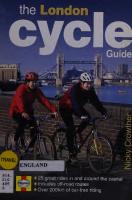
The London Cycle Guide 1859603203, 9781859603208
Have fun cruising around London! The exciting routes in this guide cover more than 250 miles of enjoyable cycling. Much
121 101 13MB
English Pages 148 Year 1998
Recommend Papers


![The Rough Guide to London (Travel Guide eBook) [13 ed.]
9781839059230](https://ebin.pub/img/200x200/the-rough-guide-to-london-travel-guide-ebook-13nbsped-9781839059230.jpg)

File loading please wait...
Citation preview
Nicky. Crowther
travel
ENGLAND
I
aynes) [ ® 1
s in and a 'oad route: of car-free
Nicky Crowther
^ILf-XlO^0!
301 30 1455619
Acknowledgements Thanks go to the following for their help in working out the routes in this book:
London boroughs and neighbours Barnet: Tanseer Sadiq, environmental services Bromley: Deborah Barnes, traffic, and the rangers and Ros Martin of Crystal Palace Park. Camden: Mr G Morris City of London: Ian Simmons, engineers Elmbridge District Council: Martin James, countryside and land resources manager Enfield: Mr G Ludlow, traffic engineers office Epping Forest District Council: Mr Keasley, Paul Hewitt and Margaret Jones Epsom and Ewell District Council: Alan Flaherty, highways department Greenwich: Mr R Warhurst Hackney: Liam Mulrooney, environmental services Hammersmith and Fulham: MrS Franklin Haringey: Malcolm Smith Harrow: Ashad Khan Hillingdon: Bob Castelijn, transportation
Hounslow: Mr S Sidhu, principal engineer Islington: Tony Bowen Lambeth: Maz Khan and Angela Christie, transport planning Lewisham: Brian Dalton, transportation planning Merton: Peter Thomas arid Edwina Parry Newham: Mr M Hill, engineering Richmond: Councillor Jo Frith, Carole Rapley Southwark: Rob Hayward, Stave Hill ecology park, Rotherhithe, and Mr Barkatoolah, engineering Surrey County Council: Will Ward, district engineer, Mark Bisson, divisional engineer Tower Hamlets: Matthew Hill, transport planner (cycling) Wandsworth: Mark Raisbeck, Mahmood Sadiqqi and Adewale Adeyoyin, engineering consultancy Westminster City: Peter McBride, senior transport planner
Other organisations British Waterways: Mark Blackwell, Madge Bailey and Liz Kelly Corporation of London, Ashtead Common: Paul Ritchey, keeper Corporation of London, Hampstead Heath: the superintendent, Mr P Canneaux Cyclists’ Touring Club: Colin Palmer, off-road access officer Epping Forest: the superintendent Mr Besent Groundwork Colne Valley: Paul Hodgson, Colne Valley programme manager Hainault Forest Country Park: Linda Herbert Havering and Bedfords Parks: Paul Vickers Lee Valley Regional Park: Paul Mitchell, access officer The London Cycling Campaign
London Docklands Development Corporation: Phil Harrison, cycle officer Royal Parks and Estates: Mrs Jennifer Adams, LVO, head of commerce and inner park; Simon Richards, Richmond Park superintendent Sustrans: Jane Heggett (London) and Jeremy Isles (HQ) Thames Water: Mike Brophy, recreation manager Trent Park: the chief ranger Wimbledon and Putney Commons Conservators: J A Reader, clerk and ranger Thanks also to John and Sarah Crowther, Phil Elms, Perry Bellisario and Katie Burgess for their companionship and help in hunting for clues.
Thurrock Council Libraries
Contents Acknowledgements
2
Overview
4
Foreword
6
Introduction
7
Explanatory notes a
CITY RIDES
17 Grade 7
'
—
km
\
1
Palaces, Parks and Politics
easy
10/13 km
20
2
Fashion and Philosophy: Camden to Covent Garden
easy
8km
24
3
Sunday up the City
easy
10km
28
4
Thames Bridges from Chelsea to Lambeth
easy
6km
34
5
Tower Bridge along the River to Greenwich
easy
15km
38
6
The Isle of Dogs
easy
7km
44
7
Greenway and the Royal Docks
medium
16km
48
8
Marshes and Meadows of the Lee Valley
easy
13km
54
9
Green Tour d’Hackney
easy
10km
60
10
Hampstead Heath and Parkland Walk
medium
9/17km
64
11
Barnet Brookside
medium
27km
68
12
Kew, Ham and Richmond
medium
20km
74
13
Wimbledon Common and Richmond Park
easy
10km
80
14
Three Commons and the Wandle
easy
14km
84
15
Herne Hill to Greenwich via the Ravensbourne
medium
17km
88
COUNTRY RIDES
Grade
km 26km
94
16
Into Essex
medium/difficult
17
Epping Forest
medium
17km
100
18
Hadley Common and Trent Park
medium
12km
104
19
Pinner, Harrow Weald and Northwood
medium
21km
106
20
Colne Valley Scamper
easy/medium
6/17km
110
21
Western Water Tour
medium
38km
116
22
Chessington Chase
easy
12km
124
23
Epsom Gallop
medium/difficult
19km
128
24
Valleys and Views around Warlingham
difficult
27km
132
25
Big Air at Biggin Hill
difficult
29km
136
•
Useful addresses
142
Credits
144
Bovmgdon ?
I
fV
Abb"NT>
[Youth yCen
PRIMROSE HILL
nuyti.
'
^/lailOcyotA^-kV
PRIMROSE \/HILL' '
’House"
^CVVMDEIN/S
:
\ M
KMOf n GEORGE'S,CATH
Kennedy
REG?
Glassl'nusos
I Hotel i-'
BOATING
.
iusinessvSc ^(Un of Lon)
[QUEEN, MARY’S \ CARDENS. , (MUNSI.
’Bandstanii;
^\ \ IRegent svCm!
. MARVUEBOM
EUSTON
CARDS NS.
eP
■\IAKE
OCLorVdon,
v
Cumberland ' I Gate
fc^S\VOollege%^
Royal Colleg; of Physician
-TenmsK Courts
LONGFORO
^ Cen
, EUSION TOWER,
'PARK «s®
? so
>ScfNpa t e ^ y,SHERLOCK'HOLM
\%3DNS^r;•-
POHITaND’
U S^MAD A~M E -
IARYLEBON:,
KM' WD0N'’
‘r-^?,Tsgj\3*cA
w,;
' ,
381
WTpsMri tNHAM__
So> y.^r-ASTORia' UrvTA i rn. ,
6
After 100m turn right at the zebra crossing and walk down Kent Passage - mind the pedestrians - to reach the Outer Circle of Regents Park. Cycling is not allowed in the park itself, apart from on the Inner Circle road. (It was a campaign by the Cyclists’ Touring Club that got cycling permitted on the Outer Circle in 1885.) Turn left and follow the Outer Circle threequarters of the way round for 3km, passing London Zoo and the Regency Nash Terraces.
7
Leave the park at Marylebone Road, continue straight across at the lights into Park Crescent
and turn left down Portland Place. After 100m take another left into Weymouth Street and go right at the end into Great Portland Street (following cycling signs). Take the first left into Clipstone Street (where the Telecom Tower looms). At the kink, continue straight ahead (Maple Street) and take the first right into Fitzroy Street. Continue straight ahead past the TV company HQs and eateries of Charlotte Street. Cross straight ahead at Goodge Street and continue down Rathbone Place to London’s temple to shopping, Oxford Street.
ROUTE
iRoyal'Cancastefi
WASTfcR’% r GATE (
fy
[borough'^&h-'ictoriajGate
OXFORD STREf to through trail from 7a m. 7p n
Gate 'The Fountains I
•tester ce Gar pefce s r
| BIRD /"SANCTUARY
\IGTON )ENS^ I
HYDl
Physical Energy Statue N
THE SERPENT 3'serpentine GALLERY
Clubhouse"i
•Bandstand „ "
rotten row Pa h yo»l;ng\_\Tenn>
q Queen's
Gate /f
tTNBoyal'
Prince of lCrn \~~\ fj Cts CoalbrookHale :. —Wales- AlexandraI HTTTGate 15
_
;tongml2 l , Roy Geoy. \ROYAL USoc.
Vbert,-5£>.
8
This is the boundary of Soho, the dense quarter of cafes, theatres, media offices and strip joints. Continue straight ahead into Soho Street, round to the left of Soho Square and at the far side down Greek Street. At Compton Street, packed in the summer with cafe society, continue straight ahead to the T-junction with Shaftesbury Avenue. Turn right carefully and continue down Shaftesbury Avenue almost to Piccadilly Circus worth a lock-up and look. Fork left down Great Windmill Street and at the lights at the end continue straight ahead, extremely carefully, down Haymarket, which has fast traffic. At the bottom, either dismount and use the pedestrian crossings to turn right into Pall Mall, or do some nifty lane changing.
9
100m along Pall Mall, turn left into Waterloo Place and carry the bike down the wide flight of steps at the end to emerge on The Mall.
Buckingham Palace is to the right, Admiralty Arch to the left and St James's Park over the road - no cycling. Cross into Horse Guards Road nearly opposite, passing Horse Guards Parade on the left, site of many ceremonial occasions, the backside of Downing Street, home of the prime minister, and the Cabinet War Rooms, Winston Churchill's war¬ time headquarters.
“t A\Turn right at the end into Birdcage Walk, A v past the backside of the Home Office, the Guards’ Museum and the parade ground of Wellington Barracks, home of the Foot Guards. As you approach Buckingham Palace, because of changing lanes across busy traffic, either dismount again and use the pedestrian crossings or get into the right-hand lane ready to turn right beyond the black iron gates to gain the front of the palace once more.
The 3km of riding inside Hyde Park around the Serpentine is grand for children.
aJurr&erland^A^loiint ^ ^5Tmarbl£'"Xaj
^CATH %%6^0
Ssfi EarchVo^^354^ 6^' 'Sotheby.s'
S3S 'nsfe^
CORNER, ) STREET where marked rs closed gh traffic (except buses & taxis) m 7p m Monday Saturday - ^
^MAYFAIR W\\\ ^MONUMEN/S ^4 // IzFJ nl ,The)Momjment/'•:/
I juildhalil 1\ UniCJj
M.OWER-GTWY^
1. )
L/cannont*,,
5
OWER HIU,'
JUondcm—j rTT--Fvc>\ iCommodGyfT ST \\£v r^^cha ncjeirA t marine's &
.TOWER
MLonoon l GlazUs/$/ BRIDGE p
S-^S/HOSP
■
Hay s ^ Galleria
CATH /ztON
HMS BELFAST
li3S.Ml«'-4^#S0UTHWARIC /a CROWN CT
■S>;:iI6n.dqn25L,
f
International
;uVstofrTOjf\r/ cr h nglsch
/ Tow«rj_. -
/LThistletj^wrfl -
WWAPPING'JlS
t^yKatharine's Pier* if Albexman' y Stairs
J TOWER
BRIOGE J MUS & EXHIBITION
DESIGN
.-CSpots’ iFTVF
Little Britain. At the end, turn left into Montague Place and left again at the roundabout into Aldersgate Street.
Street, and right at the first lights over the railway bridge along Primrose Street.
4
At the traffic lights at the main road, go straight ahead into Spital Square, and right along the front side of the old Spitalfields market building - a former fruit and veg market currently used for sport, fun fairs, alternative retailing and dining, but now threatened with redevelopment. Turn left at the end along the side of the market, towards Nicholas Hawksmoor’s Christ Church, Spitalfields. At the end, cross Commercial Street and go ahead down the left-hand side of the church along Fournier Street, with its 18th-century terraces now occupied by wealthy city traders. At the end turn left into Brick Lane with its smells, sights and sounds of Little Bangladesh. After the East End Jews moved out to north London, the Bangladeshis moved in. Now the quarter features mosques, sari shops, wonderful curry houses and music. Take the second right down Hanbury Street, giving way at the change of priority at Spital Street. Continue along Hanbury Street, staying left at the mini-roundabout. Go right to the end and down the alley, turning right onto Vallance Road. Take care crossing Whitechapel Road into New Road, where there is an abrupt architectural change to clothing .
7
After 200m turn right at the lights into Beech Street and continue to the far end of the tunnel. Then turn right into Whitecross Street.
5
This is the entrance to the magnificent Barbican Arts Centre. Use the cycle parking and wander in for a look at the lake, some Shakespeare, a concert or maybe just some refreshments. Then continue riding along Silk Street, turn left into Moor Lane and right into Ropemaker Street. Cross straight over Finsbury Pavement into South Place and continue straight ahead on the cycle lane down Eldon Street.
6
At the end, dismount to the left at the side entrance to Liverpool Street Station. Walk up the marble stairs to the left for a view of Broadgate Circus - a winter-time ice rink. Continue walking ahead around the Circus and through the pedestrian passage to the iron gates. Turn right into Appold
factories - the rag trade remains the mainstay of the local economy.
1 nsligji
ilHSiSS
*118 •To* f«T-L-JL
jj|
mm
Continue ahead at the traffic light junction with Commercial Road into Cannon Street Road and continue underneath the railway bridge. Beyond it, turn right into Cable Street, which is commemorated for the 1936 street battle between fascists and local residents, and was bombed to oblivion in the Second World War. Ride along the main carriageway, not the contraflow cycle lane, with the Docklands Light Railway high up on your right for 200m. Turn left at the lights down Dock Street, signed LCN Wapping. At the junction with The Highway
35 P
ElseC”
-
8
1
go straight over into Vaughan Way. Turn first right
Left: The timbered gateway leading to the church of St Bartholomew-the-Great. Originally, this was the church doorway, but the nave was demolished in about 1540 during Henry Vlll's dissolution of the monasteries.
—*
Opposite: The magnificent west front of St Paul’s Cathedral. The route passes to the left.
iitTSMi:
iji 0 J5L.u>‘
after 300m at the zebra crossing into Thomas More Street. This is the territory of the Docklands ‘yuppy’ where derelict docks and wharves have been converted to upmarket housing and marinas. Continue to the end and turn right along the cobbles of St Katharine’s Way, with the river through the wasteland to your left, and follow signs to St Katharine’s Dock. (For a short diversion on foot to the river front with a view of Tower Bridge, follow the Thames Path signs between the housing.)
9
Explore St Katharine's Dock, the first and most elegant of the resurrected docks, through to the right. Its hostelry is the Dickens Inn. Continue across the bridge across the dock mouth under the Tower Thistle Hotel, one of the most expensive in the capital. At the end, turn left for the passageway beneath Tower Bridge, where you must walk the bike. (A museum relates the Bridge’s history and operation, and you can cross the high-level walkway.) Emerge in front of the Tower of London. Continue to walk the bike and, avoiding the tourists, complete the riverside edge of the Tower, and then turn right up the far side to climb to the main road, Tower Hill. Turn left along Byward Street, dismount and cross right at the pedestrian lights into Great Tower Street and go immediately right up Mark Lane. Note Fenchurch Street Station through to the right. Cross over Fenchurch Street into Billiter Street.
U
At the end turn left into Leadenhall Street and pass the fantastic Lloyd's Building, the work of the architect Richard Rogers, where the plumbing and wiring is elevated to a desirable feature and displayed on the exterior. Continue along Leadenhall Street and turn left down Whittington Avenue into the grand aisles of Leadenhall Market, built in 1881, where the shops retain their period style.
Walk your bike through the tourists outside the Tower of London - or you risk being thrown inside the White Tower.
Go straight ahead through the market and turn right at the end into Lime Street. Turn right into Fenchurch Street and left at the lights into Gracechurch Street. Just before the lights, hop on to the pavement and walk the bike to cross at the pedestrian crossing down Fish Street Hill to the
Monument. This commemorates the start of the Great Fire of London in 1666, which destroyed much of the City of London. Ascend the Monument for a fine view. Retrace your steps back up Gracechurch Street for 200m to Cornhill on the left. This is officially a no-left turn, so please dismount the bike, walk on the pavement and remount. Continue to the
junction, where the Royal Exchange and the Bank of England stand on the right, Mansion House (the Lord Mayor’s official residence) on the left. The Bank of England Museum and the Stock Exchange are reached along Threadneedle Street. To return to the starting-point at Blackfriars, follow Queen Victoria Street ahead and to the left for 800m. Watch the traffic.
ROUTE
4 CITY CENTRE
Thames Bridges from Chelsea to Lambeth
T
his superb ride along the river provides a great snapshot of London. Follow the Thames Cycle route (National Cycle Route 4) from Chelsea Harbour to Lambeth, with an option to
continue to Tower Bridge. Cross the Thames three times via magnificent Victorian bridges, and run along the embankments in between. See dozens of famous London sights and landmarks as the tide ebbs and flows beside you. From Chelsea Harbour, cross to the south bank and ride through Battersea Park past the Peace Pagoda and Battersea Power Station and back to the north bank for Tate Britain. On the far side at Vauxhall Bridge is the MI6 building, home of the secret service. Cross to the south bank again and finish at Lambeth Palace, home of the Archbishop of Canterbury. A little further north is the best view of the Houses of Parliament. The route cleverly lifts you out of the traffic on pavement paths along Cheyne Walk and Millbank. Mind people on foot here, and take care cross narrow Albert Bridge. Official negotiations continue on the wonderful 4km central section marked in dashes from Lambeth to Tower Bridge. The stretch is only properly open to walkers, so ride slowly and dismount if it gets crowded. Along here are the cream of attractions; the London Eye, the Royal Festival Hall, Tate Modern, the rebuilt Globe threatre, the Blade of Light bridge and Southwark Cathedral. The Thames cycle route continues westward along the river to Putney, Richmond and Hampton Court, extending to Reading, Newbury and eventually Bristol. Travelling eastward the route becomes NCN1 at Greenwich, continues to Dartford, leaves the river a little before Rochester and continues all the way to Dover.
Park or push the bike, and start with a walkabout around Chelsea Harbour marina, a former canal basin now filled with luxury cruisers and hotels overlooked by Belvedere Tower. Cycling is not allowed inside the automatic car barriers or on the river front.
2
Mount the bike outside the harbour barriers to cross the bridge over Chelsea Creek, where herons can be seen fishing, and take the first right beside the Firkin pub into Lots Road. At the junction at the end, beyond the vast, defunct Lots Road Power Station, turn right into Cheyne Walk on the pavement cycle path, beside Old Wharf and the Chelsea Yacht and Boat Company.
3
Continue for 1km along the pavement past Battersea Bridge, and cross the river via Albert
A
Bridge, built in the early 1870s, taking care on the narrow roadway. On the south side of the Thames, continue down Albert Bridge Road for 200m. Turn left through the ceremonial gates of Battersea Park. Continue straight ahead along the roughly tarmacked North Carriage Drive, past the restored Grand Vista (right), first constructed in 1951 as part of the Festival of Britain. Then comes the Peace Pagoda (left), erected in 1985 and the 70th of its type built around the world by Buddhist monks, and finally the Children’s Zoo (right). At the fork go left, and emerge on to Queenstown Road opposite Battersea Power Station (also defunct).
5
Cross to the other side of Queenstown Road
using the toucan crossing and ride carefully over Chelsea Bridge on the pavement.
TiPorchester
uirougn name 'except uuses a id* •fom-7a.nl -7p.m. Monday - Saturday
uate
.The Fountains
\ Gate
Terrace Gate
^Inverness Ter/ace'
Chelsea to Lambeth 6km (eventually, Chelsea to Tower Bridge 10km) Easy - all flat Grade Preferably with smooth tyres Bike Yes, with care. When the Suitable for the major roads. When the children/beginners? section from Westminster Bridge to Tower Bridge is complete, this will be a classic cycle ride Traffic and surface 25 per cent traffic-free, 100 per cent hard-topped (in future nearly 100 per cent from Westminster to Tower Bridge) Chelsea Reach and Lambeth Start and finish Bridge Battersea Park, Queenstown Overground Road (Battersea), Vauxhall, stations Victoria, Waterloo Fulham Broadway, Sloane Underground Square, Victoria, Westminster stations The Firkin in Lots Road, cafe Refreshments in Battersea Park | Great river views, Chelsea What to see Harbour, Peace Pagoda in Battersea Park, MI6 building, Lambeth Palace, views of Palace of Westminster | Museum of Garden History What to visit (closed Saturdays and midDecember to early March), Tate Gallery Distance
KENSINGTON f\GARDENS*: KENSINGTON PALACE
i
vLancaster
‘OUKNSWAY,
Physical Energy k. Statue
ROUND POND ^SERPENTINE IPENTINE /v. 'GALLERY vT"
'COURT
COLLECTII
Clubhouse"r
•Bandstand
Jfl«nyrmgnren, (Grn ^ rl CIS
Albert Memorial
Palace
,s
Prince
Coalbrookdale __Wale O Alexandral "U T H Gate
Queen s
5TUn_Go5LT-S 1 i Roy Geuy. \ ROYAL W-Soc. JALBIRt4R>,
DKENSINt
izrGoetheJ.J institut]
iiSt
%1
J
ftVICTOBIAN
STt4 ^=tSCI6NCE-MUS ,_CNAT^‘=t-FAf,7H\
i O clMISTORyQAUT1BiLS)
&Wbert \ MUSEUM
aBADEN-^MUS.-J
Ij'ROWELL-HO^—r,,-^^— ifpSMAli
^.GLOS-ROAl rShop-, yflForumTpn^ i&Hoiel \ulos -
ial* «£soum
KENSING
T '*PE1.H4MT -' .jrx !>*IVERN -Sr--LL
«^Coll
ftx'fiOVA ,BR0MPTI
^HOS! :0LEH£RNi
IlCOURK *BURTON' vMUS Danelagh X ^GARDENS sX ROYAL ^HOSPITAL \ CHELSEA
mema'
H Vm /'
°TONii
CHELSEl WES A'HOSi
'TERY
Use riverside pavement cycle path here
mm
Paqodo WATERSIOE POINT
A,/ DOC* X
Festival \\ Pleasure \\ Gardens i'
tOUNTAIH 'haring \
Jurist £>)!'2v4;'L"S3Neis loa'd^COCKs^^-ptt.^'
Arabia-
'
^CIVIL SERvJ\A^
PARK
AMES'SS
armyV
MARLBOROUGH
Sandsia-d
/..HOUSE r-. \ J^CIarence'1
/'Duck u //cy
Bandstand
~t
/
7Q^pArk
| 077 Owning1 ■ST^jCen.
WATERLOO' iTA.tVesrmrrrsfar fe7//
_
GALLERY
9[Slalue,LJ 7/
.
FLORENCE NIGlr INGALE pus, =
iltel
:
siJ'br::
r-¥l Looses.
fellingtonMl
^Sp^glnS
WATEpLfOO'
rSruament TH( mas;
r^te^^ilSt^lNOUSTRY industry] F=
THE.ROYAL-
/
Wj^TERNAT-IOM^
^ BRIDGE
GUARDS -p-rMUS”
QUEENS'
Si
CASTLE'
.(-CABINET /L® WAR R00MS«~S ^
BUCKINGHAM'S =S=r'"'N. PALACE\
rfl^S&iA'-.
House)
">S7. JAMESES rial /
I
ps1 TATTER!
.Horse HQ A — - Guards^- P Gj/a.as AopgTaiie c. Memor.al\c;\ | If T/CABINET
^SpencersHo
.Centre!
Jtj£jK2|
ROYAL&W, MOMr h 7 rW^tifST.iv .,‘>5 C\ WAYWARD GALLERY'
^=MAFFI SguupG AL L'/J^i3jrtr
-GREEN
IICKINGHAM ACE GARDENS
t^MBANKMENT
^^fo-AOMIRALTY .(\ V_ xv^MAUC ARCHU \\W.
)hnsties
The'Londan* BWxV%fch aIbion
(CiviCy,^.
/-
X^THE LONDON VGAS MUSEUI
T
asch
bETHELL.
/
%
s&
n
IARGEABL£
II l^BEACONSF
L@Wai
] prcwgn BLANCHE~*si' HO
CLIFFORD-
7
.CROYDON «GARR If
nthetic [Pitch ‘
'Svondali
•VENU|
^SfSBUE
\ LOCHNAGAR-
■l^NGDONr
\\PK
GasWorks
^VINCENT.
ISBURYi £ est-
Carrier
ricaroo"
uumm n
DHS'
\
-ROYAL VV-
^VICTORIA^f
(p W E S T- Q Black wall Pier
popCar’
Works
POPLAR Thames's s Wharf
poplar\ \dooo
Canary Wharf r-Tower
Blackwall Point
London City' v ’ -Airport. \ v PierJ
BLACKWALL
Map base © Nicholson 1998
BASIN
j WEST'INDIA~DOCKS
SOUTH, QUAY
MERIDIAN *i GATE 5/,
\P10r '
Under Construction
Pumping Sta
Delta1
Manhattan
'Whari
Phocmx Wharf
Wharf Jetty
CEARNS
H
\tUPJONMRK;'•
The Greenway is locked after dark. Bikes are not allowed on the Docklands Light Railway (DLR).
PARK!
ROUTE ALLOTP
For information on cycling and sites of historic interest in the Lee Valley Park, telephone the Lee Valley Regional Park Authority on 01992 702200; fax: 01992 702230.
l?scSLri1>LAIST0W^^sf'
Bowl Grn,
^CASTl!fA .jAtoes / HO’
EAST HAM; JEWISH,-'
e=sSch
Y 1 v*P .Clime Gomm ; :
Q
'BRAMPJON. park/~~~-
NEWHAMGENERAi. c HOSPITAL/”
Con-
5 ,#°\2
-S B.
_^Health • Ye - Cen,-***^
WANVj^-
1
.)Qrts i
r- Cen
\6sMO'Kg:
,1 ^'onSO
WGRrillk^ BECKTON^
.PLAYING FIELDS
Tennis’, J-Cts-I
r
TERENCE ’ MCMILLAN •STADIUMS
——-
’AIMER
UBBSz \ PT I
'
CEMETERY-
IND.PK
rI Sports Cen£ r|playinS^-z^field^Q
\P\
'-VA">rS'
Pav \
\
\
\
O0RCH,D CIO!_^ 1 /) SORREL
'BECK TON,
PERIDOT
V? -Superstore
CANNING TOWN Civ f
REC
SciLT u
Beckton
—XADrySkiS
Tast'ham]'^??
grd
rr^Comm
/es-'v I k1
‘
KIRKHAf
LCHEV MAPIIN RD
^eusTDiymt JOKING AL
>ai Comm.Cen'-^'
GEORGE V
^ imnn
LOT
f \X
\WPARK
/'Newham
KERR}.
Will Thorne
dlo\
Pav V (TA
%fo&L coTTCFlrr
NEW BECKTON PARK
CUSTOM HOUSE
PRINCE REGENT
CAMp/ok c
ALLOT ,1
ALLOTMENTS
B0S5
I
t AL ALBERT
BECKTON
Warehouse
ALBERT
ROYAL
VICTORIA
DOCK
J, LONDON CITY AIRPORT TERMINAL BUILDINGS
PONTOON DOCK l
u M ^—
KING GEOI
■ ■r^^o6iw[firsrNLif
Iixhamsi
SlLVERTOWN & L0N00N CITY'AIRPORT.!
Works
Thames
'OflTRJ
SILVFRTOWN
TANOAf® IND ESfJ
PARK! Works!
WOOLWICH
THAMES FLOOD
BEACH
Footbridge to the south side of the dock. To the west is Royal Victoria Dock.
3
On the far side of the bridge, pass underneath main Connaught Bridge (A1020) above and take the road on the right to the mini-roundabout. Take the third exit, right. At the big roundabout after a few metres (watch for the Tate & Lyle sugar refinery tankers), take the first exit, left, marked the Blackwall Tunnel. At the third roundabout (North Woolwich roundabout) go right to pick up the cycle route west along North Woolwich Road.
(After 200m on the left is the entrance to the Thames Barrier, which is worth a diversion through the wasteland approach, where a new park is under construction. Unfortunately, the visitor centre is located on the south bank.) Another very pleasant diversion is Lyle Park further along North Woolwich Road. 1km on from the Barrier, turn left into Bradfield Road for the park entrance on the left. The tranquil park between the industrial sites was donated to the Borough of West Ham by the sugar refiners in 1912 and occupies a precious 50m of riverfront, however, there is no cycling in the park.
4
250m further along North Woolwich Road, take Dock Road, the side road to the left of the flyover, and continue past the old Tate & Lyle refinery and the Charrington brewery to the end. Follow the cycle signs. At the roundabout stay on the cycle path along Lower Lea Crossing, pass the timber yards and nature reserves of Bow Creek, which twists and turns as it escapes to Old Father Thames. Watch for herons. On the far side of the Creek, turn left back on yourself down the slope into Orchard Place and divert right at the bottom round to the East India Dock bird sanctuary.
5
Return to the cycle path on the main road and continue westwards. At the roundabout continue westwards on the path (signed LCN Isle of Dogs/Greenwich, not City) beside the fast road (Aspen Way). Pass the Reuters building (satellite dish on top), designed by Richard Rogers. Stay with the path as it moves into back streets and emerge at the traffic light T-junction with Preston’s Road.
6
Use the Toucan lights to cross Preston’s Road to the shared cycle/footway on the far side, go right
Right: Signing on the Greenway Overleaf: Clock Mill on Three Mills Island a gem hidden amid east London’s light industry.
and head down the cycle track subway that leads under the roundabout. Follow signs for Poplar back up to Preston’s Road, turn right briefly and take the first left into Poplar High Street, signed LCN City and Hackney. Take the second right, Newby Place, past Hawksmoor’s All Saints Church to reach busy East India Dock Road. Cross over using the pedestrian crossing on the left and go north up Chrisp Street ahead. Pass Chrisp Street market on your left and converted Spratts warehousing/housing on your right, cross Limehouse Cut (now permanently closed to bikes, as it is too narrow and floods), and continue as the road becomes Morris Road and Violet Road to the mini-roundabout with Devons Road at the end.
7
Turn right into Devons Road at the mini¬ roundabout, and go straight on at the next one, past the DLR station. Over the bridge, take the second left (still Devons Road) and the first right after the low bridge, Talwin Street. At the end on the lefthand bend, walk the bike on to the dual-carriageway pavement round to the left, and find the subway that leads under the motorway to Tesco. Emerge at the supermarket, walk the bike in front of it, and turn right down Three Mill Lane.
8
Ride down to the old mills. In House Mill on the left, built in the Dutch style in 1776, grain was ground for distilling gin. Turn left through the buildings, pick up the towpath beside the river and follow it back to the main road (All High Street). The entrance to Greenway is 100m to the right. If you want to cut off the ride’s top corner, take the Long Wall Path from Three Mills past Abbey Mills pumping station to the Greenway. Please take particular care on the first section and crossing the Prescott Channel bridge, where it is better to dismount altogether.
fiIll jap 111 II
ROUTE
8 THE SUBURBS
Marshes and Meadows of the Lee Valley
H
ere’s a sweet turn around the canals, marshes and meadows of Hackney and Walthamstow, and nearly all off-road into the bargain. Note that you can only complete the
full circuit after a dry spell - on Walthamstow Marshes near Coppermill Lane there is a section beneath low railway lines that gets flooded and completely impassable after wet weather, particularly in winter. Also note that up the quiet backwater of the River Lee above Old Ford the path is narrow and a bit creepy, so take care here and don’t ride alone. We start at Old Ford Locks, run up the River Lee beside Hackney Marsh, past the Middlesex Filter Beds nature reserve and then alongside Walthamstow Marsh nature reserve (please stick to the path), to return down the towpath of the Lee Navigation to Old Ford. Although they are cyclable, two sections are in need of work. These are the backwater mentioned above between Old Ford and Carpenters Road and the stretch under the railway lines on Walthamstow Marshes where you have to duck your head! These two sections form part of the Lee Valley pathway, a 25-mile route all the way from Ware, Hertfordshire, south to Greenwich on the Thames, due for completion around the year 2000. The track, which is route number one in the National Cycle Network developed by Sustrans, is designed to relieve cycle congestion on the River Lea/Lee Navigation towpath. For an information leaflet on the Pathway, contact Lee Valley Park Information Centre, Abbey Gardens, Waltham Abbey, Essex EN9 1XQ; tel: 01992 702200; fax: 01992 702230.
Distance Grade
| 13km j Easy - flat, but narrow canalside in one place and a very low bridge in another
Bike Suitable for
Preferably with knobbly tyres Yes. Lots of traffic-free riding and children/beginners? open space Traffic and surface 90 per cent traffic-free, all surfaced Start and finish Old Ford Locks Overground Clapton, Hackney Wick, Stratford stations Refreshments Prince of Wales pub on Lea Bridge Road What to see Old Ford Locks and Big Breakfast studios, Middlesex Filter Beds nature reserve, Walthamstow Marsh nature reserve, Springfield Marina
The green corridor of the Lee Valley, used by migrating birds and cyclists alike.
fry
RECREATION GROUND
PARK> ■^UajDBURv
To cycle the towpaths in London you must get a permit from British Waterways and please follow the Waterways Code for Cyclists (page 10).
GROUND
In
/ ETON'S*
\v£
MANOR 'T 1 SPORTS Lea
MARSH
1 GRD
Valley
^Sports
V'-'A Centre, LESON.
\rshgate Bridge
MOBLEY >§>VSN GREEN < Xys£\ '
P»v
HOMERTON
—Pav
Z^/
WICK FIELD AZ
EASTWAY CYCLE %CIRCUIT
"
Z /^ASTWAV \ 'Zr / COMMERCIAL., y\CENTRE=^
-%\
HOSpiTAC*,’^ |UUUVi\i V \
' CKNEY^
-(clo'sed)V\^\S HOMERTON; ORIEL
I
R0Tp~
a ' MXffrkJt
ROAD
HASSETT
, FHD\
.BALANCE
WIG/c Works
s®
ALLOT
vgHACKNEY w
WELL x STREET COMMON
.(Queens Gate
I
carpenter: BUSy^ PARK f
Works
Map base © Nicholson 1998
Bandstand
P^WAVERTON HOpO)
if, CANOY \
VICTORIA /> Victoria > Fountain
wWA'I
'i Gunmakers
V
—-‘oiois^ra'
PARK G°r*f\DEER. Gafe\PARKi
YT\
i
ipbsfj
PUDDING MILL'LANE
Crown
Gate' •Centre:
I
Find picturesque Old Ford Locks - home to TV’s
The Big Breakfast - at the end of Dace Road. Cross the black and white bridge and follow the sign for Carpenters Road left up the river path (not up the canal). Ignore the waterways leading off to the right. Cross over the green bridge and go left carefully where the track narrows. Cross the black and white bridge to the high-level path and continue to Carpenter’s Road.
2
Turn left into Carpenter’s Road and take the first right up Waterden Road, through the industrial sites past Hackney Dog Stadium. At the lights go straight ahead and pick up the path on the right beside the River Lea, just on the other side of Homerton Road.
3
Continue to the railings of the Middlesex Filter Beds, now a nature reserve open to the public
during the summer (call Lee Valley Information on 01992 702200 for opening times). Follow its perimeter around to pick up the towpath of the Lee Navigation northwards. (When the Lee Valley Pathway is complete it will cross the river via a new bridge linking Hackney Marsh and Walthamstow Marsh via Essex Filter beds, making this route a true circuit rather than a figure of eight.)
4
Leave the towpath through the car park of the Princes of Wales pub, turn right eastwards, on to Lea Bridge Road. (Walk the bike along the pavement if you prefer to keep out of the way of the heavy traffic.)
5
Pass the Lee Valley Ice Centre, then after 100m turn left northwards away from the road, following the sign for St James Street, Walthamstow, Chingford, along the gravelled track, past the
then turn left through the bike gates and get back on to the towpath of the canal beside the narrow boats.
Lea Bridge Riding School. Continue along this filled-in aqueduct to the crossing of railway lines.
6
8
Here you hit a short piece of track due for upgrading soon as part of the Lee Valley Pathway. This side of the arches, leave the track, go right and duck carefully under the very low railway line - mind your head! In winter the path here is usually flooded and completely impassable. Turn left and go through the neighbouring arches to continue northwards over the grass banking, with the fenced-in Thames Water Coppermills Water Treatment Works on the right. Continue in the same direction across the field to the far corner and emerge through the gate on to Coppermill Lane. Turn left under the railway.
Continue southwards for about 1.5km (to just before the steely-green ice rink) and go right over the black and white footbridge to the far side of the canal. Stay heading south on the towpath under the Lea Bridge Road past the pub. Continue along the canal for 4km back to Old Ford Locks, following the signs for alternative parallel tracks where you are not allowed on the towpath itself.
Right: The green corridor of the Lee Valley, used by migrating birds and cyclists alike. Walthamstow marsh is a nature reserve of atmospheric beauty bordered by the Lee Navigation.
7
Continue across the top edge of Walthamstow Marsh Nature Reserve, a Site of Special Scientific Interest (SSSI), to Springfield Marina, I'VWo/ks-
>morKs
'FilteryfBeds
Overleaf: Idyll in E5 - pootling along the Lee Navigation. 1 ST. ^ '''Supers’. 'CAMBRIDGE'^glil "HEATH nCSfe
ERSTONj 4 PARK i
lond5n |S CHEST 5S
H0SP^-> S^»SckG^
QUEEN ELIZ
Map base © Nicholson 1998
'H0SPVG'AU
\ fc'libf- S\ IMHNAL'iL^t^ nRFFNVrtRNWAU^
^ ^ ^cComm) ALCbr Cen'
&
MEATH
\
gardens'
another 100m. At the Downs, take the track diagonally across the grass, straight over a concrete circle, to the far corner to leave on Downs Park Road.
3
Turn right, then left on to the main Amhurst Road. Soon, at the mini-roundabout, turn right into Sandringham Road and immediately left into Wayland Avenue. Continue straight ahead at Dalston Lane on to the cycle path of Navarino Road. Cross over main Graham Road, and take the first left into Wilton Way, and then the first right into Eleanor Road. Cross Richmond Road at the end and pick up the track through London Fields.
6
Where the towpath rises over the canal junction, turn left up the Hertford Union Canal, built in 1830 to link the Regent’s Canal and River Lee Navigation. Continue for 1km to the third bridge, Three Colts Bridge, which bears a heritage trail sign and carries Gunmaker’s Lane over. Here leave the canal, turning left into Victoria Park.
7
Turn right inside the park and follow the wide designated cycle track along the outside edge, to the end, St Mark’s Gate. Turn left across the park, back to the Falcon and Firkin.
4
At the end, at the Pub on the Park, turn right into Martello Street, past the pub, and then turn right on the cycle path back on to the Fields. Continue to the end, the cycle path crossing over Lansdowne Drive and into Broadway Market.
5
At the end, find the gate to the Regent's Canal towpath in Regent’s Row to the right. Turn left on the canal and continue for 1.5km. It’s narrow in places and there are lots of anglers to give way to.
Right: London Fields after a rain shower. Below: East End life is alive and wriggling in Broadway Market.
rt^Ki' ■l|io ^
-^HMnT
Hampstead Heath 10 and Parkland Walk ROUTE
THE SUBURBS
H
ampstead Heath may be renowned for poets, kites and drinking holes, but it won’t go down in history for its cycle tracks. Considering its size, cyclists get a strictly limited share
of the pie. The three linear tracks you are permitted to ride finish at roads, which means a circular tour within the Heath doesn’t exist. This ride is split into long and short loops. Our long route down to Finsbury Park makes the best of a bad job. Although a third of the riding is car-free, the rest is on-road and much of it very busy, so we cannot recommend this route for children. The short loop keeps to the Heath as far as possible. From Hampstead Heath station, the route scrambles over the Heath, passes two famous pubs, Jack Straw’s Castle and the Spaniards, and then heads for the smart hill village of Highgate. Here the short loop turns down across the Heath again. The long circuit continues 3km to Finsbury Park down Parkland Walk, an old railway line. From there, it follows a web of cycle paths, backroads and parks to get back to the Heath. It isn’t ideal, but it closes the circle as pleasantly as possible. Bike muggings have taken place on Parkland Walk, so be sensible and don’t ride it alone or after dark. Please also ride considerately of pedestrians.
Short loop 9km; long loop 17km Distance Grade Medium - hilly Preferably with knobbly tyres Bike Unfortunately no. The cycle path Suitable for children/beginners? across the Heath spits you out at a very busy junction, and most of the roads are fast and furious Traffic and surface 35 per cent traffic-free; 30 per cent natural, 70 per cent hard-top Hampstead Heath station Start and finish Crouch Hill, Finsbury Park, Overground Gospel Oak, Hampstead Heath, stations Finsbury Park, Upper Holloway. Crouch Hill, Gospel Oak and Upper Holloway are on the Rolling Cycleway Spaniards Inn (Spaniards Road), Refreshments Jack Straw’s Castle (Whitestone Pond), the Flask (Highgate village), Kenwood House cafe (Hampstead Lane), Hampstead and Highgate villages, Jacksons Lane Arts Centre, Highgate Hampstead mixed bathing pond, What to see sculptures on Parkland Walk Kenwood House, with its art What to visit gallery
A
I
Tum right out of the station and climb up the main South End Road for 100m (ignore the tree-lined path on your right) to the Heath car park,
2
Here, pick up the cycle track (8mph speed
limit, marked by yellow cycles) and follow it as it passes between the ponds (the mixed bathing pond is on the left). Continue as the track turns leftwards and climbs for 1.5km to emerge at the top of the Heath on to busy Spaniards Road.
3
Leaving the Heath, briefly turn left, watching the busy junction outside Jack Straw’s Castle
pub - dismount if you prefer. Then turn right down the right-hand northern edge of Whitestone Pond, and go right again down West Heath Road. Descend on the road down the zig-zags for 800m. Watch out on the right for the wide track, Sandy Road, on to West Heath. Follow this for 500m past Leg of Mutton pond. The animal pens of Golders Hill Park children's zoo are on your left.
5
Emerge through the houses opposite the Bull and Bush pub, and - watch the busy traffic turn right carefully on to the road for a stiff climb
A good way to travel to this route is on the ‘Rolling Cycleway’, the Gospel Oak to Barking train line which cyclists are being encouraged to use (see page 9). On the back of research for this route the Corporation of London, which owns Hampstead Heath, was asked to consider the feasibility of building a circular route around ^ 3 the Heath and the Heath extension, so that inexperienced cyclists do not have to grapple with North End Road and p Spaniards Road. The Corporation responded thus: . It is very unlikely, given the local opposition to cycling on the Heath, that there will be any alteration to the existing routes. If the cycling fraternity had established a more user-friendly attitude to other Heath users over the years then the situation may not be anything like as bad as it is.’
v
c\ 10WN
I’M"
IujI
\
Zpy
Town
U-H‘
CROUCH
Comm.
/Pen.
& fe>\ GJ END[ /—77 HI6HGATE v ' Libi
'TMENTS
)/chwS1:
SPORTS
CHURCH..
kiGROUND
r ^y\^i «"3H (POINT
Highgate
/ /
JOUTHWOOD HOSPITAL'S
PLAYING' I FIELD^m
YWCA
/ LONG LOOP
*J*SfyAfSx
UPPER HOLLOWAY,
l
gj/Comm Ceiv -TUF.NEl
RUNNING TRACK )
rpKi
Lido^ ^GOSPEL
>J5PAK? /PRISON HOLLOWAY
fx
GOSPEL OAK ~/|c! ROLLING CYCLEWAY
■HlLLDROP
RESTATE/ TflWW
back up to Jack Straw’s Castle. Turn left here along Spaniards Road, minding the traffic (cyclists aren't allowed to use the track on the left, the law requiring that you be squeezed by cars driving at 40mph instead), and through the old toll gate at the Spaniards pub. (The entrance to Kenwood House is on the right soon after. It is well worth a diversion here to look at the superb paintings and enjoy the smashing cafe.) Continue along Hampstead Lane, for a total of 2.5km, up to Highgate village.
A,
6
Short loop: Just before Hampstead Lane finishes at the mini-roundabout at Highgate, take the last right turn into The Grove, then the first right into Fitzroy Park. Follow this pleasant road steeply downwards and curving left, becoming Millfield Road. Continue straight ahead where it comes alongside the Heath. Ignore the first track right across the Heath, and take the second track, clearly signed Cycleway, between the ponds. Continue on this track straight ahead, following the markings (speed limit 8mph).
Community Centre at the lights has a cool cafe.) At the traffic lights with Archway Road, turn right and almost immediately first left into Holmesdale Road.
7
After 20m, the entrance to Parkland Walk is found at the five-bar gate. Continue as the former railway track drops down a gentle grade for 3km, through old platforms and past sculptures. Please ride carefully and give priority to pedestrians - Haringey Council has received complaints about ‘intimidatory’ cyclists.
8
Nearing Finsbury Park, you come to a bridge going left over the main railway line. (For Finsbury Park station, cross the bridge, turn right, and continue for another 300m to the end of the path.) Turn right down the slope into Oxford Road, then turn left on to Tollington Park Road. Go straight ahead at the lights into Tollington Park. At the end, turn right into Hornsey Road, and after 400m left into Marlborough Road. At the kink after 400m, turn left into Kiver Road, then immediately right into Davenant Road, and emerge at Holloway Road. Cross Holloway Road at the cycle lights and continue straight ahead through Whittington Park on the cycle path. Turn right back on to the road at the end, and continue around the corner, becoming Foxham Road. At the end of the straight section, go through the gated railings on the right and cross the playing field. Emerge beside the entrance to student halls. Turn right and then immediately left into Station Road. At the end, turn right briefly into Junction Road and immediately left into Wyndham Crescent. At the end, turn right briefly up Dartmouth Park and immediately left into Chetwynd Road. At the end, turn right at the traffic lights.
9
After a few hundred metres, at a junction with a choice of cycleways, take the left fork and follow the markings to retrace your steps back past the mixed bathing pond and onwards to East Heath Road. The station is leftwards down the road. Long loop: At the end of Hampstead Lane, turn left at the mini-roundabout, then after 100m turn right carefully on to a busy road and after 50m left into Southwood Lane. After 100m turn right, down through the width restriction of Jacksons Lane. (Jacksons Lane Arts and
After 400m take the entrance on the left back on to Hampstead Heath along the metalled road by the tennis courts. Continue straight ahead, past the staff offices and cafe, for 750m. Passing the athletics track, turn left by the brick pavilion over the railway lines, then right into Savernake Road and Constantine Road. You will have to walk along the pavement to the cluster of shops at the station, as the roads are one-way - an unfortunate damp-squib end to the ride. However, if you happen to have reached here before 10am on weekday mornings, you can continue straight ahead at the brick pavilion and leave the Heath by Nassington Road, turning left into Parliament Hill and left again into South Hill Park.
A
ROUTE
11
Barnet Brookside
THE SUBURBS
C
ntrast frenetic concrete jungle with timeless green-belt ridges and old villages in this leasant tour of the Barnet’s green spaces. From an ugly but well-engineered start at Brent
Cross shopping centre on the North Circular Road, the route tracks the course of Dollis Brook northwards along quiet streets and green parkland on a set of enlightened cycle routes. Below Barnet town we turn back to close the circle via Totteridge, the Mill Hill Ridgeway and through old and new Hendon, once again on cycle paths. According to Barnet Council, footpaths in Totteridge Vale, around which most of the route revolves, are unlikely ever to be turned into bridleways. This would allow cyclists to enjoy the valley off-road and avoid the nasty road along Totteridge Common. Apparently, the local Totteridge Manor Association is totally opposed to bridleways.
Distance Grade Bike Suitable for children/beginners?
Traffic and surface Start and finish Overground stations Underground stations
Refreshments
What to see
What to visit
A
27km Medium - some hills Preferably with knobbly tyres The traffic is tight at Brent Cross shopping centre, and Barnet Lane and Totteridge Common are narrow with fast driving, spoiling what is otherwise a quiet green route with long parkland sections 6km car-free riding, rough in places Staples Corner near Brent Cross, or to suit Cricklewood, Hendon You can take a bike along these sections of the Northern Line only: East Finchley to High Barnet, Golders Green to Hendon Central Greyhound (Hendon), Rising Sun (Highwood Hill), Orange Tree (Totteridge) and Hammers (Mill Hill Ridgeway) Grasslands beside Dollis Brook, Totteridge and Mill Hill villages, footbridge view of junction 2 of the Ml, old Hendon with St Mary’s Church Church Farm Museum, Hendon
I
Pick up the signed cycle route beneath the flyover on the southern side of Staples Corner roundabout (junction of the North Circular Road and the Edgware Road) where it crosses the southern slip road. Follow the signs for 1km, initially along Tilling Road. At a roundabout, the cycle path turns right on to Templehof Avenue, back on itself and then across the North Circular Road to Brent Cross shopping centre. The signs peter out here, so turn right at the roundabout to the west of the building, ride along Prince Charles Drive in front of it, and at the busy traffic lights at the far end carefully take the right fork. (There is a car-free track through the fence on the right that leads down under the flyover, but it is difficult to cross to, so stay on the road.) Take care through the subway, and emerge at a roundabout.
2
Take the second exit into Shirehall Lane and continue in this direction for 1.5km, along Green Lane and Alexandra Road as far the T-junction with Finchley Lane. Turn right carefully, drop to the lights (over Dollis Brook) and take the first left into Broughton Avenue. Ignore the cycle signs that turn you left down Waverley Grove.
3
Continue across along Broughton Avenue and, where the tarmac ends, pick up the park track for the start of 1km of pleasant parkland. This is full of children, dogs and people, so ride watchfully and considerately.
works PLAYING
CHASE LODGE Wav PLAYING \
fields
Gas Works
EIELD^P
l LLOT Clubhouse
VINEYARD AVENUE
CXPLAYING \\ Swimming 1LJ FLD^\ Poo*
?^-S2?s^r
COPTHALL f
. STADIUM C
Clubhouse
HENDON
GROUND
HENDON Oenk.CE METER Y
'PLAYING FLDSy'l
COPTHALL /ALLOT
SPORTS
Clubhouse
Cricket
^Junction 2
GOLF
\|
XfCENTRE
Five 'COPTHALL\ Wavs \PLAYINC
'Tennis Courts
^G/Swrsi/swA n. CO JFtSE Clubhouse
CHURCH#
HOLDERS \ HILL
ALLOT\
(indsorCS^- cvjgDg;
SUNNY
OP,£N
/_
Space 1^0^SOUTHS {L^NOOi
PARK College
"THE^ /
sFarm
‘GARDEN/ HOSP A
CHURCHFAHN ?/ HQU.SE r4
cSooM. I^Sch ^
JHESSINGTON-^ LODGE.
■CONS.
&&H.
Middles* , °®ks * Universil
■
iBELLEjVUE
Bf MtfTOI
A ESTfCSquash Cts
WSSS^d
'■V'jHvfeT;
prOThERO, ARMELITE IONASTERY
■npmil ~i MALCOLM park'I
iaSP*
Hendon^
^Cannon
HENDO "ft
OIPHIN^ RIVERSIDE N. OR
PAfl/C
j"Brent Cross Shopping Centre
Map base © Nicholson 1998
PLAYING FIELDS/ Works
>uior -unction I 5
ONWAll
Corner
NO ESTATE. BR DEPOT
|| CLITTERHOUSE l*j \
fill iNGDf
nort-
\l§Jp r~~i-
MJlil
ALLOT
[m BeTchwooq
CHALGROYEI
PLAYING FIELDS
4
After 1km, leave the park at the end over a footbridge, turn right carefully on to the road (signed Whetstone) and continue for 200m. Beyond the high arches, take the first left into Gordon Road and continue in the same direction for 2.5km, along Brent Way, Chesterfield Road, Westbury Road and Holden Road. Then, 500m beyond Woodside Park underground station, turn
climb the right-hand side of the playing fields. Turn out of the park into Grasvenor Avenue. Continue uphill, turning left into Fairfield Way, then left into Westcombe Drive, past Barnet FC ground. At the end, turn left into Barnet Lane. (Eventually the parkland track should continue through King George V Playing Fields, cutting out this detour.)
left down Laurel View.
7
5
After 100m turn right for another shot of sweet, green parkland. Continue for 1km to Totteridge Lane. Turn right and climb the hill briefly to pick up the track on the far side below Totteridge underground station, and continue in the same direction for 1.5km to Barnet.
6
At King George V playing fields, leave the brookside, pass the black and white barrier and
Climb on narrow, cycle-unfriendly Barnet Lane for 1.5km to the war memorial junction
at Totteridge village. St Andrew’s parish church is just to the left and the Orange Tree pub lies 200m along the road to the left. Turn right and follow the road for 3km along picturesque Totteridge Common, unfortunately enlivened by Damon Hill wannabes on the twists and turns. There isn’t even the relief of a track along the swards as an alternative!
'OLD CHOLELEl^N SPORTS GROUNDTOTTERIDGE I PARK IENDON WOl ANE OPEN >PACEr
?LSGOF^ MUTTON POND
Nursing Homt
_MoleTl Mount
Tho W»
Cricket Ground
rjS
Consolata
tflIERN
Missionary 7 SWAN
ALLQ
D ARLAN OS'S " lake Mature reserve
sWorks
LANE OPEN SPACE,
Tennis _Club
NOR1
MIDDLE: ■^OfiSipf GR
PLAYING/ I FLD L
'house
HNCHill .
i f Oepot X» / I. 5) (HIGHWOQC \ AVENUE
SPORTS'\ jROUNCl
mayhhO~
I MW*
Clubhouse
/Clubhouse
7o/ Works 1
00DSI0E
fP/
PARK /
'sports ] GRD
dVENUE
1
-
ROAD.
T’l^P'AIT (Superstore
WOOQSlDE
'£AE\
S
’Sorting OMice Health Centre
->jL/SUSSEX 'GAiNSBOR
CT
PLAYING * -FLD
ch
H)iim
^Rv PARlQT pRjYi
'Tennis
■^Courts
ITingITs o —L FINCHLEY
BARRACKS
ALLOT
GOLF NETHER V COURT IC'ubhousel
ROUTE
The parish church at Totteridge.
8
At Highwood Hill, opposite the Rising Sun pub, signed Mill Hill, turn left and ride steeply down then up Holcombe Hill - is this north London's only hairpin? - to the smart Ridgeway. After 1km, past the Hammers Pub, private schools, stables and churches, turn right carefully into Mill Hill High Street, just after the white buildings of Mill Hill boys public school and just before the road narrows between the houses.
9
This is old Mill Hill village with its pond, church and village sign. A 17th-century timbered Quaker meeting house sits on the main road behind the church. Turn right down lkm-long Milespit Hill and continue at the bottom to Pursley Road. Turn left, over the bridge, and, at the bottom of the slope, turn right carefully into Ashley Lane. Take the bridleway track at the end, through Hendon golf course, and follow it up to the road and to the Great North Way dual carriageway at the end. Turn right on to the residential side road parallel with the main road as far as the footbridge. Cross on the bridge (quite a view), and turn right on the other side downhill. At the subway after 400m, turn left into Sunny Hill Park. Turn right just inside the park and keep to the right-
A
hand, western edge, all the way round for 1km, climbing at the end to leave the park on the track to the left of St Mary’s churchyard, Church Terrace, leading to old Hendon village. Turn right past the shops for a look at the 17th-century Church Farm Museum of local history, the 19th-century Greyhound pub and St Mary’s itself.
U
Turn back along Church End to the T-junction with Church Road, with almshouses opposite, and turn carefully right. The road becomes The Burroughs as it passes the Hendon site of Middlesex University, the ornate buildings of The Burroughs (Hendon Town Hall) and the library. After 500m turn left into Brampton Grove, and after 200m right into Wykeham Avenue. Continue to the bottom and turn left into Queens Road with Hendon Park on your right. Continue along the top of the park to the far edge, then cross the road and take the track down the left-hand side of the park. Continue to the water fountain, then fork right across the centre of the park and head down to the fencing of the Northern Line in the right-hand, south-west corner. Leave the park at the bottom and turn right on Shirehall Lane to close the circle.
Mill Hill village pond, before the long descent of Milespit Hill.
ROUTE
12 THE SUBURBS
Kew, Ham and Richmond
F
our stately homes, herds of deer in Richmond Park, a foot ferry across the Thames and plenty of car-free riding make this west London mountain-bike tour a delight. The hills and traffic are not too bad, but the issue of cycling in Richmond Park and on the riverside is sensitive, so be considerate of walkers, only ride on the designated tracks, and do dismount where you are told to.
&
irstore;
cxqSM''-’
[hames
JZMARINA'
Augustus"
AYING ELD \ Butterfly '| House Battles of Brentford Syon Park ,v Garflen Cuntre
SYON
1016 & 1642
/
PARK
Duke of Nonh mber/and
S'
QUEEN’S
COTTAGE GROUNDS Queen Charlotte's 0 Cottage
)LE$EX1 ER3ITY;
Obelisk
ROYAL Kew Observali
MID-SURREY
GOLF
COURSE
OBSERVATORY GARDENS
PARK-
Take some change to pay the ferryman (40p adults, 40p adult’s bike, 20p child, 20p child’s bike) who operates the foot ferry across the Thames between Ham and Marble Hill Houses. Richmond Park offers car-free riding along the magnificent 11km shared cycle/walking circuit that runs around the outside edge of the entire Park - worth a trip in itself. Our route (marked in yellow and mauve) follows the track for -;•» ■' £>UhuosonI
mx\\V>V^ /Tennis' ' /Cls
1\v
■Clubhouse
/>
'Bowlingy
.CONVE
ef
t " /f*& wandswoAthS cofyr^iONo
SWORTHTERY-'
B/yLHAM
:GALL V POS I S_L
^^^Clubhouse bho \ \ ORTS \ \ )wlGRDS